
Gesamtpreis (1 Artikel Artikel):
Versandziel:

cassini maps (141 Ergebnisse)
Direkt zu den wichtigsten Suchergebnissen
Suchfilter
Produktart
- Alle Product Types
- Bücher (5)
- Magazine & Zeitschriften (Keine weiteren Ergebnisse entsprechen dieser Verfeinerung)
- Comics (Keine weiteren Ergebnisse entsprechen dieser Verfeinerung)
- Noten (Keine weiteren Ergebnisse entsprechen dieser Verfeinerung)
- Kunst, Grafik & Poster (Keine weiteren Ergebnisse entsprechen dieser Verfeinerung)
- Fotografien (Keine weiteren Ergebnisse entsprechen dieser Verfeinerung)
- Karten (136)
- Manuskripte & Papierantiquitäten (Keine weiteren Ergebnisse entsprechen dieser Verfeinerung)
Zustand Mehr dazu
- Neu (115)
- Wie Neu, Sehr Gut oder Gut Bis Sehr Gut (24)
- Gut oder Befriedigend (1)
- Ausreichend oder Schlecht (Keine weiteren Ergebnisse entsprechen dieser Verfeinerung)
- Wie beschrieben (1)
Einband
- alle Einbände
- Hardcover (Keine weiteren Ergebnisse entsprechen dieser Verfeinerung)
- Softcover (28)
Weitere Eigenschaften
- Erstausgabe (Keine weiteren Ergebnisse entsprechen dieser Verfeinerung)
- Signiert (Keine weiteren Ergebnisse entsprechen dieser Verfeinerung)
- Schutzumschlag (Keine weiteren Ergebnisse entsprechen dieser Verfeinerung)
- Angebotsfoto (25)
Sprache (2)
Gratisversand
Land des Verkäufers
Verkäuferbewertung
-
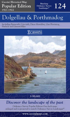
Cassini HM, POP-124: Dolgellau & Porthmadog 124 Popular Edition 124
Anbieter: Revaluation Books, Exeter, Vereinigtes Königreich
Verkäuferbewertung 5 von 5 Sternen

Karte
EUR 2,51
EUR 11,51 Versand
Versand von Vereinigtes Königreich nach USAAnzahl: 1 verfügbar
In den WarenkorbMap. Zustand: Brand New. popular ed edition. 1 pages. 8.50x4.96x0.55 inches. In Stock.
-
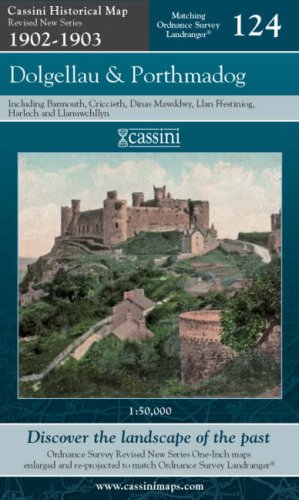
Cassini HM, RNC 124: Dolgellau & Porthmadog 124 Revised New Series
Anbieter: Revaluation Books, Exeter, Vereinigtes Königreich
Verkäuferbewertung 5 von 5 Sternen
Karte
EUR 2,51
EUR 11,51 Versand
Versand von Vereinigtes Königreich nach USAAnzahl: 1 verfügbar
In den WarenkorbMap. Zustand: Brand New. 8.43x5.12x0.55 inches. In Stock.
-
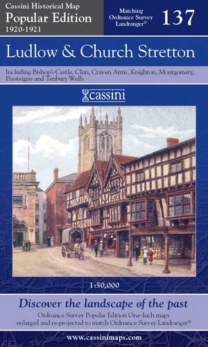
Cassini HM, POP-137: Ludlow & Church Stretton 137 Popular Edition 137
Anbieter: Revaluation Books, Exeter, Vereinigtes Königreich
Verkäuferbewertung 5 von 5 Sternen
Karte
EUR 2,51
EUR 11,51 Versand
Versand von Vereinigtes Königreich nach USAAnzahl: 1 verfügbar
In den WarenkorbMap. Zustand: Brand New. 1 pages. 5.28x0.32x8.90 inches. In Stock.
-

Cassini HM, RNC 157: St David's & Haverfordwest 157 Revised New Series
Anbieter: Revaluation Books, Exeter, Vereinigtes Königreich
Verkäuferbewertung 5 von 5 Sternen
Karte
EUR 2,51
EUR 11,51 Versand
Versand von Vereinigtes Königreich nach USAAnzahl: 2 verfügbar
In den WarenkorbMap. Zustand: Brand New. 8.50x5.12x0.55 inches. In Stock.
-

Cassini HM, RNC 146: Lampeter & Llandovery 146 Revised New Series
Anbieter: Revaluation Books, Exeter, Vereinigtes Königreich
Verkäuferbewertung 5 von 5 Sternen
Karte
EUR 2,51
EUR 11,51 Versand
Versand von Vereinigtes Königreich nach USAAnzahl: 1 verfügbar
In den WarenkorbMap. Zustand: Brand New. facsimile edition edition. 1 pages. 8.50x5.12x0.55 inches. In Stock.
-
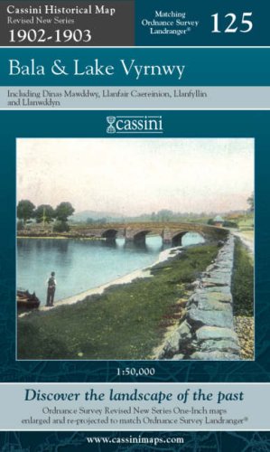
Cassini HM, RNC 125: Bala & lake Vyrnwy 125 Revised New Series
Anbieter: Revaluation Books, Exeter, Vereinigtes Königreich
Verkäuferbewertung 5 von 5 Sternen
Karte
EUR 2,51
EUR 11,51 Versand
Versand von Vereinigtes Königreich nach USAAnzahl: 1 verfügbar
In den WarenkorbMap. Zustand: Brand New. facsimile edition edition. 1 pages. 8.50x5.12x0.71 inches. In Stock.
-

Cassini HM, POP-145: Cardigan & Mynydd Preseli 145 Popular Edition 145
Anbieter: Revaluation Books, Exeter, Vereinigtes Königreich
Verkäuferbewertung 5 von 5 Sternen
Karte
EUR 2,51
EUR 11,51 Versand
Versand von Vereinigtes Königreich nach USAAnzahl: 2 verfügbar
In den WarenkorbMap. Zustand: Brand New. popular ed edition. 1 pages. 8.90x4.88x0.28 inches. In Stock.
-

Cassini HM, POP-114: Anglesey 114 Popular Edition 114
Anbieter: Revaluation Books, Exeter, Vereinigtes Königreich
Verkäuferbewertung 5 von 5 Sternen
Karte
EUR 2,51
EUR 11,51 Versand
Versand von Vereinigtes Königreich nach USAAnzahl: 1 verfügbar
In den WarenkorbMap. Zustand: Brand New. 1 pages. 9.06x5.12x0.79 inches. In Stock.
-
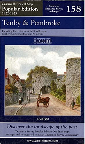
Cassini HM, POP-158: Tenby & Pembroke 158 Popular Edition 158
Anbieter: Revaluation Books, Exeter, Vereinigtes Königreich
Verkäuferbewertung 5 von 5 Sternen
Karte
EUR 2,51
EUR 11,51 Versand
Versand von Vereinigtes Königreich nach USAAnzahl: 1 verfügbar
In den WarenkorbMap. Zustand: Brand New. popular ed edition. 1 pages. 8.74x5.28x0.87 inches. In Stock.
-
![Bild des Verkäufers für Luton & Hertford Ordnance Survey Map (Old Series) : Cassini Historical Maps - sheet 166 [Map] zum Verkauf von MW Books](https://pictures.abebooks.com/inventory/md/md31120357447.jpg)
Luton & Hertford Ordnance Survey Map (Old Series) : Cassini Historical Maps - sheet 166 [Map]
Sprache: Englisch
Verlag: Cassini Historical Maps (Old Series) - sheet 166 : Luton & Hertford, 2005
ISBN 10: 1905568029 ISBN 13: 9781905568024
New Edition. Fine paperback copy. Particularly well-preserved; tight, bright and clean. Physical description; 1 sheet, 1" = 1 mile (red illus. card, 9" x 5Ľ" folded). Subjects; Maps. Maps; England. Maps; United Kingdom. Ordnance survey; United Kingdom. Ordnance survey; Great Britain. 1 Kg.
-

Buckinghamshire (1900): Cassini Historical Map, Rolled (BCO-BUC)
Sprache: Englisch
Verlag: Cassini Historical Maps, United Kingdom, 2016
ISBN 10: 1847365973 ISBN 13: 9781847365972
Anbieter: Pendleburys - the bookshop in the hills, Llanwrda, Vereinigtes Königreich
Verkäuferbewertung 5 von 5 Sternen
Karte
EUR 8,89
EUR 13,23 Versand
Versand von Vereinigtes Königreich nach USAAnzahl: 1 verfügbar
In den WarenkorbSoft cover. Zustand: Fine. No Jacket. historical rolled County map of Buckinghamshire as it was in 1900 measuring 20" x 14" (500mm x 350mm), a new copy in colours, securely enclosed in a gilt coloured post tube.
-

Leicestershire & Rutland (1900): Cassini Historical Map, Rolled (BCO-LER)
Sprache: Englisch
Verlag: Cassini Historical Maps, United Kingdom, 2016
ISBN 10: 184736618X ISBN 13: 9781847366184
Anbieter: Pendleburys - the bookshop in the hills, Llanwrda, Vereinigtes Königreich
Verkäuferbewertung 5 von 5 Sternen
Karte
EUR 8,89
EUR 13,23 Versand
Versand von Vereinigtes Königreich nach USAAnzahl: 1 verfügbar
In den WarenkorbSoft cover. Zustand: Fine. No Jacket. historical rolled County map of Leicestershire and Rutland as it was in 1900 measuring 20" x 14" (500mm x 350mm), a new copy in colours, securely enclosed in a gilt coloured post tube.
-

Cumberland & Westmoreland - North (1900): Cassini Historical Map, Rolled (BCO-CUW)
Sprache: Englisch
Verlag: Cassini Historical Maps, United Kingdom, 2016
ISBN 10: 1847366015 ISBN 13: 9781847366016
Anbieter: Pendleburys - the bookshop in the hills, Llanwrda, Vereinigtes Königreich
Verkäuferbewertung 5 von 5 Sternen
Karte
EUR 8,89
EUR 13,23 Versand
Versand von Vereinigtes Königreich nach USAAnzahl: 1 verfügbar
In den WarenkorbSoft cover. Zustand: Fine. No Jacket. historical rolled County map of Cumberland and North Westmoreland as it was in 1900 measuring 20" x 14" (500mm x 350mm), a new copy in colours, securely enclosed in a gilt coloured post tube.
-

Hertfordshire (1900): Cassini Historical Map, Rolled (BCO-HTF)
Sprache: Englisch
Verlag: Cassini Historical Maps, United Kingdom, 2016
ISBN 10: 1847366120 ISBN 13: 9781847366122
Anbieter: Pendleburys - the bookshop in the hills, Llanwrda, Vereinigtes Königreich
Verkäuferbewertung 5 von 5 Sternen
Karte
EUR 8,89
EUR 13,23 Versand
Versand von Vereinigtes Königreich nach USAAnzahl: 1 verfügbar
In den WarenkorbSoft cover. Zustand: Fine. No Jacket. historical rolled County map of Hertfordshire as it was in 1900 measuring 20" x 14" (500mm x 350mm), a new copy in colours, securely enclosed in a gilt coloured post tube.
-

Middlesex (1900) : Cassini Historical Map, Rolled (BCO-MID)
Sprache: Englisch
Verlag: Cassini Historical Maps, United Kingdom, 2016
ISBN 10: 1847366201 ISBN 13: 9781847366207
Anbieter: Pendleburys - the bookshop in the hills, Llanwrda, Vereinigtes Königreich
Verkäuferbewertung 5 von 5 Sternen
Karte
EUR 8,89
EUR 13,23 Versand
Versand von Vereinigtes Königreich nach USAAnzahl: 1 verfügbar
In den WarenkorbSoft cover. Zustand: Fine. No Jacket. historical rolled County map of Middlesex as it was in 1900 measuring 20" x 14" (500mm x 350mm), a new copy in colours, securely enclosed in a gilt coloured post tube.
-

Hertfordshire (1900): Cassini Historical Map, Rolled (BCO-HTF)
Sprache: Englisch
Verlag: Cassini Historical Maps, United Kingdom, 2016
ISBN 10: 1847366120 ISBN 13: 9781847366122
Anbieter: Pendleburys - the bookshop in the hills, Llanwrda, Vereinigtes Königreich
Verkäuferbewertung 5 von 5 Sternen
Karte
EUR 8,89
EUR 13,23 Versand
Versand von Vereinigtes Königreich nach USAAnzahl: 1 verfügbar
In den WarenkorbSoft cover. Zustand: Fine. No Jacket. historical rolled County map of Hertfordshire as it was in 1900 measuring 20" x 14" (500mm x 350mm), a new copy in colours, securely enclosed in a gilt coloured post tube.
-

Staffordshire (1900): Cassini Historical County Map, Rolled (BCO-STA)
Sprache: Englisch
Verlag: Cassini Historical Maps, United Kingdom, 2016
ISBN 10: 1847366309 ISBN 13: 9781847366306
Anbieter: Pendleburys - the bookshop in the hills, Llanwrda, Vereinigtes Königreich
Verkäuferbewertung 5 von 5 Sternen
Karte
EUR 8,89
EUR 13,23 Versand
Versand von Vereinigtes Königreich nach USAAnzahl: 1 verfügbar
In den WarenkorbSoft cover. Zustand: Fine. No Jacket. historical rolled County map of Staffordshire as it was in 1900 measuring 20" x 14" (500mm x 350mm), a new copy in colours, securely enclosed in a gilt coloured post tube.
-

Shropshire - South (1900): Cassini Historical Map, Rolled (BCO-SAS)
Sprache: Englisch
Verlag: Cassini Historical Maps, United Kingdom, 2016
ISBN 10: 1847366287 ISBN 13: 9781847366283
Anbieter: Pendleburys - the bookshop in the hills, Llanwrda, Vereinigtes Königreich
Verkäuferbewertung 5 von 5 Sternen
Karte
EUR 8,89
EUR 13,23 Versand
Versand von Vereinigtes Königreich nach USAAnzahl: 1 verfügbar
In den WarenkorbSoft cover. Zustand: Fine. No Jacket. historical rolled County map of South Shropshire as it was in 1900 measuring 20" x 14" (500mm x 350mm), a new copy in colours, securely enclosed in a gilt coloured post tube.
-

Surrey (1900): Cassini Historical Map, Rolled (BCO-SUR)
Sprache: Englisch
Verlag: Cassini Historical Maps, United Kingdom, 2016
ISBN 10: 1847366325 ISBN 13: 9781847366320
Anbieter: Pendleburys - the bookshop in the hills, Llanwrda, Vereinigtes Königreich
Verkäuferbewertung 5 von 5 Sternen
Karte
EUR 8,89
EUR 13,23 Versand
Versand von Vereinigtes Königreich nach USAAnzahl: 1 verfügbar
In den WarenkorbSoft cover. Zustand: Fine. No Jacket. historical rolled County map of Surrey as it was in 1900 measuring 20" x 14" (500mm x 350mm), a new copy in colours, securely enclosed in a gilt coloured post tube.
-

Shropshire - South (1900): Cassini Historical Map, Rolled (BCO-SAS)
Sprache: Englisch
Verlag: Cassini Historical Maps, United Kingdom, 2016
ISBN 10: 1847366287 ISBN 13: 9781847366283
Anbieter: Pendleburys - the bookshop in the hills, Llanwrda, Vereinigtes Königreich
Verkäuferbewertung 5 von 5 Sternen
Karte
EUR 8,89
EUR 13,23 Versand
Versand von Vereinigtes Königreich nach USAAnzahl: 1 verfügbar
In den WarenkorbSoft cover. Zustand: Fine. No Jacket. historical rolled County map of South Shropshire as it was in 1900 measuring 20" x 14" (500mm x 350mm), a new copy in colours, securely enclosed in a gilt coloured post tube.
-

Staffordshire (1900): Cassini Historical County Map, Rolled (BCO-STA)
Sprache: Englisch
Verlag: Cassini Historical Maps, United Kingdom, 2016
ISBN 10: 1847366309 ISBN 13: 9781847366306
Anbieter: Pendleburys - the bookshop in the hills, Llanwrda, Vereinigtes Königreich
Verkäuferbewertung 5 von 5 Sternen
Karte
EUR 8,89
EUR 13,23 Versand
Versand von Vereinigtes Königreich nach USAAnzahl: 1 verfügbar
In den WarenkorbSoft cover. Zustand: Fine. No Jacket. historical rolled County map of Staffordshire as it was in 1900 measuring 20" x 14" (500mm x 350mm), a new copy in colours, securely enclosed in a gilt coloured post tube.
-

Worcestershire & Gloucestershire - South (1900): Cassini Historical Map, Rolled (BCO-WGS)
Sprache: Englisch
Verlag: Cassini Historical Maps, United Kingdom, 2016
ISBN 10: 1847366376 ISBN 13: 9781847366375
Anbieter: Pendleburys - the bookshop in the hills, Llanwrda, Vereinigtes Königreich
Verkäuferbewertung 5 von 5 Sternen
Karte
EUR 8,89
EUR 13,23 Versand
Versand von Vereinigtes Königreich nach USAAnzahl: 1 verfügbar
In den WarenkorbSoft cover. Zustand: Fine. No Jacket. historical rolled County map of Worcestershire and South Gloucestershire as it was in 1900 measuring 20" x 14" (500mm x 350mm), a new copy in colours, securely enclosed in a gilt coloured post tube.
-

Bedfordshire (1900): Cassini Historical Map, Rolled (BCO-BED)
Sprache: Englisch
Verlag: Cassini Historical Maps, United Kingdom, 2016
ISBN 10: 1847365957 ISBN 13: 9781847365958
Anbieter: Pendleburys - the bookshop in the hills, Llanwrda, Vereinigtes Königreich
Verkäuferbewertung 5 von 5 Sternen
Karte
EUR 8,89
EUR 13,23 Versand
Versand von Vereinigtes Königreich nach USAAnzahl: 1 verfügbar
In den WarenkorbSoft cover. Zustand: Fine. No Jacket. historical rolled County map of Bedfordshire as it was in 1900 measuring 20" x 14" (500mm x 350mm), a new copy in colours, securely enclosed in a gilt coloured post tube.
-

Buckinghamshire (1900): Cassini Historical Map, Rolled (BCO-BUC)
Sprache: Englisch
Verlag: Cassini Historical Maps, United Kingdom, 2016
ISBN 10: 1847365973 ISBN 13: 9781847365972
Anbieter: Pendleburys - the bookshop in the hills, Llanwrda, Vereinigtes Königreich
Verkäuferbewertung 5 von 5 Sternen
Karte
EUR 8,89
EUR 13,23 Versand
Versand von Vereinigtes Königreich nach USAAnzahl: 1 verfügbar
In den WarenkorbSoft cover. Zustand: Fine. No Jacket. historical rolled County map of Buckinghamshire as it was in 1900 measuring 20" x 14" (500mm x 350mm), a new copy in colours, securely enclosed in a gilt coloured post tube.
-

Cumberland & Westmoreland - North (1900): Cassini Historical Map, Rolled (BCO-CUW)
Sprache: Englisch
Verlag: Cassini Historical Maps, United Kingdom, 2016
ISBN 10: 1847366015 ISBN 13: 9781847366016
Anbieter: Pendleburys - the bookshop in the hills, Llanwrda, Vereinigtes Königreich
Verkäuferbewertung 5 von 5 Sternen
Karte
EUR 8,89
EUR 13,23 Versand
Versand von Vereinigtes Königreich nach USAAnzahl: 1 verfügbar
In den WarenkorbSoft cover. Zustand: Fine. No Jacket. historical rolled County map of Cumberland and North Westmoreland as it was in 1900 measuring 20" x 14" (500mm x 350mm), a new copy in colours, securely enclosed in a gilt coloured post tube.
-

Yorkshire - South East (1900): Cassini Historical Map, Rolled (BCO-YSE)
Sprache: Englisch
Verlag: Cassini Historical Maps, United Kingdom, 2016
ISBN 10: 1847366406 ISBN 13: 9781847366405
Anbieter: Pendleburys - the bookshop in the hills, Llanwrda, Vereinigtes Königreich
Verkäuferbewertung 5 von 5 Sternen
Karte
EUR 8,89
EUR 13,23 Versand
Versand von Vereinigtes Königreich nach USAAnzahl: 1 verfügbar
In den WarenkorbSoft cover. Zustand: Fine. No Jacket. historical rolled County map of South-East Yorkshire as it was in 1900 measuring 20" x 14" (500mm x 350mm), a new copy in colours, securely enclosed in a gilt coloured post tube.
-

Devon - South (1900): Cassini Historical Map, Rolled (BCO-HTF)
Sprache: Englisch
Verlag: Cassini Historical Maps, United Kingdom, 2016
ISBN 10: 1847366058 ISBN 13: 9781847366054
Anbieter: Pendleburys - the bookshop in the hills, Llanwrda, Vereinigtes Königreich
Verkäuferbewertung 5 von 5 Sternen
Karte
EUR 8,89
EUR 13,23 Versand
Versand von Vereinigtes Königreich nach USAAnzahl: 1 verfügbar
In den WarenkorbSoft cover. Zustand: Fine. No Jacket. historical rolled County map of South Devon as it was in 1900 measuring 20" x 14" (500mm x 350mm), a new copy in colours, securely enclosed in a gilt coloured post tube.
-

Worcestershire & Gloucestershire - South (1900): Cassini Historical Map, Rolled (BCO-WGS)
Sprache: Englisch
Verlag: Cassini Historical Maps, United Kingdom, 2016
ISBN 10: 1847366376 ISBN 13: 9781847366375
Anbieter: Pendleburys - the bookshop in the hills, Llanwrda, Vereinigtes Königreich
Verkäuferbewertung 5 von 5 Sternen
Karte
EUR 8,89
EUR 13,23 Versand
Versand von Vereinigtes Königreich nach USAAnzahl: 1 verfügbar
In den WarenkorbSoft cover. Zustand: Fine. No Jacket. historical rolled County map of Worcestershire and South Gloucestershire as it was in 1900 measuring 20" x 14" (500mm x 350mm), a new copy in colours, securely enclosed in a gilt coloured post tube.
-

Surrey (1900): Cassini Historical Map, Rolled (BCO-SUR)
Sprache: Englisch
Verlag: Cassini Historical Maps, United Kingdom, 2016
ISBN 10: 1847366325 ISBN 13: 9781847366320
Anbieter: Pendleburys - the bookshop in the hills, Llanwrda, Vereinigtes Königreich
Verkäuferbewertung 5 von 5 Sternen
Karte
EUR 8,89
EUR 13,23 Versand
Versand von Vereinigtes Königreich nach USAAnzahl: 1 verfügbar
In den WarenkorbSoft cover. Zustand: Fine. No Jacket. historical rolled County map of Surrey as it was in 1900 measuring 20" x 14" (500mm x 350mm), a new copy in colours, securely enclosed in a gilt coloured post tube.