Visitors london map guide (27 Ergebnisse)

Anbieter: WeBuyBooks, Rossendale, LANCS, Vereinigtes KönigreichWeBuyBooks
Verkäufer/-in kontaktierenVerkäufer/-in mit 5 SternenZustand: Gebraucht - Befriedigend
EUR 1,18
EUR 5,30 VersandVersand von Vereinigtes Königreich nach USAAnzahl: 1 verfügbar
Zustand: Good. Most items will be dispatched the same or the next working day. A copy that has been read but remains in clean condition. All of the pages are intact and the cover is intact and the spine may show signs of wear. The book may have minor markings which are not specifically mentioned.

- Softcover
Anbieter: WorldofBooks, Goring-By-Sea, WS, Vereinigtes KönigreichWorldofBooks
Verkäufer/-in kontaktierenVerkäufer/-in mit 5 SternenZustand: Gebraucht - Ausreichend
EUR 5,04
EUR 6,45 VersandVersand von Vereinigtes Königreich nach USAAnzahl: 1 verfügbar
Paperback. Zustand: Fair. A readable copy of the book which may include some defects such as highlighting and notes. Cover and pages may be creased and show discolouration.
- Softcover
Anbieter: WorldofBooks, Goring-By-Sea, WS, Vereinigtes KönigreichWorldofBooks
Verkäufer/-in kontaktierenVerkäufer/-in mit 5 SternenZustand: Gebraucht - Gut
EUR 5,04
EUR 6,45 VersandVersand von Vereinigtes Königreich nach USAAnzahl: 1 verfügbar
Paperback. Zustand: Very Good. The book has been read, but is in excellent condition. Pages are intact and not marred by notes or highlighting. The spine remains undamaged.

- Softcover
Anbieter: WorldofBooks, Goring-By-Sea, WS, Vereinigtes KönigreichWorldofBooks
Verkäufer/-in kontaktierenVerkäufer/-in mit 5 SternenZustand: Gebraucht - Gut
EUR 10,06
EUR 6,45 VersandVersand von Vereinigtes Königreich nach USAAnzahl: 4 verfügbar
Paperback. Zustand: Very Good. The book has been read, but is in excellent condition. Pages are intact and not marred by notes or highlighting. The spine remains undamaged.

Anbieter: medimops, Berlin, Deutschlandmedimops
Verkäufer/-in kontaktierenVerkäufer/-in mit 5 SternenZustand: Gebraucht - Gut
EUR 3,49
EUR 10,00 VersandVersand von Deutschland nach USAAnzahl: 1 verfügbar
Zustand: very good. Gut/Very good: Buch bzw. Schutzumschlag mit wenigen Gebrauchsspuren an Einband, Schutzumschlag oder Seiten. / Describes a book or dust jacket that does show some signs of wear on either the binding, dust jacket or pages.
Anbieter: Reuseabook, Gloucester, GLOS, Vereinigtes KönigreichReuseabook
Verkäufer/-in kontaktierenVerkäufer/-in mit 5 SternenZustand: Gebraucht - Gut
EUR 4,63
EUR 11,52 VersandVersand von Vereinigtes Königreich nach USAAnzahl: 1 verfügbar
unknown_binding. Zustand: Used; Very Good. Dispatched, from the UK, within 48 hours of ordering. Though second-hand, the book is still in very good shape. Minimal signs of usage may include very minor creasing on the cover or on the spine.

Verlag: Peter Sanders
Anbieter: WeBuyBooks, Rossendale, LANCS, Vereinigtes KönigreichWeBuyBooks
Verkäufer/-in kontaktierenVerkäufer/-in mit 5 SternenZustand: Gebraucht - Befriedigend
EUR 8,64
EUR 9,05 VersandVersand von Vereinigtes Königreich nach USAAnzahl: 1 verfügbar
Zustand: Good. Most items will be dispatched the same or the next working day. A copy that has been read but remains in clean condition. All of the pages are intact and the cover is intact and the spine may show signs of wear. The book may have minor markings which are not specifically mentioned.

- Softcover
Anbieter: Ria Christie Collections, Uxbridge, Vereinigtes KönigreichRia Christie Collections
Verkäufer/-in kontaktierenVerkäufer/-in mit 5 SternenZustand: Neu
EUR 22,61
EUR 13,80 VersandVersand von Vereinigtes Königreich nach USAAnzahl: Mehr als 20 verfügbar
Zustand: New. In.

Verlag: Geographers' Map Co Ltd London Undated but judging by tel nos ca 's/50's 1940
- Softcover
- Karte
Anbieter: Bentfinger Book Services, Loughborough, , Vereinigtes KönigreichBentfinger Book Services
Verkäufer/-in kontaktierenVerkäufer/-in mit 2 SternenZustand: Gebraucht
EUR 11,87
EUR 14,40 VersandVersand von Vereinigtes Königreich nach USAAnzahl: 1 verfügbar
16mo(12x7cm) PB 80pp+foldout map inside back cover. Beige card with red lettering & illus. Slight age discolouring & minimal edge bumping else v.good/near fine. Internally near fine. An excellent copy of its age. (30g).
 Weitere Bilder
Verlag: London: Georgrapher's Map Co., Ltd. [nach 1944] 1944
- Softcover
Anbieter: Antikvariat Valentinska, Praha, , TschechienAntikvariat Valentinska
Verkäufer/-in kontaktierenVerkäufer/-in mit 5 SternenZustand: Gebraucht
EUR 6,00
EUR 26,50 VersandVersand von Tschechien nach USAAnzahl: 1 verfügbar
OHeft, 64 Seiten+16 Tfeln+gefaltete frbige Krte Londons, 7,5 x 12 cm, Fleck von außen (ursprünglich Wsserfleck, der sich durch den oberen ller Seiten zieht), sonst ausgeblichen, dresse mit Kugelschreiber auf S. 64, leicht eselohrig, insgesamt noch nnehmbrer Zustand. Book Language/s: English.
 Weitere Bilder
Sprache: Englisch
Verlag: Geographers' Map Company, London 1952
- Softcover
- Manuskript
Anbieter: Linda Corrigan, Knutsford, Vereinigtes KönigreichLinda Corrigan
Verkäufer/-in kontaktierenVerkäufer/-in mit 5 SternenZustand: Gebraucht - Befriedigend
EUR 11,87
EUR 37,04 VersandVersand von Vereinigtes Königreich nach USAAnzahl: 1 verfügbar
Paper. Zustand: Good. No Jacket. A very good copy (for its age) of this edition of a pocket guide to London. Undated, but mentions the Royal Festival Hall and the Fun Fair in Battersea Park, both opened as part of the Festival of Britain in 1951, so early 1950s a likely date. No Dust Jacket. Cover: thin card with black and white… photo image of the Houses of Parliament to front and rear, and black, white and red lettering to front; bright, clean and tightly perfect bound; owner's signature very neatly to front cover; some rubbing to all edges commensurate with age and use, some darkening to spine but overall very good for its age. Internally: very clean and tightly bound; no markings inscriptions or book plates; overall in very good condition.Includes a fold-out colour map bound in at rear and Underground map within text. 80 pp.

- Softcover
Anbieter: moluna, Greven, , Deutschlandmoluna
Verkäufer/-in kontaktierenVerkäufer/-in mit 5 SternenZustand: Neu
EUR 27,86
EUR 48,99 VersandVersand von Deutschland nach USAAnzahl: Mehr als 20 verfügbar
Zustand: New.

Sprache: Englisch
Verlag: British Library, Historical Print Editions Mär 2011 2011
- Softcover
Anbieter: AHA-BUCH GmbH, Einbeck, DeutschlandAHA-BUCH GmbH
Verkäufer/-in kontaktierenVerkäufer/-in mit 5 SternenZustand: Neu
EUR 33,12
EUR 61,70 VersandVersand von Deutschland nach USAAnzahl: 2 verfügbar
Taschenbuch. Zustand: Neu. Neuware - bTitle:/b Campbell's Visitors' Guide to the International Exhibition, and handy-book of London. [With a map.]br/br/bPublisher:/b British Library, Historical Print Editionsbr/br/The British Library is the national library of the United Kingdom. It is one of the world's largest research librari…es holding over 150 million items in all known languages and formats: books, journals, newspapers, sound recordings, patents, maps, stamps, prints and much more. Its collections include around 14 million books, along with substantial additional collections of manuscripts and historical items dating back as far as 300 BC.br/br/The HISTORY OF TRAVEL collection includes books from the British Library digitised by Microsoft. This collection contains personal narratives, travel guides and documentary accounts by Victorian travelers, male and female. Also included are pamphlets, travel guides, and personal narratives of trips to and around the Americas, the Indies, Europe, Africa and the Middle East. br/br/++++br/The below data was compiled from various identification fields in the bibliographic record of this title. This data is provided as an additional tool in helping to insure edition identification:br/++++br/br/b/b British Librarybr/b/b Campbell, C J.; br/b/b 1862.br/b/b 110 p. ; 8º.br/b/b 10351.e.2.br/.

Sprache: Englisch
Verlag: London Transport 1987/8. 1987
Anbieter: Borkert, Schwarz und Zerfaß GbR, Berlin, DeutschlandBorkert, Schwarz und Zerfaß GbR
Verkäufer/-in kontaktierenVerkäufer/-in mit 5 SternenZustand: Gebraucht - Gut
EUR 15,00
EUR 40,00 VersandVersand von Deutschland nach USAAnzahl: 2 verfügbar
69*42 cm. Zustand: Gut. 2 p. Stain on front cover, a bit bumped, otherwise clean. - Content: Getting around London - Travel and Transport Information - Special Tickets and Tours - Central London Key Bus Routes - Central London Buses - Planning your Journey by Underground - Key to Railways. Sprache: Englisch Gewicht in Gramm: 550….
- Hardcover
Anbieter: Visible Voice Books, Cleveland, OH, USAVisible Voice Books
Verkäufer/-in kontaktierenVerkäufer/-in mit 5 SternenZustand: Gebraucht - Gut
EUR 35,94
EUR 3,93 VersandVersand innerhalb von USAAnzahl: 1 verfügbar
Zustand: Very Good. C. Smith and Son/American Exchange in Europe London 1883 mapbook. green cloth illustrated boards with gilt lettering. boards lightly soiled and rubbed. corners bumped.
 Weitere Bilder
Sprache: Englisch
Verlag: J. Reynolds, London 1851
- Hardcover
- Karte
Anbieter: Dendera, London, Vereinigtes KönigreichDendera
Verkäufer/-in kontaktierenVerkäufer/-in mit 5 SternenZustand: Gebraucht - Befriedigend
EUR 445,05
EUR 28,81 VersandVersand von Vereinigtes Königreich nach USAAnzahl: 1 verfügbar
Hardcover. Zustand: Good. B/w paper map 78x44cm folding into the original blue cloth case 10x16cm with illustrated title label to the front, and booklet bound inside. The map was drawn and engraved by H. Martin, 1851, @3.25 inches to 1 mile, divided into half mile squares. It covers Regents Park (NW), Victoria Park (NE), Isle of… Dogs (SE), and Chelsea (SW). What came to be known as the Crystal Palace is shown fully on the lefthand edge in its original Hyde Park location before it was moved south of the river to Sydenham, labelled "Site of the Building for the Great Industrial Exhibition" with its layout about visible within the grey shading. The booklet compiles a street index (8)pp, Guide for Viewing London in Six Days (2)pp, Guide to the Sights and Amusements of London pp2-22 (p1 of which has been backed on to the back of the Guide for Viewing London in Six Days), a double-page Map Showing the Situation of the Chief Objects of Interest in London with the Main Thoroughfares and Railway Stations drawn and engraved by John Emslie also locating the "Great Exhibition" building in Hyde Park, and Sights and Amusements of London and Great Industrial Exhibition (2)pp. Map good with short closed tears at the edges and intersections, and minor loss at the outer margins (not affecting image). There have been archival tape repairs to the recto along full length of the vertical fold of the lower panel to reattach the map to the case (image fully visible if slightly milky), and to the verso along tears and at some intersections. There are also 3 earlier white paper repairs to the verso which are holding firm. Booklet good with foxing, and inner section coming slightly loose. Case very good with some scuffing.
Verlag: C.Smith and Son, London 1111
- Hardcover
- Erstausgabe
Anbieter: PEND BOOKS, Newton Stewart, , Vereinigtes KönigreichPEND BOOKS
Verkäufer/-in kontaktierenVerkäufer/-in mit 4 SternenZustand: Gebraucht - Befriedigend
EUR 71,21
EUR 74,89 VersandVersand von Vereinigtes Königreich nach USAAnzahl: 1 verfügbar
Hardcover. Zustand: Good. No Jacket. First Edition. Brown boards, with folding map mounted on linen and tape for measuring distances. Also alphabetical list of streets bound in, with chip to rear cover and some tanning to pages. Name on free front endpaper.
Verlag: James Reynolds & Sons, London 1881
- Hardcover
- Erstausgabe
- Karte
Anbieter: Barter Books Ltd, Alnwick, NORTH, Vereinigtes KönigreichBarter Books Ltd
Verkäufer/-in kontaktierenVerkäufer/-in mit 5 SternenZustand: Gebraucht - Ausreichend
EUR 280,33
EUR 9,22 VersandVersand von Vereinigtes Königreich nach USAAnzahl: 1 verfügbar
Blue/ hardback cloth cover. Zustand: Fair. First Edition. Boards worn. Linen-backed map - other than some creasing along top edge and bottom corner in Good conditon. 170mm x 110mm (7" x 4"). Original full colour. Folding map divided into quarter-mile sections - extent ranges from Highbury and Kentish Town (North) to Lambeth and…Peckham (South).

Verlag: London"Geographia" Ltd. c. 1930
- Softcover
- Karte
Anbieter: Robert Frew Ltd. ABA ILAB, London, , Vereinigtes KönigreichRobert Frew Ltd. ABA ILAB
Verkäufer/-in kontaktierenVerkäufer/-in mit 5 SternenZustand: Gebraucht
EUR 296,70
EUR 11,52 VersandVersand von Vereinigtes Königreich nach USAAnzahl: 1 verfügbar
Original colour-printed pictorial souvenir map of London (37.5 x 47.5 cm), with amusing cartoon illustrations and comments in speech bubbles, extending from the Victoria & Albert Museum and Hyde Park at the left to Saint Paul's Cathedral and the Southwark Bridge at the right, and from Regent's Park and Euston Road down to Lambet…h Bridge and St. George's Circus. Australia House is shown on the Strand near St. Clement Danes. Folds in to red pictorial printed wrappers with city skyline, with printed map of London Underground on verso. Verso with printed Index of Places of Interest and list of street locations showing nearest main thoroughfares and railway stations. Some light toning to card covers, the map itself in excellent condition. Alexander Gross (1879-1958), a Hungarian immigrant to the United Kingdom, founded cartographic firm Geographia, Ltd. (fl. 1911-1985).
 Weitere Bilder
Verlag: George Philip & Son, London and Liverpool 1869
- Hardcover
Anbieter: Dennis Holzman Antiques, Cohoes, NY, USADennis Holzman Antiques
Verkäufer/-in kontaktierenVerkäufer/-in mit 5 SternenZustand: Gebraucht - Ausreichend
EUR 336,98
EUR 6,11 VersandVersand innerhalb von USAAnzahl: 1 verfügbar
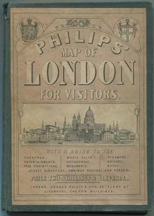
Hardcover. Zustand: Fair. No Dust Jacket. Edition Unstated. Size: 16mo. Text body is clean, and free from previous owner annotation, underlining and highlighting. Green cloth over boards with illustrated paste down label on front cover, includes 16 page Phillips' London Guide, tan string bound wraps, with information on London,…theaters, entertainment, music halls, exhibitions, cathedrals, monuments, parks, steamers, bridges, Street directory, bus routes, cab fares, and more, two-page Sketch Map of London Showing the Public Buildings, Exhibitions Etc.; linen-backed fold out pocket map of London attached to back board, folds out to 20 7/8" x 30 1/2" and is dated 1869, compiled and engraved by Edward Weller F. R. G. S. London. Pages of guide toned, back cover missing, cover of book soiled, back cover scuffed, torn at head of spine, paste down inside front cover is chipped, map has a few small spots, some wear at fold lines, some toning overall, but overall very good condition. Quantity Available: 1. Shipped Weight: 1 lb 0 oz. Category: Geography & Maps; Travel & Places. Picture 2: Map unfolded. Picture 3: Front cover of the Guide. Picture 4: Center map in Guide. Picture 5: Book open with folded map on right. Picture 6: Map detail. Picture 7: Map detail. Pictures of this item not already displayed here available upon request. Inventory No: 011003.
 Weitere Bilder
Verlag: London James Reynolds. June 1st. 1891
- Hardcover
- Karte
Anbieter: Robert Frew Ltd. ABA ILAB, London, , Vereinigtes KönigreichRobert Frew Ltd. ABA ILAB
Verkäufer/-in kontaktierenVerkäufer/-in mit 5 SternenZustand: Gebraucht
EUR 593,40
EUR 11,52 VersandVersand von Vereinigtes Königreich nach USAAnzahl: 1 verfügbar
(Map size: 53 x 68 cm). Folding plan of London on paper backed onto linen. The plan shows the extents from Kentish Town to Camberwell and Kensington Olympia to Limehouse. Original hand colour in block and outline. Folds between original blind-stamped dark brown cloth boards (15 x 10.5 cm) with gilt titles to upper cover. 64pp. i…llustrated London Guide and Directory before the map. Slight foxing to verso of map, and rear board, map itself is very clean, front cover nice and bright. Overall very good. Hyde, 54 (30) - variant title to upper cover.

Verlag: London James Wyld. Charing Cross East opposite Northumberland Street . 1851
- Hardcover
- Karte
Anbieter: Robert Frew Ltd. ABA ILAB, London, , Vereinigtes KönigreichRobert Frew Ltd. ABA ILAB
Verkäufer/-in kontaktierenVerkäufer/-in mit 5 SternenZustand: Gebraucht
EUR 1.483,50
EUR 11,52 VersandVersand von Vereinigtes Königreich nach USAAnzahl: 1 verfügbar
A most decorative folding map of London (55 x 95 cm) printed in 40 sections (though not physically dissected) with original hand colour. The plan covers extents from Islington down to North Brixton and East India Docks across to Holland Park. An attractive printed border with eleven engraved views of famous sites and buildings i…n the city, with floral cornerpieces and panels of explanatory text. Original block colour to the bodies of water, the open spaces (parks, cemeteries etc.), main roads and marking the Crystal Palace and Leicester Square. Folds between publisher's blind-stamped blue cloth covers with title to upper cover, publisher's adverts to pastedown. Gilt lettering rubbed and dulled, with extremities of cloth bumped. Internally clean, with only a few short tears and creases to edges of map. James Wyld (1812-1887) was "the most important mapmaker producing maps of London in the year of the Great Exhibition". Wyld was a highly successful publisher, MP for Bodmin, and an active figure in public life. He promoted the development of the British Library and campaigned for the Public Libraries and Museums Bill. Like his father, he was made Geographer to Queen Victoria and Prince Albert in 1836. He built his business on his ability to produce maps quickly in reaction to new discoveries and information: Punch remarked drily that if a country were discovered in the centre of the earth then Wyld would have a new map out "as soon as it is discovered, if not before". Wyld first published the present map in 1851 to capitalise on the influx of visitors into in London to see the Great Exhibition in the Crystal Palace. It was designed as both a map and a tourist guide: the border contains keys in English, French and German, and vignettes of must-see landmarks. Crystal Palace occupies a large proportion of the south side of Hyde Park; it is also depicted in one of the views to the map's border. Hyde, no. 25, (1). Boyle, 188.
- Softcover
Anbieter: Patrick Pollak Rare Books ABA ILAB, SOUTH BRENT, DEVON, Vereinigtes KönigreichPatrick Pollak Rare Books ABA ILAB
Verkäufer/-in kontaktierenVerkäufer/-in mit 3 SternenZustand: Gebraucht
EUR 59,34
EUR 28,81 VersandVersand von Vereinigtes Königreich nach USAAnzahl: 1 verfügbar
pp. 48. Many illustrated advertisements, 2 maps and woodcuts in text; 112. Numerous text woodcuts, large double-sided folding map and plan, printed in blue. Original wraps, though lacking the front wrapper, tatty, staples rusted, map grubby where section has been exposed and with a couple of marginal tears into the image though…without loss, contents clean. *First title not in COPAC, the second is recorded for the NLW only. The rear wrapper is titled 'Evans's Guide' despite being the wrapper to the 'Visitor's Guide' published by Matthews. The folding map is called for by this latter guide but has been bound at the front of the Evans's Guide. The remnant of the spine is lettered '. and Directory Lanndrindod Llanwrtyd. ' implying that both these works were issued together albeit by different publishers.
 Weitere Bilder
Sprache: Deutsch
Verlag: Philips, London 1862
- Hardcover
Anbieter: Allgäuer Online Antiquariat, Memmingen, DE, DeutschlandAllgäuer Online Antiquariat
Verkäufer/-in kontaktierenVerkäufer/-in mit 5 SternenZustand: Gebraucht - Gut
EUR 350,00
EUR 40,00 VersandVersand von Deutschland nach USAAnzahl: 1 verfügbar
Leinen, Faltkarte ( 76x53cm ). Zustand: Gut. Faltkarte im Leineneinband ( 17x12cm ) Karte in gutem Zustand Sprache: Deutsch Gewicht in Gramm: 300.
 Weitere Bilder
Verlag: James Reynolds, London 1884
- Erstausgabe
Anbieter: George Jeffery Books, HERTFORDSHIRE, Vereinigtes KönigreichGeorge Jeffery Books
Verkäufer/-in kontaktierenVerkäufer/-in mit 5 SternenZustand: Gebraucht - Gut
EUR 267,03
EUR 28,81 VersandVersand von Vereinigtes Königreich nach USAAnzahl: 1 verfügbar
Zustand: Very Good Plus. New Edition. No printed date, circa 1884.Large folding colured map, in 40 sections. Map measures 39x26 inches, 1000x660mm. With 62pp gudie & index. A few short tears on folds. Map in unusual clean bright condition, folding into original publishers case. A very bight clean copy. F.
 Weitere Bilder
Verlag: W. Mogg, London 1865
Anbieter: George Jeffery Books, HERTFORDSHIRE, Vereinigtes KönigreichGeorge Jeffery Books
Verkäufer/-in kontaktierenVerkäufer/-in mit 5 SternenZustand: Gebraucht
EUR 326,37
EUR 28,81 VersandVersand von Vereinigtes Königreich nach USAAnzahl: 1 verfügbar
Zustand: Near Very Good. No printed date, circa 1865. Coloured linen backed map, in 32 secition. Map measures 83x53.cm. Some surface wear on folds, minor stain marking. Map in good condition. Folding into cloth case. Case rubbed, worn. Generally a good clean map.

- Karte
Anbieter: Geographicus Rare Antique Maps, Brooklyn, NY, USAGeographicus Rare Antique Maps
Verkäufer/-in kontaktierenVerkäufer/-in mit 4 SternenZustand: Gebraucht
EUR 2.012,90
EUR 14,83 VersandVersand innerhalb von USAAnzahl: 1 verfügbar
Very good. Slight toning and edge wear. Folds into original binder. Size 22 x 30 Inches. A striking colorful 1851 Benjamin Pickever Wilme tourist map of London that stands out in stark contrast to contemporaneous maps for its clarity and utility. Wilme employs a novel system of symbology and reduction to create a practical easy-…to-understand tourist guide map. Coverage extends from Pentonville in the north to South Lambeth and from Bayswater in the east to Bermondsey in the west. Bears an old ownership stamp for 'J. W. Fordham'. The Wilme System The map employs the self-styled 'Wilme' system, common place to the modern eye, but revolutionary in its time. Wilme simplified the map of London by subtracting detail in minor streets and alleys, while at the same time emphasizing major arteries. He further introduces a symbol system wherein the 'Lions of London', that is points of interest, are identified by icons tied to a reference index in the margins. The whole is an easy-to-use practical guide to London perfect for the touristic visitor. Moreover, it is charmingly presented with bright colors and vignette illustrations highlighting railroad connections, ferries, and other points of interest. Publication History and Census This map was designed by Benjamin Pickever Wilme and issued in 1851 by Baily Brothers. We note just one example in OCLC, located at the Bibliothèque Nationale Universitaire de Strasbourg. Exceedingly scarce to the market. References: Hyde, Ralph, Printed Maps of Victorian London, 1851 - 1900, #2. OCLC 834992647.


