Underground railway map (15 Ergebnisse)
 Weitere Bilder
Sprache: Englisch
Verlag: Transport for London., London, England, 2018
- Karte
Anbieter: Tony Hutchinson, Seale, Vereinigtes KönigreichTony Hutchinson
Verkäufer/-in kontaktierenVerkäufer/-in mit 5 SternenZustand: Neu
EUR 20,88
EUR 24,32 VersandVersand von Vereinigtes Königreich nach USAAnzahl: 3 verfügbar
In den Warenkorbn/a. Zustand: New. Unused, original as used in Underground Railway carriages. in nice clean unfolded condition with peel off self-adhesive backing. Version K. Dec 2018. Fit to 1973 Stock. Part number 28125/236. Will be despatched rolled. See my other listings for more carriage maps - reduced postage on multiple orders).
 Weitere Bilder
Sprache: Englisch
Verlag: Transport for London., London, England, 2018
- Karte
Anbieter: Tony Hutchinson, Seale, Vereinigtes KönigreichTony Hutchinson
Verkäufer/-in kontaktierenVerkäufer/-in mit 5 SternenZustand: Neu
EUR 20,88
EUR 24,32 VersandVersand von Vereinigtes Königreich nach USAAnzahl: 3 verfügbar
In den Warenkorbn/a. Zustand: New. Unused, original as used in Underground Railway carriages. in nice clean condition with peel off self-adhesive backing. Version J. May 2018. Fit to 1973 Stock. Part number 28125/232. Will be despatched rolled in tube. See my other listings for more carriage maps - reduced postage on multiple orders).

Anbieter: The Guru Bookshop, Hereford, Vereinigtes KönigreichThe Guru Bookshop
Verkäufer/-in kontaktierenVerkäufer/-in mit 4 SternenZustand: Gebraucht - Ausreichend
EUR 10,73
EUR 13,89 VersandVersand von Vereinigtes Königreich nach USAAnzahl: 1 verfügbar
In den WarenkorbZustand: Acceptable. circa 1920's/40's loose binding.

Verlag: Geographers' Map Co Ltd, London (undated)
- Softcover
- Karte
Anbieter: CURIO, Cleethorpes, North East Lincolnshire, Vereinigtes KönigreichCURIO
Verkäufer/-in kontaktierenVerkäufer/-in mit 5 SternenZustand: Gebraucht - Gut
EUR 25,04
EUR 34,74 VersandVersand von Vereinigtes Königreich nach USAAnzahl: 1 verfügbar
In den WarenkorbSoft cover. Zustand: Very Good. No Jacket. Undated, 2/6 printed on front cover. Wear to cover edges, no damage to cloth map, no holes or wear to folds. (22/2).
 Weitere Bilder
Sprache: Englisch
Verlag: London Transport., London, England, 2012
- Karte
Anbieter: Tony Hutchinson, Seale, Vereinigtes KönigreichTony Hutchinson
Verkäufer/-in kontaktierenVerkäufer/-in mit 5 SternenZustand: Neu
EUR 28,62
EUR 24,32 VersandVersand von Vereinigtes Königreich nach USAAnzahl: 1 verfügbar
In den Warenkorbn/a. Zustand: New. Unused original, as used in Underground Railway carriages. in nice clean unfolded condition still with original peel off self-adhesive backing. From Chesham, Amersham, Watford, and Uxbridge to Aldgate. Part number 28124/186 07.12. Approx 150 x 22cm. Will be despatched rolled.
 Weitere Bilder
Sprache: Englisch
Verlag: London Transport., London, England, 2017
- Karte
Anbieter: Tony Hutchinson, Seale, Vereinigtes KönigreichTony Hutchinson
Verkäufer/-in kontaktierenVerkäufer/-in mit 5 SternenZustand: Neu
EUR 28,62
EUR 24,32 VersandVersand von Vereinigtes Königreich nach USAAnzahl: 1 verfügbar
In den Warenkorbn/a. Zustand: New. Unused original, as used in Underground Railway carriages. in nice clean unfolded condition still with original peel off self-adhesive backing. From Chesham, Amersham, Watford, and Uxbridge to Aldgate. Part number 28124/142 04.2017. Approx 155 x 15cm. Will be despatched rolled.

Sprache: Englisch
Verlag: Geographia
- Softcover
Anbieter: Optimon Books, Gravesend, Vereinigtes KönigreichOptimon Books
Verkäufer/-in kontaktierenVerkäufer/-in mit 5 SternenZustand: Gebraucht - Befriedigend
EUR 113,29
EUR 17,37 VersandVersand von Vereinigtes Königreich nach USAAnzahl: 1 verfügbar
In den WarenkorbPaperback. Zustand: Good. THERE ARE NO TARIFFS OR CUSTOMS DUTIES ON BOOKS. Published 1937The double-sided sheet has a map with the underground and some other central London lines on one side. On the other side there is a half sheet map of central London and a smaller map of the central London theatres together with other useful…information. It is a little worn with small holes at the joins of some of the creases and couple of small tears at the edges, again on the creases and a taped repair at the left hand edge of the theatre map, but still in one piece and overall in good/good condition for the age and type of document.
 Weitere Bilder
Verlag: Geographica Limited, London 1938
- Softcover
- Karte
Anbieter: Garden City Books, Herts, Vereinigtes KönigreichGarden City Books
Verkäufer/-in kontaktierenVerkäufer/-in mit 5 SternenZustand: Gebraucht - Befriedigend
EUR 47,70
EUR 23,16 VersandVersand von Vereinigtes Königreich nach USAAnzahl: 1 verfügbar
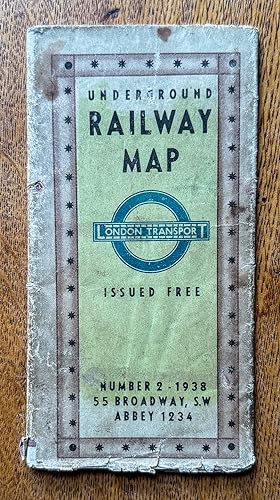
In den WarenkorbSoft cover. Zustand: Good. vintage fold out paper map that shows the Underground in diagramatic form just prior to WW2. Lines shown are the Metropolitan & District, Picadilly, Bakerloo, Northern and Central. Catchment are covered includes Staines to the West, Hight Barnet to the North , Upney to the East and Mordon to the South.… Rear shows blow up to central brown area, also map of theatres and cinemas.Condition: has a few large tears but not taped . Top margin has small stains but does not impinge on map. Would still look fantastic as a wall hanging.

Verlag: London: Johnson, Riddle & Co. Ltd. 1935
- Softcover
- Erstausgabe
Anbieter: MW Books, New York, USAMW Books
Verkäufer/-in kontaktierenVerkäufer/-in mit 5 SternenZustand: Gebraucht
EUR 277,56
Versand nach gratisVersand innerhalb von USAAnzahl: 1 verfügbar
In den WarenkorbFirst Edition. Good folding copy in the original stiff-card wrappers; edges slightly nicked and dust-dulled as with age. Physical description; 1 folding map ; 220 x 145 mm. Subjects; London Underground. LONDON. Transport. Railways (1935-). Genre; cartographic image. 3 Kg.
 Weitere Bilder
- Karte
Anbieter: Lindisfarne Prints, Shrewsbury, Vereinigtes KönigreichLindisfarne Prints
Verkäufer/-in kontaktierenVerkäufer/-in mit 5 SternenZustand: Gebraucht
EUR 33,39
EUR 12,74 VersandVersand von Vereinigtes Königreich nach USAAnzahl: 1 verfügbar
In den WarenkorbAntique Map London Underground "Map of London shewing Districts Served by Tube Railways"Published London circa 1925 by George Philip & Son in "Philips' Handy Volume Atlas of London" A highly detailed map ,uncoloured, except for all tube railway lines outlined in red, linking them to the indvidual companies that owned them at tha…t time as shown in the key upper right. The map details the London Underground as it was in The 1920's before nationalisation. Fine, clean condition. The map was printed in two seperate halves which have been conjoined with archival tape (neutral pH) on the back of the map. Due to inconsistencies of the printing process there may be some slight mis-register along the join. There are unrelated maps and text printed on the back. Approx. 8" x 7" (210mm x 180mm) overall. T 2L 1 25.
 Weitere Bilder
Verlag: London Transport, London 1937
Anbieter: Antipodean Books, Maps & Prints, ABAA, Garrison, USAAntipodean Books, Maps & Prints, ABAA
Verkäufer/-in kontaktierenVerkäufer/-in mit 3 SternenZustand: Gebraucht - Gut
EUR 54,13
EUR 8,62 VersandVersand innerhalb von USAAnzahl: 1 verfügbar
In den WarenkorbZustand: Very good condition. Scarce folding color original London Underground map, which includes 2 other maps of important London sites. With the three cover panels offering information on fares, and listing dominion offices and consulates, with the the flip side with a map showing theatres and cinemas in relation to the under…ground lines, in red and blue stars, and lists of art galleries, museums, public halls, and churches and cathedrals. The Tube map extends from Cockfosters in the north, to Morden in the south; Becontree in the east and Uxbridge in the west. Authorized extensions are shown in dotted red lines. Unfolds to 18 x 24"; 3 x 6" folded. Very good + condition, very clean, with the colors on maps bright and fresh.

Verlag: Chas. Baker & Co. ca. 1896 1896
- Karte
Anbieter: Garwood & Voigt, Sevenoaks, Vereinigtes KönigreichGarwood & Voigt
Verkäufer/-in kontaktierenVerkäufer/-in mit 5 SternenZustand: Gebraucht - Sehr gut
EUR 71,56
EUR 34,74 VersandVersand von Vereinigtes Königreich nach USAAnzahl: 1 verfügbar
In den WarenkorbZustand: Fine. 38 x 47 cm. Printed in full colours. Previously folded.
Verlag: Dangerfield Printing Company 1920
Anbieter: Francis Edwards ABA ILAB, Hay on Wye, Vereinigtes KönigreichFrancis Edwards ABA ILAB
Verkäufer/-in kontaktierenVerkäufer/-in mit 5 SternenZustand: Gebraucht
EUR 118,07
EUR 22,00 VersandVersand von Vereinigtes Königreich nach USAAnzahl: 1 verfügbar
In den Warenkorb13.5 x 11 inches. Printed in Colour. With smaller plans to verso. Several sm. splits to folds., some browning, signs of taping to one fold, sm. central hole to fold. US$133.
Verlag: Johnson Riddle & Co. Ltd 1936
Anbieter: Francis Edwards ABA ILAB, Hay on Wye, Vereinigtes KönigreichFrancis Edwards ABA ILAB
Verkäufer/-in kontaktierenVerkäufer/-in mit 5 SternenZustand: Gebraucht
EUR 196,78
EUR 22,00 VersandVersand von Vereinigtes Königreich nach USAAnzahl: 1 verfügbar
In den Warenkorb9 x 6 inches. Bi-Fold Colour card map. Sl. chipped to folds. and with sm. stain. Henry Charles Beck (19021974) English technical draughtsman who created the present London Underground Tube map in 1931, the map was first issued a pocket edition in January 1933. It was immediately popular, and the Underground has used topological…maps to illustrate the network ever since. US$221.
 Weitere Bilder
- Karte
Anbieter: Altea Antique Maps, London, Vereinigtes KönigreichAltea Antique Maps
Verkäufer/-in kontaktierenVerkäufer/-in mit 5 SternenZustand: Gebraucht
EUR 477,04
EUR 40,53 VersandVersand von Vereinigtes Königreich nach USAAnzahl: 1 verfügbar
In den WarenkorbLondon: London Underground, 1935. Colour-printed map, 150 x 225mm, folded twice. Central panel of the reverse toned. The first 1935 issue of Beck's map of the London Underground, two years after its first appearance. The reverse shows a detail of the interchange stations in the central area with the names of the interchange stat…ions within diamonds. See GARLAND: Mr Beck's Underground Map.


