
Gesamtpreis (1 Artikel Artikel):
Versandziel:

uganda map (25 Ergebnisse)
Direkt zu den wichtigsten Suchergebnissen
Suchfilter
Produktart
- Alle Product Types
- Bücher (16)
- Magazine & Zeitschriften (Keine weiteren Ergebnisse entsprechen dieser Verfeinerung)
- Comics (Keine weiteren Ergebnisse entsprechen dieser Verfeinerung)
- Noten (Keine weiteren Ergebnisse entsprechen dieser Verfeinerung)
- Kunst, Grafik & Poster (2)
- Fotografien (Keine weiteren Ergebnisse entsprechen dieser Verfeinerung)
- Karten (7)
- Manuskripte & Papierantiquitäten (Keine weiteren Ergebnisse entsprechen dieser Verfeinerung)
Zustand Mehr dazu
Einband
Weitere Eigenschaften
- Erstausgabe (1)
- Signiert (Keine weiteren Ergebnisse entsprechen dieser Verfeinerung)
- Schutzumschlag (2)
- Angebotsfoto (15)
Sprache (3)
Gratisversand
Land des Verkäufers
Verkäuferbewertung
-
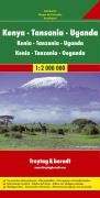
East Africa Road Map (Kenya, Tanzania, Uganda) (German Edition)
Sprache: Englisch
Verlag: Freytag-Berndt (edition ), 2006
ISBN 10: 3850842215 ISBN 13: 9783850842211
Map. Zustand: Fair. The item might be beaten up but readable. May contain markings or highlighting, as well as stains, bent corners, or any other major defect, but the text is not obscured in any way.
-
Zustand: very good. Gut/Very good: Buch bzw. Schutzumschlag mit wenigen Gebrauchsspuren an Einband, Schutzumschlag oder Seiten. / Describes a book or dust jacket that does show some signs of wear on either the binding, dust jacket or pages.
-

Ayear Book & Guide To East Africa 1951 Including Egypt, Sudan, Eritrea, Somaliland, Kenya, Uganda, Tanganyika, Zanzibar, Nyasaland, Portugese East Africa, The Congo, Mauritius , Madagascar, Reunion Etc Etc. With A Folding Map. Towen Plans And Route Maps
Sprache: Englisch
Verlag: Union Castle Mail Steamship Company. Robert Hale Ltd London, London, 1951
Anbieter: Westside Stories, Hamilton, ON, Kanada
Verkäuferbewertung 5 von 5 Sternen

Hardcover. Zustand: Very Good. No Jacket. First Thus. A Very Solid Book, Slight Aging To Pages Over 100 Pages Of Adverts, 16 Pages Of Maps And A Folded Map In A Front Pocket. Ribbon Marker Still Attached And Tied To An Integral Stand Bank Of South Africa Book Mark. Previous Owners Name On The First Page, Though It Appear The Ffep Has Been Removed. Very Slight Fraying To Edge Of Front Pages . Red Boards Cloth Covered And Very Slightly . Shaken But Holding Very Well. Gilt Title On Front Board And Slightly Faded Gilt Title On Spine. Only Minor Bumping Particularly To Spine Ends.
-
Tanzania, Kenya, Uganda Road Map
Verlag: Freytag & Berndt
Anbieter: Wonder Book, Frederick, MD, USA
Verkäuferbewertung 5 von 5 Sternen
Zustand: Fair. Acceptable condition. No date stated, ca. 1990s. [9783850842211] (East Africa, Road Maps) A readable, intact copy that may have noticeable tears and wear to the spine. All pages of text are present, but they may include extensive notes and highlighting or be heavily stained. Includes reading copy only books.
-

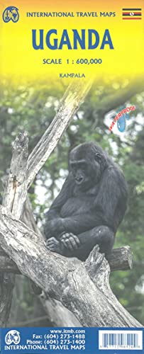
Uganda Travel Reference Map 2024 edi
Anbieter: Majestic Books, Hounslow, Vereinigtes Königreich
Verkäuferbewertung 4 von 5 Sternen

EUR 20,54
EUR 7,50 Versand
Versand von Vereinigtes Königreich nach USAAnzahl: 1 verfügbar
In den WarenkorbZustand: New.
-
The Year Book and Guide to East Africa, 1964 (Kenya, Uganda, Tanganyika, Zanzibar, Portugeuse East Africa, Mauritius, Seychelles, etc. with Atlas, Folding Map and Town Plans
Sprache: Englisch
Verlag: Robert Hale, London, UK, 1964
Anbieter: All Lost Books, Wollaston, Vereinigtes Königreich
Verkäuferbewertung 5 von 5 Sternen
EUR 21,40
EUR 23,31 Versand
Versand von Vereinigtes Königreich nach USAAnzahl: 1 verfügbar
In den WarenkorbHardcover. Zustand: Very Good. Zustand des Schutzumschlags: Good. Includes 13*colour maps (one folding) and many b/w maps and several colour illustrations. xxxiv+352+16pp. DJ rubbed and nicked at edges. 1.5cm closed tear to lower rear DJ edge, Red cloth boards with gilt lettering.
-
The Year Book and Guide to East Africa. (Including Egypt, Sudan, Eritrea, Somaliland, Kenya, Uganda, Tanganyika, Zanzibar, Nyasaland, Portuguese, East Africa, the Congo, Mauritius, Madagascar, Reunion etc., etc.) with Atlas, Folding Map, Town Plans and Route Maps.
Sprache: Englisch
Verlag: London, A. Gordon-Brown, 1952
Anbieter: Antiquariat Weinek, Salzburg, Österreich
Verkäuferbewertung 4 von 5 Sternen
XXXII + 435 + 16 + 107 S. OLwd. In Englisch. - Mit allen Karten u. Mappe. - Ebd. stärker berieben u. fleckig, sonst leichte Gbrsp.
-

Uganda: NEL.315 (Nelles Map)
Anbieter: Sell Books, Elland, YORKS, Vereinigtes Königreich
Verkäuferbewertung 5 von 5 Sternen
EUR 39,47
EUR 14,02 Versand
Versand von Vereinigtes Königreich nach USAAnzahl: 1 verfügbar
In den Warenkorbmap. Zustand: Acceptable. Please see the condition note after this for details, if this is missing please consider Acceptable to mean poor quality that could include major staining, water damage, writing, missing dustjacket, etc etc. Our books are dispatched from a Yorkshire former cotton mill. We list via barcode/ISBN so please note that the images are stock images and may not be the exact copy you receive, furthermore the details about edition and year might not be accurate as many publishers reuse the same ISBN for multiple editions and as we simply scan a barcode or enter an ISBN we do not check the validity of the edition data when listing. If you're looking for an exact edition please don't order (at least not without checking with us first, although we don't always have time to check). We aim to dispatch prompty, the service used will depend on order value and book size. We can ship to most countries, see our shipping policies. Payment is via Abe only.
-

Uganda for a holiday / by Sir Frederick Treves ; with seventy- two illustrations from photographs by the author and a map
Verlag: London : Smith, Elder, 1910
2nd impression. Very good copy in the original gilt-blocked cloth. Top edge gilt. Spine bands and panel edges somewhat dulled and rubbed as with age. Light foxing. Remains quite well-preserved overall. Physical description: xi, 233 p., [41] leaves of plates : ill., fold. map ; 23 cm. Subjects: Uganda Description and travel. Kenya Description and travel. Africa, East ; Handbooks, manuals, etc. 3 Kg.
-
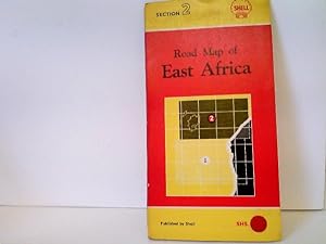
Road Map of East Africa - Section 2 - covering: Tanganyika (Southern Portion), Kenya and Uganda - Maßstab: 1 : 1.000.000
Sprache: Englisch
Verlag: London, Foldex
Anbieter: ABC Versand e.K., Aarbergen, Deutschland
Verkäuferbewertung 5 von 5 Sternen
Karte
Zustand: Gut. 1 Straßenkarte Straßenkarte von Ost-Afrika (Tanganijka, Kenia und Uganda) mit leichten altersbedingten Gebrauchsspuren, ohne Jahresangabe, ca. 1950er-Jahre, Kartendeckel leicht angestaubt, Ecken und Kanten bestoßen, Karte farbig, sehr gut erhalten, Sprache: EN; diese Karte schließt an an Abschnitt 1 der Shell Road Map von Ost-Afrika Ordner9 Sprache: Englisch Gewicht in Gramm: 202.
-

Zustand: Sehr gut. Zustand: Sehr gut | Seiten: 48 | Sprache: Englisch | Produktart: Bücher | Keine Beschreibung verfügbar.
-

Somalia & Horn of Africa : Touristik Map, Somalia, Ethiopia, South Susan, Uganda, Kenya, Djibouti, Socotra
Sprache: Englisch
Verlag: ITM International Travel Maps, 2020
ISBN 10: 1771297158 ISBN 13: 9781771297158
Anbieter: AHA-BUCH GmbH, Einbeck, Deutschland
Verkäuferbewertung 5 von 5 Sternen
Karte. Zustand: Neu. Neuware.
-
Spanning East Africa - Standard-Vacuum Road Map - Tanganyika - Kenya And Uganda
Sprache: Englisch
Verlag: Standard-Vacuum Oil Company (East Africa) Limited, Nairobi, Kenya, 1955
Anbieter: Hornseys, Ripon, Vereinigtes Königreich
Verbandsmitglied: PBFA
Verkäuferbewertung 5 von 5 Sternen
EUR 112,93
EUR 28,85 Versand
Versand von Vereinigtes Königreich nach USAAnzahl: 1 verfügbar
In den WarenkorbSoft cover. Zustand: Very Good Plus. Date: 1955. Printed lithographically in Nairobi. Double-sided folding map. Revised to April, 1955 after the original 1954 edition. Size: 75.3cm x 51.1cm when opened. Folds to 15.3cm x 25.7cm. Wrappers slightly creased and rubbed. Very slight foxing otherwise the maps are bright and clean and in very good plus condition with original fold-lines. Scarce. Worldcat lists only five copies in total of all three editions from 1954-1957.
-
A. M. Mackay, pioneer missionary of the Church missionary society to Uganda; by his sister. With etched portrait by H. Manesse and map.
Anbieter: D2D Books, Berkshire, Vereinigtes Königreich
Verkäuferbewertung 4 von 5 Sternen
EUR 27,23
EUR 22,97 Versand
Versand von Vereinigtes Königreich nach USAAnzahl: 1 verfügbar
In den WarenkorbHardcover. Zustand: Good. No Jacket. Hodder & Stoughton, 1890. First Edition. Hardcover, in green cloth. Gilt motif to front. Gilt titles to spine viii, 488p., plus folded map , soiling and scuffs to covers, fep torn out, foxing to feps and extreme page edges but inside in VERY GOOD CLEAN TIGHT READING ORDER. Full refund if not satisfied. 24 hour despatch.
-

Year Book & Guide to East Africa 1962: Kenya, Uganda, Tanganyika, zanzibar, Portuguese East Africa, Mauritius, Seychelles, Etc. With Atlas, Folding Map & Town Plans
Erscheinungsdatum: 2026
Anbieter: WeBuyBooks, Rossendale, LANCS, Vereinigtes Königreich
Verkäuferbewertung 5 von 5 Sternen
EUR 27,65
EUR 7,48 Versand
Versand von Vereinigtes Königreich nach USAAnzahl: 1 verfügbar
In den WarenkorbZustand: Good. Most items will be dispatched the same or the next working day. A copy that has been read but remains in clean condition. All of the pages are intact and the cover is intact and the spine may show signs of wear. The book may have minor markings which are not specifically mentioned. A good condition vintage book. No dust jacket. Toning to the contents and notable fading to the spine. Still an unfaded copy with a decent binding. An original 1962 printing in red hardcover boards.
-
Eighteen Years in Uganda & East Africa With Illustrations from Drawings by the Author an a Map
Sprache: Deutsch
Verlag: London, Edward Arnold, Publisher to the India Office, ., 1911
Anbieter: avelibro OHG, Dinkelscherben, Deutschland
Verbandsmitglied: BOEV
Verkäuferbewertung 5 von 5 Sternen
Erstausgabe
Zustand: Gut. 0. New Edition. 20,5 x 14 cm XVI, 362 S., 1 mehrfach gefaltete, farbige Karte, 8 S. Verlagsanzeigen Hardcover. Original Leineneinband mit goldbedrucktem Vorderdeckel und Buchrücken. Kanten und Ecken etwas stärker berieben bzw. bestoßen. Vorderdeckel mit Blindprägung. - Full cloth binding with gilt title and decoration on spine. Edges and corners rubbed and bumped. Seiten durchgehend leicht gebräunt. Zu Beginn und vor allem der Seitenschnitt stockfleckig. Sonst innen sauber. Seiten ungleich beschnitten. - Inside with slight browning. Foxing at margins and on the first few pages. Otherwise good, clean condition. Mit mehreren Tafeln mit Zeichnungen vom Verfasser sowie eine mehrfach gefaltete farbige Karte in sehr gutem Zustand. DX-202|10837BB Sprache: Deutsch Gewicht in Gramm: 700.
-

Antique Map-CENTRAL AFRICA-ANGOLA-MOZAMBIQUE-KONGO-UGANDA-Meyers-1893
Erscheinungsdatum: 1893
Anbieter: Pictura Prints, Art & Books, Overasselt, Niederlande
Verkäuferbewertung 4 von 5 Sternen
Kunst / Grafik / Poster
Original colour lithograph. on paper. Size in cm: The overall size is ca. 29.8 x 24.1 cm. The image size is ca. 27.6 x 20.8 cm. Size in inch: The overall size is ca. 11.7 x 9.5 inch. The image size is ca. 10.9 x 8.2 inch.Map: 'Aquatorial-Afrika.' (Map of Equatorial/Central Africa). This includes Congo, Tanzania, Zambia, Mozambique, lake Victoria and Tanganyika, as well as Mt. Kilimanjaro. This attractive original old antique print / plate / map originates from 1885-1907 editions of a famous German encyclopedia: 'Meyers grosses Konversations-Lexikon.', published in Leipzig and Vienna. Meyers Konversations-Lexikon was a major German encyclopedia that existed in various editions from 1839 until 1984, when it merged with the Brockhaus encyclopedia. Several of the plates were also used in Dutch Encyclopedia's like Winkler Prins.Artists and Engravers: The original founder and publisher who initiated this famous encyclopedia was Joseph Meyer (1796-1856, Hildburghausen, Germany).Condition: Excellent, given age. Original middle fold, as issued. General age-related toning and/or occasional minor defects from handling. Please study scan carefully.Keywords: ANTIQUE MAP-CENTRAL AFRICA-ANGOLA-MOZAMBIQUE-KONGO-UGANDA-MEYERS(PCOMAN) A168-08.
-

UGANDA MAP
Erscheinungsdatum: 1953
Anbieter: les routes du globe, PARIS, Frankreich
Verkäuferbewertung 5 von 5 Sternen
Zustand: bon. Drawn & photo-lithographed by Survey, Land & Mines Dept, Format déplié 43 x 34,5 cm, bon état. Cet ouvrage est disponible ŕ la librairie. Merci de me contacter avant de vous déplacer 06 51 13 88 91. This book is available at the antiquarian bookstore.
-

'ABISSINIE OU HAUTE ETHOPIE'. Antique map of East Africa, incl. Sudan, Ethiopia, Uganda, Kenya and Tanzania
Verlag: Pierre Du Val 1682, 1682
Anbieter: Garwood & Voigt, Sevenoaks, Vereinigtes Königreich
Verkäuferbewertung 5 von 5 Sternen
Karte
EUR 71,33
EUR 34,62 Versand
Versand von Vereinigtes Königreich nach USAAnzahl: 1 verfügbar
In den Warenkorb12x10cm. Uncoloured. Very good condition.
-

'ABISSINIE OU HAUTE ETHOPIE'. Antique map of East Africa, incl. Sudan, Ethiopia, Uganda, Kenya and Tanzania
Verlag: Pierre Du Val 1663, 1663
Anbieter: Garwood & Voigt, Sevenoaks, Vereinigtes Königreich
Verkäuferbewertung 5 von 5 Sternen
Karte
EUR 71,33
EUR 34,62 Versand
Versand von Vereinigtes Königreich nach USAAnzahl: 1 verfügbar
In den Warenkorb12x10cm. Original outline colour. Very good condition.
-
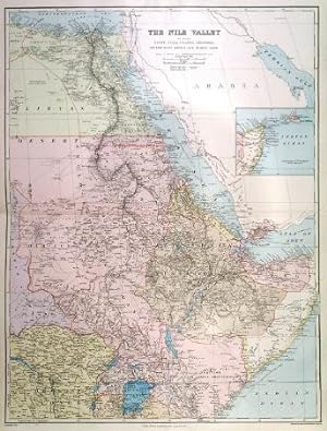
'THE NILE VALLEY'. Large map of Egypt and the Nile, Nubia, Uganda, Abyssinia, Congo Free State, Darfur, Somali Land, British East Africa Protectorate
Verlag: Edward Stanford. 1904, 1904
Anbieter: Garwood & Voigt, Sevenoaks, Vereinigtes Königreich
Verkäuferbewertung 5 von 5 Sternen
Karte
EUR 83,21
EUR 34,62 Versand
Versand von Vereinigtes Königreich nach USAAnzahl: 1 verfügbar
In den WarenkorbZustand: Fine. 69x52cm. Printed in colours.
-
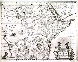
'AETHIOPIA SUPERIOR VEL INTERIOR VULGO ABISSINORUM SIVE PRESBITERIIOANNIS IMPERIUM'. Map of Central and Eastern Africa, incl. Ethiopia, Somalia, Kenya, Uganda and Tanzania, with figurative cartouche and scale of miles. Engraved by Merian and published by
Verlag: Johann Ludwig Gottfried in Frankfurt 1650, 1650
Anbieter: Garwood & Voigt, Sevenoaks, Vereinigtes Königreich
Verkäuferbewertung 5 von 5 Sternen
Karte
EUR 160,48
EUR 34,62 Versand
Versand von Vereinigtes Königreich nach USAAnzahl: 1 verfügbar
In den Warenkorb29x37cm. Very good condition. Uncoloured as originally published.
-

Provisional Geological Map of Uganda.
Verlag: Uganda: Geological Survey of Uganda, 1940., 1940
Anbieter: Michael S. Kemp, Bookseller, Sheerness, KENT, Vereinigtes Königreich
Verbandsmitglied: PBFA
Verkäuferbewertung 5 von 5 Sternen
Karte
EUR 372,80
EUR 46,17 Versand
Versand von Vereinigtes Königreich nach USAAnzahl: 1 verfügbar
In den WarenkorbLarge coloured map, 720 x 740 mm. mounted on linen, old folds, overall browning and a few old tape stains to the outer blank margins. Scarce with 3 locations traced: Manchester, Bodleian and Cambridge.
-

Map of the Uganda Protectorate to illustrate the paper by Sir Harry Johnston, G.C.M.G., K.C.B.
Erscheinungsdatum: 1902
Anbieter: Geographicus Rare Antique Maps, Brooklyn, NY, USA
Verbandsmitglied: ABAA ESA ILAB
Verkäuferbewertung 3 von 5 Sternen

Karte
Very good. Light wear along original fold lines. Small area of reinforcement on verso. Accompanied by Johnston's article. Size 17.5 x 18.5 Inches. This is a 1902 Royal Geographical Society and Harry Hamilton Johnston 'Scramble for Africa' map of the Uganda Protectorate - including modern-day Uganda and western Kenya. The map was issued to accompany a descriptive article by Johnston, which emerged as the British were working to assert administrative and economic control over the region through the building of the Mombasa-Victoria Railway, the establishment of new administrative zones, and the construction of colonial trade towns. A Closer Look The map highlights the British colonial Uganda Protectorate - encompassing a massive territory ranging from the Congo border east as far as Nairobi, Kenya. Lake Victoria (Victoria Nyanza) dominates the bottom border. The region's impressive topography is illustrated, with individual mountain peaks identified - including an impressive Mount Kenya (Elgon). Lake Albert, Lake Kyoga, and Lake Rudolf (Lake Turkana) appear as well. The Nile River runs north from Lake Albert, creating part of the border of the Uganda Protectorate. The Mombasa-Victoria Railway, opened one year earlier in 1901, extends form Nairobi in the lower right to Lake Victoria. Although most of the line was complete when this map was issued, the dashed section here emphasizes that it had not yet reached its terminus at Kisumu. A notation along the route states 'site of projected new capital', which never emerged. Uganda Protectorate The Uganda Protectorate, established by the British in 1894, marked the beginning of formal colonial rule over the kingdom of Buganda and its neighbors. The era was characterized by administrative, economic, and social changes, as the British sought to consolidate their control through indirect rule, leveraging the existing traditional kingdoms. The introduction of cotton and coffee transformed the local economy, integrating the region into the global markets and altering traditional agricultural practices. The period also saw the establishment of Christian missions, which played a crucial role in education and the spread of Christianity, alongside the introduction of Western legal and administrative systems. Despite these changes, the protectorate era was marked by resistance and negotiation between the British and the local rulers, leading to a complex legacy of colonial rule that shaped Uganda's path to independence in 1962. The Mombasa-Victoria (Uganda) Railway An ancient Kikuyu prophecy predicted 'an iron snake will cross from the lake of salt to the lands of the Great Lake.' Prophecy became reality in 1896, when the British began construction of an ambitious meter-gauge railway from the Indian Ocean port of Mombasa to the Ugandan city of Kisumu, on Lake Victoria. The construction was plagued by difficult terrain, infectious disease, and the man-eating lions of Tsavo. It also ran excessively over budget, so much so that political critics in London dubbed it the 'Lunatic Express'. Nonetheless, by 1901, the line was complete and proved a strategic coup. The British used railroads as a logistical and tactical tool to assert 'Effective Occupation' during the Scramble for Africa. In this case, the Uganda Railway, as it came to be known despite running almost entirely in Kenya, opened the African Great Lakes region to economic and military development and proved to be the binding linchpin of British East African hegemony. From 1929, the line began running under the management of Kenya Railways as one of the world's great heritage railroads. Passing through some of Africa's most beautiful terrain, travel on the train became a luxury staple for the safari-set, carrying Theodore Roosevelt, among others. Today, although much faded from its colonial glory, the railroad remains little changed, using original tracks, moderately-well maintained original cars, old-world table services, and more. Scramble f.
-

"Carta dell'Affrica" - Afrika Afrique Africa / Ägypten Lybien Tunesien Senegal Südafrika Madagaskar Kongo Ghana Algerien Niger Tschad Sudan Nigeria Äthipien Guinea Ghana Tansania Angola Botswana Mosambik Mauretanien Marokko Uganda Sierra Leone Guinea / Egypt Libya Tunisia Senegal South Africa Madagascar Congo Ghana Algeria Niger Chad Sudan Nigeria Ethiopia Guinea Ghana Tanzania Angola Botswana Mozambique Mauritania Morocco Uganda Sierra Leone Guinea / Kontinent continent / Karte map
Sprache: Deutsch
Verlag: Milano um 1820., 1820
Anbieter: Antiquariat Steffen Völkel GmbH, Seubersdorf, Deutschland
Verkäuferbewertung 5 von 5 Sternen
Kunst / Grafik / Poster
Seltene, großformatige,altkolorierte Kupferstich-Karte von ca. 1820- Blatt-Format: ca.53 x 74cm - mit alten original Faltspuren - sonst gut erhalten. // Wir, das Antiquariat Steffen Völkel, kaufen und verkaufen alte Bücher, Handschriften, Zeichnungen, Autographen, Grafiken und Fotografien. Wir sind stets am Ankauf von kompletten Bibliotheken, Sammlungen und Nachlässen interessiert. Sprache: Deutsch.


