
Gesamtpreis (1 Artikel Artikel):
Versandziel:

tombleson views rhine von tombleson fearnside (16 Ergebnisse)
Direkt zu den wichtigsten Suchergebnissen
Suchfilter
Produktart
- Alle Product Types
- Bücher (16)
- Magazine & Zeitschriften (Keine weiteren Ergebnisse entsprechen dieser Verfeinerung)
- Comics (Keine weiteren Ergebnisse entsprechen dieser Verfeinerung)
- Noten (Keine weiteren Ergebnisse entsprechen dieser Verfeinerung)
- Kunst, Grafik & Poster (Keine weiteren Ergebnisse entsprechen dieser Verfeinerung)
- Fotografien (Keine weiteren Ergebnisse entsprechen dieser Verfeinerung)
- Karten (Keine weiteren Ergebnisse entsprechen dieser Verfeinerung)
- Manuskripte & Papierantiquitäten (Keine weiteren Ergebnisse entsprechen dieser Verfeinerung)
Zustand Mehr dazu
- Neu (Keine weiteren Ergebnisse entsprechen dieser Verfeinerung)
- Wie Neu, Sehr Gut oder Gut Bis Sehr Gut (Keine weiteren Ergebnisse entsprechen dieser Verfeinerung)
- Gut oder Befriedigend (8)
- Ausreichend oder Schlecht (1)
- Wie beschrieben (7)
Einband
- alle Einbände
- Hardcover (14)
- Softcover (Keine weiteren Ergebnisse entsprechen dieser Verfeinerung)
Weitere Eigenschaften
- Erstausgabe (8)
- Signiert (Keine weiteren Ergebnisse entsprechen dieser Verfeinerung)
- Schutzumschlag (Keine weiteren Ergebnisse entsprechen dieser Verfeinerung)
- Angebotsfoto (14)
Sprache (3)
Preis
- Beliebiger Preis
- Weniger als EUR 20 (Keine weiteren Ergebnisse entsprechen dieser Verfeinerung)
- EUR 20 bis EUR 45
- Mehr als EUR 45
Gratisversand
- Kostenloser Versand nach USA (Keine weiteren Ergebnisse entsprechen dieser Verfeinerung)
Land des Verkäufers
Verkäuferbewertung
-
Tombleson's Views of the Rhine
Verlag: W Tombleson / Black and Armstrong, London, undated, c.1838,, 1838
Anbieter: BRIMSTONES, Lewes, Vereinigtes Königreich
Verkäuferbewertung 5 von 5 Sternen

EUR 42,45
EUR 22,89 shipping
Ships from Vereinigtes Königreich to USAAnzahl: 1 verfügbar
In den Warenkorbhardback, 8vo, 190pp, 68 engraved plates, folding map, the map foxed and creased, tissue guards browned, the plates mostly with foxing on margins only, inner hinges cracked and weak, green cloth gilt, frayed at corners and spine ends, Fair condition.
-
Tombleson's Views of the Rhine
Verlag: Tombleson & Co [1832], London, 1832
Anbieter: Barter Books Ltd, Alnwick, NORTH, Vereinigtes Königreich
Verbandsmitglied: IOBA
Verkäuferbewertung 5 von 5 Sternen
EUR 81,71
EUR 9,16 shipping
Ships from Vereinigtes Königreich to USAAnzahl: 1 verfügbar
In den WarenkorbZustand: Fair. Reprint. Worn condition. Boards detached. Loss to spine. Slight foxing, but content in overall good condition. 250mm x 160mm (10" x 6"). 190pp + plates. 68 b/w plates + fold-out map. Green hardback half-leather cover.
-
William Tombleson's Views of the Rhine / Vues du Rhine / Rhein Ansichten.
Verlag: London : W. Tombleson & Comp., 1832
ISBN 10: 1002488451 ISBN 13: 9781002488454
Anbieter: Antiquariat Smock, Freiburg, Deutschland
Verkäuferbewertung 5 von 5 Sternen
Erstausgabe
Zustand: Gut. Formateinband: Halbledereinband / gebundene Ausgabe 190 S. + 62 Stahlstiche Erstausgabe / 1. Aufl.; Halbleder; Deutschsprachige Ausgabe; Mit Titelansicht und 62 Stahlstichen; Außen gealtert und am Rücken und den Lederecken deutlich berieben; Schnitt und Tafeln etwas stockfleckig (meist außerhalb der Abbildung), 2 kleine Kreuze auf den Vorsatzblättern; sonst gut erhalten. Sprache: Deutsch Gewicht in Gramm: 900 [Stichwörter: Rheinansichten, Städte am Rhein, Alte Stiche].
-
Tombleson's Views of the Rhine
Verlag: W. Tombleson & Company, London, 1832
Anbieter: Rooke Books PBFA, Bath, Vereinigtes Königreich
Verbandsmitglied: PBFA
Verkäuferbewertung 5 von 5 Sternen
Erstausgabe
EUR 82,54
EUR 17,16 shipping
Ships from Vereinigtes Königreich to USAAnzahl: 1 verfügbar
In den WarenkorbLeather. Zustand: Good. William Tombleson (illustrator). First edition. The first edition of this extensively illustrated look at the beautiful views seen along the Rhine. The first edition.A sentimental look at the beauties of the Rhine, one of the major rivers in Europe.This work shows the many beautiful views along the run of the Rhine, which runs through Switzerland, Liechtenstein, Austria, Germany, France, and the Netherlands.By William Tombleson, a topographical and architecture artist, who also published a similar volume on the Thames, and the Upper Rhine.This was a popular work, also being translated into French and German.Illustrated with a frontispiece, vignette title page, and sixty-eight plates.Collated, lacking most of the folding map to the frontispiece, otherwise all other plates are present.Edited by W. G. Fearnside. In a half calf binding with marbled paper to the boards. Externally, generally smart, a little rubbed with some light marks. Spine is lightly discoloured. Minor bumping to the extremities. Front hinge is starting but firm. Internally, firmly bound. Pages are very lightly age-toned and generally clean with scattered spots. Lacking most of the frontispiece. Good. book.
-
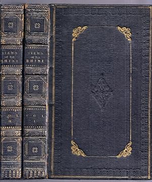
(1) Tombleson's Views of the Rhine. Vues du Rhin. Rhein Ansichten. (2) Tombleson's Upper Rhine. Ober Rhein. Le Rhin Superieur. 2 Bände.
Verlag: London, Verlag Black and Armstrong [um ], 1840
Sprache: Französisch
Anbieter: Antiquariat Lenzen, Düsseldorf, Deutschland
Verbandsmitglied: GIAQ ILAB VDA
Verkäuferbewertung 5 von 5 Sternen
Erstausgabe
Zustand: Gut. 8°. 23,5 x 15 cm. [1] Blatt, 190 Seiten, [1] Blatt; [1] Blatt, VIII, 181 Seiten, [1] Blatt. 134 [von 138] Tafeln. Leinenbände der Zeit mit Blindprägung, goldgeprägtem Titel auf ledernem Rückenschild und Goldschnitt. Erste Ausgabe. Französischsprachige Ausgabe. Mit gestochenen Titelblättern nach Tombleson durch Clark, einer mehrfach gefalteten Panoramakarte des Rheins von Köln bis Mainz, einer mehrfach gefalteten Karte des Oberrheins und insgesamt 134 [von 138] Tafeln. Einbände leicht berieben, Rücken aufgehellt, Vorsätze fleckig, "Upper Rhine" im vorderen Innenfalz leicht eingerissen, Seiten und Tafeln leicht gebräunt und leicht bis stellenweiße mäßig stockfleckig, eine Lage im ersten Band lose beiliegend, es fehlen insgesamt 4 Tafeln (im ersten Band 1 Tafel, im zweiten 3 Tafeln), Faltkarte leicht angerändert und mit minimalen Randläsuren, beide Karten leicht knickspurig, ansonsten gutes Exemplar. Cloth binding of the times with blind embossing, gilt-stamped title on leather spine label and gilt edges. First edition. French language edition. With engraved title pages after Tombleson by Clark, a multi-fold panoramic map of the Rhine from Cologne to Mainz, a multi-fold map of the Upper Rhine and a total of 134 [of 138] plates. Bindings slightly rubbed, spine brightened, endpapers stained, 'Upper Rhine' slightly torn in the front hinge, pages and plates slightly darkened and lightly to moderately foxed in places, one quire in the first volume loose, a total of 4 plates missing (1 plate in the first, 3 plates in the second volume), folding map with narrrow darkened edges and minimal marginal wear, both maps slightly creased, otherwise a good copy.
-
Tombleson's Views of the Rhine. Vues du Rhin. Rheim Ansichten
Verlag: Black and Armstrong, London, 1832
Anbieter: The Kelmscott Bookshop, ABAA, Savage, MD, USA
Verbandsmitglied: ABAA ESA ILAB IOBA
Verkäuferbewertung 5 von 5 Sternen
Hardcover. Zustand: Very Good. Hardcover. Not dated. William Tombleson (1795 - 1846) was an English artist, author, and printmaker best known for his topographical drawings of the Rhine River in Germany and the Thames River in England. This is the English language edition; it was also printed in German and French. Very good in original blue cloth boards with gilt title and decoration to spine. Gilt and embossed design to both boards. Minor fading to spine although gilt remains bright. Minor wear to spine ends and edges of boards. Dampstaining to bottom corners and edges of some pages. There is light foxing throughout and both hinges are starting. Full gilt edges. Includes 68 illustrations plus engraved title page, and a large double fold out map of the Rhine. The map has multiple creases and a few spots of foxing. 190 pages plus plates. TRA/092013.
-

Tombleson's Views of the Rhine. Vues du Rhin. Rheim Ansichten.
Verlag: Black and Armstrong, London,, 1832
Anbieter: FIRENZELIBRI SRL, Reggello, FI, Italien
Verkäuferbewertung 5 von 5 Sternen
Zustand: MOLTO BUONO. NOTA:Dorso con piccola mancanza nella parte superiore di circa 2 cm. legatura con lievi spellature. / London, Black and Armstrong cm.15,5x24,5, pp.190, con 69 incisioni in tavole fuori testo, protette da velina e una carta ripiegata in appendice del Reno ripiegata in varie parti. Bella legatura in piena pelle, piatti e dorso con doppia cornice con impressioni a secco in oro, filetti dorati alle sguardie, i tre tagli dorati. William Tombleson (1795 - 1846) was an English artist, author, and printmaker best known for his topographical drawings of the Rhine River in Germany and the Thames River in England. This is the English language edition; it was also printed in German and French.
-

Tombleson s Views of the Vues du Rhin- Rhein Ansichten-Rhine.
Verlag: Tombleson, London, 1832
Anbieter: Liwall Bücher und mehr, Halle, Deutschland
Verkäuferbewertung 5 von 5 Sternen
Titeltafel, 66 Tafeln, 1 Rheinleporello ca.16x110 cm 190 S.+Tafeln Späteres Leinen unter Verwendung eines Rücken der Zeit +8° (Vorsätze neu, Tafeln teilweise etwas fleckig) Sprache: de.
-

Tombleson's Views of the Rhine / Vues du Rhin / Rhein Ansichten. Edited by W. G. Fearnside. Deutschsprachige Ausgabe: Textseiten vollständig in deutscher Sprache, Bildunterschriften in Englisch, Französisch und Deutsch. Wohl 1. Ausgabe in deutscher Sprache im Jahr der englischen EA.
Verlag: Tombleson & Co, London, 1832
Anbieter: AixLibris Antiquariat Klaus Schymiczek, Aachen, Deutschland
Verbandsmitglied: BOEV
Verkäuferbewertung 5 von 5 Sternen
Gr.8°. (1832). Erste Auflage, 190 S., 1 Bl., 180 S., 2 Bll., Kleisterpapier-Pappband der Zeit mit Rückenschild, schmalen Pergaminstreifen an den Kapitalen und Pergamentverstärkung in den Ecken. Mit gest. Titel (mit Ansicht), 68 Stahlstichansichten und 1 gest., mehrfach gefalteten Panorama. Einband gering berieben und leicht bestossen; Bezugspapier etwas beschabt; Vorsätze stockfleckig; gest. Faltpanorama gering verfaltet und gebräunt sowie leicht stockfleckig; die Stahlstich-Ansichten (Tafeln) meist etwas oder leicht stockfleckig, einige der Ansichten aber auch stärker stockfleckig und in den Rändern braunfleckig; die ersten und die letzten Textblätter stockfleckig - Textblätter ansonsten nur teils leicht oder etwas stockfleckig. Schmitt (Die illustrierten Rhein-Beschreibungen) Nr. 266.
-

TOMBLESON'S VIEWS OF THE RHINE and VIEWS OF THE UPPER RHINE
Verlag: W. Tombleson and Company, London, 1832
Anbieter: Charles Agvent, est. 1987, ABAA, ILAB, Fleetwood, PA, USA
Verkäuferbewertung 5 von 5 Sternen
Erstausgabe
Hardcover. W. Tombleson (illustrator). First Edition. Two small quarto (6" x 9-1/2") volumes bound in polished black calf with gilt-decorated and lettered spines. Illustrated with 2 engraved title pages and 137 fine steel-engraved views as well as a long (45"!) folding panoramic map of the Rhine from Cologne to Mainz in the first volume and a large folding color map of the Upper Rhine in the second volume. Occasional scattered foxing, but plates mostly bright and clean; one map with two-inch closed tear. Bindings rather worn with some losses to the spine of one volume; joints rubbed but covers secure. Overall Very Good.
-
Tombleson's Views of the Rhine and Tombleson's Upper Rhine. 2 Volumes.
Verlag: Black and Armstrong.
Anbieter: Elaine Beardsell, HOLMFIRTH, Vereinigtes Königreich
Verbandsmitglied: PBFA
Verkäuferbewertung 4 von 5 Sternen

Erstausgabe
EUR 383,20
EUR 16,03 shipping
Ships from Vereinigtes Königreich to USAAnzahl: 1 verfügbar
In den WarenkorbHardcover. Zustand: Very Good. Tombleson, W. (illustrator). 1st Edition. Vol 1. 190 pp + [2] pp appendix + all plates ( and foldg map ) as called for. Vol 2. 181 pp + [3] pp appendix + all plates ( and foldg map ) as called for. No date on title pages but ' Foreign Booksellers to the King' ie pre Victoria, on title page. POS on paste down fep, bookplate of previous owner on ffep of ffeps. Scattered foxing else near fine hardbacks in contemporary blind and gilt stamped green cloth with elaborate gilt decoration to spines.
-
[Proof copy]: Tombleson's Views of the Rhine (Vues du Rhin / Rhein Ansichten), Volume 1: Cologne to Mainz
Verlag: Black & Armstrong, Foreign Booksellers to the King, London, 1832
Anbieter: Between the Covers-Rare Books, Inc. ABAA, Gloucester City, NJ, USA
Verbandsmitglied: ABAA ESA ILAB IOBA
Verkäuferbewertung 5 von 5 Sternen
Erstausgabe
Hardcover. Zustand: Good. Proof copy. Volume 1 only (of 2). Edited by W.G. Fearnside. Octavo. 190, [2]pp., 69 engraved plates and 1 folding panoramic map of the Rhine at the rear. Contemporary dark green quarter morocco and moiré cloth boards, all edges gilt. The binding is moderately stained and worn at the edges, hinges are split, else good, the interior plates are clean and tight. Very good bright proof impressions of Tombleson's famous topographical steel engravings of the Rhine from Cologne to Mainz. All 69 proofs are printed on Japan tissue paper and tipped in on thick paper plates.
-
TOMBLESON'S VIEWS OF THE RHINE and VIEWS OF THE UPPER RHINE
Verlag: W. Tombleson and Company, London, 1832
Anbieter: Charles Agvent, est. 1987, ABAA, ILAB, Fleetwood, PA, USA
Verkäuferbewertung 5 von 5 Sternen
Erstausgabe
Hardcover. W. Tombleson (illustrator). First Edition. Two small quarto (5-3/4" x 9-1/2") volumes bound in gilt-decorated and blind-stamped full black morocco leather. Illustrated with 2 engraved title pages and 137 fine steel-engraved views as well as a long (45"!) folding panoramic map of the Rhine from Cologne to Mainz in the first volume and a large folding color map of the Upper Rhine in the second volume. Owner name of Harriet Mosely dated 1835 on the front blank of each volume with an armorial bookplate on the front endpaper of each volume. Plates bright and clean. Some rubbing to the hinges which are just a little tender with slightly pulled headcaps. Near Fine.
-

Tombleson's Views of the Rhine. Rhein Ansichten. - Edited by W.G. Fearnside - Band 1.
Verlag: London, Tombleson & Comp., 1832
Sprache: Deutsch
Anbieter: Antiquariat Deinbacher, Murstetten, Österreich
Verkäuferbewertung 4 von 5 Sternen
Erstausgabe
1. Aufl. 95 Seiten Text und 1 gestochenes Titelblatt und 71 ungezählte Stahlstich-Tafeln, Einband etwas berieben, Tafeln leicht stockfleckig, ansonst guter und sauberer Zustand Sprache: Deutsch Gewicht in Gramm: 1200 4°, Leinen- Hardcover/Pappeinband,
-

Tombleson's Views of the Rhine. Vues du Rhin. Rheim Ansichten.
Verlag: Black and Armstrong, London,, 1832
Anbieter: FIRENZELIBRI SRL, Reggello, FI, Italien
Verkäuferbewertung 5 von 5 Sternen
Zustand: MOLTO BUONO. London, Black and Armstrong cm.15,5x24,5, pp.190, con 69 incisioni in tavole fuori testo, protette da velina e una carta ripiegata in appendice del Reno ripiegata in varie parti. Legatura in tutta tela verde confredi in oro ai piatti e al dorso, con i tre tagli dorati. Ex libris inciso con simbolo zoomorfo, applicato alla sguardia anteriore Montvaillant. William Tombleson (1795 - 1846) was an English artist, author, and printmaker best known for his topographical drawings of the Rhine River in Germany and the Thames River in England. This is the English language edition; it was also printed in German and French.
-
Tombleson's Views Of The Rhine.
Verlag: London: W.Tombleson & Company, 1832., 1832
Anbieter: D & E LAKE LTD. (ABAC/ILAB), Toronto, ON, Kanada
Verkäuferbewertung 3 von 5 Sternen

tall 8vo. pp. 190, [2]. long folding panoramic map of the Rhine from Cologne to Mainz, steel-engraved title with large vignette view, & 68 steel-engraved plates. tissue guards. contemporary half calf (rubbed, spine faded & lacking label, some offsetting from plates, scattered foxing). Offered without the companion volume on the Upper Rhine which was published the same year.


![Bild des Verkäufers für [Proof copy]: Tombleson's Views of the Rhine (Vues du Rhin / Rhein Ansichten), Volume 1: Cologne to Mainz zum Verkauf von Between the Covers-Rare Books, Inc. ABAA](https://pictures.abebooks.com/inventory/md/md9925551548.jpg)