
Gesamtpreis (1 Artikel Artikel):
Versandziel:

satellite remote sensing forest (9 Ergebnisse)
Direkt zu den wichtigsten Suchergebnissen
Suchfilter
Produktart
- Alle Product Types
- B³cher (9)
- Magazine & Zeitschriften (Keine weiteren Ergebnisse entsprechen dieser Verfeinerung)
- Comics (Keine weiteren Ergebnisse entsprechen dieser Verfeinerung)
- Noten (Keine weiteren Ergebnisse entsprechen dieser Verfeinerung)
- Kunst, Grafik & Poster (Keine weiteren Ergebnisse entsprechen dieser Verfeinerung)
- Fotografien (Keine weiteren Ergebnisse entsprechen dieser Verfeinerung)
- Karten (Keine weiteren Ergebnisse entsprechen dieser Verfeinerung)
- Manuskripte & Papierantiquitõten (Keine weiteren Ergebnisse entsprechen dieser Verfeinerung)
Zustand Mehr dazu
- Neu (5)
- Wie Neu, Sehr Gut oder Gut Bis Sehr Gut (1)
- Gut oder Befriedigend (1)
- Ausreichend oder Schlecht (Keine weiteren Ergebnisse entsprechen dieser Verfeinerung)
- Wie beschrieben (2)
Einband
Weitere Eigenschaften
- Erstausgabe (2)
- Signiert (Keine weiteren Ergebnisse entsprechen dieser Verfeinerung)
- Schutzumschlag (3)
- Angebotsfoto (6)
Sprache (3)
Preis
- Beliebiger Preis
- Weniger als EUR 20 (Keine weiteren Ergebnisse entsprechen dieser Verfeinerung)
- EUR 20 bis EUR 45
- Mehr als EUR 45
Gratisversand
- Kostenloser Versand nach USA (Keine weiteren Ergebnisse entsprechen dieser Verfeinerung)
Land des Verkõufers
Verkõuferbewertung
-
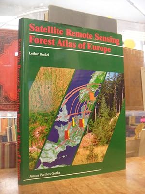
Satellite Remote Sensing Forest Atlas of Europe.
Anbieter: Bibliotheca Botanica, Adendorf, Deutschland
Verbandsmitglied: GIAQ
Verkõuferbewertung 5 von 5 Sternen

Zustand: Wie neu. 37 cm. 256 S. Mit hunderten von terrestrischen und Satelliten Fotos, Karten, Plõnen und Diagrammen. Dekoriertes Leinen (Hardcover), Fadenheftung. Neuwertiges Exemplar. In englischer Sprache. [Klimawandel Waldschõden Atlanten Forest Waldatlas Forstwissenschaft Forstkartierung Kartierung].
-
Satellite Remote Sensing Forest Atlas of Europe
Anbieter: Antiquariat Orban & Streu GbR, Frankfurt am Main, Deutschland
Verkõuferbewertung 5 von 5 Sternen
Erstausgabe
2░, 256 S. mit sehr zahlr. Farb- und s/w-Abb., Illustr., Luft- und Satelitenbildern, Kartendarstellungen etc., Text: englisch, original Leineneinband mit dem illustr. original Schutzumschlag, sehr sch÷nes, sauberes Exemplar (RG1) Abholung im Ladengeschõft in Frankfurt am Main (Nordend gg³. Musterschule) m÷glich. Das spart die Portokosten. Pickup at the store in Frankfurt am Main (Nordend, close to Musterschule) is possible. It saves the shipping costs.
-

Taschenbuch. Zustand: Neu. Remote Sensing in Rio de Janeiro City | Automatic Land-Cover Classification Derived from High-Resolution IKONOS Satellite Image in the Urban Atlantic Forest | Luiz F. Guanaes | Taschenbuch | Englisch | VDM Verlag Dr. M³ller | EAN 9783639057133 | Verantwortliche Person f³r die EU: preigu GmbH & Co. KG, Lengericher Landstr. 19, 49078 Osnabr³ck, mail[at]preigu[dot]de | Anbieter: preigu.
-

Satellite Remote Sensing for Forest and Environmental Monitoring (Earth Observation)
Buch 14Āvon 26: Earth ObservationAnbieter: Majestic Books, Hounslow, Vereinigtes K÷nigreich
Verkõuferbewertung 4 von 5 Sternen

EUR 161,33
EUR 7,52 Versand
Versand von Vereinigtes K÷nigreich nach USAAnzahl: 3 verf³gbar
In den WarenkorbZustand: New.
-

EUR 207,49
EUR 48,99 Versand
Versand von Deutschland nach USAAnzahl: Mehr als 20 verf³gbar
In den WarenkorbZustand: New. Covers a range of cutting-edge sensors and platforms for advanced forest analyses and novel remote sensing methodologiesExplore diverse global case studies, utilizing consistent observations for effective geospatial monitoring strategies.
-
Satellite Remote Sensing for Forest and Environmental Monitoring
Buch 14Āvon 26: Earth ObservationAnbieter: Revaluation Books, Exeter, Vereinigtes K÷nigreich
Verkõuferbewertung 5 von 5 Sternen
EUR 283,41
EUR 17,36 Versand
Versand von Vereinigtes K÷nigreich nach USAAnzahl: 2 verf³gbar
In den WarenkorbPaperback. Zustand: Brand New. 375 pages. 9.00x6.00x9.02 inches. In Stock.
-

Satellite Remote Sensing for Forest and Environmental Monitoring
Buch 14Āvon 26: Earth ObservationSprache: Englisch
Verlag: Elsevier - Health Sciences Division Dez 2025, 2025
ISBN 10: 0443402965 ISBN 13: 9780443402968
Anbieter: AHA-BUCH GmbH, Einbeck, Deutschland
Verkõuferbewertung 5 von 5 Sternen
Taschenbuch. Zustand: Neu. Neuware - Satellite Remote Sensing for Forest and Environmental Monitoring provides a thorough examination of the applications and methods of satellite remote sensing for analyzing and managing forest environments. From forest height mapping to biodiversity modeling, the book explores a variety of Earth observation applications across cutting-edge sensors and platforms. The book addresses the ability of satelitte technologies to observe and analyse ecological functions, conditions, and socioeconomic benefits for sustainable nature protection in the face of anthropogenic change, offering practical tools and strategies for large-scale forest inventories, fire risk assessment, and freshwater management. Satellite Remote Sensing for Forest and Environmental Monitoring offers postgraduates, researchers, and academics in remote sensing and geospatial technologies, particularly those focusing on forestry applications and related disciplines insights into environmental changes, land use patterns, vegetation mapping, and climate indicators.
-

Satellite Remote Sensing Forest Atlas of Europe.
Sprache: Deutsch
Verlag: Justus Perthes. Gotha., 1995
Anbieter: avelibro OHG, Dinkelscherben, Deutschland
Verbandsmitglied: BOEV
Verkõuferbewertung 5 von 5 Sternen
Erstausgabe
Zustand: Gut. 1st edition. 256 P. In mint condition. English Language. Part I: Satelitte Remote Sensing and Foresty. Introduction./ Part II. The Forests and their Environment. Satellite Image Maps./ Part III: The Countries of Europe and the Neighbouring Mediterranean Country Reports and Case Studies.; - Permanent Illustr. in colored. deu MIG-33-02A|Lager 22|14523BB Altersfreigabe FSK ab 0 Jahre Sprache: Deutsch Gewicht in Gramm: 444 38,5 x 28,5 cm. Original Cloth binding with illustr. dust jacket.
-

Satellite Remote Sensing Forest Atlas of Europe.
Verlag: Gotha: Perthes ., 1995
Anbieter: Antiquariat am Waidspeicher, Erfurt, Deutschland
Verkõuferbewertung 1 von 5 Sternen

256 S. m. Zahlr. Abb. u.Karten. Gr-4░; Ln.m.SchU - neuwertig (verschwei▀t). Im Buchhandel (109.- ) vergriffen. ISBN 3-623-00035-3.

