remote sensing geographical information (37 Ergebnisse)
Suchfilter
Produktart
- Alle Product Types
- Bücher (37)
- Magazine & Zeitschriften (Keine weiteren Ergebnisse entsprechen dieser Verfeinerung)
- Comics (Keine weiteren Ergebnisse entsprechen dieser Verfeinerung)
- Noten (Keine weiteren Ergebnisse entsprechen dieser Verfeinerung)
- Kunst, Grafik & Poster (Keine weiteren Ergebnisse entsprechen dieser Verfeinerung)
- Fotografien (Keine weiteren Ergebnisse entsprechen dieser Verfeinerung)
- Karten (Keine weiteren Ergebnisse entsprechen dieser Verfeinerung)
- Manuskripte & Papierantiquitäten (Keine weiteren Ergebnisse entsprechen dieser Verfeinerung)
Zustand Mehr dazu
Weitere Eigenschaften
- Erstausgabe (3)
- Signiert (Keine weiteren Ergebnisse entsprechen dieser Verfeinerung)
- Schutzumschlag (1)
- Angebotsfoto (9)
Sprache (3)
Gratisversand
Land des Verkäufers
Verkäuferbewertung
-
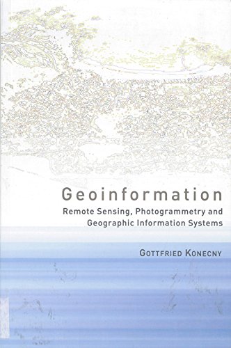
Geoinformation : Remote Sensing, Photogrammetry and Geographical Information Systems
Anbieter: Better World Books Ltd, Dunfermline, Vereinigtes Königreich
Erstausgabe
EUR 8,27
EUR 9,10 für den Versand von Vereinigtes Königreich nach USAAnzahl: 2 verfügbar
In den WarenkorbZustand: Good. 1st Edition. Ships from the UK. Former library book; may include library markings. Used book that is in clean, average condition without any missing pages.
-
Remote Sensing and Geographical Information Systems
Anbieter: Majestic Books, Hounslow, Vereinigtes Königreich
EUR 10,60
EUR 7,40 für den Versand von Vereinigtes Königreich nach USAAnzahl: 4 verfügbar
In den WarenkorbZustand: New. pp. 288 Illus.
-
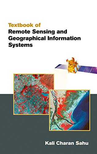
Textbook of Remote Sensing and Geographical Information Systems
Verlag: Atlantic Publishers and Distributors, 2008
ISBN 10: 8126909102 ISBN 13: 9788126909100
Sprache: Englisch
Anbieter: Majestic Books, Hounslow, Vereinigtes Königreich
EUR 10,91
EUR 7,40 für den Versand von Vereinigtes Königreich nach USAAnzahl: 4 verfügbar
In den WarenkorbZustand: New. pp. 512.
-
Remote Sensing and Geographical Information Systems
Anbieter: Majestic Books, Hounslow, Vereinigtes Königreich
EUR 11,39
EUR 7,40 für den Versand von Vereinigtes Königreich nach USAAnzahl: 4 verfügbar
In den WarenkorbZustand: New. pp. 264.
-
Remote Sensing and Geographical Information Systems for Resource Management in Developing Countries
Anbieter: Anybook.com, Lincoln, Vereinigtes Königreich
EUR 10,39
EUR 14,73 für den Versand von Vereinigtes Königreich nach USAAnzahl: 1 verfügbar
In den WarenkorbZustand: Poor. This is an ex-library book and may have the usual library/used-book markings inside.This book has hardback covers. In poor condition, suitable as a reading copy. No dust jacket. Please note the Image in this listing is a stock photo and may not match the covers of the actual item,1150grams, ISBN:0792312686.
-
Textbook Of Remote Sensing And Geographical Information Systems
Anbieter: Romtrade Corp., STERLING HEIGHTS, MI, USA
Zustand: New. Brand New. Soft Cover International Edition. Different ISBN and Cover Image. Priced lower than the standard editions which is usually intended to make them more affordable for students abroad. The core content of the book is generally the same as the standard edition. The country selling restrictions may be printed on the book but is no problem for the self-use. This Item maybe shipped from US or any other country as we have multiple locations worldwide.
-
Textbook of Remote Sensing and Geographical Information Systems (Reprint)
Anbieter: Vedams eBooks (P) Ltd, New Delhi, Indien
Soft cover. Zustand: New. 4th Edition. Contents Preface to second edition. 1. Map language. 2. Remote sensing basic principles. 3. Microwave remote sensing. 4. Remote sensing platforms and sensors. 5. Visual image interpretation. 6. Digital image processing. 7. Fundamentals of GIS. 8. Spatial data modelling. 9. GIS data management. 10. Data input and editing. 11. Data quality issues. 12. Data analysis and modelling. 13. Integration of remote sensing and GIS. 14. Urban and municipal applications. 15. Creation of information system a case study. References. Subject index. Remote Sensing and Geographical Information Systems (GIS) deals with mapping technology concepts of maps and all relevant terminology which are necessary for a beginner to develop his skills in this new and upcoming technology. This book provides basic principles and techniques of remote sensing microwave remote sensing remote sensing platforms and sensors and data analysis techniques. Further the book deals with GIS data quality issues GIS data analysis and modelling attribute data management GIS data input and editing and integration and linkage of Remote Sensing and GIS. This third edition is thoroughly revised few new topics are incorporated in the 5 chapter along with the addition of one new chapter namely Creation of Information System A Case Study. Keeping the importance of the visual interpretation of high resolution satellite images a detailed procedure for photo interpretation 3 D interpretation method application of aerial photo interpretation and key elements of visual image interpretation techniques are discussed in detail. The author of this book has developed a methodology to create a Digital Information System based on GIS concept using Remote Sensing Data topographical data field data and other collateral data products. 453 pp.
-
Textbook of Remote Sensing and Geographical Information Systems
Verlag: Atlantic Publishers and Distributors, 2007
ISBN 10: 8126909099 ISBN 13: 9788126909094
Sprache: Englisch
Anbieter: Majestic Books, Hounslow, Vereinigtes Königreich
EUR 21,46
EUR 7,40 für den Versand von Vereinigtes Königreich nach USAAnzahl: 4 verfügbar
In den WarenkorbZustand: New. pp. 512 Figures.
-
Geoinformation: Remote Sensing, Photogrammetry and Geographical Information Systems
Anbieter: Ammareal, Morangis, Frankreich
SonderangebotEUR 6,99
EUR 22,50 für den Versand von Frankreich nach USAAnzahl: 1 verfügbar
In den WarenkorbHardcover. Zustand: Très bon. Ancien livre de bibliothèque. Edition 2002. Ammareal reverse jusqu'à 15% du prix net de cet article à des organisations caritatives. ENGLISH DESCRIPTION Book Condition: Used, Very good. Former library book. Edition 2002. Ammareal gives back up to 15% of this item's net price to charity organizations.
-
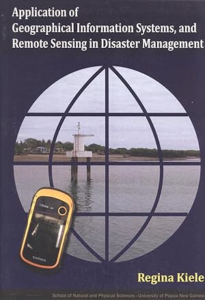
Application of Geographical Information Systems, and Remote Sensing in Disaster Management
Verlag: School of Natural and Physical Sciences, University of Papua New Guinea, 2012
ISBN 10: 9980871040 ISBN 13: 9789980871046
Sprache: Englisch
Anbieter: Masalai Press, Oakland, CA, USA
Soft cover. Zustand: Very Good. 54 pp., bibliography. A school workbook.
-
Textbook of Remote Sensing and Geographical Information Systems
Verlag: Atlantic Publishers & Distributors (P) Ltd., 2007
ISBN 10: 8126909099 ISBN 13: 9788126909094
Sprache: Englisch
Anbieter: Romtrade Corp., STERLING HEIGHTS, MI, USA
Zustand: New. Brand New. Soft Cover International Edition. Different ISBN and Cover Image. Priced lower than the standard editions which is usually intended to make them more affordable for students abroad. The core content of the book is generally the same as the standard edition. The country selling restrictions may be printed on the book but is no problem for the self-use. This Item maybe shipped from US or any other country as we have multiple locations worldwide.
-
Remote Sensing and Geographical Information System
Verlag: Academic Aspirations
ISBN 10: 9390473365 ISBN 13: 9789390473366
Anbieter: Majestic Books, Hounslow, Vereinigtes Königreich
EUR 9,61
EUR 7,40 für den Versand von Vereinigtes Königreich nach USAAnzahl: 4 verfügbar
In den WarenkorbZustand: New. pp. 376.
-
Remote Sensing and Geographical Information Systems for Resource Management in Developing Countries (Eurocourses: Remote Sensing)
Anbieter: Phatpocket Limited, Waltham Abbey, HERTS, Vereinigtes Königreich
EUR 24,90
EUR 12,11 für den Versand von Vereinigtes Königreich nach USAAnzahl: 1 verfügbar
In den WarenkorbZustand: Good. Your purchase helps support Sri Lankan Children's Charity 'The Rainbow Centre'. Ex-library, so some stamps and wear, but in good overall condition. Our donations to The Rainbow Centre have helped provide an education and a safe haven to hundreds of children who live in appalling conditions.
-
Remote Sensing and Geographical Information Systems: Basics and Applications
Anbieter: Vedams eBooks (P) Ltd, New Delhi, Indien
Erstausgabe
Hardcover. Zustand: New. Zustand des Schutzumschlags: New. 1st Edition. The book provides a comprehensive coverage of techniques, applications and technologies of remote sensing and Geographical Information System (GIS). It is organized into three parts: the first part focuses on the basic concepts of Remote Sensing, Digital Image Processing and Geographical Information System; second part deals with the application aspects in the field of natural resource management and the third part covers applied aspects of environment and regional planning based on primary field observations. In fact, Remote Sensing and Geographical Information System (GIS) techniques are being widely used since last two decades, mainly by earth scientists, geologists, geographers, regional planners, environmentalists in the fields of mineral explorations, archaeological excavations, geographical and topographical analysis, terrain studies, urban planning, regional planning, natural resources management, natural disaster management etc. The basic purpose of this book is to provide literature to research scholars, scientist and planners working in fields of application of remote sensing and GIS.
-
Remote Sensing and Geographical Information Systems in Epidemiology
Anbieter: PEMBERLEY NATURAL HISTORY BOOKS BA, ABA, Iver, Vereinigtes Königreich
EUR 41,03
EUR 25,04 für den Versand von Vereinigtes Königreich nach USAAnzahl: 1 verfügbar
In den WarenkorbZustand: Good. xviii, 357, . . HB. Good. Signature of first editor, British epidemiologist Prof Simon Hay to endpaper. Advances in Parasitology Vol. 47. [9780120317479].
-
Development of an agricultural drought assessment system : integration of crop and soil modeling, remote sensing and geographical information . Proefschrift.Wageningen Universiteit.
Verlag: Wageningen. Ponsen & Looijen.Bibliotheek Wageningen UR.
ISBN 10: 9085047978 ISBN 13: 9789085047971
Anbieter: Antiquariaat Ovidius, Bredevoort, Niederlande
Zustand: Gebraucht / Used. 2007. Pap. x,148pp. 8°. Diss./Thesis. Blibliogr.
-
Textbook of Remote Sensing and Geographical Information Systems 5th edn
ISBN 10: 939503856X ISBN 13: 9789395038560
Anbieter: Majestic Books, Hounslow, Vereinigtes Königreich
EUR 13,54
EUR 7,40 für den Versand von Vereinigtes Königreich nach USAAnzahl: 4 verfügbar
In den WarenkorbZustand: New.
-
Remote Sensing and Geographical Information System Application: for Public Health
Verlag: LAP LAMBERT Academic Publishing, 2017
ISBN 10: 3330322497 ISBN 13: 9783330322493
Sprache: Englisch
Anbieter: Revaluation Books, Exeter, Vereinigtes Königreich
EUR 66,88
EUR 11,38 für den Versand von Vereinigtes Königreich nach USAAnzahl: 1 verfügbar
In den WarenkorbPaperback. Zustand: Brand New. 52 pages. 8.66x5.91x0.12 inches. In Stock.
-
Geo-spatial analysis of wetland: Land evaluation using geographical information system and remote sensing
Verlag: LAP LAMBERT Academic Publishing, 2019
ISBN 10: 6200483299 ISBN 13: 9786200483294
Sprache: Englisch
Anbieter: Revaluation Books, Exeter, Vereinigtes Königreich
EUR 66,61
EUR 11,38 für den Versand von Vereinigtes Königreich nach USAAnzahl: 1 verfügbar
In den WarenkorbPaperback. Zustand: Brand New. 56 pages. 8.66x5.91x0.13 inches. In Stock.
-
A Geographical Information System And Satellite Remote Sensing To Plan For Aquaculture Development A FAO UNEP-GRID Cooperative Study In Costa Rica Fis
Anbieter: moluna, Greven, Deutschland
EUR 35,95
EUR 48,99 für den Versand von Deutschland nach USAAnzahl: Mehr als 20 verfügbar
In den WarenkorbGebunden. Zustand: New.
-
Remote Sensing and Geographical Information System.
Verlag: Alpha Science International Ltd., 2005
Sprache: Englisch
Anbieter: Antiquariat Thomas Haker GmbH & Co. KG, Berlin, Deutschland
Verbandsmitglied: GIAQ
Erstausgabe
SonderangebotEUR 10,56
EUR 75,00 für den Versand von Deutschland nach USAAnzahl: 1 verfügbar
In den WarenkorbHardcover. Zustand: Wie neu. 1st ed. 298 S.; Ill. Like new. Shrink wrapped. Sprache: Englisch Gewicht in Gramm: 905.
-
pls, paperbound 0.0.
-
Textbook of Remote Sensing and Geographical Information Systems
Verlag: Atlantic Publishers & Distributors (P) Ltd., 2007
ISBN 10: 8126909099 ISBN 13: 9788126909094
Sprache: Englisch
Anbieter: Revaluation Books, Exeter, Vereinigtes Königreich
EUR 82,68
EUR 14,23 für den Versand von Vereinigtes Königreich nach USAAnzahl: 1 verfügbar
In den WarenkorbHardcover. Zustand: Brand New. 512 pages. 8.60x5.80x1.40 inches. In Stock.
-
Remote Sensing and Geographical Information System Application
Verlag: LAP LAMBERT Academic Publishing Jul 2017, 2017
ISBN 10: 3330322497 ISBN 13: 9783330322493
Sprache: Englisch
Anbieter: buchversandmimpf2000, Emtmannsberg, BAYE, Deutschland
Taschenbuch. Zustand: Neu. Neuware -The advanced technology of geographical information, mapping have emerged as good opportunities for public health administrators and for better planning of programming, field monitoring, and analysis of epidemiological survey, data management of health system. Epidemiology Geographical Information System (GIS) and Global Positioning System (GPS) helps in visualizing and analysis of geographic distribution of disease, with respect to time and space, which is difficult to perform in any other systems. Based on regions the distribution of vector borne disease cases were represented on density maps which were calculated for each Primary Health Centers (PHC). As more number of vector borne disease cases were rampant in the backward areas of south India we have focused our attention towards tribal agencies of Telangana state, India. Which are identified through GIS & GPS techniques, also help in pinpointing the infected areas or person for further treatment processes. Our main aim is to map the vector borne diseases, density areas by using above techniques. Remote Sensing data was also used to identify the favorable indicators of malaria breeding areas.Books on Demand GmbH, Überseering 33, 22297 Hamburg 52 pp. Englisch.
-
Evaluation Of Rainfall-Runoff Relationship For Durbendekhan Basin: with aid of remote sensing and geographical information system
Anbieter: Revaluation Books, Exeter, Vereinigtes Königreich
EUR 92,16
EUR 11,38 für den Versand von Vereinigtes Königreich nach USAAnzahl: 1 verfügbar
In den WarenkorbPaperback. Zustand: Brand New. 140 pages. 8.66x5.91x0.32 inches. In Stock.
-
Remote Sensing and Geographical Information System Application | for Public Health
Verlag: LAP LAMBERT Academic Publishing, 2017
ISBN 10: 3330322497 ISBN 13: 9783330322493
Sprache: Englisch
Anbieter: preigu, Osnabrück, Deutschland
Taschenbuch. Zustand: Neu. Remote Sensing and Geographical Information System Application | for Public Health | Gujju Gandhi (u. a.) | Taschenbuch | 52 S. | Englisch | 2017 | LAP LAMBERT Academic Publishing | EAN 9783330322493 | Verantwortliche Person für die EU: BoD - Books on Demand, In de Tarpen 42, 22848 Norderstedt, info[at]bod[dot]de | Anbieter: preigu.
-
Textbook of Remote Sensing and Geographical Information Systems
Verlag: BS Publication, Hyderabad, 2006
ISBN 10: 8178001357 ISBN 13: 9788178001357
Anbieter: Vedams eBooks (P) Ltd, New Delhi, Indien
Hardbound. Zustand: As New. Third edition. Contents Preface. 1. Map language. 2. Remote sensing basic principles. 3. Microwave remote sensing. 4. Remote sensing platforms and sensors. 5. Visual image interpretation. 6. Digital image processing. 7. Fundamentals of GIS. 8. Spatial data modelling. 9. GIS data management. 10. Data input and editing. 11. Data quality issues. 12. Data analysis and modelling. 13. Integration of remote sensing and GIS. 14. Urban and municipal applications. 15. Creation of information system a case study. References. Subject index. Remote Sensing and Geographical Information Systems (GIS) deals with mapping technology concepts of maps and all relevant terminology which are necessary for a beginner to develop his skills in this new and upcoming technology. This book provides basic principles and techniques of remote sensing microwave remote sensing remote sensing platforms and sensors and data analysis techniques. Further the book deals with GIS data quality issues GIS data analysis and modelling attribute data management GIS data input and editing and integration and linkage of Remote Sensing and GIS. This third edition is thoroughly revised few new topics are incorporated in the 5th chapter along with the addition of one new chapter namely Creation of Information System A Case Study. Keeping the importance of the visual interpretation of high resolution satellite images a detailed procedure for photo interpretation 3 D interpretation method application of aerial photo interpretation and key elements of visual image interpretation techniques are discussed in detail. The author of this book has developed a methodology to create a Digital Information System based on GIS concept using Remote Sensing Data topographical data field data and other collateral data products. 454 pp.
-
Remote Sensing and Geographical Information System Application | Agricultural Drought Monitoring and Assessment Using Satellite Data
Anbieter: preigu, Osnabrück, Deutschland
Taschenbuch. Zustand: Neu. Remote Sensing and Geographical Information System Application | Agricultural Drought Monitoring and Assessment Using Satellite Data | Rizatus Shofiyati | Taschenbuch | Englisch | VDM Verlag Dr. Müller | EAN 9783639205077 | Verantwortliche Person für die EU: preigu GmbH & Co. KG, Lengericher Landstr. 19, 49078 Osnabrück, mail[at]preigu[dot]de | Anbieter: preigu.
-
Evaluation Of Rainfall-Runoff Relationship For Durbendekhan Basin | with aid of remote sensing and geographical information system
Anbieter: preigu, Osnabrück, Deutschland
Taschenbuch. Zustand: Neu. Evaluation Of Rainfall-Runoff Relationship For Durbendekhan Basin | with aid of remote sensing and geographical information system | Ghassan AL-Dulaimi | Taschenbuch | 140 S. | Englisch | 2017 | Noor Publishing | EAN 9783330802759 | Verantwortliche Person für die EU: BoD - Books on Demand, In de Tarpen 42, 22848 Norderstedt, info[at]bod[dot]de | Anbieter: preigu.


