
Gesamtpreis (1 Artikel Artikel):
Versandziel:

reference atlas nelsons encyclopaedia vol (2 Ergebnisse)
Direkt zu den wichtigsten Suchergebnissen
Suchfilter
Produktart
- Alle Product Types
- Bücher (2)
- Magazine & Zeitschriften (Keine weiteren Ergebnisse entsprechen dieser Verfeinerung)
- Comics (Keine weiteren Ergebnisse entsprechen dieser Verfeinerung)
- Noten (Keine weiteren Ergebnisse entsprechen dieser Verfeinerung)
- Kunst, Grafik & Poster (Keine weiteren Ergebnisse entsprechen dieser Verfeinerung)
- Fotografien (Keine weiteren Ergebnisse entsprechen dieser Verfeinerung)
- Karten (Keine weiteren Ergebnisse entsprechen dieser Verfeinerung)
- Manuskripte & Papierantiquitäten (Keine weiteren Ergebnisse entsprechen dieser Verfeinerung)
Zustand Mehr dazu
- Neu (Keine weiteren Ergebnisse entsprechen dieser Verfeinerung)
- Wie Neu, Sehr Gut oder Gut Bis Sehr Gut (Keine weiteren Ergebnisse entsprechen dieser Verfeinerung)
- Gut oder Befriedigend (Keine weiteren Ergebnisse entsprechen dieser Verfeinerung)
- Ausreichend oder Schlecht (1)
- Wie beschrieben (1)
Einband
- alle Einbände
- Hardcover (1)
- Softcover (Keine weiteren Ergebnisse entsprechen dieser Verfeinerung)
Weitere Eigenschaften
- Erstausgabe (Keine weiteren Ergebnisse entsprechen dieser Verfeinerung)
- Signiert (Keine weiteren Ergebnisse entsprechen dieser Verfeinerung)
- Schutzumschlag (Keine weiteren Ergebnisse entsprechen dieser Verfeinerung)
- Angebotsfoto (2)
Sprache (1)
Preis
- Beliebiger Preis
- Weniger als EUR 20
- EUR 20 bis EUR 45
- Mehr als EUR 45 (Keine weiteren Ergebnisse entsprechen dieser Verfeinerung)
Gratisversand
- Kostenloser Versand nach USA (Keine weiteren Ergebnisse entsprechen dieser Verfeinerung)
Land des Verkäufers
Verkäuferbewertung
-
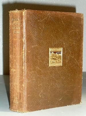
Nelson's Encyclopaedia - Vol.XXIV - Reference Atlas
Verlag: Thomas Nelson & Sons
Anbieter: Washburn Books, Pateley Bridge, Vereinigtes Königreich
Verkäuferbewertung 5 von 5 Sternen

EUR 7,73
EUR 23,87 Versand
Versand von Vereinigtes Königreich nach USAAnzahl: 1 verfügbar
In den WarenkorbBrown Leather. Zustand: Fair. No Jacket. Undated volume, circa 1911. (Last geographical discovery listed dated 1909 and population figures given for the British Empire, 1911) Soft brown leather binding with publisher's gilt design to front board and lettering to spine, 360pp, coloured maps, plus 190pp index to place-names. Rubbing to spine and corners, top edges dusty and pencil inscription to front endpaper, otherwise fair/good copy. Size: 16mo - over 5ľ" - 6ľ" tall. Book.
-
Reference Atlas. Nelson's Encyclopaedia Vol. XXV.
Verlag: Thomas Nelson and sons, London a.o., 1912
Anbieter: Antiquariat Günter Hochgrebe, Kassel, Deutschland
Verkäuferbewertung 5 von 5 Sternen
Kl.8°, ca. 16,3 x 10,5 cm, xxiv S., 4 Bl., 360 S., 190 S., Sprenkelschnitt, Orig.-Leinenband. Contents: List of maps / Alphabetical index of maps, chief countries, etc. / Statistical tables / Maps / Pronouncing index of geographical names. List of maps: General maps / Europe / Asia / Africa / America / Australasia / Ancient Geography. Druck der Karten von John Bartholomew & Co., Edinburgh. Name auf Titelblatt: Wilhelm Müller, 1912 Lang: englisch 501 g. Aufkleberreste auf Buchrücken, sonst gut erhalten.
