

Gesamtpreis (1 Artikel Artikel):
Versandziel:

pocket guide philippines (7 Ergebnisse)
Direkt zu den wichtigsten Suchergebnissen
Suchfilter
Produktart
- Alle Product Types
- Bücher (5)
- Magazine & Zeitschriften (Keine weiteren Ergebnisse entsprechen dieser Verfeinerung)
- Comics (Keine weiteren Ergebnisse entsprechen dieser Verfeinerung)
- Noten (Keine weiteren Ergebnisse entsprechen dieser Verfeinerung)
- Kunst, Grafik & Poster (Keine weiteren Ergebnisse entsprechen dieser Verfeinerung)
- Fotografien (Keine weiteren Ergebnisse entsprechen dieser Verfeinerung)
- Karten (2)
- Manuskripte & Papierantiquitäten (Keine weiteren Ergebnisse entsprechen dieser Verfeinerung)
Zustand Mehr dazu
- Neu (1)
- Wie Neu, Sehr Gut oder Gut Bis Sehr Gut (Keine weiteren Ergebnisse entsprechen dieser Verfeinerung)
- Gut oder Befriedigend (3)
- Ausreichend oder Schlecht (Keine weiteren Ergebnisse entsprechen dieser Verfeinerung)
- Wie beschrieben (3)
Einband
- alle Einbände
- Hardcover (Keine weiteren Ergebnisse entsprechen dieser Verfeinerung)
- Softcover (4)
Weitere Eigenschaften
- Erstausgabe (2)
- Signiert (Keine weiteren Ergebnisse entsprechen dieser Verfeinerung)
- Schutzumschlag (Keine weiteren Ergebnisse entsprechen dieser Verfeinerung)
- Angebotsfoto (4)
Sprache (2)
Gratisversand
Land des Verkäufers
Verkäuferbewertung
-

I Love the Philippines! A Comprehensive Pocket Travel Guide for First Time Travelers: A Local's Guide to the 20 Best Destinations- What to See, Do, St
Verlag: Independently Published
ISBN 10: 1079851674 ISBN 13: 9781079851670
Anbieter: ThriftBooks-Atlanta, AUSTELL, GA, USA
Verkäuferbewertung 5 von 5 Sternen

Paperback. Zustand: Very Good. No Jacket. May have limited writing in cover pages. Pages are unmarked. ~ ThriftBooks: Read More, Spend Less.
-
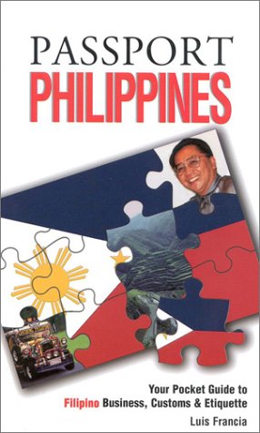
Passport Philippines: Your Pocket Guide to Filipino Business, Customs & Etiquette (Passport to the World) (Passport to the World)
Anbieter: Revaluation Books, Exeter, Vereinigtes Königreich
Verkäuferbewertung 5 von 5 Sternen
EUR 17,53
EUR 11,54 Versand
Versand von Vereinigtes Königreich nach USAAnzahl: 1 verfügbar
In den WarenkorbPaperback. Zustand: Brand New. 96 pages. 7.25x4.25x0.25 inches. In Stock.
-
A POCKET GUIDE TO THE PHILIPPINES
Verlag: US Government Printing Office, Washington D. C., 1961
Anbieter: Complete Traveller Antiquarian Bookstore, Westport, CT, USA
Verkäuferbewertung 5 von 5 Sternen
Softcover. Zustand: Very Good+. A small guide with many b&w illustrations from photographs. Including an extensive rear phrasebook. ; 32mo 4" - 5" tall; 206 pages.
-

Zustand: Good. Original wrapers, illustrations in colour and b/w, small 8vo.
-

A Pocket Guide to Oriental Ceramics in the Philippines.
Verlag: Manila: Bookmark, [1988]., 1988
Anbieter: D & E LAKE LTD. (ABAC/ILAB), Toronto, ON, Kanada
Verkäuferbewertung 2 von 5 Sternen

Erstausgabe
12mo. pp. 124, [2 leaves]. illus. in colour & b/w. wrs. First Edition.
-

Table and Pocket Map Guide City of Manila Republic of the Philippines.
Erscheinungsdatum: 1960
Anbieter: Geographicus Rare Antique Maps, Brooklyn, NY, USA
Verbandsmitglied: ABAA ESA ILAB
Verkäuferbewertung 4 von 5 Sternen

Karte
Very good. Wear along original fold lines. Printed photographs on verso. Size 15.5 x 13.5 Inches. This is a 1960 Domingo de Jesus city plan or map of Manila, Philippines. Districts are labeled throughout the city, including Intramuros, as are streets, parks, railroad stations, and universities. United Nations Park, situated near south Manila Bay, is prominently illustrated, as is the U.S. Embassy, the University of Philippines, and Philippine General Hospital. Thirty-seven locations across the city are numerically identified and correspond with an index situated in the upper right corner. A photograph of the Monument of the National Hero of the Philippines Dr. Jose P. Rizal is printed in the lower right corner. Publication History This map was created and copyrighted by Domingo D. de Jesus and published in two editions. This is an example of the second edition, published in 1960.
-

Table and Pocket Map Guide City of Manila Republic of the Philippines.
Erscheinungsdatum: 1958
Anbieter: Geographicus Rare Antique Maps, Brooklyn, NY, USA
Verbandsmitglied: ABAA ESA ILAB
Verkäuferbewertung 4 von 5 Sternen
Karte Erstausgabe
1st Edition. Good. Wear along original folds. Some loss at junctions of folds. Several small tears professionally repaired. Text and images on verso. Size 18.75 x 16.5 Inches. A scarce folding city plan or map of Manila, the capital of the Philippines, prepared by Domingo de Jesus and published by J.M. Azucena Publishing in 1958. A Closer Look Presented in an interesting cyanotype style, with white against a blue background, districts are labeled throughout, including the historic walled city of Intramuros, as are streets, parks, railroad stations, and universities. United Nations Park, situated near south Manila Bay, is prominently illustrated, as is the U.S. Embassy, the University of the Philippines, and the Philippine General Hospital. Thirty-seven locations across the city are numerically identified and correspond with an index in the upper right corner. A photograph of the Monument of the National Hero of the Philippines, Dr. Jose P. Rizal, is printed in the lower right corner. The verso includes photographs of several locations identified on the recto, including the Legislative Building, City Hall, and the Army and Navy Club. The prominence of American military, diplomatic, and cultural institutions suggests the map may have been intended for American visitors and residents of the city. Rebuilding the 'Pearl of the Orient' Before World War II, Manila was a bustling, cosmopolitan city with impressive amenities, earning it the nickname 'the Pearl of the Orient.' However, World War II took a serious toll on the city. Although it was not heavily damaged by the Japanese invasion of late 1941 and early 1942, the Japanese fought tooth and nail to defend the city in early 1945. Manila was almost completely destroyed (only Warsaw saw worse destruction during the war), and at least 100,000 civilians were killed in the crossfire and a series of war crimes committed by Japanese troops. After a period of basic reconstruction, the city emerged from the horrific destruction of the war into a 'golden age' lasting from the 1950s to the 1980s. Three successive mayors - Arsenio Lacson, Antonio Villegas, and Ramon Bagatsing - are credited with ushering Manila through a period of rapid urbanization and economic growth, focusing on infrastructure and modernization, giving the city its modern form. Publication History and Census This map was prepared by Domingo D. de Jesus and published by J.M. Azucena Publishing. The present example is the first edition of the map, published in 1958. Additional editions were published in 1960, 1964, and 1967, all of which are quite rare. The OCLC only notes one example of this first edition, held by Pennsylvania State University, with later editions held by the Library of Congress, the National Library of Scotland, and the National Library of Australia. References: OCLC 55726496, 1417317636 (1967 edition).


