Gesamtpreis (1 Artikel Artikel):
Versandziel:

ordnance survey atlas great (49 Ergebnisse)
Direkt zu den wichtigsten Suchergebnissen
Produktart
- Alle Product Types
- Bücher (47)
- Magazine & Zeitschriften
- Comics
- Noten
- Kunst, Grafik & Poster
- Fotografien
- Karten (2)
- Manuskripte & Papierantiquitäten
Zustand
Einband
Weitere Eigenschaften
- Erstausgabe
- Signiert
- Schutzumschlag (4)
- Angebotsfoto (12)
Gratisversand
- Versand nach USA gratis
Land des Verkäufers
Verkäuferbewertung
-
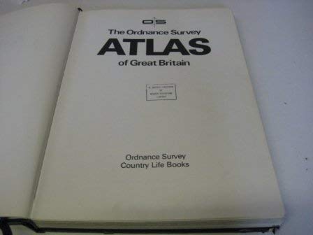
The Ordnance Survey National Atlas of Great Britain
Verlag: Ordnance Survey, 1986
ISBN 10: 0600333167ISBN 13: 9780600333166
Buch
Zustand: Good. Used book that is in clean, average condition without any missing pages.
-
Ordnance Survey motoring atlas of Great Britain
Verlag: Ordnance Survey, 1983
ISBN 10: 0600350665ISBN 13: 9780600350668
Anbieter: Wonder Book, Frederick, MD, USA
Bewertung:

Buch
Zustand: Good. Good condition. A copy that has been read but remains intact. May contain markings such as bookplates, stamps, limited notes and highlighting, or a few light stains.
-
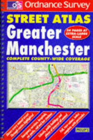
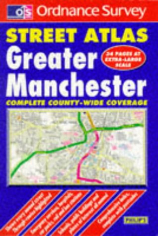
Ordnance Survey Greater Manchester Street Atlas
Verlag: George Philip, 1997
ISBN 10: 0540064866ISBN 13: 9780540064861
Buch
Paperback. Zustand: Very Good. The book has been read, but is in excellent condition. Pages are intact and not marred by notes or highlighting. The spine remains undamaged.
-

Nature Atlas Of Great Britain, Ireland and the Channel Isles (Ordnance Survey)
Verlag: Marks & Spencer, 1995
ISBN 10: 1858334055ISBN 13: 9781858334059
Buch
Paperback. Zustand: Very Good. The book has been read, but is in excellent condition. Pages are intact and not marred by notes or highlighting. The spine remains undamaged.
Mehr Angebote von anderen Verkäufern bei ZVAB
Gebraucht ab EUR 0,92
-

Ordnance Survey Greater Manchester Street Atlas
Verlag: Survey, 1997
ISBN 10: 0540064858ISBN 13: 9780540064854
Buch
Hardback. Zustand: Very Good. The book has been read, but is in excellent condition. Pages are intact and not marred by notes or highlighting. The spine remains undamaged.
-

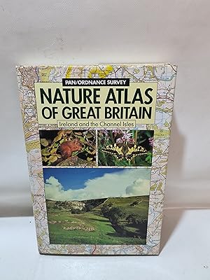
The Pan/Ordnance Survey Nature Atlas of Great Britain, Ireland and the Channel Isles
Verlag: Pan Macmillan, United Kingdom, London, 1989
ISBN 10: 0330299484ISBN 13: 9780330299480
Buch
Paperback. Zustand: Very Good. A guide to the best visitable natural history sites in Britain, Ireland and the Channel Islands. The sites are highlighted on OS Routemaster maps (scale 1:250,000) and described in gazetteer entries, and the most important sites of all (about 100 in total) are featured in detail on Landranger mapping (scale 1:50,000) to enable visitors to make the most of their visit to the site. A star rating system distinguishes sites worthy of a special journey. An enormous range of natural history interests is covered in the book: birds, butterflies, dragonflies, flowering plants, mammals, moths, reptiles and amphibians, ferns, snails, geology and fossils. The text is compiled by local experts. The book has been read, but is in excellent condition. Pages are intact and not marred by notes or highlighting. The spine remains undamaged.
Mehr Angebote von anderen Verkäufern bei ZVAB
Gebraucht ab EUR 1,67
-

Ordnance Survey Road Atlas of Great Britain
Verlag: -, 1994
ISBN 10: 0600582043ISBN 13: 9780600582045
Buch
Hardcover. Zustand: Very Good. Ordnance Survey Road Atlas of Great Britain This book is in very good condition and will be shipped within 24 hours of ordering. The cover may have some limited signs of wear but the pages are clean, intact and the spine remains undamaged. This book has clearly been well maintained and looked after thus far. Money back guarantee if you are not satisfied. See all our books here, order more than 1 book and get discounted shipping.
-
Ordnance Survey Atlas of Great Britain
Verlag: Country Life Books, 1982
ISBN 10: 0600350053ISBN 13: 9780600350057
Buch
Hardback. Zustand: Very Good. The book has been read, but is in excellent condition. Pages are intact and not marred by notes or highlighting. The spine remains undamaged.
-

Ordnance Survey road atlas of Great Britain
Verlag: Temple Press, 1983
ISBN 10: 0600350541ISBN 13: 9780600350545
Buch
Paperback. Zustand: Good. The book has been read but remains in clean condition. All pages are intact and the cover is intact. Some minor wear to the spine.
Mehr Angebote von anderen Verkäufern bei ZVAB
Gebraucht ab EUR 2,59
-
Ordnance Survey Greater Manchester Street Atlas (OS / Philip's Street Atlases)
Verlag: -, 2006
ISBN 10: 0540064874ISBN 13: 9780540064878
Buch
Paperback. Zustand: Very Good. Ordnance Survey Greater Manchester Street Atlas (OS / Philip's Street Atlases) This book is in very good condition and will be shipped within 24 hours of ordering. The cover may have some limited signs of wear but the pages are clean, intact and the spine remains undamaged. This book has clearly been well maintained and looked after thus far. Money back guarantee if you are not satisfied. See all our books here, order more than 1 book and get discounted shipping.
-

Ordnance Survey Road Atlas of Great Britain
Verlag: Philip's OS Publications, 1988
ISBN 10: 0600558665ISBN 13: 9780600558668
Buch
Zustand: Good. Most items will be dispatched the same or the next working day. Previous owners name.
-

Ordnance Survey Motoring Atlas of Great Britain
Verlag: Newnes Bks., 1986
ISBN 10: 0600333388ISBN 13: 9780600333388
Buch
Zustand: acceptable. Ausreichend/Acceptable: Exemplar mit vollständigem Text und sämtlichen Abbildungen oder Karten. Schmutztitel oder Vorsatz können fehlen. Einband bzw. Schutzumschlag weisen unter Umständen starke Gebrauchsspuren auf. / Describes a book or dust jacket that has the complete text pages (including those with maps or plates) but may lack endpapers, half-title, etc. (which must be noted). Binding, dust jacket (if any), etc may also be worn.
-

Ordnance Survey Interactive Atlas of Great Britain (Attica Knowledge)
Verlag: Attica Interactive Ltd, 1997
ISBN 10: 1873472560ISBN 13: 9781873472569
Buch
Zustand: Good. Most items will be dispatched the same or the next working day.
-

Ordnance Survey Superscale Atlas of Great Britain
Verlag: Ordnance Survey and Temple Press
Anbieter: Wonder Book, Frederick, MD, USA
Bewertung:
Zustand: Fair. Acceptable condition. New edition. [9780600566427] (Great Britain, Atlas, Maps) A readable, intact copy that may have noticeable tears and wear to the spine. All pages of text are present, but they may include extensive notes and highlighting or be heavily stained. Includes reading copy only books.
-

Ordnance Survey Touring Atlas of Great Britain
Verlag: Hamlyn, 1989
ISBN 10: 0600566765ISBN 13: 9780600566762
Buch
Zustand: Good. Most items will be dispatched the same or the next working day. A tan to the page edges/pages.
-

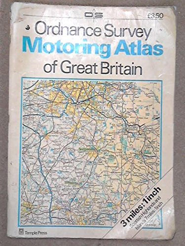
1991 ORDNANCE SURVEY MOTORING ATLAS OF GREAT BRITAIN: 3 MILES - 1 INCH.
Verlag: Ordnance Survey/Hamlyn, 1990
ISBN 10: 0600570738ISBN 13: 9780600570738
Anbieter: Cambridge Rare Books, Cambridge, GLOUC, Vereinigtes Königreich
Bewertung:
Buch
Paperback. 1990. Ordnance Survey/Hamlyn. Softback. Book- VG. 15x11. 140pp. Profuse colour maps.
-
Ordnance Survey Super Scale: Atlas of Great Britain
Verlag: Hamlyn
Anbieter: Wonder Book, Frederick, MD, USA
Bewertung:
Zustand: Fair. Acceptable condition. Reading copy. Pages detatched, but present. (great britain, maps, roads, atlases ).
-

Ordnance Survey motoring atlas of Great Britain
Verlag: Littlehampton Book Services Ltd
ISBN 10: 0600550435ISBN 13: 9780600550433
Anbieter: Wonder Book, Frederick, MD, USA
Bewertung:
Buch
Zustand: Good. Good condition. A copy that has been read but remains intact. May contain markings such as bookplates, stamps, limited notes and highlighting, or a few light stains. Bundled media such as CDs, DVDs, floppy disks or access codes may not be included.
-
Pan/Ordnance Survey Nature Atlas Of Great Britain Ireland And The Channel Islands
Verlag: Pan Books Ltd and Ordnance Survey/Ordnance Survey Of Northern Ireland/Ordnance Survey Of Ireland, 1989
Anbieter: Cambridge Rare Books, Cambridge, GLOUC, Vereinigtes Königreich
Bewertung:
Hardcover. Zustand: GOOD. 1989. Pan Books Ltd and Ordnance Survey/Ordnance Survey Of Northern Ireland/Ordnance Survey Of Ireland. Hardcover. GOOD DJ; Good. Beautiful colour photographs and maps as well as black and white illustrations. Text is clear and bright. Light foxing on some of the pages and page edges. 11x8.
-

The Ordnance Survey National Atlas of Great Britain
Verlag: Book Club Associates
Anbieter: JLG_livres anciens et modernes, Saint Maur des Fossés, Frankreich
Verbandsmitglied: ILAB
Bewertung:

Buch
Zustand: Trčs bon. Nos envois se font avec suivi, pour tout problčme n'hésitez pas ŕ nous contacter pour trouver une solution.
-

ORDNANCE SURVEY ATLAS OF GREAT BRITAIN
Verlag: Peerage Books, 1989
ISBN 10: 1850521107ISBN 13: 9781850521105
Karte
Couverture rigide. Zustand: bon. RO30001976: 1989. In-4. Relié. Bon état, Couv. convenable, Dos satisfaisant, Intérieur frais. 187 pages. Illustré de nombreuses cartes en couleur. . . . Classification Dewey : 912-Atlas, cartes et plans.
-
Ordnance Survey Road Atlas of Great Britain
Verlag: BCA ( Book Club Associates ), 1983
Anbieter: Kennys Bookshop and Art Galleries Ltd., Galway, GY, Irland
Bewertung:
Zustand: Very Good. 1983. Hardcover. Good copy with minor shelf wear, dustwrapper with minor edge wear but remains good. . . . .
-

Couverture rigide. Zustand: bon. R260108819: 1986. In-Folio. Cartonnage d'éditeurs. Etat d'usage, Couv. convenable, Dos satisfaisant, Intérieur frais. 256 pages. Jaquette illustrée en couleurs. Nombreuses cartes en couleurs. Nombreuses illustrations en couleurs dans le texte. Texte en anglais. Avec Jaquette. . . Classification Dewey : 912-Atlas, cartes et plans.
-

Couverture souple. Zustand: bon. R200078862: VERS 1985. In-Folio. Broché. Bon état, Tâchée, Dos satisfaisant, Intérieur frais. 128 pages. Nombreuses cartes en couleurs, hors texte. . . . Classification Dewey : 820-Littératures anglaise et anglo-saxonne.
-

Ordnance Survey Touring Atlas of Great Britain
Verlag: -, 1987
ISBN 10: 0600556093ISBN 13: 9780600556091
Buch
Hardcover. Zustand: Very Good. Ordnance Survey Touring Atlas of Great Britain This book is in very good condition and will be shipped within 24 hours of ordering. The cover may have some limited signs of wear but the pages are clean, intact and the spine remains undamaged. This book has clearly been well maintained and looked after thus far. Money back guarantee if you are not satisfied. See all our books here, order more than 1 book and get discounted shipping.