
Gesamtpreis (1 Artikel Artikel):
Versandziel:

monumenta cartographica neerlandica von schilder günter (33 Ergebnisse)
Direkt zu den wichtigsten Suchergebnissen
Produktart
- Alle Produktarten
- Bücher (32)
- Magazine & Zeitschriften
- Comics
- Noten
- Kunst, Grafik & Poster
- Fotografien
- Karten (1)
-
Manuskripte &
Papierantiquitäten
Zustand
- Alle
- Neu
- Antiquarisch/Gebraucht
Einband
Weitere Eigenschaften
- Erstausgabe
- Signiert
- Schutzumschlag (4)
- Angebotsfoto (9)
Land des Verkäufers
Verkäuferbewertung
-
![Beispielbild für Monumenta Cartographica Neerlandica. Volume I: Printed Wall-maps of the Seventeen Provinces [Text & Portfolio = Complete Set]. zum Verkauf von Antiquariaat Schot](https://pictures.abebooks.com/isbn/9789064695612-de-300.jpg)
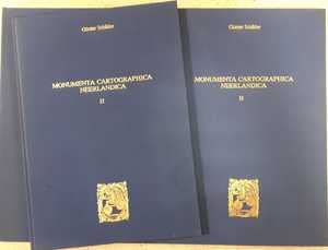
Monumenta Cartographica Neerlandica. Volume I: Printed Wall-maps of the Seventeen Provinces [Text & Portfolio = Complete Set].
Verlag: Alphen aan den Rijn, Uitgeversmaatschappij Canaletto 1997, 1986
ISBN 10: 906469561XISBN 13: 9789064695612
Buch
Original publisher's blue CLOTH hardback, gilt title spine and frontcover, gilt ornament frontcover, 3rd printing [1986], small folio & oblong shaped small elephant folio: TEXT: [iv], 172pp., 111 maps / illustrations with descriptions - notes & references, footnotes & references, list illustrations, index, table of contents. MAPS: 6 complete wall-maps on actual size on 50 sheets: Gerard de Jode - Willem Jansz. Blaeu [2 maps] - Joannes van Deutecom - Claes Jansz. Visscher - François van der Hoeye. All texts in Dutch as in English. Very fine complete set. Volume I: Monumenta Cartographica Neerlandica.
Mehr Angebote von anderen Verkäufern bei ZVAB
Gebraucht ab EUR 143,75
-

Monumenta Cartographica Neerlandica I. [Text volume]. 3e druk.
Anbieter: Antiquariaat A. Kok & Zn. B.V., Amsterdam, Niederlande
Bewertung:

Alphen aan den Rijn, Canaletto, 1997. 1 (of 2) vols. [III],171pp. 111b./w. ills. Blank paper wrappers. Sm. folio. Only the text volume of the set (in blank paper wrappers without the linen binding !). - Without the portfolio with the loose maps. - Text in Dutch & English.
-
Monumenta Cartographica Neerlandica I. [Set of two volumes].
Anbieter: Antiquariaat A. Kok & Zn. B.V., Amsterdam, Niederlande
Bewertung:
Alphen aan den Rijn, Canaletto, 1986/1997. 2 vols. Vol. 1 (text vol.): [III],171pp. 111b./w. ills. Blank wrappers [!]. Sm. folio; vol. 2 (plate vol.): 50 loose b./w. plts in original cloth portfolio. Oblong folio. - PLEASE NOTICE: The text volume (3rd ed.) will be supplied in blank paper wrappers without the linen binding ! Complete set of volume one. - The portfolio contains full size reprints of six large maps of the Seventeen Provinces (published between 1566 and 1636) on 50 unconnected leaves. - Text in Dutch & English.
-
Monumenta Cartographica Neerlandica I. [Set of two volumes].
Anbieter: Antiquariaat A. Kok & Zn. B.V., Amsterdam, Niederlande
Bewertung:
Alphen aan den Rijn, Canaletto, 1986. 2 vols. Vol. 1 (text vol.): [III],171pp. 111b./w. ills. Hardcover. Sm. folio. - [AND]: vol. 2 (plate vol.): 50 loose b./w. plts in original hardcover portfolio. Oblong folio. - Cover of text vol. very sl. soiled.Complete set of volume one. - The portfolio contains full size reprints of six large maps of the Seventeen Provinces (published between 1566 and 1636) on 50 unconnected leaves. - Text in Dutch & English.
-
Monumenta Cartographica Neerlandica II. [Set of two volumes].
Anbieter: Antiquariaat A. Kok & Zn. B.V., Amsterdam, Niederlande
Bewertung:
Alphen aan den Rijn, Canaletto, 1987. 2 vols. Vol. 1 (text vol.): [III],171pp. 146 b./w. ills. Orig. hardcover (gilt lettered blue cloth). Sm. folio. - [AND:] vol. 2 (plate vol.): 55 loose b./w. plts in orig. hardcover portfolio (gilt lettered blue cloth). Oblong folio.Complete set of volume two. - The portfolio contains full size reprints of nine large maps of the Seventeen Provinces, the world, Asia, Spain and of the central Netherlands (published between 1564 and 1652) on 55 unconnected leaves. - Text in Dutch & English.
-
Monumenta Cartographica Neerlandica I - VIII. [Set of 8 volumes].
Anbieter: Antiquariaat A. Kok & Zn. B.V., Amsterdam, Niederlande
Bewertung:
Alphen a./d. Rijn, Canaletto, 1986 - 2007. 8 vols (of 9) in 16 parts (8 text vols & 8 plate volumes). Num. b./w. ills (maps, etc.) Orig. uniform gilt cloth. Folio / Loose in unif. gilt portfolio, oblong folio. - - Flaps & edge of pages with some foxing.Set of the 8 volumes of the set: Vol. 1: [IV], 172 pp. 112 illustrations & maps [plates & text-illustrations], footnotes, index. Portfolio Vol. 1: 6 maps on 50 leaves. Vol. 2: [VI],172 pp. 146 illustrations & maps, footnotes, index names, index maps. Portfolio Vol. 3: 9 maps on 55 leaves. Vol. 3: Twee wandkaarten van de wereld van Blaeu / Two wall-maps of the world by Blaeu: 1619 en 1645/46; [II],352 pp. 352 illustrations & maps, notes, appendix, list illustrations, quoted literature, general index. Portfolio Vol. 3: 2 maps on 41 leaves. Vol. 4: Losse kaarten en topografische prenten uitgegeven door Willem Jansz. Blaeu / Single-sheet maps and topographical prints published by Willem Blaeu; [IV],364 pp. 326 illustrations & maps, footnotes, list illustrations, quoted literature, general index. Portfolio Vol. 4: 23 maps on 37 leaves. Vol. 5. Tien wandkaarten van Blaeu en Visscher / Ten Wall Maps by Blaeu and Visscher; [IV], 384 pp. 371 illustrations & maps, sources for the full-scale reproductions, quoted literature, general index. Portfolio Vol. 5: 10 maps on 142 leaves. Vol. 6: Nederlandse foliokaarten met decoratieve randen / Dutch folio-sized sngle sheet maps with decorative borders, 1604-60: 452 pp. several hundred illustrations & maps, notes, quoted literature, general index. Portfolio 6: 95 maps on 96 leaves. Vol. 7: Cornelis Claesz [c. 1551 - 1609]: Stimulator and Driving Force of Dutch Cartography; 556 pp. 690 illustrations & maps, footnotes, bibliography, general index. Portfolio 7: 63 maps on 108 leaves. Vol. 8: 596 pp. ca. 900 illustrations. Portfolio 8: 37 maps in 88 leaves. - - The set is allmost complete (without the ninth volume issued in 2013) and in excellent condition. The leaves of the portfolio measure 40--55cm. - - All texts in Dutch & English [footnotes just in English]. - - NOTE on vol. IV: Of the world map in two parts by Blaeu from 1604 (map 3A in this work), only the left part is included in facsimile (3A.1). This is a reprint of the left part of this world map that is present in the UB Erlangen-Nürnberg. To date, no copy of the right part of the original 1604 Blaeu edition of this world map is known. Map 3A.2 is therefore not missing in this edition. It has never been included in this edition.
-
Monumenta Cartographica Neerlandica I - VIII. [Set of 8 volumes].
Anbieter: Antiquariaat A. Kok & Zn. B.V., Amsterdam, Niederlande
Bewertung:
Alphen a./d. Rijn, Canaletto, 1986 - 2007. 8 vols (of 9) in 16 parts (8 text vols & 8 plate volumes). Num. b./w. ills (maps, etc.) Orig. uniform gilt cloth. Folio / Loose in unif. gilt portfolio, oblong folio. - Fine set.Set of the 8 volumes of the set: Vol. 1: [IV], 172 pp. 112 illustrations & maps [plates & text-illustrations], footnotes, index. Portfolio Vol. 1: 6 maps on 50 leaves. Vol. 2: [VI],172 pp. 146 illustrations & maps, footnotes, index names, index maps. Portfolio Vol. 3: 9 maps on 55 leaves. Vol. 3: Twee wandkaarten van de wereld van Blaeu / Two wall-maps of the world by Blaeu: 1619 en 1645/46; [II],352 pp. 352 illustrations & maps, notes, appendix, list illustrations, quoted literature, general index. Portfolio Vol. 3: 2 maps on 41 leaves. Vol. 4: Losse kaarten en topografische prenten uitgegeven door Willem Jansz. Blaeu / Single-sheet maps and topographical prints published by Willem Blaeu; [IV],364 pp. 326 illustrations & maps, footnotes, list illustrations, quoted literature, general index. Portfolio Vol. 4: 23 maps on 37 leaves. Vol. 5. Tien wandkaarten van Blaeu en Visscher / Ten Wall Maps by Blaeu and Visscher; [IV], 384 pp. 371 illustrations & maps, sources for the full-scale reproductions, quoted literature, general index. Portfolio Vol. 5: 10 maps on 142 leaves. Vol. 6: Nederlandse foliokaarten met decoratieve randen / Dutch folio-sized sngle sheet maps with decorative borders, 1604-60: 452 pp. several hundred illustrations & maps, notes, quoted literature, general index. Portfolio 6: 95 maps on 96 leaves. Vol. 7: Cornelis Claesz [c. 1551 - 1609]: Stimulator and Driving Force of Dutch Cartography; 556 pp. 690 illustrations & maps, footnotes, bibliography, general index. Portfolio 7: 63 maps on 108 leaves. Vol. 8: 596 pp. ca. 900 illustrations. Portfolio 8: 37 maps in 88 leaves. - - The set is allmost complete (without the ninth volume issued in 2013) and in excellent condition. The leaves of the portfolio measure 40--55cm. - - All texts in Dutch & English [footnotes just in English]. - - NOTE on vol. IV: Of the world map in two parts by Blaeu from 1604 (map 3A in this work), only the left part is included in facsimile (3A.1). This is a reprint of the left part of this world map that is present in the UB Erlangen-Nürnberg. To date, no copy of the right part of the original 1604 Blaeu edition of this world map is known. Map 3A.2 is therefore not missing in this edition. It has never been included in this edition.
-
Monumenta Cartographica Neerlandica I. [Set of two volumes]. [With dedication]
Anbieter: Antiquariaat A. Kok & Zn. B.V., Amsterdam, Niederlande
Bewertung:
Alphen aan den Rijn, Canaletto, 1986. 2 vols. Vol. 1 (text vol.): [III],171pp. 111b./w. ills. Hardcover. Sm. folio. - [AND]: vol. 2 (plate vol.): 50 loose b./w. plts in original hardcover portfolio. Oblong folio. - Cover of text vol. very sl. soiled.Complete set of volume one. With a dedication in ink by the author. - The portfolio contains full size reprints of six large maps of the Seventeen Provinces (published between 1566 and 1636) on 50 unconnected leaves. - Text in Dutch & English.
-
Monumenta Cartographica Neerlandica II (TEXT VOLUME). Abraham Ortelius / Galle / Van Deutecom / De Wit
Verlag: Alphen aan den Rijn, Uitgeverij Canaletto 1999, 1987
ISBN 10: 9064695733ISBN 13: 9789064695735
Buch
171 p. Bound in the publisher's large blue cloth binding with gilt lettering and decoration (Very fine copy, text volume only. All text printed in both English and Dutch.).
Mehr Angebote von anderen Verkäufern bei ZVAB
Gebraucht ab EUR 51,75
-
Monumenta Cartographica Neerlandica IX. [Plate volume].
Anbieter: Antiquariaat A. Kok & Zn. B.V., Amsterdam, Niederlande
Bewertung:
Alphen a./d. Rijn, Canaletto, 2013. 1 vol. (of 2). 17 facsimile's on 51 loose folding sheets. Loose in orig. gilt hardcover portfolio. Oblong. folio.This is (only) the plate volume of the last and final volume in the series Monumenta Cartographica Neerlandica. This serie is the result of the author's investigations, carried out during the past thirty years in numerous Dutch and foreign collections. In this way rare cartographic material is now more easily accessible. The work is monumental in every respect, and it is indispensable for private as well as public reference collections. - This volume focuses exclusively on the work of Hessel Gerritsz. (c. 1581-1632), who ranks among the most important and influential cartographers of the early-seventeenth-century Amsterdam. He started his career in Willem Jansz. Blaeu's workshop. About 1608 he established himself as an independent engraver, mapmaker and printer. A selection of his maps has been described and reproduced in full size and his position as chart-maker of the Dutch East and West India Company is discussed in detail.
-
Monumenta Cartographica Neerlandica VII (TEXT VOLUME). Cornelis Claesz (c. 1551-1609): Stimulator and Driving Force of Dutch Cartography
Verlag: Alphen aan den Rijn, Uitgeverij Canaletto/Repro-Holland 2003, 2003
ISBN 10: 9064697655ISBN 13: 9789064697654
Buch
556 p. Bound in the publisher's large blue cloth binding with gilt lettering and decoration (Very fine copy, text volume only.).
-
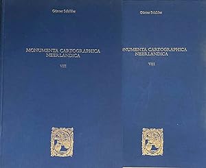
Monumenta Cartographica Neerlandica VIII (TEXT VOLUME & PLATES IN PORTFOLIO). Jodocus Hondius (1563-1612) and Petrus Kaerius (1571-c. 1646)
Verlag: Alphen aan den Rijn, Uitgeverij Canaletto/Repro-Holland 2007, 2007
ISBN 10: 9064698333ISBN 13: 9789064698330
Buch
2 parts, TEXT VOLUME: 596 p. Bound in the publisher's large blue cloth binding with gilt lettering and decoration (Fine copy.) / PORTFOLIO: 37 maps on 93 sheets in matching large blue cloth portfolio with gilt lettering (Bottom spine-end of the portfolio split/bumped on one side, otherwise in good condition.).
Mehr Angebote von anderen Verkäufern bei ZVAB
Gebraucht ab EUR 339,25
-
Monumenta Cartographica Neerlandica V (TEXT VOLUME). Ten Wall Maps by Blaeu and Visscher. / Tien wandkaarten van Blaeu en Visscher
Verlag: Alphen aan den Rijn, Uitgeverij Canaletto 1996, 1996
ISBN 10: 9064697043ISBN 13: 9789064697043
Buch
384 p. Bound in the publisher's large blue cloth binding with gilt lettering and decoration (Very fine copy, text volume only. All text printed in both English and Dutch.).
Mehr Angebote von anderen Verkäufern bei ZVAB
Gebraucht ab EUR 57,50
-
Monumenta Cartographica Neerlandica IV (PLATES IN PORTFOLIO ONLY). Single-sheet maps and topographical prints published by Willem Jansz. Blaeu
Verlag: Alphen aan den Rijn, Uitgeverij Canaletto/Repro-Holland 1990, 1990
23 maps on 37 sheets in large blue cloth portfolio with gilt lettering (In very good condition, plate volume only.).
-
Monumenta Cartographica Neerlandica VII (PLATES IN PORTFOLIO ONLY). Cornelis Claesz (c. 1551-1609): Stimulator and driving force of Dutch cartography
Verlag: Alphen aan den Rijn, Uitgeverij Canaletto/Repro-Holland 2003, 2003
63 maps on 108 sheets in large blue cloth portfolio with gilt lettering (In very good condition, plate volume only.).
-

Monumenta Cartographica Neerlandica III (TEXT VOLUME). Two wall-maps of the world by Blaeu: 1619 and 1645/46. / Twee wandkaarten van de wereld van Blaeu: 1619 en 1645/46
Verlag: Alphen aan den Rijn, Uitgeverij Canaletto 1997, 1990
ISBN 10: 9064696519ISBN 13: 9789064696510
Buch
351 p. Bound in the publisher's large blue cloth binding with gilt lettering and decoration (Very fine copy, text volume only. All text printed in both English and Dutch.).
Mehr Angebote von anderen Verkäufern bei ZVAB
Gebraucht ab EUR 86,25
-
Monumenta cartographica neerlandica II. 2 Bände (Textband u. Kartenmappe). Alphen aan den Rijn, "Canaletto", 1987. Fol. (39,5 : 28,5 cm) u. Quer-gr.-fol. (41 : 56,5 cm). 2 Bl., 171 S. mit 146 teils ganzseitigen Abbildungen u. Mappe mit 45 (davon 3 doppelblattgroßen) Blatt Reproduktionen von großformatigen, von mehreren Platten gedruckten Landkarten. Blauer Or.-Lwd. mit Goldprägung; minimal stockfleckig u. leicht angestaubt. (ISBN 9064695733).
Niederländisch-englische Parallelausgabe. - Insgesamt werden vier großformatige, von mehreren Platten gedruckte Karten vorgestellt: "Welt" (1564), "Asien" (1567) und "Spanien" (1571) von Abraham Ortelius (die Spanienkarte in Zusammenarbeit mit Carolus Clusius) und eine Wandkarte der "Siebzehn Provinzen" (1605) von Joan Baptista Vrients. Bei der Welt- und Spanienkarte von Ortelius wird jeweils ausführlich auf die großformatigen "Wandkarten" früherer Kartographen eingegangen. - Vorsätze etwas stockfleckig, S. 90 mit kl. Braunfleck.
-
Monumenta Cartographica Neerlandica Vols I-VI [6 Plate Volumes]
Verlag: Published by Uitgeverij Canaletto, Alphen aan der Rijn 1987-2000, Netherlands, 1987
ISBN 10: 906469561XISBN 13: 9789064695612
Karte
, Volume I, [Maps of the Seventeen Provinces] ; Volume II [Wall maps] ISBN 9064695733; Volume III, Two Wall-Maps of the World by Blaeu:1619 and 1645/46, ISBN 9064696519; Volume IV Single Sheet Maps and Topographical Prints Published by Willem Jansz Blaeu, ISBN 9064696608; Volume V Ten Wall Maps by Blaeu and Visscher, ISBN 9064697043; Volume VI Dutch Folio Sized Single Sheet Maps with Decorative Borders,1604-60, ISBN 9064697493 First and Second editions , a few marks to boards, corners slightly rubbed, very good condition , blue cloth, gilt title and illustration to fronts, gilt title to spines , 42 cm x 53 cm Hardback ISBN: 906469561x.
-
Monumenta Cartographica Neerlandica VII. Cornelis Claesz (c. 1551-1609): Stimulator and driving force of Dutch cartography. [Complete set of two volumes].
Anbieter: Antiquariaat A. Kok & Zn. B.V., Amsterdam, Niederlande
Bewertung:
Alphen a./d. Rijn, Uitgeverij Canaletto / Repro-Holland, 2003. 2 vols. Vol. 1 (text vol.): 556 pp. B./w. ills. Orig. hardcover (publisher's large blue cloth binding with gilt lettering and vignette on front boards). Sm. folio. - [AND:] Vol. 2 (plate vol.): 63 maps & charts (4 col.) on [100] loose sheets, together in orig. matching large blue cloth portfolio with gilt lettering. Oblong folio.Complete set of the rather rare seventh volume of the series. - Text in Dutch & English.
-
Alpen aan den Rijn, Canaletto / Repro Holland, 2000. 2 vols. Vol. 1 (text vol.): 452 pp. Ca. 900 b./w. ills. Orig. hardcover (publisher's large blue cloth binding with gilt lettering and vignette on front boards). Sm. folio. - [AND:] vol. 2 (plate vol.): 95 maps on [96] loose leaves, together in orig. matching large blue cloth portfolio with gilt lettering. Oblong folio.Complete set of volume six. - The portfolio contains reprints of 95 folio-sized single sheet maps with decorative borders issued in the Netherlands in the first three quarters of the seventeenth century. - Text in Dutch & English.
-
[Alpen aan den Rijn, Canaletto / Repro Holland, 1997]. 1 vol. (of 2). Two b./w. wallmaps on [41] unconnected sheets. Together in orig. publisher's large blue cloth portfolio with gilt lettering. Oblong folio.Only the plate volume with two complete large worldmaps of Joan Blaeu. - The text volume is not present !.
-
Monumenta Cartographica Neerlandica III. Twee wandkaarten van de wereld van Blaeu: 1619 en 1645/46. / Two wall-maps of the world by Bleau: 1619 and 1645/46. (Monumenta Cartographica Neerlandica III). 2nd edition. [Set of two volumes].
Anbieter: Antiquariaat A. Kok & Zn. B.V., Amsterdam, Niederlande
Bewertung:
Alpen aan den Rijn, Canaletto / Repro Holland, 1997. 2 vols. Vol. 1 (text vol.): 351 pp. B./w. ills. Orig. hardcover (publisher's large blue cloth binding with gilt lettering and vignette on front boards). Sm. folio. - [AND:] Vol. 2 (plate vol.): Two b./w. wallmaps on [41] unconnected sheets. Together in orig. matching large blue cloth portfolio with gilt lettering. Oblong folio.Rather rare complete set of volume three of the series. - Text in Dutch & English. - Important reference work on Joan Blaeu's worldmaps of 1619 and 1645/46. - The volume of plates contains the full size reproductions of the two wall-maps.
-
Monumenta Cartographica Neerlandica VIII. Jodocus Hondius (1563-1612) and Petrus Kaerius (1571-c. 1646). [Text volume].
Anbieter: Antiquariaat A. Kok & Zn. B.V., Amsterdam, Niederlande
Bewertung:
Alpen aan den Rijn, 2007. 596 pp. Num. b./w. ills. Hardcover. Sm. folio. Only the text volume of volume VIII. - Text in Dutch & English. - - The volume of plates (not present !) contains large size reproductions of maps. The text volume offered here is well illustrated and very useful as separate reference work.
-
Monumenta Cartographica Neerlandica V. Tien wandkaarten van Blaeu en Visscher / Ten Wall Maps by Blaeu and Visscher. [Complete two volume set].
Anbieter: Antiquariaat A. Kok & Zn. B.V., Amsterdam, Niederlande
Bewertung:
Alphen aan den Rijn, Uitgeverij "Canaletto", 1996. 2 vols. Vol. 1 (text vol.): [II],384 pp. 371 b./w. ills. Orig. hardcover (publisher's large blue cloth binding with gilt lettering and vignette on front boards). Sm. folio. - [AND:] vol. 2 (plate vol.): 10 b./w. wall maps (in actual size) on [145] loose leaves (not 142 as indicated), together in orig. matching large blue cloth portfolio with gilt lettering. Oblong folio.Complete set of volume five. - The portfolio contains full size reprints of ten wall maps of the four continents, Germany, Italy, Flanders and parts of the Netherlands, all published by Willem Jansz. Blaeu and the Visscher family. - Text in Dutch & English.
-
Alphen aan den Rijn, Uitgeverij "Canaletto", 1993. 1 vol. (of 2). 23 b./w. maps & views on [37] loose sheets, together in orig. large blue cloth portfolio with gilt lettering. Oblong folio.Only the plate volume with 23 fulls size reproductions of maps by Willem Jansz. Blaeu: 2 views of navle battles (each on 3 sheets), 2 worlmaps (2 different states, each on 2 sheets), 16 bifolio maps, a panorama of Amsterdam (on 4 sheets) and Venice (on 5 sheets) and a map of the Beemster (on 2 sheets). - The text volume is not present !! - - Please note: of the world map in two parts by Blaeu from 1604 (map 3A in this work), only the left part is included in facsimile (3A.1). This is a reprint of the left part of this world map that is present in the UB Erlangen-Nürnberg. To date, no copy of the right part of the original 1604 Blaeu edition of this world map is known. Map 3A.2 is therefore not missing in this edition. It has never been included in this edition.
-
Alphen aan den Rijn, Uitgeverij "Canaletto", 1993. 2 vols. Vol. 1: (text vol.): [IV],364 pp. 326 b./w. ills & maps. Orig. hardcover (publisher's large blue cloth binding with gilt lettering and vignette on front boards). Sm. folio. - [AND:] vol. 2 (plate vol.): 23 b./w. maps & views on [37] loose sheets, together in orig. matching large blue cloth portfolio with gilt lettering. Oblong folio.Complete set of the rather rare fourth volume of the series. - Text in Dutch & English. - Including 23 fulls size reproductions: 2 views of navle battles (each on 3 sheets), 2 worlmaps (2 different states, each on 2 sheets), 16 bifolio maps, a panorama of Amsterdam (on 4 sheets) and Venice (on 5 sheets) and a map of the Beemster (on 2 sheets). - - Please note: of the world map in two parts by Blaeu from 1604 (map 3A in this work), only the left part is included in facsimile (3A.1). This is a reprint of the left part of this world map that is present in the UB Erlangen-Nürnberg. To date, no copy of the right part of the original 1604 Blaeu edition of this world map is known. Map 3A.2 is therefore not missing in this edition. It has never been included in this edition.

![Bild des Verkäufers für Monumenta Cartographica Neerlandica Vols I-VI [6 Plate Volumes] zum Verkauf von Keoghs Books](https://pictures.abebooks.com/inventory/md/md30987028374.jpg)