Gesamtpreis (1 Artikel Artikel):
Versandziel:

mitchells new general atlas containing von mitchell augustus (9 Ergebnisse)
Feedback
Direkt zu den wichtigsten Suchergebnissen
Suchfilter
Produktart
- Alle Product Types
- Bücher (9)
- Magazine & Zeitschriften (Keine weiteren Ergebnisse entsprechen dieser Verfeinerung)
- Comics (Keine weiteren Ergebnisse entsprechen dieser Verfeinerung)
- Noten (Keine weiteren Ergebnisse entsprechen dieser Verfeinerung)
- Kunst, Grafik & Poster (Keine weiteren Ergebnisse entsprechen dieser Verfeinerung)
- Fotografien (Keine weiteren Ergebnisse entsprechen dieser Verfeinerung)
- Karten (Keine weiteren Ergebnisse entsprechen dieser Verfeinerung)
- Manuskripte & Papierantiquitäten (Keine weiteren Ergebnisse entsprechen dieser Verfeinerung)
Zustand Mehr dazu
- Neu (1)
- Wie Neu, Sehr Gut oder Gut Bis Sehr Gut (Keine weiteren Ergebnisse entsprechen dieser Verfeinerung)
- Gut oder Befriedigend (4)
- Ausreichend oder Schlecht (Keine weiteren Ergebnisse entsprechen dieser Verfeinerung)
- Wie beschrieben (4)
Einband
Weitere Eigenschaften
- Erstausgabe (2)
- Signiert (Keine weiteren Ergebnisse entsprechen dieser Verfeinerung)
- Schutzumschlag (Keine weiteren Ergebnisse entsprechen dieser Verfeinerung)
- Angebotsfoto (8)
Sprache (2)
Preis
- Beliebiger Preis
- Weniger als EUR 20 (Keine weiteren Ergebnisse entsprechen dieser Verfeinerung)
- EUR 20 bis EUR 45
- Mehr als EUR 45
Gratisversand
Land des Verkäufers
Verkäuferbewertung
-

Mitchell's New General Atlas ?containing Maps of the Various Countries of the World, Plans of Cities, Etc. Embraced in Forty?seven Quarto Maps, Formin
Verlag: Creative Media Partners, LLC Sep 2021, 2021
ISBN 10: 1013644395 ISBN 13: 9781013644399
Sprache: Englisch
Anbieter: AHA-BUCH GmbH, Einbeck, Deutschland
Verkäuferbewertung 5 von 5 Sternen

EUR 27,02
Währung umrechnenKostenlos für den Versand innerhalb von/der DeutschlandAnzahl: 2 verfügbar
In den WarenkorbTaschenbuch. Zustand: Neu. Neuware.
-
Mitchell's New General Atlas; containing Maps of the Various Countries of the World, Plans of Cities, etc. Embraced in Ninety-Three Quarto Maps, Forming a series of One Hundred and Forty-Seven Maps and Plans. Together with Valuable Statistical Tables. Also, a list of Post-Offices of the United States and Territories, and also a Census of 1880 for States, Territories and Counties, also of Cities of over 10,000 inhabitants
Verlag: Philadelphia: Wm. M. Bradley & Bro., 1889, 1889
Anbieter: Adrian Harrington Ltd, PBFA, ABA, ILAB, Royal Tunbridge Wells, KENT, Vereinigtes Königreich
Verbandsmitglied: ABA ILAB PBFA
Verkäuferbewertung 5 von 5 Sternen
EUR 884,83
Währung umrechnenEUR 17,18 für den Versand von Vereinigtes Königreich nach DeutschlandAnzahl: 1 verfügbar
In den Warenkorb[American World Atlas] ORIGINAL COLOURED MAPS. Large quarto (40 x 32cm), with 123 pages of coloured maps, and 46 pages of text at rear. A map of South Africa loosely inserted at rear. Original embossed dark brown cloth over boards, with gilt titles to upper, recently re-backed in brown calf with gilt titles to burgundy morocco label. All edges red. Some gentle spotting to title page, otherwise internally clean. Light general wear to boards, restored to a robust, attractive condition.
-
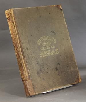
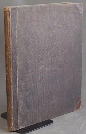
MITCHELL'S NEW GENERAL ATLAS, CONTAINING MAPS OF THE VARIOUS COUNTRIES OF THE WORLD, PLANS OF CITIES, ETC., EMBRACED IN FIFTY-THREE QUARTO MAPS, FORMING A SERIES OF EIGHTY-FOUR MAPS AND PLANS, TOGETHER WITH VALUABLE STATISTICAL TABLES
Verlag: S. Augustus Mitchell, Jr., Philadelphia, PA, 1863
Anbieter: Aardvark Rare Books, ABAA, EUGENE, OR, USA
Verbandsmitglied: ABAA CBA ILAB IOBA
Verkäuferbewertung 5 von 5 Sternen
EUR 1.929,60
Währung umrechnenEUR 51,09 für den Versand von USA nach DeutschlandAnzahl: 1 verfügbar
In den WarenkorbLeather-bound. Zustand: Very Good. Folio. 40 cm. 15 3/4 in. x 13 in. Contemporary brown textured cloth. Rebacked (spine and corners) in brown half-morocco, with borders of gilt roll. Original boards somewhat scuffed, rubbed and stained, but the entire refurbishing has yielded a very handsome and serviceable volume with many lovely colored maps. Title embossed to top board, in gilt with copper-tone highlights. Green gold-vein endpapers, probably replacements. Eighty-Four colored maps, including three double maps. Some age-toning to endpapers and map margins -- overall very readable and useable! Maps include many groups of U.S. States and Territories, and plans of U.S. Cities. Also maps of Canada (Nova Scotia, New Brunswick, Cape Breton, and Prince Edward's Islands, Halifax, Montreal;, Mexico, Central America and West Indies, Cuba, Jamaica, Bermuda, Panama Railroad, South America, Proposed Atrato Canal; New Grenada, Venezuela, Guiana; Equador and Peru; Argentine Confederation; Brazil Chili (& Island of Juan Fernandez); Europe; Russia in Europe, Norway and Sweden; Denmark; Holland and Belgium; France, Spain, and Portugal; Switzerland; England and Wales; Scotland (& Shetland Islands); Ireland; Prussia and the German States; Austria, Italy, Turkey in Europe,and Greece; Maltese Islands; Asia; Persia, Turkey in Asia, Afghanistan, and Beloochistan; Palestine, or The Holy Land; Hindoostan, Farther India, China, and Thibet; Oceanica; Sandwich Islands; Africa; Island of St. Helena; Harbors. Also The World - Eastern and Westernb Hemispheres; The World - Mercator's Projection; North America. Statistical Information at rear includes: (Complete) LIST OF POST OFFICES IN THE UNITED STATES; POPULATION OF THE UNITED STATES by the Census of 1850 and 1860; LIST OF SLAVE STATES AND THEIR POPULATIONS IN BOTH 1850 AND 1860; Table of (Foreign) POPULATION AND GOVERNMENTS; TABLE OF DISTANCES (ROUTES TO AND FROM FOREIGN PORTS AND CITIES; LAND ROUTES TO PLACES WITHIN THE UNITED STATES; MOUNTAINS OF THE WORLD; RIVERS OF THE WORLD. A beautiful, restored and VERY sturdy Atlas from 1863.
-
Mitchell's New General Atlas, Containing Maps of the Various Countries of the World, Plans of Cities, Etc., Embraced in Sixty-Three Quarto Maps, Forming a Series of One Hundred Maps and Plans, Together with Valuable Statistical Tables.
Verlag: Philadelphia, 1871
Anbieter: Attic Books (ABAC, ILAB), London, ON, Kanada
Verkäuferbewertung 5 von 5 Sternen
EUR 2.192,73
Währung umrechnenEUR 21,29 für den Versand von Kanada nach DeutschlandAnzahl: 1 verfügbar
In den WarenkorbHardcover. Zustand: Good. 96 hand-coloured maps on 70 sheets, followed by 27, [4] p. 40 cm. Respined. Original cloth with gold lettering, blank impressing, leather corners. Corners bumped, cloth stained and rubbed. Dent in top front edge. Some wear to gold print on new spine label. New endpapers. Pages soiled and thumbed. Tear in map of Mexico, Central America, and the West Indies. Includes full-page city maps of Boston, New York, Philadelphia, Baltimore, Washington, Cincinnati, St Louis and New Orleans. The atlas concentrates on America for Americans but includes highlights from the rest of the world. Being 1871, it includes the Argentine Confederation, Prussia and the German States, Persia, Beloochistan, Hindoostan, Farther India, and the Sandwich Islands. At rear is a reference table, followed by tables of population, governments, distances, mountains, and rivers.
-

Mitchell's New General Atlas, containing Maps of the Various Countries Of The World, Plans of Cities, Etc.; Embraced in Ninety Three Quarto Maps forming a Series of One Hundred and Forty-seven Maps and Plans
Verlag: S. Augustus Mitchell, Philadelphia, 1879
Anbieter: Old Book Shop of Bordentown (ABAA, ILAB), Bordentown, NJ, USA
Verkäuferbewertung 3 von 5 Sternen

EUR 1.052,51
Währung umrechnenEUR 42,11 für den Versand von USA nach DeutschlandAnzahl: 1 verfügbar
In den WarenkorbHardcover. Zustand: Very Good. Folio in three quarter dark brown leather over original brown cloth ornately decorated in black and gilt. Complete with all color tinted maps and city plans plus at rear 37 pp. reference table consisting of "Post Offices on The United States and Territories Alphabetically Arranged in States Forming A List of the Cities, Towns And Villages, With Their Locations", "Official Census of Canada--1871", "Population of the United States by the Census of 1860 and 1870", "Table Population, Governmets, &c.", "Table Of Distances" , "Mountains of the World", "Rivers of the World', "Population of the Principal Cities, Towns, and Villages of the United States in 1879", and "Table Showing the Relative Rank of the States in Population during each Decade from 1776 to 1876". A tight example though with front hinge starting. crease to the ffep, wear to the leather tips and running to the spine strip with an aprox 3/4" loss to the foot of the spine. Front hinge starting. Internally clean and unmarked.
-
Mitchell's New General Atlas, Containing Maps of the Various Countries of the World, Plans of Cities, Etc. Embraced in Fifty Quarto Maps, Forming a Series of Eighty Maps and Plans, Together with Valuable Statistical Tables
Verlag: S.A. Mitchell, Philadelphia, 1862
Anbieter: Between the Covers-Rare Books, Inc. ABAA, Gloucester City, NJ, USA
Verbandsmitglied: ABAA ESA ILAB IOBA
Verkäuferbewertung 5 von 5 Sternen
Erstausgabe
EUR 2.631,27
Währung umrechnenEUR 38,32 für den Versand von USA nach DeutschlandAnzahl: 1 verfügbar
In den WarenkorbHardcover. Zustand: Very Good. First edition. Small folio, unpaginated. Original publisher's half calf and gilt-lettered pebbled cloth binding. A very good copy with wear to the leather, the title page and list of maps foxed and with occasional mild soiling to the margins of plates, but strong joints and hinges, with an attractive 19th Century American bookplate. A desirable example of this Civil War-era atlas. Excellent original hand-coloring for all maps. This copy is complete with all 80 maps plus two additional maps not called for: "New Hampshire and Vermont" and "County Map of Massachusetts, Connecticut and Rhode Island." Among the more notable American maps are those detailing Texas, California, New Orleans, the Indian Territory of future Oklahoma, and plans of Baltimore and Washington, DC. The atlas also has three double-page maps. A beautiful example of a mid-19th Century American atlas.
-

Mitchell's New General Atlas, Containing Maps of the Various Countries of the World, Plans of Cities, etc. .
Verlag: S. Augustus Mitchell, Philadelphia, 1871
Anbieter: Abacus Bookshop, Pittsford, NY, USA
Verkäuferbewertung 5 von 5 Sternen
Erstausgabe
EUR 2.192,73
Währung umrechnenEUR 21,29 für den Versand von USA nach DeutschlandAnzahl: 1 verfügbar
In den Warenkorb1/2 leather. Illus. with maps (illustrator). 1st. Folio, unpag., Complete with all hand-colored maps; leather spine and corners rubbed, hinges tight, all plates clean & bright, Full title reads as follows: "Mitchell's New General Atlas, Containing Maps of the Various Countries of the World, Plans of Cities, etc. Embraced in Sixty-Three Quarto Maps, Forming a Series of One Hundred Maps and Plans,Together with Valuable Statistical Tables" Very good copy in the original leather-backed brown cloth.
-
Mitchell's new general atlas containing maps of the various countries of the world, plans of cities, etc., embraced in sixty-three quarto maps, forming a series of one hundred maps and plans, together with valuable statistical tables
Verlag: S. Augustus Mitchell, no. 31 South Sixth Street, Philadelphia, 1871
Anbieter: Rulon-Miller Books (ABAA / ILAB), St. Paul, MN, USA
Verbandsmitglied: ABAA ILAB RMABA
Verkäuferbewertung 5 von 5 Sternen
EUR 1.370,46
Währung umrechnenEUR 59,61 für den Versand von USA nach DeutschlandAnzahl: 1 verfügbar
In den WarenkorbSquare folio, pp. [4], 27, [5]; 96 hand-colored maps on 70 sheets; a worn copy with joints amateurishly repaired, front free endpaper and flyleaf with creases and tears in the margins, title page with short tear in gutter, gilt on cover dull, spine scuffed and with amateur repairs at top and bottom; internally with the maps uniformly clean but occasionally with a tear or two entering from the margins or folds (no loss); original brown cloth lettered in gilt on upper cover. A good and complete copy. Includes full page city maps of Boston, New York, Philadelphia, Baltimore, Washington, D.C., Greenbrier, West Virginia, Cincinnati, St. Louis, and New Orleans. Contained in a new stiff card clamshell box.
-
Mitchell's new general atlas containing maps of the various countries of the world, plans of cities, etc.
Verlag: S. Augustus Mitchell, Jr., Philadelphia, 1864
Anbieter: Rulon-Miller Books (ABAA / ILAB), St. Paul, MN, USA
Verbandsmitglied: ABAA ILAB RMABA
Verkäuferbewertung 5 von 5 Sternen
EUR 1.644,55
Währung umrechnenEUR 59,61 für den Versand von USA nach DeutschlandAnzahl: 1 verfügbar
In den WarenkorbSquare folio, pp. [4], 27, [4]; 84 hand-colored maps on 54 sheets; gilt on cover dull, spine a little scuffed; internally very clean; aside from the dullness of the binding, a very good, sound copy in publisher's quarter brown morocco and brown cloth lettered in gilt on front. Includes full page city maps of Boston, New York, Baltimore, Washington, D.C., Cincinnati, and New Orleans.