
Gesamtpreis (1 Artikel Artikel):
Versandziel:

methode abregee facile apprendre geographie avec (10 Ergebnisse)
Direkt zu den wichtigsten Suchergebnissen
Suchfilter
Produktart
- Alle Product Types
- Bücher (10)
- Magazine & Zeitschriften (Keine weiteren Ergebnisse entsprechen dieser Verfeinerung)
- Comics (Keine weiteren Ergebnisse entsprechen dieser Verfeinerung)
- Noten (Keine weiteren Ergebnisse entsprechen dieser Verfeinerung)
- Kunst, Grafik & Poster (Keine weiteren Ergebnisse entsprechen dieser Verfeinerung)
- Fotografien (Keine weiteren Ergebnisse entsprechen dieser Verfeinerung)
- Karten (Keine weiteren Ergebnisse entsprechen dieser Verfeinerung)
- Manuskripte & Papierantiquitäten (Keine weiteren Ergebnisse entsprechen dieser Verfeinerung)
Zustand Mehr dazu
- Neu (Keine weiteren Ergebnisse entsprechen dieser Verfeinerung)
- Wie Neu, Sehr Gut oder Gut Bis Sehr Gut (1)
- Gut oder Befriedigend (2)
- Ausreichend oder Schlecht (Keine weiteren Ergebnisse entsprechen dieser Verfeinerung)
- Wie beschrieben (7)
Einband
Weitere Eigenschaften
- Erstausgabe (Keine weiteren Ergebnisse entsprechen dieser Verfeinerung)
- Signiert (Keine weiteren Ergebnisse entsprechen dieser Verfeinerung)
- Schutzumschlag (Keine weiteren Ergebnisse entsprechen dieser Verfeinerung)
- Angebotsfoto (7)
Sprache (2)
Preis
- Beliebiger Preis
- Weniger als EUR 20 (Keine weiteren Ergebnisse entsprechen dieser Verfeinerung)
- EUR 20 bis EUR 45 (Keine weiteren Ergebnisse entsprechen dieser Verfeinerung)
- Mehr als EUR 45
Gratisversand
- Kostenloser Versand nach USA (Keine weiteren Ergebnisse entsprechen dieser Verfeinerung)
Land des Verkäufers
Verkäuferbewertung
-
Méthode abrégée et facile pour apprendre la géographie ; oů l'on décrit la forme du gouvernement de chaque pays, ses qualités, les moeurs de ses habitants, et ce qu'il y a de plus remarquable. Avec un abrégé de la sphčre, & une table des longitudes & latitudes des principales villes du monde, conformes aux derničres observations de messieurs de l'Académie de sciences, et autres astronomes. Derničre édition, revue, corrigée et augmentée.
Verlag: Chez Blache et Boyet, 1806
Anbieter: Rometti Vincent, Nice, Frankreich
Verkäuferbewertung 5 von 5 Sternen

Couverture rigide. Zustand: Satisfaisant. A Paris, Chez Blache et Boyet, 1806. In-12, IV+(1f)+380pp.+24pp. Plein veau de l'époque, dos lisse orné, pičce de titre. 17 cartes gravées dépliantes par Robert de Vaugondy d'aprčs l'édition de 1750. Par Le François (Barbier III, 290). Curieusement la pičce de titre indique "Crozat" ; Anne-Marie Crozat fut la dédicataire de plusieurs éditions cette Méthode de géographie, mais elle n'est pas l'auteur. Reliure frotté avec de petits manques de cuir. Quelques brunissures.
-

Méthode Abrégée et Facile pour Apprendre la Géographie; Oů l'on décrit la forme du Gouvernement de chaque Pays, ses qualités, les moeurs de ses Habitans, & ce qu'il y a de plus remarquable. Avec un abrégé de la sphere, & une table des longitudes & latitudes des principales villes du monde conforme aux dernieres observations de messieurs de l'académie des sciences, des RR. PP. Jésuites & autres astronomes. Nouvelle edition, revűe, corrigée & augmentée.
Verlag: Paris Barois, 1751
Sprache: Französisch
Anbieter: Antiquariat carpe diem, Monika Grevers, Bocholt, Deutschland
Verkäuferbewertung 5 von 5 Sternen
Kl. 8°, 15 Blätter, 552 Seiten. mit 17 gefalteten, gestochenen Karten. Marmoriertes Leder der Zeit auf 5 Bünden mit Rückenvergoldung, 3seitigem Rotschnitt und marmorierten Vorsätzen. Die Karten von Robert de Vaugondy zeigen die Welt in zwei Hemisphären, Europa, Frankreich, Belgien, die Niederlande, Italien, Spanien und Portugal, Deutschland, Großbritannien, Skandinavien, Polen, Russland, den Balkan, Asien, Afrika sowie Nord- und Südamerika. Mit Register. - Exlibris, Vorderdeckel quer eingeritzt, Ecken bestoßen und beschabt, oberes Kapital leicht abgeschabt, Namenseintrag von alter Hand auf Titel, Namensstempel auf Titel und jeder Karte rückseiteitig sowie auf der letzten Seite, 1 Seite mit kleinem Eckabriß, die Kartenfalze teils löchrig, teils wurmfraßspurig. Insgesamt schönes Exemplar.
-
Méthode abrégée et facile pour apprendre la géographie, oů l'on décrit la forme du Gouvernement de chaque Pays, ses qualités, les moeurs de ses Habitans, & ce qu'il y a de plus remarquable. Avec un Abrégé de la Sphčre, & une table des longitudes & latitudes des principales villes du monde, conforme aux derničres observations de messieurs de l'Académie des sciences, & autres astronomes. Nouvelle édition, revue, corrigée & augmentée.
Verlag: Chez Nyon Jeune, Libraire, 1781
Anbieter: Eric Girod, Estavayer-le-Lac, FR, Schweiz
Verkäuferbewertung 5 von 5 Sternen
Couverture rigide. Zustand: Bon. XVI + 4 + 614 pages + cartes ŕ déplier (en avons compté 16). Premičre partie : Epitre « Ŕ Mademoiselle Crozat (Marie-Anne, née vers 1700) » , préface de l'auteur, avis sur cette édition, Table des Titres et Approbation de Robert de Vaugondy datée du 20 juin 1780, Privilčge général, Avertissement tiré de l'édition précédente. Puis la pagination (page 1) débute avec « L'Abrégé de la Sphčre ». Dčs la page 30, la Méthode éponyme du titre de l'ouvrage. Couverture rigide reliure basane, dos ŕ 5 nerfs, fleurons, dorures. Etat : Bon, état d'ancienneté. Couverture : assez bon, frottements, accident sur 1er plat en bas ŕ droite (frottement et perte de basane), dorures défraîchies sur le dos. Intérieur : bon, quelques menus accidents. Parfois lisibilité un peu difficile, encre défraîchie. Frontispice annoté (voire photo). Prévoir diminution des frais de port, catégorie petit colis; nous vous renseignons volontiers. 17,5 x 10,5 x 4,5 cm 500g.
-
Méthode abrégée et facile pour apprendre la géographie, dite de Crozat, oů l'on décrit la forme du gouvernement de chaque pays, ses qualités, les moeurs de ces habitans, et ce qu'il y a de plus remarquable; Avec un Abrégé de la sphčre et une Table des longitudes et latitudes. Nouvelle édition, revue et corrigée d'aprčs les actes du Congrčs de Vienne, et les traités de Paris de 1814 et 1815; ornée de cartes. . Par un Professeur de Géographie. (Dédicace signé A. L. F. : l'abbé A. Le François).
Verlag: Chez Guichard, Imprimeur-Libraire, Avignon, 1820
Anbieter: Emile Kerssemakers ILAB, Heerlen, Niederlande
Verkäuferbewertung 5 von 5 Sternen
Small 8vo (17x11 cm). Contemporary leather, spine gilt, with morocco title-label (top spine, backcover and second hinge damaged with loss of leather; frontcover warpled. (xxiv: misbound),432 pp. (endpapers soiled; last endpaper with serious inkspots and old annotations in ink; some small lightbrown inkspots in places). With 7 folding maps, the same as in the 1818 edition, but with the present date 1820: 1) "Royaume de France Divisé en Départemens 1820", 2) "L'Europe Divisée en ses grands Etats 1820", 3) "Amérique Mérid. 1820", 4) "Amérique Sept. 1820", 5) "Afrique 1820", 6) Asie 1820", 7) "Mappe-Monde divisée en ses quatre parties 1820", world map, 30x16,5 cm, representing the Western and Eastern hemispheres (small repair; upper margin short; some brown spots). - Schoolbook, on the whole in acceptable condition. 350g.
-
Méthode abrégée et facile pour apprendre la géographie avec un abrege de la sphere
Verlag: Pierre Husson, Paris, 1706
Anbieter: James Cummins Bookseller, ABAA, New York, NY, USA
Verkäuferbewertung 3 von 5 Sternen

552 pp.; [xii], and with [xvi] unpaginated pages of index at rear. Illustrated plate at title. 8vo. From the collection of John Waldie (b.1781 - d.1862), who was the administrator of Hendersyde Park at Kelso, Roxburgshire, Scotland. Leather boards with ornate gilt on banded spine, partial splitting on front board from bottom, some soiling to edges and toning and moderate warping. John Waldie's bookplate is pasted down on fep 552 pp.; [xii], and with [xvi] unpaginated pages of index at rear. Illustrated plate at title. 8vo.
-
METHODE ABREGEE ET FACILE POUR APPRENDRE LA GEOGRAPHIE.AVEC UN ABREGE DE LA SPHERE.
Verlag: Chez les Libraires Associes, Paris, 1772
Anbieter: Bartleby's Books, ABAA, Chevy Chase, MD, USA
Verbandsmitglied: ABAA ESA ILAB IOBA
Verkäuferbewertung 5 von 5 Sternen
12mo.; (2), x, 515, (1) pp. With 17 folding engraved maps by Robert de Vaugondy (dated 1750). Contemporary mottled calf, spine gilt-tooled, leather spine label, marbled endpapers and edges. Ecclesiastical supralibros, gilt, on both covers, described in an old manuscript note on a fly-leaf as that of "Mgr Duplesses de Argentre, eveque de Sees, 1776 a la Revolution." Spine ends somewhat chipped, but a very good copy. Maps are clean (one has a closed tear). "Nouvelle edition, revue, corigee & augmentee" (first published in 1719, the work went through many editions in the 17th and early 18th centuries). The authorship is disputed, and, as the dedicatory letter is addressed to Madamoiselle Crozet, the work is often referred to as the "Geographie de Crozat," and the spine label on this copy is titled thusly. The 17 folding maps, all approximately 6 1/2 x 6 1/2 inches, picture the world as represented on the globe, Europe, 10 individual European countries, Turkey & Greece, Asia, Africa, South America, and North America.
-
Methode abregée et facile pour apprendre la geographie; Ou l`on de`crit la forme du Gouvernement de chaque Pays, ses Qualités, les Moeurs de ses Habitans, & ce qu`il y a de plus remarquable. Avec un Aabregé de la Sphere, & une Table des Longitudes & Latitudes des principales Villes du Monde, conforme aux dernieres Observations de Messieurs de l` Académie des Sciences, des R R. P P. Jesuites, & autres Astronomes.
Verlag: Paris Veuve Delaulne, 1734
Sprache: Französisch
Anbieter: Antiquariat Viarius, Frauenfeld, Schweiz
Verkäuferbewertung 5 von 5 Sternen
Nouvelle Ed., revűe, corrigée & augmentée, Kl.8°, Kopfleisten, Vign., Initialen, 17 Bl., 457 S., 12 Bl., Batik-Vorsätze, Ldr., dekorat. Rvg. Rücken am Kopf etwas beschäd., Schnitt teils etwas fleckig. Im KVK und den französischen Bibliotheken nicht nachweisbar. + + + Achtung: Für unsere Kunden in Deutschland erfolgt der Versand in der Regel verzollt vierzehntäglich ab Deutschland. + Bankverbindung in Deutschland vorhanden. + Bitte fragen Sie uns an. Danke + + +.
-
Méthode abregée et facile pour apprendre La Geographie ; ou l'on décrit la forme du Gouvernement de chaque Pays,ses Qualités, les Moers de ses Habitans, & ce qu'il y a de plus remarquable. Avec un Abregé de la Sphere, & une table de Longitudes & Latitudes.conformes aux dernieres Observations de Messieurs de l'Académie des Sciences , des R R, P P. Jesuites, & autres Astronomes.
Anbieter: Antiquariaat Wim de Goeij, Kalmthout, ANTW, Belgien
Verbandsmitglied: ILAB
Verkäuferbewertung 5 von 5 Sternen
6. Paris, Chez Denis Horthemels, 1741, in-8°, (32) pp nn + 457 pp + (23)pp nn (index) , reliure en plein veau d'époque, dos ŕ cinq nerfs avec décoration et titre doréé, tranches rouges. Exemplaire trčs correct avec peu traces d'usage.Ceci est la 4e ou 5e édition de ce manuel trčs populaire de géographie. La premičre édition est de 1714. Le livre a été ré-imprimé jusq'au 19e sičcle. Le livre est dédié ŕ Mademoiselle Crozat.
-
Méthode abrégée et facile pour apprendre la géographie, ou? l'on décrit la forme du gouvernement de chaque pays, ses qualités, les m?urs de ses habitants, & ce qu'il y a de plus remarquable. Avec un Abrégé de la Sphere, & une table des longitudes & latitudes des principales villes du monde, conforme aux dernieres observations de messieurs de l'Académie des sciences, & autres astronomes. Nouvelle édition, revue, corrigée & augmentée. Original editioin.
Verlag: Paris: Librairies Associés., 1770
Anbieter: Wittenborn Art Books, San Francisco, CA, USA
Verkäuferbewertung 5 von 5 Sternen
Zustand: Good. 12mo. 10 x 16.5 cm. Contemporary calf, worn but solid. 560pp. Folding maps, one torn without loss.; includes one of North America, dated 1750.Epître dédicatoire a? mademoiselle Crozat, préface.Fleuron au titre, bandeaux, lettres ornées, culs-de-lampe gr. s. b.Sig. a6, A-X12, Y6.Description: [1-1bl.]-x-515-[1] p. : cartes gr. s. m. ; In-1.OCLC Number: 936419825.
-
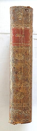
Méthode Abrégée et Facile Pour Apprendre La Géographie [.]. Oů l'on decrit la forme du Gouvernement de chaqye pays, ses qualités, les moeurs de ses habitans, et ce qu'il y a de plus remarquable; Avec un Abrégé de la Sphčre, et une Table des Longitudes et Latitudes des principales villes du monde. Derničre édition, Revue, corrigée, et augmentée de la nouvelle division de la France par Départmens, Préfecture, sous-Préfectures, Tribunaux, Archęvechč, Echęvechč, etc.
Anbieter: Libreria Oreste Gozzini snc, Firenze, FI, Italien
Verkäuferbewertung 5 von 5 Sternen
A Lyon, Chez Robert et Gauthier, Libraries, Rue De l'Archęveché, 1803, in-12, legatura coeva in mezza pelle, titolo e filetti in oro al dorso, pp. XII, 423, [1]. Con 17 carte geografiche f.t. di Robert de Vaugondy incise in rame con confini colorati a mano e ripiegate, compreso un planisfero in antiporta. Buon esemplare.


![Bild des Verkäufers für Méthode Abrégée et Facile Pour Apprendre La Géographie [.]. Oů l'on decrit la forme du Gouvernement de chaqye pays, ses qualités, les moeurs de ses habitans, et ce qu'il y a de plus remarquable; Avec un Abrégé de la Sphčre, et une Table des Longitudes et Latitudes des principales villes du monde. Derničre édition, Revue, corrigée, et augmentée de la nouvelle division de la France par Départmens, Préfecture, sous-Préfectures, Tribunaux, Archęvechč, Echęvechč, etc. zum Verkauf von Libreria Oreste Gozzini snc](https://pictures.abebooks.com/inventory/md/md22878466575.jpg)