
Gesamtpreis (1 Artikel Artikel):
Versandziel:

map northallerton ripon sheet (9 Ergebnisse)
Direkt zu den wichtigsten Suchergebnissen
Suchfilter
Produktart
- Alle Product Types
- Bücher (8)
- Magazine & Zeitschriften (Keine weiteren Ergebnisse entsprechen dieser Verfeinerung)
- Comics (Keine weiteren Ergebnisse entsprechen dieser Verfeinerung)
- Noten (Keine weiteren Ergebnisse entsprechen dieser Verfeinerung)
- Kunst, Grafik & Poster (Keine weiteren Ergebnisse entsprechen dieser Verfeinerung)
- Fotografien (Keine weiteren Ergebnisse entsprechen dieser Verfeinerung)
- Karten (1)
- Manuskripte & Papierantiquitäten (Keine weiteren Ergebnisse entsprechen dieser Verfeinerung)
Zustand Mehr dazu
- Neu (Keine weiteren Ergebnisse entsprechen dieser Verfeinerung)
- Wie Neu, Sehr Gut oder Gut Bis Sehr Gut (Keine weiteren Ergebnisse entsprechen dieser Verfeinerung)
- Gut oder Befriedigend (7)
- Ausreichend oder Schlecht (1)
- Wie beschrieben (1)
Einband
Weitere Eigenschaften
- Erstausgabe (Keine weiteren Ergebnisse entsprechen dieser Verfeinerung)
- Signiert (Keine weiteren Ergebnisse entsprechen dieser Verfeinerung)
- Schutzumschlag (Keine weiteren Ergebnisse entsprechen dieser Verfeinerung)
- Angebotsfoto (4)
Sprache (2)
Gratisversand
- Kostenloser Versand nach USA (Keine weiteren Ergebnisse entsprechen dieser Verfeinerung)
Land des Verkäufers
Verkäuferbewertung
-
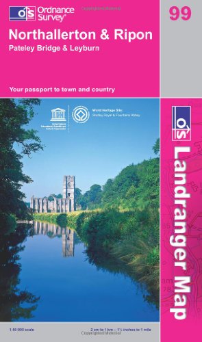
Northallerton and Ripon, Pateley Bridge and Leyburn: Sheet 99 (OS Landranger Map)
Anbieter: WorldofBooks, Goring-By-Sea, WS, Vereinigtes Königreich
Verkäuferbewertung 5 von 5 Sternen

EUR 2,48
EUR 6,48 Versand
Versand von Vereinigtes Königreich nach USAAnzahl: 1 verfügbar
In den WarenkorbPaperback. Zustand: Good. The book has been read but remains in clean condition. All pages are intact and the cover is intact. Some minor wear to the spine.
-
Northallerton and Ripon, Pateley Bridge and Leyburn: Sheet 99 (OS Landranger Map)
Anbieter: WorldofBooks, Goring-By-Sea, WS, Vereinigtes Königreich
Verkäuferbewertung 5 von 5 Sternen
EUR 2,48
EUR 6,48 Versand
Versand von Vereinigtes Königreich nach USAAnzahl: 8 verfügbar
In den WarenkorbPaperback. Zustand: Very Good. The book has been read, but is in excellent condition. Pages are intact and not marred by notes or highlighting. The spine remains undamaged.
-

Northallerton and Ripon, Pateley Bridge and Leyburn: Sheet 99 (OS Landranger Map)
Anbieter: WeBuyBooks, Rossendale, LANCS, Vereinigtes Königreich
Verkäuferbewertung 5 von 5 Sternen
EUR 4,47
EUR 5,33 Versand
Versand von Vereinigtes Königreich nach USAAnzahl: 1 verfügbar
In den WarenkorbZustand: Good. Most items will be dispatched the same or the next working day. A copy that has been read but remains in clean condition. All of the pages are intact and the cover is intact and the spine may show signs of wear. The book may have minor markings which are not specifically mentioned.
-

Northallerton, Ripon and Surrounding Area (Sheet 99) (OS Landranger Map)
Sprache: Englisch
Verlag: Ordnance Survey, United Kingdom, Hants, 1989
ISBN 10: 0319220990 ISBN 13: 9780319220993
Anbieter: WorldofBooks, Goring-By-Sea, WS, Vereinigtes Königreich
Verkäuferbewertung 5 von 5 Sternen
EUR 5,20
EUR 6,48 Versand
Versand von Vereinigtes Königreich nach USAAnzahl: 6 verfügbar
In den WarenkorbPaperback. Zustand: Very Good. This map is part of the Landranger (Pink) series and is designed for people who really want to get to know an area. It includes the following information: tourist information, camping and caravan sites, picnic areas and viewpoints, selected places of interest and rights of way information for England and Wales. Each map in the series covers an area of 40 km by 40 km (25 miles by 25 miles) and like other Ordnance Survey maps, National Grid squares are provided so that any feature can be given a unique reference number. Perfect for planning ahead and local excursions, these maps are full of useful information that will help you really get to know an area. The book has been read, but is in excellent condition. Pages are intact and not marred by notes or highlighting. The spine remains undamaged.
-
Northallerton, Ripon and Surrounding Area (Sheet 99) (OS Landranger Map)
Sprache: Englisch
Verlag: Ordnance Survey, United Kingdom, Hants, 1989
ISBN 10: 0319220990 ISBN 13: 9780319220993
Anbieter: WorldofBooks, Goring-By-Sea, WS, Vereinigtes Königreich
Verkäuferbewertung 5 von 5 Sternen
EUR 5,20
EUR 6,48 Versand
Versand von Vereinigtes Königreich nach USAAnzahl: 1 verfügbar
In den WarenkorbPaperback. Zustand: Fair. This map is part of the Landranger (Pink) series and is designed for people who really want to get to know an area. It includes the following information: tourist information, camping and caravan sites, picnic areas and viewpoints, selected places of interest and rights of way information for England and Wales. Each map in the series covers an area of 40 km by 40 km (25 miles by 25 miles) and like other Ordnance Survey maps, National Grid squares are provided so that any feature can be given a unique reference number. Perfect for planning ahead and local excursions, these maps are full of useful information that will help you really get to know an area. A readable copy of the book which may include some defects such as highlighting and notes. Cover and pages may be creased and show discolouration.
-

Ordnance Survey Map Sheet 99 Northallerton & Ripon
Verlag: Ordnance Survey, 1974
Anbieter: World of Rare Books, Goring-by-Sea, SXW, Vereinigtes Königreich
Verkäuferbewertung 5 von 5 Sternen
EUR 7,83
EUR 5,58 Versand
Versand von Vereinigtes Königreich nach USAAnzahl: 1 verfügbar
In den WarenkorbZustand: Good. 1974. Unpaginated. Pink and white pictorial paperback. Sheet 99. Map is bright and clear with some light foxing and tanning. Slight creases to corners. Paper cover is lightly rub worn and thumbed with light shelf wear to edges and corners. Light creases to corners and spine. Light tanning to spine and edges.
-
![Bild des Verkäufers für Ordnance Survey Contoured Road Map [One-inch Popular Edition], sheet 21, Ripon and Northallerton. zum Verkauf von Cornell Books Limited](https://pictures.abebooks.com/inventory/md/md31088193049.jpg)
Ordnance Survey Contoured Road Map [One-inch Popular Edition], sheet 21, Ripon and Northallerton.
Verlag: Southampton: Ordnance Survey, 1929., 1929
Anbieter: Cornell Books Limited, Tewkesbury, Vereinigtes Königreich
Verbandsmitglied: PBFA
Verkäuferbewertung 5 von 5 Sternen
Karte
EUR 17,89
EUR 17,31 Versand
Versand von Vereinigtes Königreich nach USAAnzahl: 1 verfügbar
In den WarenkorbZustand: Good. First published in 1925, this copy is a reprint from 1929 (print code 3000/29). Mounted on cloth and folded in the original covers, with a front cover illustration by Ellis Martin. The map is in very good condition; the covers are in good to very good condition (some rubbing, some chafing of the edges). Also covers Catterick, Bedale, Masham, Middleham and Leyburn.
-

OS Map of Northallerton & Ripon - Sheet 99
Sprache: Englisch
Verlag: OS
Anbieter: Optimon Books, Gravesend, KENT, Vereinigtes Königreich
Verkäuferbewertung 5 von 5 Sternen
EUR 50,07
EUR 17,37 Versand
Versand von Vereinigtes Königreich nach USAAnzahl: 1 verfügbar
In den WarenkorbPaperback. Zustand: Good. THERE ARE NO TARIFFS OR CUSTOMS DUTIES ON BOOKS. 1976 copy of sheet 99 Northallerton and Ripon 1:50 000 second series.
-

Ripon & Northallerton: Ordnance Survey Contoured Road Maps. Sheet 21. Folded coloured map mounted on cloth. Scale one inch to one mile.
Verlag: Southampton. Ordnance Survey Office. 1931., 1931
Anbieter: Worpsweder Antiquariat, Worpswede, Deutschland
Verkäuferbewertung 5 von 5 Sternen
Red card cover. Reprint edn. Edges & spine slightly worn. Sticker on cover. Very good.
