Gesamtpreis (1 Artikel Artikel):
Versandziel:

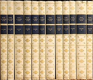
le grand atlas ou von blaeu, 1967 (10 Ergebnisse)
Direkt zu den wichtigsten Suchergebnissen
Produktart
- Alle Produktarten
- Bücher (10)
- Magazine & Zeitschriften
- Comics
- Noten
- Kunst, Grafik & Poster
- Fotografien
- Karten
-
Manuskripte &
Papierantiquitäten
Zustand
- Alle
- Neu
- Antiquarisch/Gebraucht
Einband
- alle Einbände
- Hardcover (1)
- Softcover
Weitere Eigenschaften
- Erstausgabe
- Signiert
- Schutzumschlag
- Angebotsfoto (1)
Land des Verkäufers
Verkäuferbewertung
-
Le grand atlas ou cosmographie Blauiana. Faksimile der Ausgabe Amsterdam 1663.
Verlag: Amsterdam, Theatrum Orbis Terrarum (1967-68)., 1967
Anbieter: Antiquariat Peter Fritzen, Speicher, Deutschland
Bewertung:

Buch
12 Bände. Imperial-Folio (55 x 34 cm). Mit mehr als 600 Karten. Helles Original-Kunstleder mit Goldprägung, welches die vergoldeten Pergamentausgaben nachahmt, dunkelblaue Rückenschilder. Teilweise bestoßen, ein Gelenk etwas eingerissen, im Schnitt stellenweise stock- und braunfleckig. Einzige vollständige Faksimile-Ausgabe des prächtigsten Kartenwerkes aller Zeiten, eins von 1000 num. Exemplaren. Nach der französischen Ausgabe, erschienen 1663 in Amsterdam. Mit über 600, meist doppelblattgroßen Karten zählt Joan Blaeus "Atlas Major" zu den bedeutendsten kartographischen Werken des 17. Jahrhunderts. Die teils farbig reproduzierten Karten werden durch eine Vielzahl von Stadtansichten, Tafeln und Textabbildungen zu den beschriebenen Ländern und Erdteilen ergänzt. Fac-similé du Grand Atlas ou Cosmographie blaviane, en laquelle est exactement décrite la Terre, la mer et le ciel, paru ŕ Amsterdam en 1663, publié ŕ l 'occasion du tricentenaire de l'ouvrage. Il est composé de plus de 600 cartes, certaine en couleurs, de leurs explications et de quelques titre-frontispices. A fantastic facsimile of the 12 volume French edition of Blaeu's le Grand Atlas, originally published in 1663 in Amsterdam. It contains all the original maps, plans and in-text drawings, and many of the maps are reproduced in colour. Blaeu's atlas was a monumental production and was intended to be part of a larger work containing maps of ocean and the heavens. Contents: Volume 1: Globe, Arctic, Europe: Norway, Denmark, Schleswig. Vol. 2: Sweden, Russia, Poland, western regions, Greece. Vol. 3: Germany. Vol. 4: Netherlands & Belgium. Vol. 5: Great Britain. Vol. 6: Scotland & Ireland. Vol. 7: France. Vol. 8: France & Switzerland. Vol. 9: Italy & Corsica. Vol. 10: Spain & Africa. Vol 11: Asia & China. Vol. 12: The Americas. The largest and most expensive work published in the 17th century. A beautiful facsimile in a simulated period binding. Extra shipping will be necessary depending on location for this massive collection. Kostenlose frei Haus Lieferung für Deutschland und Luxemburg ! VERSAND NUR NACH ABSPRACHE, DA DAS WERK NICHT NUR ALLE STANDARDKISTEN SPRENGT, SONDERN AUCH CA. 100 KILO WIEGT! Only complete facsimile edition of the worlds most famous atlas. PLEASE ASK FOR SHIPPING CONDITIONS, THIS OPUS MAGNUM WEIGHS MORE THAN 220 LBS.
-

Le Grand atlas ou Cosmographie blaviane, en laquelle est exactement descritte la terre, la mer et le ciel. Vol. V: L'Europe: L'Angleteterre.
Anbieter: Antiquariaat A. Kok & Zn. B.V., Amsterdam, Niederlande
Bewertung:
Amst., 1663. [Reprint Amst., 1967]. VI,321pp. Num. maps in black & white. Gilted vellum. Gr. Folio.This is volume 5 of the Atlas Major with the maps of Great-Britain. Text in French.
-
Le Grand atlas ou Cosmographie blaviane, en laquelle est exactement descritte la terre, la mer et le ciel. Vol. III: L'Europe: L'Alemagne.
Anbieter: Antiquariaat A. Kok & Zn. B.V., Amsterdam, Niederlande
Bewertung:
Amst., 1663. [Reprint Amst., 1967]. Text & Num. maps in black & white. Gilted vellum. Gr. Folio, corners bumped.This is volume 3 of the Atlas Major with the maps of Germany. Text in French.
-
Le Grand atlas ou Cosmographie blaviane, en laquelle est exactement descritte la terre, la mer et le ciel. Vol. VI: L'Europe: [Escosse; Yrlande.]
Anbieter: Antiquariaat A. Kok & Zn. B.V., Amsterdam, Niederlande
Bewertung:
Amst., 1663. Reprint Amst., 1967. 181,571pp. Num. maps in black & white. Gilted vellum. Gr. FolioThis is volume 6 of the Atlas Major with the maps of Scotland. Text in French.
-
Le Grand atlas ou Cosmographie blaviane, en laquelle est exactement descritte la terre, la mer et le ciel. [COMPLETE SET].
Anbieter: Antiquariaat A. Kok & Zn. B.V., Amsterdam, Niederlande
Bewertung:
Amsterdam, 1663. [Reprint Amst., Teatrum Orbis Terrarum, 1967-68]. 12 vols. Text & num. maps (col. & b./w.). Gilt. tooled full vellum bindings. Folio. - [AND]: C. Koeman. Joan Blaeu and his Grand Atlas. Introduction to the facsimile edition of Le Grand Atlas, 1663. Amst., Teatrum Orbis Terrarum, [1970]. 114,12 pp. Gilt stamped imit. leather. 8vo. - - Vignets on spine of atlasses with light shelfwear; backcovers of vols VI & X with some staines. Rare deluxe set of the third centenary facsimile edition. - One of 10 copies bound in full vellum, of which 5 lettered copies for sale. This is copy "C". - Complete set of 12 volumes + the introduction volume by C. Koeman. - Contains: Vol. I: [Introduction. Arctique. L'Europe: Norvčge; Danemarque.]; vol. II: L'Europe: [Sučde; Russie; Pologne; Régions orientales au delŕ de l'Alemagne, prčs le Danube; Grčce]; vol. III: L'Europe: L'Alemagne. IV.L'Europe: [Belgique Royale; Belgique Confédérée]; vol. V: L'Europe: L'Angleteterre; vol. VI: L'Europe: [Escosse; Yrlande]; vol. VII: L'Europe: [France, 1e partie]; vol. VIII: L'Europe: [France, 2e partie; Suisse]; vol. IX: L'Europe: L'Italie; vol. X: L'Europe: [Espagne]. L'Afrique; vol. XI: L'Asie: [L'Empire du Turc; Anatolie, ou Asie mineure; Isle de Cypre; Terre Saincte, autrement nommée La Palestine; Arabie; Perse; ou les Estats du Sophi; Inde orientale; Estats du Grand Mogol; Isles Moluques; Tartarie; Chine]; vol. XII: L'Amérique.
-
Le Grand atlas ou Cosmographie blaviane, en laquelle est exactement descritte la terre, la mer et le ciel. Vol. VII: L'Europe: [France, 1e partie].
Anbieter: Antiquariaat A. Kok & Zn. B.V., Amsterdam, Niederlande
Bewertung:
Amst., 1663. [Reprint Amst., 1967]. CIIIJ,448 pp. Num. maps in black & white. Gilted vellum. Gr. Folio.This is volume 7 of the Atlas Major. Text in French.
-
Amst., 1663. [Reprint Amst., 1967]. Text & Num. maps in black & white. Gilted vellum. Gr. FolioThis is volume 1 of the Atlas Major with the maps of Scandinavia. Text in French. With the coloured world-map.
-
Amst., 1663. [Reprint Amst., 1967]. 449-786 pp. pp. Num. maps in black & white. Gilted vellum. Gr. Folio, slightly damaged.This is volume 8 of the Atlas Major with the maps of France & Switzerland. Text in French.
-
Le Grand Atlas ou Cosmographie Blauiana. Faksimile der Ausgabe Amsterdam 1663. Amsterdam Theatrum Orbis Terrarum 1967-68. 12 Bde. Imperial-Folio. Mit über 600 teils farbigen Karten. Orig.-Einbände in heller Pergamentnachbildung mit reicher Vergoldung im Stil der Zeit und schwarz-goldenen Lederrückenschildern.
Anbieter: Antiquariat Schmidt & Günther, Kelkheim, Deutschland
Bewertung:
In 990 numerierten Exemplaren erschienen. Vollständiges Exemplar der französischen Ausgabe , erschienen 1663 in Amsterdam. Faksimiliert nach dem Exemplar der Universitäts-Bibliothek in Leiden. Mit über 600, meist doppelblattgroßen Karten zählt Joan Blaeus "Atlas Major" zu den bedeutendsten kartographischen Werken des 17. Jahrhunderts. Die teils farbig reproduzierten Karten werden durch eine Vielzahl von Stadtansichten, Tafeln und Textabbildungen zu den beschriebenen Ländern und Erdteilen ergänzt. Tadelloses Exemplar.
-
Amst., 1663. [Reprint Amst., 1967]. Text & Num. maps in black & white. Gilted vellum. Gr. Folio.This is volume 2 of the Atlas Major with the maps of Russia, Poland, Text in French. With the coloured world-map.