Gesamtpreis (1 Artikel Artikel):
Versandziel:

digital elevation model technologies (8 Ergebnisse)
Direkt zu den wichtigsten Suchergebnissen
Suchfilter
Produktart
- Alle Product Types
- Bücher (8)
- Magazine & Zeitschriften (Keine weiteren Ergebnisse entsprechen dieser Verfeinerung)
- Comics (Keine weiteren Ergebnisse entsprechen dieser Verfeinerung)
- Noten (Keine weiteren Ergebnisse entsprechen dieser Verfeinerung)
- Kunst, Grafik & Poster (Keine weiteren Ergebnisse entsprechen dieser Verfeinerung)
- Fotografien (Keine weiteren Ergebnisse entsprechen dieser Verfeinerung)
- Karten (Keine weiteren Ergebnisse entsprechen dieser Verfeinerung)
- Manuskripte & Papierantiquitäten (Keine weiteren Ergebnisse entsprechen dieser Verfeinerung)
Zustand Mehr dazu
- Neu (2)
- Wie Neu, Sehr Gut oder Gut Bis Sehr Gut (1)
- Gut oder Befriedigend (5)
- Ausreichend oder Schlecht (Keine weiteren Ergebnisse entsprechen dieser Verfeinerung)
- Wie beschrieben (Keine weiteren Ergebnisse entsprechen dieser Verfeinerung)
Einband
Weitere Eigenschaften
- Erstausgabe (Keine weiteren Ergebnisse entsprechen dieser Verfeinerung)
- Signiert (Keine weiteren Ergebnisse entsprechen dieser Verfeinerung)
- Schutzumschlag (Keine weiteren Ergebnisse entsprechen dieser Verfeinerung)
- Angebotsfoto (3)
Sprache (1)
Gratisversand
Land des Verkäufers
Verkäuferbewertung
-

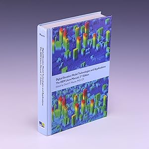
Digital Elevation Model Technologies and Applications: The Dem Users Manual
Anbieter: ThriftBooks-Atlanta, AUSTELL, GA, USA
Verkäuferbewertung 5 von 5 Sternen

Hardcover. Zustand: Very Good. No Jacket. May have limited writing in cover pages. Pages are unmarked. ~ ThriftBooks: Read More, Spend Less.
-

Digital Elevation Model Technologies and Applications: The Dem Users Manual
Anbieter: ThriftBooks-Dallas, Dallas, TX, USA
Verkäuferbewertung 5 von 5 Sternen
Hardcover. Zustand: Very Good. No Jacket. Missing dust jacket; May have limited writing in cover pages. Pages are unmarked. ~ ThriftBooks: Read More, Spend Less.
-
Digital Elevation Model Technologies and Applications: The Dem Users Manual
Anbieter: My Dead Aunt's Books, Hyattsville, MD, USA
Verkäuferbewertung 5 von 5 Sternen
Hardcover. Zustand: As New. Unmarked glossy hardcover, but for professors name and address stamp on the front flyleaf. No dust jacket.
-
Digital Elevation Model Technologies and Applications: The Dem Users Manual
Anbieter: Phatpocket Limited, Waltham Abbey, HERTS, Vereinigtes Königreich
Verkäuferbewertung 5 von 5 Sternen
EUR 30,77
EUR 12,18 shipping
Ships from Vereinigtes Königreich to USAAnzahl: 1 verfügbar
In den WarenkorbZustand: Good. Your purchase helps support Sri Lankan Children's Charity 'The Rainbow Centre'. Ex-library, so some stamps and wear, but in good overall condition. Our donations to The Rainbow Centre have helped provide an education and a safe haven to hundreds of children who live in appalling conditions.
-
Digital Elevation Model Technologies and Applications: The Dem Users Manual
Anbieter: Salish Sea Books, Bellingham, WA, USA
Verkäuferbewertung 5 von 5 Sternen
Zustand: Very Good. 2. ** CD is included & still sealed **; Very Good Minus; Hardcover; Covers are still glossy with minor scuffing along the edges; Unblemished textblock edges; The endpapers and all text pages are clean and unmarked; The binding is excellent with a straight spine; This book will be stored and delivered in a sturdy cardboard box with foam padding; Medium-Large Format (Quatro, 9.75" - 10.75" tall); White covers with elevation model illustrations, and title in black lettering; 2nd Edition; 2007, Asprs Publications; 655 pages; "Digital Elevation Model Technologies and Applications: The Dem Users Manual," by David F. Maune.
-

Digital Elevation Model Technologies and Applications, The DEM Users Manual, 3rd Edition
Anbieter: AHA-BUCH GmbH, Einbeck, Deutschland
Verkäuferbewertung 5 von 5 Sternen
Taschenbuch. Zustand: Neu. Neuware - The 3rd edition of the DEM Users Manual includes 15 chapters and three appendices. References in the Elektronisches Buch version are hyperlinked. Chapter and appendix titles include: Introduction to DEMsVertical DatumsStandards, Guidelines & SpecificationsThe National Elevation Dataset (NED)The 3D Elevation Program (3DEP)PhotogrammetryIFSARAirborne Topographic LidarLidar Data ProcessingAirborne Lidar BathymetrySonarEnabling TechnologiesDEM User ApplicationsDEM User Requirements & BenefitsQuality Assessment of Elevation DataA. AcronymsB. DefinitionsC. Sample DatasetsThis book is your guide to 3-D elevation technologies, products, and applications. It will guide you through the inception and implementation of the U.S. Geological Survey's (USGS) 3D Elevation Program (3DEP) to provide not just bare earth DEMs, but a full suite of 3-D elevation products using Quality Levels (QLs) that are standardized and consistent across the U.S. and territories. The 3DEP is based on the National Enhanced Elevation Assessment (NEEA) which evaluated 602 different mission-critical requirements for and benefits from enhanced elevation data of various QLs for 34 Federal agencies, all 50 states (with local and Tribal input), and 13 non-governmental organizations. The NEEA documented the highest Return on Investment from QL2 lidar for the conterminous states, Hawaii and U.S. territories, and QL5 IFSAR for Alaska.Chapters 1, 3, 5, 8, 9, 13, 14, and 15 are 'must-read' chapters for users and providers of topographic lidar data. Chapter 8 addresses linear mode, single photon and Geiger mode lidar technologies, and Chapter 10 addresses the latest in topobathymetric lidar. The remaining chapters are either relevant to all DEM technologies or address alternative technologies including photogrammetry, IFSAR, and sonar.As demonstrated by the figures selected for the front cover of this manual, readers will recognize the editors' vision for the future-a 3-D Nation that seamlessly merges topographic and bathymetric data from the tops of the mountains, beneath rivers and lakes, to the depths of the sea.David F. Maune, PhD, CPAmar Nayegandhi, CP, CMSCo-Editors.
-

Digital Elevation Model Technologies and Applications: The Dem Users Manual 3rd
Anbieter: ThriftBooks-Dallas, Dallas, TX, USA
Verkäuferbewertung 5 von 5 Sternen
Hardcover. Zustand: Good. No Jacket. Pages can have notes/highlighting. Spine may show signs of wear. ~ ThriftBooks: Read More, Spend Less.
-

Digital Elevation Model Technologies and Applications, The DEM Users Manual, 3rd Edition
Anbieter: AHA-BUCH GmbH, Einbeck, Deutschland
Verkäuferbewertung 5 von 5 Sternen
Buch. Zustand: Neu. Neuware - The 3rd edition of the DEM Users Manual includes 15 chapters and three appendices. References in the Elektronisches Buch version are hyperlinked. Chapter and appendix titles include: Introduction to DEMsVertical DatumsStandards, Guidelines & SpecificationsThe National Elevation Dataset (NED)The 3D Elevation Program (3DEP)PhotogrammetryIFSARAirborne Topographic LidarLidar Data ProcessingAirborne Lidar BathymetrySonarEnabling TechnologiesDEM User ApplicationsDEM User Requirements & BenefitsQuality Assessment of Elevation DataA. AcronymsB. DefinitionsC. Sample DatasetsThis book is your guide to 3-D elevation technologies, products, and applications. It will guide you through the inception and implementation of the U.S. Geological Survey's (USGS) 3D Elevation Program (3DEP) to provide not just bare earth DEMs, but a full suite of 3-D elevation products using Quality Levels (QLs) that are standardized and consistent across the U.S. and territories. The 3DEP is based on the National Enhanced Elevation Assessment (NEEA) which evaluated 602 different mission-critical requirements for and benefits from enhanced elevation data of various QLs for 34 Federal agencies, all 50 states (with local and Tribal input), and 13 non-governmental organizations. The NEEA documented the highest Return on Investment from QL2 lidar for the conterminous states, Hawaii and U.S. territories, and QL5 IFSAR for Alaska.Chapters 1, 3, 5, 8, 9, 13, 14, and 15 are 'must-read' chapters for users and providers of topographic lidar data. Chapter 8 addresses linear mode, single photon and Geiger mode lidar technologies, and Chapter 10 addresses the latest in topobathymetric lidar. The remaining chapters are either relevant to all DEM technologies or address alternative technologies including photogrammetry, IFSAR, and sonar.As demonstrated by the figures selected for the front cover of this manual, readers will recognize the editors' vision for the future-a 3-D Nation that seamlessly merges topographic and bathymetric data from the tops of the mountains, beneath rivers and lakes, to the depths of the sea.David F. Maune, PhD, CPAmar Nayegandhi, CP, CMSCo-Editors.