Gesamtpreis (1 Artikel Artikel):
Versandziel:

colorado state map (20 Ergebnisse)
Direkt zu den wichtigsten Suchergebnissen
Suchfilter
Produktart
- Alle Product Types
- Bücher (11)
- Magazine & Zeitschriften (Keine weiteren Ergebnisse entsprechen dieser Verfeinerung)
- Comics (Keine weiteren Ergebnisse entsprechen dieser Verfeinerung)
- Noten (Keine weiteren Ergebnisse entsprechen dieser Verfeinerung)
- Kunst, Grafik & Poster (Keine weiteren Ergebnisse entsprechen dieser Verfeinerung)
- Fotografien (Keine weiteren Ergebnisse entsprechen dieser Verfeinerung)
- Karten (8)
- Manuskripte & Papierantiquitäten (1)
Zustand Mehr dazu
Einband
Weitere Eigenschaften
- Erstausgabe (2)
- Signiert (Keine weiteren Ergebnisse entsprechen dieser Verfeinerung)
- Schutzumschlag (1)
- Angebotsfoto (11)
Sprache (2)
Gratisversand
Land des Verkäufers
Verkäuferbewertung
-
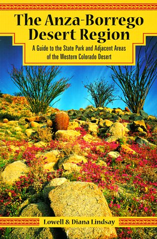
The Anza-Borrego Desert Region: A Guide to the State Park and Adjacent Areas of the Western Colorado Desert With Map
Anbieter: ThriftBooks-Dallas, Dallas, TX, USA
Verkäuferbewertung 5 von 5 Sternen

Paperback. Zustand: Very Good. No Jacket. May have limited writing in cover pages. Pages are unmarked. ~ ThriftBooks: Read More, Spend Less.
-

Zustand: good. Befriedigend/Good: Durchschnittlich erhaltenes Buch bzw. Schutzumschlag mit Gebrauchsspuren, aber vollständigen Seiten. / Describes the average WORN book or dust jacket that has all the pages present.
-
Easy to Read Colorado State Map
Anbieter: Sell Books, Elland, YORKS, Vereinigtes Königreich
Verkäuferbewertung 5 von 5 Sternen
EUR 5,94
EUR 14,07 Versand
Versand von Vereinigtes Königreich nach USAAnzahl: 1 verfügbar
In den Warenkorbmap. Zustand: Acceptable. Please see the condition note after this for details, if this is missing please consider Acceptable to mean poor quality that could include major staining, water damage, writing, missing dustjacket, etc etc. Our books are dispatched from a Yorkshire former cotton mill. We list via barcode/ISBN so please note that the images are stock images and may not be the exact copy you receive, furthermore the details about edition and year might not be accurate as many publishers reuse the same ISBN for multiple editions and as we simply scan a barcode or enter an ISBN we do not check the validity of the edition data when listing. If you're looking for an exact edition please don't order (at least not without checking with us first, although we don't always have time to check). We aim to dispatch prompty, the service used will depend on order value and book size. We can ship to most countries, see our shipping policies. Payment is via Abe only.
-

Colorado Easy to Fold State Map: Cdef
Anbieter: Revaluation Books, Exeter, Vereinigtes Königreich
Verkäuferbewertung 5 von 5 Sternen
Karte
EUR 9,92
EUR 11,58 Versand
Versand von Vereinigtes Königreich nach USAAnzahl: 1 verfügbar
In den WarenkorbMap. Zustand: Brand New. 4.50x0.40x9.00 inches. In Stock.
-
Easy to Read Colorado State Map
Anbieter: WorldofBooks, Goring-By-Sea, WS, Vereinigtes Königreich
Verkäuferbewertung 5 von 5 Sternen
EUR 23,85
EUR 6,48 Versand
Versand von Vereinigtes Königreich nach USAAnzahl: 2 verfügbar
In den WarenkorbPaperback. Zustand: Very Good. The book has been read, but is in excellent condition. Pages are intact and not marred by notes or highlighting. The spine remains undamaged.
-

State of Colorado Base Map with Highways and Contours. Scale 1:500,000 (United States Geological Survey Map).
Verlag: United States Geological Survey., 1980
Anbieter: Eryops Books, Stephenville, TX, USA
Verkäuferbewertung 5 von 5 Sternen
No Binding. Zustand: Very Good. Large Folded Topographic Map/Base Map; in very good condition. Map.
-

National Geographic Trails Illustrated Map State Bridge / Burns: Colorado
Sprache: Englisch
Verlag: Natl Geographic Society Maps, 2001
ISBN 10: 1566952875 ISBN 13: 9781566952873
Anbieter: Revaluation Books, Exeter, Vereinigtes Königreich
Verkäuferbewertung 5 von 5 Sternen
EUR 28,87
EUR 11,58 Versand
Versand von Vereinigtes Königreich nach USAAnzahl: 1 verfügbar
In den WarenkorbPaperback. Zustand: Brand New. map edition. 2 pages. 0.25x9.25x4.25 inches. In Stock.
-
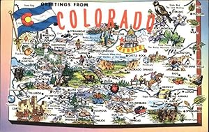
Postkarte Carte Postale 11694126 Colorado US-State Map of the Centennial State
Anbieter: Versandhandel Boeger, Weil am Rhein, Deutschland
Verkäuferbewertung 5 von 5 Sternen
Manuskript / Papierantiquität
Map of the Centennial State Alte Ansichtskarte Postkarte 1921-1965 postalisch gelaufen.
-

Rand McNally Easy to Read: Colorado State Map
Anbieter: Revaluation Books, Exeter, Vereinigtes Königreich
Verkäuferbewertung 5 von 5 Sternen
Karte
EUR 21,96
EUR 11,58 Versand
Versand von Vereinigtes Königreich nach USAAnzahl: 1 verfügbar
In den Warenkorbmap. Zustand: Brand New. 4.09x0.15x9.44 inches. In Stock.
-

Nell's Topographical & Township Map Of The State Of Colorado 1885 (Reprint Dated 1965)
Sprache: Englisch
Verlag: Chain, Hardy & Co (1965), Denver, 1885
Anbieter: Arroyo Seco Books, Pasadena, Member IOBA, Pasadena, CA, USA
Verbandsmitglied: IOBA
Verkäuferbewertung 4 von 5 Sternen

Erstausgabe
Hardcover. Zustand: Near Fine. 1st Edition. Very Large Folding Map Printed In Purplish Blue, Facsimile Printed In 1965. No Wear Or Damage But Reddish Tint To Folds.
-

Nell's New Topographical & Township Map Of The State Of Colorado 1880 (Late 20Th Century Reprint)
Sprache: Englisch
Erscheinungsdatum: 1880
Anbieter: Arroyo Seco Books, Pasadena, Member IOBA, Pasadena, CA, USA
Verbandsmitglied: IOBA
Verkäuferbewertung 4 von 5 Sternen
Karte
Hardcover. Zustand: Fine. Reprint. Very Large Folding Map Printed In Black, Immaculate And Unworn So Apparently A Very High Quality Facsimile Printed Perhaps In The Nineteen Sixties.
-

Post Route Map Of The State Of Colorado, Showing Post Offices, With The Intermediate Distances On Mail Routes, In Operation On The 1St Of August, 1932 ( Reprint)
Sprache: Englisch
Verlag: Post Office Department, Wsshington, 1932
Anbieter: Arroyo Seco Books, Pasadena, Member IOBA, Pasadena, CA, USA
Verbandsmitglied: IOBA
Verkäuferbewertung 4 von 5 Sternen
Karte
Soft cover. Zustand: Near Fine. Extremely Large Multi-Fold Map, Yellowing/Browning To Map Side Of Paper But Almost No Wear. Printed In Blue On White Paper, Now Aged To Pinkish-Tan. This May Be A Reprint, But No Marks To Indicate Reprinting.
-

Map Showing System Of Main Roads In Colorado Now Open To Travel, Revised By The State Highway Commission Of Colorado January 1916 (Reprint)
Sprache: Englisch
Verlag: State Highway Commission, 1916
Anbieter: Arroyo Seco Books, Pasadena, Member IOBA, Pasadena, CA, USA
Verbandsmitglied: IOBA
Verkäuferbewertung 4 von 5 Sternen
Karte
Soft cover. Zustand: Near Fine. Reprint. Large Folding Map, Circa 1960'S Reprint, Lacking Text On Reverse Side. Some Browning Otherwise Fine.
-

A Detailed Map: Railroads In The State Of Colorado (Revised Edition 1969)
Sprache: Englisch
Verlag: Colorado Railroad Museum, Golden Co, 1969
Anbieter: Arroyo Seco Books, Pasadena, Member IOBA, Pasadena, CA, USA
Verbandsmitglied: IOBA
Verkäuferbewertung 4 von 5 Sternen
No Binding. Zustand: Fine. 2nd Edition. Huge Folding Map, Revised Edition August 1969, With The Envelope With Museum Information.
-

State Of Colorado (Large Folding Map Mounted On Linen)
Sprache: Englisch
Verlag: General Land Office, Washington, 1910
Anbieter: Arroyo Seco Books, Pasadena, Member IOBA, Pasadena, CA, USA
Verbandsmitglied: IOBA
Verkäuferbewertung 4 von 5 Sternen
Karte Erstausgabe
No Binding. Zustand: Near Fine. First Edition Thus. 1 Map : Color ; 71 X 85 Cm. Scale [Ca. 1:760,320]. 1 In. = 12 Mi. At Head Of Title: Department Of The Interior, General Land Office, Fred Dennett, Commissioner . Compiled From The Official Records Of The General Land Office And Other Sources Under The Direction Of L.P. Berthrong, Chief Of Drafting, G.L.O. At Lower Left Margin: Compiled By A.F. Dinsmore. Traced And Lettered By Wm. Bauman, Jr.Map Shows U.S. Surveyor's And U.S. Land Offices, Indian And Military Reservations, National Forests, National Parks, National Monuments, County And Land District Boundaries. Includes Insets And Legend At Head Of Map.Insets: Leadville, Denver, Cripple Creek. Relief Shown By Shading. Mounted On Linen. Scarce; Worldcat Shows Three Institutional Holdings Of This 1910 Issue.
-
Colorado State Map
Verlag: The Colorado Department of Transportation
Anbieter: Robinson Street Books, IOBA, Binghamton, NY, USA
Verbandsmitglied: IOBA
Verkäuferbewertung 4 von 5 Sternen
Trade paperback. Zustand: Very good. Prompt Shipment, shipped in Boxes, Tracking PROVIDEDVery good, trade paperback map, clean.
-
1889 Color Map of the State of Colorado
Verlag: W.H. Stewart, Rochester, NY, 1889
Anbieter: RareNonFiction, IOBA, Ladysmith, BC, Kanada
Verbandsmitglied: IOBA
Verkäuferbewertung 5 von 5 Sternen
Map. Zustand: Very Good. Cram, Geo. F. (illustrator). First Edition Thus. Outer dimensions: 10.75" x 14.5". Counties individually colored. Clean and unmarked with light wear. An attractive vintage copy.
-

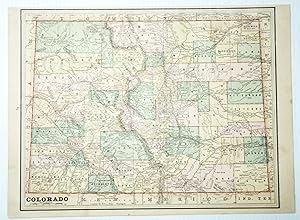
Map Of The State Of Colorado (Undated, Unattributed, But Circa 1876)
Sprache: Englisch
Erscheinungsdatum: 1876
Anbieter: Arroyo Seco Books, Pasadena, Member IOBA, Pasadena, CA, USA
Verbandsmitglied: IOBA
Verkäuferbewertung 4 von 5 Sternen
Karte
No Binding. Zustand: Very Good. Map 8 1/2" X 6", Printed On One Side Only, Probably 1876 (Colorado A State, No Continental Railroad Route, And Denver Pacific Railroad Indicated As Such, Before It Became Part Of The Union Pacific In 1880). Some Browning (Traces Of Glue On Reverse).
-

State of Colorado Compiled chiefly from the Official Records of the General Land Office with supplemental data from other map making agencies under the direction of I.P. Berthrong, Chief of Drafting Division, G.L.O.
Erscheinungsdatum: 1921
Anbieter: Geographicus Rare Antique Maps, Brooklyn, NY, USA
Verbandsmitglied: ABAA ESA ILAB
Verkäuferbewertung 4 von 5 Sternen
Karte
Very good. Dissected and mounted on linen. Size 29.25 x 34.75 Inches. This is a highly detailed 1921 map of Colorado issued by the General Land Office in 1921. The map covers the state noting National Forests (Green), American Indian Reservations (Yellow), National Parks (Purple), Military Reserves (Red), and Reclamations Projects (Blue). The major reclamation projects, which take the form of enormous irrigation dams, appear here in western Colorado and include the Grand Valley Project and the Uncompaghre Projects. Lesser reservoirs appear here and there throughout. Publication History and Census This map was compiled by A. F. Dinsmore, traced and lettered by William Bauman, Jr. and published by the Department of the Interior General Land officer under the supervision of Ithamar Parsons Berthrong. It was published in various editions from about 1910. The map is well represented institutionally, but uncommon on the private market. References: Huntington Library, 436174. OCLC 8714327.
-
1888 Colorado Map ? The Centennial State's Railroads, Mines & Counties
Anbieter: Bartele Gallery - The Netherlands, Langweer, FRL, Niederlande
Verkäuferbewertung 5 von 5 Sternen
Antique Map of Colorado ? Railroads, Mining Towns & Counties, 1888 This antique engraved map depicts the state of Colorado in 1888, published by Rand, McNally & Co. in Chicago for their Improved Indexed Business Atlas and Shippers Guide. It captures Colorado during a formative period, just over a decade after achieving statehood in 1876, when railroads and mining shaped its growth and identity. The map highlights Colorado's extensive railroad system, engraved in red and blue, reflecting the central role of rail transport in the state's economy. Lines radiate outward from Denver, already established as the state capital and commercial hub, linking to major cities such as Pueblo, Colorado Springs, and Leadville, as well as smaller mining towns in the Rocky Mountains. The Denver & Rio Grande, Atchison, Topeka & Santa Fe, and Union Pacific systems are all represented, demonstrating the state's integration into national transport and trade networks. Counties are clearly defined, including Arapahoe, Jefferson, El Paso, Weld, Boulder, Fremont, and Gunnison, alongside the rugged mountain counties such as Lake, Pitkin, San Juan, and San Miguel, where mining booms brought waves of settlement. Mining towns such as Leadville, Silverton, Ouray, and Aspen are labeled, places which became legendary for their silver and gold production during the Colorado Silver Boom of the 1880s. Agricultural and ranching regions on the eastern plains are also shown, contrasting with the mountainous west. The geography of Colorado is depicted with remarkable clarity, showing the Continental Divide, the Front Range, and river systems such as the Arkansas, Platte, and Rio Grande. These natural features not only shaped settlement patterns but also defined the challenges of building railroads through some of the most difficult terrain in North America. The historical context makes this map particularly significant. In 1888, Colorado was experiencing rapid growth fueled by mining wealth, railroad expansion, and migration. Denver was becoming a major metropolitan center, while the mountain towns were at the height of their mining prosperity. This map provides a snapshot of that era, when Colorado balanced frontier ruggedness with economic ambition. Condition summary: Very good condition overall, with mild toning consistent with age. Some faint foxing and handling marks in the margins. Original fold line as issued, paper strong with clear engraved detail. No significant tears or repairs. Framing tips: A walnut or dark oak frame will highlight the antique qualities of the piece, while a black frame with ivory matting provides a sharp modern presentation. A double mat, ivory with a muted silver or grey accent, can emphasize Colorado's mining heritage and mountainous terrain. Technique: Engraving Maker: Rand, McNally & Co., Chicago, 1888.