Gesamtpreis (1 Artikel Artikel):
Versandziel:

california state map (32 Ergebnisse)
Direkt zu den wichtigsten Suchergebnissen
Suchfilter
Produktart
- Alle Product Types
- Bücher (21)
- Magazine & Zeitschriften (Keine weiteren Ergebnisse entsprechen dieser Verfeinerung)
- Comics (Keine weiteren Ergebnisse entsprechen dieser Verfeinerung)
- Noten (Keine weiteren Ergebnisse entsprechen dieser Verfeinerung)
- Kunst, Grafik & Poster (Keine weiteren Ergebnisse entsprechen dieser Verfeinerung)
- Fotografien (Keine weiteren Ergebnisse entsprechen dieser Verfeinerung)
- Karten (9)
- Manuskripte & Papierantiquitäten (2)
Zustand Mehr dazu
Einband
Weitere Eigenschaften
- Erstausgabe (3)
- Signiert (Keine weiteren Ergebnisse entsprechen dieser Verfeinerung)
- Schutzumschlag (Keine weiteren Ergebnisse entsprechen dieser Verfeinerung)
- Angebotsfoto (18)
Sprache (3)
Gratisversand
Land des Verkäufers
Verkäuferbewertung
-

California State Map
Anbieter: WeBuyBooks, Rossendale, LANCS, Vereinigtes Königreich
Verkäuferbewertung 5 von 5 Sternen

EUR 3,03
EUR 5,16 Versand
Versand von Vereinigtes Königreich nach USAAnzahl: 1 verfügbar
In den WarenkorbZustand: Very Good. Most items will be dispatched the same or the next working day. A copy that has been read, but is in excellent condition. Pages are intact and not marred by notes or highlighting. The spine remains undamaged.
-

Rand McNally Easy to Read! California State Map
Anbieter: WeBuyBooks, Rossendale, LANCS, Vereinigtes Königreich
Verkäuferbewertung 5 von 5 Sternen
EUR 5,29
EUR 5,16 Versand
Versand von Vereinigtes Königreich nach USAAnzahl: 1 verfügbar
In den WarenkorbZustand: Good. Most items will be dispatched the same or the next working day. A copy that has been read but remains in clean condition. All of the pages are intact and the cover is intact and the spine may show signs of wear. The book may have minor markings which are not specifically mentioned.
-

Rand McNally Easy to Read! California State Map
Anbieter: WorldofBooks, Goring-By-Sea, WS, Vereinigtes Königreich
Verkäuferbewertung 5 von 5 Sternen
EUR 5,01
EUR 6,45 Versand
Versand von Vereinigtes Königreich nach USAAnzahl: 4 verfügbar
In den WarenkorbPaperback. Zustand: Very Good. The book has been read, but is in excellent condition. Pages are intact and not marred by notes or highlighting. The spine remains undamaged.
-
California State Map
Anbieter: WorldofBooks, Goring-By-Sea, WS, Vereinigtes Königreich
Verkäuferbewertung 5 von 5 Sternen
EUR 5,37
EUR 6,45 Versand
Versand von Vereinigtes Königreich nach USAAnzahl: 1 verfügbar
In den WarenkorbPaperback. Zustand: Fair. A readable copy of the book which may include some defects such as highlighting and notes. Cover and pages may be creased and show discolouration.
-
California State Map
Anbieter: WorldofBooks, Goring-By-Sea, WS, Vereinigtes Königreich
Verkäuferbewertung 5 von 5 Sternen
EUR 5,37
EUR 6,45 Versand
Versand von Vereinigtes Königreich nach USAAnzahl: 2 verfügbar
In den WarenkorbPaperback. Zustand: Very Good. The book has been read, but is in excellent condition. Pages are intact and not marred by notes or highlighting. The spine remains undamaged.
-
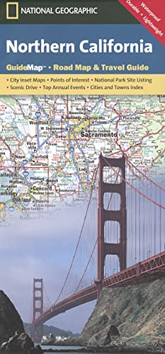
Northern California Guide Map â" National Geographic State Road Map | Waterproof Travel Map with Highways, Parks & Scenic Drives | Folded Adventure Map . Wine Country (National Geographic Guide Map)
Sprache: Englisch
Verlag: Natl Geographic Society Maps, 2026
ISBN 10: 1597750611 ISBN 13: 9781597750615
Anbieter: WorldofBooks, Goring-By-Sea, WS, Vereinigtes Königreich
Verkäuferbewertung 5 von 5 Sternen
EUR 15,09
EUR 6,45 Versand
Versand von Vereinigtes Königreich nach USAAnzahl: 1 verfügbar
In den WarenkorbPaperback. Zustand: Good. The book has been read but remains in clean condition. All pages are intact and the cover is intact. Some minor wear to the spine.
-

California's Lost Coast Recreation Map: Covers King Range National Conservation Area and Sinkyone Wilderness State Park
Anbieter: Revaluation Books, Exeter, Vereinigtes Königreich
Verkäuferbewertung 5 von 5 Sternen
Karte
EUR 11,18
EUR 11,52 Versand
Versand von Vereinigtes Königreich nach USAAnzahl: 1 verfügbar
In den WarenkorbMap. Zustand: Brand New. 3rd map edition. 9.00x4.00x0.50 inches. In Stock.
-
California's Lost Coast Recreation Map: Covers King Range National Conservation Area and Sinkyone Wilderness State Park
Anbieter: Revaluation Books, Exeter, Vereinigtes Königreich
Verkäuferbewertung 5 von 5 Sternen
Karte
EUR 11,78
EUR 11,52 Versand
Versand von Vereinigtes Königreich nach USAAnzahl: 2 verfügbar
In den WarenkorbMap. Zustand: Brand New. 3rd map edition. 9.00x4.00x0.50 inches. In Stock.
-
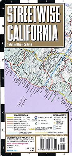
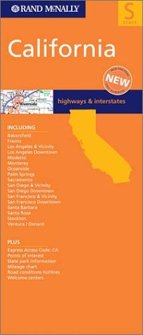
Michelin Streetwise California Map: State Road Map of California
Anbieter: Revaluation Books, Exeter, Vereinigtes Königreich
Verkäuferbewertung 5 von 5 Sternen
EUR 20,58
EUR 11,52 Versand
Versand von Vereinigtes Königreich nach USAAnzahl: 1 verfügbar
In den WarenkorbPaperback. Zustand: Brand New. fol lam ma edition. 1 pages. 8.50x4.00x0.25 inches. In Stock.
-

Zustand: good. Befriedigend/Good: Durchschnittlich erhaltenes Buch bzw. Schutzumschlag mit Gebrauchsspuren, aber vollständigen Seiten. / Describes the average WORN book or dust jacket that has all the pages present.
-
California State Map Which Way USA? colorful educational map
Verlag: Highlights for Children Inc., 1997
Karte
No Binding. Zustand: Near Fine. Illustrated Edition. 1997 Which Way USA? California map is a vintage educational, fold-out, illustrated map produced by Highlights for Children. A detailed map designed for children to learn state geography, landmarks, and facts.
-
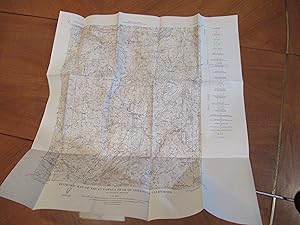
Map "Economic Map Of The Cuyamaca Peak Quadrangle, California" From Crystalline Rocks Of Southwestern California, Bulletin 159 Of Division Of Mines, Department Of Natural Resources, State Of California. June 1951
Sprache: Englisch
Verlag: Division Of Mines, San Francisco, 1951
Anbieter: Arroyo Seco Books, Pasadena, Member IOBA, Pasadena, CA, USA
Verbandsmitglied: IOBA
Verkäuferbewertung 4 von 5 Sternen

Erstausgabe
Soft cover. Zustand: Near Fine. 1st Edition. One Folding Map, P[Late 3 Of 7, From The Folding Pocket In The Book. One Map Only, No Book.
-

Map of the golden state of California. San Diego, Los Angeles, San Francisco.,.
Verlag: Murray, Belmont oJ.,, 1111
Anbieter: Antiquariat Petri, Jena, Deutschland
Verkäuferbewertung 4 von 5 Sternen
SC. Zustand: Gut. Okarte., in gutem Zustand, . [SAP225]., Deu 400g.
-
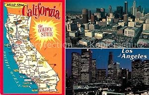
Postkarte Carte Postale Los Angeles California Map of the Golden State Downtown Skyscrapers
Anbieter: Versandhandel Boeger, Weil am Rhein, Deutschland
Verkäuferbewertung 5 von 5 Sternen
Manuskript / Papierantiquität
Carte Postale Alte Postkarte Los Angeles California Map of the Golden State Downtown Skyscrapers postalisch gelaufen 2002 Erhaltung siehe scans [FriedD77] Frierer.
-
Postkarte Carte Postale 11688206 California US-State Map of Southern California Landkarte
Anbieter: Versandhandel Boeger, Weil am Rhein, Deutschland
Verkäuferbewertung 5 von 5 Sternen
Manuskript / Papierantiquität
Map of Southern California Landkarte Alte Ansichtskarte Postkarte 1921-1965 postalisch nicht gelaufen.
-
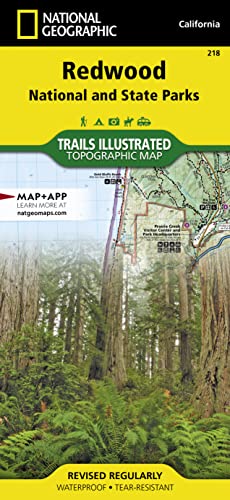
National Geographic Trails Illustrated Map Redwood National and State Parks: California, USA
Sprache: Englisch
Verlag: Natl Geographic Society Maps, 2004
ISBN 10: 1566953197 ISBN 13: 9781566953191
Anbieter: Revaluation Books, Exeter, Vereinigtes Königreich
Verkäuferbewertung 5 von 5 Sternen
Karte
EUR 29,00
EUR 11,52 Versand
Versand von Vereinigtes Königreich nach USAAnzahl: 1 verfügbar
In den WarenkorbMap. Zustand: Brand New. map edition. 2 pages. 0.25x9.25x4.25 inches. In Stock.
-
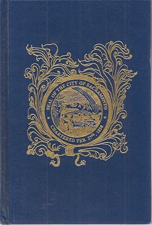
Facsimile Reproduction of The California State Library Copy of J. Horace Culver's Sacramento City Directory for the Year 1853-54 With a History of Sacramento Written by Dr. John F. Morse. Supplemented by an 1850 Map of the City of Sacramento, three contemproary woodcuts, one drawing, one lithograph and two photographs not included in the original driectory.
Verlag: California State Library Foundation, Sacramento, 1997
Anbieter: Chanticleer Books, Fort Bragg, CA, USA
Verkäuferbewertung 5 von 5 Sternen
Hardcover. Zustand: Fine. Original blue fabracoid bookcloth, 200 pp., illustrated, 21.5 x 31 inch 1850 map of Sacramento mounted to inside of rear board. Errata slip laid in. Inscribed by editor Mead Kibbey to Sacrameno-area printer Robert Dickover.
-
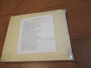
"Contents: Map Sheets", Separately Issued With "Geology Of Southern California, Bulletin 170 Of Division Of Mines, Department Of Natural Resources, State Of California"
Sprache: Englisch
Verlag: Division Of Mines, Department Of Natural Resources, State Of California / Museum Oassociation, Los Angeles County Museum, San Francisco, 1954
Anbieter: Arroyo Seco Books, Pasadena, Member IOBA, Pasadena, CA, USA
Verbandsmitglied: IOBA
Verkäuferbewertung 4 von 5 Sternen
Erstausgabe
Soft cover. Zustand: Fine. 1st Edition. Folder, Index Affixed To Front Cover, With All 34 Maps In Fine Condition.
-

California Fold-out Road Map (State Series)
Sprache: Deutsch
Verlag: 0.
Anbieter: PDST Oldbookstore Southwest, Heroldstatt, Deutschland
Verkäuferbewertung 5 von 5 Sternen
Karte
map. Zustand: Gut. Seiten; WM-X02Y-5G4K Sprache: Deutsch Gewicht in Gramm: 500.
-
The lakes of California. Reprint from Report XXIX of the State Mineralogist 1933. p.175-236, ill. + 1 folded Location-Map / WITH: Glacial epochs of the Santa Monica Mountains California. (Offprint 10 p. ill. 1932) / WITH: Granitic Domes of the Mohave Desert California. (Offprint 45 p. ill. 1933).
Verlag: 1933,, 1933
Anbieter: Harteveld Rare Books Ltd., Marly, Schweiz
Verkäuferbewertung 4 von 5 Sternen
lg. in-8vo, Stamp on covers ?Geschenk von Prof. Dr. Nussbaum? (Gift from), O.-Wrappers. Please notify before visiting to see a book. Prices are excl. VAT/TVA (only Switzerland) & postage. .
-
California State Parks Map [2003 foldout map]
Verlag: California State Parks Foundation, 2003
Anbieter: Les Livres des Limbes, Chisseaux, Frankreich
Verkäuferbewertung 5 von 5 Sternen
Pamphlet. Zustand: Very Good. 2003 foldout map gently used in overall excellent condition on 24 panels. Map.
-
Murray Map of the Golden State of California [foldout road map]
Verlag: North American Maps, 1978
Anbieter: Les Livres des Limbes, Chisseaux, Frankreich
Verkäuferbewertung 5 von 5 Sternen
Pamphlet. Zustand: Good. One fold line (corresponding to top edge) is rubbed and beginning to tear in fold intersections, otherwise very crisp and well preserved collectible condition. Map.
-
1871.Mitchell.County Map of the State of California.LARGE SAN FRANCISCO INSERT
Verlag: Samuel Augustus Mitchell Jr., Philadelphia, 1871
Karte
No Binding. Zustand: VG+. Illustrated (illustrator). Third Edition. Folded with tape on back, slight bleep through on upper comers otherwise very nice condition. Map measures 15 1/4 by 23. The David Rumsey Collection at Stanford has 9 variations of this map first published in 1860, including 1870 and 1874. This 1871 printing corresponds to the 1870 one, so might be considered the Third Printing. I am showing the map with the matting it came in; but I can ship it without to save on postage particularly for International or Priority.
-
Outdoor play places of California : a cartographic map of some of the outstanding recreational areas of the Golden State.
Erscheinungsdatum: 1954
Anbieter: Geographicus Rare Antique Maps, Brooklyn, NY, USA
Verbandsmitglied: ABAA ESA ILAB
Verkäuferbewertung 4 von 5 Sternen
Karte
Soft cover. Good. Wear and toning along fold lines, with reinforcements and repairs on verso. Size 45.75 x 31.75 Inches. A distinctive work of mid-century Californiana and Americana, this large-format map was issued in 1954 by the Automobile Club of Southern California in its publication Westways . Displaying the entire Golden State, it locates federal and state park lands, along with designated areas for fishing, hunting, skiing, and boating. A Closer Look The state of California is depicted in brilliant color, with national parks, forests, monuments, and recreation areas colored light green, dark green, or orange, highlighting their large share of California's total land. These sites, in addition to state parks, recreation areas, and areas set aside for skiing, hunting, boating, and fishing, more than 300 sites in all, are also labelled with numbers corresponding to an index surrounding the map. A legend explains additional symbols employed. Cities and highways are also noted, clarifying the ease with which these sites could be reached from major metropolitan areas. Illustrations at top and below the title cartouche are sure to include women, and children, in the idealized outdoor activities, reflecting the values (and marketing strategy) of the Automobile Club. Publication History and Census This map appeared with the December 1954 issue of Westways magazine, published by the Automobile Club of Southern California. It was designed by Lowell Butler, with descriptive notes by William Webb and Phil Townsend Hanna, drawings by Ken Sawyer, and coloring by Harry O. Diamond. As noted on the verso, the map took nearly a year to prepare, including extensive research on sites and their regulations. It is noted among the holdings of 19 institutions in the OCLC, and additionally is held by the Huntington Library and the David Rumsey Historical Map Collection. References: Rumsey 6835.002. OCLC 876789359.
-
1889 Color Map of the State of California
Verlag: W.H. Stewart, Rochester, NY, 1889
Anbieter: RareNonFiction, IOBA, Ladysmith, BC, Kanada
Verbandsmitglied: IOBA
Verkäuferbewertung 5 von 5 Sternen
Map. Zustand: Very Good. Cram, Geo. F. (illustrator). First Edition Thus. Outer dimensions: 21.75" x 14.5". Counties individually colored. Clean and unmarked with light wear. An attractive vintage copy. Bonus: includes separate extensive list of California counties and cities/towns, complete with their (1889) populations.
-

Geological Map of a part of the State of California explored in 1855 by Lieut. R. S. Williamson U.S. Top Eng.R
Verlag: Sarany, Major & Knapp [Lithographers], New York, 1855
Anbieter: Alexandre Antique Prints, Maps & Books, Toronto, ON, Kanada
Verkäuferbewertung 4 von 5 Sternen
Karte
Zustand: Excellent. Size : 561x408 (mm), 22.125x16 (Inches), Hand Colored.
-
A New Map of the State of California, the Territories of Oregon and Utah, and the Chief Part of New Mexico
Verlag: Thomas Cowperthwait & Co, Philadelphia, 1850
Anbieter: Ken Sanders Rare Books, ABAA, Salt Lake City, UT, USA
Verbandsmitglied: ABAA ILAB IOBA RMABA
Verkäuferbewertung 5 von 5 Sternen
Hand-colored. 13" x 16 1/4" [20 1/2" x 23 1/2" in frame]. Near fine. A slightly later 1850 edition with "Utah Territory" rather than "Deseret." Moffat, 22. Wheat, Transmississippi West, 685. From Samuel Augustus Mitchell's "A New Universal Atlas." The Utah geography is taken from Fremont's 1845 map, with a channel between Utah Lake and Great Salt Lake. Salt Lake City is the sole settlement depicted. The Great Basin is labeled "Fremont Basin," and "Tueson" is shown fifty miles east northeast of Tubac.
-
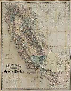
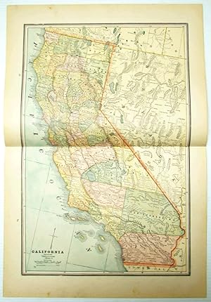
Britton & Rey's Map of the State of California.
Verlag: San Francisco: Britton & Rey, 1857., 1857
Anbieter: Arader Galleries - AraderNYC, New York, NY, USA
Verkäuferbewertung 5 von 5 Sternen
Erstausgabe
1st Edition. "Single sheet, (31 x 25 Ľ inches). Fine folding lithographed map with original hand color in full (repaired tear, some browning and spotting). Original brown cloth with printed paper label (a bit rubbed). Provenance: From the important cartographical library of Warren Heckrotte, his sale, Rare Cartography, Exploration and Voyages, Part II, December 3, 2015, Lot 153. From the distinguished library of Thomas W. Streeter, his bookplate to the front pastedown. With the label of J.J. LeCount Bookbinder San Francisco on front pastedown. "BY FAR THE MOST COMPLETE AND ACCURATE MAP OF CALIFORNIA" (Wheat) First edition. Important map of California in first edition, with very distinguished provenance. Noted in California 49 as "the first reasonably accurate and complete map of the state. Towns, great and small, county boundaries, stage and wagon roads, including a few that traverse the Sierra Nevada, and California's first railroad from Sacramento to Folsom appear. None of the errors found on Eddy's map are present. Lake Tahoe. is shown at its correct location." Warren Heckrotte notes that "This is the Streeter-Grabhorn copy and the copy that Wheat says he used for making his description in Maps of the California Gold Region. The map is rare." "In 1857 the state of knowledge of Sierra Nevada geography was outlined in the most detailed map of California to date, a map prepared by civil engineer, surveyor, architect, and artist George H. Goddard. Goddard was born in Bristol, England, and was educated at Oxford. He, like many others, was drawn to California by the prospect of making his fortune in the gold rush. In 1850, at the age of 33, he sailed to California by way of Cape Horn. The journey from Plymouth to San Francisco, with an eight-day stopover in the Falkland Islands before rounding the Horn, took 180 days. His wife and two children remained in Europe until 1858, when the family was finally reunited. Within a year after their arrival in California a third child was born. "Goddard went to the goldfields and became a partner in a drugstore in Columbia, but by 1853 he had begun a career as a surveyor. He also maintained a professional interest in architecture, and began a serious interest in landscape painting. His first expedition was a survey of a possible railroad route over the Sierra at Sonora Pass, a route already traversed by a wagon road. The work led Goddard to other mapping excursions around the state. All the while he took copious notes and measurements that would help him later in compiling the California map. "In 1855, working for the California Surveyor General, he made a reconnaissance survey of the route over Carson Pass, and also surveyed the boundary between California and Utah Territory (in what is now western Nevada). For this work Goddard carried altitude and azimuth transits and chronometers, so that he could accurately determine by astronomical observations the latitude and longitude of important survey stations. When location and circumstance permitted, he checked the chronometers against time signals received on newly erected telegraph lines "The Goddard map of the state of California, published in 1857 by order of the Surveyor General of California [as here], is based partly on the Fremont map of 1848, though many details have been added and other improvements have been made. The map (Goddard, 1857) shows no trails crossing the Sierra in the 200-mile span of the range crest from Sonora Pass, north of Yosemite, to Walker Pass, 50 miles south of Owens Lake. No habitation is shown in Owens Valley. The U.S. Army's Fort Independence is not shown; it was established five years later, on July 4, 1862, as a result of skirmishes between settlers and Indians. The main settlement in the Central Valley of California adjacent to the parks area was Visalia (spelled 'Visaija' on the map). Fresno, Bakersfield, and Merced had not yet been settled. The map shows Tulare Lake to be about 40 miles long, whereas on the Fremont m".
-
Geological Map of a Part of the State of California Explored in 1853 by Lieut. R.S. Williamson U.S. Top. Eng.r.
Verlag: [Washington D.C.: A.O.P. Nicholson, 1855]., 1855
Anbieter: Arader Galleries - AraderNYC, New York, NY, USA
Verkäuferbewertung 5 von 5 Sternen
Single sheet (22 x 16 inches to the neat line). Fine engraved map of California from the border with Oregon Territory in the north to Cape St. Quentin in the south, lithographed by Sarony, Major & Knapp of New York after Williamson, with original hand-colour highlighting the different geological zones and key (original folds). From "Report of the Secretary of War communicating the Several Pacific Railroad Explorations" House of Representatives Executive Document 129, Washington, 1855, to accompany William P. Blake's "Report of a Geological Reconnoissance in California". The key lists nine geological zones mapped by Williamson including: Granitic and Metamorphic; Erupted Granite and Syenite; Serpentine, Trap, Greenstone and Porphyry; Basaltic Lava; Metamorphic Slates; White and chrystalline Limestone; Teptiary and Quaternary; Tertiary; and Alluvium. The map also shows some interesting details along the American River: a huge Mono Lake is shown, but not Lake Tahoe, which has in its place is a small lake named Lake Bonpland. In Southern California, Los Angeles, San Gabriel and San Pedro are shown. Howes W-504; Marcou & Marcou 678.