
Gesamtpreis (1 Artikel Artikel):
Versandziel:

a z wales regional road (13 Ergebnisse)
Direkt zu den wichtigsten Suchergebnissen
Produktart
- Alle Product Types
- Bücher (13)
- Magazine & Zeitschriften
- Comics
- Noten
- Kunst, Grafik & Poster
- Fotografien
- Karten
- Manuskripte & Papierantiquitäten
Zustand
Einband
- alle Einbände
- Hardcover
- Softcover (11)
Weitere Eigenschaften
- Erstausgabe
- Signiert
- Schutzumschlag
- Angebotsfoto (3)
Gratisversand
- Versand nach USA gratis
Land des Verkäufers
Verkäuferbewertung
-
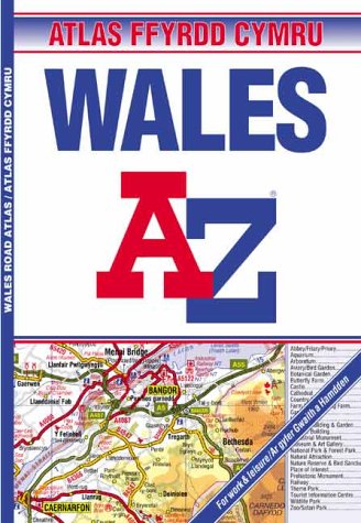
A-Z Wales Regional Road Atlas (A-Z Road Maps & Atlases)
Verlag: Geographers' A-Z Map Company, 2002
ISBN 10: 1843480077ISBN 13: 9781843480075
Buch
Paperback. Zustand: Good. The book has been read but remains in clean condition. All pages are intact and the cover is intact. Some minor wear to the spine.
-

A-Z Wales Regional Road Atlas
Verlag: Geographers' A-Z Map Co Ltd, 2005
ISBN 10: 1843481677ISBN 13: 9781843481676
Buch
Paperback. Zustand: Very Good. The book has been read, but is in excellent condition. Pages are intact and not marred by notes or highlighting. The spine remains undamaged.
-
A-Z Wales Regional Road Atlas
Verlag: Geographers' A-Z Map Co Ltd, 2005
ISBN 10: 1843481677ISBN 13: 9781843481676
Buch
Paperback. Zustand: Fair. A readable copy of the book which may include some defects such as highlighting and notes. Cover and pages may be creased and show discolouration.
-

A-Z Wales Regional Road Atlas (A-Z Road Maps & Atlases)
Verlag: -, 2001
ISBN 10: 0850398509ISBN 13: 9780850398502
Buch
Map. Zustand: Very Good. A-Z Wales Regional Road Atlas (A-Z Road Maps & Atlases) This book is in very good condition and will be shipped within 24 hours of ordering. The cover may have some limited signs of wear but the pages are clean, intact and the spine remains undamaged. This book has clearly been well maintained and looked after thus far. Money back guarantee if you are not satisfied. See all our books here, order more than 1 book and get discounted shipping.
-
A-Z Wales Regional Road Atlas (A-Z Road Maps & Atlases)
Verlag: HarperCollins Publishers, United Kingdom, 2002
ISBN 10: 1843480077ISBN 13: 9781843480075
Buch
Paperback. Zustand: Very Good. This regional road atlas extends to cover an area which includes Anglesey, Llandudno, Liverpool, Warrington, Crewe, Telford, Bridgnorth, Hereford, Ross-on-Wye, Bristol, Weston-super-Mare, Cardiff, Bridgend, Swansea, Tenby, Milford Haven, Fishguard, Aberystwyth, Porthmadog and Caernarfon. Map information includes motorways open with full junction detail, motorways under construction and proposed, motorway service areas, primary routes and destinations, A & B roads, selected major road service areas, gradients 1:5 and steeper together with tolls, mileages, national and county boundaries, spot heights and contour colouring. A wide range of ancillary and tourist information is featured along with an index to cities, towns, villages, hamlets and locations. Also included is a separate index to selected places of interest and other features. Within the atlas the title, contents, reference and tourist information headings along with other selected text are featured in Welsh as well as English. The book has been read, but is in excellent condition. Pages are intact and not marred by notes or highlighting. The spine remains undamaged.
-

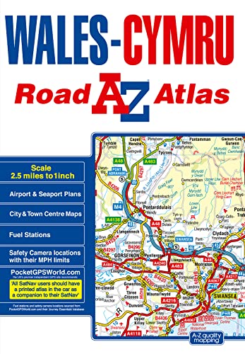
Wales Regional Road Atlas (A-Z Regional Road Atlas)
Verlag: Geographers A-Z Map Company Ltd, 2018
ISBN 10: 1843489090ISBN 13: 9781843489092
Buch
Zustand: Good. Most items will be dispatched the same or the next working day. A copy that has been read but remains in clean condition. All of the pages are intact and the cover is intact and the spine may show signs of wear. The book may have minor markings which are not specifically mentioned.
-
A-Z Wales Regional Road Atlas
Verlag: Geographers' A-Z Map Co Ltd, 2005
ISBN 10: 1843481677ISBN 13: 9781843481676
Buch
Zustand: Good. Most items will be dispatched the same or the next working day.
-

A-Z Wales Regional Road Atlas (A-Z Road Maps & Atlases)
Verlag: Geographers' A-Z Map Co Ltd, 2001
ISBN 10: 0850398509ISBN 13: 9780850398502
Buch
Zustand: Good. Most items will be dispatched the same or the next working day.
-

A-Z Wales Regional Road Atlas (Road Map)
Verlag: Geographers' A-Z Map Company, 2001
ISBN 10: 0850396077ISBN 13: 9780850396072
Buch
Zustand: good. Befriedigend/Good: Durchschnittlich erhaltenes Buch bzw. Schutzumschlag mit Gebrauchsspuren, aber vollständigen Seiten. / Describes the average WORN book or dust jacket that has all the pages present.
-
A-Z Wales Regional Road Atlas (A-Z Road Maps & Atlases)
Verlag: Geographers' A-Z Map Co Ltd 22/07/2002, 2002
ISBN 10: 1843480077ISBN 13: 9781843480075
Buch
Zustand: Very Good. This book is in very good condition and will be shipped within 24 hours of ordering. The cover may have some limited signs of wear but the pages are clean, intact and the spine remains undamaged. This book has clearly been well maintained and looked after thus far. Money back guarantee if you are not satisfied. See all our books here, order more than 1 book and get discounted shipping. .
-
Wales Regional Road Atlas (A-Z Regional Road Atlas)
Verlag: Geographers' A-Z Map Co Ltd, 2018
ISBN 10: 1843489090ISBN 13: 9781843489092
Buch
Paperback. Zustand: Good. The book has been read but remains in clean condition. All pages are intact and the cover is intact. Some minor wear to the spine.
-
Wales Regional Road Atlas (A-Z Regional Road Atlas)
Verlag: HarperCollins Publishers, United Kingdom, 2018
ISBN 10: 1843489090ISBN 13: 9781843489092
Buch
Paperback. Zustand: Very Good. This A-Z map of Wales is a full colour regional road atlas which extends into England to include all major routes into the country. In addition to covering the whole of Wales the detailed road mapping also includes: *Liverpool *Warrington *Nantwich *Shrewsbury *Hereford *Bristol *Severn River Crossings Published at a clear 2.5 miles to 1 inch the following features are shown on the road mapping: *Motorways open with full junction detail, motorways under construction and proposed, motorway service areas, primary routes and destinations, A and B roads, selected minor roads, gradients 1:5 and steeper, tolls, mileages, national and county boundaries, spot heights and hill shading. *Selected safety camera locations with their maximum speed limits and fuel stations. *Selected places of interest, tourist information centres and golf courses. *National Park boundaries for Snowdonia, Brecon Beacons and Pembrokeshire Coast Also, within this Wales Atlas are 21 city, town, airport or port plans for: *Aberystwyth *Bangor *Cardiff (Caerdydd) *Caernarfon *Carmarthen (Caerfyrddin) *Chester *Colwyn Bay (Bae Colwyn) *Hereford *Llandudno *Llanelli *Merthyr Tydfil (Merthyr Tudful) *Newport (Casnewydd) *Prestatyn *Rhyl *Shrewsbury *Swansea (Abertawe) *Wrexham (Wrecsam) *Cardiff International Airport (Maes Awyr Rhyngwladol Caerdydd) *Fishguard Port (Abergwaun) *Holyhead Port (Caergybi) *Pembroke Dock (Doc Penfro) The index is comprised of two sections: the first is an index of cities, towns, villages, hamlets and locations; the second is an index to places of interest within Wales and includes a corresponding map symbol alongside each entry for easy identification. The book has been read, but is in excellent condition. Pages are intact and not marred by notes or highlighting. The spine remains undamaged.
-

A-Z Wales Regional Road Atlas / Atlas Ffyrdd Cymru (Road Map)
Verlag: Geographers, 2007
ISBN 10: 1843485117ISBN 13: 9781843485117
Buch
Gebundene Ausgabe. Zustand: Wie neu. 88 Seiten Unbenutztes und neuwertiges Buch als Maengelexemplar gekennzeichnet / Versand spätestens am folgenden Arbeitstag / Rechnung mit ausgewiesener MwSt. liegt bei / shipping worldwide with invoice / Sprache: Englisch Gewicht in Gramm: 200.