Gesamtpreis (1 Artikel Artikel):
Versandziel:

ptolemy world map (416 Ergebnisse)
Stichwörter:
ptolemy world map
Mit der Detailsuche verfeinern
Direkt zu den wichtigsten Suchergebnissen
Suchfilter
Produktart
- Alle Product Types
- Bücher (233)
- Magazine & Zeitschriften (Keine weiteren Ergebnisse entsprechen dieser Verfeinerung)
- Comics (Keine weiteren Ergebnisse entsprechen dieser Verfeinerung)
- Noten (Keine weiteren Ergebnisse entsprechen dieser Verfeinerung)
- Kunst, Grafik & Poster (27)
- Fotografien (Keine weiteren Ergebnisse entsprechen dieser Verfeinerung)
- Karten (156)
- Manuskripte & Papierantiquitäten (Keine weiteren Ergebnisse entsprechen dieser Verfeinerung)
Zustand Mehr dazu
- Neu (28)
- Wie Neu, Sehr Gut oder Gut Bis Sehr Gut (19)
- Gut oder Befriedigend (95)
- Ausreichend oder Schlecht (Keine weiteren Ergebnisse entsprechen dieser Verfeinerung)
- Wie beschrieben (274)
Weitere Eigenschaften
Sprache (7)
Gratisversand
Land des Verkäufers
Verkäuferbewertung
-

Ptolemy'S Geography A Brief Account Of All The Printed Editions Down To 1730 With Notes On Some Important Variations Observed In That Of Ulm 1482 Including The Recent Discovery Of The Earliest Printed Map Of The World Yet Known On Modern Geographical Conc
Anbieter: Majestic Books, Hounslow, Vereinigtes Königreich
Verkäuferbewertung 4 von 5 Sternen

EUR 8,38
EUR 7,46 Versand
Versand von Vereinigtes Königreich nach USAAnzahl: 4 verfügbar
In den WarenkorbZustand: New. pp. 72.
-
![Beispielbild für Ptolemy's geography a brief account of all the printed editions down to 1730 with notes on some important variations observed in that of Ulm 1482 including the recent discovery of the earliest printed map of the world yet known on modern geographical conceptions 1908 [Hardcover] zum Verkauf von Majestic Books](https://pictures.abebooks.com/isbn/9789333358521-de-300.jpg)
Ptolemy's geography a brief account of all the printed editions down to 1730 with notes on some important variations observed in that of Ulm 1482 including the recent discovery of the earliest printed map of the world yet known on modern geographical conceptions 1908 [Hardcover]
Anbieter: Majestic Books, Hounslow, Vereinigtes Königreich
Verkäuferbewertung 4 von 5 Sternen
EUR 6,35
EUR 7,46 Versand
Versand von Vereinigtes Königreich nach USAAnzahl: 4 verfügbar
In den WarenkorbZustand: New. pp. 72.
-

The Map of Heaven : How Science, Religion, and Ordinary People Are Proving the Afterlife
Anbieter: Better World Books, Mishawaka, IN, USA
Verkäuferbewertung 5 von 5 Sternen

Zustand: Good. Former library copy. Pages intact with minimal writing/highlighting. The binding may be loose and creased. Dust jackets/supplements are not included. Includes library markings. Stock photo provided. Product includes identifying sticker. Better World Books: Buy Books. Do Good.
-

1434: The Year a Chinese Fleet Sailed to Italy and Ignited the Renaissance
Sprache: Englisch
Verlag: HarperCollins Publishers, United Kingdom, London, 2009
ISBN 10: 0007269552 ISBN 13: 9780007269556
Anbieter: WorldofBooks, Goring-By-Sea, WS, Vereinigtes Königreich
Verkäuferbewertung 5 von 5 Sternen
EUR 1,45
EUR 6,43 Versand
Versand von Vereinigtes Königreich nach USAAnzahl: 11 verfügbar
In den WarenkorbPaperback. Zustand: Very Good. In his bestselling book 1421:The Year China Discovered the World, Gavin Menzies revealed that it was the Chinese that discovered America, not Columbus. Now he presents further astonishing evidence that it was also Chinese advances in science, art, and technology that formed the basis of the European Renaissance and our modern world. In his bestselling book 1421: The Year China Discovered the World, Gavin Menzies presented controversial and compelling evidence that Chinese fleets beat Columbus, Cook and Magellan to the New World. But his research has led him to astonishing new discoveries that Chinese influence on Western culture didnt stop there. Until now, scholars have considered that the Italian Renaissance the basis of our modern Western world came about as a result of a re-examining the ideas of classical Greece and Rome. A stunning reappraisal of history is about to be published. Gavin Menzies makes the startling argument that a sophisticated Chinese delegation visited Italy in 1434, sparked the Renaissance, and forever changed the course of Western civilization. After that date the authority of Aristotle and Ptolemy was overturned and artistic conventions challenged, as was Arabic astronomy and cartography. Florence and Venice of the 15th century attracted traders from across the world. Menzies presents astonishing evidence that a large Chinese fleet, official ambassadors of the Emperor, arrived in Tuscany in 1434 where they met with Pope Eugenius IV in Florence. A mass of information was given by the Chinese delegation to the Pope and his entourage concerning world maps (which Menzies argues were later given to Columbus), astronomy, mathematics, art, printing, architecture, steel manufacture, civil engineering, military machines, surveying, cartography, genetics, and more. It was this gift of knowledge that sparked the inventiveness of the Renaissance Da Vinci's inventions, the Copernican revolution, Galileo, etc. Following 1434, Europeans embraced Chinese intellectual ideas, discoveries, and inventions, which formed the basis of European civilization just as much as Greek thought and Roman law. In short, China provided the spark that set the Renaissance ablaze. The book has been read, but is in excellent condition. Pages are intact and not marred by notes or highlighting. The spine remains undamaged.
-

The Map of Knowledge: How Classical Ideas Were Lost and Found: A History in Seven Cities
Sprache: Englisch
Verlag: Pan Macmillan, United Kingdom, London, 2020
ISBN 10: 1509829628 ISBN 13: 9781509829620
Anbieter: WorldofBooks, Goring-By-Sea, WS, Vereinigtes Königreich
Verkäuferbewertung 5 von 5 Sternen
EUR 2,05
EUR 6,43 Versand
Versand von Vereinigtes Königreich nach USAAnzahl: 8 verfügbar
In den WarenkorbPaperback. Zustand: Very Good. 'Violet Moller brings to life the ways in which knowledge reached us from antiquity to the present day in a book that is as delightful as it is readable.' Peter Frankopan, author of The Silk Roads In The Map of Knowledge Violet Moller traces the journey taken by the ideas of three of the greatest scientists of antiquity Euclid, Galen and Ptolemy through seven cities and over a thousand years. In it, we follow them from sixth-century Alexandria to ninth-century Baghdad. From Muslim Cordoba to Catholic Toledo. From Salernos medieval medical school to Palermo, capital of Sicilys vibrant mix of cultures. And finally to Venice, where that great merchant citys printing presses would enable Euclids geometry, Ptolemys system of the stars and Galens vast body of writings on medicine to spread even more widely. In tracing these fragile strands of knowledge from century to century, from east to west and north to south, Moller also reveals the web of connections between the Islamic world and Christendom. Connections that would both preserve and transform astronomy, mathematics and medicine from the early Middle Ages to the Renaissance. Vividly told and with a dazzling cast of characters, The Map of Knowledge is an evocative, nuanced and vibrant account of our common intellectual heritage. 'An endlessly fascinating book, rich in detail, capacious and humane in vision.' Stephen Greenblatt, author of The Swerve: How the World Became Modern. The book has been read, but is in excellent condition. Pages are intact and not marred by notes or highlighting. The spine remains undamaged.
-

The Map of Heaven : A Neurosurgeon Explores the Mysteries of the Afterlife and the Truth about What Lies Beyond
Sprache: Englisch
Verlag: Little, Brown Book Group Limited, 2014
ISBN 10: 0349403511 ISBN 13: 9780349403519
Anbieter: Better World Books, Mishawaka, IN, USA
Verkäuferbewertung 5 von 5 Sternen
Zustand: Good. Pages intact with minimal writing/highlighting. The binding may be loose and creased. Dust jackets/supplements are not included. Stock photo provided. Product includes identifying sticker. Better World Books: Buy Books. Do Good.
-

1434: The Year a Chinese Fleet Sailed to Italy and Ignited the Renaissance
Sprache: Englisch
Verlag: HarperCollins Publishers, United Kingdom, London, 2008
ISBN 10: 0007269374 ISBN 13: 9780007269372
Anbieter: WorldofBooks, Goring-By-Sea, WS, Vereinigtes Königreich
Verkäuferbewertung 5 von 5 Sternen
EUR 3,55
EUR 6,43 Versand
Versand von Vereinigtes Königreich nach USAAnzahl: 5 verfügbar
In den WarenkorbPaperback. Zustand: Very Good. In his bestselling book 1421:The Year China Discovered the World, Gavin Menzies revealed that it was the Chinese that discovered America, not Columbus. Now he presents further astonishing evidence that it was also Chinese advances in science, art, and technology that formed the basis of the European Renaissance and our modern world. In his bestselling book 1421: The Year China Discovered the World, Gavin Menzies presented controversial and compelling evidence that Chinese fleets beat Columbus, Cook and Magellan to the New World. But his research has led him to astonishing new discoveries that Chinese influence on Western culture didnt stop there. Until now, scholars have considered that the Italian Renaissance - the basis of our modern Western world - came about as a result of a re-examining the ideas of classical Greece and Rome. However, a stunning reappraisal of history is about to be published. Gavin Menzies makes the startling argument that a sophisticated Chinese delegation visited Italy in 1434, sparked the Renaissance, and forever changed the course of Western civilization. After that date the authority of Aristotle and Ptolemy was overturned and artistic conventions challenged, as was Arabic astronomy and cartography. Florence and Venice of the 15th century attracted traders from across the world. Menzies presents astonishing evidence that a large Chinese fleet, official ambassadors of the Emperor, arrived in Tuscany in 1434 where they met with Pope Eugenius IV in Florence. A mass of information was offered by the Chinese delegation to the Pope and his entourage - concerning world maps (which Menzies argues were later given to Columbus), astronomy, mathematics, art, printing, architecture, steel manufacture, civil engineering, military machines, surveying, cartography, genetics, and more. It was this gift of knowledge that sparked the inventiveness of the Renaissance - Da Vinci's inventions, the Copernican revolution, Galileo, etc. Following 1434, Europeans embraced Chinese intellectual ideas, discoveries, and inventions, which formed the basis of European civilization just as much as Greek thought and Roman law. In short, China provided the spark that set the Renaissance ablaze. The book has been read, but is in excellent condition. Pages are intact and not marred by notes or highlighting. The spine remains undamaged.
-
The Map of Heaven : A Neurosurgeon Explores the Mysteries of the Afterlife and the Truth about What Lies Beyond
Sprache: Englisch
Verlag: Little, Brown Book Group Limited, 2014
ISBN 10: 0349403511 ISBN 13: 9780349403519
Anbieter: Better World Books Ltd, Dunfermline, Vereinigtes Königreich
Verkäuferbewertung 5 von 5 Sternen
EUR 5,37
EUR 5,74 Versand
Versand von Vereinigtes Königreich nach USAAnzahl: 1 verfügbar
In den WarenkorbZustand: Very Good. Pages intact with possible writing/highlighting. Binding strong with minor wear. Dust jackets/supplements may not be included. Stock photo provided. Product includes identifying sticker. Better World Books: Buy Books. Do Good.
-
The Map of Heaven : A Neurosurgeon Explores the Mysteries of the Afterlife and the Truth about What Lies Beyond
Sprache: Englisch
Verlag: Little, Brown Book Group Limited, 2014
ISBN 10: 0349403511 ISBN 13: 9780349403519
Anbieter: Better World Books Ltd, Dunfermline, Vereinigtes Königreich
Verkäuferbewertung 5 von 5 Sternen
EUR 5,37
EUR 5,74 Versand
Versand von Vereinigtes Königreich nach USAAnzahl: 5 verfügbar
In den WarenkorbZustand: Good. Former library copy. Pages intact with minimal writing/highlighting. The binding may be loose and creased. Dust jackets/supplements are not included. Includes library markings. Stock photo provided. Product includes identifying sticker. Better World Books: Buy Books. Do Good.
-
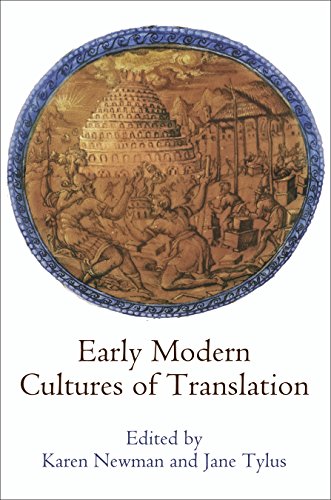
Early Modern Cultures of Translation
Sprache: Englisch
Verlag: University of Pennsylvania Press, 2015
ISBN 10: 081224740X ISBN 13: 9780812247404
Anbieter: Powell's Bookstores Chicago, ABAA, Chicago, IL, USA
Verkäuferbewertung 5 von 5 Sternen
Hardcover. Zustand: Very Good. Zustand des Schutzumschlags: Very Good. Minor shelf wear. Else a bright, clean copy. "Would there have been a Renaissance without translation?" Karen Newman and Jane Tylus ask in their Introduction to this wide-ranging group of essays on the uses of translation in an era formative for the modern age. The early modern period saw cross-cultural translation on a massive scale. Humanists negotiated status by means of their literary skills as translators of culturally prestigious Greek and Latin texts, as teachers of those same languages, and as purveyors of the new technologies for the dissemination of writing. Indeed, with the emergence of new vernaculars and new literatures came a sense of the necessary interactions of languages in a moment that can truly be defined as "after Babel." As they take their starting point from a wide range of primary sourcesâ"the poems of Louise LabĂ , the first Catalan dictionary, early printed versions of the Ptolemy world map, the King James Bible, and Roger Williams's Key to the Language of Americaâ"the contributors to this volume provide a sense of the political, religious, and cultural stakes for translators, their patrons, and their readers. They also vividly show how the very instabilities engendered by unprecedented linguistic and technological change resulted in a far more capacious understanding of translation than what we have today. A genuinely interdisciplinary volume, Early Modern Cultures of Translation looks both east and west while at the same time telling a story that continues to the present about the slow, uncertain rise of English as a major European and, eventually, world language. Contributors: Gordon Braden, Peter Burke, Anne Coldiron, Line Cottegnies, Margaret Ferguson, Edith Grossman, Ann Rosalind Jones, LázlĂ Kontler, Jacques Lezra, Carla Nappi, Karen Newman, Katharina N. Piechocki, Sarah Rivett, Naomi Tadmor, Jane Tylus. .
-

GREECE, CRETE, AND THE AEGEAN ISLANDS IN THE EARLY BRONZE AGE The Cambridge Ancient History Volume I, Chapter XXVI (A)
Verlag: Cambridge University Press, 1965
Anbieter: Ancient World Books, Toronto, ON, Kanada
Verkäuferbewertung 5 von 5 Sternen
Softcover. Zustand: Good+. Zustand des Schutzumschlags: No Dust Jacket. Minor scuffing along spine. Scholar's name to ffep (Jenifer Neils). Scholar's bookplate to inner cover (Jenifer Neils). Upper corner of book creased. Pen underlining and marginalia to a few pages. ; CHAPTER 1: PERSIA, FROM XERXES TO ALEXANDER: Xerxes and his successors; enterprise of Cyrus; battle of Cunaxa; retreat of the Ten Thousand to Trapezus (Kurdistan etc.) ; From Trapezus to Pergamum; Great king and his Satrapies; Artaxerxes III and the reconquest of Egypt CHAPTER II: THE ASCENDACY OF SPARTA: Lysander's settlement; spartan home affairs; Sparta's dependents in the greek homeland (Thebes, Athens, Thessaly etc.) ; Sparta's relations with Persia; Persian Thalassocracy; Corintian War (fall of Pausanias, battle of Corinth etc.) ; New Pact between Sparta and Persia (Thrasybulus etc. ) ; CHAPTER III THE SECOND ATHENIAN LEAGUE : General condition of Greece in 386 B. C. ; Sparta's Policy of Precautions; Rise of Thebes; New Athenian Thalassocracy; Jason of Pherae (siege of Corcyra etc. ) CHAPTER IV THEBES The Battle of Leuctra; theban ascendacy in Northern Greece; disruption of the Peloponnesian league; diplomatic failures of Thebes; Failure of Arcadian Imperialism; Battle of Mantinea; Decline of the Athenian Naval League; CHAPTER V DIONYSIUS OF SYRACUSE: Carthaginian invasions 409-406 B. C. ; Rise of Dionysius, 405 B. C. ; dionysius and the Sicels, 403 B. C. ; First war with Carthage, 398-392 B. C. ; Italian wars of Dionysius and his later wars with Carthage; Relations with Eastern Greece; Death of Dionysius, 367 B. C. ; Estimate of Dionysius; CHAPTER VI EGYPT TO THE COMING OF ALEXANDER: The Achaemenid Rule (Athenians in Egypt Herodotus jews at Syene etc.) ; last native Monarchy; Coming of Alexander; Retrospect (Libyans, and Ethiopians Demotic literature, Egyptian religion etc.) ; CHAPTER VII: THE INAUGURATION OF JUDAISM: Historical outlines (Nehemiah, benevolence of Persia, Samaritan schism, Ezra etc. ) ; jews and their neighbours; Edom and Samaria (desolation of Judah and Jerusalem etc.) ; Religious tendencies (Jewish self-consciousness etc. ) ; Priestly source and the Pentateuch; CHAPTER VIII THE RISE OF MACEDONIA Greek World at the Accession of Philip; early years of Philip's reign, 359-356 B. C. ; war of Athens and her allies, 357-5 B. C. ; sacred war down to 353 B. C. ; philip's activities in Thrace and Thessaly down to 352 B. C. ; Athenian policy: Aristophon, Eubulus, Demosthenes; Sacred war continued; olynthian war; peace of philocrates, and the end of the sacred war; CHAPTER IX MACEDONIAN SUPREMACY IN GREECE: Years of Nominal Peace between Philip and Athens, 346-3 B. C. ; relations of Philip and the greek cities with Persia; struggle in Thrace and the Chersonese, 342-339 B. C. ; Amphissean War: Chaeronea (338 B. C. ) ; After Chaeronea; death of Philip. Characters of Philip and Demosthenes; CHAPTER X: SICILY, 367 TO 330 B. C. Dionysius the Second (plato Dion etc.) ; Enterprise of Dion; Timoleon: delivery of Syracuse (Carthaginian activity) ; Timoleon Settlement of Sicily; Southern italy; CHAPTER XI: THE ATHENIAN PHILOSOPHICAL SCHOOLS: philosophy of Socrates; Plato the early dialogues; Academy dialogues of the middle period (Republic Phaedo, meno, Symposium, Phaedrus) ; Later dialogues (Timaeus, Philebus) ; Aristotle; Form and matter, the actual and potential; objects and methods of science; cosmology; biology and psychology; ethics and politics; peripatetic school at Athens; CHAPTER XII: ALEXANDER: THE CONQUEST OF PERSIA Alexander's early years; preparations for invading persia; granicus and asia minor; battle of issus; administration of asia minor; tyre and egypt; battle of Gaugamela; death of Darius; CHAPTER XIII: ALEXANDER CONQUEST OF THE FAR EAST: Alexander, Philotas, and Parmenion; conquest of Turkestan; Cleitus, Callisthenes, and alexander's divine descent; india, from Bactria to the Jhelum; India from Jhelum to Beas; to Patiala; Punjab, Punjabi; Gedrosia and Susa; Alexander's Deification and death (Arabia and Arabian Expedition) ; Alexander's character and policy; finance and new cities (coinage) ; Empire: Alexander's personality; CHAPTER XIV: GREECE 335 TO 321 B. C. : the Feeling in Greece (antipater etc.) ; lycurgus and Athens; Agis III of Sparta; Prosecution of Demosthenes (Ctesiphon, on the Crown etc. ) ; Affair of Harpalus; lamian War (Hellenic league etc.) ; CHAPTER XV: THE HERITAGE OF ALEXANDER: Question of the succession; perdiccas; antipater's regency; polyperchon and Greece; eumenes and antigonus; cassander and the coalition; antigonus' first struggle for the empire; kingdom; cassander and Ptolemy; Defeat and Death of Antigonus; CHAPTER XVI; GREEK POLITICAL THOUGHT AND THEORY IN THE FOURTH CENTURY: Political thought of the fourth century; Xenophon and Isocrates; Plato and Aristotle; end of the Polis, and its political theory; CHAPTER XVII: Greek Art and Architecture: Classical Sculpture (Praxiteles, Scopas, Timotheus: Cephisodotus, Lysippus Attic grave reliefs; Fourth Century Doric Architecture; Corinthian capital; ionic architecture in Asia; civil buildings LIST OF TABLES, MAPS, PLANS : March of the Ten Thousand; Asia Minor; Second Athenian League; Central and north eastern peloponnese; plain of Mantinea and Tegea; Dominions of Dionysius; Central Greece; Alexander's Route; plans of temples etc. ; Cambridge Ancient History Series; 37 pages.
-
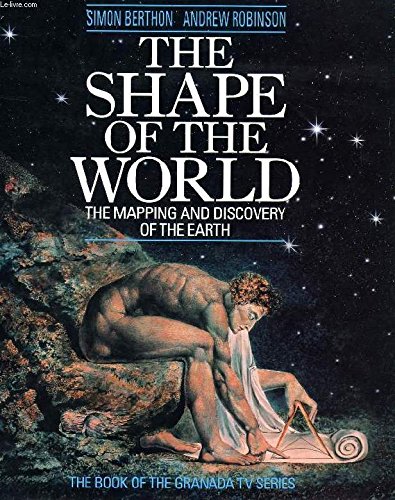
The Shape Of The World
Anbieter: THE CROSS Art + Books, Sydney, NSW, Australien
Verkäuferbewertung 2 von 5 Sternen

28.0 x 24.0cms 192pp b/w & colour illusts very good hardback & dustwrapper This history of map making and scientific invention including the work of Pythagoras Ptolemy Marco Polo Galileo Newton John Harrison Captain Cook NASA Apollo 8 and recent record that show eroded framlands depleted rainforests etc.
-

1434: The Year a Chinese Fleet Sailed to Italy and Ignited the Renaissance
Sprache: Englisch
Verlag: HarperCollins Publishers, United Kingdom, London, 2008
ISBN 10: 0007275862 ISBN 13: 9780007275861
Anbieter: WorldofBooks, Goring-By-Sea, WS, Vereinigtes Königreich
Verkäuferbewertung 5 von 5 Sternen
EUR 23,12
EUR 6,43 Versand
Versand von Vereinigtes Königreich nach USAAnzahl: 2 verfügbar
In den WarenkorbPaperback. Zustand: Very Good. In his bestselling book 1421:The Year China Discovered the World, Gavin Menzies revealed that it was the Chinese that discovered America, not Columbus. Now he presents further astonishing evidence that it was also Chinese advances in science, art, and technology that formed the basis of the European Renaissance and our modern world. In his bestselling book 1421: The Year China Discovered the World, Gavin Menzies presented controversial and compelling evidence that Chinese fleets beat Columbus, Cook and Magellan to the New World. But his research has led him to astonishing new discoveries that Chinese influence on Western culture didn't stop there. Until now, scholars have considered that the Italian Renaissance - the basis of our modern Western world - came about as a result of a re-examining the ideas of classical Greece and Rome. However, a stunning reappraisal of history is about to be published. Gavin Menzies makes the startling argument that a sophisticated Chinese delegation visited Italy in 1434, sparked the Renaissance, and forever changed the course of Western civilization. After that date the authority of Aristotle and Ptolemy was overturned and artistic conventions challenged, as was Arabic astronomy and cartography. Florence and Venice of the 15th century attracted traders from across the world. Menzies presents astonishing evidence that a large Chinese fleet, official ambassadors of the Emperor, arrived in Tuscany in 1434 where they met with Pope Eugenius IV in Florence. A mass of information was offered by the Chinese delegation to the Pope and his entourage - concerning world maps (which Menzies argues were later given to Columbus), astronomy, mathematics, art, printing, architecture, steel manufacture, civil engineering, military machines, surveying, cartography, genetics, and more. It was this gift of knowledge that sparked the inventiveness of the Renaissance - Da Vinci's inventions, the Copernican revolution, Galileo, etc. Following 1434, Europeans embraced Chinese intellectual ideas, discoveries, and inventions, which formed the basis of European civilization just as much as Greek thought and Roman law. In short, China provided the spark that set the Renaissance ablaze. The book has been read, but is in excellent condition. Pages are intact and not marred by notes or highlighting. The spine remains undamaged.
-

ORIGINAL ENGRAVED Map ptolemy's map of the World, compared with the actual positions after H. Kiepert Original antique Coloured map of IRELAND from the Encyclopaedia Britannica - 9th Edition, Volume XV Plate VII
Verlag: Published by Charles Scribner's Sons 1875, 1875
Anbieter: PROCTOR / THE ANTIQUE MAP & BOOKSHOP, DORCHESTER, Vereinigtes Königreich
Verbandsmitglied: PBFA
Verkäuferbewertung 5 von 5 Sternen
Karte
EUR 26,00
EUR 22,95 Versand
Versand von Vereinigtes Königreich nach USAAnzahl: 1 verfügbar
In den WarenkorbDouble Page Map Overall size: 16 x 10.5 inches In very good condition. A few faint foxing spots.
-
Cosmographiae Introductio
Verlag: University Microfilms, Ann Arbor MI, 1966
Anbieter: JBK Books, North Manchester, IN, USA
Verkäuferbewertung 5 von 5 Sternen
Hardcover. Zustand: Very Good. 151pp; blue cloth; no evident shelf wear. Facsimile reproduction of book first printed in 1507. Ex-library volume with customary markings and labels. Contents clean, tight, textually unmarked. Book is best known for having given the New World its name, "America", based on information supplied by the voyages of Amerigo Vespucci. The first part of the book is the facsimile reprint; second part is its English translation entitled, "INTRODUCTION TO COSMOGRAPHY WITH CERTAIN NECESSARY PRINCIPLES OF GEOMETRY AND ASTRONOMY TO WHICH ARE ADDED THE FOUR VOYAGES OF AMERIGO VESPUCCI. A REPRESENTATION OF THE ENTIRE WORLD, BOTH IN THE SOLID AND PROJECTED ON THE PLANE, INCLUDING ALSO LANDS WHICH WERE UNKNOWN TO PTOLEMY, AND HAVE BEEN RECENTLY DISCOVERED.
-
![Beispielbild für IMAGO MUNDI 54 [ONLY]. The International Journal for the History of Cartography. zum Verkauf von Hay Cinema Bookshop Limited](https://pictures.abebooks.com/isbn/9780905776279-de-300.jpg)
IMAGO MUNDI 54 [ONLY]. The International Journal for the History of Cartography.
Anbieter: Hay Cinema Bookshop Limited, Hay on Wye, Vereinigtes Königreich
Verkäuferbewertung 5 von 5 Sternen
EUR 19,51
EUR 21,80 Versand
Versand von Vereinigtes Königreich nach USAAnzahl: 1 verfügbar
In den WarenkorbSmall folio. [240pp.] Colour and b/w. illustrations. Paperback in original navy wrapps. lettered in orange. Includes: The Medieval Texts of the 1486 Ptolemy Edition by Johann Reger of Ulm. By Margriet Hoodvliet; Maps of the World for Ottoman Princes? Further Evidence and Questions Concerning 'The Mappamondo of Hajji Ahmed'. By Benjamin Arbel; Draft Town Maps for John Speed's Theatre of the Empire of Great Britaine. by Sarah Bendall. ISBN 0905776275 US$22.
-
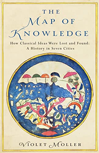
The Mp of Knowledge. How Classical Ideas Were Lost and Found : A History in Seven Cities
Anbieter: The Blue Penguin, FRODSHAM, Vereinigtes Königreich
Verkäuferbewertung 5 von 5 Sternen
Erstausgabe
EUR 17,73
EUR 23,70 Versand
Versand von Vereinigtes Königreich nach USAAnzahl: 1 verfügbar
In den WarenkorbHardcover. Zustand: Near Fine. Zustand des Schutzumschlags: Near Fine. 1st Edition. Dustwrapper, pp.xviii, 331. Illustrated inc maps. Traces the journeys taken by the ideas of three of the greatest scientists of antiquity - Euclid, Galen and Ptolemy - through seven cities over a thousand years. In so doing the author also traces the links between the Islamic world and Christendom, preserving and transforming astronomy, mathematics and medicine from the early Middle Ages to the Renaissance. Wrapper priceclipped, with a couple of very small closed edge splits to top edge in places. Contents crisp and bright. Inscription on half title. Near fine in near fine wrapper.
-

A Guide To The Temple of Kom-Ombo
Verlag: The Palm Press, Cairo, Egypt, 2001
ISBN 10: 9775089387 ISBN 13: 9789775089380
Anbieter: Ground Zero Books, Ltd., Silver Spring, MD, USA
Verkäuferbewertung 4 von 5 Sternen
Erstausgabe
Wraps. Zustand: Very good. Zustand des Schutzumschlags: No dust jacket issued. Joseph Hunwick (Photography) (illustrator). Presumed First Edition, First printing. Format is approximately 6.25 inches by 8.25 inches. 24 pages, plus covers. Illustrations (some in full color). Map. Diagram. Drawings. One of the most unusual temples of Ancient Egypt, Kom Ombo was mainly built during the Ptolemaic Dynasty from 180 - 47 BCE, although there is evidence that it is stood upon an earlier temple. The temple is unique for its dedication to two different deities: the local crocodile-headed god Sobek, and the first "god of the Kingdom", the falcon-headed god Horus the Elder (also called Haroeris). This double dedication was deliberate. Not only is it architecturally duplicated, with two sets of courts, hypostyle halls and sanctuaries, the twin temple is symbolic of the local and universalist themes that the two different deities represented. While much of Kom Ombo temple has been destroyed over the millennia, it has been reconstructed in part, and it is still home to a number of well-preserved and fascinating reliefs, including some intricately carved columns and friezes divided between the two gods. The layout of the complex - apart from being a double temple - is similar to that of the Temple of Edfu. The Temple of Kom Ombo is an unusual double temple in the town of Kom Ombo in Aswan Governorate, Upper Egypt. It was constructed during the Ptolemaic dynasty, 180-47 BC. Some additions to it were later made during the Roman period. The building is unique because its 'double' design meant that there were courts, halls, sanctuaries and rooms duplicated for two sets of gods. The southern half of the temple was dedicated to the crocodile god Sobek, god of fertility and creator of the world with Hathor and Khonsu. Meanwhile, the northern part of the temple was dedicated to the falcon god Haroeris ("Horus the Elder"), along "with Tasenetnofret (the Good Sister, a special form of Hathor or Tefnet/Tefnut) and Panebtawy (Lord of the Two Lands)." The temple is atypical because everything is perfectly symmetrical along the main axis. The texts and reliefs in the temple refer to cultic liturgies which were similar to those from that time period. The temple itself had a specific theology. The characters invoked the gods of Kom Ombo and their legend. Two themes were present in this temple: the universalist theme and the local theme. The two combine to form the theology of this temple. A temple was already built in the New Kingdom to honor these gods, however, this site gained in importance during the Ptolemaic Kingdom. Little remains of the New Kingdom temple. The existing temple was begun by Ptolemy VI Philometor (180-145 BC) at the beginning of his reign and added to by other Ptolemies, most notably Ptolemy XIII Theos Philopator (51-47 BC), who built the inner and outer hypostyles. The scene on the inner face of the rear wall of the temple is of particular interest, and "probably represents a set of surgical instruments." Much of the temple has been destroyed by the Nile, earthquakes, and later builders who used its stones for other projects. Some of the reliefs inside were defaced by Copts, who once used the temple as a church. All the temples buildings in the southern part of the plateau were cleared of debris and restored by Jacques de Morgan in 1893. A few of the three hundred crocodile mummies discovered in the vicinity are displayed in The Crocodile Museum. In April 2018, the Egyptian Ministry of Antiquities announced the discovery of the head of the bust of Roman Emperor Marcus Aurelius during work to protect the site from groundwater. In September 2018, the Egyptian antiquities ministry announced that a sandstone sphinx statue had been discovered at the temple. The statue, measuring approximately 11 in in width and 15 in in height, likely dates to the Ptolemaic Dynasty.
-
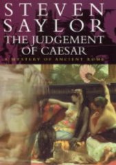
The Judgement of Caesar
Anbieter: Alpha 2 Omega Books BA, Southampton, HANTS, Vereinigtes Königreich
Verkäuferbewertung 5 von 5 Sternen
Erstausgabe
EUR 22,81
EUR 26,39 Versand
Versand von Vereinigtes Königreich nach USAAnzahl: 1 verfügbar
In den WarenkorbHardcover. Zustand: Fine. Zustand des Schutzumschlags: Fine. First UK edition-first printing. Fine condition.Constable,2004.First UK edition-first printing.Tan hardback(gilt lettering to the spine,small nick on the edge of the back cover) with Dj(a couple of scratches,nicks and crease on the Dj cover),both in fine condition.Illustrated with two b/w maps.Nice and clean pages as new with two pencil marks impressions and scratch on the edge of the first blank page of the book,two small nicks on the edges of the pages.Nice and clean book.357pp.Price un-clipped. This is another paragraph Product Description: The civil wars that have consumed both Rome and Egypt are about to reach their climax in the fabled city of Alexandria, capital of Egypt. Gordianus will witness the death throes of the old world, and play a crucial role in the birth of the world to come. For years, across seas and continents, the rival Roman generals Caesar and Pompey have engaged in a contest for world domination. Now Pompey, his forces destroyed at the battle of Pharsalus in Greece, flees to Egypt, hoping to make a last desperate stand on the banks of the Nile. But Egypt is a treacherous land, torn apart by the murderous rivalry between Queen Cleopatra and her brother King Ptolemy. Caesar, too, is on his way to Egypt, where his legendary encounter with the goddess-queen will spark a romance that reverberates down the centuries. Into this hothouse atmosphere of intrigue and deception comes Gordianus the Finder, seeking a cure for his wife Bethesda in the sacred waters of the Nile. But when his plans go awry, he finds himself engaged in an even more desperate pursuit - to prove the innocence of the son he once disowned.
-

Berenice II and the Golden Age of Ptolemaic Egypt (Women in Antiquity)
Buch 2 von 14: Women in AntiquitySprache: Englisch
Verlag: Oxford University Press, Oxford etc., 2013
ISBN 10: 0195370899 ISBN 13: 9780195370898
Anbieter: Edinburgh Books, Edinburgh, Vereinigtes Königreich
Verkäuferbewertung 5 von 5 Sternen
Erstausgabe
EUR 28,96
EUR 22,95 Versand
Versand von Vereinigtes Königreich nach USAAnzahl: 1 verfügbar
In den WarenkorbSoft cover. Zustand: Near Fine. First Edition. 2013 or 2014. xii, 270pp. Map, b&w ills. "Berenice II (c. 264-221 BCE), daughter of King Magas of Cyrene and wife of Ptolemy III Euergetes, came to embody all the key religious, political, and artistic ideals of Ptolemaic Alexandria. Though she arrived there nearly friendless, with the taint of murder around her, she became one of the most accomplished and powerful of the Macedonian queens descended from the successors of Alexander the Great. She was at the center of a group of important poets and intellectuals associated with the Museum and Library, not the least of which was Callimachus, the most important poet of the age. These men wrote poems not just for her, but about her, and their eloquent voices projected her charisma widely across the Greek-speaking world. Though the range of Berenice's interests was impressive and the quantity and quality of the poetry she inspired unparalleled, today she is all but known. Assimilating the scant and scattered evidence of her life, Dee L. Clayman presents a woman who was more powerful and fascinating than we had previously imagined. Berenice II and the Golden Age of Ptolemaic Egypt offers a portrait of a woman who had access to the cultural riches of both Greece and Egypt and who navigated her way carefully through the opportunities and dangers they presented, ultimately using them to accrue unprecedented honors that were all but equal to those of the king." The book is in excellent condition with minor shelfwear to corners, no inscriptions.
-

The Map of Knowledge: How Classical Ideas Were Lost and Found: A History in Seven Cities
Verlag: London: Picador, 2019
Anbieter: BookLovers of Bath, Peasedown St. John, BATH, Vereinigtes Königreich
Verkäuferbewertung 5 von 5 Sternen
Erstausgabe
EUR 22,45
EUR 17,21 Versand
Versand von Vereinigtes Königreich nach USAAnzahl: 1 verfügbar
In den WarenkorbHardback in Dust Wrapper. Zustand: Very Good. Zustand des Schutzumschlags: Good. Condition Notes: A touch faded at the spine of the dust wrapper with a peculiar, possibly damp, marking to the spine verso. The contents complete, clean and tight; First edition (first printing). Hardback. Dust wrapper over blue boards with gilt titles to the spine; Measures 9˝" x 6Ľ" (1 kg); pp (xiii) 330; Index; Bibliography; Includes: Street plans; Black & white photographs, within the text; Colour photographs, on individual leaves; Black & white drawings; Diagrams; Maps; || The book is on the shelf, ready to be appropriately packed, and posted from the pastoral paradise of Peasedown St. John, Bath, by a real bookseller in a real book shop - with my personal guarantee and beady eye on the Consumer Contracts Regulations. REMEMBER! Buying my copy means the book shop Jack Russells get their supper! My Book #203640 ||.
-

Theocritus: Idylls
Anbieter: Fundus-Online GbR Borkert Schwarz Zerfaß, Berlin, Deutschland
Verkäuferbewertung 5 von 5 Sternen
Gebundene Ausgabe. Zustand: Sehr gut. Auflage: Annotated. 250 Seiten Fresh and clean hardcover copy with original dustjacket in good condition. Frisches und sauberes Hardcover-Exemplar mit Original-Schutzumschlag in gutem Zustand. Contents: Introduction / Richard Hunter --Map of Theocritus' World --Thyrsis' Lament for Daphnis --The Sorceress --The Serenade --The Two Herdsmen --Goatherd and Shepherd --Damoetas and Daphnis --The Harvest Festival --The Reapers --The Cyclops' Serenade --The Beloved --The Story of Hylas --Aeschinas and Thyonichus --The Women at the Festival --The Graces --In Praise of Ptolemy --The Marriage Song for Helen --The Dioscuri --The Childhood of Heracles --The Bacchantes --The Distaff --To a Boy -- To Another Boy -- Explanatory Notes / Richard Hunter. ISBN 9780198152903 Sprache: Englisch Gewicht in Gramm: 320.
-

Cleopatra: A Life
Sprache: Englisch
Verlag: Back Bay Books/Little Brown and Company, New York, N.Y., 2011
ISBN 10: 0316001945 ISBN 13: 9780316001946
Anbieter: Ground Zero Books, Ltd., Silver Spring, MD, USA
Verkäuferbewertung 4 von 5 Sternen
Erstausgabe Signiert
Trade paperback. Zustand: Very good. xiv, [6], 394, [2], 13, [3] pages Signed by author sticker on front. Color illustrations of a reconstruction of Alexandia; an Aerial view of Alexandria; the inhabited world as Cleopatra knew it; 4 busts of Cleopatra; and a bust of Cleopatra as the goddess Isis. Signed by the author on the title page. Chapters cover That Egyptian Woman; Dead Men Don't Bite; Cleopatra Captures the Old Man by Magic; The Golden Age Never Was the Present Age; Man Is by Nature a Political Creature; We Must Often Shift the Sails When We Wish to Arrive in Port; An Object of Gossip for the Whole World; Illicit Affairs and Bastard Children; and The Wickedest Woman in History. Also includes Notes, Selected Bibliography, Index, and Reading Group Guide, Questions and Topics for discussion, as well as a map of Alexandria in Cleopatra's day and a map of the Mediterranean in Cleopatra's day. In Cleopatra: A Life, the author has managed to create a masterpiece: both a hugely readable portrait of a fascinating, unscrupulous, and powerful woman, and a brilliant explanation of the politics that lay behind her actions. Stacy Madeleine Schiff (born October 26, 1961) is an American former editor, essayist, and author of five biographies; her biography of Vera Nabokov, the wife and muse of the Russian-American novelist Vladimir Nabokov, won the 2000 Pulitzer Prize in biography. Schiff has written biographies of French aviator Antoine de Saint-Exupéry, prime mover of America's founding, Benjamin Franklin, ancient Egyptian queen Cleopatra, and the key figures and events of the Salem Witch Trials of 1692-93 in colonial Massachusetts. Derived from a Kirkus review: A Pulitzer Prize-winning biographer presents a swift, sympathetic life of one of history's most maligned and legendary women. Schiff acknowledges that our image of Cleopatra VII arrives through the distorted lenses of biased (male, Roman) history, romanticized and melodramatic stage productions and films and the distortion of time itself. Cleopatra. During that time, she took into her bed some of the most powerful men in history (Julius Caesar, Mark Antony), maneuvered through a male world with intelligence, skill and sanguinary brutality, met and failed to charm Herod and bore children to both Caesar and Antony. Schiff reminds us that Cleopatra and her family were not related to the Egyptian pharaohs but descended from Ptolemy, a Macedonian general with Alexander the Great. She also reminds us that Caesar's Rome was not the Rome of later glories and depravities. The Coliseum did not yet stand, nor did the Pantheon or any number of other Roman architectural marvels. Born in 69 BCE, Cleopatra entered a family for whom the word internecine was surely invented-killing family members standing in the way was routine, and Cleopatra was not above it. The young girl was intellectually quick, savvy and willing to learn, and she soon made her first significant conquest: Caesar. She came to Rome to see him, causing uproar, for Rome was an empire that had a gender test for human rights (women need not apply). Schiff notes that Caesar's assassination was a political disaster for Cleopatra, but she quickly recovered, won Antony and enjoyed a number of amazingly powerful and profligate years before history and the forces of Octavian brought her down. Schiff finds a remarkably complex woman-brutal and loving, dependent and independent, immensely strong but finally vulnerable. First Black Bay Paperback Edition [stated]. First printing [stated].
-

To the Ends of the Earth: Did the Greeks Circumnavigate the World and Settle New Zealand Before the Birth of Christ? (T)
Sprache: Englisch
Verlag: Ancient History Publications, Nelson, 2014
ISBN 10: 0473310732 ISBN 13: 9780473310738
Anbieter: The Secret Bookshop, Tararua, Neuseeland
Verkäuferbewertung 5 von 5 Sternen
Soft cover. Zustand: Very Good. Feels unread. For some 24 years in the 1500s map makers included Australia on their world maps - long before Australia was actually 'discovered' by Europeans, according to conventional history. This book presents evidence that the ancient Greeks landed in the Americas and circumnavigated the world more than 1300 years before the voyage of Magellan. This great expedition was recorded by the Greeks and the resultant maps and scrolls stored in the Great Library of Alexandria. There they remained until 340-345AD when Roman troops removed selected items and took them back to Italy. History sadly records that in 390AD the then Bishop of Alexandria ordered the library's entire contents, some 700,000 scrolls, maps and other artefacts, burnt or smashed. This research traces what really happened in those turbulent times and explains how some of these records were not destroyed but remained intact for map makers to rediscover more than one thousand years later. Importantly, it explores how the magnificent works of ancient master map maker Claudius Ptolemy were found and redrawn in the 1300s. Strangely, though the original ancient maps were found, it is clear that those who drew new maps from them did not fully understand the extent of what the ancient Greek voyagers had achieved.
-
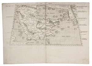
Sexta Asiae tabula.
Verlag: Petrus de Turre,, [Rome,, 1490
Anbieter: Antiquariaat FORUM BV, Houten, Niederlande
Verkäuferbewertung 5 von 5 Sternen
EUR 50.000,00
EUR 25,00 Versand
Versand von Niederlande nach USAAnzahl: 1 verfügbar
In den WarenkorbSecond map of the Arabian peninsula ever published, in its first state. It was originally engraved as part of the extraordinary 1478 Rome edition of Ptolemy's Geographia, and the map was preceded by only the one published in the less detailed and crudely engraved Bologna edition published in 1477. It shows the city of Medina (Lathrippa) and the archaeological sites of Zubarah (Catara), and Al-Dur (Domana). The association of Macoraba with Mecca is disputed.The 1478 Geographia was created under the direction of Conrad Sweynheym, who together with Arnold Pannartz introduced printing to Italy, and after his death in 1477 finished by his successor Arnold Buckinck. The edition was planned as early as 1474 and possibly even 1473 and the plates were likely engraved before the publication of the 1477 Bologna edition. These two atlases contain the earliest copperplate maps ever produced and Sweynheym's careful experiments clearly paid off: "its firm, sure lines and crisp impression are in sharp contrast to the rather crudely engraved and muddily printed Bologna edition" (Karrow). "Many consider the Rome plates to be the finest Ptolemaic plates produced until Gerard Mercator engraved his classical world atlas of 1578" (Shirley). Christopher Columbus bought a copy.The map was reprinted unchanged in the Rome edition of 1490, published by De Turre, and again in a 1507 edition, reissued in 1508. It is here printed on two folio leaves, each watermarked with a cardinal's hat (the two slightly different and probably the twins of a single paper stock). They are very close to Briquet 3391 (Florence 1491), so our map probably comes from the 1490 edition.Some faint stains along the edges of the paper and in the gutter, small restoration in gutter of the lower margin and a very minor tear near the upper left corner. In good condition.l Campbell, Earliest printed maps, map 141 & atlas D42 (pp. 131-133), cf. pp. 122-127, 223-225; Nordenskiöld 201, map 21; Tibbetts 4 note; cf. Al Ankary 3 (1511?); Karrow 32/B1 (atlas, 1478 ed.); Shirley, Maps in atlases T.POL-2c (atlas, 1490 ed.); Shirley, Mapping of the world 4 note (atlas, 1490 ed.). Mounted on paper board, in a modern gilt frame (50.5 x 67 cm). Engraved map of the Arabian peninsula (topographic image 25.5 x 46 cm) printed, as usual, on two joined folio leaves (together 39.5 x 56 cm).
-
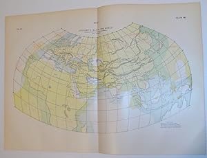
Ptolemy's Map of the World - Compared with the Actual positions, After H. Kiepert
Verlag: Publisher Not Stated, UK, 1902
Anbieter: RareNonFiction, IOBA, Ladysmith, BC, Kanada
Verbandsmitglied: IOBA
Verkäuferbewertung 5 von 5 Sternen
Karte Erstausgabe
Map. Zustand: Very Good. First Edition. Outside dimensions 14.5" x 10.5". Circa 1902. Centerfold. Light wear. Please see our photo for details.; Folio - over 12" - 15" tall; Ptolemy's Map of the World H. Kiepert.
-

Starye karty velikoi Russkoi imperii : Ptolemei i Ortelii v svete novoi khronologii
Anbieter: Palimpsest Scholarly Books & Services, Brooktondale, NY, USA
Verkäuferbewertung 5 von 5 Sternen
Erstausgabe
Hardcover. Zustand: Fine. 1st Edition. Hardcover volume, measuring approximately 6.25" x 9", display light shelfwear. Work is profusely illustrated with map reproductions, with some facsimiles in color. 631 pages. This work of cartography presents the first Russian-language commentary on Ptolemy's "Geographia" (1540), Corneille Wytfliet's "Descriptionis Ptolemaicae augmentum" (1597) and the 1564 "Typus orbis terrarum" of Abraham Ortelius, an eight-leaved wall map of the world.
-
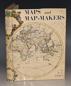
Maps and Map-Makers. (standard map reference book). First edition.
Verlag: B.T. Batsford Ltd., 1949 1st edition 1949 1st edition, 1949
Anbieter: PROCTOR / THE ANTIQUE MAP & BOOKSHOP, DORCHESTER, Vereinigtes Königreich
Verbandsmitglied: PBFA
Verkäuferbewertung 5 von 5 Sternen
EUR 13,00
EUR 22,95 Versand
Versand von Vereinigtes Königreich nach USAAnzahl: 1 verfügbar
In den WarenkorbHardback, 10 x 7.5 inches. In light brown cloth covers with red lettering to spine. With pictorial dustwrapper. In very good condition with very good dustwrapper. (DW some foxing, some rubbing to edges and corners, small tear/nick to bottom end of spine. In protective sleeve, Not price clipped.) Cover clean and smart. Some minor light foxing to endpapers, neat inscription and bookplate to front, some mild foxing to outer page edges. Plates clean and bright. Else a very good clean and tight copy. 128pp. Illustrated with 95 colour & B&W plates.
-
![Beispielbild für Letters of the Four Voyages to the New World. Reprinted in Facsimile and Translated from the Rare Original Edition (Florence, 1505 - 6) by Bernard Quaritch [i. e.: Lettera delle isole nuovamente trovate in quattro suoi viaggi] zum Verkauf von HJP VERSANDBUCHHANDLUNG](https://pictures.abebooks.com/isbn/9783925682322-de-300.jpg)
Letters of the Four Voyages to the New World. Reprinted in Facsimile and Translated from the Rare Original Edition (Florence, 1505 - 6) by Bernard Quaritch [i. e.: Lettera delle isole nuovamente trovate in quattro suoi viaggi]
Verlag: WAYASBAH, Hamburg, 1992
ISBN 10: 3925682325 ISBN 13: 9783925682322
Anbieter: HJP VERSANDBUCHHANDLUNG, WEDEL, SH, Deutschland
Verkäuferbewertung 4 von 5 Sternen
Paperback. Zustand: Good. X + 16 (non-numbered) + 45 p. Text in English and Italien; includes Facsimile of 5 Woodcuts; 1 Fold-out map (Admiral's Map) by Martin Waldseemüller for the 1513 Strassburg Ptolemy Edition. Reprint of the Edition: Bernard Quaritch, London, 1893. [WAYASBAH PUBLICATION ; 32].