
Gesamtpreis (1 Artikel Artikel):
Versandziel:

gerardus mercator atlas 1595 (31 Ergebnisse)
Feedback
Direkt zu den wichtigsten Suchergebnissen
Suchfilter
Produktart
- Alle Product Types
- Bücher (27)
- Magazine & Zeitschriften (Keine weiteren Ergebnisse entsprechen dieser Verfeinerung)
- Comics (Keine weiteren Ergebnisse entsprechen dieser Verfeinerung)
- Noten (Keine weiteren Ergebnisse entsprechen dieser Verfeinerung)
- Kunst, Grafik & Poster (1)
- Fotografien (1)
- Karten (2)
- Manuskripte & Papierantiquitäten (Keine weiteren Ergebnisse entsprechen dieser Verfeinerung)
Zustand Mehr dazu
- Neu (2)
- Wie Neu, Sehr Gut oder Gut Bis Sehr Gut (5)
- Gut oder Befriedigend (2)
- Ausreichend oder Schlecht (Keine weiteren Ergebnisse entsprechen dieser Verfeinerung)
- Wie beschrieben (22)
Einband
Weitere Eigenschaften
- Erstausgabe (2)
- Signiert (Keine weiteren Ergebnisse entsprechen dieser Verfeinerung)
- Schutzumschlag (Keine weiteren Ergebnisse entsprechen dieser Verfeinerung)
- Angebotsfoto (21)
Sprache (3)
Preis
- Beliebiger Preis
- Weniger als EUR 20 (Keine weiteren Ergebnisse entsprechen dieser Verfeinerung)
- EUR 20 bis EUR 45
- Mehr als EUR 45
Gratisversand
Land des Verkäufers
Verkäuferbewertung
-
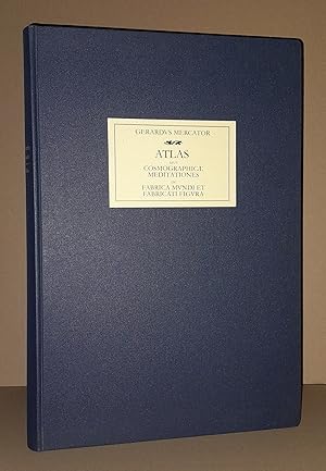
Atlas Gerardus Mercator 1595. Atlas sive Cosmographicae meditationes de fabrica mundi et fabricati figura.
Verlag: Lachen am Zürichsee: Coron o.J. (ca. 2000)., 2000
Sprache: Deutsch
Anbieter: Kunsthandlung Primavera Birgit Stamm, Dortmund, Deutschland
Verkäuferbewertung 5 von 5 Sternen

EUR 102,00
Währung umrechnenEUR 3,00 für den Versand innerhalb von/der DeutschlandAnzahl: 1 verfügbar
In den WarenkorbZustand: Sehr gut. Sehr gutes Exemplar einer undatierten Ausgabe, laut Impressum für die Freunde des Hauses Coron. Minimalste Gebrauchsspuren, sehr schönes und dekoratives Exemplar. Großformatiges Faksimile (Format ca. 45 X 33 cm) in Originalgröße nach dem kolorierten Exemplar der Fürstlich Fürstenbergischen Hofbibliothek Donaueschingen. BITTE BEACHTEN SIE: VERSAND INS AUSLAND MOMENTAN NUR in die USA, Japan, Großbritannien, Schweiz, Irland, Frankreich, Spanien, Italien, Österreich, Belgien und die Niederlande! PLEASE NOTE: SHIPPING TO FOREIGN COUNTRIES AT THE MOMENT ONLY to the USA, Japan, Great Britain, Switzerland, Ireland, France, Spain, Italy, Austria, Belgium and the Netherlands! Schneller Versand auf Rechnung (Vorauszahlung vorbehalten) mit der Post bzw. DHL. Sprache: Deutsch Gewicht in Gramm: 6000 2°. 264 n.n. S. und 31 S. Kommentar und Inhaltsverzeichnis. Mit 57 doppelblattgroßen kolorierten Karten, 4 kolorierten Titeln und einem Porträt Mercators, sowie weiteren Abbildungen im Kommentarteil. Brauner Orig.-Ganzlederband auf 6 Bünden mit Gold- und Blindprägung im Orig.-Papp-Schuber.
-
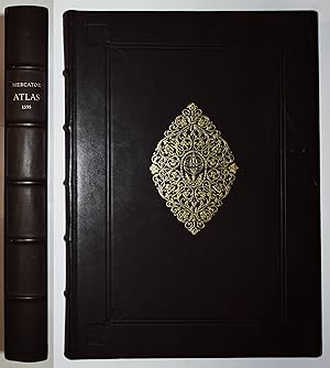
Atlas Gerardus Mercator 1595. Atlas sive Cosmographicae meditationes de fabrica mundi et fabricati figura.
Verlag: Lachen am Zürichsee: Coron, 1979
Sprache: Deutsch
Anbieter: Kunsthandlung Primavera Birgit Stamm, Dortmund, Deutschland
Verkäuferbewertung 5 von 5 Sternen
EUR 107,50
Währung umrechnenEUR 3,00 für den Versand innerhalb von/der DeutschlandAnzahl: 1 verfügbar
In den WarenkorbZustand: Sehr gut. Sehr gutes Exemplar der Ausgabe 1979. Großformatiges Faksimile (Format ca. 45 X 33 cm) in Originalgröße nach dem kolorierten Exemplar der Fürstlich Fürstenbergischen Hofbibliothek Donaueschingen. BITTE BEACHTEN SIE: VERSAND INS AUSLAND MOMENTAN NUR in die USA, Japan, Großbritannien, Schweiz, Irland, Frankreich, Spanien, Italien, Österreich, Belgien und die Niederlande! PLEASE NOTE: SHIPPING TO FOREIGN COUNTRIES AT THE MOMENT ONLY to the USA, Japan, Great Britain, Switzerland, Ireland, France, Spain, Italy, Austria, Belgium and the Netherlands! Schneller Versand auf Rechnung (Vorauszahlung vorbehalten) mit der Post bzw. DHL. Sprache: Deutsch Gewicht in Gramm: 6000 2°. 264 n.n. S. und 31 S. Kommentar und Inhaltsverzeichnis. Mit 57 doppelblattgroßen kolorierten Karten, 4 kolorierten Titeln und einem Porträt Mercators, sowie weiteren Abbildungen im Kommentarteil. Brauner Orig.-Ganzlederband auf 5 Bünden mit Gold- und Blindprägung im Orig.Schuber.
-
Atlas sive Cosmographicae meditationes de fabrica mundi et fabricati figura [Gerardus Mercator Atlas 1595 (Faksimile)].
Verlag: Coron bei Kindler Verlag, Berlin, 2008
Anbieter: Nicoline Thieme, Leipzig, Deutschland
Verbandsmitglied: GIAQ
Verkäuferbewertung 4 von 5 Sternen

EUR 140,00
Währung umrechnenEUR 11,00 für den Versand innerhalb von/der DeutschlandAnzahl: 1 verfügbar
In den WarenkorbZustand: Sehr gut. Gr.2° Faksimileteil:134 Blätter, Einführungsteil: 31 (1) Seiten; Orig.-Ledereinband; 4920g; [Deutsch]; Ecken minimal berieben, sonst wie neu Diese Faksimile-Ausgabe basiert auf ein in der Fürstlich Fürstenbergischen Hofbibliothek Donaueschingen befindlichen Exemplar der ersten vollständigen Ausgabe des Mercator-Atlas von 1595. Es sind neben der Welt- und den Kontinentalkarten, die Generalkarten der europäischen Länder, sämtliche Regionalkarten von Österreich und der Schweiz und des Bereichs "Germania" enthalten - somit ist dieses Kartenwerk eine Art "Europa-Atlas". _ xQx_. BUCH.
-

Atlas sive Cosmographicae meditationes de fabrica mundi et fabricati figura (Gerardus Mercator: Atlas 1595). Faksimile (Teilfaksimile) der Ausgabe Duisburg 1595 - Faksimile nach dem kolorierten Exemplar der Fürstlich Fürstenbergischen Hofbibliothek Donaueschingen. Mit einer Einführung zum Faksimile am Schluß des Bandes.
Verlag: Coron Verlag, Lachen am Zürichsee, 2001
Anbieter: AixLibris Antiquariat Klaus Schymiczek, Aachen, Deutschland
Verbandsmitglied: BOEV
Verkäuferbewertung 5 von 5 Sternen
EUR 180,00
Währung umrechnenEUR 3,00 für den Versand innerhalb von/der DeutschlandAnzahl: 1 verfügbar
In den WarenkorbGroß-Folio (45,2 x 33 cm). 134 Faksimileblätter (= 268 S.), 31(1) S. Einführung zum Faksimile. Brauner OLederband auf 5 imit. Bünden, mit Schwarzprägung auf beiden Deckeln, goldgepr. Supralibro auf dem Vorderdeckel und schwarzgepr. Supralibro auf dem hinteren Deckel. Mit 57 farbigen, doppelseitigen Karten, 4 farb. ill. Titeln nach kolorierten Kupferstichen, 1 Portrait nach einem Kupferstich und einigen faks. Textseiten sowie einigen teils farbigen Abbildungen in der Einführung. Einband nur minimal berieben und bestoßen. Druck auf (beschnittenem) Bütten.
-

El Atlas de Gerardus Mercator
Anbieter: Agapea Libros, Malaga, MA, Spanien
Verkäuferbewertung 5 von 5 Sternen
EUR 37,95
Währung umrechnenEUR 6,41 für den Versand von Spanien nach DeutschlandAnzahl: 3 verfügbar
In den WarenkorbZustand: New. Idioma/Language: Espańol. El Art Book del ?Atlas de Gerardus Mercator? analiza uno de los atlas más espectaculares de todos los tiempos, que detalla hasta el más mínimo detalle un mundo en expansión en pleno siglo XVI. El estudio viene a cargo de Kevin R. Wittmann, un apasionado historiador que sumergirá al lector en el conocimiento de la cartografía y la historia en un ambiente fresco y claro para que cualquiera pueda disfrutar de principio a fin, hasta el último detalle. El libro comienza contando la biografía de Gerardus Mercator, una de las mentes más brillantes del campo geográfico, cuya reputación y trabajo han sido reconocidos mundialmente hasta la actualidad. De origen humilde y mente prometedora. Posteriormente, se da paso a la introducción donde se profundiza en el contexto global sin el cual no se tendría una visión objetiva y completa de toda la cartografía moderna. El siguiente capítulo, ?Abriendo ventanas al mundo?, nos cuenta cómo se forjó la amistad entre Gerardus Mercator y Abraham Ortelius, relación que marcaría un punto de inflexión en la historia de la cartografía. Destaca una de las grandes contribuciones que hizo, el mapamundi que cambiaría la historia de la cartografía para siempre: Nova et Aucta Orbis Terrae Descriptio ad Usum Navigantium Emendate Accommodata, que constituyó los fundamentos de la proyección de Mercator, teoría utilizada hasta día de hoy. Tuvo grandes relaciones con la nobleza: realizó varios instrumentos científicos por encargo de Carlos V, como el globo terráqueo de la izquierda, fue cosmógrafo del Duque Guillermo de Jülich-Cléveris-Berg? El tercer capítulo: ?El mundo en un libro. La creación del Atlas? curiosamente comienza con la muerte de Mercator, quien había planeado un proyecto tan ambicioso que no pudo ver su obra terminada. Así fueron sus hijos quienes terminaron, en 1595, Atlas sive Cosmographicae meditationes de fabrica mundi et fabricati figura. El objeto de este estudio es la segunda edición de la obra en gran formato, que ejemplifica perfectamente la importancia de la obra de Mercator en la historia de la cartografía. ?El atlas de la Biblioteca Histórica de Salamanca? es el último capítulo y el más extenso, consta de unas 200 páginas, donde se realiza un análisis profundo y completo sobre cada mapa del ejemplar que nos ocupa, la edición de 1607. La clave del Atlas es la interrelación de las imágenes y los textos que las acompańan, lo que otorga a la obra su carácter enciclopédico. Para la elaboración de este Art Book, hemos contado con la aportación del fondo gráfico de gran multitud de bibliotecas de todo el mundo, entre las que destacan, la British Library, la Biblioteca Histórica de Salamanca, la Biblioteca Nacional de Francia (BnF)? *** Nota: Los envíos a Espańa peninsular, Baleares y Canarias se realizan a través de mensajería urgente. No aceptamos pedidos con destino a Ceuta y Melilla.
-

Atlas. 1595. Faksimile Ausgabe.
Verlag: Stgt./Zürich/Wien, Coron-Vlg., 1980
Anbieter: Antiquariat Kai Groß, Gleichen OT Bischhausen, Deutschland
Verkäuferbewertung 5 von 5 Sternen
EUR 95,00
Währung umrechnenEUR 3,00 für den Versand innerhalb von/der DeutschlandAnzahl: 1 verfügbar
In den WarenkorbGr.-Folio. [240] S. m. 66 mehrfarb. Karten u. 31 S. Anhang, dazu 1 beigelegte Faltkte., brauner Ldr. -E. mit 5 unechten Bünden u. goldgeprägt. Medaillons auf vorderem u. hinterem Deckel 1-2, in Schuber.
-
ATLAS sive COSMOGRAPHICAE MEDITATIONES de FABRICA MUNDI ET FABRICATI FIGURA.
Verlag: Originalausgabe Duisburg 1595, unveränderter Faksimilereprint 2010., 1595
Anbieter: TINTENKILLER, Dortmund, NRW, Deutschland
Verkäuferbewertung 5 von 5 Sternen
EUR 95,00
Währung umrechnenEUR 5,00 für den Versand innerhalb von/der DeutschlandAnzahl: 1 verfügbar
In den WarenkorbLeineneinband mit Titelschild, Seiten nicht numeriert, 46x31 cm, 2418 gr. Numeriertes Exemplar (Nr. 083) des auf 499 Exemplare limitierten Nachdrucks, hergestellt von Fines Mundi Saarbrücken für die Buchversender Rhenania und Akzente. Sprache: deutsch. Gut erhaltenes Exemplar.
-
Atlas sive cosmographicae meditationes de fabrica mundi et fabricati figura.
Verlag: Coron (ohne Jahr), Lachen am Zürichsee
Anbieter: terrahe.oswald, Gangkofen, Deutschland
Verkäuferbewertung 5 von 5 Sternen
EUR 100,00
Währung umrechnenEUR 3,00 für den Versand innerhalb von/der DeutschlandAnzahl: 1 verfügbar
In den WarenkorbFolio. Mit 4 farbigen Titeln, 57 doppelblattgroßen farbigen Karten und zahlreichen, meist farbigen Textabbildungen. 31,(1) S. (Kommentar). Orig.-Lederband mit goldgeprägtem Deckeltitel und blindgeprägtem Deckelornament. Faksimiledruck des Mercator-Atlas nach der Ausgabe Duisburg 1595, exclusiv für die Freunde des Hauses Coron. - Schönes Exemplar.
-
Atlas sive cosmographicae meditationes de fabrica mundi et fabricati figura. Faksimiledruck des Mercator-Atlas nach der Ausgabe Duisburg 1595. 4 farb. Titeln, 57 doppelblattgroßen farbigen Karten.
Verlag: Coron, 1995
Anbieter: Klaus Schöneborn, Würzburg, Deutschland
Verkäuferbewertung 4 von 5 Sternen
EUR 100,00
Währung umrechnenEUR 3,20 für den Versand innerhalb von/der DeutschlandAnzahl: 1 verfügbar
In den Warenkorb0. Folio 31 S. (Kommentar) Leder im Stil der Zt., dreiseit. Goldschnitt. Sprache: Deutsch 1.100 gr. Leder im Stil der Zt., dreiseit. Goldschnitt.
-
Atlas sive cosmographicae meditationes de fabrica mundi et fabricati figura.
Verlag: Stuttgart, Lachan am Zürichsee, Wien, Coron, o.J. [1979]., 1979
Sprache: Deutsch
Anbieter: Antiquariat J. Hünteler, Hamburg, Deutschland
Verbandsmitglied: GIAQ
Verkäuferbewertung 5 von 5 Sternen
EUR 500,00
Währung umrechnenEUR 5,50 für den Versand innerhalb von/der DeutschlandAnzahl: 1 verfügbar
In den WarenkorbZustand: Sehr gut. 139 ungezählte Blätter, 32 Seiten. Mit 4 farbigen Titelblättern, 57 doppelblattgr. farbige Karten, 1 s/w Illustration (Porträt Gerardus Mercator) und zahlreichen teils farbigen Abbildungen im Einführungstext. Vorliegende Faksimile-Ausgabe basiert auf der ersten vollständigen Ausgabe des Mercator-Atlas aus dem Jahre 1595 nach dem Exemplar aus der Fürstlich Fürstenbergischen Hofbibliothek in Donaueschingen. Einband nach einem Original aus der Württembergischen Landesbibliothek Stuttgart. Coron-Exklusiv-Ausgabe die nicht im Handel bezogen werden konnte. - Gutes Exemplar. 114861_Atlanten Sprache: Deutsch Gewicht in Gramm: 550 Folio, 45 x 33 cm, OLdr. mit reicher dekorativer Blindprägung.
-
Atlas sive Cosmographicae Meditationes de Fabrica Mundi et Fabricati Figura.
Verlag: Lachen am Zürichsee, Coron Verlag, 2001
Anbieter: Antiquariat Lenzen, Düsseldorf, Deutschland
Verbandsmitglied: GIAQ ILAB VDA
Verkäuferbewertung 5 von 5 Sternen
EUR 120,00
Währung umrechnenEUR 8,90 für den Versand innerhalb von/der DeutschlandAnzahl: 1 verfügbar
In den Warenkorb2°. 45 x 34 cm. [258] Faksimile-Seiten, 30 Seiten Anhang. Original-Ganzlederband mit goldgeprägtem Deckelornament. Faksimile-Ausgabe des Mercator-Atlas von 1595, exklusiv erschienen für die Freunde des Hauses Coron. Zweisprachige Ausgabe in Latein (Faksimiletext) und Deutsch (Begleittext). Mit farbig illustriertem Titelblatt, Portraitkupfer, 57 doppelseitigen kolorierten Karten und 30-seitigem Anhang: "Gerardus Mercator - Atlas 1595. Einführung". Einband nur leicht berieben, ansonsten tadelloses Exemplar. Facsimile edition of the Mercator Atlas of 1595, published exclusively for the Friends of the publishing house Coron. Bilingual edition in Latin (facsimile text) and German (accompanying text). With colour illustrated title page, portrait copper engraving, 57 double-page coloured maps and 30-page appendix: "Gerardus Mercator - Atlas 1595. Introduction". Binding only slightly rubbed, otherwise an impeccable copy. Sprache: Deutsch und Latein.
-
Atlas sive Cosmographicae meditationes de fabrica mundi et fabricati figura. [Faksimile der Ausgabe von 1595.]
Verlag: Zürich, Coron, ,, 1980
Anbieter: Books & Art, Reichenbach, Deutschland
Verkäuferbewertung 5 von 5 Sternen
EUR 150,00
Währung umrechnenEUR 13,20 für den Versand innerhalb von/der DeutschlandAnzahl: 1 verfügbar
In den WarenkorbFolio, Leder-Einband im Schuber, Einband schwach berieben, sehr guter, sauberer Zustand. Sprache: Deutsch.
-
400 Jahre Mercator-Atlas 1595-1995. Atlas sive Cosmographicae meditationes de fabrica mundi et fabricati figura.Num. Exemplar Nr.1243 einer Auflage von 1995 Exemplaren. o. J. um 1990
Verlag: Verlag: Coron. o.J. um 1990, Lachen am Zürichsee., 1990
Anbieter: Buecherstube Eilert, Versandantiquariat, Dresden, DD, Deutschland
Verkäuferbewertung 5 von 5 Sternen
EUR 260,00
Währung umrechnenEUR 7,00 für den Versand innerhalb von/der DeutschlandAnzahl: 1 verfügbar
In den Warenkorb2° 45 x 33,5 cm mit 10 n.n. Blatt, 58 doppelblattgroßen farbigen Karten nebst Beschreibung sowie 31 Seiten Einführung in das Werk Mercators mit einigen Abbildungen und Illustrationen. Exemplar Nr.1243 .Gebunden in gold- und blindgeprägtem Ganzleder mit faksimiliertem Rückenschildchen, Goldschnitt, Messingbeschlägen und 2 Messing-Schließen,sehr guter Zustand, neuwertig in original Styropor-Verlagsbox. 25, Wg, neu Sprache: de.
-

400 Jahre Mercator-Atlas 1595-1995. Atlas sive Cosmographicae meditationes de fabrica mundi et fabricati figura.
Verlag: Coron, Lachen am Zürichsee
Anbieter: Antiquariat Friederichsen, Hamburg, Deutschland
Verbandsmitglied: BOEV
Verkäuferbewertung 5 von 5 Sternen
EUR 450,00
Währung umrechnenEUR 10,00 für den Versand innerhalb von/der DeutschlandAnzahl: 1 verfügbar
In den Warenkorb( Ohne Erscheinungsjahr - offenbar 1995 erschienen ) ( Nummeriertes Exemplar Nr. 1913 einer Auflage von 1995 nummerierten Exemplaren ) Faksimile der Ausgabe Duisburg 1595 nach dem Exemplar der Fürstenbergischen Hofbibliothek Donaueschingen. Mit 10 n.n. Blättern, 58 doppelblattgroßen farbigen Karten nebst Beschreibung sowie 31 Seiten Einführung in das Werk Mercators mit einigen Abbildungen und Illustrationen. Gebunden in gold- und blindgeprägtem Original-Ganzleder mit faksimiliertem Rückenschildchen, Goldschnitt, Messingbeschlägen und 2 Messing-Schließen, Folio ( 45 x 33,5 cm ). Von insgesamt guter und dekorativer Erhaltung. ( Gewicht 5500 Gramm ) ( Weitere Bilder auf Anfrage erhältlich ) Artikel 12966 /// No year of publication - apparently published in 1995 ) ( Numbered copy no. 1913 of an edition of 1995 numbered copies ) Facsimile of the Duisburg 1595 edition after the copy in the Fürstenbergische Hofbibliothek Donaueschingen. With 10 leaves n.d., 58 double-page coloured maps with descriptions and 31 pages of introduction to Mercator's work with several illustrations. Bound in gold and blind-stamped full leather with facsimile spine label, gilt edges, brass mountings and 2 brass clasps, folio ( 45 x 33.5 cm ). In overall good and decorative condition. ( weight 5500 gram ) ( more pictures available on request ) item 12966.
-

Hispaniae Novae Nova Descriptio
Verlag: Ámsterdam, 1616
Anbieter: Bolivar Old Prints Anticuario, Barcelona, B, Spanien
Verkäuferbewertung 4 von 5 Sternen
Karte
EUR 490,00
Währung umrechnenEUR 20,00 für den Versand von Spanien nach DeutschlandAnzahl: 1 verfügbar
In den WarenkorbSin Encuadernar. Zustand: Bueno. Muy decorativo mapa original de Nueva Espańa de 1616, realizado por el afamado Gerardus Mercator y Jodocus Hondius. Abarca desde la Ciudad de México hasta la costa del Pacífico en el occidente y hacia el norte hasta Michoacán. Cartográficamente hablando, el mapa de Mercator está fuertemente influenciado por el de Ortelius de 1579 de la misma región. Aunque no estamos seguros de cuáles fueron las fuentes de Ortelius, este mapa exhibe una combinación de elementos cartográficos tanto conocidos, como especulativos. La Ciudad de México aparece rodeada por agua, tal como la conocieron los espańoles. En la época en la que este mapa antiguo fue trazado, buena parte del territorio comprendido entre la Ciudad de México y los puertos de la costa del Pacífico, así como las zonas mineras ubicadas al norte y el oeste, ya habían sido cartografiados por los conquistadores. El Lago Chapala (Chapalicum Mare), por ejemplo, está correctamente situado y trazado. Sin embargo, conforme el mapa se extiende más al norte, a regiones vagamente exploradas, la cartografía se vuelve más especulativa. Indica sitios como Puebla (Angelorum), Cuernavaca, Colima, Guadalajara, Michoacán, entre otros. Contiene un ornamentado cartouche con el título, una leyenda que indica sitios destacados, un monstruo marino y un navío. Gerardus Mercator es uno de los dos grandes personajes de la cartografía antigua, junto con Abraham Ortelius. Geógrafo, cartógrafo y matemático flamenco, nació en Rupelmundo, Bélgica en 1512 y murió en Duisburgo, Alemania en 1594, justo antes de la publicación de su gran atlas en 1595. Fue el primero en usar el término atlas para referirse a un libro que contiene mapas de todo el mundo e inventó la famosa proyección que lleva su nombre y que se sigue usando en la actualidad. Tal fue la demanda de sus mapas que una versión más pequeńa de su Atlas Minor fue publicada en 1607 por Jan Jansson, con mapas grabados por Jodocus Hondius. Esta obra tuvo varias ediciones, algunas de ellas traducidas a otros idiomas, hasta que, en 1628, Jan Jansson el joven publicó una nueva edición con mapas de Pieter van den Keere y Abraham Goos. 37 x 49.5 cm. FRA. Very good.
-
Cl. Ptolemaei Alexandrini, geographiae libri octo, recogniti iam et diligenter emendati cum tabilis geographicis ad mentem auctoris restitutis ac emendatis, per Gerardum Mercatorem, Illustriß. Ducis Cliuensis etc. Cosmographum BOUND WITH Italiae, Sclavoniae et Grćcić tabulae geographicae, Per Gerardum Mercatorem Illustrußimi Ducis Juliae, Cliuiae, &c. Cosmographum Duysburgi editć
Verlag: Gottfried von Kempen & Mercator, Cologne & Duisburg, 1584
Erstausgabe
EUR 60.667,24
Währung umrechnenEUR 30,21 für den Versand von USA nach DeutschlandAnzahl: 1 verfügbar
In den WarenkorbHardcover. Zustand: Very good. Second. MERCATOR'S PTOLEMAIC AND ITALIAN ATLAS IN BOARDS, WITH OUTSTANDING CONTEMPORARY COLOR. Geographia: Cologne: Gottfried von Kempen, 1584. Second edition. Italia: [Duisburg: Mercator, 1589.] First edition. Folio in 6s and 2s (15 1/2" x 10 1/2", 395mm x 268mm). [Full collation avaioable.] With two hand-colored engraved title-pages and 43 (Geographia: 26 of 28, Italia: 17 of 22) double-page hand-colored engraved maps integral with the text, Italia extra-illustrated with a double-page hand-colored engraved map "Europa ad magnae Europae Gerardi Mercatoris P. imitationem Rumoldi Mercatoris" (Duisberg, ca. 1595; the first state, without text verso). Bound in later (XVIIIc?) paste-paper-covered boards backed in vellum (re-backed, with the original back-strip laid down). Ink manuscript title to the front cover (ligatured): "librx eńrmi/ ~PTLs~" with the Trisagion (hymn) in Greek in four lines above. On the spine, the author, title and date in ink manuscript. All edges of the text-block speckled blue. Re-backed, with the original back-strip laid down. Rubbed and worn, with some soiling. Mild tanning, in some places moderate, with the odd spot of soiling or foxing. Lacking 2 maps in the Geographia and 5 maps in the Italia; extra-illustrated with a 1595 Rumold Mercator map of Europe. Pigment oxidation throughout, with resultant cracking at the spine of quire N (Africae Tabula IIII). Scattered peripheral tears. Worming to the lower margin of the first three and final three leaves, not affecting the text. The free edges of the final two leaves extended. A worn graphite gift inscription to the recto of the front free end-paper seemingly repeated in ink along the verso of the same leaf. Oval blind-stamp to a paster paper label at the head of the title-leaf, repeated in ink verso. Claudius Ptolemaeus (usually anglicized to Ptolemy) was a second-century philosopher living in Roman Alexandria in Egypt. No manuscripts his Geographike Hyphegesis (Geographical Guidance; in Latin this is usually rendered Geographicae enarrationis libri octo or "eight books of geographical explanation") survive from before the XIIIc, but some XIIIc examples survive with maps that bear some relation to those Ptolemy himself drew. It was crucial to explorers; Columbus expected to find the East Indies because of Ptolemy's calculations and assertions about longitude. As the world expanded beyond its ancient bounds, discoveries were integrated into the Ptolemaic maps, distinct with their trapezoidal frames. Gerardus Mercator (1512-1594) pioneered the projection that bears his name and established the recognizable modern world map. Called by Ortelius (to whom the Geographia is dedicated) the modern Ptolemy, he edited the text of the Geographia in 1576, and was able to "correct" maps -- i.e., to present a Ptolemaic rather than a modern conception of the three continents (Europe, Africa, Asia) -- to conform to the revised text. There is a particularly strong emphasis on the (ancient) mapping of Asia. The present example has unusually rich color, which has oxidized over the centuries to tan the cellulose of the paper, while keeping the vibrant oranges intact. Bound with the Geographia is the (eventual) fifth part of Mercator's Atlas -- the first book so-called (and meaning, roughly, "a book of maps published at the same size"), published in six parts from 1585 to 1595 -- published at Duisburg in 1589: Italy, "Sclavonia" (the lands of the (South) Slavs, i.e., modern Bosnia, Herzegovina, Croatia, Serbia, Slovenia etc.) and Greece. Although a "custom" combination of works, it's not uncommon to find individual parts of the eventual Atlas combined with Mercator's Ptolemy. It speaks, seemingly, to a particularly south-eastern European purchaser. Geographia: VD-16 P 5219; Italia: Van der Krogt/Koeman 1:002A.
-
Theatrum oder Schawplatz des Erdbodems, warin das die Landttafell der gantzen welt, mitt sambt ainer der selben kurtze erklarung zu ersehn ist.
Verlag: (Colophon: Antwerp: Gielis von Diest, 1572-[1573]) Durch Abrahamum Ortelium. c. 1572, [ & 1570 -1595], 1572
Anbieter: Alexandre Antique Prints, Maps & Books, Toronto, ON, Kanada
Verkäuferbewertung 5 von 5 Sternen
Erstausgabe
EUR 84.445,25
Währung umrechnenEUR 7,34 für den Versand von Kanada nach DeutschlandAnzahl: 1 verfügbar
In den WarenkorbExpertly rebacked in style; saving the armorial, seventeenth century, heavily gilt panelled, full red calf, with Louis xiv?s fleur-de-lis bookplates on upper and lower covers; spine raised with six (6) bands, gilt ornamented compartments and gilt lettered title on two; inner gilt dentelles. , [The 1572 German special edition plus other early maps].First very rare, German 1572 edition in contemporary colour [bound with] maps from editions up to 1595. 1572 Atlas with text in German and captions in Latin; extra plates in Latin, one in Spanish. [A5v] Ortelius, publ., ?Abraham Ortelius or Ortels or Orthellius or Wortels (1527?1598) was a ? cartographer, geographer, and cosmographer, conventionally recognized as the creator of the first modern atlas, the Theatrum Orbis Terrarum? Along with Gemma Frisius and Gerardus Mercator, Ortelius is generally considered one of the founders of the Netherlandish school of cartography and geography. He was also one of the most notable figures of the school in its golden age (approximately 1570s?1670s). The publication of his atlas in 1570 is often considered as the official beginning of the Golden Age of Netherlandish cartography. ? On 20 May 1570, Gilles Coppens de Diest at Antwerp issued Ortelius's Theatrum Orbis Terrarum, the "first modern atlas" (of 53 maps)? Three Latin editions of this (besides a Dutch, a French, and a German edition) appeared before the end of 1572. ?? Tooley states: "The publication of this atlas marked an epoch in the history of cartography. It was the first uniformly sized, systematic collection of maps of the countries of the world based only on contemporary knowledge". ?The present work is the first German edition, of the Theatrum with the German title ?Theatrum oder Schawplatz des Erdtbodems, ?? The plates are identical; however, the Index/ Register is reduced/ absent as explained at A5v of the German edition or Ortelius? to the Reader or ?Abraham Ortelius// Zum guetwilligen Leser.? Shirley states: ?From the first atlas in 1570 with 53 map sheets, the work grew in size so that the final edition in 1612 contained over 160 items. Initially, new maps were issued through a series of Additamenta between 1573 and 1597; in addition, a classical addendum, called the Parergon was produced from 1579 onwards.? "Shape and contents set the standards for later atlases, when the centre of the map-trade moved from Antwerp to Amsterdam. The characteristic feature of the Theatrum is, that it consists of two elements, forming part of a unitary whole: text and maps. This concept for a 'Theatre of the world' was followed through the 17th century. Before Ortelius no one had done this" (Koeman). Koeman (1961) mentions [on p.138/ under 49.1] the 1572 German text edition following its 1570 Latin ?Theatrum orbis terrarum? , Size : Folio (414x285mm), Illustrated allegorical title; ornamental woodcut initials at openings (of poetry, dedication, explanation of the allegorical title and the ?to the Reader?) as well as each of the 53 openings of explanatory texts preceding each plate; head and endpieces; all fifty-three (53) double page plates , reflecting the same plates first published in the 1570 Latin edition; and various literature mention that only the first German edition is similar to First Latin edition. moreover, the second edition had extra plates. the twenty (20) further double page plates representing twenty-eight (28) early maps [this includes small insert maps] dating up to 1595, both in contemporary hand colour and uncoloured. , References : Lilly Library, Indiana University, Bloomington, The Bernando Mendel Collection, (1964): p.42; Koeman, vol.III: pp.25-33; Shirley I: p.771, Ll: Bl., A1-6 with title and texts of poetry, dedication, explanation of allegory in title, and to the reader; [ill 53 DP plates]; [ill 20 interspersed DP plates], bl. occasional minor damp staining, map of Morocco rebacked; rare oxidization spots otherwise a very good example.
-
Mercator Atlas 1595. Atlas sive cosmographicae meditationes de fabrica mundi et fabricati figura.
Verlag: Berlin. Coron bei Kindler., 2004
Anbieter: Antiquariat Bernhardt, Kassel, Deutschland
Verkäuferbewertung 5 von 5 Sternen
EUR 87,90
Währung umrechnenEUR 3,00 für den Versand innerhalb von/der DeutschlandAnzahl: 1 verfügbar
In den WarenkorbLedereinband. Zustand: Sehr gut. Ledereinband mit Goldprägung. Zust.: Sehr gutes Exemplar. ca. 150 Seiten, Deutsch 4700g.
-
Atlas sive cosmographicae meditationes de fabrica mundi et fabricati figura. (Farbiges Faksimile der Ausgabe Duisburg 1595).
Verlag: Lachen am Zürichsee, Coron Verlag o. J. (1995)., 1995
Anbieter: Antiquariat Haufe & Lutz, Karlsruhe, BW, Deutschland
Verkäuferbewertung 4 von 5 Sternen
EUR 120,00
Währung umrechnenEUR 8,00 für den Versand innerhalb von/der DeutschlandAnzahl: 1 verfügbar
In den WarenkorbFolio. 10 unbez. Bl, 57 doppelblattgroße farbige Karten, 31, (1) S. (Kommentar). Blindgepr. OLdr. über 5 Bünden mit goldgepr. Rückentitel und Deckelvignette. Aufwendiges Faksimile des berühmten Mercator-Atlas nach dem prächtig kolorierten Exemplar der Fürsten von Fürstenberg in Donaueschingen. Die Erläuterungen beinhalten: DIE WELT DER ALTEN KARTEN, Die Anfänge, Rom, Die Wiederbelebung der Geogaphie des Ptolemeäus, Die Weltsicht des Mittelalters, Die Geheimnisse der Portolane, Welteroberung und Kartenbild: Auf dem Wege zu Mercator, Die Erdkarte des Martin Waldseemüller von 1507, Das Theatrum Orbis Terrarum des Abraham Ortelius, GERARDUS MERCATOR, LEBEN UND WERK, Die Lebensbeschreibung Mercators durch Walther Ghim im Atlas von 1595, Gerardus Mercator: Mathematiker, Geograph, Globograph und Kartograph, Die Mercator-Projektion, Verzeichnis der Werke Mercators, DER MERCATOR-ATLAS VON 1595, Die Gliederung des ersten Teils, Gliederung des Kartenteils, Erläuterungen, Die Nachwirkung des Mercator, ZUR FAKSIMILE-AUSGABE, VERZEICHNIS DER KARTEN Farbige Faksimile-Ausgabe des Mercator Atlas von 1595 nach einem Exemplar aus dem Besitz der Fürstlich Fürstenbergischen Hofbibliothek Donaueschingen. Sämtliche Karten sind genau in den Formaten des Originals reproduziert; die Farben der alten Kolorierungen wurden völlig unverändert gelassen, so dass keinerlei "Retuschen" den ursprünglichen Eindruck stören. Aus dem Inhalt: DIE WELT DER ALTEN KARTEN, Die Anfänge, Rom, Die Wiederbelebung der Geogaphie des Ptolemeäus, Die Weltsicht des Mittelalters, Die Geheimnisse der Portolane, Welteroberung und Kartenbild: Auf dem Wege zu Mercator, Die Erdkarte des Martin Waldseemüller von 1507, Das Theatrum Orbis Terrarum des Abraham Ortelius, GERARDUS MERCATOR, LEBEN UND WERK, Die Lebensbeschreibung Mercators durch Walther Ghim im Atlas von 1595, Gerardus Mercator: Mathematiker, Geograph, Globograph und Kartograph, Die Mercator-Projektion, Verzeichnis der Werke Mercators, DER MERCATOR-ATLAS VON 1595, Die Gliederung des ersten Teils, Gliederung des Kartenteils, Erläuterungen, Die Nachwirkung des Mercator, sowie Informationen zur Faksimile-Ausgabe und ein Verzeichnis der Karten. - Schönes Exemplar. Sprache: deutsch.
-
Atlas sive Cosmographiecae meditationes de fabrica mundi et fabricati fugura 1595. Angehängt: Einführung und Erläuterungen.
Verlag: Stuttgart Coron Verlag, 1978
Anbieter: Neusser Buch & Kunst Antiquariat, Neuss, NRW, Deutschland
Verkäuferbewertung 4 von 5 Sternen
EUR 195,00
Währung umrechnenEUR 6,00 für den Versand innerhalb von/der DeutschlandAnzahl: 1 verfügbar
In den Warenkorb0. Faksimile. 32x44cm. 4 Titelblätter, 57 doppels. Großformatkart., 30 Original-Texts., OLeder. Einband mit Gold- und Blindpräg., sehr schöner Zustand. Sprache: Deutschutsch 4,600 gr.
-
Atlas Sive Cosmographicae Meditationes de Fabrica Mundi et Fabricati Figura. (Faksimile der Ausgabe 1595).
Verlag: Zürich, Stuttgart, Wien, Coron-Verlag., 1980
Anbieter: Biblion Antiquariat, Zürich, ZH, Schweiz
Verbandsmitglied: GIAQ ILAB VEBUKU
Verkäuferbewertung 5 von 5 Sternen
EUR 220,00
Währung umrechnenEUR 15,00 für den Versand von Schweiz nach DeutschlandAnzahl: 1 verfügbar
In den Warenkorb46x34 cm. Faks. Atlas + 31 S. Einführung. Dunkelbrauner OLederband mit goldgepr. Rückentitel und Deckelvignette, in Schuber. Schönes Exemplar.
-
![Bild des Verkäufers für Atlas Sive Cosmographicae Meditationes de Fabrica Mundi et Fabricati Figura. [Atlas 1595]. - Faksimile - zum Verkauf von Antiquariat Friederichsen](https://pictures.abebooks.com/inventory/md/md15391663372.jpg)
Atlas Sive Cosmographicae Meditationes de Fabrica Mundi et Fabricati Figura. [Atlas 1595]. - Faksimile -
Anbieter: Antiquariat Friederichsen, Hamburg, Deutschland
Verbandsmitglied: BOEV
Verkäuferbewertung 5 von 5 Sternen
EUR 280,00
Währung umrechnenEUR 10,00 für den Versand innerhalb von/der DeutschlandAnzahl: 1 verfügbar
In den Warenkorb( Ohne Verlags, - Orts- oder Jahresangabe: Wohl im Coron-Verlag um 2001 erschienen ). Mit 57 doppelseitigen farbigen Karten sowie 31 Seiten einführendem Text mit 6 farbigen und 7 schwarz-weißen Illustrationen. Blindgeprägter Original-Ganzlederband mit goldgeprägtem Deckelsignet und goldgeprägtem schmalen Einbandrücken. Der schmale Einbandrücken mit Rückenschildchen. Folio ( 45 x 33 cm ). Einband minimal berieben, minimal fleckig - insgesamt guter Zustand. ( Gewicht 4400 Gramm )( Lagerort Illustrierte Bücher - Folio ) ( Weitere Bilder auf Anfrage erhältlich ) Artikel 13216 /// ( Without indication of publisher, place or year: probably published by Coron-Verlag around 2001 ). With 57 double-page color maps and 31 pages of introductory text with 6 color and 7 black and white illustrations. Blind-stamped original full leather binding with gold-stamped cover signature and gold-stamped narrow spine. The narrow spine with spine label. Folio ( 45 x 33 cm ). Binding minimally rubbed, minimally stained - overall good condition. ( weight 4400 gram ) ( storage location illustrated books - folio ) ( more pictures available on request ) item 13216.
-
Atlas Sive Cosmographicae Meditationes de Fabrica Mundi et Fabricati Figura. [Atlas 1595]. - Faksimile -
Anbieter: Antiquariat Friederichsen, Hamburg, Deutschland
Verbandsmitglied: BOEV
Verkäuferbewertung 5 von 5 Sternen
EUR 290,00
Währung umrechnenEUR 10,00 für den Versand innerhalb von/der DeutschlandAnzahl: 1 verfügbar
In den Warenkorb( Ohne Verlags, - Orts- oder Jahresangabe: Wohl im Coron-Verlag um 2001 erschienen ). Mit 57 doppelseitigen farbigen Karten sowie 31 Seiten einführendem Text mit 6 farbigen und 7 schwarz-weißen Illustrationen. Blindgeprägter Original-Ganzleder mit goldgeprägtem Deckelsignet und goldgeprägtem schmalen Einbandrücken in einem mit Samt gefüttertem Original-Pappschuber, Folio ( 45 x 33 cm ). Der Pappschuber zu den unteren Ecken hin bestoßen und etwas beschädigt, der schöne dunkelbraune Ganzleder-Faksimileband von guter, dekorativer Erhaltung. ( Gewicht 5500 Gramm ) ( Bitte beachten: Hier erhöhte Versandkosten )( Lagerort Illustrierte Bücher - Folio ) ( Weitere Bilder auf Anfrage erhältlich ) Artikel 11394 /// ( Without indication of publisher, place or year: probably published by Coron-Verlag around 2001 ). With 57 double-page color maps and 31 pages of introductory text with 6 color and 7 black and white illustrations. Blind-stamped original full leather with gilt-stamped cover signature and gilt-stamped narrow spine in an original velvet-lined cardboard slipcase, folio ( 45 x 33 cm ). The cardboard slipcase bumped to the lower corners and somewhat damaged, the beautiful dark brown full leather facsimile binding in good, decorative condition. ( Weight 5500 grams ) ( Please note: higher shipping costs ) ( Storage location Illustrated Books - Folio ) ( More pictures available on request ) Item 11394.
-

Gerhard Merkator gebohr. Zu Rüremont d: 5. Merz 1512, gestorb. zu Cölln d: 2. Dec. 1595.
Verlag: Artist: Westermayr C; ca:, 1800
Anbieter: Antique Sommer& Sapunaru KG, München, Deutschland
Verkäuferbewertung 4 von 5 Sternen
Kunst / Grafik / Poster
EUR 330,00
Währung umrechnenEUR 20,00 für den Versand innerhalb von/der DeutschlandAnzahl: 1 verfügbar
In den WarenkorbTechnic: Steel engraving, colorit: black/whitecondition: Mounted, size (in cm): 19 x 18 cm; - Portrait of Gerardus Mercator (1512 born in Rupelmonde, County of Flanders, died 1594 in Duisburg) was a cartographer, philosopher and mathematician. He is best known for his work in cartography, in particular the world map of 1569 based on a new projection which represented sailing courses of constant bearing as straight lines. He was the first to use the term ;atlas; for a collection of maps.
-
Atlas sive Cosmographiecae meditationes de fabrica mundi et fabricati fugura. Atlantis Pars Altera. Geographia Nova Totius Mundi. Nachdruck der Ausgabe Duisburg 1595. Angehängt: Einführung und Erläuterungen.
Verlag: Zü Coron Vlg, 1985
Anbieter: Neusser Buch & Kunst Antiquariat, Neuss, NRW, Deutschland
Verkäuferbewertung 4 von 5 Sternen
EUR 376,00
Währung umrechnenEUR 6,00 für den Versand innerhalb von/der DeutschlandAnzahl: 1 verfügbar
In den Warenkorb0. Folio. 10 nn Bll. 57 doppelblattgroße Karten (farbig) 32 S. 2-spaltig mit Erläuterungen mit z. Tl. farbigen Abb., OLeder mit geprägter ornamentaler Deckel- u. Rü. Verzierung z. Teil in Gold, Goldaufschrift a. Rü., 3-seitiger Farbschnitt, Schuber. Sehr gut erhalten. Sprache: Deutschu.
-

Corsica, Sardinia.
Verlag: Mercator, Amsterdam, 1629
Anbieter: Antiquariat Reinhold Berg eK Inh. R.Berg, Regensburg, Deutschland
Verkäuferbewertung 5 von 5 Sternen
Karte
EUR 490,00
Währung umrechnenEUR 10,00 für den Versand innerhalb von/der DeutschlandAnzahl: 1 verfügbar
In den WarenkorbOriginal antique copper engraving, uncolored. Gerardus Mercator (5 March 1512 2 December 1594) was a Flemish geographer, cosmographer and cartographer. He is most renowned for creating the 1569 world map based on a new projection which represented sailing courses of constant bearing (rhumb lines) as straight linesan innovation that is still employed in nautical charts.Mercator was a notable maker of globes and scientific instruments. In addition, he had interests in theology, philosophy, history, mathematics and geomagnetism. He was also an accomplished engraver and calligrapher. Unlike other great scholars of the age, he travelled little and his knowledge of geography came from his library of over a thousand books and maps, from his visitors and from his vast correspondence (in six languages) with other scholars, statesmen, travellers, merchants and seamen. Mercator's early maps were in large formats suitable for wall mounting but in the second half of his life, he produced over 100 new regional maps in a smaller format suitable for binding into his Atlas of 1595. This was the first appearance of the word Atlas in reference to a book of maps. However, Mercator used it as a neologism for a treatise (Cosmologia) on the creation, history and description of the universe, not simply a collection of maps. He chose the word as a commemoration of the Titan Atlas, "King of Mauretania", whom he considered to be the first great geographer.A large part of Mercator's income came from sales of terrestrial and celestial globes. For sixty years they were considered the finest in the world, and were sold in such numbers that there are many surviving examples. This was a substantial enterprise involving the manufacture of the spheres, printing the gores, building substantial stands, packing and distributing them all over Europe. He was also renowned for his scientific instruments, particularly his astrolabes and astronomical rings used to study the geometry of astronomy and astrology.Mercator wrote on geography, philosophy, chronology and theology. All of the wall maps were engraved with copious text on the region concerned. As an example, the famous world map of 1569 is inscribed with over five thousand words in fifteen legends. The 1595 Atlas has about 120 pages of maps and illustrated title pages, but a greater number of pages are devoted to his account of the creation of the universe and descriptions of all the countries portrayed. His table of chronology ran to some 400 pages fixing the dates (from the time of creation) of earthly dynasties, major political and military events, volcanic eruptions, earthquakes and eclipses. He also wrote on the gospels and the Old Testament.Mercator was a devout Christian born into a Catholic family at a time when Martin Luther's Protestantism was gaining ground. He never declared himself as a Lutheran but was clearly sympathetic, and he was accused of heresy by Catholic authorities; after six months in prison he was released unscathed. This period of persecution is probably the major factor in his move from Catholic Leuven (Louvain) to a more tolerant Duisburg, in the Holy Roman Empire, where he lived for the last thirty years of his life. Walter Ghim, Mercator's friend and first biographer, describes him as sober in his behavior, yet cheerful and witty in company, and never more happy than in debate with other scholars. (Wikipedia) In good condition. Few repairs on the margins slightly visible. 345 by 460mm (13˝ by 18 inches).
-
Atlas 1595 Einfuhrung. German Facsimile Edition
Verlag: Zurich, Coron Verlag, 1990 facsimile, 1990
Anbieter: PROCTOR / THE ANTIQUE MAP & BOOKSHOP, DORCHESTER, Vereinigtes Königreich
Verbandsmitglied: PBFA
Verkäuferbewertung 5 von 5 Sternen
EUR 623,79
Währung umrechnenEUR 12,56 für den Versand von Vereinigtes Königreich nach DeutschlandAnzahl: 1 verfügbar
In den WarenkorbLarge folio hardback, approx 18 x 13 inches. Full calf leather fine binding, blind embossed decoration with gilt lettering to front. In hard slipcase. In very good near fine condition. (Slipcase, some rubbing to corners.) Some minor rubbing to corners on boards. Else a very good clean and tight copy. Illustrated in full colour reproduction. Coloured Titles & 51 double-page colour maps.
-

Gerardus Mercator natus Rupelmundae.Iudocus Hondius natus in Pago Flandriae Dicto Wackene.
Verlag: 1613-1630]., [Amsterdam,, 1613
Anbieter: Daniel Crouch Rare Books Ltd, London, Vereinigtes Königreich
Verbandsmitglied: ABA ILAB PBFA
Verkäuferbewertung 4 von 5 Sternen
Fotografie
EUR 2.362,83
Währung umrechnenEUR 17,21 für den Versand von Vereinigtes Königreich nach DeutschlandAnzahl: 1 verfügbar
In den WarenkorbThe celebrated double-portrait of Gerard Mercator and Jodocus Hondius Double-page hand-coloured engraving with Latin text to verso. This double portrait shows two of the sixteenth century's great cartographers, Gerard Mercator and Jodocus Hondius, engraved by the latter's widow shortly after his death in 1612. Mercator is best-known for having introduced a new cartographic projection, exhibited on his 1569 world map, which is still in use today on nautical charts. In his final years, he worked on an atlas, which his family posthumously published in 1595 under the title of 'Atlas Sive Cosmographicae Meditationes de Fabrica Mundi et Fabricati Figura'. This was not met with great enthusiasm by the public, and Mercator's family found themselves in such financial difficulty that they were forced to his library and the copper plates from which the maps in the atlas had been printed. These were purchased by Hondius, whose subsequent work helped to re-establish Mercator's reputation. Hondius included a further 36 maps in his edition of the atlas, among which were the vital additions of Spain and Portgular. Many of these new maps were Hondius' own creations, although he gave full credit to Mercator and listed himself only as publisher. Hondius died at the early age of 48, and his publishing work was taken over by his widow and sons, all of whom were also skilled engravers. The present image first appears as the frontispiece in the 1613 edition of the 'Atlas sive Cosmographicae Meditationes', which continued to be published by Hondius' family until 1641. It was engraved by his widow, Colette, as a tribute to her late-husband, and shows him sitting alongside Mercator as his equal, even though the two never met. The men, poised over a pair of globes and consulting reference books, are surrounded by the tools of their trade. A large wall map of Europe is hung behind them, suspended from the elaborate cartouche in which they are pictured. It is surmounted by globes, scrolls, cross-staffs and a grand golden armillary sphere, recreating a style often employed in their own work. Colette herself died shortly after completing this engraving, but the image continued to be reissued for many decades and is often considered one of the finest illustrations of the early cartographers.
-
MERCATOR ATLAS Ausgabe 2001
Verlag: CORON Verlag, Lachen am Zürichsee, 2001
Anbieter: agentiko - Antiquariat & Galerie, Erfurt, Deutschland
Verkäuferbewertung 5 von 5 Sternen
EUR 439,99
Währung umrechnenKostenlos für den Versand innerhalb von/der DeutschlandAnzahl: 1 verfügbar
In den WarenkorbHier verkaufen wir die Faksimile-Ausgabe des wertvollen Gerardus Mercator Weltatlas 1595, welcher beim Coron Verlag erschien und hier in der Auflage aus dem Jahr 2001 vorliegt. Der Kaufpreis beim Verlag beläuft sich auf 1.498,00! - Auflage 2001, gekauft in 11/2008, noch in orig. Styroporverpackung befindlich (nicht auf Foto abgebildet), stammt aus Nichtraucherhaushalt, perfekte Erhaltung, da seit Kauf nur gelagert, Coron Verlag, Lachen am Zürich See, Faksimile-Ausgabe der Fürstlich Fürstenbergischen Hofbibliothek Donaueschingen - Buch befindet sich in ungelesenem Zustand; Gewicht: ca. 5 kg; ca. 45 x 33 x 5cm; gebunden in feinstem Rindsleder; Goldprägung in historischem Dekor; 4 Titelblätter; 57 doppelseitige Großformat-Karten; 30 Original-Textseiten; 258 Faksimile-Seiten; Karten und Ergänzungen in lateinischer Sprache - Inhaltsübersicht: die Welt der alten Karten, Gerardus Mercator - Leben und Werk -, der Mercator Atlas von 1595, zur Faksimile-Ausgabe, Verzeichnis der Karten - Die vorliegende Faksimile-Ausgabe basiert auf der ersten vollständigen Ausgabe des Mercator-Atlas aus dem Jahr 1595. Sie enthält die Weltkarte, sowie sämtliche Kontinentalkarten. Die europäischen Länder sind mit den jeweiligen Generalkarten vertreten, die Schweiz und Österreich auch mit sämtlichen Regionalkarten. Vollständig faksimiliert ist der Teil Germania, in dem auch Länder wie Polen und Ungarn vertreten sind. Aus dem Teil Italien ist nicht nur die Übersichtskarte aufgenommen, sondern es sind auch die Einzelkarten der gesamten Lombardei enthalten, die große Teile Österreichs und der Schweiz zeigen. Sämtliche Karten sind genau in den Formaten des Originals reproduziert; die Farben der alten Kolorisierungen wurden völlig unverändert gelassen, so daß keinerlei "Retuschen" den ursprünglichen Eindruck stören. Erwerben Sie hier eine wahre Rarität. Sprache: deu.
-
MERCATOR ATLAS Ausgabe 2004
Verlag: CORON Verlag, Lachen am Zürichsee, 2004
Anbieter: agentiko - Antiquariat & Galerie, Erfurt, Deutschland
Verkäuferbewertung 5 von 5 Sternen
EUR 479,99
Währung umrechnenKostenlos für den Versand innerhalb von/der DeutschlandAnzahl: 1 verfügbar
In den WarenkorbHier verkaufen wir die Faksimile-Ausgabe des wertvollen Gerardus Mercator Weltatlas 1595, welcher beim Coron Verlag erschien und hier in der aktuellen Auflage aus dem Jahr 2004 vorliegt. er Kaufpreis beim Verlag beläuft sich auf 1.498,00! - Auflage 2004 Coron Verlag, Lachen am Zürich See, Faksimile-Ausgabe der Fürstlich Fürstenbergischen Hofbibliothek Donaueschingen- gekauft in 12/2008, stammt aus Nichtraucherhaushalt; beinahe perfekte Erhaltung, da seit Kauf nur gelagert, Buch befindet sich in ungelesenem Zustand, nur zwei minimale Eindrücke am Rücken und zwei minimale Abschürfungen am Leder (wirklich kaum erwähnenswert), Gewicht: ca. 5 kg, ca. 45 x 33 x 5cm, gebunden in feinstem Rindsleder, Goldprägung in historischem Dekor, 4 Titelblätter, 57 doppelseitige Großformat-Karten, 30 Original-Textseiten, 258 Faksimile-Seiten, Karten und Ergänzungen in lateinischer Sprache - Inhaltsübersicht: die Welt der alten Karten; Gerardus Mercator - Leben und Werk -; der Mercator Atlas von 1595; zur Faksimile-Ausgabe; Verzeichnis der Karten - Die vorliegende Faksimile-Ausgabe basiert auf der ersten vollständigen Ausgabe des Mercator-Atlas aus dem Jahr 1595. Sie enthält die Weltkarte, sowie sämtliche Kontinentalkarten. Die europäischen Länder sind mit den jeweiligen Generalkarten vertreten, die Schweiz und Österreich auch mit sämtlichen Regionalkarten. Vollständig faksimiliert ist der Teil Germania, in dem auch Länder wie Polen und Ungarn vertreten sind. Aus dem Teil Italien ist nicht nur die Übersichtskarte aufgenommen, sondern es sind auch die Einzelkarten der gesamten Lombardei enthalten, die große Teile Österreichs und der Schweiz zeigen. Sämtliche Karten sind genau in den Formaten des Originals reproduziert; die Farben der alten Kolorisierungen wurden völlig unverändert gelassen, so daß keinerlei "Retuschen" den ursprünglichen Eindruck stören. Erwerben Sie hier eine wahre Rarität. Sprache: deu.


![Bild des Verkäufers für Atlas sive Cosmographicae meditationes de fabrica mundi et fabricati figura [Gerardus Mercator Atlas 1595 (Faksimile)]. zum Verkauf von Nicoline Thieme](https://pictures.abebooks.com/inventory/md/md32215047023.jpg)


![Bild des Verkäufers für Atlas Sive Cosmographicae Meditationes de Fabrica Mundi et Fabricati Figura. [Atlas 1595]. - Faksimile - zum Verkauf von Antiquariat Friederichsen](https://pictures.abebooks.com/inventory/md/md15341474294.jpg)
