Gesamtpreis (1 Artikel Artikel):
Versandziel:

geographia universalis (56 Ergebnisse)
Stichwörter:
geographia universalis
Mit der Detailsuche verfeinern
Direkt zu den wichtigsten Suchergebnissen
Suchfilter
Produktart
- Alle Product Types
- Bücher (31)
- Magazine & Zeitschriften (Keine weiteren Ergebnisse entsprechen dieser Verfeinerung)
- Comics (Keine weiteren Ergebnisse entsprechen dieser Verfeinerung)
- Noten (Keine weiteren Ergebnisse entsprechen dieser Verfeinerung)
- Kunst, Grafik & Poster (1)
- Fotografien (Keine weiteren Ergebnisse entsprechen dieser Verfeinerung)
- Karten (24)
- Manuskripte & Papierantiquitäten (Keine weiteren Ergebnisse entsprechen dieser Verfeinerung)
Zustand Mehr dazu
- Neu (6)
- Wie Neu, Sehr Gut oder Gut Bis Sehr Gut (3)
- Gut oder Befriedigend (9)
- Ausreichend oder Schlecht (Keine weiteren Ergebnisse entsprechen dieser Verfeinerung)
- Wie beschrieben (38)
Einband
Weitere Eigenschaften
- Erstausgabe (9)
- Signiert (Keine weiteren Ergebnisse entsprechen dieser Verfeinerung)
- Schutzumschlag (Keine weiteren Ergebnisse entsprechen dieser Verfeinerung)
- Angebotsfoto (44)
Sprache (5)
Gratisversand
Land des Verkäufers
Verkäuferbewertung
-

Repertorium Commentationum a Societatibus Litterariis Editarum, Vol. 8: Historia; Subsidia Historica (Geographia, Chronologia, Monumenta Veterum Populorum, Inscriptiones, Numi Et Res Numaria, Ars Diplomatica, Heraldica); Historia Universalis, Historia Gen
Anbieter: PBShop.store US, Wood Dale, IL, USA
Verkäuferbewertung 5 von 5 Sternen

HRD. Zustand: New. New Book. Shipped from UK. Established seller since 2000.
-
Repertorium Commentationum a Societatibus Litterariis Editarum, Vol. 8: Historia; Subsidia Historica (Geographia, Chronologia, Monumenta Veterum Populorum, Inscriptiones, Numi Et Res Numaria, Ars Diplomatica, Heraldica); Historia Universalis, Historia Gen
Anbieter: PBShop.store UK, Fairford, GLOS, Vereinigtes Königreich
Verkäuferbewertung 4 von 5 Sternen

EUR 36,87
EUR 7,80 Versand
Versand von Vereinigtes Königreich nach USAAnzahl: 15 verfügbar
In den WarenkorbHRD. Zustand: New. New Book. Shipped from UK. Established seller since 2000.
-
Repertorium Commentationum A Societatibus Litterariis Editarum, Vol. 8: Historia: Subsidia Historica; (Geographia; Chronologia; Monumenta Veterum Populorum; Inscriptiones; Nummi Et Res Nummaria; Ars Diplomatica; Heraldica); Historia Universalis, Historia
Anbieter: PBShop.store US, Wood Dale, IL, USA
Verkäuferbewertung 5 von 5 Sternen
PAP. Zustand: New. New Book. Shipped from UK. Established seller since 2000.
-
Repertorium Commentationum A Societatibus Litterariis Editarum, Vol. 8: Historia: Subsidia Historica; (Geographia; Chronologia; Monumenta Veterum Populorum; Inscriptiones; Nummi Et Res Nummaria; Ars Diplomatica; Heraldica); Historia Universalis, Historia
Anbieter: PBShop.store UK, Fairford, GLOS, Vereinigtes Königreich
Verkäuferbewertung 4 von 5 Sternen
EUR 31,00
EUR 7,80 Versand
Versand von Vereinigtes Königreich nach USAAnzahl: 15 verfügbar
In den WarenkorbPAP. Zustand: New. New Book. Shipped from UK. Established seller since 2000.
-

Repertorium Commentationum A Societatibus Litterariis Editarum, Vol 8 Historia Subsidia Historica Geographia Chronologia Monumenta Veterum Heraldica Historia Universalis, Historia
Anbieter: PBShop.store US, Wood Dale, IL, USA
Verkäuferbewertung 5 von 5 Sternen
HRD. Zustand: New. New Book. Shipped from UK. Established seller since 2000.
-
Repertorium Commentationum A Societatibus Litterariis Editarum, Vol 8 Historia Subsidia Historica Geographia Chronologia Monumenta Veterum Heraldica Historia Universalis, Historia
Anbieter: PBShop.store UK, Fairford, GLOS, Vereinigtes Königreich
Verkäuferbewertung 4 von 5 Sternen
EUR 36,84
EUR 7,80 Versand
Versand von Vereinigtes Königreich nach USAAnzahl: 15 verfügbar
In den WarenkorbHRD. Zustand: New. New Book. Shipped from UK. Established seller since 2000.
-
Zustand: Sehr gut. Zustand: Sehr gut | Seiten: 686 | Sprache: Französisch | Produktart: Bücher | Keine Beschreibung verfügbar.
-
Descriptio Mirandulae oppidi munitissimi
Verlag: Basileae, Petri H., 1552-1554-1559-1572, 1552-1554-1559-1572, Basileae, 1552
Anbieter: Libreria Antiquaria Pregliasco, Torino, TO, Italien
Verkäuferbewertung 4 von 5 Sternen
Zustand: molto buono. Xilografia (mm 305x393), coloratura coeva. Veduta a volo d'uccello della città di Mirandola, incisa su doppia pagina, con testo in latino, racchiusa entro ricca bordatura ornamentale. Tratta dall'opera "Cosmographia universalis". Le edizioni in latino sono databili nel nel 1552, 1554, 1559 e 1572, ma la presente è del 1552, in quanto Mirandola, la città natale di Pico, in quell'anno fu assediata per nove mesi dalle eterogenee milizie di Giulio III, pontefice a Roma che mosse contro i francesi e contro il loro alleato Ludovico, conte e signore del feudo di Mirandola (signore in violazione dell'interdetto dell'imperatore Carlo che, dichiarando illegittimo il potere di Galeotto Pico, padre di Ludovico, aveva sancito che non potesse lasciare il titolo agli eredi).Le carte geografiche presenti nell'opera sono tratte da legni già utilizzati nella Geographia Universalis, che si dimostra, così, la base di partenza adoperata da Münster per la sua Cosmographia. L'opera raggiunse in breve un enorme successo editoriale, grazie alla ricchezza delle illustrazioni ed alle numerose carte geografiche che l'arricchiscono. Le silografie che la illustrano raffigurano vedute e piante topografiche di varie nazioni, battaglie, ritratti, usi e costumi dei vari popoli. Macchia di umido lungo il margine superiore, restauro con rinforzo posteriore lungo la piega centrale e perdita di alcune lettere, abilmente ripristinate. Book.
-
Landtafeln. Der älteste Atlas der Schweiz.
Verlag: Gattikon, Dorfpresse, 1975
Anbieter: EOS Buchantiquariat Benz, Zürich, Schweiz
Verkäuferbewertung 5 von 5 Sternen
4°. u. Klein-4°. (Faksimilebd.:) (2) S., (1) S. (faksimil.), (1) S., (1) Bl. Mit 12 (dv. 4 doppelblattgr.) faksimil., kol. Karten; (Kommentar:) 43 S. Orig.-Halbpergamentbd. mit goldgepr. Rückentitel u. Orig.-Heft. in mont. Stecktasche auf hint. fest. Vorsatz. Nr. 83 von 300 (GA 325) Ex. Die Faksimileausgabe der "Landtaflen" der Dorfpresse Gattikon inLangnau am Albis stützt sich auf das vermutlich besterhaltene Exemplar der ältesten bekannten Auflage von 1548, die durch nur zwei bis drei Original bekannt ist. Alle Karten wurden in der alten Manier von Hand koloriert, woebei als Vorlage für das Kolorit ein Exemplar der GEOGRAPHIA UNIVERSALIS aus dem persönlichen Besitz von Johann Stumpf als Vorlage diente. Der Begleittext zur Faksimileausgabe wurde von Arthur Dürst verfasst. - Mit aufgeklebter Etikette. + Wichtig: Für unsere Kunden in der EU erfolgt der Versand alle 14 Tage verzollt ab Deutschland / Postbank-Konto in Deutschland vorhanden +.
-
Geographia universalis pars prior : das ist: Der allgemeinen Erd-Beschreibung erster Theil, Darinnen die Drey Theil der Welt, Nemlich America; Africa und Asia. (Volume one only)
Verlag: Hoffmann, Johann., Nurnberg., 1694
Anbieter: Zephyr Books LLC, Reno, NV, USA
Verbandsmitglied: ABAA ILAB IOBA
Verkäuferbewertung 5 von 5 Sternen
Zustand: Good. German text. First volume only of this seventeenth century atlas with 4 world maps, 15 maps of the Americas, 15 maps of Africa, and 16 maps of Asia. Lacks the volume with the European maps. Includes the map of Mexico showing California as an island. weight: 0.8 lb. Good. covers worn, moderate toning to paper, old bookseller's pencil notes to endpapers. Engraved fold-out half-title, 52 fold-out maps, 11coats-of-arms on four full page plates. 14x8x5 cm. [12]. 566, [40] pages. 12mo. Hardcover. Contemporary brown leather over boards, raised bands, red speckled edges.
-
Ioannis Camertis minoritani, artium, et sacrae theologiae doctoris, in. C. Iulii Solini polyhistora enarrationes. Additus eiusdem Camertis Index, tum literarum ordine, tum rerum notabiliu[m] copia, perco[m]modus Studiosis BOUND WITH Pomponii Melae Hispani, Libri de situ orbis tres, adiectis IOachimi VAdiani Heluetii in eosdem Scholiis: Addita quoque in Geographia Catechesi: & Epistola Vadiani ad Agricola[m] digna lectu. Cum Indice summatim omnia complecte[n]te
Verlag: Johann Singriener for Lucas Alantse, Vienna, 1518
Erstausgabe
Hardcover. Zustand: Good. First. EX-COLL. PRINCE-ABBOT COELESTINUS II STEIGLEHNER, MIKLÓS JANKOVICH and the HUNGARIAN NATIONAL MUSEUM Solinus: Vienna: Johann Singriener for Lucas Alantse, 1520. First Camers edition. Pomponius Mela: Vienna: Johann Singriener for Lucas Alantse, 1518. Editio princeps (first edition). Folio in 6s and 4s (11 7/8" x 8 3/16", 301mm x 209mm). [Full collation available.] With Apianus' 1520 folding woodcut world map. Bound in contemporary clasped beveled wooden boards backed in alum-tawed pigskin. Authors and date in black (tarnished silver?) to the front cover. On the spine, six raised bands. Authors and titles ink manuscript to the first panel. "SOLINVS" ink manuscript to the upper edge of the text-block. Soiling to the spine, with some wear at the head. A quarter-inch loss to the upper fore-edge of the front board (above the clasp). The thongs of the clasps renewed. Some worming to the boards, continuing into the text-block (from the front paste-down to r3, affecting the text to b3), and from 2C4 to the end (mostly in a single track). Dampstain along the upper edge, mostly quite mild (heavy to F2 and surrounding leaves), sometimes at the fore and lower edges as well. An old fore-edge tab to 2L2 (Vadianus' letter). The map restored. Armorial bookplate of Coelestinus Steiglehner to the front paste-down, with the oval purple ink-stamp of the Hungarian state museum. Ink institutional ownership inscription and shelfmark of the "Bibiliothecae Hungaricae Jankowichianæ/ H. ord. 13". Oval purple ink-stamp of the Hungarian state museum and their rectangular deaccession stamp to the verso of the map as well as to the verso of the Pomponius Mela title-page. Oval black ink-stamp of the Hungarian state museum and their rectangular deaccession stamp to the title-page. Mechanical ink-stamp ("600550") to the verso of the Solinus title-page. Gaius Julius Solinus wrote his treatise De mirabilibus mundi (On the wonders of the world) -- also called the Polyhistor ("very learned"), as here -- in the first half of the third century of the current era. Although it draws on the work of Pliny and Pomponius Mela, it sets its observations on customs and peoples in a firmer chorographical-cartographical framework. Its editio princeps (1473) was before the discovery of the New World, and so its awareness of the world was surpassed only east- and southward. Over time, the Polyhistor along with the work of Pomponius Mela and Ptolemy became the framework for modern atlases. The present work is not (only) the Polyhistor but the commentary (enarrationes) of Johannes Camers )1468-1546), the Franciscan humanist. The cordiform (heart-shaped, though in reality more renal) map of Peter Apian (Petrus Apianus, 1492-1552) had long been thought the earliest appearance of "America" -- i.e., South America -- on a map, but it has been antedated by Waldseemüller's 1507 map Universalis Cosmographia, of which only one copy survives. It is thus the earliest obtainable map naming America. Pomponius Mela (d. AD 45) was born hard by the Strait of Gibraltar; it is no accident that as a resident of the end of the known world, he was the first Roman geographer whose work survives. Until Ptolemy was translated into Latin in 1406, it was the principal geographical work available in Europe. Joachim Vadianus (van Watt, 1484-1551) here edits for the first time Pomponius Mela's De orbis situ libri tres. Coelestinus II Steiglehner OSB (1738-1819), was the last prince-abbot of St. Emmeram's Abbey in Regensburg. Thereafter the volume came into the possession of the greatest Hungarian bibliophile of the early XIX, Miklós Jankovich (1772-1846), whose library was sold under financial necessity to the Hungarian Parliament, bringing it -- along with antiquities and art -- into the library of the Hungarian National Museum (Magyar Nemzeti Múzeum). Solinus: Adams S-1391; Aldin-Landis 520/25; Church 45; JCB 1:77; Sabin 86390; Shirley 45 (map). Mela: Sabin 63956; VD16 M 2310.
-
Ioannis Camertis minoritani, artium, et sacrae theologiae doctoris, in. C. Iulii Solini polyhistora enarrationes. Additus eiusdem Camertis Index, tum literarum ordine, tum rerum notabiliu[m] copia, perco[m]modus Studiosis BOUND WITH Pomponii Melae Hispani, Libri de situ orbis tres, adiectis IOachimi VAdiani Heluetii in eosdem Scholiis: Addita quoque in Geographia Catechesi: & Epistola Vadiani ad Agricola[m] digna lectu. Cum Indice summatim omnia complecte[n]te
Verlag: Johann Singriener for Lucas Alantse, Vienna, 1518
Erstausgabe
Hardcover. Zustand: Very good. First. First Camers edition of Solinus. Vienna: Johann Singriener for Lucas Alantse, 1520. Editio princeps (first edition) of Pomponius Mela. Vienna: Johann Singriener for Lucas Alantse, 1518. Folio in 6s and 4s (11 7/8" x 8 5/16", 301mm x 212mm). [Full collation available.] With Apianus' 1520 woodcut world map excised and framed separately. Bound in contemporary stabbed vellum over later vellum, with three sets of red alum-tawed pigskin binding cords and yapp edges. On the spine, the authors in ink manuscript twice (horizontal at the head: "Solinus/ et/ Pomp. Mela" and lengthwise at the center ("SOLIN & POMPON"), and the remnants of paper spine lable at the head ("Camerti/././Solini"). Paper shelf-label ("130") at the tail. All edges of the text-block stained blue (Mela previously red). Presented in a cloth clam-shell box. The original binding laid over later vellum, with patches and losses to the original, as well as soiling, cockling and shrinkage. Old shelf-mark ("D.5.5.") to the front cover. Loss to the paper spine-label. No paste-downs, revealing old manuscript binder's waste. Tanning to the index of the Solinus (aa-ee) and throughout the Mela. Dampstaining to the upper fore-corner of the Mela 2k1-l1, and throughout along the lower edge. Losses to the lower fore-corners of 2c3 and 2e3, with splits along the gutter of 2k1. Old ownership inscription (". libro Guglielmi") to the front paste-down. Ink marginalia to 2i3r and to 2L4v. Particularly full margins (deckles at, e.g., the lower edge of quire 2p) both to the volume and to the map. Gaius Julius Solinus wrote his treatise De mirabilibus mundi ("On the wonders of the world") -- also called the Polyhistor ("very learned"), as here -- in the first half of the third century of the current era. Although it draws on the work of Pliny and Pomponius Mela, it sets its observations on customs and peoples in a firmer chorographical-cartographical framework. Over time, the Polyhistor along with the work of Pomponius Mela and Ptolemy became the framework for modern atlases. The present work is not (only) the Polyhistor but the commentary (enarrationes) of Johannes Camers (1468-1546), the Franciscan humanist. Laid out in the traditional manner of a manuscript commentary, the text unfurls from the spine and is ringed on three sides by notes on the text. The text and commentary are followed by Camers's index of locations, which, as the title boasts, is indeed perco[m]modus Studiosis, very convenient for scholars. The cordiform (heart-shaped, though in reality more renal) map of Peter Apian (Petrus Apianus, 1492-1552) had long been thought the earliest appearance of "America" -- i.e., South America -- on a map, but it has been antedated by Waldseemüller's 1507 map Universalis Cosmographia, of which only one copy survives (in the Library of Congress; Waldseemüller also made gores for a globe in the same year, which survive in a few more instances). It is thus the earliest obtainable map to name the continent "America." The present example has unusually full margins. Pomponius Mela (d. AD 45) was born hard by the Strait of Gibraltar; it is no accident that as a resident of the end of the known world, he was the first Roman geographer whose work survives. A frequent source of Pliny (whose Historia naturalis has geographical components but belongs properly to a different genre), Mela bridges the gap between the Greek geographers (Eratosthenes, Ptolemy) and his successors; his knowledge of the expanding Roman Empire in western and northern Europe surpasses that of his predecessors. Until Ptolemy was translated into Latin in 1406, it was the principal geographical work available in Europe. Joachim Vadianus (van Watt, 1484-1551) here edits for the first time in print Pomponius Mela's De orbis situ libri tres ("three books on the description of the world"). Solinus: Adams S-1391; Aldin-Landis 520/25; Church 45; JCB 1:77; Sabin 86390; Shirley 45 (map). Mela: Sabin 63956; VD16 M 2310.
-
![Bild des Verkäufers für Geographia universalis Das ist: Allgemeine Welt-Beschreibung Nach neuer Art und Weise [.], Darinnen erstlich Von der natürlich-himmlischen und künstlichen nachgemachten Sphaera, Erd- und Himmels-Kugeln, samt deren Gebrauch, ferner denen Himmeln, Gestirnen, Cometen, Lufftzeichen [.] hernach Die Theile der Welt [.] beschrieben [.] wie auch mit Land-Charten und Figuren [.] übersetzet worden [.] [von] Hieronymus Dicelius. 4 Teile in 2 Bänden. zum Verkauf von Versandantiquariat Wolfgang Friebes](https://pictures.abebooks.com/inventory/md/md31441300064.jpg)
Geographia universalis Das ist: Allgemeine Welt-Beschreibung Nach neuer Art und Weise [.], Darinnen erstlich Von der natürlich-himmlischen und künstlichen nachgemachten Sphaera, Erd- und Himmels-Kugeln, samt deren Gebrauch, ferner denen Himmeln, Gestirnen, Cometen, Lufftzeichen [.] hernach Die Theile der Welt [.] beschrieben [.] wie auch mit Land-Charten und Figuren [.] übersetzet worden [.] [von] Hieronymus Dicelius. 4 Teile in 2 Bänden.
Verlag: Leipzig, Johann Ludwig Gleditsch, 1697., 1697
Anbieter: Versandantiquariat Wolfgang Friebes, Graz, Österreich
Verkäuferbewertung 5 von 5 Sternen
Erstausgabe
Zustand: 0. Die umfangreiche und detaillierte Weltbeschreibung behandelt in den ersten beiden Teilen die Staaten Europas, im dritten Teil ausschließlich Frankreich und im vierten Teil Asien, Afrika, Amerika sowie die unter den Polis gelegenen Ländern. - Contains substantial material on America, along with a special index of East and West Indian topics. Includes W. Penn's ,Eine Nachricht wegen der Landschafft Pennsilvania (Alden-L.). - Neben geographischen Karten (u.a. eine Welt- u. fünf Erdteilkarten) und Tafeln werden auch die Landesbewohner in ihren typischen Trachten dargestellt. - Die Übersetzung stammt von Hieronymus Ditzel. - Die dekorativen Einbände etw. berieben. Gebräunt u. etw. stock- bzw. braunfleckig. - VD17, 39:129348H; Bircher C 3351; Alden-L. 697/104; Graesse IV, 65; vgl. Muller 854 u. Sabin 38504; nicht bei Lipperheide. ge Gewicht in Gramm: 3000 4°. Haupttitel in Rot u. Schwarz. Mit 4 Kupfertiteln, 17 gefalt. Kupferkarten, 55 (2 gefalt.) Kupfertafeln u. einigen Textholzschnitten. Zus. ca. 1.700 S., Ldr.-Bde. d. Zt. a. 5 Bünden m. reicher Rückenverg., goldgepr. Rückenschild u. gespränkeltem Farbschnitt.
-
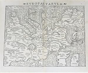
Europae Tabula
Verlag: Basel, Ex Officina Henricpetrina, 1572, , Basel, 1572
Anbieter: Libreria Antiquaria Pregliasco, Torino, TO, Italien
Verkäuferbewertung 4 von 5 Sternen
Zustand: molto buono. Xilografia in bianco e nero incisa su doppio foglio (325x395 mm), titolo "Europae Tabula" lungo il margine superiore. Una delle prime rappresentazioni del continente europeo. Il suo insolito orientamento con il nord nella parte inferiore del foglio e il Mar Mediterraneo nella parte superiore, la rende particolarmente interessante. Montagne, foreste, fiumi e città popolano la terraferma. Un grande veliero anima l'Oceano Atlantico. Testo latino al verso. Tratta dalla "Cosmographiae Universalis" nell'edizione latina del 1572. Pubblicata per la prima volta in tedesco nel 1544 ed in latino l'anno successivo, l'opera raggiunse in breve un enorme successo editoriale, grazie alla ricchezza delle illustrazioni ed alle numerose carte geografiche che l'arricchiscono. Bella e rara incisione in buono stato di conservazione.//Double-page (325x395 mm) woodcut map of Europe from Sebastian Münster's famous "Cosmographia". One of the earliest representations of the European continent, unusually oriented with North at the bottom of the map. Text in Latin on verso with caption title. Sebastian Munster (1489 - 1552) was one of the three most renowned cartographers of the sixteenth century, along with Mercator and Ortelius. Munster's Geographia and Cosmographia Universalis were two of the most widely read and influential books of the time. The "Cosmographia Universalis" (1572) was a geographical as well as historical and ethnographic description of the world. First published in German in 1544 and in Latin the following year, the work quickly achieved enormous popularity, thanks to the rich illustrations and numerous geographical maps. Beautiful and scarce engraving, in good condition. Book.
-

Geographia universalis Pars prior - [Pars posterior]. Das ist Der allgemeinen Erd-Beschreibung
Verlag: Nuremberg: Christoff Gerhard for Johann Hoffman, 1679., 1679
Anbieter: Arader Galleries - AraderNYC, New York, NY, USA
Verkäuferbewertung 5 von 5 Sternen
Erstausgabe
Hardcover. 1st Edition. 2 volumes. 12mo., (5 2/8 x 2 6/8 inches). 2 engraved title-pages. 83 engraved maps, most double-page or folding, and 16 full-page engraved woodcut coats of arms (map of Bavaria with small marginal tear affecting the image). Contemporary vellum over paste-board, title in manuscript on the spines; preserved in a blue cloth clamshell box. Provenance: with the engraved armorial bookplates of Christoph Wenzel Graf von Nostitz (1643-1712), on the front paste-down of each volume, and his signature on each title-page. First German edition, first published in French as "Le Monde ou la Geographie universelle", 1663. The atlas describes America, Africa, Asia, and Europe in detail illustrated with numerous maps of each. Maps related to America include the Western Hemisphere, and the world map, Terra Arctica, America (showing California as an island), Canada, Virginia, Florida, Nova Mexico (showing Californa as an island), Mexico sive N. Hispania, Insula Antiles, Guaiana, Castilo Doro, Peru, Chili, Terra Magellanica, Tucuman, LaPlata, Brasilia, and Insulae Capo Viridis. Maps relating to the Pacific and Indian Ocean regions include Terra Antarctica, Asia showing the East Indies, Insulae Sindae, Insulae Moluccae, as well as maps of Ceylon, the Maldives and Japan. "Like his uncle Nicolas Sanson, Pierre du Val was born in Abbeville. He produced a variety of cartographical works from 1654 onwards until his death in 1683, with later editions being published by his widow Marie Desmaretz" (Shirley). Sabin 21482 citing the French edition of 1688. Catalogued by Kate Hunter.
-
Geographia nova hodiernam orbis terrarum faciem illustrans. Editio septima, accessionibus aucta, emendationibus perpolita, et observationibus geographicis, historicis ac genealogicis locupletata a Laurent. Reinhardo, D.
Sprache: Latein
Verlag: Jena, Jo. Felicis Bielck, 1745., 1745
Anbieter: Versandantiquariat Wolfgang Friebes, Graz, Österreich
Verkäuferbewertung 5 von 5 Sternen
Zustand: 0. Ohne den ersten Teil Geographia antiqua. - Der Philologe, Historiker u. Geograph Christoph Cellarius (1638-1707) wurde nach dem 1656-61 in Jena und Gießen absolvierten Studium der alten und der orientalischen Sprachen, der Geschichte, Theologie und Mathematik 1667 Lehrer in Weißenfels, 1673 Rektor in Weimar, 1676 in Zeitz. Seit 1688 Rektor der Merseburger Domschule, wurde er 1693 Prof. der Beredsamkeit und der Geschichte an der Univ. Halle. Dort schuf er die Statuten der Philosophischen Fakultät, leitete seit 1696 die Bibliothek, ferner das Franckesche Seminarium Praeceptorum, seit 1697 auch das erste deutsche Philologische Seminar und war 1697/98 Prorektor. Cellarius veröffentlichte neben Lehrbüchern der klassischen und orientalischen Sprachen römische Geschichtsbücher, eine Geographia antica (1686) und eine Geographia nova (1687), die vorliegt. Behandelt neben Deutschland u. Europa auch Asien, Afrika u. Amerika. Er führte die Geographie als Lehrfach ein und setzte gegen den Widerstand der Theologen in seinem postum 1709 als Historia universalis zusammengefaßt erschienenen Werk die Periodisierung der Geschichte in Altertum, Mittelalter und Neuzeit durch. - Einband gering berieben. Deckeln m. kl. Wurmspuren. Rücken verblaßt. Die letzten Bll. oben etw. geknittert. Tlw. schwach stockfleckig. la Gewicht in Gramm: 500 Kl.-8°. Mit zahlr. tlw. gefalt. genealogischen Tabellen. 676 (recte 576) S., 54 Bll., Ldr. d. Zt. m. gepr. Rückenschild.
-
[HAND-COLOURED MAP of ASIA MINOR by MÜNSTER] Von den Landern Asie.
Sprache: Deutsch
Verlag: From 'Munster's Cosmography', Germany, 1579
Anbieter: Khalkedon Rare Books ABA, ILAB, IOBA, ESA, Istanbul, Türkei
Verbandsmitglied: ABA ESA ILAB IOBA
Verkäuferbewertung 5 von 5 Sternen
Karte
Soft cover. Zustand: Very Good. Original hand-colored map. 4to. 27x19 cm, with cartoon frame: 40x30 cm. A decorative small map of Asia Minor, from east to the Euphrates, South to the Mediterranean, North to the Black Sea and including Thracia (Thrace). It shows Thracia, Bithynia, Pontus, Paphlagonia, Galatia, Phrygia Minor, Mysia, Phrygia Maior, Lydia, Ionia, Ephesos, Meandros, Lycus [Valley], Caria, Lycia, Pamphylia, Cilicia, Lycaoni, Pisidia, Argos Mt., Taurus Mt., Sebastia, Cappadocia, Armenia, Syria, Nicopolis. Seas decorated with sea monsters. The land filled with mountains. "Münster's Cosmography was one of the most influential geographical works of the 16th Century. It was published in a number of editions over a half century and was continuously revised and updated to include new illustrations and updated information. Sebastian Münster (1488-1552) was a cosmographer and professor of Hebrew who taught at Tübingen, Heidelberg, and Basel. He settled in the latter in 1529 and died there, of plague, in 1552. As a young man, Münster joined the Franciscan order and studied philosophy in Heidelberg. He also studied geography and mathematics in Loewen, as well as Hebrew at Freiburg. In 1512, he was ordained as a priest and taught philosophy and theology at Tübingen from 1514 to 1518. While in Tübingen, he also conducted further studies in geography. He moved to Basel in 1518 and published a Hebrew grammar, one of the first books in Hebrew published in Germany. In 1521 Münster moved again, back to Heidelberg, where he continued to publish Hebrew texts and the first German-produced books in Aramaic. After converting to Protestantism in 1529, he took over the chair of Hebrew at Basel, where he published his main Hebrew work, a two-volume Old Testament with a Latin translation. Münster made himself the center of a large network of scholars from whom he obtained geographic descriptions, maps, and directions. He published his first known map, a map of Germany, in 1525. Three years later, he released a treatise on sundials. In 1540, he published Geographia universalis vetus et nova, an updated edition of Ptolemy's Geographia. In addition to the Ptolemaic maps, Münster added 21 modern maps. One of Münster's innovations was to include one map for each continent, a concept that would influence Ortelius and other early atlas makers. The Geographia was reprinted in 1542, 1545, and 1552. Münster is best known today for his Cosmographia universalis, the first German-language description of the world. It was first published in 1554 and contained 471 woodcuts and 26 maps over 6 volumes. Many of the maps were taken from the Geographia and modified over time. It was released in at least 46 editions in 6 languages by 1650, with 21 German editions alone. The Cosmographia was widely used in the sixteenth and seventeenth centuries and the text, woodcuts, and maps all influenced geographical thought for generations.".
-
Aphrica mit seinen besundern lendern / thieren und wunderbarlichen dingen. (Africa with its special countries, animals, and wonderful things). [Africa].
Verlag: Basel c., 1572
Anbieter: Robert Frew Ltd. ABA ILAB, London, Vereinigtes Königreich
Verbandsmitglied: ABA ILAB PBFA
Verkäuferbewertung 5 von 5 Sternen
Karte
EUR 118,84
EUR 11,54 Versand
Versand von Vereinigtes Königreich nach USAAnzahl: 1 verfügbar
In den WarenkorbOriginal wood-block map of Africa with later hand-colouring. Map dimensions 16 x 13 cm, overall sheet dimensions 30 x 20.5 cm. Text in German. Verso with additional text and a woodcut depicting a cannibal roasting another human on a spit. Light dampstaining to margins not affecting map, else good. Sebastian Munster (1489 - 1552) was one of the three most renowned cartographers of the sixteenth century, along with Mercator and Ortelius. Munster's Geographia and Cosmographia Universalis were two of the most widely read and influential books of the period. His editions of Ptolemy's Geographia, published between 1540 and 1552, were illustrated with 48 woodcut maps, the standard 27 Ptolemaic maps supplemented by 21 new maps. These new maps included a separate map of each of the known continents and marked the development of regional cartography in Central Europe. The antique geography was a prelude to Munster's major work, the Cosmographia, which was published in nearly 30 editions in six languages between 1544 and 1578 and then was revised and reissued by Sebastian Petri from 1588 to 1628. The Cosmographia was a geographical as well as historical and ethnographic description of the world. It contained the maps from the Geographia plus additional regional maps and city views with nearly 500 illustrations which made it one of the most popular pictorial encyclopedias of the sixteen century. This small woodblock map of the continent excludes the Horn of Africa and the Cape of Good Hope. It concentrates on the many kingdoms of Central and North Africa and depicts the Nile's origins in twin lakes located near the Motes Lunae. On verso are engravings of natives along a coastline shooting arrows at ships and of cannibalism, with a man roasting on a spit.
-

Asia Minore
Verlag: Basle, 1560
Anbieter: Clive A. Burden Ltd., Chalfont St. Giles, BUCKS, Vereinigtes Königreich
Verkäuferbewertung 5 von 5 Sternen
Karte
EUR 148,55
EUR 25,56 Versand
Versand von Vereinigtes Königreich nach USAAnzahl: 1 verfügbar
In den WarenkorbNo binding. 310 x 200 mm., in good condition. A distinctive map of the region from Moscow to the Black Sea and Caspian Sea taking in the Caucasus and Armenia. From Sebastian Munster's 'Cosmographia Universalis'. Munster was a renowned hebraist and geographer. The 'Cosmographia' was first published in 1544 just four years after his first publication of Ptolemy's 'Geographia'. It was a large compendium of topographical information which was consistently expanded during its lifetime. Later publication of the 'Cosmographia' was by his step-son Heinrich Petri. Burmeister; Oehme 'Introduction to the Facsimile of the 1550 Edition of Munster's Cosmographia'; Karrow, R.W. (16 c.) 58/182; Shirley Atlases in the BL T.Mun 1a.
-
Tabula Aphricae III
Verlag: Basel, 1542
Anbieter: Antikvariat Krenek, Prag, Tschechien
Verbandsmitglied: ILAB
Verkäuferbewertung 5 von 5 Sternen
Northeast Africa (Egypt). "Tabula Aphricae III". Orig. woodblock from the S. Münster's Geographia. Published by Henricus Petrus in Basel, 1542. With latin title above the map, 2 cartouches and a depiction of a sea ??monster devouring a sailor. 25,5:34 cm (10 x 13 1/2 inch.). A Ptolemaic map of Northeast Africa with Egypt, Nile delta and the northern part of the Red Sea from Münster's 'Geographia universalis vetus et nova complectens Claudii Ptolemaei Alexandrini enarrationis Libros VIII'.
-
Aphricae tabula I
Verlag: Basel, 1540
Anbieter: Antikvariat Krenek, Prag, Tschechien
Verbandsmitglied: ILAB
Verkäuferbewertung 5 von 5 Sternen
Erstausgabe
North Africa. "Aphricae Tabula I". Orig. woodblock from the first edition of S. Münster's Geographia. Published by Henricus Petrus in Basel, 1540. With latin title above the map, a cartouche and depiction of a ship. 25,5:33 cm (10 x 13 inch.). A Ptolemaic map of Northeast Africa and the Mediterranean with Balearic islands and southern part of Spain from the 1st edition of Münster's 'Geographia universalis vetus et nova complectens Claudii Ptolemaei Alexandrini enarrationis Libros VIII'.
-
Aphricae Tabula II
Verlag: Basel, 1540
Anbieter: Antikvariat Krenek, Prag, Tschechien
Verbandsmitglied: ILAB
Verkäuferbewertung 5 von 5 Sternen
Erstausgabe
North Africa. "Aphricae Tabula II". Original woodblock from the first edition of S. Münster's Geographia. Published by Henricus Petrus in Basel, 1540. With latin title above the map, a cartouche and a depiction of the Apostle Paul's shipwreck near Malta. 25,5:33,5 cm (10 x 13 1/4 inch.). Norwich 289. - A Ptolemaic map of North Africa and the Mediterranean with Malta and Sicily from the 1st edition of Münster's 'Geographia universalis vetus et nova complectens Claudii Ptolemaei Alexandrini enarrationis Libros VIII'.
-
Des Herrn de la Croix Geographia Universalis, Das ist: Allgemeine Welt-Beschreibung. Nach neuer Art und Weise/ wie diese Wissenschafft leicht zu begreiffen/ und erlernet kan. 4 Teile in 1 Band (vollständig, alle Tafeln vorhanden). Darinnen erstlich Von der natürlich-himmlischen und künstlich nachgemachten Sphaera, Erd- und Himmels-Kugeln/ samt deren Gebrauch/ ferner denen Himmeln/ Gestirnen/ Cometen/ Luftzeichen/ Elementen/ und allen denen zwischen dem Empyreichen Himmel und der Erden merckwürdigsten Sachen/ ingleichen auch derer Land-Charten Arten klärlich geredet wird (.)
Verlag: Gleditsch / Leipzig, 1697
Anbieter: Antiquariat an der Linie 3, Darmstadt, Deutschland
Verkäuferbewertung 5 von 5 Sternen
EUR 2.800,00
EUR 15,00 Versand
Versand von Deutschland nach USAAnzahl: 1 verfügbar
In den Warenkorb8° Pergament. Zustand: Gut. Pergamenteinband, 21 x 15 cm, handschriftliche Rückenbeschriftung, altersübliche Gebrauchsspuren, materialüblich nachgedunkelt und angegraut, Frontispiz des 1. Teils fachmännisch hinterlegt, 1. Titelblatt etwas unsauber, S. 2 und 3 der Widmung fachmännisch am Rand verstärkt, Falttafel der Weltsysteme nach Ptolemäus, Tycho Brahe und Descartres fachmännisch hinterlegt, ansonsten lediglich altersübliche Seitenbräunung, ggf. wenige kleinste Randläsuren, wenige Seiten etwas randfleckig, insges. aber durchgehend sauber und voll intakt. Enthält alle vier Frontispize sowie alle der im Verzeichnis der Figurae aufgeführten 72 Tafeln und Karten, davon 19 gefaltete. Im ersten Teil zur Astrologie und Sphären zudem 15 Textholzschnitte. Titel des ersten Teils zweifarbig rot/schwarz, übrige drei Titel nur schwarz, zahlreiche Tabellen im Text. VD17, 39:129348H Umfangreiche Beschreibung aller zum Zeitpunkt der Verlegung bekannten Erdteile und deren Bewohner. Contains substantial material on America, along with a special index of East and West Indian topics. Includes W. Penn s Eine Nachricht wegen der Landschafft Pennsilvania (A.-L.). 49 Tafeln mit Trachten und 6 Tafeln zur Astronomie, darunter eine Sternbildkarte. Unter den Karten Weltkarte, 5 Erdteilkarten (darunter Nord- und Südamerika) sowie Karten europäischer Länder. Teil 1: Sphären und Astrologie, Teil 2: Europa und Europäische Länder, Teil 3: ausschließlich Frankreich, Teil 4: Amerikas, Asien, Afrika, Polare Regionen. Stichworte: Geographie, Erdkunde, 17. Jahrhundert 10 Bll., 418 S., 2 Bll. / 420 S. / 358 S., 1 Bl. / 384 S., 48 Bll. Deutsch - Frakturschrift 2600g.
-
Orbis typus universalis iuxta hydrographorum traditionem Exactissime Depicta. 1522. L.F.
Verlag: Johannes Gruninger,
Anbieter: Daniel Crouch Rare Books Ltd, London, Vereinigtes Königreich
Verbandsmitglied: ABA ILAB PBFA
Verkäuferbewertung 4 von 5 Sternen
Karte
EUR 9.507,06
EUR 23,08 Versand
Versand von Vereinigtes Königreich nach USAAnzahl: 1 verfügbar
In den WarenkorbAn early crack at the modern world Double-page woodcut map. One of the earliest printed maps in an edition of Ptolemy to include the name "America" (Shirley 48). First published in 1522, this example is an early issue, in which the near horizontal crack, emerging from the righthand margin near the equator, is very short, and before the new title-banner, 'Tabu. Totius Orbis', was added. In this map of the modern world "Europe is very crudely drawn with England and Scotland reverting to separate islands. India, which was well defined on Waldseemuller's great 'Carta Marina' of 1515 to be re-issued by Fries himself in 1525 has become a confusing double peninsula, with the largest southward-extending land mass being east of the Ganges delta. South America is shown in part, with the shape of its western coastline inserted more by intuition than by factual report. Magellan had indeed reached the Pacific via Tierra del Fuego in 1519 but his surviving ship did not reach the ports of Europe until September 1522, several months after publication of Fries' work" (Shirley 48). Issued in the first edition of Ptolemy's geography to be edited by Michael Villanovanus, better known as Servetus (1511-1553), born at Villanueva, in Aragon, Spain. While working as an editor for the publisher Trechsel he wrote the preface and many of the modern descriptions for the versos of the celebrated maps. He also edited a second edition printed at Vienne in the Dauphiné, in 1541. For his writings against the Holy Trinity and infant baptism Servetus was burnt at the stake in 1553. However there were forty counts of heresy against him, including the offence of having asserted, in the text accompanying map 41 (The Holy Land), that Palestine was not as fertile as it was generally believed. Many copies of the book were burned with him on the orders of John Calvin, although the offending passage was not actually written by Servetus, and had appeared previously in the 1522 and 1525 editions, and was pointedly omitted from the second edition of 1541. The maps of the 1522 edition of Ptolemy's geography were cut in wood by Laurent Fries after the original 1513 maps of Martin Waldseemuller (1470-1520). Fries was originally a physician, "at a succession of places in the Alsace region, with a short spell in Switzerland, before settling in Strasbourg, in about 1519. By this time, he had established a reputation as a writer on medical topics, with several publications already to his credit. Indeed, it was thus that Fries met the Strasbourg printer and publisher Johann Grüninger, an associate of the St. Die group of scholars formed by, among others, Walter Lud, Martin Ringmann and Martin Waldseemuller. It would seem that Gruninger was responsible for printing several of the maps prepared by Waldseemuller, and for supervising the cutting of the maps for the 1513 edition of Ptolemy, edited by the group. The mapmaker Laurent Fries had studied medicine at the universities of Pavia, Piacenza, and Montpellier, before establishing himself as a physician in the Alsace region and Switzerland, and eventually settling in Strassburg, in about 1519. There he met the printer and publisher Johann Grüninger, who worked with the Saint-Dié group of scholars, which included Walter Lud, Martin Ringmann, and Martin Waldseemüller. Grüninger printed several maps prepared by Waldseemüller, and supervised the cutting of the woodblocks for his 1513 edition of Ptolemy's 'Geographia'. Fries's first venture into mapmaking was probably in 1520, when he assisted Petrus Apianus in publishing a reduced version of Martin Waldseemüller's wall-map of the world, first published in 1507. The engraver of the map was almost certainly Laurent Fries, whose initials appear on either side of the garland at the lower right corner. The map, 'Tipus Orbis Universalis Iuxta Ptolomei Cosmographi Traditionem Et Americ Vespucii Aliorque Lustrationes A Petro Apiano Leysnico Elucubrat. An.o Dni MDXX', was issued in an edition of Julius Caius Solinus's 'Polyhistor', a third century compilation of history and geography, based largely on the works of Pliny and Pomponius Mela. It may also have been issued separately. Next, in 1522, Fries and Grüninger worked together on Fries's own edition of Ptolemy's 'Geographia', in which nearly all the maps were after those in Waldseemüller's atlas. However, they added three new maps, of the world, of China and Japan, and Southeast Asia, as here. Laurent Fries's 1522 edition of Ptolemy's 'Geographia' is exceedingly rare, suggesting that the work was not initially commercially successful. Grüninger reissued the geography in 1525. Literature: Shirley, 'The mapping of the world: early printed world maps, 1472-1700', 48; Suarez, 'Early Mapping of Southeast Asia', page 96, image 50.
-
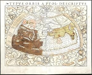
Typus Orbis A Ptol. Descriptus
Verlag: [Henricum Petrum], [Basileæ], 1545
Anbieter: Rooke Books PBFA, Bath, Vereinigtes Königreich
Verbandsmitglied: PBFA
Verkäuferbewertung 5 von 5 Sternen
EUR 1.414,18
EUR 23,06 Versand
Versand von Vereinigtes Königreich nach USAAnzahl: 1 verfügbar
In den WarenkorbDisbound. Zustand: Good. Sebastian MuÌnster (illustrator). A very scarce map extracted from the 1545 edition of Sebastian Munster's 'Geographia Universalis', drawn from the written observations of Ptolemy. A single map from the very scarce 1545 edition of Munster's foundational work on geography. Identified as taken from the 1545 edition via the vertical crack in the ink that appears top right headwind, extending downwards.Clouds and eight named wind heads surround the world map, which depicts prevailing conception of world geography prior to the discovery of the New World, using the work of Claudius Ptolemy.No original maps created by Ptolemy survive, and so Munster undertook a recreation using his geographical coordinates and detailed instructions on how to create maps. With Latin text to verso. With crossed out ink marginalia to the upper right hand corner, and small ink notations beneath 'India' and 'Gangem'. Munster was a German cartographer and cosmographer, best known for his 'Cosmographia'.The map represents prevailing understanding of the day, and depicts an enclosed Indian Ocean, and multiple lake sources for the Nile. Disbound. Paper lightly age toned, with faint handling marks to perimeters. With a former owner's ink notation to the upper right hand corner. With central vertical fold. Small area of worming towards head of vertical fold, with minor loss and closed tear to fold tail. One further closed tear to the tail of the map. Small ink notations below 'India' and 'Gangem'. Light spotting to map reverse, concentrated at central fold. Good. book.
-

Orbis Typus Universalis iuxta Hydrographorum Traditionem
Verlag: Strasbourg, 1508
Anbieter: Clive A. Burden Ltd., Chalfont St. Giles, BUCKS, Vereinigtes Königreich
Verkäuferbewertung 5 von 5 Sternen
Karte
EUR 121.928,05
EUR 25,56 Versand
Versand von Vereinigtes Königreich nach USAAnzahl: 1 verfügbar
In den WarenkorbNo binding. Zustand: Good. 'THE ADMIRAL'S MAP' in EARLY WASH COLOUR. 440 x 580 mm., in full early wash colour, trimmed close as usual due to the map being larger than all the others in the atlas, with some loss to lower portion including the scale, some reinforcement to the centrefold due to not being published with guards, again as usual, otherwise in good condition. 'THE ADMIRAL'S MAP' in EARLY WASH COLOUR. One of the most important maps in one of the most significant editions of Ptolemy's 'Geographia'. It represents a decisive shift away from Ptolemaic geography to a focus on more current knowledge and exploration. There are arguably only two earlier obtainable printed maps to show America; the Johann Ruysch of 1507 and the Bernard Sylvanus of 1511, both world maps appearing in editions of Ptolemy.This is known as the 'Admiral's map' based on some of the introductory text to the atlas which states 'the Charta Marina which they call the Hydrographia, made known from the most authentic voyages by a former Admiral of the most serene King of Portugal Ferdinand, and finally [from those] of other explorers, was given out to be engraved for the press, together with certain of the maps specified on the front of this leaf, through the generous assistance, whilst he lived, of Renà most illustrious Duke of Lorraine, now piously deceased' (Stevens). The Admiral is generally understood to be Christopher Columbus, by which name he was referred to at the time. The other explorers we know included a large amount from Amerigo Vespucci. The manuscript map referred to was that in the possession of the Duke of Lorraine, it 'was almost certainly the large chart by Nicolo de Caveri that is now in the Bibliothà que Nationale, Paris (illustrated Burden I p. xxi). If it was not this chart, it was another nearly identical' (Karrow). WaldseemullerMartin Waldseemüller (c.1475-c.1521) was born near Freiburg, Germany and became the greatest geographer of his age. His family moved into the town and in 1490 he enrolled at the university. One of his classmates was Johannes Schott, the printer of Waldseemuller's 1513 Ptolemy. Amongst his tutors was Gregor Reisch. By the early 1500's the Duke of Lorraine, Renà II, had developed a place of considerable learning at St. Dià . Waldseemuller was encouraged by his fine library and support for scholars and in about 1506 moved there.GeographiaThis 1513 edition of Ptolemy's 'Geographia' is notable for being the first to separate the ancient Ptolemaic maps from the modern ones. With their own title page there were twenty in all. It is considered the first modern atlas to have been printed. As the first map in the modern part, pride of place goes to this world map. Karrow succinctly outlines the majority view of the history of this atlas. 'Waldseemuller and [Matthias] Ringmann work energetically on the Ptolemy after 1507 (and quite likely earlier) and complete most of the textual collation and the drawing of the maps by 1511, when Ringmann dies. Some of the printing blocks have already been cut. The greatest obstacle to completion of the new edition is financial'. The death of their supporter the Duke of Lorraine, Renà II (1451-1508) hurts the project. Karrow goes on to state that the St. Dià press was too small to work on such a large book, indeed a quarto size was the largest they had produced and one small woodcut.It was a pair of Strasbourg lawyers who rescued the project; Jacob Aeszler and Georg Uebelin. 'With their help, the types and equipment of the St. Dià press are transported in 1510 to Strasbourg, where Schott opens a printing shop . Aeszler and Uebelin finance the cutting of the remaining blocks from Waldseemuller's drawing and pay for the production of the whole edition, in which Waldseemuller assists Schott at the press' (Karrow).'America'Under the influence most likely of Vespucci's book, 'Mundus Novus' printed c.1504, Waldseemuller 'hailed Vespucci as the modern Ptolemy and proposed that the New World should be named Ame.
-

Hispania III Nova Tabula.
Verlag: Heinrich Petri, Basel, 1542
Anbieter: Librería José Porrúa Turanzas S.A., Madrid, M, Spanien
Verkäuferbewertung 5 von 5 Sternen
Basel, Heinrich Petri, 1542. (283 x 370)mm. Mapa montado sobre dos hojas coloreado a mano de época. Segunda edición del mapa de España de la Geographia Universalis del cartógrafo alemán Sebastian Münster, la primera impresa en 1540. El mapa está coloreado a mano en la época y representa la Península Ibérica con sus poblaciones más importantes y los accidentes geográficos. 283x370mm. (11¼x14½").
-
Geographicae Enarrationis, Libri Octo. Ex Bilibaldi Pircheymheri tralatione, sed ad Graeca & Prisca exemplaria a Michaele Villanovan (d.i. Servertus) secondo recogniti, & locis innumeris denuo castigati.
Verlag: apud Hugonem a Porta,, Prostant Lugduni,, 1541
Anbieter: Daniel Crouch Rare Books Ltd, London, Vereinigtes Königreich
Verbandsmitglied: ABA ILAB PBFA
Verkäuferbewertung 4 von 5 Sternen
EUR 237.676,51
EUR 23,08 Versand
Versand von Vereinigtes Königreich nach USAAnzahl: 1 verfügbar
In den WarenkorbServetus - the expurgated edition - with contemporary hand-colour Folio. Large woodcut printer's device on title-page; double-page woodcut old map of the world, 26 old regional maps, 2 modern maps of the world, 20 new regional maps and one full-page, most with text enclosed in elaborate woodcut borders, probably by Hans Holbein and Urs Graf, text with 2 full-page woodcuts of a diagram and armillary sphere showing the projection of the winds by Albrecht Dürer (l4 verso), all with magnificent contemporary hand-colour in full, 4 large woodcut diagrams, woodcut initials, colophon n4 present, seventeenth-century limp vellum, recased. Collation: a-i(6), k-m(6), n(4), 50 maps, A-G(6), 2[-]; pp., [1]-149, [3], 50 maps, [76]. Beautifully coloured in a contemporary hand throughout, and very rare as such, this is the second edition of Ptolemy's 'Geographia' to be edited by Michael Villanovanus, better known as Servetus, (c1490-1570). It was printed by Gaspar Trechsel for Hugues de la Porte (1500-1572) in Lyon, a well-known protestant publisher and bookseller, and a prominent member of the Grande Compagnie des Libraries de Lyon (founded in 1519), many of whose works were on the list of condemned books, some of which were destroyed on the banks of the Saone by order of the Archbishop in 1568 (Davis). Nevertheless, the most inflammatory remarks from the earlier editions of the text have been removed. While working as an editor for the publishers Melchior (c1490-1570) and Gaspar Trechsel, Servetus, who was born at Villanueva, in Aragon, Spain, wrote the preface and many of the descriptions for the versos of these maps, for an edition which was first published in 1535. He unwittingly translated verbatim the text accompanying map 41, 'Tab. Ter. Sanctae', of the Holy Land, from the 1522 and 1525 editions, in which it states that Palestine "was not such a fertile land as was generally believed, since modern travellers reported it barren". Excising the offensive text for this new edition did not save Servetus, when he was burnt at the stake in 1553, this heresy was charged to him, along with 39 other counts, which included the sins of writing against the Holy Trinity and infant baptism. As a result, many copies of the book were burned with him on the orders of John Calvin. The maps, which are very rarely found with such fine contemporary colour, as here, include 27 depicting the ancient world, 22 of the modern world, and one of Lotharingia. They are printed from the same woodblocks that were created by Laurent Fries for the 1522 edition of Ptolemy's 'Geographia', after the original 1513 maps of Martin Waldseemuller (1470-1520). Fries was originally a physician, "at a succession of places in the Alsace region, with a short spell in Switzerland, before settling in Strasbourg, in about 1519. By this time, he had established a reputation as a writer on medical topics, with several publications already to his credit. Indeed, it was thus that Fries met the Strasbourg printer and publisher Johann Grüninger, an associate of the St. Die group of scholars formed by, among others, Walter Lud, Martin Ringmann and Martin Waldseemuller. It would seem that Gruninger was responsible for printing several of the maps prepared by Waldseemuller, and for supervising the cutting of the maps for the 1513 edition of Ptolemy, edited by the group. Three of the maps relate to the Americas: 'Terra Nova', the first map in an atlas dedicated to America; 'Tabula noua totius orbis', to which he added images of Russian, Egyptian, Etheopian, Trapobanan and Mursulian kings, and an elephant off the coast of Greenland; and 'Orbis typus universalis', the 'Admiral's map', and the first map in an atlas to name America'. Albrecht Durer (1471-1528) created his image of the armillary sphere for the Gruninger edition of Ptolemy's Geography, 1525. His simple and elegant rendition of the inhabited parts of the globe, within the floating spherical astrolabe, is less a scientific instrument and more a framework for the schematized world; belying the complex nature of Ptolemy's text. Alden & Landis 541/9; Burden 4; Davis 'On the Protestantism of Benoit Rigaud', 1955, page 246; Phillips Atlases 366; Sabin 66485; Shirley 47-49.
-
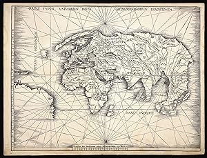
Orbis Typus Universalis Iuxta Hydrographorum Traditionem.
Verlag: Johannes Schott, 12th March, 1513, Strassburg,, 1513
Anbieter: Daniel Crouch Rare Books Ltd, London, Vereinigtes Königreich
Verbandsmitglied: ABA ILAB PBFA
Verkäuferbewertung 4 von 5 Sternen
Karte
EUR 95.070,60
EUR 23,08 Versand
Versand von Vereinigtes Königreich nach USAAnzahl: 1 verfügbar
In den WarenkorbThe Admiral's map Double-page woodcut map of the world, lower margin extended. The so-called Admiral's Map; the first of two maps in Waldseemuller's atlas that relate New World discoveries, and is referred to in the index as the 'Hydrographia sive Charta marina', and in the 'Ad Lectorem' as the 'Charta Marina', where it is clearly stated that the geographical facts have been made known "through the most authentic voyages of a former Admiral of the most serene King of Portugal, Ferdinand, and those of other explorers" (The Admiral's Map What Was It? And Who the Admiral? Samuel Mc Coskry Stanton, Isis, Vol. 22, No. 2. (Feb., 1935), pp. 511-515). The map was created for inclusion in the Strassburg edition of Ptolemy's 'Geographia', signaling the beginning of the section of twenty modern maps which were added to the twenty-seven Ptolemaic originals. This world map gives a more accurate outline of eastern Asia than Ptolemy. It contains Greenland, which is attached to Europe, but only a tiny section of North America, meant to represent either Newfoundland or Labrador. The coastline of South America is left unfinished, and only five place names are given. Martin Waldseemüller (1470-1521) was a German scholar and cartographer. He studied under Gregor Reisch at the University of Freiburg, and then moved to Basel in the late 1490s, where he met the printer Johannes Amerbach. In 1506 he moved to Saint-Dié in Lorraine, where Duke René II had established a humanist academy, the Gymnasium Vosagense. There he read about Amerigo Vespucci's voyage to the Americas, and Portuguese accounts of circumnavigating Africa. Together they proved that the Indian Ocean was not landlocked. He and his colleagues decided to create a map which compared Vespucci's geographical information with Ptolemy's, along with an explanation of why they had deviated from Ptolemy's precepts. That work, 'Cosmographia introductio', was published in 1507. It contains the first printed instance of the name 'America' being applied to the discoveries over the Atlantic: "The fourth part of the earth, we have decided to call Amerige, the land of Amerigo we might even say, or America because it was discovered by Amerigo". The book was accompanied by a set of small woodcut map gores, the first known printed gores for a terrestrial globe ever made, which showed a landmass meant to represent South America labelled as 'America'. The globe gores were a companion to the 'Universalis cosmographia', the great world map in twelve sheets by Waldseemüller. It was unusually large for a woodcut map, and drawn using an adaptation of the second method of projection advocated by Ptolemy. It shows the Americas as one contiguous continent, and was the first map to give this name to the new discoveries. Waldseemüller himself was reluctant to identify America as a continent, and would never use the name America in any of his later work. When he finally published his edition of Ptolemy in Strasbourg in 1513, he labelled South America "Terra Incognita". However, nearly every significant mapmaker for the next quarter of a century relied on his work, popularising his geography and terminology. Sabin 66478; Shirley 35.
-
Typus Orbis a Ptol. Descriptus
Verlag: Basle, 1540
Anbieter: Antikvariat Krenek, Prag, Tschechien
Verbandsmitglied: ILAB
Verkäuferbewertung 5 von 5 Sternen
Erstausgabe
The World. "Typus Orbis a Ptol. Descriptus". Orig. woodcut, S. Münster after C. Ptolemy's map of the Ancient World. Orig. old coluring. Basle, H. Petri, 1540. With Latin title at the top and 12 classical windheads in the decorative region outside the map, each named. 26,5:34,5 cm (10 1/2 x 13 1/2 inch.). Shirley: The Mapping of the World, map 76. - A decorative Ptolemaic world map from the rare first edition of Munster's "Geographia Universalis". - C enterfold professionally restored.



![Bild des Verkäufers für Ioannis Camertis minoritani, artium, et sacrae theologiae doctoris, in. C. Iulii Solini polyhistora enarrationes. Additus eiusdem Camertis Index, tum literarum ordine, tum rerum notabiliu[m] copia, perco[m]modus Studiosis BOUND WITH Pomponii Melae Hispani, Libri de situ orbis tres, adiectis IOachimi VAdiani Heluetii in eosdem Scholiis: Addita quoque in Geographia Catechesi: & Epistola Vadiani ad Agricola[m] digna lectu. Cum Indice summatim omnia complecte[n]te zum Verkauf von Arader Books](https://pictures.abebooks.com/inventory/md/md32249256367.jpg)
![Bild des Verkäufers für Ioannis Camertis minoritani, artium, et sacrae theologiae doctoris, in. C. Iulii Solini polyhistora enarrationes. Additus eiusdem Camertis Index, tum literarum ordine, tum rerum notabiliu[m] copia, perco[m]modus Studiosis BOUND WITH Pomponii Melae Hispani, Libri de situ orbis tres, adiectis IOachimi VAdiani Heluetii in eosdem Scholiis: Addita quoque in Geographia Catechesi: & Epistola Vadiani ad Agricola[m] digna lectu. Cum Indice summatim omnia complecte[n]te zum Verkauf von Arader Books](https://pictures.abebooks.com/inventory/md/md32248788050.jpg)

![Bild des Verkäufers für [HAND-COLOURED MAP of ASIA MINOR by MÜNSTER] Von den Landern Asie. zum Verkauf von Khalkedon Rare Books ABA, ILAB, IOBA, ESA](https://pictures.abebooks.com/inventory/md/md30358782472.jpg)
![Bild des Verkäufers für Aphrica mit seinen besundern lendern / thieren und wunderbarlichen dingen. (Africa with its special countries, animals, and wonderful things). [Africa]. zum Verkauf von Robert Frew Ltd. ABA ILAB](https://pictures.abebooks.com/inventory/md/md30898102398.jpg)