
Gesamtpreis (1 Artikel Artikel):
Versandziel:

9781908402134 - Bradshaw's Railway Folded Map 1907 von Bradshaw, George (18 Ergebnisse)
Direkt zu den wichtigsten Suchergebnissen
Suchfilter
Produktart
- Alle Product Types
- Bücher (16)
- Magazine & Zeitschriften (Keine weiteren Ergebnisse entsprechen dieser Verfeinerung)
- Comics (Keine weiteren Ergebnisse entsprechen dieser Verfeinerung)
- Noten (Keine weiteren Ergebnisse entsprechen dieser Verfeinerung)
- Kunst, Grafik & Poster (Keine weiteren Ergebnisse entsprechen dieser Verfeinerung)
- Fotografien (Keine weiteren Ergebnisse entsprechen dieser Verfeinerung)
- Karten (2)
- Manuskripte & Papierantiquitäten (Keine weiteren Ergebnisse entsprechen dieser Verfeinerung)
Zustand Mehr dazu
- Neu (10)
- Wie Neu, Sehr Gut oder Gut Bis Sehr Gut (2)
- Gut oder Befriedigend (5)
- Ausreichend oder Schlecht (1)
- Wie beschrieben (Keine weiteren Ergebnisse entsprechen dieser Verfeinerung)
Einband
- alle Einbände
- Hardcover (Keine weiteren Ergebnisse entsprechen dieser Verfeinerung)
- Softcover (3)
Weitere Eigenschaften
- Erstausgabe (Keine weiteren Ergebnisse entsprechen dieser Verfeinerung)
- Signiert (Keine weiteren Ergebnisse entsprechen dieser Verfeinerung)
- Schutzumschlag (1)
- Angebotsfoto (5)
Sprache (1)
Preis
- Beliebiger Preis
- Weniger als EUR 20
- EUR 20 bis EUR 45 (Keine weiteren Ergebnisse entsprechen dieser Verfeinerung)
- Mehr als EUR 45 (Keine weiteren Ergebnisse entsprechen dieser Verfeinerung)
Gratisversand
Land des Verkäufers
Verkäuferbewertung
-
Bradshaw's Railway Folded Map 1907
Anbieter: WorldofBooks, Goring-By-Sea, WS, Vereinigtes Königreich
Verkäuferbewertung 5 von 5 Sternen

EUR 1,05
EUR 6,49 Versand
Versand von Vereinigtes Königreich nach USAAnzahl: 1 verfügbar
In den WarenkorbPaperback. Zustand: Fair. A readable copy of the book which may include some defects such as highlighting and notes. Cover and pages may be creased and show discolouration.
-
New Edition Bradshaw Railway Map 1907
Sprache: Englisch
Verlag: Bloomsbury Publishing PLC, United Kingdom, London, 2011
ISBN 10: 190840213X ISBN 13: 9781908402134
Anbieter: WorldofBooks, Goring-By-Sea, WS, Vereinigtes Königreich
Verkäuferbewertung 5 von 5 Sternen
EUR 2,10
EUR 6,49 Versand
Versand von Vereinigtes Königreich nach USAAnzahl: 11 verfügbar
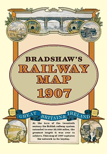
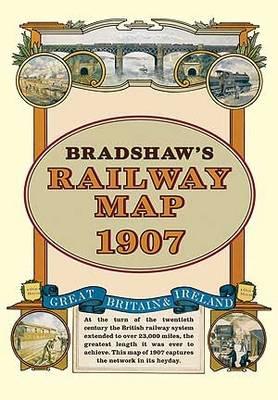
In den WarenkorbPaperback. Zustand: Very Good. At the turn of the 20th century the rail network extended to over 23,000 miles. Very nearly the circumference of the world, this was the greatest length it was ever to achieve. Some urban routes had closed and later, hundreds of rural lines and stations succumbed to the Beeching axe. A facsimile of Bradshaw's classic map from 1907, this iconic piece of Victorian history shows the Great British and Irish rail network in its heyday before the decline commenced. The book has been read, but is in excellent condition. Pages are intact and not marred by notes or highlighting. The spine remains undamaged.
-

Bradshaw's Railway Folded Map 1907
Anbieter: WeBuyBooks, Rossendale, LANCS, Vereinigtes Königreich
Verkäuferbewertung 5 von 5 Sternen
EUR 1,18
EUR 5,33 Versand
Versand von Vereinigtes Königreich nach USAAnzahl: 1 verfügbar
In den WarenkorbZustand: Good. Most items will be dispatched the same or the next working day. A copy that has been read but remains in clean condition. All of the pages are intact and the cover is intact and the spine may show signs of wear. The book may have minor markings which are not specifically mentioned.
-
Bradshaw's Railway Map 1907
Anbieter: RIVERLEE BOOKS, Waltham Cross, HERTS, Vereinigtes Königreich
Verkäuferbewertung 5 von 5 Sternen
EUR 5,84
EUR 13,97 Versand
Versand von Vereinigtes Königreich nach USAAnzahl: 1 verfügbar
In den WarenkorbSoft cover. Zustand: As New. Zustand des Schutzumschlags: As New. An as new copy of the facsimile edition of Bradshaw's 1907 Railway Map, in a card slipcase with a commentary. Conditionn is as new and the map shows no sign of having been unfolded.
-
Bradshaw's Railway Folded Map 1907
Sprache: Englisch
Verlag: Bloomsbury Publishing PLC, 2011
ISBN 10: 190840213X ISBN 13: 9781908402134
Anbieter: PBShop.store US, Wood Dale, IL, USA
Verkäuferbewertung 5 von 5 Sternen
UNK. Zustand: New. New Book. Shipped from UK. Established seller since 2000.
-
Bradshaw's Railway Folded Map 1907
Sprache: Englisch
Verlag: Bloomsbury Publishing PLC, 2011
ISBN 10: 190840213X ISBN 13: 9781908402134
Anbieter: PBShop.store UK, Fairford, GLOS, Vereinigtes Königreich
Verkäuferbewertung 5 von 5 Sternen
EUR 13,17
EUR 3,81 Versand
Versand von Vereinigtes Königreich nach USAAnzahl: 15 verfügbar
In den WarenkorbUNK. Zustand: New. New Book. Shipped from UK. Established seller since 2000.
-
Bradshaw's Railway Folded Map 1907
Sprache: Englisch
Verlag: Old House Books 21/11/2011, 2011
ISBN 10: 190840213X ISBN 13: 9781908402134
Anbieter: AwesomeBooks, Wallingford, Vereinigtes Königreich
Verkäuferbewertung 5 von 5 Sternen
EUR 11,92
EUR 5,78 Versand
Versand von Vereinigtes Königreich nach USAAnzahl: 2 verfügbar
In den WarenkorbZustand: Very Good. This book is in very good condition and will be shipped within 24 hours of ordering. The cover may have some limited signs of wear but the pages are clean, intact and the spine remains undamaged. This book has clearly been well maintained and looked after thus far. Money back guarantee if you are not satisfied. See all our books here, order more than 1 book and get discounted shipping. .
-
Bradshaw's Railway Folded Map 1907
Sprache: Englisch
Verlag: Old House Books 21/11/2011, 2011
ISBN 10: 190840213X ISBN 13: 9781908402134
Anbieter: Bahamut Media, Reading, Vereinigtes Königreich
Verkäuferbewertung 5 von 5 Sternen
EUR 11,92
EUR 8,09 Versand
Versand von Vereinigtes Königreich nach USAAnzahl: 2 verfügbar
In den WarenkorbZustand: Very Good. Shipped within 24 hours from our UK warehouse. Clean, undamaged book with no damage to pages and minimal wear to the cover. Spine still tight, in very good condition. Remember if you are not happy, you are covered by our 100% money back guarantee.
-
Bradshaw's Railway Folded Map 1907 (Old House)
Anbieter: Majestic Books, Hounslow, Vereinigtes Königreich
Verkäuferbewertung 4 von 5 Sternen

EUR 14,51
EUR 7,53 Versand
Versand von Vereinigtes Königreich nach USAAnzahl: 3 verfügbar
In den WarenkorbZustand: New.
-
Bradshaw's Railway Folded Map 1907 (Old House)
Anbieter: Kennys Bookstore, Olney, MD, USA
Verkäuferbewertung 5 von 5 Sternen
Zustand: New. At the turn of the 20th century the rail network extended to over 23,000 miles, very nearly the circumference of the world - the greatest length it was ever to achieve. Some urban routes had closed and later, hundreds of rural lines and stations succumbed to the Beeching axe. This title shows the network in its heyday before the decline commenced. Series: Old House. BIC Classification: HBTP1; WGF; WQN. Category: (G) General (US: Trade). Dimension: 209 x 150 x 7. Weight in Grams: 124. New. 2011. Facsimile map. Sheet map. . . . .
-
BRADSHAW'S RAILWAY FOLDED MAP1907
Anbieter: Revaluation Books, Exeter, Vereinigtes Königreich
Verkäuferbewertung 5 von 5 Sternen
Karte
EUR 11,92
EUR 11,59 Versand
Versand von Vereinigtes Königreich nach USAAnzahl: 2 verfügbar
In den WarenkorbMap. Zustand: Brand New. 1 pages. 8.27x5.91x0.28 inches. In Stock.
-
New Edition Bradshaw Railway Map 1907
Anbieter: Ria Christie Collections, Uxbridge, Vereinigtes Königreich
Verkäuferbewertung 5 von 5 Sternen
EUR 13,83
EUR 13,89 Versand
Versand von Vereinigtes Königreich nach USAAnzahl: 4 verfügbar
In den WarenkorbZustand: New. In English.
-
Bradshaw's Railway Folded Map 1907
Anbieter: Zardoz Books, Westbury, WILTS, Vereinigtes Königreich
Verkäuferbewertung 3 von 5 Sternen

EUR 5,91
EUR 23,13 Versand
Versand von Vereinigtes Königreich nach USAAnzahl: 1 verfügbar
In den WarenkorbZustand: fine. fine like new Trade Old House edition In stock shipped from our UK warehouse.
-

BRADSHAW'S RAILWAY MAP 1907
Anbieter: GfB, the Colchester Bookshop, Colchester, Vereinigtes Königreich
Verkäuferbewertung 5 von 5 Sternen
EUR 4,78
EUR 24,92 Versand
Versand von Vereinigtes Königreich nach USAAnzahl: 1 verfügbar
In den WarenkorbMap. Zustand: Very Good. No jacket. Old House, 2011. Folding map in card case, 8vo. A good copy. 9781908402134/0.2uk . (Please note that our condition gradings are stricter than those of Abebooks and many other sellers. There may therefore be a discrepancy between this description and its listed condition grading).
-
BRADSHAW'S RAILWAY FOLDED MAP 1907
Anbieter: Speedyhen, Hertfordshire, Vereinigtes Königreich
Verkäuferbewertung 5 von 5 Sternen
EUR 12,06
EUR 47,53 Versand
Versand von Vereinigtes Königreich nach USAAnzahl: 4 verfügbar
In den WarenkorbZustand: NEW.
-
Bradshaw\ s Railway Folded Map 1907
Sprache: Englisch
Verlag: Bloomsbury Publishing PLC, 2011
ISBN 10: 190840213X ISBN 13: 9781908402134
Zustand: New. At the turn of the 20th century the rail network extended to over 23,000 miles, very nearly the circumference of the world - the greatest length it was ever to achieve. Some urban routes had closed and later, hundreds of rural lines and stations succumbed t.
-

Bradshaw's Railway Folded Map 1907
Sprache: Englisch
Verlag: Bloomsbury Publishing PLC, 2011
ISBN 10: 190840213X ISBN 13: 9781908402134
Anbieter: AHA-BUCH GmbH, Einbeck, Deutschland
Verkäuferbewertung 5 von 5 Sternen
Landkarte. Zustand: Neu. Neu neuware, importqualität, auf lager.
-

Bradshaw's Railway Folded Map 1907
Sprache: Englisch
Verlag: Bloomsbury Publishing PLC, 2011
ISBN 10: 190840213X ISBN 13: 9781908402134
Karte
(Land-)Karte. Zustand: Neu. Bradshaw's Railway Folded Map 1907 | George Bradshaw | (Land-)Karte | Karte/Landkarte | Englisch | 2011 | Bloomsbury Publishing PLC | EAN 9781908402134 | Verantwortliche Person für die EU: Libri GmbH, Europaallee 1, 36244 Bad Hersfeld, gpsr[at]libri[dot]de | Anbieter: preigu.