
Gesamtpreis (1 Artikel Artikel):
Versandziel:

9781851702985 - Decorative Maps von Barron, Roderick (12 Ergebnisse)
Direkt zu den wichtigsten Suchergebnissen
Suchfilter
Produktart
- Alle Product Types
- Bücher (11)
- Magazine & Zeitschriften (Keine weiteren Ergebnisse entsprechen dieser Verfeinerung)
- Comics (Keine weiteren Ergebnisse entsprechen dieser Verfeinerung)
- Noten (Keine weiteren Ergebnisse entsprechen dieser Verfeinerung)
- Kunst, Grafik & Poster (Keine weiteren Ergebnisse entsprechen dieser Verfeinerung)
- Fotografien (Keine weiteren Ergebnisse entsprechen dieser Verfeinerung)
- Karten (1)
- Manuskripte & Papierantiquitäten (Keine weiteren Ergebnisse entsprechen dieser Verfeinerung)
Zustand Mehr dazu
- Neu (Keine weiteren Ergebnisse entsprechen dieser Verfeinerung)
- Wie Neu, Sehr Gut oder Gut Bis Sehr Gut (1)
- Gut oder Befriedigend (7)
- Ausreichend oder Schlecht (Keine weiteren Ergebnisse entsprechen dieser Verfeinerung)
- Wie beschrieben (4)
Einband
- alle Einbände
- Hardcover (Keine weiteren Ergebnisse entsprechen dieser Verfeinerung)
- Softcover (12)
Weitere Eigenschaften
- Erstausgabe (3)
- Signiert (1)
- Schutzumschlag (Keine weiteren Ergebnisse entsprechen dieser Verfeinerung)
- Angebotsfoto (9)
Sprache (2)
Preis
- Beliebiger Preis
- Weniger als EUR 20
- EUR 20 bis EUR 40
- Mehr als EUR 40 (Keine weiteren Ergebnisse entsprechen dieser Verfeinerung)
Gratisversand
Land des Verkäufers
Verkäuferbewertung
-

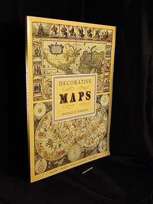
Decorative Maps
Anbieter: WorldofBooks, Goring-By-Sea, WS, Vereinigtes Königreich
Verkäuferbewertung 5 von 5 Sternen

EUR 3,33
EUR 9,01 Versand
Versand von Vereinigtes Königreich nach USAAnzahl: 5 verfügbar
In den WarenkorbPaperback. Zustand: Very Good. The book has been read, but is in excellent condition. Pages are intact and not marred by notes or highlighting. The spine remains undamaged.
-

Decorative Maps
Anbieter: WeBuyBooks, Rossendale, LANCS, Vereinigtes Königreich
Verkäuferbewertung 5 von 5 Sternen
EUR 3,75
EUR 11,78 Versand
Versand von Vereinigtes Königreich nach USAAnzahl: 1 verfügbar
In den WarenkorbZustand: Good. Most items will be dispatched the same or the next working day. A copy that has been read but remains in clean condition. All of the pages are intact and the cover is intact and the spine may show signs of wear. The book may have minor markings which are not specifically mentioned. Small Tears to the Dust Jacket, Slipcase, or cover.
-
Decorative Maps
Anbieter: Orbiting Books, Hereford, Vereinigtes Königreich
Verkäuferbewertung 5 von 5 Sternen
EUR 3,28
EUR 13,86 Versand
Versand von Vereinigtes Königreich nach USAAnzahl: 1 verfügbar
In den Warenkorbpaperback. Zustand: Fine. Tanning to edge of pages Appears unread, may have minor superficial marking. Next day dispatch from the UK (Mon-Fri). Please contact us with any queries.
-

Decorative maps
Erstausgabe
First Edition. Near fine paperback copy; wrapper edges very slightly dulled. Remains particularly well-preserved overall; tight, bright, clean and especially sharp-cornered. Physical description: 1 atlas (8 pages, 40 leaves of plates) : color maps ; 38 cm. Notes: Reproduces some plates and originals held by the British Museum and Jonathan Potter Ltd., London. Subjects: Great Britain Maps. Railroads Great Britain Maps. England. History - ; atlases. Genre: Atlas. Language: English. 3 Kg.
-

Decorative maps
Erstausgabe
First Edition. Very good paperback copy; edges somewhat slightly dust-dulled and nicked. Remains particularly well-preserved overall; tight, bright, clean and strong. Physical description; 8 pages, 40 leaves of plates : color maps ; 39 cm. Subjects; Pictorial maps -- History. Cartography -- History. 3 Kg.
-

Decorative Maps
Sprache: Englisch
Verlag: Studio Editions Ltd, London, 1990
ISBN 10: 1851702989 ISBN 13: 9781851702985
Anbieter: Washburn Books, Pateley Bridge, Vereinigtes Königreich
Verkäuferbewertung 5 von 5 Sternen
EUR 3,93
EUR 23,91 Versand
Versand von Vereinigtes Königreich nach USAAnzahl: 1 verfügbar
In den WarenkorbSoft cover. Zustand: Good. No Jacket. Reprint. Volume in the Poster Art Series. Collection of 40 decorative historical maps dated from the middle ages to the 19th century, with introduction and 40 full colour plates, each accompanied by a description. Slight peeling to the laminate cover and minor fading to spine, otherwise good copy with no inscriptions. Size: Folio - over 12 - 15" tall. Book.
-

Zustand: Good. Paperback, 40 full colour plates, unpaged, folio.; Slightly foxed on cut; some foxing inside.
-

Zustand: Good. Paperback, 40 full colour plates, unpaged, folio.; Edges slightly browned.
-
Decorative Maps
Anbieter: Mooney's bookstore, Den Helder, Niederlande
Verkäuferbewertung 4 von 5 Sternen

Zustand: Very good.
-

tapa blanda. Zustand: Bien. Mapas. Atlas geográficos. Globos terráqueos (912"14/18") Studio. London. 1990. 38 cm. 8 p., 40 h. de map. col. Encuadernación en tapa blanda de editorial ilustrada. Idioma ingles. Poster art series. Mapas antiguos . Contiene pegatina en lomo. ISBN: 1851702989 (=3645174=) PP163.
-
Decorative Maps
Sprache: Englisch
Verlag: Published by Bracken Books, London, 1989
ISBN 10: 1851702989 ISBN 13: 9781851702985
Anbieter: Keoghs Books, Skipton, Vereinigtes Königreich
Verbandsmitglied: PBFA
Verkäuferbewertung 5 von 5 Sternen
Karte Erstausgabe Signiert
EUR 29,75
EUR 32,35 Versand
Versand von Vereinigtes Königreich nach USAAnzahl: 1 verfügbar
In den Warenkorb, 8 pages of text, plus 40 full colour plates, SIGNED by the author on title page, from the Poster Art series First Edition , book in very good condition 38 x 28 cm Paperback SIGNED by author ISBN: 1851702989.
-
Decorative maps - With forty full colour plates -
Verlag: Bracken Books -, London -, 1989
ISBN 10: 1851702989 ISBN 13: 9781851702985
Anbieter: Erlbachbuch Antiquariat, Berlin, Deutschland
Verbandsmitglied: GIAQ
Verkäuferbewertung 5 von 5 Sternen
Broschur (Paperback) -. - Mit 40 farbigen Plänen aus der British Library - - internlpC-145-B-2711 Englisch - 8 + (80) Seiten S. 39 x 29 x 1 cm - Groß-Quart 680g. mit leichten Gebrauchsspuren - leicht berieben und bestoßen mit kleinen Randläsuren, - mit leichten Gebrauchsspuren - leicht berieben und bestoßen mit kleinen Randläsuren, -.
