
Gesamtpreis (1 Artikel Artikel):
Versandziel:

9780008102333 - 2016 Collins Map of Britain von Collins Maps (3 Ergebnisse)
Direkt zu den wichtigsten Suchergebnissen
Produktart
- Alle Produktarten
- Bücher (3)
- Magazine & Zeitschriften
- Comics
- Noten
- Kunst, Grafik & Poster
- Fotografien
- Karten
-
Manuskripte &
Papierantiquitäten
Zustand
- Alle
- Neu
- Antiquarisch/Gebraucht
Einband
- alle Einbände
- Hardcover
- Softcover
Weitere Eigenschaften
- Erstausgabe
- Signiert
- Schutzumschlag
- Angebotsfoto
Land des Verkäufers
Verkäuferbewertung
-
2016 Collins Map of Britain
Verlag: HarperCollins UK, 2016
ISBN 10: 0008102333ISBN 13: 9780008102333
Buch
Paperback. Zustand: Good. The book has been read but remains in clean condition. All pages are intact and the cover is intact. Some minor wear to the spine.
-
2016 Collins Map of Britain
Verlag: HarperCollins UK, 2016
ISBN 10: 0008102333ISBN 13: 9780008102333
Buch
Paperback. Zustand: Fair. A readable copy of the book which may include some defects such as highlighting and notes. Cover and pages may be creased and show discolouration.
-
2016 Collins Map of Britain
Verlag: HarperCollins Publishers, United Kingdom, London, 2015
ISBN 10: 0008102333ISBN 13: 9780008102333
Buch
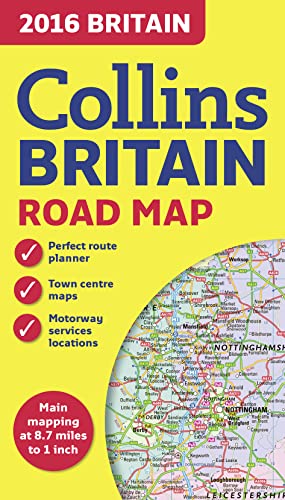
Paperback. Zustand: Very Good. Full colour double-sided map of Great Britain at 8.7 miles to 1 inch (1:550,000), with clear, detailed road network and administrative areas shown in colour. With its political colouring of counties and unitary authorities it is ideal for business users but it is also perfect for tourists as a route planning map. MAIN FEATURES Fully updated for 2016. Counties and local council areas shown in colour. Clear, detailed road network. Town and city names, rivers, railway lines and canals are clearly shown. 16 city/town centre street plans. Index to place names. Mileage chart. Car ferry routes. Key in English, French and German. AREA OF COVERAGE Double-sided road map covering the whole of Britain. Northern England, Scotland and the Isle of Man are on one side with Southern England and Wales on the other. The book has been read, but is in excellent condition. Pages are intact and not marred by notes or highlighting. The spine remains undamaged.