Gesamtpreis (1 Artikel Artikel):
Versandziel:

tooley r v charles bricker (23 Ergebnisse)
Direkt zu den wichtigsten Suchergebnissen
Suchfilter
Produktart
- Alle Product Types
- Bücher (22)
- Magazine & Zeitschriften (Keine weiteren Ergebnisse entsprechen dieser Verfeinerung)
- Comics (Keine weiteren Ergebnisse entsprechen dieser Verfeinerung)
- Noten (Keine weiteren Ergebnisse entsprechen dieser Verfeinerung)
- Kunst, Grafik & Poster (Keine weiteren Ergebnisse entsprechen dieser Verfeinerung)
- Fotografien (Keine weiteren Ergebnisse entsprechen dieser Verfeinerung)
- Karten (1)
- Manuskripte & Papierantiquitäten (Keine weiteren Ergebnisse entsprechen dieser Verfeinerung)
Zustand Mehr dazu
- Neu (1)
- Wie Neu, Sehr Gut oder Gut Bis Sehr Gut (6)
- Gut oder Befriedigend (6)
- Ausreichend oder Schlecht (Keine weiteren Ergebnisse entsprechen dieser Verfeinerung)
- Wie beschrieben (10)
Einband
- alle Einbände
- Hardcover (21)
- Softcover (Keine weiteren Ergebnisse entsprechen dieser Verfeinerung)
Weitere Eigenschaften
- Erstausgabe (3)
- Signiert (Keine weiteren Ergebnisse entsprechen dieser Verfeinerung)
- Schutzumschlag (15)
- Angebotsfoto (10)
Sprache (2)
Gratisversand
Land des Verkäufers
Verkäuferbewertung
-

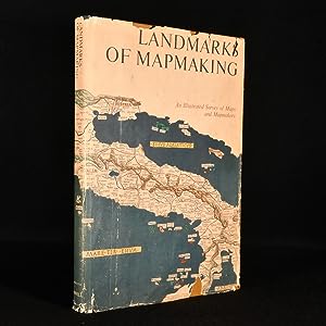
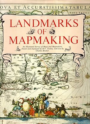
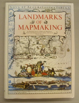
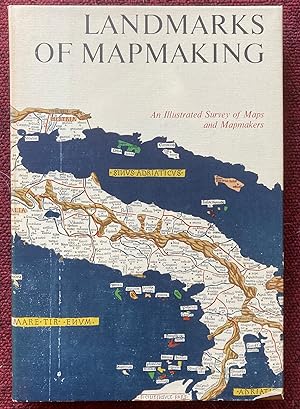
Landmarks of Mapmaking: Illustrated Survey of Maps & Mapmakers
Anbieter: ThriftBooks-Atlanta, AUSTELL, GA, USA
Verkäuferbewertung 5 von 5 Sternen

EUR 16,33
Währung umrechnenKostenlos für den Versand innerhalb von/der USAAnzahl: 1 verfügbar
In den WarenkorbHardcover. Zustand: Very Good. No Jacket. Former library book; Missing dust jacket; May have limited writing in cover pages. Pages are unmarked. ~ ThriftBooks: Read More, Spend Less 5.85.
-
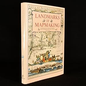
Landmarks of Mapmaking: An Illustrated History of Maps and Mapmakers
Anbieter: GridFreed, North Las Vegas, NV, USA
Verkäuferbewertung 5 von 5 Sternen
EUR 16,80
Währung umrechnenEUR 4,68 für den Versand innerhalb von/der USAAnzahl: 1 verfügbar
In den WarenkorbHardcover. Zustand: New. In shrink wrap.
-

Landmarks of Mapmaking : An Illustrated Survey of Maps and Mapmakers
Anbieter: Better World Books, Mishawaka, IN, USA
Verkäuferbewertung 5 von 5 Sternen
EUR 43,13
Währung umrechnenKostenlos für den Versand innerhalb von/der USAAnzahl: 1 verfügbar
In den WarenkorbZustand: Good. Former library book; may include library markings. Used book that is in clean, average condition without any missing pages.
-
Landmarks Of Mapmaking: An Illustrated Survey Of Maps & Mapmaking
Anbieter: THE CROSS Art + Books, Sydney, NSW, Australien
Verkäuferbewertung 2 von 5 Sternen

EUR 28,49
Währung umrechnenEUR 14,17 für den Versand von Australien nach USAAnzahl: 1 verfügbar
In den Warenkorb36.0 c 26.0cms 276pp b/w & colour illusts including 20 foldout maps very good hardback & dustwrapper (chip at base of spine) The chapters are: the mapmaker''s skills; Europe the rise of map publishing; Asia seaway to the Indies; Africa the mysterious continent; the Americas a New World; Australia the Southern Land.
-
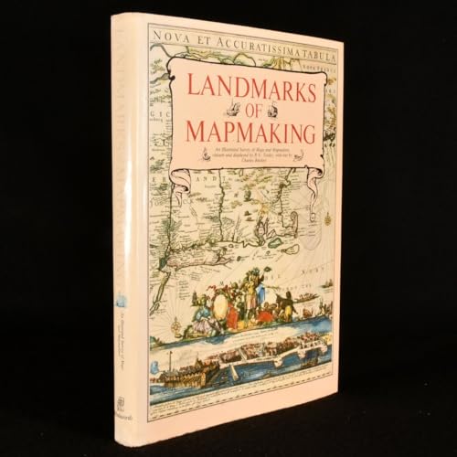
Landmarks of Mapmaking: An Illustrated Survey of Maps and Mapmakers
Verlag: Westminster Editions, United Kingdom, 1981
ISBN 10: 187212805X ISBN 13: 9781872128054
Sprache: Englisch
Anbieter: Pendleburys - the bookshop in the hills, Llanwrda, Vereinigtes Königreich
Verkäuferbewertung 5 von 5 Sternen
EUR 31,95
Währung umrechnenEUR 13,24 für den Versand von Vereinigtes Königreich nach USAAnzahl: 1 verfügbar
In den Warenkorbhardback. Zustand: Very Good. Zustand des Schutzumschlags: Very Good. hardback, small folio measuring 14 1/4" x 10 1/2", a very good tightly bound copy in a well preserved pictorial dust wrapper that has faded a little to spine, the text is clean and is unmarked, folding colour maps, b&w maps, illustrations, 276pp. Owing to size and weight, a request for additional postage might be made if ordered from certain overseas locations.
-
Landmarks of Mapmaking. An Illustrated Survey of Maps and Mapmaking.
Verlag: New York, Dorset Press [Marboo Books Corporation]. 1989, 1989
ISBN 10: 0880293497 ISBN 13: 9780880293495
Sprache: Englisch
Anbieter: Antiquariaat Schot, Hendrik-Ido-Ambacht, Niederlande
Verkäuferbewertung 5 von 5 Sternen
EUR 27,60
Währung umrechnenEUR 25,00 für den Versand von Niederlande nach USAAnzahl: 1 verfügbar
In den WarenkorbOriginal publisher's brown paper-covered boards, gilt lettering spine, pictorial dustjacket, folio: frontispiece tipped-in, 276pp., very richly illustrated [several plates folding & double-page large], notes & references, general bibliography, credits illustrations, index, colophon.
-
Landmarks of Mapmaking: An Illustrated Survey of Maps and Mapmakers.
Anbieter: Frans Melk Antiquariaat, HILVERSUM - NO SHIPPING TO THE U.S.A AT THE MOMENT, Niederlande
Verkäuferbewertung 4 von 5 Sternen

EUR 18,00
Währung umrechnenEUR 35,00 für den Versand von Niederlande nach USAAnzahl: 1 verfügbar
In den WarenkorbMaps chosen and displayed by R.V. Tooley. Text by Charles Bricker. Oxford, Phaidon, 1976. 36,5 x 26 cm. Hardcover with dustjacket. More than 350 illustr. 276 pages. NEAR FINE COPY [Cartografie / Cartography ].
-

Landmarks of Mapmaking. An Illustrated Survey of Maps And Mapmakers.
Verlag: Phaidon Press Ltd, Oxford, 1976
ISBN 10: 0714817589 ISBN 13: 9780714817583
Sprache: Englisch
Anbieter: FOLIOS LIMITED, Oxford, Vereinigtes Königreich
Verkäuferbewertung 5 von 5 Sternen
EUR 35,56
Währung umrechnenEUR 34,53 für den Versand von Vereinigtes Königreich nach USAAnzahl: 1 verfügbar
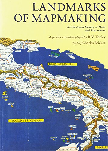
In den WarenkorbHardcover. Zustand: As New. Zustand des Schutzumschlags: Fair. R.V Tooley (illustrator). First English Edition. 276 pp., 350 maps & plates in colour and b/w , 4 folding, maps chosen and displayed by R. V. Tooley, preface by Gerald Roe Crone, half-title, title, endpaper plates, biblio, cloth backed boards in slightly rubbed round edges d/w, otherwise copy clean and in very good condition. Over 200 years of cartography are covered in this fascinating study. The author describes chronologically, in separate chapters, the exploration and mapping of Europe, Asia, Africa, and the America. A special reference is made to Muslim contribution to cartography in the middle ages. #8645.
-

Landmarks of Mapmaking. An Illustrated Survey of Maps and Mapmakers. Text by Ch. Bricker.
Verlag: Amsterdam, Brussels, Elsevier, 1968, 1968
Anbieter: Antiquariaat De Keerkring, Malden, Niederlande
Verkäuferbewertung 5 von 5 Sternen
EUR 20,00
Währung umrechnenEUR 26,00 für den Versand von Niederlande nach USAAnzahl: 1 verfügbar
In den WarenkorbAmsterdam, Brussels, Elsevier, 1968 Folio. Hardbound with pictorial dustjacket. 276 pp. Dustjacket frayed, otherwise in good condition.
-

EUR 60,54
Währung umrechnenEUR 15,00 für den Versand von Polen nach USAAnzahl: 1 verfügbar
In den WarenkorbHardcover. Zustand: Fine. Folio (36.5 cm), 276 pp, including 14 folding maps. Publisher's cloth with dust jacket (minor shelf wear). Covering over 2000 years of cartographic history, this richly illustrated volume traces the evolution of mapmaking from early Eskimo bone carvings to the precision of modern scientific maps. Following an introductory chapter on the development of cartography, the book is organized chronologically, with separate chapters devoted to the exploration and mapping of Europe, Asia, Africa, the Americas, and Australia. More than 350 illustrations accompany the text, including maps discussed, portraits of explorers and cartographers, title pages and frontispieces of significant publications, and many additional images. A detailed index and a comprehensive bibliography are also included.
-
Geschiedenis van de Cartografie
Verlag: Atrium 1975, 1975
Anbieter: Antiquariaat Schot, Hendrik-Ido-Ambacht, Niederlande
Verkäuferbewertung 5 von 5 Sternen
EUR 25,88
Währung umrechnenEUR 25,00 für den Versand von Niederlande nach USAAnzahl: 1 verfügbar
In den WarenkorbGeb., hardcover, groot formaat, fraai exemplaar, 275 pagina's.
-

Landmarks of mapmaking. An illustrated survey of maps and mapmaking
EUR 45,80
Währung umrechnenEUR 42,00 für den Versand von Frankreich nach USAAnzahl: 1 verfügbar
In den WarenkorbCouverture rigide. Zustand: bon. RO60147517: 1989. In-Folio. Relié. Bon état, Couv. convenable, Dos satisfaisant, Papier jauni. 276 pages. Texte en anglais. Nombreuses illustrations en noir et blanc et en couleur, dans et hors texte. Rousseurs. Jaquette en bon état. Avec Jaquette. . . Classification Dewey : 420-Langue anglaise. Anglo-saxon.
-
Landmarks of Mapmaking
Verlag: Thomas Crowell, New York, 1976
Anbieter: Argosy Book Store, ABAA, ILAB, New York, NY, USA
Verkäuferbewertung 5 von 5 Sternen
EUR 53,06
Währung umrechnenEUR 5,15 für den Versand innerhalb von/der USAAnzahl: 1 verfügbar
In den Warenkorbhardcover. 350 illus. and 14 fold-out maps, 10 in full color. folio, brown cloth boards (beautiful embossed compass rose emblem), d.w., brand new. N.Y., 1976. In excellent condition. An illustrated survey of 2,000 years of maps and mapmakers. First American edition.
-
Geschiedenis van de Cartografie.
Verlag: Alphen am Rhein, Atrium., 1981
Anbieter: Antiquariat Bücheretage, Bonn, Deutschland
Verbandsmitglied: GIAQ
Verkäuferbewertung 4 von 5 Sternen
EUR 20,00
Währung umrechnenEUR 26,00 für den Versand von Deutschland nach USAAnzahl: 1 verfügbar
In den WarenkorbFolio. 275 S. m. zahlr. Abb. u. Tafeln. Oln. m. Schutzumschlag. Exlibris.
-
Landmarks Of Mapmaking An Illustrated Survey of Maps and Mapmaking
Verlag: Elsevier, Amsterdam, 1968
Erstausgabe
EUR 57,49
Währung umrechnenEUR 6,01 für den Versand innerhalb von/der USAAnzahl: 1 verfügbar
In den WarenkorbHardcover. Zustand: Near Fine. Zustand des Schutzumschlags: Near Fine. Illustrated (illustrator). First Edition. Very minor rippling to the dust jacket otherwise a wonderful copy. A landmark history of cartography that features 14 luxurious full color, oversize fold-out maps by master cartographers. Text by Charles Bricker includes details of astronomical and mathematical advances, voyages of discovery, new printing techniques, carto-biographies, etc. Enhanced with 350 maps, portraits of explorers and mapmakers, sea charts, reproductions from contemporary publications, etc. Illustrated endpapers. Preface by Gerald Roe Crone. Bound in the original oatmeal color cloth, gilt-stamped over bright white accents. Big and beautiful and therefore requiring Extra Postage.
-
Landmarks of Mapmaking; An Illustrated History of Maps and Mapmakers
Verlag: Dorset Press, Hertfordshire, England
ISBN 10: 0880293497 ISBN 13: 9780880293495
Anbieter: Spafford Books (ABAC / ILAB), Regina, SK, Kanada
Verkäuferbewertung 5 von 5 Sternen
EUR 37,78
Währung umrechnenEUR 28,34 für den Versand von Kanada nach USAAnzahl: 1 verfügbar
In den Warenkorb[0-88029-349-7] 1989. (hardcover) Very good in very good dust jacket. 276pp. Folio. Over 350 illustrations, which includes maps, some of which are fold-out, as well as portraits of cartographers and explorers. A clean, bright, crisp, and solid copy.
-

A History of Cartography: 2500 Years of Maps and Mapmakers
Verlag: Thames and Hudson, 1969
Anbieter: Chapter 1, Johannesburg, GAU, Südafrika
Verkäuferbewertung 5 von 5 Sternen
Erstausgabe
EUR 49,53
Währung umrechnenEUR 17,50 für den Versand von Südafrika nach USAAnzahl: 1 verfügbar
In den WarenkorbHardcover. Zustand: Very Good. Zustand des Schutzumschlags: Fair. First Edition. The jacket is shelf worn with creasing, tears, chips and marks. The boards are tidy overall with little edge wear. The binding is secure. Ex-libris plate on the back of the front end page. Browning along the edges of the pages, There are no ink inscriptions or annotations. Protected in cellophane. Tall, extra postage required unless posted within South Africa. JHK. Our orders are shipped using tracked courier delivery services.
-
Landmarks of Map Making An Illustrated Survey of Maps and Mapmakers
Verlag: Thomas Y. Crowell Company, New York, 1976
Anbieter: Rooke Books PBFA, Bath, Vereinigtes Königreich
Verbandsmitglied: PBFA
Verkäuferbewertung 5 von 5 Sternen
Erstausgabe
EUR 58,09
Währung umrechnenEUR 17,25 für den Versand von Vereinigtes Königreich nach USAAnzahl: 1 verfügbar
In den WarenkorbCloth. Zustand: Fine. Zustand des Schutzumschlags: Very Good. Not Stated (illustrator). First edition. A stunning volume on the history of maps and mapmaking with numerous illustrations and folding maps throughout. A first US edition of this work on maps and mapmaking, the maps were chosen and displayed by R. V. Tooley and the text was written by Charles Bricker.This is a spectacular survey of maps and their creators that spans more than two thousand years. The innumerable social, political and economic influences that shaped the creation of maps are charted within this volume as well as the evolution of cartography and the chronological exploration of Europe, Asia, Africa, the Americas and Australia.The volume is richly illustrated with over three hundred and fifty illustrations including maps, portraits of explorers and cartographers. With fourteen stunning colour folded maps.Collated, complete.In the original unclipped dust wrapper. In the publisher's original cloth binding. Externally, lovely. Internally, firmly bound with bright and clean pages. In the original unclipped dust wrapper which is smart with some chipping to the extremities and a few marks to the wraps. Fine. book.
-
Landmarks of Mapmaking
Verlag: Wordsworth, London, 1989
Anbieter: Rooke Books PBFA, Bath, Vereinigtes Königreich
Verbandsmitglied: PBFA
Verkäuferbewertung 5 von 5 Sternen
EUR 69,94
Währung umrechnenEUR 17,25 für den Versand von Vereinigtes Königreich nach USAAnzahl: 1 verfügbar
In den WarenkorbCloth. Zustand: Fine. Zustand des Schutzumschlags: Near Fine. Not Stated (illustrator). A flawless copy of this colourfully illustrated work on the history of mapmaking and cartography, stretching over 2,000 years. A fascinating and comprehensive history of mapmaking and cartography, stretching over 2,000 years. Including chapters on cartographic history in Europe, Asia, Africa, the Americas, and Australia.Including over three hundred and fifty in-text illustrations, many of which are in colour, along with fifteen folding maps. Collated and complete.Maps edited and chosen by R.V. Tooley, text written by Charles Bricker, and preface by Gerald Row Crone.Containing a previous owner's ink signature to the front free-endpaper, dated 1989.A fine copy of this work enclosed in the original dust wrapper. In the publisher's original cloth binding. Externally, excellent. Original unclipped dust wrapper is lovely and bright, with just a few spots to the front flyleaf. Previous owner's ink inscription to the front free-endpaper. Internally, firmly bound. Pages are bright and clean. Fine. book.
-
Landmarks of Mapmaking.
Anbieter: Redins antikvariat, Enköping, Schweden
Verkäuferbewertung 5 von 5 Sternen
EUR 31,25
Währung umrechnenEUR 36,00 für den Versand von Schweden nach USAAnzahl: 1 verfügbar
In den WarenkorbWordsworth 1981. 276 pages. Folio. Original cloth. Dust jacket. Very fine.*An illustrated survey of Maps and Mapmakers.[#208798].
-
Landmarks of Mapmaking: An Illustrated Survey of Maps and Mapmakers
Verlag: Elsevier
Anbieter: Powell's Bookstores Chicago, ABAA, Chicago, IL, USA
Verkäuferbewertung 5 von 5 Sternen
EUR 119,62
Währung umrechnenEUR 3,86 für den Versand innerhalb von/der USAAnzahl: 1 verfügbar
In den WarenkorbZustand: Used - Good. Folio. Cloth, dj. Dampstaining and toning to jacket at head of front panel. Chipping and creasing at ends of spine, corners. Plastic coating covering jacket beginning to fray. Approx. 3 inch tear in rear pastedown; binding unaffected. Else fine. Despite external wear, a sound copy with bright, clean internals. Good.
-
LANDMARKS OF MAPMAKING. AN ILLUSTRATED SURVEY OF MAPS AND MAPMAKERS.
Erscheinungsdatum: 1976
Anbieter: Graham York Rare Books ABA ILAB, Honiton, Vereinigtes Königreich
Verbandsmitglied: ABA ILAB PBFA
Verkäuferbewertung 5 von 5 Sternen
Karte
EUR 35,56
Währung umrechnenEUR 18,41 für den Versand von Vereinigtes Königreich nach USAAnzahl: 1 verfügbar
In den WarenkorbZustand: Very good. 1976, Oxford, Phaidon, folio, reprint, pp276, colour and black and white maps and illustrations, cream cloth spine over brown rexine in dustwrapper in open cardboard sleeve. This is a large, heavy book and will incur extra postage.
-
Landmarks of Mapmaking.
Anbieter: Vangsgaards Antikvariat Aps, Copenhagen, Dänemark
Verkäuferbewertung 5 von 5 Sternen
EUR 41,37
Währung umrechnenEUR 42,00 für den Versand von Dänemark nach USAAnzahl: 1 verfügbar
In den WarenkorbWestminster Editions, Poole 1981. Large 4to. 276 pages + 14 extendable charts. Richly illustrated in colour and b/w. Orig. boards in dust wrapper.