Gesamtpreis (1 Artikel Artikel):
Versandziel:

survey office (86 Ergebnisse)
Direkt zu den wichtigsten Suchergebnissen
Suchfilter
Produktart
- Alle Product Types
- Bücher (47)
- Magazine & Zeitschriften (Keine weiteren Ergebnisse entsprechen dieser Verfeinerung)
- Comics (Keine weiteren Ergebnisse entsprechen dieser Verfeinerung)
- Noten (Keine weiteren Ergebnisse entsprechen dieser Verfeinerung)
- Kunst, Grafik & Poster (1)
- Fotografien (Keine weiteren Ergebnisse entsprechen dieser Verfeinerung)
- Karten (38)
- Manuskripte & Papierantiquitäten (Keine weiteren Ergebnisse entsprechen dieser Verfeinerung)
Zustand Mehr dazu
Weitere Eigenschaften
Sprache (2)
Gratisversand
Land des Verkäufers
Verkäuferbewertung
-

Hong Kong now and then : a collection of Hong Kong aerial photos
Verlag: Lands Department
ISBN 10: 962567277X ISBN 13: 9789625672779
Anbieter: ThriftBooks-Atlanta, AUSTELL, GA, USA
Verkäuferbewertung 5 von 5 Sternen

Hardcover. Zustand: Good. No Jacket. Pages can have notes/highlighting. Spine may show signs of wear. ~ ThriftBooks: Read More, Spend Less.
-

Scientific and Technical, Spatial, and Bibliographic Data Bases of the U. S. Geological Survey, 1979 (United States Geological Survey Circular 817).
Verlag: United States Geological Survey (USGS, U.S.G.S.), 1980
Anbieter: Eryops Books, Stephenville, TX, USA
Verkäuferbewertung 5 von 5 Sternen
Soft cover. Zustand: Very Good. ORIGINAL PUBLICATION; Softcovers; in very good condition. Book.
-
Earth Science Technical Plan for Disposal of Radioactive Waste (Office of Nuclear Waste Management, U. S. Department of Energy and the U. S. Geological Survey Report DOE/TID-29018- Draft).
Verlag: Office of Nuclear Waste Management, U. S. Department of Energy and United States Geological Survey., 1979
Anbieter: Eryops Books, Stephenville, TX, USA
Verkäuferbewertung 5 von 5 Sternen
Soft cover. Zustand: Good. ORIGINAL 1979 PUBLICATION; Softcovers; ex-library; several light foxing spots on covers; good condition. Book.
-
Earth Science Technical Plan for Disposal of Radioactive Waste in a Mined Repository (Office of Nuclear Waste Management, U. S. Department of Energy and the U. S. Geological Survey Report DOE/TIC-11033- Draft).
Verlag: Office of Nuclear Waste Management, U. S. Department of Energy and United States Geological Survey., 1980
Anbieter: Eryops Books, Stephenville, TX, USA
Verkäuferbewertung 5 von 5 Sternen
Soft cover. Zustand: Very Good. ORIGINAL 1980 PUBLICATION; Softcovers; ex-library; in very good condition. Book.
-

The Plant Disease Reporter Supplements, Vol. 45: 45-51 (Classic Reprint)
Anbieter: PBShop.store US, Wood Dale, IL, USA
Verkäuferbewertung 5 von 5 Sternen
PAP. Zustand: New. New Book. Shipped from UK. Established seller since 2000.
-

The Plant Disease Reporter Supplements, 1927: Supplement 52 to 57 (Classic Reprint)
Anbieter: PBShop.store US, Wood Dale, IL, USA
Verkäuferbewertung 5 von 5 Sternen
PAP. Zustand: New. New Book. Shipped from UK. Established seller since 2000.
-
The Plant Disease Reporter Supplements, 1927: Supplement 52 to 57 (Classic Reprint)
Anbieter: PBShop.store UK, Fairford, GLOS, Vereinigtes Königreich
Verkäuferbewertung 5 von 5 Sternen
EUR 30,55
EUR 5,81 Versand
Versand von Vereinigtes Königreich nach USAAnzahl: 15 verfügbar
In den WarenkorbPAP. Zustand: New. New Book. Shipped from UK. Established seller since 2000.
-
The Plant Disease Reporter Supplements, Vol. 45: 45-51 (Classic Reprint)
Anbieter: PBShop.store UK, Fairford, GLOS, Vereinigtes Königreich
Verkäuferbewertung 5 von 5 Sternen
EUR 31,46
EUR 6,80 Versand
Versand von Vereinigtes Königreich nach USAAnzahl: 15 verfügbar
In den WarenkorbPAP. Zustand: New. New Book. Shipped from UK. Established seller since 2000.
-

The Plant Disease Reporter Supplements, 1927: Supplement 52 to 57 (Classic Reprint)
Anbieter: PBShop.store US, Wood Dale, IL, USA
Verkäuferbewertung 5 von 5 Sternen
HRD. Zustand: New. New Book. Shipped from UK. Established seller since 2000.
-

The Plant Disease Reporter Supplements, Vol. 45: 45-51 (Classic Reprint)
Anbieter: PBShop.store US, Wood Dale, IL, USA
Verkäuferbewertung 5 von 5 Sternen
HRD. Zustand: New. New Book. Shipped from UK. Established seller since 2000.
-

Pavillon Le Corbusier Zurich
Sprache: Englisch
Verlag: Scheidegger und Spiess AG, Verlag, 2019
ISBN 10: 3858818526 ISBN 13: 9783858818522
Anbieter: PBShop.store UK, Fairford, GLOS, Vereinigtes Königreich
Verkäuferbewertung 5 von 5 Sternen
EUR 36,42
EUR 6,80 Versand
Versand von Vereinigtes Königreich nach USAAnzahl: 7 verfügbar
In den WarenkorbHRD. Zustand: New. New Book. Shipped from UK. Established seller since 2000.
-
The Plant Disease Reporter Supplements, 1927: Supplement 52 to 57 (Classic Reprint)
Anbieter: PBShop.store UK, Fairford, GLOS, Vereinigtes Königreich
Verkäuferbewertung 5 von 5 Sternen
EUR 38,90
EUR 6,80 Versand
Versand von Vereinigtes Königreich nach USAAnzahl: 15 verfügbar
In den WarenkorbHRD. Zustand: New. New Book. Shipped from UK. Established seller since 2000.
-
The Plant Disease Reporter Supplements, Vol. 45: 45-51 (Classic Reprint)
Anbieter: PBShop.store UK, Fairford, GLOS, Vereinigtes Königreich
Verkäuferbewertung 5 von 5 Sternen
EUR 39,82
EUR 6,80 Versand
Versand von Vereinigtes Königreich nach USAAnzahl: 15 verfügbar
In den WarenkorbHRD. Zustand: New. New Book. Shipped from UK. Established seller since 2000.
-
BELGIUM 5 - TOURNAI
Sprache: Englisch
Verlag: War Office, 1912
Anbieter: Portman Rare Books, Tonbridge, Vereinigtes Königreich
Verkäuferbewertung 4 von 5 Sternen

Karte
EUR 35,77
EUR 28,94 Versand
Versand von Vereinigtes Königreich nach USAAnzahl: 1 verfügbar
In den WarenkorbSoft cover. Zustand: Very Good. Photo-etched at the Ordnance Survey Office, Southampton, 1912 (illustrator). Near fine condition, canvas backed scale 1/100,000or 1 inch to 1.58 miles or 1 cm to 1km, coloured. [QP].
-
Hawaiian Archipelago. [map]
Verlag: United States: Dept. of Commerce, ca. 1950., 1950
Anbieter: Wittenborn Art Books, San Francisco, CA, USA
Verkäuferbewertung 5 von 5 Sternen
Kunst / Grafik / Poster
Zustand: Good. Full color lithograph, 29 x 44 cm. in the plate. Mercator Projection, 1: 1,650,000 scale, at Lat. 24 deg. Laminated. Very good.
-
Great Barrier Reef. Tourist Map including Coastal Districts of Queensland.
Sprache: Englisch
Verlag: Department of Public Lands, Survey Office, Brisbane, 1947
Anbieter: Peter Moore Bookseller, (Est. 1970. PBFA, BCSA), Cambridge, Vereinigtes Königreich
Verbandsmitglied: PBFA
Verkäuferbewertung 5 von 5 Sternen
EUR 17,89
EUR 35,83 Versand
Versand von Vereinigtes Königreich nach USAAnzahl: 1 verfügbar
In den WarenkorbNo Binding. Zustand: Good. Full colour map measures c.100 x 33cm, folded to c.26 x19cm. Extends from Torres Strait South to the NSW border. Coastal towns, roads, railways, air routes and coastal islands. Insets of islands off Cairns, Cannonvale and Gladstone. Slight edge wear. Archive tape strengthening one fold. Good clean copy.
-
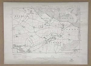
OS MAP Nottinghamshire, Edition of 1921 Ordnance Survey, Sheet XVIII. N.W.
Verlag: Director General at the Ordnance Survey Office, Southhampton, 1921
Anbieter: Maynard & Bradley, Leicester, Vereinigtes Königreich
Verkäuferbewertung 5 von 5 Sternen
Erstausgabe
EUR 23,26
EUR 25,41 Versand
Versand von Vereinigtes Königreich nach USAAnzahl: 1 verfügbar
In den WarenkorbSoftcover. Zustand: Very Good. First Edition. Original print of an ordnance survey of the North West Nottinghamshire showing part of Holbeck, Nether Langwith, Cuckney, Norton, and Blyth and Cuckney R.D. Map is 425 x 580 mm, a bit grubby around the margins from age, edges a bit rough, some creases from storage, overall in great condition for its age. Why on Amazon do most sellers not describe their actual book? Buy with confidence and support a genuine Independent Bricks & Mortar Real Bookshop. We are Maynard & Bradley CAMBO & PBFA(now lapsed) members here in Leicester City Centre. Size: 425 x 580 mm. Item Type: Antique Print. Quantity Available: 1. Shipped Weight: Under 500 grams. Category: Geography & Maps; Map; Britain/UK; 1920s; Pictures of this item not already displayed here available upon request. Inventory No: 30013.
-
Original Printed Map, Provisional Edition Ordinance Survey, OS MAP of Nottinghamshire, Sheet XVIII. S.W.
Verlag: Director General at the Ordnance Survey Office, Southhampton, 1948
Anbieter: Maynard & Bradley, Leicester, Vereinigtes Königreich
Verkäuferbewertung 5 von 5 Sternen
Erstausgabe
EUR 23,26
EUR 25,41 Versand
Versand von Vereinigtes Königreich nach USAAnzahl: 1 verfügbar
In den WarenkorbSoftcover. Zustand: Very Good. First Edition. Original print of an ordinance survey of the south west of Nottinghamshire showing part of Warsop. Map is 425 x 580 mm, a bit grubby around the margins from age, edges a bit rough, some creases from storage, heavy foxing on bottom half and bottom right corner, overall in great condition for its age. Why on Amazon do most sellers not describe their actual book? Buy with confidence and support a genuine Independent Bricks & Mortar Real Bookshop. We are Maynard & Bradley CAMBO & PBFA(now lapsed) members here in Leicester City Centre. Size: 425 x 580 mm. Item Type: Antique Print. Quantity Available: 1. Shipped Weight: Under 500 grams. Category: Geography & Maps; Map; Britain/UK; 1940s; Pictures of this item not already displayed here available upon request. Inventory No: 30014.
-
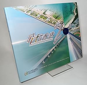
Flashbacks of Two Decades in Hong Kong: A Collection of Hong Kong Aerial Photos
Sprache: Englisch
Verlag: Survey & Mapping Office, Lands Department, Hong Kong, 2017
ISBN 10: 9625673229 ISBN 13: 9789625673226
HARDCOVER. Zustand: Very Good+. Zustand des Schutzumschlags: Fine. Hardcover edition. 165pp. Oblong quarto in blue cloth. Color photos. Small stain to spine else boards crisp and unworn; interior clean and crisp, faint shelfwear to jacket.
-

Gambia
Verlag: Southampton, 1912, 1912
Anbieter: Pennymead Books PBFA, Knaresborough, Vereinigtes Königreich
Verbandsmitglied: PBFA
Verkäuferbewertung 5 von 5 Sternen
EUR 21,17
EUR 17,36 Versand
Versand von Vereinigtes Königreich nach USAAnzahl: 1 verfügbar
In den WarenkorbFolding coloured litho map 27 x 12". Fine.
-

3320BB Laingsburg (Western Cape) 1: 50 000
Verlag: Hoofdirekteur van Opmetings en Kartering / Chief Director of Surveys and Mapping, 1985
Anbieter: Chapter 1, Johannesburg, GAU, Südafrika
Verkäuferbewertung 5 von 5 Sternen
Soft cover. Zustand: Very Good. No Jacket. 2nd Edition. Sheet map of the Laingsburg area of the Western Cape of South Africa. The map face is in very good, thick, fresh condition. Folds are supple and sound. Detail and colouring are excellent. fk. Our orders are shipped using tracked courier delivery services.
-
[Map] Main Trunk Air Routes 1933 (O.R. 501)
Sprache: Englisch
Verlag: Printed at the War Office, London, 1934
Anbieter: Dendera, London, Vereinigtes Königreich
Verkäuferbewertung 5 von 5 Sternen
Karte
EUR 59,62
EUR 28,94 Versand
Versand von Vereinigtes Königreich nach USAAnzahl: 1 verfügbar
In den WarenkorbSoft cover. Zustand: Near Fine. Colour folding paper map of the World 88x58cm. Near fine, neatly folded with some spotting. This is credited to the Ordnance Survey (1926), printed at the War Office (1934). It shows actual and proposed air routes and rail connections, indicating the nationality of each with an alphabetical key from Afghan to Venezuelan.
-
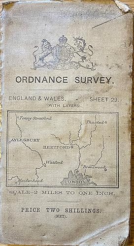
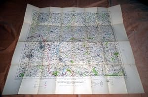
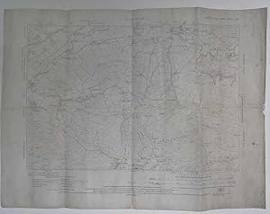
Ordnance Survey. England & Wales. Sheet 29 (with layers). St. Albans. Scale -2 Miles to One Inch.
Verlag: Southampton, 1911
Anbieter: FOLIOS LIMITED, Oxford, Vereinigtes Königreich
Verkäuferbewertung 5 von 5 Sternen
Karte
EUR 17,89
EUR 40,52 Versand
Versand von Vereinigtes Königreich nach USAAnzahl: 1 verfügbar
In den WarenkorbSoft cover. Zustand: Near Fine. Map measuring approximately 71 x 61 cm. Reduced from the One Inch Map of 1902-03. Published by Colonel S.C.N Grant, Director General at the Ordnance Survey Office. #36461.
-
Cumberland OS Map 1926 Edition Sheet LXVIII.SW Six Inches to the Mile
Verlag: Ordnance Survey Office, Southampton, 1923
Anbieter: Maynard & Bradley, Leicester, Vereinigtes Königreich
Verkäuferbewertung 5 von 5 Sternen
Karte
EUR 20,21
EUR 25,41 Versand
Versand von Vereinigtes Königreich nach USAAnzahl: 1 verfügbar
In den WarenkorbSingle sheet thick paper. Zustand: Very Good. Zustand des Schutzumschlags: No Dust Jacket. Revised Edition. Map has hard creases from being a book insert. Has scattered foxing mostly around the border of the map. Edges have some wear and a small part is missing from the right side but is only in the white margin area and does not effect the map image or surrounding text. Why on Amazon do most sellers not describe their actual book? Buy with confidence and support a genuine Independent Bricks & Mortar Real Bookshop. We are Maynard & Bradley CAMBO & PBFA(now lapsed) members here in Leicester City Centre. Size: 570 x 425 mm. Item Type: Map. Quantity Available: 1. Shipped Weight: Under 500 grams. Category: Geography & Maps; Britain/UK; 1920s; Pictures of this item not already displayed here available upon request. Inventory No: 04052.
-
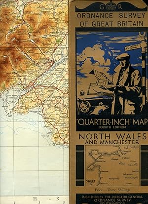
Ordnance Survey of Great Britain | Quarter-Inch Map | Fourth Edition | Sheet 4: North Wales and Manchester
Verlag: Published by Minister of Agriculture and Fisheries for Ordnance Survey Office, Southampton Fourth Edition . 1934., 1934
Anbieter: Little Stour Books PBFA Member, Canterbury, Vereinigtes Königreich
Verbandsmitglied: PBFA
Verkäuferbewertung 5 von 5 Sternen
EUR 14,91
EUR 34,73 Versand
Versand von Vereinigtes Königreich nach USAAnzahl: 1 verfügbar
In den WarenkorbZustand: Very Good. Publisher's original illustrated front cover brown and blue card covered single-sided map. 12'' x 5'' which folds out to measure 42" x 24". Scale of map is 4 miles to 1 inch, mounted in sections on linen, includes fold-out sheet of 17 town plans with with inset details of Mersey Tunnel Charges and Horse Power limitations. Small chip to the top front corner of the front cover and in Very Good clean and crisp condition. Member of the P.B.F.A. CARTOGRAPHY, MAPS, PLANS.
-
Suid-Afrika 1: 50 000 Vel 3319DD Robertson / South Africa 1: 50 000 3319DD Robertson
Erscheinungsdatum: 1963
Anbieter: Chapter 1, Johannesburg, GAU, Südafrika
Verkäuferbewertung 5 von 5 Sternen
Erstausgabe
No Binding. Zustand: Good. No Jacket. 1st Edition. Folded sheet. Ordnance Survey equivalent. In smart, tidy condition. The folds are supple and healthy. The sheet is neat, clean, clear and competent. fk. Our orders are shipped using tracked courier delivery services.
-

Suid-Afrika 1: 50 000 Vel 3320AC Touwsrivier / South Africa 1: 50 000 Sheet 3320AC Touwsrivier
Erscheinungsdatum: 1970
Anbieter: Chapter 1, Johannesburg, GAU, Südafrika
Verkäuferbewertung 5 von 5 Sternen
Erstausgabe
No Binding. Zustand: Good. No Jacket. 1st Edition. Folded sheet. Ordnance Survey equivalent. In smart, tidy condition. The folds are supple and healthy. The sheet is neat, clean, clear and competent. fk. Our orders are shipped using tracked courier delivery services.
-
![Bild des Verkäufers für Konvolut von drei Karten auf Stoff: Ad 1, Anglo-Egyptian Sudan: El Geteina. Africa Sheet 55-F. Scale 1:250,000. Drawn by S. Shaoul. Exd. by O. M. A. Originally drawn Dec. 1941. Corrected Feb. 1949. [.] Ad 2, Anglo-Egyptian Sudan: Wad Medani. Africa Sheet 55-G. Scale 1:250,000. Drawn by S. Saoul. Exd. by S. ud Din. Dec. 1939. [.] Ad 3, Anglo-Egyptian Sudan: Sennar. Africa Sheet 55-K. Scale 1:250,000. Drawn by M. Iskander. Exd. by S. S. Febr. 1943. [.] zum Verkauf von Antiquariat Weinek](https://pictures.abebooks.com/inventory/md/md3216437387.jpg)
Konvolut von drei Karten auf Stoff: Ad 1, Anglo-Egyptian Sudan: El Geteina. Africa Sheet 55-F. Scale 1:250,000. Drawn by S. Shaoul. Exd. by O. M. A. Originally drawn Dec. 1941. Corrected Feb. 1949. [.] Ad 2, Anglo-Egyptian Sudan: Wad Medani. Africa Sheet 55-G. Scale 1:250,000. Drawn by S. Saoul. Exd. by S. ud Din. Dec. 1939. [.] Ad 3, Anglo-Egyptian Sudan: Sennar. Africa Sheet 55-K. Scale 1:250,000. Drawn by M. Iskander. Exd. by S. S. Febr. 1943. [.]
Sprache: Englisch
Verlag: London - Giza, Stanford & Survey of Egypt (1939 - 1949), 1949
Anbieter: Antiquariat Weinek, Salzburg, Österreich
Verkäuferbewertung 3 von 5 Sternen

In engl. Sprache und einseitig auf Stoff (Leinen bzw. Baumwolle) gedruckt [Kartengröße ca. 46 x 67 cm], z. T. farbig. - Fleckig, Ränder etw. fransig. Gefaltet. - Zusammengestellt und gedruckt wurden die Karten vom Survey Office in Khartoum. Der Sudan war ab 1899 als anglo-ägyptisches Kondominium unter einem engl. Generalgouverneur konstituiert, bis das Land 1953 in die Unabhängigkeit trat.
-
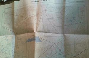
3319BB Matroosberg (Western Cape) 1: 50 000
Verlag: Government Printer, Cape Town, 1969
Anbieter: Chapter 1, Johannesburg, GAU, Südafrika
Verkäuferbewertung 5 von 5 Sternen
Erstausgabe
No Binding. Zustand: Very Good. No Jacket. 1st Edition. Sheet map of the Matroosberg area of the Western Cape of South Africa. The map face is in very good, thick, fresh condition. Folds are supple and sound. Detail and colouring are excellent. fk. Our orders are shipped using tracked courier delivery services.
-
3320CA Baden (Western Cape) 1:50 000
Verlag: Government Printer, Pretoria, 1970
Anbieter: Chapter 1, Johannesburg, GAU, Südafrika
Verkäuferbewertung 5 von 5 Sternen
Erstausgabe
No Binding. Zustand: Very Good. No Jacket. 1st Edition. Sheet map of the Baden area of the Western Cape of South Africa. The map face is in very good, thick, fresh condition. Folds are supple and sound. Detail and colouring are excellent. fk. Our orders are shipped using tracked courier delivery services.

![Bild des Verkäufers für [Map] Main Trunk Air Routes 1933 (O.R. 501) zum Verkauf von Dendera](https://pictures.abebooks.com/inventory/md/md31579095493.jpg)