
Roger baskes (5 Ergebnisse)

- Softcover
- Erstausgabe
Anbieter: Alkahest Books, Deerfield, IL, USAAlkahest Books
Verkäufer/-in kontaktierenVerkäufer/-in mit 5 SternenZustand: Gebraucht - Befriedigend
EUR 17,96
EUR 5,67 VersandVersand innerhalb von USAAnzahl: 1 verfügbar
softcover. Zustand: Good. First Edition. Softcover, quarto (approx. 8 1/2" wide by 11" tall), 48 pages. Color covers. Black and white illustrations. Includes bibliography. There is a stain on upper right of front cover. Presentation card laid in. The Hermon Dunlap Smith Center for the History of Cartography the Newberry Library.… Maps, Cartography. 071202B.

Verlag: Kalmbach Pub. Co, Wisconsin, 1981
- Softcover
Anbieter: Bookshelf of Maine, Franklin, ME, USABookshelf of Maine
Verkäufer/-in kontaktierenVerkäufer/-in mit 5 SternenZustand: Gebraucht - Gut
EUR 17,96
EUR 6,93 VersandVersand innerhalb von USAAnzahl: 1 verfügbar
Paperback. Zustand: Very Good-. Reprint. Corners are curled and light surface soiling to the covers - see image. ; 4to 11" - 13" tall; 48 pages.
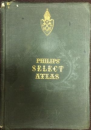
Philips' select atlas of physical and political geography
George Philip; George Philip & Son,; Philip, Son & Nephew,; Roger S. Baskes Collection (Newberry Library)
Verlag: London : George Philip & Son, Ltd. [19-]
- Hardcover
Anbieter: Joseph Burridge Books, Dagenham, Vereinigtes KönigreichJoseph Burridge Books
Verkäufer/-in kontaktierenVerkäufer/-in mit 5 SternenZustand: Gebraucht - Ausreichend
EUR 24,32
EUR 27,15 VersandVersand von Vereinigtes Königreich nach USAAnzahl: 1 verfügbar
Hardcover. Zustand: Fair. 1 atlas, 24 folded color maps + index ; 28 cm. lacks title page. rubbing to corners of covers. 1 map is loose. some with small tears to edges.

Verlag: The compiler], [Chicago, IL, 1997
- Softcover
- Signiert
Anbieter: Bartleby's Books, ABAA, Chevy Chase, MD, USABartleby's Books, ABAA
Verkäufer/-in kontaktierenVerkäufer/-in mit 5 SternenZustand: Gebraucht
EUR 224,50
EUR 6,97 VersandVersand innerhalb von USAAnzahl: 1 verfügbar
Revised edition (first issued in 1995?). 4to. iv, (2, atlases by author), 80, (2, atlases chronologically), 50, (2, index of names), 123, (2, classical/Bible), 4, (2, maps of Britain), 7, (2, geographies), 9, (2, French atlases), 9, (2, Netherlands), 5, (2, German atlases), 6, (2, Baedekers), 16, (2, guidebooks), 10, (2, cartogr…aphy), 59, (2, mapfile examples), (18), (2, S.A. Mitchell), 31 pp. A "short-title bibliography" of the compiler's collection of more than 7000 books (3500 atlases and books with maps, 2400 cartographic reference works, and 1100 Baedekers and other guidebooks), given in a spread-sheet style for a number of categories for each item. Laid in is a short typed letter of presentation, signed by the compiler. OCLC locates six copies (New York Public, Newberry, Harvard, Texas-Arlington, Wisconsin-Milwaukee, British Library) and two of the 1995 edition (Newberry, Harvard). Comb-bound printed cream wrappers. Very good.
 Weitere Bilder
Atlas universel de géographie. Revu et corrigé par A. Vuillemin pour l'intelligence de la Géographie de Malte-Brun. First edition.
Tardieu, Ambroise 1788 - 1841; Alexandre Vuillemi, (1812 - 1886); S. Jacobs (Engraver),A. Blanchard (Engraver),; Jules Claye (Printer); Conrad Malte-Brun; Furne (Firm) (Publisher); Imprimerie Delamain (Printer); Roger S. Baskes ; S. Jacobs (Engraver); A. Blanchard (Engraver).
Verlag: Paris: Furne et Cie, libraires-éditeurs, 1855, 1855
Anbieter: Wittenborn Art Books, San Francisco, CA, USAWittenborn Art Books
Verkäufer/-in kontaktierenVerkäufer/-in mit 5 SternenZustand: Gebraucht - Befriedigend
EUR 785,76
EUR 8,72 VersandVersand innerhalb von USAAnzahl: 1 verfügbar
Zustand: Good. In-folio , 27.5 41.5cm; demi-toile verte, étiquette de titre sur le plat (reliure de l'époque). Reliure usagée, mors int. cassé. 30 cartes sur double page en couleurs. Qqs petites rousseurs, bon état des cartes. Bookblock partially loose from spine.OCLC Number / Unique Identifier:794503958:([4] pages, [60] leaves)… : 30 hand colored maps ; 42 cm; "Pour l'intelligence de la Géographie universelle de Malte-Brun."J. Claye, imprimeur-libraire"--Half t.p. verso"Imp. Delamain, 8, rue Git--le-C?ur, Paris"--Most maps.Some maps engraved by S. Jacobs; some maps with script engraved by A. BlanchardRelief shown by hachures and shadingMaps hand colored in outlin.


