Gesamtpreis (1 Artikel Artikel):
Versandziel:

rapin tindal (55 Ergebnisse)
Direkt zu den wichtigsten Suchergebnissen
Suchfilter
Produktart
- Alle Product Types
- Bücher (23)
- Magazine & Zeitschriften (Keine weiteren Ergebnisse entsprechen dieser Verfeinerung)
- Comics (Keine weiteren Ergebnisse entsprechen dieser Verfeinerung)
- Noten (Keine weiteren Ergebnisse entsprechen dieser Verfeinerung)
- Kunst, Grafik & Poster (12)
- Fotografien (Keine weiteren Ergebnisse entsprechen dieser Verfeinerung)
- Karten (20)
- Manuskripte & Papierantiquitäten (Keine weiteren Ergebnisse entsprechen dieser Verfeinerung)
Zustand Mehr dazu
- Neu (4)
- Wie Neu, Sehr Gut oder Gut Bis Sehr Gut (Keine weiteren Ergebnisse entsprechen dieser Verfeinerung)
- Gut oder Befriedigend (23)
- Ausreichend oder Schlecht (4)
- Wie beschrieben (24)
Einband
Weitere Eigenschaften
- Erstausgabe (2)
- Signiert (Keine weiteren Ergebnisse entsprechen dieser Verfeinerung)
- Schutzumschlag (Keine weiteren Ergebnisse entsprechen dieser Verfeinerung)
- Angebotsfoto (49)
Sprache (2)
Gratisversand
Land des Verkäufers
Verkäuferbewertung
-

Histoire d'Angletere. Tome Dixieme.
Verlag: Haye, 1749
Anbieter: Books From California, Simi Valley, CA, USA
Verkäuferbewertung 4 von 5 Sternen

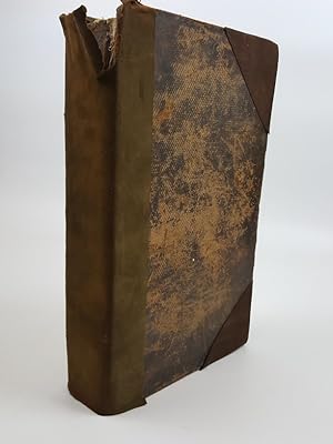
Hardcover. Zustand: Very Good. Volume 10 only. French language text. Full leather cover shows minor wear and tear, rubbing and holing, soiling, raised bands and gilt decoration on the backstrip. Pages show minor tanning and soiling, text and pictures are intact and unmarred.
-
Histoire d'Angleterre. Tome Quatorzieme.
Verlag: Haye, 1749
Anbieter: Books From California, Simi Valley, CA, USA
Verkäuferbewertung 4 von 5 Sternen
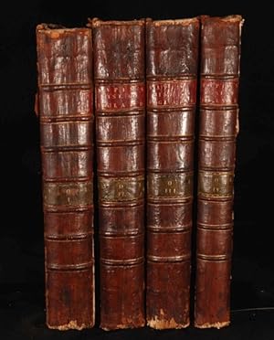
Hardcover. Zustand: Very Good. Volume 14 only. French language text. Full leather cover shows minor wear and tear, rubbing and holing, soiling, raised bands and gilt decoration on the backstrip. Pages show minor tanning and soiling, text and pictures are intact and unmarred.
-

EUR 46,53
EUR 48,99 Versand
Versand von Deutschland nach USAAnzahl: Mehr als 20 verfügbar
In den WarenkorbGebunden. Zustand: New.
-

EUR 48,16
EUR 48,99 Versand
Versand von Deutschland nach USAAnzahl: Mehr als 20 verfügbar
In den WarenkorbGebunden. Zustand: New.
-
A Summary of Mr Rapin De Thoyras's History of England and Mr Tindal's Continuation, from the Invasion of Julius Cæsar, to the End of the Reign of King George I. Illustrated with Medals, Plans of Battles, Towns, and Sieges. Vol.III, Books XXV XXVI XXVII
Verlag: London, 1747
Anbieter: Victoria Bookshop, BERE ALSTON, DEVON, Vereinigtes Königreich
Verkäuferbewertung 4 von 5 Sternen
Erstausgabe
EUR 46,83
EUR 11,42 Versand
Versand von Vereinigtes Königreich nach USAAnzahl: 1 verfügbar
In den WarenkorbHardcover. Zustand: Poor. 1st Edition. No title page Nothing before page 1 Spine split no cover. Book.
-

Tindal, N: CONTINUATION OF MR RAPINS HIST
Anbieter: AHA-BUCH GmbH, Einbeck, Deutschland
Verkäuferbewertung 5 von 5 Sternen

Taschenbuch. Zustand: Neu. Neuware - This is an EXACT reproduction of a book published before 1923. This IS NOT an OCR'd book with strange characters, introduced typographical errors, and jumbled words. This book may have occasional imperfections such as missing or blurred pages, poor pictures, errant marks, etc. that were either part of the original artifact, or were introduced by the scanning process. We believe this work is culturally important, and despite the imperfections, have elected to bring it back into print as part of our continuing commitment to the preservation of printed works worldwide. We appreciate your understanding of the imperfections in the preservation process, and hope you enjoy this valuable book.
-

Tindal, N: CONTINUATION OF MR RAPINS HIST
Anbieter: AHA-BUCH GmbH, Einbeck, Deutschland
Verkäuferbewertung 5 von 5 Sternen
Taschenbuch. Zustand: Neu. Neuware - This is an EXACT reproduction of a book published before 1923. This IS NOT an OCR'd book with strange characters, introduced typographical errors, and jumbled words. This book may have occasional imperfections such as missing or blurred pages, poor pictures, errant marks, etc. that were either part of the original artifact, or were introduced by the scanning process. We believe this work is culturally important, and despite the imperfections, have elected to bring it back into print as part of our continuing commitment to the preservation of printed works worldwide. We appreciate your understanding of the imperfections in the preservation process, and hope you enjoy this valuable book.
-
The History of England 2nd edition Volume II
Sprache: Englisch
Verlag: James, John and Paul Knapton, 1733
Anbieter: Talisman Books, Stockport, CHS, Vereinigtes Königreich
Verkäuferbewertung 5 von 5 Sternen
EUR 238,92
EUR 29,00 Versand
Versand von Vereinigtes Königreich nach USAAnzahl: 1 verfügbar
In den WarenkorbHardcover. Zustand: Very Good. Translator : N. Tindal (illustrator). 2nd Edition. 1547 Edward VI to William and Mary 1689. Full calf binding of this 2nd edition, volume 2. six raised bands to spine with black and green labels. Decorated compartments. Decorated boards. Some partial fading to spine and front board. Slightest rubbing to boards otherwise very good indeed. Internally there is slight foxing with the odd mark but overall very good indeed.(7), frontis, title page, 807pp, index to first and second volumes 19pp, extract of a letter+ advertisement + errata 2pp, books printed, advertisements 12pp, (6) All portraits present (12 ) plus genealogical table. No maps. Volume 4 part 2 is available in identical binding.
-
The History of England by Mr. Rapin de Thoyras , continued from the Revolution to the accession of King George II. by N Tindal Vol XXIII
Verlag: Knapton, London, 1745
Anbieter: Victoria Bookshop, BERE ALSTON, DEVON, Vereinigtes Königreich
Verkäuferbewertung 4 von 5 Sternen
EUR 61,76
EUR 11,42 Versand
Versand von Vereinigtes Königreich nach USAAnzahl: 1 verfügbar
In den WarenkorbHardcover. Zustand: Fair. First edition thus. volume 8 of the continuation. No maps, plates in this one. Book.
-
A complete history of england By Question and Answer from the Invasion of Julius Caesar to the Begining of the Year 1780 Extracted from Rapin tindal Hume and Smollett
Verlag: S Crowder, London, 1780
Anbieter: Victoria Bookshop, BERE ALSTON, DEVON, Vereinigtes Königreich
Verkäuferbewertung 4 von 5 Sternen
EUR 63,59
EUR 11,42 Versand
Versand von Vereinigtes Königreich nach USAAnzahl: 1 verfügbar
In den WarenkorbHardcover. Zustand: Poor. 3rd. 12mo. A good copy for its age but LACKS ffep and title page, cover worn and has tears bookplate of Alexander Annand. Amazingly not in British Library so unusually rare. Probably a school textbook which was destroyed as it became out of date. PO bookplate Alexander Annand on front pastedown. Contains several engraved plates. A few old brown ink marginal notes. Book.
-
![Bild des Verkäufers für Plan of the City of Bouchain situated upon the Rivers Sensette and Scheld in the County of Hainault [ Battle plan taken from Mr Tindal's continuation of Mr. Rapin's History of England ] zum Verkauf von Keoghs Books](https://pictures.abebooks.com/inventory/md/md571891052.jpg)
Plan of the City of Bouchain situated upon the Rivers Sensette and Scheld in the County of Hainault [ Battle plan taken from Mr Tindal's continuation of Mr. Rapin's History of England ]
Verlag: no date givenapproximately 1745, London, 1745
Anbieter: Keoghs Books, Skipton, Vereinigtes Königreich
Verbandsmitglied: PBFA
Verkäuferbewertung 5 von 5 Sternen
Karte
EUR 28,67
EUR 32,47 Versand
Versand von Vereinigtes Königreich nach USAAnzahl: 1 verfügbar
In den Warenkorb, 41 x 50 cm , engraved, folding map, originally a plate from a book, showing defences and attacks on Bouchain with key to map in decorated cartouche at top right Second editon , edges trimmed close to borders of map, creases from folding, ten or so small (worm?) holes at top edge of map otherwise map in very good condition engraved area 36 x 47 cm Map ISBN:
-
![Bild des Verkäufers für Intrenchment of the Army of the Allies to cover the Siege of Douay against the French Army that came to raise it in June 1710 [ Battle plan taken from Mr Tindal's continuation of Mr. Rapin's History of England ] zum Verkauf von Keoghs Books](https://pictures.abebooks.com/inventory/md/md571891050.jpg)
Intrenchment of the Army of the Allies to cover the Siege of Douay against the French Army that came to raise it in June 1710 [ Battle plan taken from Mr Tindal's continuation of Mr. Rapin's History of England ]
Verlag: no date givenapproximately 1745, London, 1745
Anbieter: Keoghs Books, Skipton, Vereinigtes Königreich
Verbandsmitglied: PBFA
Verkäuferbewertung 5 von 5 Sternen
Karte
EUR 28,67
EUR 32,47 Versand
Versand von Vereinigtes Königreich nach USAAnzahl: 1 verfügbar
In den Warenkorb, 41 x 50 cm , engraved, folding map, originally a plate from a book, showing defences and attacks on Douay Second editon , edges trimmed close to borders of map, creases from folding, otherwise map in very good condition engraved area 37 x 48 cm Map ISBN:
-
![Bild des Verkäufers für Plan of the Battle of Eckeren [ Battle plan taken from Mr Tindal's continuation of Mr. Rapin's History of England ] zum Verkauf von Keoghs Books](https://pictures.abebooks.com/inventory/md/md571891034.jpg)
Plan of the Battle of Eckeren [ Battle plan taken from Mr Tindal's continuation of Mr. Rapin's History of England ]
Verlag: no date givenapproximately 1745, London, 1745
Anbieter: Keoghs Books, Skipton, Vereinigtes Königreich
Verbandsmitglied: PBFA
Verkäuferbewertung 5 von 5 Sternen
Karte
EUR 28,67
EUR 32,47 Versand
Versand von Vereinigtes Königreich nach USAAnzahl: 1 verfügbar
In den Warenkorb, 42 x 49 cm, engraved, folding map, originally a plate from a book, showing deployment of troops at the Battle of Eckeren Second editon , edges a little rubbed outside border of engraving, creases from folding, a few faint brown spots, otherwise very good condition engraved area 36 x 46 cm Map ISBN:
-
![Bild des Verkäufers für Plan of ye Battle of Wynendale between ye Troops of ye Allies commanded by Major Gen. Webb & those of France under Count de La Motte Sept. 28 1708 [ Battle plan taken from Mr Tindal's continuation of Mr. Rapin's History of England ] zum Verkauf von Keoghs Books](https://pictures.abebooks.com/inventory/md/md571891038.jpg)
Plan of ye Battle of Wynendale between ye Troops of ye Allies commanded by Major Gen. Webb & those of France under Count de La Motte Sept. 28 1708 [ Battle plan taken from Mr Tindal's continuation of Mr. Rapin's History of England ]
Verlag: no date givenapproximately 1745, London, 1745
Anbieter: Keoghs Books, Skipton, Vereinigtes Königreich
Verbandsmitglied: PBFA
Verkäuferbewertung 5 von 5 Sternen
Karte
EUR 28,67
EUR 32,47 Versand
Versand von Vereinigtes Königreich nach USAAnzahl: 1 verfügbar
In den Warenkorb, 41 x 49 cm , engraved, folding map, originally a plate from a book, showing deployment of troops at the Battle of Wynendale with decorative cartouche surrounded by engravings of weapons, artillery etc. Second editon , creases from folding, map in very good condition engraved area 36 x 46 cm Map ISBN:
-
![Bild des Verkäufers für Menin - A very strong town in the Earldom of Flanders taken by ye Allies in the year 1706 and retaken by the French in 1744 [ Map of Menin taken from Mr Tindal's continuation of Mr. Rapin's History of England ] zum Verkauf von Keoghs Books](https://pictures.abebooks.com/inventory/md/md571891024.jpg)
Menin - A very strong town in the Earldom of Flanders taken by ye Allies in the year 1706 and retaken by the French in 1744 [ Map of Menin taken from Mr Tindal's continuation of Mr. Rapin's History of England ]
Verlag: no date givenapproximately 1745, London, 1745
Anbieter: Keoghs Books, Skipton, Vereinigtes Königreich
Verbandsmitglied: PBFA
Verkäuferbewertung 5 von 5 Sternen
Karte
EUR 28,67
EUR 32,47 Versand
Versand von Vereinigtes Königreich nach USAAnzahl: 1 verfügbar
In den Warenkorb, 44 x 50 cm, engraved, folding map, originally a plate from a book, scale of approximately 260 feet to the inch showing defences and attacks on the fortified city of Menin, 1 cm + margin at all sides Second editon , edges a little rubbed with a few small chips all outside border of engraving, creases from folding, otherwise very good condition engraved area 37 x 48 cm Map ISBN:
-
![Bild des Verkäufers für Plan of Toulon, with a View of its Road, and the Situation of its towns, &c.[ Battle plan taken from Mr Tindal's continuation of Mr. Rapin's History of England ] zum Verkauf von Keoghs Books](https://pictures.abebooks.com/inventory/md/md571891032.jpg)
Plan of Toulon, with a View of its Road, and the Situation of its towns, &c.[ Battle plan taken from Mr Tindal's continuation of Mr. Rapin's History of England ]
Verlag: no date givenapproximately 1745, London, 1745
Anbieter: Keoghs Books, Skipton, Vereinigtes Königreich
Verbandsmitglied: PBFA
Verkäuferbewertung 5 von 5 Sternen
Karte
EUR 29,87
EUR 32,47 Versand
Versand von Vereinigtes Königreich nach USAAnzahl: 1 verfügbar
In den Warenkorb, 44 x 48 cm , engraved, folding map, originally a plate from a book, scale of approximately 1000 feet to the inch showing defences and attacks at Toulon with inset map of region Second editon , margins tatty with chips and tears outside border of engraving, tear along 50% of one vertical fold, creases from folding, worn but servicable copy engraved area 37 x 46 cm Map ISBN:
-
![Bild des Verkäufers für Ypres a strong City and Castle in Flanders, restored to the Emperor by the Treaty of Utrecht [ Map of Ypres taken from Mr Tindal's continuation of Mr. Rapin's History of England ] zum Verkauf von Keoghs Books](https://pictures.abebooks.com/inventory/md/md571891026.jpg)
Ypres a strong City and Castle in Flanders, restored to the Emperor by the Treaty of Utrecht [ Map of Ypres taken from Mr Tindal's continuation of Mr. Rapin's History of England ]
Verlag: no date givenapproximately 1745, London, 1745
Anbieter: Keoghs Books, Skipton, Vereinigtes Königreich
Verbandsmitglied: PBFA
Verkäuferbewertung 5 von 5 Sternen
Karte
EUR 29,87
EUR 32,47 Versand
Versand von Vereinigtes Königreich nach USAAnzahl: 1 verfügbar
In den Warenkorb, 40 x 50 cm, engraved, folding map, originally a plate from a book, scale of approximately 500 feet to the inch showing defences of the fortified city of Ypres, 1 cm + margin at all sides Second editon , edges a little rubbed outside border of engraving, two tiny holes at top left corner, creases from folding, otherwise very good condition engraved area 36 x 47 cm Map ISBN:
-
![Bild des Verkäufers für Plan of the City of Dendermonde, and the manner in which it was blocked by troops of the Allies [ Battle plan taken from Mr Tindal's continuation of Mr. Rapin's History of England ] zum Verkauf von Keoghs Books](https://pictures.abebooks.com/inventory/md/md571891044.jpg)
Plan of the City of Dendermonde, and the manner in which it was blocked by troops of the Allies [ Battle plan taken from Mr Tindal's continuation of Mr. Rapin's History of England ]
Verlag: no date givenapproximately 1745, London, 1745
Anbieter: Keoghs Books, Skipton, Vereinigtes Königreich
Verbandsmitglied: PBFA
Verkäuferbewertung 5 von 5 Sternen
Karte
EUR 29,87
EUR 32,47 Versand
Versand von Vereinigtes Königreich nach USAAnzahl: 1 verfügbar
In den Warenkorb, 43 x 50 cm, engraved, folding map, originally a plate from a book, showing defences and encirclement of Dendermonde with key in decorative cartouche, and inset Prospect of the City Second editon , a few small edge tears outside borders of map, one 2 inch tear to right border affects map, creases from folding, otherwise map in very good condition engraved area 37 x 47 cm Map ISBN:
-
![Bild des Verkäufers für Plan of the Country and Camps of Almanar, the one under Charles III and the other in the Enemy under the D.of Anjou, who was defeated by 16 Squadrons commanded by Lieut.Genl. Stanhope July 27 1710 [ Battle plan taken from Mr Tindal's continuation of Mr. Rapin's History of England ] zum Verkauf von Keoghs Books](https://pictures.abebooks.com/inventory/md/md571891030.jpg)
Plan of the Country and Camps of Almanar, the one under Charles III and the other in the Enemy under the D.of Anjou, who was defeated by 16 Squadrons commanded by Lieut.Genl. Stanhope July 27 1710 [ Battle plan taken from Mr Tindal's continuation of Mr. Rapin's History of England ]
Verlag: no date givenapproximately 1745, London, 1745
Anbieter: Keoghs Books, Skipton, Vereinigtes Königreich
Verbandsmitglied: PBFA
Verkäuferbewertung 5 von 5 Sternen
Karte
EUR 29,87
EUR 32,47 Versand
Versand von Vereinigtes Königreich nach USAAnzahl: 1 verfügbar
In den Warenkorb, 42 x 49 cm, engraved, folding map, originally a plate from a book, scale of approximately 1000 Common Paces to the inch showing deployment of troops at the Battle of Almanar Second editon , edges a little rubbed with a few small chips and tears all outside border of engraving, creases from folding, small split at junction of folds, two worn patches with small hole at right margin of map, sligtly yellowed, good condition engraved area 36 x 47 cm Map ISBN:
-
![Bild des Verkäufers für Plan of the City of Doway [ Battle plan taken from Mr Tindal's continuation of Mr. Rapin's History of England ] zum Verkauf von Keoghs Books](https://pictures.abebooks.com/inventory/md/md571891042.jpg)
Plan of the City of Doway [ Battle plan taken from Mr Tindal's continuation of Mr. Rapin's History of England ]
Verlag: no date givenapproximately 1745, London, 1745
Anbieter: Keoghs Books, Skipton, Vereinigtes Königreich
Verbandsmitglied: PBFA
Verkäuferbewertung 5 von 5 Sternen
Karte
EUR 31,06
EUR 32,47 Versand
Versand von Vereinigtes Königreich nach USAAnzahl: 1 verfügbar
In den Warenkorb, 43 x 50 cm, engraved, folding map, originally a plate from a book, scale 700 feet to the inch, showing defences of Doway with decorative cartouche around title Second editon , a few small edge tears outside borders of map, creases from folding, map in very good condition engraved area 37 x 47 cm Map ISBN:
-
THE HISTORY OF THE ENGLAND Continued from the Revolution to the Accession of king George II Volume III
Verlag: Printed for John and Paul Knapton, 1744, 1744
Anbieter: Rothwell & Dunworth (ABA, ILAB), Dulverton, Vereinigtes Königreich
Verkäuferbewertung 5 von 5 Sternen
EUR 89,60
EUR 14,50 Versand
Versand von Vereinigtes Königreich nach USAAnzahl: 1 verfügbar
In den WarenkorbFolio (16 x 10¼ ins). Contemporary full calf, raised-ribbed spine with gilt lettered label, boards with double gilt filet border and gilt tooled edges (poor - chipped at head and tail of spine and heavily rubbed and worn at edges and corners but binding still firm). Pp. [x] + xxviii + 532 + 40, title printed in red and black, pages in double columns, illus with 3 engraved vignettes, lacks medals plates (previous owner's inscription in contemporary hand at top edge of title page).
-
![Bild des Verkäufers für Plan of the City and Citadel of Dunkirk [ Battle plan taken from Mr Tindal's continuation of Mr. Rapin's History of England ] zum Verkauf von Keoghs Books](https://pictures.abebooks.com/inventory/md/md571891046.jpg)
Plan of the City and Citadel of Dunkirk [ Battle plan taken from Mr Tindal's continuation of Mr. Rapin's History of England ]
Verlag: no date givenapproximately 1745, London, 1745
Anbieter: Keoghs Books, Skipton, Vereinigtes Königreich
Verbandsmitglied: PBFA
Verkäuferbewertung 5 von 5 Sternen
Karte
EUR 41,81
EUR 32,47 Versand
Versand von Vereinigtes Königreich nach USAAnzahl: 1 verfügbar
In den Warenkorb, 43 x 50 cm, engraved, folding map, originally a plate from a book, showing defences of Dunkirk with title in decorative cartouche Second editon , a few small edge tears outside borders of map, two 2 inch tears to top margin show on map, creases from folding, otherwise map in good + condition engraved area 37 x 49 cm Map ISBN:
-
![Bild des Verkäufers für Plan of the Incampment of the Allies at Prats Del Rey under the command of Count Staremberg. 1711 [ Battle plan taken from Mr Tindal's continuation of Mr. Rapin's History of England ] zum Verkauf von Keoghs Books](https://pictures.abebooks.com/inventory/md/md571891054.jpg)
Plan of the Incampment of the Allies at Prats Del Rey under the command of Count Staremberg. 1711 [ Battle plan taken from Mr Tindal's continuation of Mr. Rapin's History of England ]
Verlag: no date givenapproximately 1745, London, 1745
Anbieter: Keoghs Books, Skipton, Vereinigtes Königreich
Verbandsmitglied: PBFA
Verkäuferbewertung 5 von 5 Sternen
Karte
EUR 41,81
EUR 32,47 Versand
Versand von Vereinigtes Königreich nach USAAnzahl: 1 verfügbar
In den Warenkorb, 51 x 39 cm, engraved, folding map, originally a plate from a book, showing troop deployments at the battle of Prats Del Rey, with key to map in decorated cartouche at top left Second editon , small chips and tears to edges outside borders of map, creases from folding, otherwise map in very good condition engraved area 46 x 37 cm Map ISBN:
-
The History of England, Vol. I. Books I-XVII
Verlag: Published by John and Paul Knapton 1743; 1817, London, 1743
Anbieter: Keoghs Books, Skipton, Vereinigtes Königreich
Verbandsmitglied: PBFA
Verkäuferbewertung 5 von 5 Sternen
EUR 298,65
EUR 32,47 Versand
Versand von Vereinigtes Königreich nach USAAnzahl: 1 verfügbar
In den Warenkorb, 798 pages, with all 4 folding maps, 8 genealogical tables and 44 other plates, (Books I-XV), pages 691-800 of later edition [1817] at the rear with 7 plates, continues from vol I (Books XVI-XVII), English translation from the French, 63 plates in total Third Edition and later edition , spine and corners amateurly repaired with reversed calf, tear to top of spine, boards scuffed, lacks frontispiece, hinges cracked thus covers loosely held, creasing and edge tears to some plates, occasional stains inside, book in fair condition , contemporary diced calf with reversed calf over corners and spine Folio Hardback ISBN:
-
![Bild des Verkäufers für [Mapa] A Map of the kingdoms of Spain and Portugal from the latest and best observations for Mr Tindals continuation of Mr Rapin's History zum Verkauf von Bolivar Old Prints Anticuario](https://pictures.abebooks.com/inventory/md/md32007399323.jpg)
[Mapa] A Map of the kingdoms of Spain and Portugal from the latest and best observations for Mr Tindals continuation of Mr Rapin's History
Verlag: London, 1745
Anbieter: Bolivar Old Prints Anticuario, Barcelona, B, Spanien
Verkäuferbewertung 5 von 5 Sternen
Karte
Sin Encuadernar - No binding. Zustand: Bueno. Mapa detallado de España y Portugal de Nicholas Tindal, de 1752. Este mapa de la Península Ibérica muestra a España y Portugal, así como los estrechos de Gibraltar, parte de África del Norte y parte de Francia, y las islas Baleares de Mallorca, Menorca e Ibiza. Las características de alivio se muestran pictóricamente. Un cartucho ricamente adornado con dos brazos contiene el título del mapa. En la parte inferior del mapa, una leyenda destaca varios símbolos para indicar los lugares y eventos de importancia. ------------------------------ A detailed map of Spain and Portugal by Nicholas Tindal, dated 1752. This map of the Iberian Peninsula shows Spain and Portugal, as well as the Straits of Gibraltar, part of North Africa, part of France, and the Balearic Islands of Mallorca, Menorca, and Ibiza. Relief features are shown pictorially. A richly adorned cartouche with two coats of arms encloses the map's title. At the bottom of the map, a legend highlights various symbols to indicate the sites and events of importance. FRA. Good (bueno).
-

The continuation of M. Rapin de Thoyras's History of England : from the revolution to the accession of King George II: in three volumes
Verlag: London: printed for James, John, and Paul Knapton, at the Crown in Ludgate-street, near the West-End of St. Paul's, 1733
Second Edition. Poor set in the original full worn aniline calf; wear and tear as with age. Some plates missing. Text remains in fine condition and without blemish. Provenance; from the library of James Whatman with the owner's bookplate. Physical description; 3 vols. ( vol. II, vol. IV and vol. IV: part II) : ill. ; 41 cm. Subjects; Great Britain History ; Early works to 1800. Genre; Illustrated. 6 Kg.
-
The History of England
Verlag: James, John, and Paul Knapton; John and Paul Knapton 1732-43, London, 1732
Anbieter: Rooke Books PBFA, Bath, Vereinigtes Königreich
Verbandsmitglied: PBFA
Verkäuferbewertung 5 von 5 Sternen
EUR 447,98
EUR 23,18 Versand
Versand von Vereinigtes Königreich nach USAAnzahl: 1 verfügbar
In den WarenkorbLeather. Zustand: Good Only. Not Stated (illustrator). Paul de Rapin de Thoyras' important and influential history of England, an illustrated work translated to English by Nicholas Tindal. A mixed edition set, with Volume I being the second edition, whereas Volume II is the third edition.Complete in two volumes, though Tindal later expanded the work to four volumes in 1744-47 with his additions.Volume I is illustrated with a vignette title, four folding maps, one folding plate, seven plates, and in-text engravings.Volume II is illustrated with a frontispiece, a vignette title, one folding plate, sixteen plates, and in-text engravings. One page of adverts to the rear.Collated, bound without the frontispiece for Volume I, however there is no definitie collation for this work, as many of the plates were issued separately from the volumes themselves, as advertised to the rear of Volume II.This is an influential exposition of the view of English history from the side of the Whigs, in which the author traces the rich history of England from the Ancient times, up to the reign of William and Mary. It exposed a Whig view of history, being influential on both sides of the channel, and was written for the endorsement of the British monarchy, specifically for the House of Hanover. The work was noted for its effective and lucid writing style.Rapin spent seventeen years on this work, and it ruined his health. He was noted for having been the first person to describe King Stephen's reign as 'anarchy'. This work was the greatest contribution to British historiography and it's development in the eighteenth century, as, at this time, no other history of England was as comprehensive.Originally written in French by Paul Rapin de Thoyras, first published as 'Histoire d'Angleterre' is 1724-27 in monthly installments.Here translated to English by Nicholas Tindal. Tindal began this translation whilst he was working as a chaplain to the Royal Navy. His translation is superb, known for his large number of innovative and informative notes that he added throughout the volumes, expanding on Rapin's words. Volume I is in a half calf binding with marbled paper to the boards, Volume II is in a full calf binding. Externally, Volume I is generally smart, Volume II is a little worn and rubbed, boards held by cords only. Light rubbing and discolouration to the boards of Volume I, resulting in a small amount of loss of paper. Bumping and loss to the extremities of Volume II, lighter bumping to the extremities of Volume I. Loss to the spine and joints of Volume II. Hinges of Volume I are starting but firm. Loss to the rear endpaper of Volume I. Internally, firmly bound. Pages are generally bright and clean with scattered spots. Repairs to the margins of leaves A2 and Ff1 to Volume II. Light tidemark to the bottom edge of Volume II. Good Only. book.
-
The History of England. Vol. IV. Part II.
Verlag: John and Paul Knapton, London, 1747
Anbieter: Attic Books (ABAC, ILAB), London, ON, Kanada
Verkäuferbewertung 5 von 5 Sternen
Hardcover. Zustand: Poor. Pages 394-714, 1-274, [29], interspersed with plates. 41 cm. Frontispiece portrait of King George I and 2 other portraits. Title vignette and 2 decorations. 2 plates illustrating the Great Seals of George I and Queen Anne. 10 plates illustrating medals numbered I to X. 15 fold-out maps or plans. Full leather. Black and red title page. Text in 2 columns. From our As Is shelf. Split in three sections at plan of Mechlin and p. 247. Newer hand-printed spine label is partly missing. Large tear in spine tail. Corners and edges worn. Large tear in p. 595. Some smaller tears elsewhere. Offsetting from maps. Plans of Mechlin and Aeth detached. A few scattered ink notes. Dampstains to margins of rear pages. Armorial bookplate on both pastedowns. Title continues: "by Mr. Rapin de Thoyras. Continued from the Revolution to the Accession of King George II. By N. Tindal, M. A. Rector of Alverstoke in Hampshire, and Chaplain to the Royal Hospital at Greenwich. Illustrated With the Heads of the Kings, Queens, and several Eminent Persons; also with Plans of Battles and cities, Maps, Medals, and other Copper-Plates." Text discusses the reign of George I. Next section describes the medals issued during the reign of Queen Anne and King George I. Followed by "A Summary of the History of England. From the Invasion of Julius Caesar to the Death of King George I." Finally has lists of the Kings and Princes of Wales, chancellors, English archbishops and bishops, chief justices, justices, barons, knights of the Bath, admirals of England. Index at rear. 15 fold-out maps or plans as follows: Draught of ye Bay of Bulls between the Town of Rotta and Fort St. Catherine, under the Command of his Grace the Duke of Ormond, with the disposition of the Frigates which were ordered to stand in by the Shore, to favour the Landing, as also the Situation of the Ground and Bay, with that of the Enemy's Batteries & Troops; An Exact Draught of the Bay and Harbour of Vigo; Plan of the Works of the City of Messina, one of the strongest and most considerable Cities of Sicily, and a fine Sea-Port; Plan of the Battle of Eckeren; Battle of Maestricht; Plan of the Town and Fortification of Gibraltar, exactly taken on the Spot in the Year 1738; Plan of the Lines of Brabant Forced July 18, 1705 by the Army of ye Allies, commanded by His Grace the Duke of Marlborough, & Felt-Marshal D'Averquerque. Designed upon the Spot by Monsr. Divoy Colonel and Quarter-master General of the Army of the States General; Plan of the City of Barcelona; Plan of the Investiture of Ostend Surrendered, 6 July 1706; Menin; Mechlin, or Malines the Capital of one of the ten Provinces of the Netherlands in Brabant an Archbishoprick, situated upon ye Dyle; Plan of the City of Dendermonde, and the manner in which it was blocked by the troops of the Allies; Aeth a Strong Frontier Town in Brabant, taken by the Duke of Marlborough in 1706; Plan of Turin as Besieged in 1706; A View of Casal, a very strong City and Castle in Italy, taken by the Duke of Savoy in December, 1706.
-
The Continuation of Mr. Rapin de Thoyras's History of England From the Revolution to the Accession of King George II
Verlag: Printed, by Assignment from Mr. Knapton, for T. Osborne, et al, London, 1758
Anbieter: Attic Books (ABAC, ILAB), London, ON, Kanada
Verkäuferbewertung 5 von 5 Sternen
Hardcover. Zustand: Good. Third Edition. 2 vols.: xxviii, [1], 30-796; 714, [27] p. + maps. 2 cm. First volume has 4 maps: England & Wales; Scotland; Ireland; France. Also has 5 full-page engraved portraits & 8 smaller engravings or vignettes. Second volume has 16 maps: Spain & Portugal; Italy; United Provinces; Netherland or Low Countries; 4 maps of Germany; North America (shows California as an island); South America; Baltic; German Ocean; St. George's Channel and the Irish Sea; English Channel; Mediterranean Sea; Bay of Biscay. Also has 6 full-page portraits and 4 smaller engravings or vignettes. Half leather with marbled paper boards. Edges are worn, boards rubbed. Vol. I has discoloured spine. Vol. II has detached rear board and leather and label wearing off spine. The usual occasional foxing and darkening to pages but overall neat and clean. Vol. II has chip in margin of p. 393 not affecting text. Dampstains to front endpapers of vol. II. Arguably a good text block in need of rebinding.
-
The History of England
Verlag: John and Paul Knapton 1743-5, London, 1743
Anbieter: Rooke Books PBFA, Bath, Vereinigtes Königreich
Verbandsmitglied: PBFA
Verkäuferbewertung 5 von 5 Sternen
EUR 2.149,10
EUR 23,18 Versand
Versand von Vereinigtes Königreich nach USAAnzahl: 1 verfügbar
In den WarenkorbLeather. Zustand: Good Only. Various (illustrator). A four volume leather set of Rapin de Thoyras' 'The History of England' translated into English with additional notes by N Tindal Volume I has an engraved frontispiece, 3 fold-out maps, 4 foldout plates, and 49 other plates. Volume II has an engraved frontispiece and 12 plates. Volume III has an engraved frontispiece, 2 foldout maps, 1 foldout plate and 6 other plates. Volume IV has an engraved frontispiece, 1 other plate, 5 foldout maps and plans, and all 22 plates of medals. Paul de Rapin (March 25, 1661 - 1725), sieur of Thoyras (and therefore styled Thoyras de Rapin), was a French historian writing under English patronage. The son of Jacques de Rapin, an avocat at Castres (Tarn), he was educated at the Protestant academy of Saumur, and in 1679 became an advocate, but soon afterwards joined the army. The revocation of the Edict of Nantes in 1685, and the death of his father led him to come to England; but, unable to find work there, he went on to the Netherlands where he enlisted in a company of French volunteers at Utrecht, commanded by his cousin, Daniel de Rapin. He accompanied William III to England in 1688, and during the Williamite war in Ireland he took part in the siege of Carrickfergus and the Battle of the Boyne, and was wounded at the Siege of Limerick (1690). Soon afterwards he was promoted to captain; but in 1693 he resigned in order to become tutor to the Earl of Portland's son. After travelling with the boy, he settled with his family (he married Marie-Anne Testart in 1699) in Holland, first at the Hague, then, to save money, at Wesel, in 1707. It was at Wesel that he began his great work, L'Histoire d'Angleterre. Volume I contained, in five books, an account of Britain from the time of the Ancient British down to the Norman Conquest, and made an unsually thorough attempt for its time to rally the various principal sources. Volume II (Books VI-VIII) Covered from William the Conqueror to Henry III; Volume III (IX, X and XI), Edward I to Henry V; Volume IV (XII to XIV), Henry VI to Henry VII; Volume V (XV), Henry VIII; Volume VI (XVI & XVII), Edward VI to Elizabeth, and Vol VII (XVIII), James I and Charles I. It was printed at the Hague in 1724, with illustrations and allegorical endpieces designed and engraved by F.M. La Cave, and with a dedicatory epistle to King George I. The written style is lucid and effective. Although written in French this work was produced for the endorsement of the British monarchy, and at the time of its publication, for the House of Hanover. The original version was almost the only English History available in France in the first half of the eighteenth century. All volumes of his work were translated in the early 18th century by the Rev Nicolas Tindal. Tindal, the nephew and heir of Dr Matthew Tindal, the eminent deist, in a total of 14 volumes. Tindal began this great task as a chaplain to the Royal Navy, as attested in his Forward to an early volume. He added large numbers of informative notes throughout the volumes, which were illustrated with engravings, maps and genealogical tables of great quality. In half calf binding with marble paper covered boards and gilt titles to the spines. Externally, rubbed. There is some wear to the extremities including heavy rubbing to the boards with loss to the paper at the edges, and some cracking to the leather on the spines. Joints are starting to crack. Internally, generally firmly bound. Pages are generally clean and bright with the occasional handling mark, odd spot, mild water stain and some pencil and ink annotations. Pages are rough cut. There are repairs to a few of the edges of the pages, mainly in Volume I, including the title page of Volume I. There are two pages with large closed tears to the middle: p 671/2 in Volume II, and p 513/4 in Volume III. Page 11/12 in Volume IV is detached and present. The volumes are missing some plates, although there is no pagination on the ESTC to properly compare this. All the medals plates of Volum. book.