Occupation germany (8 Ergebnisse)
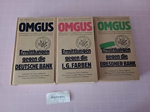
OMGUS. Ermittlungen gegen I. G. Farbenindustrie AG - September 1945 -
1945-1955-germany-territory-under-allied-occupation-dokumentationsstelle-zur-ns-sozialpolitik
- Hardcover
Anbieter: medimops, Berlin, Deutschlandmedimops
Verkäufer/-in kontaktierenVerkäufer/-in mit 5 SternenZustand: Gebraucht - Befriedigend
EUR 5,68
EUR 10,00 VersandVersand von Deutschland nach USAAnzahl: 4 verfügbar
Zustand: good. Befriedigend/Good: Durchschnittlich erhaltenes Buch bzw. Schutzumschlag mit Gebrauchsspuren, aber vollständigen Seiten. / Describes the average WORN book or dust jacket that has all the pages present.
OMGUS. Ermittlungen gegen I. G. Farbenindustrie AG - September 1945 -
1945-1955-germany-territory-under-allied-occupation-dokumentationsstelle-zur-ns-sozialpolitik
- Hardcover
Anbieter: medimops, Berlin, Deutschlandmedimops
Verkäufer/-in kontaktierenVerkäufer/-in mit 5 SternenZustand: Gebraucht - Gut
EUR 6,03
EUR 10,00 VersandVersand von Deutschland nach USAAnzahl: 3 verfügbar
Zustand: very good. Gut/Very good: Buch bzw. Schutzumschlag mit wenigen Gebrauchsspuren an Einband, Schutzumschlag oder Seiten. / Describes a book or dust jacket that does show some signs of wear on either the binding, dust jacket or pages.

O.M.G.U.S. Ermittlungen gegen die I.G. Farbenindustrie AG - September 1945. Übersetzt und bearbeitet von der Dokumentationsstelle zur NS-Sozialpolitik Hamburg. ("Die Andere Bibliothek", Sonderband)
1945-1955-germany-territory-under-allied-occupation-dokumentationsstelle-zur-ns-sozialpolitik
- Hardcover
- Erstausgabe
Anbieter: Versandantiquariat Dr. Wolfgang Ruß, Langen, , DeutschlandVersandantiquariat Dr. Wolfgang Ruß
Verkäufer/-in kontaktierenVerkäufer/-in mit 5 SternenZustand: Gebraucht
EUR 7,10
EUR 18,70 VersandVersand von Deutschland nach USAAnzahl: 1 verfügbar
8°, OPb. 1. Auflage. Mit Phototafeln, LXXI,492 S., Einband nur minimal berieben, sehr gut erhalten (I-II) 9565 ISBN 3891900198 Sprache: Deutsch Gewicht in Gramm: 710.

Die Deutsche Gemeindeordnung. Fur Das Britische Kontrollgebiet.
Zone), Germany (Territory Under Allied Occupation 1945 1955 British
- Softcover
Anbieter: Kennys Bookstore, Olney, MD, USAKennys Bookstore
Verkäufer/-in kontaktierenVerkäufer/-in mit 5 SternenZustand: Neu
EUR 89,62
EUR 9,06 VersandVersand innerhalb von USAAnzahl: 15 verfügbar
Zustand: New. Num Pages: 81 pages, black & white illustrations, bibliography. BIC Classification: GB; PD. Category: (G) General (US: Trade). Dimension: 210 x 148 x 5. Weight in Grams: 118. . . Paperback / so. . . . . Books ship from the US and Ireland.
 Weitere Bilder
Verlag: [Munich: Raumbild-Werkstätte, 1946] 1946
- Erstausgabe
Anbieter: Peter Harrington. ABA/ ILAB., London, Vereinigtes KönigreichPeter Harrington. ABA/ ILAB.
Verkäufer/-in kontaktierenVerkäufer/-in mit 5 SternenZustand: Gebraucht
EUR 447,02
EUR 25,46 VersandVersand von Vereinigtes Königreich nach USAAnzahl: 1 verfügbar
First edition, produced for sale to American troops, comprising 36 stereo photographs showing cities in the occupation zone prior to the destruction of the war, including Frankfurt, Nuremberg, and Munich. The inner cover has a map of the American zone keyed to the photographs. "For those American armed services personnel who pur…chased the 1946 book, the contrast between what they viewed three-dimensionally via the folding stereoscope and the ruined architectural landscape that confronted them must have been memorable, to say the least" (Klahr, p. 90). The publisher had previously produced Heinrich Hoffmann's lavish photobooks for the Third Reich. Douglas M. Klahr, "Stereoscopic Architectural Photography and Merleau-Ponty's Phenomenology", in ZARCH, number 9, 2017. Original folding case of quarter cloth and pictorial boards, enclosing stereoscopic glasses and 36 stereo photographs; manuscript title to spine by early owner. Slight soiling and rubbing: in very good condition.
 Weitere Bilder
Verlag: [London: 1945] 1945
Anbieter: Peter Harrington. ABA/ ILAB., London, Vereinigtes KönigreichPeter Harrington. ABA/ ILAB.
Verkäufer/-in kontaktierenVerkäufer/-in mit 5 SternenZustand: Gebraucht
EUR 1.788,09
EUR 25,46 VersandVersand von Vereinigtes Königreich nach USAAnzahl: 1 verfügbar
A collection of material compiled by an RAF officer involved in classified British preparations for denazification and the takeover of Germany. Established at Viceroy Court, Regent's Park, in 1944, the Control Commission School (Air) trained attendees on the makeup of the German air force and state, ahead of their deployment inE…urope. Personnel are warned that "the title of the school is not, repeat not, to be used in unofficial correspondence." The binder opens with "Notes for Students", which, alongside administrative and day-to-day matters, stress the need for utmost secrecy and include a plan of the school. The syllabus covers background on European history and politics, the Luftwaffe, and the Allied plan for disarming and disbanding air units after occupation. There follows course-specific training documents, such as granular briefings on the German national character, the conditions expected after the Nazi surrender, the structure of the Luftwaffe, and the Gestapo. An informative four-page document draws lessons from the aftermath of the First World War, calling for "absolute unanimity" among Allied personnel administering the occupation, and two illustrated leaves guide personnel in the recognition of Luftwaffe and Wehrmachtbeamte ranks. Concluding the grouping is a six-page handwritten essay on the rise of Nazism by Flying Officer A. H. Reeve, presumably the compiler of this group, together with the comments of his supervising tutor at the school. Earlier in the war, Reeve was assigned to the RAF Administrative and Special Duties Branch. Together, 152 sides of printed material, mostly duplicated typescript on foolscap sheets (c. 330 x 200 mm) but also some letterpress and illustrations; 6 manuscript sheets (225 x 170 mm), each written one side only. Housed in contemporary quarto spring-back binder, brown cloth, cover stamped in blind. Occasional contemporary annotations internally. Contents creased and showing other signs of handling, a couple of leaves with text faded but still legible: very good.

Ubersichtskarte uber die Zonenabgrenzung nebst Ubergangsbahnhofen. / Rund um die britische Zone Uebersichtskarte mit samtlichen Uebergangsbahnhofen.
1945 Westring Map of Post World War II Occupation Zones in Germany
- Karte
Anbieter: Geographicus Rare Antique Maps, Brooklyn, NY, USAGeographicus Rare Antique Maps
Verkäufer/-in kontaktierenVerkäufer/-in mit 4 SternenZustand: Gebraucht
EUR 422,95
EUR 14,67 VersandVersand innerhalb von USAAnzahl: 1 verfügbar
Good. Wear along original fold lines. Verso repairs to fold separations. Closed edge tears professionally repaired on verso. Old verso repairs to fold separations and at a fold intersection. Size 22.25 x 16 Inches. This is a Westring Verlags- und Vertriebs-Gesellschaft map of post-World War II occupation zones in Germany. It ill…ustrates the transitional zones that evolved in the division of Germany into democratic West Germany and communist East Germany. A Closer Look Depicting from Süderlügum south to Stuttgart, Germany is divided into four Occupation Zones: British (colored green), French, American, and Russian. Cities and towns are labeled throughout with rail lines illustrated. Many cities along the borders of the British Zone are marked as 'transition zones'. The Allied Occupation of Germany At the February 1945 Yalta Conference at the end of World War II (1939 - 1945), the United States, Great Britain, and the Soviet Union divided conquered Germany into zones of occupation. Nonetheless, the cordiality between the Western Allies and the Soviet Union began evaporating soon after, and by 1947, efforts to govern Germany jointly floundered. The British and American zones merged on January 1, 1947, creating the jointly administered 'Bizone'. This entity was soon joined by the French zone, thus 'Trizone'. The Trizone merged to form the Federal Republic of Germany (West Germany) in May 1949. In October 1949, the Soviets established the German Democratic Republic (East Germany). The occupation of West Germany continued until May 5, 1955, when the General Treaty, which transferred governance from the Allied military governments to civilian German leaders, went into effect. Publication History and Census This map was published by Westring Verlags- und Vertriebs-Gesellschaft and printed by Carl Lange Verlag in November 1945. We note two cataloged examples in OCLC: Landesbibliothekszentrum Reinland-Pfalz and the Univeristät Regensburg. We have found records of a handful of examples entering the market in recent years. References: OCLC 1071617790, 634388145.

Germany Zones of Occupation.
1946 U.S. State Department Map of Germany Post World War II Allied Occupation Zones
- Karte
Anbieter: Geographicus Rare Antique Maps, Brooklyn, NY, USAGeographicus Rare Antique Maps
Verkäufer/-in kontaktierenVerkäufer/-in mit 4 SternenZustand: Gebraucht
EUR 945,42
EUR 14,67 VersandVersand innerhalb von USAAnzahl: 1 verfügbar
Very good. Light wear along original fold lines. Size 26.75 x 32.5 Inches. This is a 1946 Division of Map Intelligence and Cartography map of occupied Germany after World War II (1939 - 1945). Bold lines delineate British, American, French, Soviet, and Polish occupation zones. Berlin, within the Soviet Occupation Zone, was joint…ly occupied by the British, Americans, French, and Soviets, as detailed in the lower right. The Allied Occupation of Germany The United States, Great Britain, and the Soviet Union agreed to divide conquered Germany into zones of occupation at the February 1945 Yalta Conference. The more comprehensive plan to create four separate zones was ratified at the subsequent Potsdam Conference. Unfortunately, the cordiality between the Western Allies and the Soviet Union began evaporating soon after the war, and by 1947 any effort to govern Germany jointly floundered. The British and American zones merged on January 1, 1947, creating the jointly administered 'Bizone'. This entity was soon joined by the French zone, necessitating a name change to 'Trizone'. In May 1949, these zones merged to form the Federal Republic of Germany (West Germany). In October 1949, the Soviets established the German Democratic Republic (East Germany). The occupation in West Germany continued until May 5, 1955, when the General Treaty transferred governance from the Allied military governments to civilian German leaders. East Germany remained under Soviet control until 1990. Publication History and Census This map was created and published by the Division of Map Intelligence and Cartography of the United States Department of State. It is well represented in institutional collections. Rare on the private market. References: OCLC 36052909.


