Gesamtpreis (1 Artikel Artikel):
Versandziel:

map germany (128 Ergebnisse)
Direkt zu den wichtigsten Suchergebnissen
Suchfilter
Produktart
- Alle Product Types
- Bücher (32)
- Magazine & Zeitschriften (Keine weiteren Ergebnisse entsprechen dieser Verfeinerung)
- Comics (Keine weiteren Ergebnisse entsprechen dieser Verfeinerung)
- Noten (Keine weiteren Ergebnisse entsprechen dieser Verfeinerung)
- Kunst, Grafik & Poster (Keine weiteren Ergebnisse entsprechen dieser Verfeinerung)
- Fotografien (Keine weiteren Ergebnisse entsprechen dieser Verfeinerung)
- Karten (96)
- Manuskripte & Papierantiquitäten (Keine weiteren Ergebnisse entsprechen dieser Verfeinerung)
Zustand Mehr dazu
- Neu (Keine weiteren Ergebnisse entsprechen dieser Verfeinerung)
- Wie Neu, Sehr Gut oder Gut Bis Sehr Gut (Keine weiteren Ergebnisse entsprechen dieser Verfeinerung)
- Gut oder Befriedigend (28)
- Ausreichend oder Schlecht (Keine weiteren Ergebnisse entsprechen dieser Verfeinerung)
- Wie beschrieben (100)
Einband
- alle Einbände
- Hardcover (5)
- Softcover (Keine weiteren Ergebnisse entsprechen dieser Verfeinerung)
Weitere Eigenschaften
- Erstausgabe (17)
- Signiert (5)
- Schutzumschlag (Keine weiteren Ergebnisse entsprechen dieser Verfeinerung)
- Angebotsfoto (100)
Sprache (2)
Gratisversand
- Kostenloser Versand nach USA (Keine weiteren Ergebnisse entsprechen dieser Verfeinerung)
Land des Verkäufers
Verkäuferbewertung
-

GERMANY: INDUSTRIES & COMMUNICATIONS - an Original Coloured Map, Printed C1908
Sprache: Englisch
Verlag: George Philip & Son/The London Geographical Institute, London, 1908
Anbieter: K Books Ltd ABA ILAB, York, YORKS, Vereinigtes Königreich
Verbandsmitglied: ABA ILAB PBFA
Verkäuferbewertung 5 von 5 Sternen

EUR 17,88
EUR 22,57 Versand
Versand von Vereinigtes Königreich nach USAAnzahl: 1 verfügbar
In den WarenkorbNo Binding. Zustand: Very Good. An original map, printed in full colour, central fold. A map of Germany, including parts of the surrounding countries, showing railways, canals, steamship routes, cables, British and American Consuls, and the main products of all the areas including flax, coal, china, pianos, lignite, salt, wine , tobacco, pencils, zinc etc.
-
EASTERN GERMANY - an Original Coloured Map, Printed C1908
Sprache: Englisch
Verlag: George Philip & Son/The London Geographical Institute, London, 1908
Anbieter: K Books Ltd ABA ILAB, York, YORKS, Vereinigtes Königreich
Verbandsmitglied: ABA ILAB PBFA
Verkäuferbewertung 5 von 5 Sternen
EUR 17,88
EUR 22,57 Versand
Versand von Vereinigtes Königreich nach USAAnzahl: 1 verfügbar
In den WarenkorbNo Binding. Zustand: Very Good. An original map, printed in full colour, central fold. A map of Eastern Germany, with insets showing German Possessions, the Rhine, Hamburg and the Environs of Berlin.
-
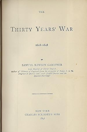
THE THIRTY YEARS' WAR 1618-1648
Verlag: Charles Scribner's Sons, NY, 1891
Anbieter: Antic Hay Books, Asbury Park, NJ, USA
Verkäuferbewertung 5 von 5 Sternen
Large Fold-Out Color Map Of Germany (illustrator). Later Edition. Very Good (covers nice & bright; contents clean & tight, pencil name on front blank page). 12mo., embossed brown cloth, stamped in black & gilt; 237 pages, plus catalogue.
-
Germany, Southern Part - Antiquarian Coloured Map
Sprache: Englisch
Verlag: H.G.Collins, London
Anbieter: K Books Ltd ABA ILAB, York, YORKS, Vereinigtes Königreich
Verbandsmitglied: ABA ILAB PBFA
Verkäuferbewertung 5 von 5 Sternen
EUR 29,80
EUR 22,57 Versand
Versand von Vereinigtes Königreich nach USAAnzahl: 1 verfügbar
In den WarenkorbNo Binding. Zustand: Very Good. An original antique map of Southern Germany, ca. 1860. Mounted and ready to frame. Contemporary Colouring in outline. In excellent condition, decorative and impressive.
-
Germany, Northern Part - Antiquarian Coloured Map
Sprache: Englisch
Verlag: H.G.Collins, London
Anbieter: K Books Ltd ABA ILAB, York, YORKS, Vereinigtes Königreich
Verbandsmitglied: ABA ILAB PBFA
Verkäuferbewertung 5 von 5 Sternen
EUR 29,80
EUR 22,57 Versand
Versand von Vereinigtes Königreich nach USAAnzahl: 1 verfügbar
In den WarenkorbNo Binding. Zustand: Very Good. An original antique map of Northern Germany. Mounted and ready to frame. Contemporary Colouring in outline. In excellent condition, decorative and impressive.
-
Antique Map - Ancient Germany
Sprache: Englisch
Verlag: Stanford, London, 1857
Anbieter: K Books Ltd ABA ILAB, York, YORKS, Vereinigtes Königreich
Verbandsmitglied: ABA ILAB PBFA
Verkäuferbewertung 5 von 5 Sternen
Erstausgabe
EUR 29,80
EUR 22,57 Versand
Versand von Vereinigtes Königreich nach USAAnzahl: 1 verfügbar
In den WarenkorbNo Binding. Zustand: Very Good. First Edition. An antique coloured map- colouring contemporary but expertly and delicately executed - very good condition . Mounted - matted - and ready to frame . . Shows Ancient Germany - very detailed - - very attractive and in excellent condition.
-
Map, Germany - 19th Century
Sprache: Englisch
Erscheinungsdatum: 1880
Anbieter: K Books Ltd ABA ILAB, York, YORKS, Vereinigtes Königreich
Verbandsmitglied: ABA ILAB PBFA
Verkäuferbewertung 5 von 5 Sternen
EUR 17,88
EUR 22,57 Versand
Versand von Vereinigtes Königreich nach USAAnzahl: 1 verfügbar
In den WarenkorbNo Binding. Zustand: Very Good. An antique map, very good condition. Mounted - matted - and ready to frame. Mount size approx 12 x 10 inches, 36 x 30 cms. Original contemporary colouring. Circa 1880. Very detailed - Shows - Germany and coloured - attractive and reasonably priced - quite detailed.
-
GERMANY MAP. An Original Hand-Coloured Engraved Map.
Sprache: Englisch
Verlag: BRIGHTLY & KENNEDY, Bungay, Suffolk, 1807
Anbieter: K Books Ltd ABA ILAB, York, YORKS, Vereinigtes Königreich
Verbandsmitglied: ABA ILAB PBFA
Verkäuferbewertung 5 von 5 Sternen
EUR 35,76
EUR 22,57 Versand
Versand von Vereinigtes Königreich nach USAAnzahl: 1 verfügbar
In den WarenkorbNo Binding. Zustand: Very Good. Barlow (illustrator). An original, hand-coloured engraved map; colouring not contemporary, but delicately and expertly done. Will come mounted (matted) and ready to frame - mount size 13 x 11 inches. An opportunity to buy a decorative and attractive antique map of Germany.
-
Germany, Germania Antiqua - Antique Map, Contemporary Colouring 1798
Sprache: Englisch
Verlag: R Wilkinson, London, 1798
Anbieter: K Books Ltd ABA ILAB, York, YORKS, Vereinigtes Königreich
Verbandsmitglied: ABA ILAB PBFA
Verkäuferbewertung 5 von 5 Sternen
EUR 35,76
EUR 22,57 Versand
Versand von Vereinigtes Königreich nach USAAnzahl: 1 verfügbar
In den WarenkorbNo Binding. Zustand: Very Good. E Bourne (illustrator). A splendid original antique map of Germany. Contemporary colouring and in excellent condition. Mounted and ready to frame. Extremely decorative and printed in 1798. A most desirable map with much detail and splendid colouring.
-
Germany & Central Europe - Antique Map, Contemporary Colouring 1798
Sprache: Englisch
Verlag: R Wilkinson, London, 1801
Anbieter: K Books Ltd ABA ILAB, York, YORKS, Vereinigtes Königreich
Verbandsmitglied: ABA ILAB PBFA
Verkäuferbewertung 5 von 5 Sternen
EUR 35,76
EUR 22,57 Versand
Versand von Vereinigtes Königreich nach USAAnzahl: 1 verfügbar
In den WarenkorbNo Binding. Zustand: Very Good. J Roper (illustrator). A splendid original antique map of Germany & Central Europe. Contemporary coloring and in excellent condition. Mounted and ready to frame. Extremely decorative map of antiquity, printed in 1801. Detailed and attractive map entitled "Pannonia, Davia, Illyricum et Moesia".
-
Germany - Antique Map, Contemporary Colouring 1798
Sprache: Englisch
Verlag: R Wilkinson, London, 1801
Anbieter: K Books Ltd ABA ILAB, York, YORKS, Vereinigtes Königreich
Verbandsmitglied: ABA ILAB PBFA
Verkäuferbewertung 5 von 5 Sternen
EUR 35,76
EUR 22,57 Versand
Versand von Vereinigtes Königreich nach USAAnzahl: 1 verfügbar
In den WarenkorbNo Binding. Zustand: Very Good. J Roper (illustrator). A splendid original antique map of the Germany. Contemporary coloring and in excellent condition. Mounted and ready to frame. Extremely decorative and printed in 1801. Detailed and attractive historic map of Germany "Vindelicia Rhaetia et Noricum Antiqua".
-
Plan of Ehrenbreitstein - German Fortress on the River Moselle - an Original Antique Engraving
Sprache: Englisch
Verlag: Luffman, 1800
Anbieter: K Books Ltd ABA ILAB, York, YORKS, Vereinigtes Königreich
Verbandsmitglied: ABA ILAB PBFA
Verkäuferbewertung 5 von 5 Sternen
EUR 35,76
EUR 22,57 Versand
Versand von Vereinigtes Königreich nach USAAnzahl: 1 verfügbar
In den WarenkorbNo Binding. Zustand: Very Good. An original hand-coloured antique engraved map, printed circa 1800. Hand-colouring contemporary. Mounted/matted and ready to frame. A fine opportunity to purchase an attractive and decorative engraving of a plan of Ehrenbreitstein - German Fortress on the River Moselle.
-
Map of Germany - an Original Engraving
Sprache: Englisch
Anbieter: K Books Ltd ABA ILAB, York, YORKS, Vereinigtes Königreich
Verbandsmitglied: ABA ILAB PBFA
Verkäuferbewertung 5 von 5 Sternen
EUR 23,84
EUR 22,57 Versand
Versand von Vereinigtes Königreich nach USAAnzahl: 1 verfügbar
In den WarenkorbNo Binding. Zustand: Very Good. A fine Engraving - printed circa 1870. Mounted and ready to frame. A fine opportunity to purchase an attractive and decorative engraved Map of Germany.
-
MAP OF GERMANY. Antique Map
Sprache: Englisch
Verlag: G ROLLOS, 1790
Anbieter: K Books Ltd ABA ILAB, York, YORKS, Vereinigtes Königreich
Verbandsmitglied: ABA ILAB PBFA
Verkäuferbewertung 5 von 5 Sternen
EUR 47,68
EUR 22,57 Versand
Versand von Vereinigtes Königreich nach USAAnzahl: 1 verfügbar
In den WarenkorbNo Binding. Zustand: Very Good. Hand coloured, copperplate engraved map. It has a fine cartouche, A fold markas is always the case with maps of this size, otherwise a vg copy of an attractive decorative hand coloured antique map. Scarce. A splendid map, colouring not contemporary but delicately and expertly done. Decorative cartouche.
-
Map of Germany - Fine Detailed Map - an Original Engraving
Sprache: Englisch
Erscheinungsdatum: 1850
Anbieter: K Books Ltd ABA ILAB, York, YORKS, Vereinigtes Königreich
Verbandsmitglied: ABA ILAB PBFA
Verkäuferbewertung 5 von 5 Sternen
EUR 35,76
EUR 22,57 Versand
Versand von Vereinigtes Königreich nach USAAnzahl: 1 verfügbar
In den WarenkorbNo Binding. Zustand: Very Good. A fine engraving - printed circa 1850. Mounted and ready to frame. Hand colouring not contemporary, but delicately and expertly executed. A fine opportunity to purchase an attractive and decorative engraving - Map of Germany.
-
Germany - Attractive - Antiquarian Coloured Map
Sprache: Englisch
Erscheinungsdatum: 1807
Anbieter: K Books Ltd ABA ILAB, York, YORKS, Vereinigtes Königreich
Verbandsmitglied: ABA ILAB PBFA
Verkäuferbewertung 5 von 5 Sternen
EUR 35,76
EUR 22,57 Versand
Versand von Vereinigtes Königreich nach USAAnzahl: 1 verfügbar
In den WarenkorbNo Binding. Zustand: Very Good. An original antique map. Mounted and ready to frame. Hand coloured. In excellent condition, decorative and impressive.
-
Germany - Eastern Part of the Prussian States - an Antique Map
Sprache: Englisch
Anbieter: K Books Ltd ABA ILAB, York, YORKS, Vereinigtes Königreich
Verbandsmitglied: ABA ILAB PBFA
Verkäuferbewertung 5 von 5 Sternen
EUR 35,76
EUR 22,57 Versand
Versand von Vereinigtes Königreich nach USAAnzahl: 1 verfügbar
In den WarenkorbNo Binding. Zustand: Very Good. Engraved By Walker (illustrator). A fine antique map in very good condition - printed in circa 1844. Mounted (matted) and ready to frame. Engraved size approx 16 x 13 Ins, 41 x 33 Cms. Mounted size approx 19 x 16 in, 49 x 41cm. Coloured in outline, hand colouring contemporary. A fine engraved map of Germany - Eastern Part of the Prussian States.
-
Map of Germany - Fine Detailed Map - an Original Engraving
Sprache: Englisch
Erscheinungsdatum: 1850
Anbieter: K Books Ltd ABA ILAB, York, YORKS, Vereinigtes Königreich
Verbandsmitglied: ABA ILAB PBFA
Verkäuferbewertung 5 von 5 Sternen
EUR 41,72
EUR 22,57 Versand
Versand von Vereinigtes Königreich nach USAAnzahl: 1 verfügbar
In den WarenkorbNo Binding. Zustand: Very Good. A fine engraving - printed circa 1850. Mounted and ready to frame. Hand colouring not contemporary, but delicately and expertly executed. A fine opportunity to purchase an attractive and decorative engraving - Map of Germany.
-
Germany - an Original Coloured Map Printed C. 1758
Sprache: Englisch
Anbieter: K Books Ltd ABA ILAB, York, YORKS, Vereinigtes Königreich
Verbandsmitglied: ABA ILAB PBFA
Verkäuferbewertung 5 von 5 Sternen
EUR 41,72
EUR 22,57 Versand
Versand von Vereinigtes Königreich nach USAAnzahl: 1 verfügbar
In den WarenkorbNo Binding. Zustand: Very Good. An original antique coloured map of part of Germany, a plan of Zell, Saxony. Mounted and ready to frame . Very good condition . A splendid vintage map - decorative, attractive and somewhat uncommon. An impressive map with a great amount of detail with fine contemporary colouring.
-
Germany - Showing Hungary, Tyrol, Switzerland, Prussia Etc - an Antique Map
Sprache: Englisch
Anbieter: K Books Ltd ABA ILAB, York, YORKS, Vereinigtes Königreich
Verbandsmitglied: ABA ILAB PBFA
Verkäuferbewertung 5 von 5 Sternen
EUR 41,72
EUR 22,57 Versand
Versand von Vereinigtes Königreich nach USAAnzahl: 1 verfügbar
In den WarenkorbNo Binding. Zustand: Very Good. Engraved By Walker (illustrator). A fine antique map in very good condition - printed in circa 1844. Mounted (matted) and ready to frame. Engraved size approx 16 x 13 Ins, 41 x 33 Cms. Mounted size approx 19 x 16 in, 49 x 41cm. Coloured in outline, hand colouring contemporary. A fine engraved map of Germany - Showing Hungary, Tyrol, Switzerland, Prussia Etc.
-
Germany - Showing holstein, Hanover, Meckenburg, and the Prussian States, Saxony Etc - an Antique Map
Sprache: Englisch
Anbieter: K Books Ltd ABA ILAB, York, YORKS, Vereinigtes Königreich
Verbandsmitglied: ABA ILAB PBFA
Verkäuferbewertung 5 von 5 Sternen
EUR 41,72
EUR 22,57 Versand
Versand von Vereinigtes Königreich nach USAAnzahl: 1 verfügbar
In den WarenkorbNo Binding. Zustand: Very Good. Engraved By Walker (illustrator). A fine antique map in very good condition - printed in circa 1844. Mounted (matted) and ready to frame. Engraved size approx 16 x 13 Ins, 41 x 33 Cms. Mounted size approx 19 x 16 in, 49 x 41cm. Coloured in outline, hand colouring contemporary. A fine engraved map of Germany - Showing holstein, Hanover, Meckenburg, and the Prussian States, Saxony Etc.
-
Germany - Austrian Dominions - Bohemia, Moravia, austria, Styria , Croatia, Etc - an Antique Map
Sprache: Englisch
Anbieter: K Books Ltd ABA ILAB, York, YORKS, Vereinigtes Königreich
Verbandsmitglied: ABA ILAB PBFA
Verkäuferbewertung 5 von 5 Sternen
EUR 41,72
EUR 22,57 Versand
Versand von Vereinigtes Königreich nach USAAnzahl: 1 verfügbar
In den WarenkorbNo Binding. Zustand: Very Good. Engraved By Walker (illustrator). A fine antique map in very good condition - printed in circa 1844. Mounted (matted) and ready to frame. Engraved size approx 16 x 13 Ins, 41 x 33 Cms. Mounted size approx 19 x 16 in, 49 x 41cm. Coloured in outline, hand colouring contemporary. A fine engraved map of Germany - Austrian Dominions - Bohemia, Moravia, austria, Styria , Croatia, Etc.
-
Germany - an Original Hand-Coloured Map Printed C. 1764
Sprache: Englisch
Anbieter: K Books Ltd ABA ILAB, York, YORKS, Vereinigtes Königreich
Verbandsmitglied: ABA ILAB PBFA
Verkäuferbewertung 5 von 5 Sternen
EUR 47,68
EUR 22,57 Versand
Versand von Vereinigtes Königreich nach USAAnzahl: 1 verfügbar
In den WarenkorbNo Binding. Zustand: Very Good. An original antique hand-coloured map of Germany in classical times. Mounted and ready to frame . Very good condition . A splendid vintage map - decorative, attractive and somewhat uncommon. An impressive map with a great amount of detail and fine non-contemporary colouring.
-
Germany and Central Europe . . a Fine Antique World Map Printed in 1809
Sprache: Englisch
Erscheinungsdatum: 1809
Anbieter: K Books Ltd ABA ILAB, York, YORKS, Vereinigtes Königreich
Verbandsmitglied: ABA ILAB PBFA
Verkäuferbewertung 5 von 5 Sternen
EUR 47,68
EUR 22,57 Versand
Versand von Vereinigtes Königreich nach USAAnzahl: 1 verfügbar
In den WarenkorbNo Binding. Zustand: Very Good. A splendid large coloured map of Central Europe in Classical Times . Germany to Russia and down to Dalmatia . . - in Classical times . Mounted and ready to frame / Very good condition . Printed in 1809 . Names in Latin etc .A really fine large map.
-
Germany - Splendid Antique Hand Coloured Detailed Map
Sprache: Englisch
Erscheinungsdatum: 1790
Anbieter: K Books Ltd ABA ILAB, York, YORKS, Vereinigtes Königreich
Verbandsmitglied: ABA ILAB PBFA
Verkäuferbewertung 5 von 5 Sternen
EUR 53,64
EUR 22,57 Versand
Versand von Vereinigtes Königreich nach USAAnzahl: 1 verfügbar
In den WarenkorbNo Binding. Zustand: Very Good. Antique hand-coloured map. Plate size approx. 10 x 8.5 inches, 26 x 22 cms. Mounted and ready to frame. VERY GOOD. *Decorative and unusual. circa 1790.
-
Germany - Antiquarian Coloured Map
Sprache: Englisch
Anbieter: K Books Ltd ABA ILAB, York, YORKS, Vereinigtes Königreich
Verbandsmitglied: ABA ILAB PBFA
Verkäuferbewertung 5 von 5 Sternen
EUR 59,60
EUR 22,57 Versand
Versand von Vereinigtes Königreich nach USAAnzahl: 1 verfügbar
In den WarenkorbNo Binding. Zustand: Very Good. A new and correct map of the Empire of Germany, ca. 1780. Mounted and ready to frame. Colouring in outline, not contemporary. In excellent condition, decorative and impressive.
-
Panoramic Map.
Sprache: Englisch
Erscheinungsdatum: 1840
Anbieter: K Books Ltd ABA ILAB, York, YORKS, Vereinigtes Königreich
Verbandsmitglied: ABA ILAB PBFA
Verkäuferbewertung 5 von 5 Sternen
EUR 71,52
EUR 22,57 Versand
Versand von Vereinigtes Königreich nach USAAnzahl: 1 verfügbar
In den WarenkorbNo Binding. Zustand: Very Good. A splendid original antique Map. . Excellent condition. A rare opportunity to acquire a desireable and somewhat uncommon panoramic map. . Very large - 45 x 9 inches , 120 x 23 cms - would look superb mounted and framed .
-
[I]. NARRATIVE OF THE EXPEDITION OF AN AMERICAN SQUADRON TO THE CHINA SEAS AND JAPAN, PERFORMED IN THE YEARS 1852, 1853, AND 1854, UNDER THE COMMAND OF COMMODORE M. C. PERRY, UNITED STATES NAVY, BY ORDER OF THE GOVERNMENT OF THE UNITED STATES. - COMPILED FROM THE ORIGINAL NOTES AND JOURNALS OF COMMODORE PERRY AND HIS OFFICERS, at his Request, and under his Supervision, by Francis L. Hawks, D.D. L.L.D.; WITH NUMEROUS ILLUSTRATIONS*. --- SENATE EDITION, P. G. WASHINGTON'S COPY; INSCRIBED BY HIM to then German U.S. Ambassador Friedrich Karl Joseph Freiherr von Gerolt. / II. 33rd Congress, 2nd Session: REPORTS ON NATURAL HISTORY AND ECONOMIC GEOGRAPHY incl. the Facsimile of the 'Treaty of Kanagawa'. / III 'UNITED STATES JAPAN EXPEDITION: OBSERVATIONS ON THE ZODIACAL LIGHT, from April 2, 1853, to April 22, 1855, made chiefly on Board the United States Steam-Frigate Mississippi, during her late Cruise in Eastern Seas, and her Voyage homeward; with Conclusions from the Data thus obtained.'. -
Verlag: Washington, Beverley Tucker - Senate Printer (I/III) / A.O.P. Nicholson (House Printer), 1856/1857., 1857
Anbieter: C O - L I B R I , Bremen - Berlin ; Deutschland / Germany ., Berlin, Deutschland
Verkäuferbewertung 5 von 5 Sternen
Erstausgabe
EUR 1.800,00
EUR 45,00 Versand
Versand von Deutschland nach USAAnzahl: 1 verfügbar
In den WarenkorbI. 2 blank sheets, XVII (I); 537 pages, with 78 xylographic illustrations in the text; 86 singleside-printed toned or colour-lithographic plates (incl. portraits after Daguerreotypes by Eliphalet Brown) and 3 foldout-colourplates of japanese woodblock-prints (89 plates in total) and 3 geographical maps (1 foldout) bound within; 2 blank sheets. / II. (House Edition, 1857). (8) 414, (1) 14 pages ('Treaty of Ka-na-ga-wa'[Kanagawa], the first document ever negotiated by the Empire of Japan with any western nation according to International Law), (1) XI (1) p.; some xylographic text-illustrations, 4 (3 coloured) lithographic plates 'Agriculture of China', 22 (of 23, 17 [hand-]coloured) plates of Natural History (Yack, Japanese Fox), Ornithology (Japanese Birds, 5 of 6), Ichthyology (Japanese Fishes, 10), Conchyology (Japanese Shells, 5); 3 (2 folded) maps in the text, 16 plates with meteorological diagrams; 15 of 17 very large multiple folded maps at the end. / III. XLIII, 705 pages with 365 (of 366) astronomic xylographic plates (lacking plate 66); all plates in I and II on singleside printed cardboards. - I. Thick and heavy 'night-blue' full morocco-binding of the period over 4 raised bands with gilt-ornamental frames at panels and bands and gilt title and owner's name ('P. G. Washington') at bottom-of-spine, colour-marbled endpapers; II./III. Blind-tooled (naval motive) publisher's cloth bindings; lex.-4to.(ca. 31 x 23 x 20 cm; ca. 9 kg.). *** (Sabin #30958, Cordier 'Japonica' #513, Nissen ZBI #3132) I. FIRST EDITION, BIBLIOPHILE BOUND ORIGINAL; THE SENATE-EDITION (Senate executive Documents #34 of 33rd Congress, 2nd Session), published parrallel to Nicholson's 'House-Editon'. - FIRST BLANK SHEET WITH 4-LINE INSCRIPTION ''to Baron Gerolt / with the kind regards / of P. G. Washington / Feby. 16 1857''. Peter Grayson Washington (1798-1872), son of the Nephew of a Cousin of George Washington (1732-1799, American Founding Father and first President of the United States) served as 'Assistant Secretary of the Treasury Virginia New York City'; Friedrich Karl Joseph Freiherr von Gerolt (1797-1879) was the German-Prussian 'Envoy Extraordinary and Minister Plenipotentiary in the United States' and has been the longest-ever serving ambassador of Germany in the U.S. In the quarter+ century of service, Gerolt met presidents James K. Polk, Zachary Taylor, Millard Fillmore, Franklin Pierce, James Buchanan, Abraham Lincoln, Andrew Johnson and Ulysses Grant. As a studied mining geologist (Freiberg Mining Academy) in ''1824 he travelled to Mexico as an agent of the German-American Mining Association, where significant silver mines were suspected. Together with Carl de Berghes, also an Mining Association Agent, he published the 'Carta geognostica de los principales distritos minerales del Estado de Mexico' in 1827 with Arnz & Comp., a special mineralogical map of central Mexico, which is considered the first geological map of Mexico printed in colour.''(german wikipedia). - Corners of the leather-binding partly somewhat rubbed, panels slightly rubbed and slightly scratched; some textpages opposite of lithographic plates with slight offsetting (shadow) last sheets with slim humidity-stain at top sharp-corner, last 10 sheets (incl. rear endpaper) with small hole in the blank bottom margin; A MAGNIFICIENT COPY WITH A 'WELL NAMED' ASSOCIATION OF THE PERIOD. --- II. Binding somewhat rubbed, lacks plate 6 of Ornithology and textpages 257-262 (beginning of Ichthyology); Acceptably used. / III. Binding rubbed, many pages with humiditystain at foreedge or top sharp-corner (growing towards the end), lacks zodiac-plate #66 (of 352). --- MAIN OFFER IS THE LUXOURIUS EQUIPPED AND COMPLETE HISTORIC ASSOCIATION COPY OF VOLUME I; Vols. II and III have been added from another set to create scientific completeness (more or less). . .
-

Theâtre de la Guerre sur le Rhin, Moessele, Mayn, le Necker, Meuse avec les pais voisins.
Verlag: Amsterdam, Jean Covens & Corn. Mortier, c1710., 1710
Anbieter: Hünersdorff Rare Books ABA ILAB, London, Vereinigtes Königreich
Verkäuferbewertung 3 von 5 Sternen

Karte
EUR 1.490,05
EUR 26,04 Versand
Versand von Vereinigtes Königreich nach USAAnzahl: 1 verfügbar
In den WarenkorbHardcover. Zustand: Very Good. Engraved handcoloured folding map measuring 97.5 x 118mm, divided into 72 oblong segments mounted on contemporary cloth; allegorical title cartouches with imperial arms in top left and right panels. Preserved in original slipbox covered in blind-tooled sheep with manuscript label; traces of worming, worn. Fine military map after Sanson for use in the French campaign in the Rhineland, Palatinate and other parts of southern Germany during the War of the Spanish Succession (1701-1714). The provinces affected by the war are coloured in shades of pink, green and yellow. Cities and fortified places are marked in red. Well preserved with original cloth hangers intact.
-
![Bild des Verkäufers für Cartography Czech Republic [1868] Karte des nordwestlichen theils von Bohmen, Carlsbad, Verlag Franieck, [1868]. Large map of Carlsbad, Franzenbad, Marienbad, König Otto-Quelle, Teplitz und die umgegend bis Dresden. zum Verkauf von Antiquariaat Arine van der Steur / ILAB](https://pictures.abebooks.com/inventory/md/md32340270759.jpg)
Cartography Czech Republic [1868] Karte des nordwestlichen theils von Bohmen, Carlsbad, Verlag Franieck, [1868]. Large map of Carlsbad, Franzenbad, Marienbad, König Otto-Quelle, Teplitz und die umgegend bis Dresden.
Anbieter: Antiquariaat Arine van der Steur / ILAB, Den Haag, Niederlande
Verkäuferbewertung 4 von 5 Sternen

Hardcover. Zustand: Very Good. Half linen binding with large folding map inside. Front of the bookcover with text 'Karte des nordwestlichen theils von Böhmen" verlag d. Gebr. Franieck in Carlsbad.Folding map in very good condition. total size: 55 x 76 cm. Lithographed map in oval and decorative corners in 4 circles. On the back of the cover a stamp of Emil Pohlenz, Buch-, Kunst- & Musikalienhandlung Carlsbad am Markt zum weissen Löwen.[NL] Gelithografeerde kaart van Böhmen, Bohemen in Tsjechië. De stad, die de naam draagt van keizer Karel IV, kreeg vooral bekendheid als kuuroord voor de hoge adel in de 18e en 19e eeuw. West-Bohemen bestaat uit de regio's Karlovy Vary en Pilsen.Tjechie - Tjechoslowakije - Bohemen - Bohmen - Karlsbad - Karlovy Vary -.