
Gesamtpreis (1 Artikel Artikel):
Versandziel:

kitchen hells (10 Ergebnisse)
Direkt zu den wichtigsten Suchergebnissen
Suchfilter
Produktart
- Alle Product Types
- Bücher (8)
- Magazine & Zeitschriften (Keine weiteren Ergebnisse entsprechen dieser Verfeinerung)
- Comics (Keine weiteren Ergebnisse entsprechen dieser Verfeinerung)
- Noten (Keine weiteren Ergebnisse entsprechen dieser Verfeinerung)
- Kunst, Grafik & Poster (Keine weiteren Ergebnisse entsprechen dieser Verfeinerung)
- Fotografien (Keine weiteren Ergebnisse entsprechen dieser Verfeinerung)
- Karten (2)
- Manuskripte & Papierantiquitäten (Keine weiteren Ergebnisse entsprechen dieser Verfeinerung)
Zustand Mehr dazu
- Neu (7)
- Wie Neu, Sehr Gut oder Gut Bis Sehr Gut (Keine weiteren Ergebnisse entsprechen dieser Verfeinerung)
- Gut oder Befriedigend (1)
- Ausreichend oder Schlecht (Keine weiteren Ergebnisse entsprechen dieser Verfeinerung)
- Wie beschrieben (2)
Einband
Weitere Eigenschaften
- Erstausgabe (Keine weiteren Ergebnisse entsprechen dieser Verfeinerung)
- Signiert (Keine weiteren Ergebnisse entsprechen dieser Verfeinerung)
- Schutzumschlag (Keine weiteren Ergebnisse entsprechen dieser Verfeinerung)
- Angebotsfoto (4)
Sprache (2)
Preis
- Beliebiger Preis
- Weniger als EUR 20 (Keine weiteren Ergebnisse entsprechen dieser Verfeinerung)
- EUR 20 bis EUR 45
- Mehr als EUR 45
Gratisversand
Land des Verkäufers
Verkäuferbewertung
-
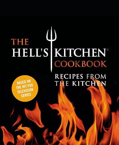
The Hell's Kitchen Cookbook: Recipes from the Kitchen
Sprache: Englisch
Verlag: Grand Central Life & Style, 2015
ISBN 10: 1455535699 ISBN 13: 9781455535699
Anbieter: WorldofBooks, Goring-By-Sea, WS, Vereinigtes Königreich
Verkäuferbewertung 5 von 5 Sternen

EUR 22,20
EUR 6,48 Versand
Versand von Vereinigtes Königreich nach USAAnzahl: 1 verfügbar
In den WarenkorbPaperback. Zustand: Very Good. The book has been read, but is in excellent condition. Pages are intact and not marred by notes or highlighting. The spine remains undamaged.
-
The Hell's Kitchen Cookbook
Anbieter: PBShop.store US, Wood Dale, IL, USA
Verkäuferbewertung 5 von 5 Sternen
HRD. Zustand: New. New Book. Shipped from UK. Established seller since 2000.
-
The Hell's Kitchen Cookbook
Anbieter: PBShop.store UK, Fairford, GLOS, Vereinigtes Königreich
Verkäuferbewertung 4 von 5 Sternen

EUR 30,97
EUR 8,83 Versand
Versand von Vereinigtes Königreich nach USAAnzahl: 13 verfügbar
In den WarenkorbHRD. Zustand: New. New Book. Delivered from our UK warehouse in 4 to 14 business days. Established seller since 2000.
-
The Hell's Kitchen Cookbook
Anbieter: Majestic Books, Hounslow, Vereinigtes Königreich
Verkäuferbewertung 4 von 5 Sternen
EUR 50,47
EUR 7,52 Versand
Versand von Vereinigtes Königreich nach USAAnzahl: 3 verfügbar
In den WarenkorbZustand: New. pp. 288.
-
The Hell's Kitchen Cookbook: Recipes from the Kitchen
Sprache: Englisch
Verlag: Grand Central Life & Style, 2015
ISBN 10: 1455535699 ISBN 13: 9781455535699
Anbieter: Revaluation Books, Exeter, Vereinigtes Königreich
Verkäuferbewertung 5 von 5 Sternen
EUR 43,70
EUR 17,36 Versand
Versand von Vereinigtes Königreich nach USAAnzahl: 1 verfügbar
In den WarenkorbHardcover. Zustand: Brand New. 264 pages. 12.00x10.00x1.00 inches. In Stock.
-
The Hell's Kitchen Cookbook: Recipes from the Kitchen
Sprache: Englisch
Verlag: Grand Central Life & Style, 2015
ISBN 10: 1455535699 ISBN 13: 9781455535699
Anbieter: Revaluation Books, Exeter, Vereinigtes Königreich
Verkäuferbewertung 5 von 5 Sternen
EUR 45,09
EUR 17,36 Versand
Versand von Vereinigtes Königreich nach USAAnzahl: 2 verfügbar
In den WarenkorbHardcover. Zustand: Brand New. 264 pages. 12.00x10.00x1.00 inches. In Stock.
-

EUR 36,23
EUR 48,99 Versand
Versand von Deutschland nach USAAnzahl: Mehr als 20 verfügbar
In den WarenkorbZustand: New.
-

The Hell's Kitchen Cookbook : Recipes from the Kitchen
Sprache: Englisch
Verlag: Grand Central Publishing Okt 2015, 2015
ISBN 10: 1455535699 ISBN 13: 9781455535699
Anbieter: AHA-BUCH GmbH, Einbeck, Deutschland
Verkäuferbewertung 5 von 5 Sternen
Buch. Zustand: Neu. Neuware - The official companion cookbook from the enormously popular Fox cooking competition show.Hell's Kitchen debuted in 2005 on Fox and is currently in in its 14th season. On the show, one explosive, charismatic Head Chef oversees 16 chefs as they battle it out to win a job as Head Chef of top restaurant with a total prize value of $250,000. In each episode the chefs are put to the test in a skill's-based challenge, and must follow it up by completing dinner service at the exclusive Hell's Kitchen restaurant set in Los Angeles. Now, in their first ever cookbook, readers will learn how to recreate over one hundred of the contestant's delectable, restaurant-worthy dishes in their own home and will be given access to the recipes, menus, and behind-the-scenes secrets that they've been craving!
-
Map of the Glass House Farm Also the Schroepple, Ray, and other estates down to the Franklin and Robinson and the Widow Mary Clarke and Thomas B. Clarke.
Erscheinungsdatum: 1873
Anbieter: Geographicus Rare Antique Maps, Brooklyn, NY, USA
Verbandsmitglied: ABAA ESA ILAB
Verkäuferbewertung 4 von 5 Sternen
Karte
Good. Laid on fresh linen. Closed tears extending 14.5 inches into printed area from top margin. Cracking in bottom left and right quadrants. Some reinstatement to margins. No loss to printed image. Size 33.75 x 30.5 Inches. A rare 1873 John Bute Holmes cadastral map of part of the Manhattan neighborhoods Chelsea and Hell's Kitchen, New York City. It is likely the earliest obtainable specific map of this part of Manhattan. A Closer Look The map covers northern Chelsea from 27th Street to the southern part of Hell's Kitchen at 42nd Street and from the Hudson River to 8th Avenue, including the present-day mega-development of Hudson Yards. This is one of a series of 21 scarce maps drawn by Holmes between 1867 and 1875. Like all maps in this series, it was independently issued, is quite large, and impressively detailed. The maps illustrate New York City land claims as the vast early estates in central and upper Manhattan were being subdivided under eminent domain laws for assimilation into the grid system. This led to countless legal battles, much of the litigation behind which depended upon access to comprehensive cadastral maps. Breaking Up the Glass House Farm The current map illustrates the breakup of the Glass House Farm, as well as the estates of George C. Schroepple, George Rapelje, and Cornelius Ray. Some of these claims date to the early Dutch Period of New Amsterdam but were honored by the British even after the takeover. The breakup of the estates is detailed via tables in the upper right quadrant, where individual heirs and landowners are identified. Each is referenced by the New York City record book and page number. A Short History of the Glass House Farm The map's namesake, the Glass House Farm, was a large farm situated between the Hudson River and Fitzroy Road (as shown here) in today's West 30s. The unusual name, Glass House, refers to a short-lived glass factory that was established on the location in 1754. There was also a nearby tavern of the same name that, at the time of the American Revolutionary War, was a popular roadhouse and inn. The street names on this map reflect the original owners of the farm. The Lotting of Manhattan In the early 19th century, most of Manhattan was undeveloped farmland, the property of wealthy landowners with claims dating to the Dutch Period. The northern 2/3rd Manhattan was dotted with farms and sprawling gentlemanly estates, many with great manor houses overlooking the Hudson River. The Commissioner's Plan of 1811 and the 1807 Commission Law laid the street grid through many of these properties and gave the city the right to claim the lands under eminent domain, providing due compensation to the landowners. While this work occurred early in lower Manhattan, central and upper Manhattan were not formally acquired by the city until the mid-19th century. What Holmes Did and Why Holmes became fascinated by the early history of Manhattan real estate ownership, recognizing the wealth to be accrued by accurately understanding the history of city land ownership, division, and inheritance. Moreover, Holmes allied himself with the corrupt Tweed administration, assuring himself and his allies even greater wealth and political power from the eminent domain seizure of old Manhattan estates. Holmes created a series of maps, reminiscent of John Randall's 'Farm Maps', overlaid with property data, showing old estates' borders and notating the land's breakup among various heirs. The complex work of compiling the maps earned Holmes a fortune, with one newspaper suggesting on his death in 1887 that some of his individual maps were worth more than 30,000 USD. There is no complete carto-bibliography of Holmes' maps, but we believe there to be at least 50 maps, possibly more. Publication History and Census This map is rare. Only 2 examples are cataloged in the OCLC: New York State Library and another at the University of Wisconsin. References: OCLC 50560870.
-

Map of the Hermitage Farm and the Norton Estate.
Erscheinungsdatum: 1872
Anbieter: Geographicus Rare Antique Maps, Brooklyn, NY, USA
Verbandsmitglied: ABAA ESA ILAB
Verkäuferbewertung 4 von 5 Sternen
Karte
Good. Original linen exhibits some verso reinforcement. Minor wear and some damage along original fold lines. Even overall toning. Size 37 x 22.5 Inches. This is an 1872 John Bute Holmes cadastral map of the modern-day neighborhood of Hell's Kitchen in the borough of Manhattan in New York City. The map depicts the neighborhood from the Hudson River to Broadway (labeled as Bloomingdale Road) and from 48th Street to 39th Street. Highly detailed, Holmes's map provides the viewer with a look at the neighborhood as it was in 1872 and also projects an image of how it developed. Streets are labeled, and individual lots are identified by their addresses. Some elements are ghosted in using dashed lines, including Twelfth Avenue and several wharves. Hermitage Farm and Norton Estate John George Leake (1752 - 1827), a wealthy New York lawyer, counted the Hermitage Farm among his many assets. Leake, who had no children or siblings, left the farm in his will to his niece Martha Norton, with reversion to her son John Leake Norton. The rest of his fortune, in sum over $300,000, was used to found a home for orphaned children operated by Trinity Church. Holmes' 'Farm Maps' In the early 19th century most of Manhattan was undeveloped farm lands, the property of wealthy landowners with claims dating to the Dutch period of New York's history. The northern 2/3rd Manhattan was dotted with farm lands and sprawling gentlemanly estates, many with great manor houses overlooking the Hudson River. The Commissioner's Plan of 1811 and the 1807 Commission Law, laid the street grid through many of these properties and gave the city the right to claim these lands under eminent domain, providing due compensation to the landowners. While this work occurred early in lower Manhattan, central and upper Manhattan were not formally acquired by the city until the mid-19th century. Holmes became fascinated by the early history of Manhattan real estate ownership, recognizing the wealth to be accrued by accurately understanding the history of city land ownership, division, and inheritance. Moreover, Holmes allied himself with the corrupt Tweed administration, assuring himself and his allies even greater wealth and political power from the eminent domain seizure of old Manhattan estates. Holmes created a series of maps, reminiscent of John Randall's 'Farm Maps', overlaid with property data, showing the borders of old estates, and notating the breakup of the lands among various heirs. The complex work of compiling the maps earned Holmes a fortune, with one newspaper suggesting on his death in 1887 that some of his individual maps were worth more than 30,000 USD. There is no complete carto-bibliography of Holmes' maps, but we believe there to be at least 50 maps, possibly more. Provenance This map was acquired as a part of a large collection of New York cadastral maps associated with the layer Ronald K. Brown, a Deed Commissioner operating in the late 19th and early 20th century with an office at 76 Nassau Street, New York - not far from Holmes' own office. Most of the maps in the collection, including the present map, bear Brown's stamp on the verso. The maps were passed to Dominic Anthony Trotta, a real estate agent working under Brown. Brown seems to have ceased business around 1919, but Trotta continued as a real estate agent, becoming a New York Tax Commissioner in 1934 under the Fiorello H. La Guardia administration. The maps remained with Trotta's heirs until our acquisition of the collection. Publication History and Census This map was created and published by John Bute Holmes in 1872. Three examples are recorded in the OCLC as being part of the collection at Princeton University, the New York State Library, and the University of Wisconsin - Milwaukee. The Museum of the City of New York also has an example in their collection as does, we believe, the New York Public Library, although their example is uncatalogued. References: OCLC 50565877.
