Gesamtpreis (1 Artikel Artikel):
Versandziel:

jean baptiste nicolas denis daprčs mannevillette (2 Ergebnisse)
Direkt zu den wichtigsten Suchergebnissen
Suchfilter
Produktart
- Alle Product Types
- Bücher (2)
- Magazine & Zeitschriften (Keine weiteren Ergebnisse entsprechen dieser Verfeinerung)
- Comics (Keine weiteren Ergebnisse entsprechen dieser Verfeinerung)
- Noten (Keine weiteren Ergebnisse entsprechen dieser Verfeinerung)
- Kunst, Grafik & Poster (Keine weiteren Ergebnisse entsprechen dieser Verfeinerung)
- Fotografien (Keine weiteren Ergebnisse entsprechen dieser Verfeinerung)
- Karten (Keine weiteren Ergebnisse entsprechen dieser Verfeinerung)
- Manuskripte & Papierantiquitäten (Keine weiteren Ergebnisse entsprechen dieser Verfeinerung)
Zustand Mehr dazu
- Neu (Keine weiteren Ergebnisse entsprechen dieser Verfeinerung)
- Wie Neu, Sehr Gut oder Gut Bis Sehr Gut (Keine weiteren Ergebnisse entsprechen dieser Verfeinerung)
- Gut oder Befriedigend (1)
- Ausreichend oder Schlecht (Keine weiteren Ergebnisse entsprechen dieser Verfeinerung)
- Wie beschrieben (1)
Einband
- alle Einbände
- Hardcover (2)
- Softcover (Keine weiteren Ergebnisse entsprechen dieser Verfeinerung)
Weitere Eigenschaften
- Erstausgabe (2)
- Signiert (Keine weiteren Ergebnisse entsprechen dieser Verfeinerung)
- Schutzumschlag (Keine weiteren Ergebnisse entsprechen dieser Verfeinerung)
- Angebotsfoto (1)
Sprache (1)
Preis
- Beliebiger Preis
- Weniger als EUR 20 (Keine weiteren Ergebnisse entsprechen dieser Verfeinerung)
- EUR 20 bis EUR 45 (Keine weiteren Ergebnisse entsprechen dieser Verfeinerung)
- Mehr als EUR 45
Gratisversand
Land des Verkäufers
Verkäuferbewertung
-

LE NEPTUNE ORIENTAL: . . . / 'Instructions sur la Navigation de France aux Indes.' / 'De la Route qu'on doit faire pour aller aux Indes, suivant les differens Endroits d'ou l'on part, & ceu ou l'on veu aborder.' / 'Description de la Côte d'Afrique, depuis la Cap de Bonne Espérance jusqu'au Cap des Courans, par Manoel de Mesquitta-Pestrello, Commandant [d']une petite Frégate, qui eu fut envoyé en l'Année 1575, par ordre de Dom Sébastien, Roi de Portugal, pour Reconnoître & Examiner la Côte.' / 'Des Cotes d'Afrique depuis la Ligne équinoxiale, jusqu'au Détroit de Babel-Mandel.' / 'Mémoire sur la Carte des Mers de la Chine, par M. Alexandre D'Alrymple, Écuyer.' / . . . - LARGE-PAPER COPY OF THE COMPLETE TEXT, in the original Binding; WITHOUT MAPS. . . [Le Neptune Oriental, ou Routier General des Côtes des Indes Orientales et de la Chine]
Verlag: Ŕ Paris, chez Demonville & Malassis, Imprimeur-Libraire de l'Académie Francoise, . . . et ŕ Brest, chez Malassis, Imprimeur de la Marine, M. DCC LXXV. (1775), 1775
Anbieter: C O - L I B R I , Bremen - Berlin ; Deutschland / Germany ., Berlin, Deutschland
Verkäuferbewertung 5 von 5 Sternen

Erstausgabe
EUR 1.650,00
Währung umrechnenEUR 26,13 für den Versand von Deutschland nach USAAnzahl: 1 verfügbar
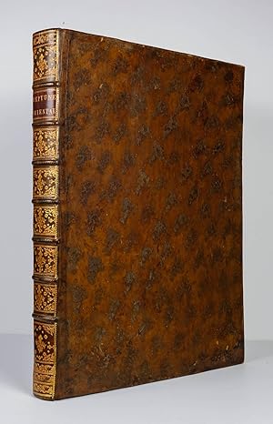
In den Warenkorb1 blank sheet, singleside printed titlesheet, x[10] sheets 'Preface'; 52 sheets of text consisting of 194 [+14] vertically halfpage columns of 'Instructions . . .'(c. [1]-38); 'De la Route . . .'(c. 39-47/48); 'Description de la Côte d'Afrique, . . .'(c. 47/48-64); 'Des Cotes d'Afrique . . .'(c. 65-191); 'Mémoire sur la Carte . . .'(c. 191-194); 'Tables des Variations' (c. [195]-[199/200]); 'Avis au relieur. . .'(c. [199/200]); 'Table des Articles' (c. [201]-[202]); 'Extraits des Régistres de L'Académie Royale de Marine du 9 Mars 1775'; 'Rapport de >Neptune Oriental<' (c. [203]-[207/208]); 'Privilčge du Roi' (c. [207/208]); except 1st blank and titlesheet re. all printed on thick and untrimmed blueish large paper. - Thick colour-marbled paper covered cardbord-binding of the period with gilt-titled and -decorated leather spinelabel; imperial-folio (ca. 59 x 44 x 5 cm; ca. 4,5 kg.). *** SECOND EDITION, IN A ORIGINAL BINDING OF THE PERIOD; text complete, lacking all maps (not removed by us). - Shortly after its publication the 1745 first edition of 'Le Neptune Oriental' most copies were destroyed by the French Admiralty to keep the secrets of East Indian navigation. 30 years later, having been appointed 'Director of Chart at L'Orient' in 1762 by the Compagnie des Indes and conferred the 'Order of St. Michael' in 1767 by King Louis XV, Mannevillette, together with his friend Alexander Dalrymple, updated his original work with new and improved charts and republished his opus magnum in a greatly expanded format. --- Corners of the binding slightly rubbed; A VERY GOOD COPY.
-
EUR 39.778,97
Währung umrechnenKostenlos für den Versand innerhalb von/der USAAnzahl: 1 verfügbar
In den WarenkorbHardcover. Zustand: Very good. Second. Second edition, enlarged. Paris: Chez Demonville & Brest: Chez Malassis, 1775. Folio (21 5/8" x 16 13/16", 548mm x 426mm). [Full collation available.] With an engraved frontispiece (painted by Boucher, engraved by Tilliard), an engraved head-piece to the dedication and 63 engraved charts (29 folding, 34 single). Bound in contemporary cat's paw calf with a triple gilt fillet border. On the spine, five raised bands with a dashed gilt roll. In the panels, gilt florals. Title gilt to red morocco in the second panel. Gilt roll to the edges of the boards. All edges of the text-block speckled red. Spine and fore-corners restored. Some wear to the boards at the acid-spots. Moderate fore-edge dampstain to charts 51, 51bis and 52, and lower-edge marginal dampstain to a several plates. Some numbers have been pasted over, as have sections of some charts. Altogether quite a clean and robust set of charts on the original stubs. D'Apres de Mannevillette (1707-1780), unlike so many of his cartographic colleagues, was a proper ship's captain and navigator. As a captain of the French East-India Company, he was the first Frenchman to use the octant, which allowed him to make significant advances over previous charts and maps throughout southern Asia. Indeed, so much did his publications surpass his peers' that his atlases became de rigeur in the cabins of nearly all French ships in the second half of the XVIIIc. Although the king and then the revolution would hamper French colonial holdings in eastern India and southeast Asia broadly, d'Apres's maps would guide their rivals and successors. The first edition of Neptune Oriental (1745) contained only about two dozen charts; d'Apres worked for three additional decades to add some forty maps. As often with atlases of this period, the number of charts was variable depending on the purse and interests of the purchaser. The copy inscribed by d'Apres to George III (now in the BL) has 59 charts; those in the BnF have between 60 and 69 plates. It seems that no copy adheres to the list of plates supplied for the binder. The present copy with its 63 charts lines up fairly well; no. 10 is "ŕ placer" and lacking, no. 19 is bound after 20, and no. 46 is lacking numerically but the chart itself, "Carte de l'isle to Java" is present as no. 44. In all, this is quite a robust collection. The chart of Hong Kong (53) deserves special mention. It benefitted from Dalrymple's surveys through 1760, far surpassing previous charts, and almost indicates its separation from the mainland; the northeast was clearly too rocky to allow for an accurate account. Phillips 3165, Shirley BL Atlases 1067-1068.