
Gesamtpreis (1 Artikel Artikel):
Versandziel:

good edward (80 Ergebnisse)
Direkt zu den wichtigsten Suchergebnissen
Suchfilter
Produktart
- Alle Product Types
- Bücher (80)
- Magazine & Zeitschriften (Keine weiteren Ergebnisse entsprechen dieser Verfeinerung)
- Comics (Keine weiteren Ergebnisse entsprechen dieser Verfeinerung)
- Noten (Keine weiteren Ergebnisse entsprechen dieser Verfeinerung)
- Kunst, Grafik & Poster (Keine weiteren Ergebnisse entsprechen dieser Verfeinerung)
- Fotografien (Keine weiteren Ergebnisse entsprechen dieser Verfeinerung)
- Karten (Keine weiteren Ergebnisse entsprechen dieser Verfeinerung)
- Manuskripte & Papierantiquitäten (Keine weiteren Ergebnisse entsprechen dieser Verfeinerung)
Zustand Mehr dazu
Weitere Eigenschaften
Sprache (2)
Gratisversand
Land des Verkäufers
Verkäuferbewertung
-

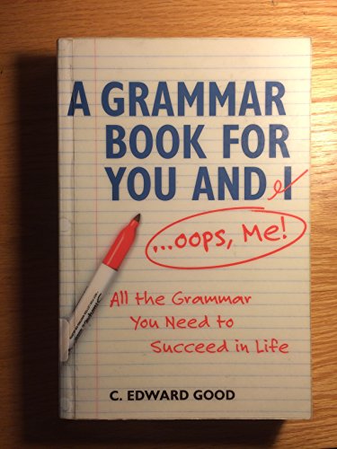
A Grammar Book for You and I.Oops, Me!
Anbieter: World of Books (was SecondSale), Montgomery, IL, USA
Verkäuferbewertung 5 von 5 Sternen

Zustand: Good. Item in good condition. Textbooks may not include supplemental items i.e. CDs, access codes etc.
-
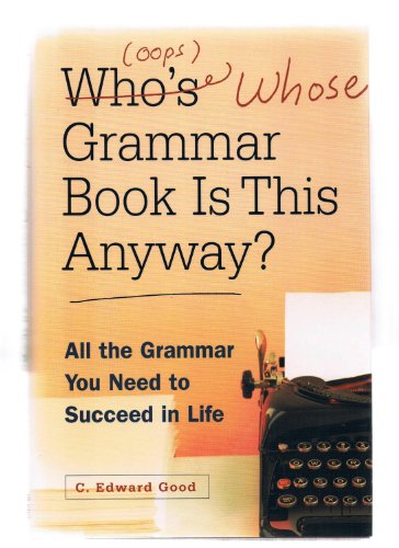
Who's (oops whose) Grammar Book is This Anyway?
Anbieter: World of Books (was SecondSale), Montgomery, IL, USA
Verkäuferbewertung 5 von 5 Sternen
Zustand: Good. Item in good condition. Textbooks may not include supplemental items i.e. CDs, access codes etc.
-
Who's (oops whose) Grammar Book is This Anyway?
Anbieter: World of Books (was SecondSale), Montgomery, IL, USA
Verkäuferbewertung 5 von 5 Sternen
Zustand: Very Good. Item in very good condition! Textbooks may not include supplemental items i.e. CDs, access codes etc.
-
Who's (oops whose) Grammar Book is This Anyway?
Anbieter: World of Books (was SecondSale), Montgomery, IL, USA
Verkäuferbewertung 5 von 5 Sternen
Zustand: Acceptable. Item in acceptable condition! Textbooks may not include supplemental items i.e. CDs, access codes etc.
-
Grammar Book for You And I (Oops Me): All the Grammar You Need to Succeed in Life
Anbieter: World of Books (was SecondSale), Montgomery, IL, USA
Verkäuferbewertung 5 von 5 Sternen
Zustand: Very Good. Item in very good condition! Textbooks may not include supplemental items i.e. CDs, access codes etc.
-
Who's (oops whose) Grammar Book is This Anyway?
Sprache: Englisch
Verlag: Barnes and Noble Books (edition Later Printing), 2002
ISBN 10: 1567315763 ISBN 13: 9781567315769
Hardcover. Zustand: Fair. Later Printing. With dust jacket. The item might be beaten up but readable. May contain markings or highlighting, as well as stains, bent corners, or any other major defect, but the text is not obscured in any way.
-
Who's (oops whose) Grammar Book is This Anyway?
Sprache: Englisch
Verlag: Barnes and Noble Books (edition Later Printing), 2002
ISBN 10: 1567315763 ISBN 13: 9781567315769
Hardcover. Zustand: Very Good. Later Printing. With dust jacket. It's a well-cared-for item that has seen limited use. The item may show minor signs of wear. All the text is legible, with all pages included. It may have slight markings and/or highlighting.
-
Grammar Book for You And I (Oops Me): All the Grammar You Need to Succeed in Life
Sprache: Englisch
Verlag: Capital Books (edition First Edition), 2002
ISBN 10: 1892123231 ISBN 13: 9781892123237
Erstausgabe
Paperback. Zustand: Fair. First Edition. The item might be beaten up but readable. May contain markings or highlighting, as well as stains, bent corners, or any other major defect, but the text is not obscured in any way.
-
A Grammar Book For You and I.Oops, Me
Anbieter: World of Books (was SecondSale), Montgomery, IL, USA
Verkäuferbewertung 5 von 5 Sternen
Zustand: Good. Item in good condition. Textbooks may not include supplemental items i.e. CDs, access codes etc.
-
A Grammar Book For You and I.Oops, Me
Anbieter: World of Books (was SecondSale), Montgomery, IL, USA
Verkäuferbewertung 5 von 5 Sternen
Zustand: Very Good. Item in very good condition! Textbooks may not include supplemental items i.e. CDs, access codes etc.
-
A Grammar Book for You and I.Oops, Me!
Anbieter: ThriftBooks-Atlanta, AUSTELL, GA, USA
Verkäuferbewertung 5 von 5 Sternen
Paperback. Zustand: As New. No Jacket. Pages are clean and are not marred by notes or folds of any kind. ~ ThriftBooks: Read More, Spend Less.
-
A Grammar Book for You and I.Oops, Me!
Anbieter: ThriftBooks-Dallas, Dallas, TX, USA
Verkäuferbewertung 5 von 5 Sternen
Paperback. Zustand: As New. No Jacket. Pages are clean and are not marred by notes or folds of any kind. ~ ThriftBooks: Read More, Spend Less.
-
Who's (oops whose) Grammar Book is This Anyway?
Anbieter: ThriftBooks-Atlanta, AUSTELL, GA, USA
Verkäuferbewertung 5 von 5 Sternen
Hardcover. Zustand: Very Good. No Jacket. May have limited writing in cover pages. Pages are unmarked. ~ ThriftBooks: Read More, Spend Less.
-
Who's (oops whose) Grammar Book is This Anyway?
Anbieter: ThriftBooks-Dallas, Dallas, TX, USA
Verkäuferbewertung 5 von 5 Sternen
Hardcover. Zustand: As New. No Jacket. Pages are clean and are not marred by notes or folds of any kind. ~ ThriftBooks: Read More, Spend Less.
-

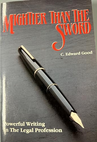
Mightier Than the Sword: Powerful Writing in the Legal Profession/Legal
Anbieter: World of Books (was SecondSale), Montgomery, IL, USA
Verkäuferbewertung 5 von 5 Sternen
Zustand: Good. Item in good condition. Textbooks may not include supplemental items i.e. CDs, access codes etc.
-
Mightier Than the Sword: Powerful Writing in the Legal Profession/Legal
Anbieter: ThriftBooks-Atlanta, AUSTELL, GA, USA
Verkäuferbewertung 5 von 5 Sternen
Paperback. Zustand: Very Good. No Jacket. Former library book; May have limited writing in cover pages. Pages are unmarked. ~ ThriftBooks: Read More, Spend Less.
-
Mightier Than the Sword: Powerful Writing in the Legal Profession/Legal
Anbieter: ThriftBooks-Dallas, Dallas, TX, USA
Verkäuferbewertung 5 von 5 Sternen
Paperback. Zustand: Good. No Jacket. Pages can have notes/highlighting. Spine may show signs of wear. ~ ThriftBooks: Read More, Spend Less.
-
Mightier Than the Sword: Powerful Writing in the Legal Profession/Legal
Anbieter: ThriftBooks-Atlanta, AUSTELL, GA, USA
Verkäuferbewertung 5 von 5 Sternen
Paperback. Zustand: Very Good. No Jacket. May have limited writing in cover pages. Pages are unmarked. ~ ThriftBooks: Read More, Spend Less.
-
Mightier Than the Sword: Powerful Writing in the Legal Profession
Anbieter: ThriftBooks-Dallas, Dallas, TX, USA
Verkäuferbewertung 5 von 5 Sternen
Paperback. Zustand: Very Good. No Jacket. Former library book; May have limited writing in cover pages. Pages are unmarked. ~ ThriftBooks: Read More, Spend Less.
-
Mightier Than the Sword: Powerful Writing in the Legal Profession
Anbieter: ThriftBooks-Atlanta, AUSTELL, GA, USA
Verkäuferbewertung 5 von 5 Sternen
Paperback. Zustand: As New. No Jacket. Pages are clean and are not marred by notes or folds of any kind. ~ ThriftBooks: Read More, Spend Less.
-
A Grammar Book for You and I (Oops, Me!) : All the Grammar You Need to Succeed in Life
Anbieter: Better World Books, Mishawaka, IN, USA
Verkäuferbewertung 5 von 5 Sternen
Zustand: Good. 1 Edition. Pages intact with minimal writing/highlighting. The binding may be loose and creased. Dust jackets/supplements are not included. Stock photo provided. Product includes identifying sticker. Better World Books: Buy Books. Do Good.
-
A Grammar Book for You and I (Oops, Me!) : All the Grammar You Need to Succeed in Life
Anbieter: Better World Books, Mishawaka, IN, USA
Verkäuferbewertung 5 von 5 Sternen
Zustand: Very Good. 1 Edition. Pages intact with possible writing/highlighting. Binding strong with minor wear. Dust jackets/supplements may not be included. Stock photo provided. Product includes identifying sticker. Better World Books: Buy Books. Do Good.
-
Grammar Book for You And I (Oops Me): All the Grammar You Need to Succeed in Life
Anbieter: ThriftBooks-Atlanta, AUSTELL, GA, USA
Verkäuferbewertung 5 von 5 Sternen
Paperback. Zustand: As New. No Jacket. Pages are clean and are not marred by notes or folds of any kind. ~ ThriftBooks: Read More, Spend Less.
-
Grammar Book for You And I (Oops Me): All the Grammar You Need to Succeed in Life
Anbieter: ThriftBooks-Atlanta, AUSTELL, GA, USA
Verkäuferbewertung 5 von 5 Sternen
Paperback. Zustand: Very Good. No Jacket. May have limited writing in cover pages. Pages are unmarked. ~ ThriftBooks: Read More, Spend Less.
-
Mightier Than the Sword: Powerful Writing in the Legal Profession
Anbieter: World of Books (was SecondSale), Montgomery, IL, USA
Verkäuferbewertung 5 von 5 Sternen
Zustand: Good. Item in good condition. Textbooks may not include supplemental items i.e. CDs, access codes etc.
-
Mightier Than the Sword : Powerful Writing in the Legal Profession
Sprache: Englisch
Verlag: Crown Publishing Group, The, 1989
ISBN 10: 0934961034 ISBN 13: 9780934961035
Anbieter: Better World Books: West, Reno, NV, USA
Verkäuferbewertung 5 von 5 Sternen
Zustand: Good. Pages intact with minimal writing/highlighting. The binding may be loose and creased. Dust jackets/supplements are not included. Stock photo provided. Product includes identifying sticker. Better World Books: Buy Books. Do Good.
-
Mightier Than the Sword : Powerful Writing in the Legal Profession
Sprache: Englisch
Verlag: Crown Publishing Group, The, 1989
ISBN 10: 0934961034 ISBN 13: 9780934961035
Anbieter: Better World Books, Mishawaka, IN, USA
Verkäuferbewertung 5 von 5 Sternen
Zustand: Good. Pages intact with minimal writing/highlighting. The binding may be loose and creased. Dust jackets/supplements are not included. Stock photo provided. Product includes identifying sticker. Better World Books: Buy Books. Do Good.
-
A Grammar Book for You and I.Oops, Me!
Anbieter: Redux Books, Grand Rapids, MI, USA
Verkäuferbewertung 5 von 5 Sternen
Paperback. Zustand: As New. Paperback. Cover shows very minor shelving wear, otherwise an unblemished copy.; 100% Satisfaction Guaranteed! Ships same or next business day!
-
Vocabulary of Success:413 Words That Smart People Should Know
Sprache: Englisch
Verlag: Konecky & Konecky (edition second), 2012
ISBN 10: 1568527810 ISBN 13: 9781568527819
Hardcover. Zustand: Fair. second. With dust jacket. The item might be beaten up but readable. May contain markings or highlighting, as well as stains, bent corners, or any other major defect, but the text is not obscured in any way.
-
Vocabulary of Success:413 Words That Smart People Should Know
Anbieter: World of Books (was SecondSale), Montgomery, IL, USA
Verkäuferbewertung 5 von 5 Sternen
Zustand: Very Good. Item in very good condition! Textbooks may not include supplemental items i.e. CDs, access codes etc.