Gesamtpreis (1 Artikel Artikel):
Versandziel:

e e benest (22 Ergebnisse)
Direkt zu den wichtigsten Suchergebnissen
Suchfilter
Produktart
- Alle Product Types
- Bücher (22)
- Magazine & Zeitschriften (Keine weiteren Ergebnisse entsprechen dieser Verfeinerung)
- Comics (Keine weiteren Ergebnisse entsprechen dieser Verfeinerung)
- Noten (Keine weiteren Ergebnisse entsprechen dieser Verfeinerung)
- Kunst, Grafik & Poster (Keine weiteren Ergebnisse entsprechen dieser Verfeinerung)
- Fotografien (Keine weiteren Ergebnisse entsprechen dieser Verfeinerung)
- Karten (Keine weiteren Ergebnisse entsprechen dieser Verfeinerung)
- Manuskripte & Papierantiquitäten (Keine weiteren Ergebnisse entsprechen dieser Verfeinerung)
Zustand Mehr dazu
Einband
Weitere Eigenschaften
- Erstausgabe (7)
- Signiert (Keine weiteren Ergebnisse entsprechen dieser Verfeinerung)
- Schutzumschlag (7)
- Angebotsfoto (14)
Sprache (2)
Gratisversand
- Kostenloser Versand nach USA (Keine weiteren Ergebnisse entsprechen dieser Verfeinerung)
Land des Verkäufers
Verkäuferbewertung
-

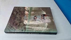
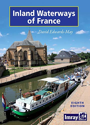
Inland Waterways of France
Sprache: Englisch
Verlag: Imray, Laurie, Norie & Wilson Ltd, United Kingdom, Huntingdon, 1984
ISBN 10: 0852880820 ISBN 13: 9780852880821
Anbieter: WorldofBooks, Goring-By-Sea, WS, Vereinigtes Königreich
Verkäuferbewertung 5 von 5 Sternen

EUR 2,69
EUR 6,46 Versand
Versand von Vereinigtes Königreich nach USAAnzahl: 1 verfügbar
In den WarenkorbPaperback. Zustand: Fair. A readable copy of the book which may include some defects such as highlighting and notes. Cover and pages may be creased and show discolouration.
-

Inland Waterways of France
Sprache: Englisch
Verlag: Imray, Laurie, Norie & Wilson Ltd, 1971
ISBN 10: 0852880065 ISBN 13: 9780852880067
Anbieter: WeBuyBooks, Rossendale, LANCS, Vereinigtes Königreich
Verkäuferbewertung 5 von 5 Sternen
EUR 1,97
EUR 9,15 Versand
Versand von Vereinigtes Königreich nach USAAnzahl: 1 verfügbar
In den WarenkorbZustand: Good. Most items will be dispatched the same or the next working day. A copy that has been read but remains in clean condition. All of the pages are intact and the cover is intact and the spine may show signs of wear. The book may have minor markings which are not specifically mentioned. Ex library copy with usual stamps & stickers.
-
Inland Waterways of France
Sprache: Englisch
Verlag: Imray, Laurie, Norie and Wilson Ltd, 1978
ISBN 10: 0852880642 ISBN 13: 9780852880647
Anbieter: BoundlessBookstore, Wallingford, Vereinigtes Königreich
Verkäuferbewertung 5 von 5 Sternen
EUR 3,56
EUR 8,05 Versand
Versand von Vereinigtes Königreich nach USAAnzahl: 1 verfügbar
In den WarenkorbZustand: Good. 4th edition. Light wear to boards. Content has light even toning and writing on the front pastedown. Good DJ with some edge wear and tonint.
-

Inland Waterways Of France
Sprache: Englisch
Verlag: Imray Laurie Norie & Wilson Ltd, United Kingdom, 1963
Anbieter: RIVERLEE BOOKS, Waltham Cross, HERTS, Vereinigtes Königreich
Verkäuferbewertung 5 von 5 Sternen
EUR 3,57
EUR 13,89 Versand
Versand von Vereinigtes Königreich nach USAAnzahl: 1 verfügbar
In den WarenkorbHardcover. Zustand: Good. No Jacket. Good for year, hardcover. Some marks, front of board nibbled. Fading to cover and spine. Wear to base of spine. No dustjacket, red cloth boards with gilt lettering to spine. 262 pages.
-
The Inland Waterways of France
Sprache: Englisch
Verlag: Imray, Laurie, Norie & Wilson Ltd, United Kingdom, Huntingdon, 2002
ISBN 10: 0852884729 ISBN 13: 9780852884720
Anbieter: WorldofBooks, Goring-By-Sea, WS, Vereinigtes Königreich
Verkäuferbewertung 5 von 5 Sternen
EUR 12,12
EUR 6,46 Versand
Versand von Vereinigtes Königreich nach USAAnzahl: 6 verfügbar
In den WarenkorbPaperback. Zustand: Very Good. The book has been read, but is in excellent condition. Pages are intact and not marred by notes or highlighting. The spine remains undamaged.
-
Inland Waterways Of France
Sprache: Englisch
Verlag: Imray Laurie Norie & Wilson Ltd, United Kingdom, 1963
Anbieter: RIVERLEE BOOKS, Waltham Cross, HERTS, Vereinigtes Königreich
Verkäuferbewertung 5 von 5 Sternen
EUR 6,40
EUR 13,89 Versand
Versand von Vereinigtes Königreich nach USAAnzahl: 1 verfügbar
In den WarenkorbHardcover. Zustand: Fair. No Jacket. Hardcover. Some marks, piece of front board missing (about 2cm X 6 cm). Fading to cover and spine. No dustjacket, dark red cloth boards with gilt lettering to spine. 262 pages.
-

Inland Waterways of the Netherlands III : North West and West-middle Netherlands
Sprache: Englisch
Verlag: Imray, Laurie, Norie & Wilson Ltd, United Kingdom, 1971
ISBN 10: 0852880081 ISBN 13: 9780852880081
Anbieter: Pendleburys - the bookshop in the hills, Llanwrda, Vereinigtes Königreich
Verkäuferbewertung 5 von 5 Sternen
Erstausgabe
EUR 12,05
EUR 13,26 Versand
Versand von Vereinigtes Königreich nach USAAnzahl: 1 verfügbar
In den WarenkorbHardcover. Zustand: Very Good. No Jacket. 1st Edition. hardback, blue cloth lettered gilt to spine, no dust wrapper, a very good tightly bound copy, text unmarked and clean, folding map to rear, b&w plates, 205pp.
-

Inland Waterways of France
Sprache: Englisch
Verlag: Imray Laurie Norie and Wilson Ltd, St Ives, Cambridgeshire, U.K., 1978
ISBN 10: 0852880642 ISBN 13: 9780852880647
Anbieter: PsychoBabel & Skoob Books, Didcot, Vereinigtes Königreich
Verkäuferbewertung 5 von 5 Sternen
EUR 11,36
EUR 14,41 Versand
Versand von Vereinigtes Königreich nach USAAnzahl: 1 verfügbar
In den WarenkorbHardcover. Zustand: Good. Zustand des Schutzumschlags: No Dust Jacket. Hardcover. No jacket. Ex-library. Five centimetre closed tear on spine head. A few light scores on rear board. Square of tape on spine foot. Spine ends, leading corners and edges are lightly bumped. Page block is lightly foxed. Upper leading corner of front pastedown is creased and detacherd from board. Sticker remains and library stamp on front pastedown. Abrasions on FEP. Light marks throughout pages. Contents are clear throughout. Volume is cocked, but binding remains intact. HJW. Ex-Library.
-
Inland Waterways Of Belgium
Verlag: Imray, Laurie, Norie and Wilson Ltd, 1960
Anbieter: BoundlessBookstore, Wallingford, Vereinigtes Königreich
Verkäuferbewertung 5 von 5 Sternen
EUR 3,56
EUR 8,05 Versand
Versand von Vereinigtes Königreich nach USAAnzahl: 1 verfügbar
In den WarenkorbZustand: Good. Light wear to boards. Content is clean and bright. Light toning to pag ends. DJ with some edge wear, small tears and creasing.
-
Inland Waterways of France
Sprache: Englisch
Verlag: Imray, Laurie, Norie, & Wilson, Ltd., London & St. Ives, Huntingdonshire, England, 1963
Anbieter: Ryde Bookshop Ltd, Isle of Wight, Vereinigtes Königreich
Verkäuferbewertung 5 von 5 Sternen
Erstausgabe
EUR 6,54
EUR 23,01 Versand
Versand von Vereinigtes Königreich nach USAAnzahl: 1 verfügbar
In den WarenkorbHardcover. Zustand: Good. Zustand des Schutzumschlags: Fair. 1st Edition. Firmly bound, maroon cloth boards. Dust spotting on the end papers and closed page edges. Scuffing, creases, tears and dust spotting on jacket.
-
Inland Waterways of France. 4. Aufl.
Sprache: Englisch
Verlag: Imray, Laurie, Norie & Wilson Ltd, Sanint Ives, 1978
ISBN 10: 0852880642 ISBN 13: 9780852880647
Anbieter: Gebrauchtbücherlogistik H.J. Lauterbach, Gummersbach, NRW, Deutschland
Verkäuferbewertung 5 von 5 Sternen
SonderangebotEUR 10,94
EUR 21,50 Versand
Versand von Deutschland nach USAAnzahl: 1 verfügbar
In den WarenkorbHardcover. Zustand: Gut. 4. Aufl. 25 cm X, 371 S. ; 24 Abb. Kunstleder Rot mit Schutzumschlag. Sprache: Englisch, Zustand: Sehr Gut, eher ungelesen (Innen); Minischildchen (2x1cm) auf dem Vorsatzblatt, läßt sich wohl entfernen, mir gelang das einmal; * Die Photos sind original von uns erstellt worden, u.a. erkennbar an einem kleinen weißen Stück Papier im oberen Schnitt. Ab und an verwenden Suchmaschinen Verlagsphotos, bei den Portalen selbst, werden aber nur unsere Originalphotos gezeigt.
-
Inland Waterways of Belgium
Sprache: Englisch
Verlag: Imry, Laurie, Norie & Wilson, United Kingdom, 1960
Anbieter: Pendleburys - the bookshop in the hills, Llanwrda, Vereinigtes Königreich
Verkäuferbewertung 5 von 5 Sternen
Erstausgabe
EUR 21,37
EUR 13,26 Versand
Versand von Vereinigtes Königreich nach USAAnzahl: 1 verfügbar
In den Warenkorbhardback. Zustand: Good. Zustand des Schutzumschlags: Good. 1st Edition. hardback, octavo, foxing to the closed page edges, a tightly bound copy in a chipped dust wrapper that has some small loss at head and foot, the text is free of marking, loosely inserted large folding map at the end of the book, 191pp.
-
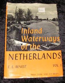
Inland Waterways of the Netherlands Volume 1
Sprache: Englisch
Verlag: Imray Laurie Norrie and Wilson, 1966
Anbieter: Yare Books, Great Yarmouth, Vereinigtes Königreich
Verkäuferbewertung 5 von 5 Sternen
Erstausgabe
EUR 6,24
EUR 30,84 Versand
Versand von Vereinigtes Königreich nach USAAnzahl: 1 verfügbar
In den WarenkorbHard Cover. Zustand: Very Good. Zustand des Schutzumschlags: Poor. First Edition. Includes duplicated 1972 supplement issued by the publishers Dust jacket badly crumpled and torn Size: 4to - over 9ľ" - 12" tall.
-
Inland Waterways of France
Sprache: Englisch
Verlag: Imry, Laurie, Norie & Wilson, United Kingdom, 1963
Anbieter: Pendleburys - the bookshop in the hills, Llanwrda, Vereinigtes Königreich
Verkäuferbewertung 5 von 5 Sternen
Erstausgabe
EUR 27,25
EUR 13,26 Versand
Versand von Vereinigtes Königreich nach USAAnzahl: 1 verfügbar
In den Warenkorbhardback. Zustand: Very Good. Zustand des Schutzumschlags: Very Good. 1st Edition. hardback, octavo, a tightly bound copy in a dust wrapper that is protected in a non-adhesive clear film sleeve, name stamp of a previous owner but the text is free of marking, maps & a loosely inserted large folding map at the end of the book, 262pp.
-

Inland Waterways of the Netherlands: Vol II - The North-East Netherlands
Verlag: Imray Laurie & Wilson, 1968
Anbieter: Diplomatist Books, Norwich, Vereinigtes Königreich
Verkäuferbewertung 4 von 5 Sternen

EUR 7,12
EUR 20,75 Versand
Versand von Vereinigtes Königreich nach USAAnzahl: 1 verfügbar
In den WarenkorbHardcover. Zustand: Very Good. hb, worn d/w, 236pp, plates.
-

Inland waterways of the Netherlands, Volume II, The north-east Netherlands
Verlag: Imray Laurie Norie & Wilson, 1966
Anbieter: Cotswold Internet Books, Cheltenham, Vereinigtes Königreich
Verkäuferbewertung 5 von 5 Sternen
EUR 7,84
EUR 15,56 Versand
Versand von Vereinigtes Königreich nach USAAnzahl: 1 verfügbar
In den WarenkorbTidy copy in tight binding; blue cloth with gilt titles on spine. Dust jacket price clipped; rather worn on edges & rubbed bare on corners, with small stains on back panel; folded map at rear. Used - Good. Good hardback in Good dust jacket Used - Good. Good hardback in Good dust jacket.
-
Inland Waterways of the Netherlands
Verlag: Imray, Laurie, Norie ., Huntingdon, Eng., 1966
Anbieter: J. Lawton, Booksellers, Readville, MA, USA
Verbandsmitglied: IOBA
Verkäuferbewertung 2 von 5 Sternen

Hardcover. Zustand: Very good condition. Zustand des Schutzumschlags: good. 2 v. illus.
-
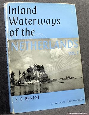
Inland Waterways of the Netherlands Volume II: East Gelderland, Overijssel, Drenthe, Groningen and Friesland
Verlag: St. Ives: Imray Laurie Norie & Wilson, 1968
Anbieter: BookLovers of Bath, Peasedown St. John, BATH, Vereinigtes Königreich
Verkäuferbewertung 5 von 5 Sternen
Erstausgabe
EUR 18,99
EUR 21,33 Versand
Versand von Vereinigtes Königreich nach USAAnzahl: 1 verfügbar
In den WarenkorbHardback in Dust Wrapper. Zustand: Good+. Zustand des Schutzumschlags: Good+. Condition Notes: Unlaminated dust wrapper a little edgeworn and faded with rubbing at the spine. Fold-out map to the rear endpaper has been torn out, photocopied and laid back in with the copies. Text complete, clean and tight; First edition (first printing). Hardback. Dust wrapper over blue boards with gilt titles to the spine; Measures 10" x 7" (0.8 kg); pp 236; Index; Illustrated by way of: Black & White Photographs; Maps; Tables; Fold-Out Maps; From the introduction: "This volume, the second of the Inland Waterways of the Netherlands, deals with the north-eastern part of the country; this includes the provinces of Friesland, Groningen, Drenthe, Overijssel and that portion of Gelderland which lies to the east of a line drawn southwards from Harderwijk to Rhenen, and which is bounded on the south and east by the Rijn and the German frontier." || The book is on the shelf, ready to be appropriately packed, and posted from the pastoral paradise of Peasedown St. John, Bath, by a real bookseller in a real book shop - with my personal guarantee and beady eye on the Consumer Contracts Regulations. REMEMBER! Buying my copy means the book shop Jack Russells get their supper! My Book #164598 ||.
-

Inland Waterways of France.
Sprache: Englisch
Verlag: Saint Ives/Imray Laurie Norie and Wilson., 1971
Anbieter: Dobben-Antiquariat Dr. Volker Wendt, Oldenburg, Deutschland
Verkäuferbewertung 5 von 5 Sternen
25x18 cm, Leinen. Zustand: Sehr gut. 3. Auflage. 324 S. mit zahlreichen s/w Abbildungen und einer Karte im Anhang. Part 1:"Official formalities for entering the inland waterways", "Navigational notes" and "some through routes". Part 2:"List of rivers and canals", "Particulars of the waterways".-Einband mit minimalen Gebrauchsspuren. Sehr gut erhaltenes Exemplar. Bitte beachten: Lieferung nach Vorauszahlung. An Buchhandel, Antiquariate, Behörden, öffentliche Bibliotheken, Universitäten und Museen liefern wir auf Wunsch mit Rechnung. Sprache: Englisch Gewicht in Gramm: 934.
-

Topics in Gravitational Dynamics: Solar, Extra-Solar and Galactic Systems (Lecture Notes in Physics)
Anbieter: Revaluation Books, Exeter, Vereinigtes Königreich
Verkäuferbewertung 5 von 5 Sternen
EUR 83,54
EUR 14,41 Versand
Versand von Vereinigtes Königreich nach USAAnzahl: 2 verfügbar
In den WarenkorbHardcover. Zustand: Brand New. 1st edition. 413 pages. 9.25x6.25x1.00 inches. In Stock.
-
Map of the Inland Waterways of France and Showing the More Important Waterways of Belgium, Netherlands & W. Germany
Verlag: Imray, Laurie, Norie & Wilson ltd., St. Ives
Anbieter: Theologia Books, La Charite sur Loire, Frankreich
Verkäuferbewertung 4 von 5 Sternen
Map. Zustand: Average. Cloth map. Colour. Scale 1/1,500,000. Acceptable condition. Some waterstains on rear but not shoing on map which shows a little wear.Homemade cover. 86x62cms. Size: 88x62cms. Book.
-

Inland Waterways of the Netherlands In Three Volumes.
Verlag: Imray Laurie Norie and Wilson Ltd, 1966
Anbieter: Addyman Books, Hay-on-Wye, Vereinigtes Königreich
Verkäuferbewertung 5 von 5 Sternen
Erstausgabe
EUR 53,44
EUR 34,01 Versand
Versand von Vereinigtes Königreich nach USAAnzahl: 1 verfügbar
In den WarenkorbFirst edition. DW. Large 8vo. The three volumes are all illustrated with coloured maps and plans and b/w photographs. All vols. near fine in wrappers that have slight wear to extremities. A lovely set.