
Gesamtpreis (1 Artikel Artikel):
Versandziel:

buchroithner manfred (46 Ergebnisse)
Direkt zu den wichtigsten Suchergebnissen
Suchfilter
Produktart
- Alle Product Types
- Bücher (46)
- Magazine & Zeitschriften (Keine weiteren Ergebnisse entsprechen dieser Verfeinerung)
- Comics (Keine weiteren Ergebnisse entsprechen dieser Verfeinerung)
- Noten (Keine weiteren Ergebnisse entsprechen dieser Verfeinerung)
- Kunst, Grafik & Poster (Keine weiteren Ergebnisse entsprechen dieser Verfeinerung)
- Fotografien (Keine weiteren Ergebnisse entsprechen dieser Verfeinerung)
- Karten (Keine weiteren Ergebnisse entsprechen dieser Verfeinerung)
- Manuskripte & Papierantiquitäten (Keine weiteren Ergebnisse entsprechen dieser Verfeinerung)
Zustand Mehr dazu
- Neu (27)
- Wie Neu, Sehr Gut oder Gut Bis Sehr Gut (6)
- Gut oder Befriedigend (6)
- Ausreichend oder Schlecht (Keine weiteren Ergebnisse entsprechen dieser Verfeinerung)
- Wie beschrieben (7)
Weitere Eigenschaften
Sprache (3)
Gratisversand
- Kostenloser Versand nach USA (Keine weiteren Ergebnisse entsprechen dieser Verfeinerung)
Land des Verkäufers
Verkäuferbewertung
-

Biostratigraphische und fazielle Untersuchungen im Paläozoikum von Mittelkärnten Catharina II, 169/89, 71-95.
Verlag: 1979, 1979
Anbieter: Wissenschaftliches Antiquariat Köln Dr. Sebastian Peters UG, Köln, Deutschland
Verkäuferbewertung 4 von 5 Sternen

Signiert
geheftet, ohne Einband. Zustand: gut. 24 cm, handschr. Widmung des Verfassers, aus der Sammlung Alexander Tollmann. Sprache: deu.
-
Spätvariszische Geosynklinalentwicklung in den Ostpyrenäen. Sonderdruck aus: N. Jb. Geol. Paläont. Abh.155, S. 1-17.
Verlag: 1977, 1977
Anbieter: Wissenschaftliches Antiquariat Köln Dr. Sebastian Peters UG, Köln, Deutschland
Verkäuferbewertung 4 von 5 Sternen
Interimsbroschur. Zustand: gut. 23 cm, handschr. Widmung von Buchroithner, Besitzvermerk, aus der Sammlung Alexander Tollmann. Sprache: deu.
-

Terrigenous mass movements. detection, modelling, early warning and mitigation using geoinformation technology.
Anbieter: Universitätsbuchhandlung Herta Hold GmbH, Berlin, Deutschland
Verbandsmitglied: GIAQ ILAB VDA
Verkäuferbewertung 4 von 5 Sternen
24 cm. VIII, 398 S. Hardcover. Versand aus Deutschland / We dispatch from Germany via Air Mail. Einband bestoßen, daher Mängelexemplar gestempelt, sonst sehr guter Zustand. Imperfect copy due to slightly bumped cover, apart from this in very good condition. Stamped. Sprache: Deutsch.
-

Cartography from Pole to Pole. Selected Contributions to the XXVIth International Conference of the ICA, Dresden 2013.
Buch 32 von 74: Lecture Notes in Geoinformation and CartographyAnbieter: Universitätsbuchhandlung Herta Hold GmbH, Berlin, Deutschland
Verbandsmitglied: GIAQ ILAB VDA
Verkäuferbewertung 4 von 5 Sternen
24 cm. XVII, 496 p. Hardcover. Versand aus Deutschland / We dispatch from Germany via Air Mail. Einband bestoßen, daher Mängelexemplar gestempelt, sonst sehr guter Zustand. Imperfect copy due to slightly bumped cover, apart from this in very good condition. Stamped. Lecture Notes in Geoinformation and Cartography. Sprache: Englisch.
-
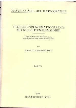
Fernerkundungskartographie mit Satellitenaufnahmen. Digitale Methoden, Reliefkartierung, geowissenschaftl. Applikationsbeisp. (=Die Kartographie u. ihre Randgebiete; Band IV/2).
Sprache: Deutsch
Verlag: Wien, Deuticke Verlag 05.10.1989., 1989
Anbieter: Antiquariat Thomas Haker GmbH & Co. KG, Berlin, Deutschland
Verbandsmitglied: GIAQ
Verkäuferbewertung 5 von 5 Sternen

Hardcover. Zustand: Gut. 523 S.; mit zahlr. Abb. Bibl.-Ex., Guter Zustand. Einband mit leichter Spur vom Ablösen eines Bibliotheksschildes. Sprache: Deutsch Gewicht in Gramm: 1490.
-
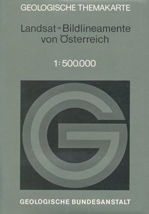
Geologische Themenkarte: Karte der Landsat-Bildlineamente von Österreich 1:500.000. Herausgegeben von der Geologischen Bundesanstalt. 122 cm x 82 cm, gefaltet. Nebst Erläuterungen (16 Seiten, 1 Abbildungen, 1 Tafel).
Verlag: Wien, 1984
Anbieter: ANTIQUARIAT ERDLEN, Untersteinach b. Kulmbach, Deutschland
Verkäuferbewertung 5 von 5 Sternen
In Plastiktasche. 0. In Plastiktasche. - Sehr gut erhalten. Sprache: Deutschu 0,450 gr.
-

Remote Sensing for Environmental Data in Albania: A Strategy for Integrated Management (NATO Science Partnership Sub-Series: 2:)
Anbieter: Revaluation Books, Exeter, Vereinigtes Königreich
Verkäuferbewertung 5 von 5 Sternen
EUR 90,01
EUR 11,49 Versand
Versand von Vereinigtes Königreich nach USAAnzahl: 1 verfügbar
In den WarenkorbPaperback. Zustand: Brand New. 1st edition. 256 pages. 9.25x6.25x0.75 inches. In Stock.
-
Fernerkundungskartographie mit Satellitenaufnahmen. Digitale Methoden, Reliefkartierung, geowissenschaftl. Applikationsbeisp. (Die Kartographie u. ihre Randgebiete Band IV/2).
Anbieter: Andreas Schüller, Chemnitz, Deutschland
Verkäuferbewertung 5 von 5 Sternen
Kunstleder. Mit zahlreichen Textabbildungen und 40 Farbtafeln. Schutzumschlag rückseitig fleckig. 17x24,5 cm. 534 In deutscher Sprache. 523 pages. 4° - Quartformat (bis 35 cm Rückenhöhe) Gut bis sehr gut, Umschlag: Gut.
-

Remote Sensing for Environmental Data in Albania : A Strategy for Integrated Management
Anbieter: AHA-BUCH GmbH, Einbeck, Deutschland
Verkäuferbewertung 5 von 5 Sternen
Taschenbuch. Zustand: Neu. Druck auf Anfrage Neuware - Printed after ordering - A comprehensive source book for anybody interested in the potential of remote sensing and GIS technology for the Eastern Europe countries in transition, and less developed countries in general. Leading experts from Europe, Canada and the USA cover a wide variety of applications, from the provision of satellite data to land, water and atmosphere planning issues. The individual contributions present a nice balance between theory and proved application methods. The book is suitable for a wide spectrum of readers, such as graduate students of the environmental and geo sciences, teachers and professors, specialists at various administrative levels, political decision makers and policy makers, and technical aid GOs and NGOs.
-
Zustand: Sehr gut. Zustand: Sehr gut | Seiten: 516 | Sprache: Englisch | Produktart: Bücher | This volume comprehends a selection of papers presented during the 26th International Cartographic Conference held in Dresden from the 26th to the 30th of August 2013. It covers many fields of relevant Mapping and GIS research subjects, such as cartographic applications, cartographic tools, generalisation and update Propagation, higher dimensional visualisation and augmented reality, planetary mapping issues, cartography and environmental modelling, user generated content and spatial data infrastructure, use and usability as well as cartography and GIS in education.
-

Nepal-Kartenwerk der Arbeitsgemeinschaft für vergleichende Hochgebirgsforschung Shorong / Hinku, Trekking-Karte
Anbieter: AHA-BUCH GmbH, Einbeck, Deutschland
Verkäuferbewertung 5 von 5 Sternen
Karte. Zustand: Neu. Neuware.
-

Paradigms in Cartography: An Epistemological Review of the 20th and 21st Centuries
Anbieter: Revaluation Books, Exeter, Vereinigtes Königreich
Verkäuferbewertung 5 von 5 Sternen
EUR 134,12
EUR 11,49 Versand
Versand von Vereinigtes Königreich nach USAAnzahl: 2 verfügbar
In den WarenkorbHardcover. Zustand: Brand New. 2014 edition. 250 pages. 9.25x6.25x0.75 inches. In Stock.
-
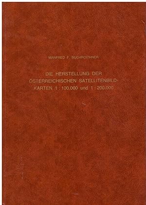
Die Herstellung der österreichischen Satellitenbildkarten 1:100000 und 1:200000. Forschungn zur theoretischen Karthographie Band 8.
Sprache: Deutsch
Verlag: Verlag der österreichischen Akademie der Wissenschaften, Wien, 1987
ISBN 10: 3700110901 ISBN 13: 9783700110903
Anbieter: Andreas Schüller, Chemnitz, Deutschland
Verkäuferbewertung 5 von 5 Sternen
Kunstleder. Zustand: Gut bis sehr gut. Mit 4 Beilagen in der Anlage. 17,5x24,5 cm. V07 In deutscher Sprache. 46 pages. 8° - Oktavformat (bis 25 cm Rückenhöhe).
-

Terrigenous Mass Movements: Detection, Modelling, Early Warning and Mitigation Using Geoinformation Technology
Anbieter: Revaluation Books, Exeter, Vereinigtes Königreich
Verkäuferbewertung 5 von 5 Sternen
EUR 152,84
EUR 14,36 Versand
Versand von Vereinigtes Königreich nach USAAnzahl: 2 verfügbar
In den WarenkorbPaperback. Zustand: Brand New. 2012 edition. 408 pages. 9.25x6.10x0.84 inches. In Stock.
-
Terrigenous Mass Movements: Detection, Modelling, Early Warning and Mitigation Using Geoinformation Technology
Anbieter: Revaluation Books, Exeter, Vereinigtes Königreich
Verkäuferbewertung 5 von 5 Sternen
EUR 154,38
EUR 14,36 Versand
Versand von Vereinigtes Königreich nach USAAnzahl: 2 verfügbar
In den WarenkorbHardcover. Zustand: Brand New. 2012 edition. 398 pages. 9.25x6.00x1.00 inches. In Stock.
-
Taschenbuch. Zustand: Neu. Terrigenous Mass Movements | Detection, Modelling, Early Warning and Mitigation Using Geoinformation Technology | Biswajeet Pradhan (u. a.) | Taschenbuch | viii | Englisch | 2014 | Springer | EAN 9783642427787 | Verantwortliche Person für die EU: Springer Verlag GmbH, Tiergartenstr. 17, 69121 Heidelberg, juergen[dot]hartmann[at]springer[dot]com | Anbieter: preigu.
-

Paradigms in Cartography
Sprache: Englisch
Verlag: Springer Berlin Heidelberg, Springer Berlin Heidelberg Aug 2015, 2015
ISBN 10: 3642447546 ISBN 13: 9783642447549
Anbieter: buchversandmimpf2000, Emtmannsberg, BAYE, Deutschland
Verkäuferbewertung 5 von 5 Sternen
Taschenbuch. Zustand: Neu. Neuware -In this book the main trends, concepts and directions in cartography and mapping in modernism and post-modernism are reviewed. Philosophical and epistemological issues are analysed in cartography from positivist-empiricist, neo-positivist and post-structuralist stances. In general, in cartography technological aspects have been considered as well as theoretical issues. The aim is to highlight the epistemological and philosophical viewpoint during the development of the discipline.Some main philosophers who have been influential for contemporary thinking such as Immanuel Kant, Ludwig Wittgenstein, Karl Popper and Bertrand Russell, are considered. None of these philosophers wrote about cartography directly (excepting Kant), but their philosophies are related to cartography and mapping issues. The book also analyses the concept of paradigm or paradigm shift coined by Thomas Kuhn, who applied it to the history of science. Different cartographic trends that have arisen since the second half of the twentieth century are analysed according to this important concept which is implicit inside the scientific or disciplinary communities.Further, the authors analyse the position of cartography in the context of the sciences and other disciplines, adopting a positivistic point of view. Additionally, they review current trends in cartography and mapping in the context of information and communication technologies in a post-modernistic or post-structuralistic framework. Thus, since the 1980s and 1990s, new mapping concepts have arisen which challenge the disciplineżs traditional map conceptions.Springer Verlag GmbH, Tiergartenstr. 17, 69121 Heidelberg 168 pp. Englisch.
-

Terrigenous Mass Movements
Sprache: Englisch
Verlag: Springer Berlin Heidelberg, Springer Berlin Heidelberg Apr 2012, 2012
ISBN 10: 3642254942 ISBN 13: 9783642254949
Anbieter: buchversandmimpf2000, Emtmannsberg, BAYE, Deutschland
Verkäuferbewertung 5 von 5 Sternen
Buch. Zustand: Neu. Neuware -Terrestrial mass movements (i.e. cliff collapses, soil creeps, mudflows, landslides etc.) are severe forms of natural disasters mostly occurring in mountainous terrain, which is subjected to specific geological, geomorphological and climatological conditions, as well as to human activities. It is a challenging task to accurately define the position, type and activity of mass movements for the purpose of creating inventory records and potential vulnerability maps. Remote sensing techniques, in combination with Geographic Information System tools, allow state-of-the-art investigation of the degree of potential mass movements and modeling surface processes for hazard and risk mapping. Similarly, through statistical prediction models, future mass-movement-prone areas can be identified and damages can to a certain extent be minimized. Issues of scale and selection of morphological attributes for the scientific analysis of mass movements call for new developments in data modeling and spatio-temporal GIS analysis.The book is a product of a cooperation between the editors and several contributing authors, addressing current issues and recent developments in GI technology and mass movements research. Its fundamental treatment of this technology includes data modeling, topography, geology, geomorphology, remote sensing, artificial neural networks, binomial regression, fuzzy logic, spatial statistics and analysis, and scientific visualization. Both theoretical and practical issues are addressed.Springer Verlag GmbH, Tiergartenstr. 17, 69121 Heidelberg 408 pp. Englisch.
-

Paradigms in Cartography : An Epistemological Review of the 20th and 21st Centuries
Sprache: Englisch
Verlag: Springer Berlin Heidelberg, Springer Berlin Heidelberg, 2013
ISBN 10: 3642388922 ISBN 13: 9783642388927
Anbieter: AHA-BUCH GmbH, Einbeck, Deutschland
Verkäuferbewertung 5 von 5 Sternen
Buch. Zustand: Neu. Druck auf Anfrage Neuware - Printed after ordering - In this book the main trends, concepts and directions in cartography and mapping in modernism and post-modernism are reviewed. Philosophical and epistemological issues are analysed in cartography from positivist-empiricist, neo-positivist and post-structuralist stances. In general, in cartography technological aspects have been considered as well as theoretical issues. The aim is to highlight the epistemological and philosophical viewpoint during the development of the discipline. Some main philosophers who have been influential for contemporary thinking such as Immanuel Kant, Ludwig Wittgenstein, Karl Popper and Bertrand Russell, are considered. None of these philosophers wrote about cartography directly (excepting Kant), but their philosophies are related to cartography and mapping issues. The book also analyses the concept of paradigm or paradigm shift coined by Thomas Kuhn, who applied it to the history of science. Different cartographic trends that have arisen since the second half of the twentieth century are analysed according to this important concept which is implicit inside the scientific or disciplinary communities. Further, the authors analyse the position of cartography in the context of the sciences and other disciplines, adopting a positivistic point of view. Additionally, they review current trends in cartography and mapping in the context of information and communication technologies in a post-modernistic or post-structuralistic framework. Thus, since the 1980s and 1990s, new mapping concepts have arisen which challenge the discipline's traditional map conceptions.
-

Paradigms in Cartography : An Epistemological Review of the 20th and 21st Centuries
Sprache: Englisch
Verlag: Springer Berlin Heidelberg, 2015
ISBN 10: 3642447546 ISBN 13: 9783642447549
Anbieter: AHA-BUCH GmbH, Einbeck, Deutschland
Verkäuferbewertung 5 von 5 Sternen
Taschenbuch. Zustand: Neu. Druck auf Anfrage Neuware - Printed after ordering - In this book the main trends, concepts and directions in cartography and mapping in modernism and post-modernism are reviewed. Philosophical and epistemological issues are analysed in cartography from positivist-empiricist, neo-positivist and post-structuralist stances. In general, in cartography technological aspects have been considered as well as theoretical issues. The aim is to highlight the epistemological and philosophical viewpoint during the development of the discipline. Some main philosophers who have been influential for contemporary thinking such as Immanuel Kant, Ludwig Wittgenstein, Karl Popper and Bertrand Russell, are considered. None of these philosophers wrote about cartography directly (excepting Kant), but their philosophies are related to cartography and mapping issues. The book also analyses the concept of paradigm or paradigm shift coined by Thomas Kuhn, who applied it to the history of science. Different cartographic trends that have arisen since the second half of the twentieth century are analysed according to this important concept which is implicit inside the scientific or disciplinary communities. Further, the authors analyse the position of cartography in the context of the sciences and other disciplines, adopting a positivistic point of view. Additionally, they review current trends in cartography and mapping in the context of information and communication technologies in a post-modernistic or post-structuralistic framework. Thus, since the 1980s and 1990s, new mapping concepts have arisen which challenge the discipline's traditional map conceptions.
-

Terrigenous Mass Movements : Detection, Modelling, Early Warning and Mitigation Using Geoinformation Technology
Sprache: Englisch
Verlag: Springer Berlin Heidelberg, 2014
ISBN 10: 3642427782 ISBN 13: 9783642427787
Anbieter: AHA-BUCH GmbH, Einbeck, Deutschland
Verkäuferbewertung 5 von 5 Sternen
Taschenbuch. Zustand: Neu. Druck auf Anfrage Neuware - Printed after ordering - Terrestrial mass movements (i.e. cliff collapses, soil creeps, mudflows, landslides etc.) are severe forms of natural disasters mostly occurring in mountainous terrain, which is subjected to specific geological, geomorphological and climatological conditions, as well as to human activities. It is a challenging task to accurately define the position, type and activity of mass movements for the purpose of creating inventory records and potential vulnerability maps. Remote sensing techniques, in combination with Geographic Information System tools, allow state-of-the-art investigation of the degree of potential mass movements and modeling surface processes for hazard and risk mapping. Similarly, through statistical prediction models, future mass-movement-prone areas can be identified and damages can to a certain extent be minimized. Issues of scale and selection of morphological attributes for the scientific analysis of mass movements call for new developments in data modeling and spatio-temporal GIS analysis. The book is a product of a cooperation between the editors and several contributing authors, addressing current issues and recent developments in GI technology and mass movements research. Its fundamental treatment of this technology includes data modeling, topography, geology, geomorphology, remote sensing, artificial neural networks, binomial regression, fuzzy logic, spatial statistics and analysis, and scientific visualization. Both theoretical and practical issues are addressed.
-

Terrigenous Mass Movements : Detection, Modelling, Early Warning and Mitigation Using Geoinformation Technology
Sprache: Englisch
Verlag: Springer Berlin Heidelberg, 2012
ISBN 10: 3642254942 ISBN 13: 9783642254949
Anbieter: AHA-BUCH GmbH, Einbeck, Deutschland
Verkäuferbewertung 5 von 5 Sternen
Buch. Zustand: Neu. Druck auf Anfrage Neuware - Printed after ordering - Terrestrial mass movements (i.e. cliff collapses, soil creeps, mudflows, landslides etc.) are severe forms of natural disasters mostly occurring in mountainous terrain, which is subjected to specific geological, geomorphological and climatological conditions, as well as to human activities. It is a challenging task to accurately define the position, type and activity of mass movements for the purpose of creating inventory records and potential vulnerability maps. Remote sensing techniques, in combination with Geographic Information System tools, allow state-of-the-art investigation of the degree of potential mass movements and modeling surface processes for hazard and risk mapping. Similarly, through statistical prediction models, future mass-movement-prone areas can be identified and damages can to a certain extent be minimized. Issues of scale and selection of morphological attributes for the scientific analysis of mass movements call for new developments in data modeling and spatio-temporal GIS analysis. The book is a product of a cooperation between the editors and several contributing authors, addressing current issues and recent developments in GI technology and mass movements research. Its fundamental treatment of this technology includes data modeling, topography, geology, geomorphology, remote sensing, artificial neural networks, binomial regression, fuzzy logic, spatial statistics and analysis, and scientific visualization. Both theoretical and practical issues are addressed.
-
Zustand: Sehr gut. Zustand: Sehr gut | Sprache: Englisch | Produktart: Bücher | In this book the main trends, concepts and directions in cartography and mapping in modernism and post-modernism are reviewed. Philosophical and epistemological issues are analysed in cartography from positivist-empiricist, neo-positivist and post-structuralist stances. In general, in cartography technological aspects have been considered as well as theoretical issues. The aim is to highlight the epistemological and philosophical viewpoint during the development of the discipline. Some main philosophers who have been influential for contemporary thinking such as Immanuel Kant, Ludwig Wittgenstein, Karl Popper and Bertrand Russell, are considered. None of these philosophers wrote about cartography directly (excepting Kant), but their philosophies are related to cartography and mapping issues. The book also analyses the concept of paradigm or paradigm shift coined by Thomas Kuhn, who applied it to the history of science. Different cartographic trends that have arisen since the second half of the twentieth century are analysed according to this important concept which is implicit inside the scientific or disciplinary communities. Further, the authors analyse the position of cartography in the context of the sciences and other disciplines, adopting a positivistic point of view. Additionally, they review current trends in cartography and mapping in the context of information and communication technologies in a post-modernistic or post-structuralistic framework. Thus, since the 1980s and 1990s, new mapping concepts have arisen which challenge the disciplineżs traditional map conceptions.
-
Taschenbuch. Zustand: Neu. Cartography from Pole to Pole | Selected Contributions to the XXVIth International Conference of the ICA, Dresden 2013 | Manfred Buchroithner (u. a.) | Taschenbuch | xvii | Englisch | 2016 | Springer | EAN 9783662522196 | Verantwortliche Person für die EU: Springer Verlag GmbH, Tiergartenstr. 17, 69121 Heidelberg, juergen[dot]hartmann[at]springer[dot]com | Anbieter: preigu.
-

Cartography from Pole to Pole
Buch 32 von 74: Lecture Notes in Geoinformation and CartographySprache: Englisch
Verlag: Springer Berlin Heidelberg, Springer Berlin Heidelberg Aug 2013, 2013
ISBN 10: 364232617X ISBN 13: 9783642326172
Anbieter: buchversandmimpf2000, Emtmannsberg, BAYE, Deutschland
Verkäuferbewertung 5 von 5 Sternen
Buch. Zustand: Neu. Neuware -This volume comprehends a selection of papers presented during the 26th International Cartographic Conferenceheld in Dresden from the 26th to the 30th of August 2013. It covers many fields of relevant Mapping and GIS research subjects, such as cartographic applications, cartographic tools, generalisation and update Propagation, higher dimensional visualisation and augmented reality, planetary mapping issues, cartography and environmental modelling, user generated content and spatial data infrastructure, use and usability as well as cartography and GIS in education.Springer Verlag GmbH, Tiergartenstr. 17, 69121 Heidelberg 516 pp. Englisch.
-

Cartography from Pole to Pole : Selected Contributions to the XXVIth International Conference of the ICA, Dresden 2013
Buch 32 von 74: Lecture Notes in Geoinformation and CartographySprache: Englisch
Verlag: Springer Berlin Heidelberg, 2013
ISBN 10: 364232617X ISBN 13: 9783642326172
Anbieter: AHA-BUCH GmbH, Einbeck, Deutschland
Verkäuferbewertung 5 von 5 Sternen
Buch. Zustand: Neu. Druck auf Anfrage Neuware - Printed after ordering - The International Cartographic Association (ICA) was founded in 1959 and organises biannual conferences, which usually attract more than 1000 attendees. No other publication or scientific series gives readers an equally comprehensive overview of the latest cartographic research and activities than the proceedings of these conferences. This book, which collects these proceedings, spans the whole scientific discipline, from questions of appropriate geo-data sources to various forms of processing geo-data, to an appropriate cartographic design and answers related to the user interaction with and perception of cartographic products. Moreover, the centuries-long tradition of cartography and its technical and design-related developments are reflected in various contributions. Cartography topics are highly relevant to society far beyond the academic world, as modern technologies generate an already vast and steadily increasing amount of geo-related data. Only a sensible and professional way of presenting these precious resources by using the expertise of cartographers will allow us to transform loads of data into useful and beneficial information.
-
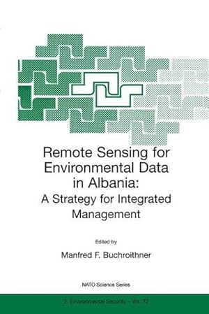
Remote Sensing for Environmental Data in Albania : A Strategy for Integrated Management
Anbieter: AHA-BUCH GmbH, Einbeck, Deutschland
Verkäuferbewertung 5 von 5 Sternen
Taschenbuch. Zustand: Neu. Druck auf Anfrage Neuware - Printed after ordering - A comprehensive source book for anybody interested in the potential of remote sensing and GIS technology for the Eastern Europe countries in transition, and less developed countries in general. Leading experts from Europe, Canada and the USA cover a wide variety of applications, from the provision of satellite data to land, water and atmosphere planning issues. The individual contributions present a nice balance between theory and proved application methods. The book is suitable for a wide spectrum of readers, such as graduate students of the environmental and geo sciences, teachers and professors, specialists at various administrative levels, political decision makers and policy makers, and technical aid GOs and NGOs.
-

Cartography from Pole to Pole : Selected Contributions to the XXVIth International Conference of the ICA, Dresden 2013
Buch 32 von 74: Lecture Notes in Geoinformation and CartographySprache: Englisch
Verlag: Springer, Berlin, Springer, 2016
ISBN 10: 3662522195 ISBN 13: 9783662522196
Anbieter: AHA-BUCH GmbH, Einbeck, Deutschland
Verkäuferbewertung 5 von 5 Sternen
Taschenbuch. Zustand: Neu. Druck auf Anfrage Neuware - Printed after ordering - This volume comprehends a selection of papers presented during the 26 th International Cartographic Conference held in Dresden from the 26 th to the 30 th of August 2013. It covers many fields of relevant Mapping and GIS research subjects, such as cartographic applications, cartographic tools, generalisation and update Propagation, higher dimensional visualisation and augmented reality, planetary mapping issues, cartography and environmental modelling, user generated content and spatial data infrastructure, use and usability as well as cartography and GIS in education.
-
Cartography from Pole to Pole: Selected Contributions to the Xxvith International Conference of the Ica, Dresden 2013: Vol 1
Buch 32 von 74: Lecture Notes in Geoinformation and CartographyAnbieter: Revaluation Books, Exeter, Vereinigtes Königreich
Verkäuferbewertung 5 von 5 Sternen
EUR 235,77
EUR 14,36 Versand
Versand von Vereinigtes Königreich nach USAAnzahl: 2 verfügbar
In den WarenkorbHardcover. Zustand: Brand New. 600 pages. 9.25x6.25x1.25 inches. In Stock.


