Gesamtpreis (1 Artikel Artikel):
Versandziel:

blaeu joan krogt peter (55 Ergebnisse)
Direkt zu den wichtigsten Suchergebnissen
Suchfilter
Produktart
- Alle Product Types
- Bücher (54)
- Magazine & Zeitschriften (Keine weiteren Ergebnisse entsprechen dieser Verfeinerung)
- Comics (Keine weiteren Ergebnisse entsprechen dieser Verfeinerung)
- Noten (Keine weiteren Ergebnisse entsprechen dieser Verfeinerung)
- Kunst, Grafik & Poster (Keine weiteren Ergebnisse entsprechen dieser Verfeinerung)
- Fotografien (Keine weiteren Ergebnisse entsprechen dieser Verfeinerung)
- Karten (1)
- Manuskripte & Papierantiquitäten (Keine weiteren Ergebnisse entsprechen dieser Verfeinerung)
Zustand Mehr dazu
- Neu (4)
- Wie Neu, Sehr Gut oder Gut Bis Sehr Gut (12)
- Gut oder Befriedigend (19)
- Ausreichend oder Schlecht (Keine weiteren Ergebnisse entsprechen dieser Verfeinerung)
- Wie beschrieben (20)
Einband
Weitere Eigenschaften
- Erstausgabe (4)
- Signiert (Keine weiteren Ergebnisse entsprechen dieser Verfeinerung)
- Schutzumschlag (20)
- Angebotsfoto (21)
Sprache (6)
Gratisversand
- Kostenloser Versand nach USA (Keine weiteren Ergebnisse entsprechen dieser Verfeinerung)
Land des Verkäufers
Verkäuferbewertung
-

Atlas Maior - Anglia, Scotia Et Hibernia (Multilingual) (JUMBO)
Anbieter: Books From California, Simi Valley, CA, USA
Verkäuferbewertung 5 von 5 Sternen

Hardcover. Zustand: Very Good.
-
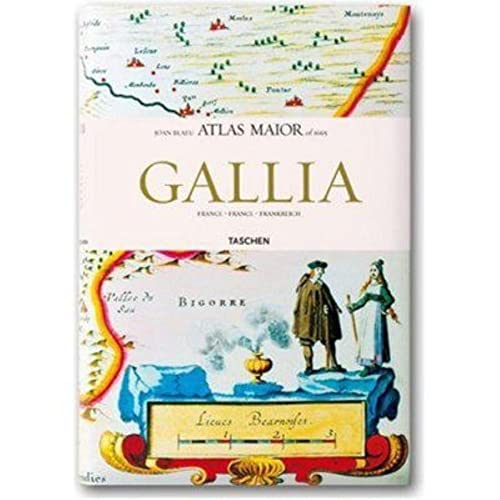
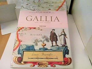
Atlas Maior - Gallia (Joan Blaeu Atlas Maior 1665)
Anbieter: Powell's Bookstores Chicago, ABAA, Chicago, IL, USA
Verkäuferbewertung 5 von 5 Sternen
Zustand: Used - Very Good. Cloth, dj. Slight shelf wear. Very Good.
-
Joan Blaeu Atlas Maior 1665 Gallia (France)
Anbieter: Dale A. Sorenson, Silver Spring, MD, USA
Verbandsmitglied: IOBA
Verkäuferbewertung 5 von 5 Sternen
Hardcover. Zustand: Fine. Zustand des Schutzumschlags: Fine. Reprint. Taschen, (2006). Introduction and texts by Peter Van Der Krogt. 15.25" x 10". 208pp. Hardcover. As new in dj. Text in English, French, and German. 64 maps in color. ; 15.25 x 10 inches; 208 pages.
-
Atlas Maior of 1665: Anglia & Scotia & Hibernia (Two Volumes)
Anbieter: Abacus Bookshop, Pittsford, NY, USA
Verkäuferbewertung 5 von 5 Sternen
Erstausgabe
hardcover. Profusely illustrated (illustrator). 1st. 4to, pp., Still shrink-wrapped from the publisher., Text in English, German and French. Fine copy in fine dust jacket & slipcase.
-

Atlas Major of 1665: Anglia (vol 1), Scotia & Hibernia (vol 2)
Anbieter: Book Express (NZ), Shannon, Neuseeland
Verkäuferbewertung 4 von 5 Sternen

Hardcover. Zustand: Very Good. vol 1 has 1cm tear at edge of dj. vol 2 OK. slipcase also very good2 volumes in slipcase.
-
Atlas Maior of 1665: Francia (Joan Blaeu Atlas Maior 1665)
Anbieter: Salsus Books (P.B.F.A.), Kidderminster, Vereinigtes Königreich
Verbandsmitglied: PBFA
Verkäuferbewertung 5 von 5 Sternen
EUR 35,13
EUR 17,05 shipping
Ships from Vereinigtes Königreich to USAAnzahl: 1 verfügbar
In den WarenkorbHardcover. Zustand: As New. Zustand des Schutzumschlags: As New. 208pp hardback, well illustrated in colour unopened, still in shrink-wrap plastic.
-

Atlas Maior - Hispania, Portugallia, America Et Africa
Anbieter: Books From California, Simi Valley, CA, USA
Verkäuferbewertung 5 von 5 Sternen
hardcover. Zustand: Good.
-

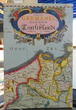
Germania, Austria & Helvetia Joan Blaeu Atlas Maior of 1665
Anbieter: Antiquariat Foertsch, Berlin, PANKO, Deutschland
Verkäuferbewertung 5 von 5 Sternen
Zustand: sehr guter Zustand. fester Pappband 404 S., mit Schuber, Fadenheftung Schuber minimal außen an einer Ecke bestoßen, sonst wie neu Sprache: ger/deu* süämtliche 124 Karten von Germanien, Österreich und der Schweiz, sowie Originaltexte von Joan Blaeu aus seie Altas Maior von 1665, "dem grössten und prachtvollsten Atlas, der jemals veröffentlicht wurde".
-
Gallia : Atlas Major de 1665 *- (Ancien prix éditeur : 29.99 euros)
Anbieter: LiLi - La Liberté des Livres, CANEJAN, Frankreich
Verkäuferbewertung 5 von 5 Sternen
Zustand: fine. vendeur professionnel, envoi sous 24/48h.
-
Atlas Maior - Gallia: Francia, France, Frankreich
Anbieter: Hay-on-Wye Booksellers, Hay-on-Wye, HEREF, Vereinigtes Königreich
Verkäuferbewertung 5 von 5 Sternen
EUR 35,62
EUR 73,89 shipping
Ships from Vereinigtes Königreich to USAAnzahl: 1 verfügbar
In den WarenkorbZustand: as New.
-

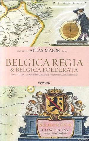
Atlas Maior of 1665. De Lage Landen. Belgica Regia & Belgica Foederata. Les Pays-Bas et La Belgique - The Netherlands and Belgium.
Anbieter: Antiquariaat A. Kok & Zn. B.V., Amsterdam, Niederlande
Verkäuferbewertung 5 von 5 Sternen
[Kerkdriel], Librero, [2010]. 207,[1] pp. Num. col. ills. Orig. softcover (pictorial stiff paper wrappers). Sm. folio. Depicting all the 63 maps of the Netherlands and Belgium as published in Joan Blaeu's Atlas maior of 1665. - Text in English, French and Dutch language.
-
![Bild des Verkäufers für Atlas maior of 1665 : "the greatest and finest atlas ever published" (based on the copy in the Österreichische Nationalbibliothek, Vienna) = "Der Größte und Prachtvollste Atlas der jemals veröffentlicht wurde" = "L' Atlas le Plus Grand et Le Plus Admirable jamais publié". // mit Schuber. With a selection of orig. texts by Joan Blaeu. Introd. and texts by Peter van der Krogt. [Transl.: Jeniffer Schaudies .] zum Verkauf von Antiquarische Fundgrube e.U.](https://pictures.abebooks.com/inventory/md/md32319279322.jpg)
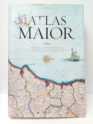
Atlas maior of 1665 : "the greatest and finest atlas ever published" (based on the copy in the Österreichische Nationalbibliothek, Vienna) = "Der Größte und Prachtvollste Atlas der jemals veröffentlicht wurde" = "L' Atlas le Plus Grand et Le Plus Admirable jamais publié". // mit Schuber. With a selection of orig. texts by Joan Blaeu. Introd. and texts by Peter van der Krogt. [Transl.: Jeniffer Schaudies .]
Anbieter: Antiquarische Fundgrube e.U., Wien, Österreich
Verkäuferbewertung 5 von 5 Sternen
gebundene Ausgabe. 512 S. mit Ill. u. Karten / Englisch/Deutsch/Französisch / Schuber etw. bestoßen / Geschichte 1665, Geografie, Reisen, Atlanten L048 9783836524117 *.* Sprache: Englisch Gewicht in Gramm: 5200.
-
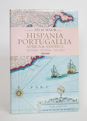
Atlas Maior of 1665: Hispania, Portugallia, Africa & America
Verlag: Taschen, Hong Kong, 2006
Anbieter: Minotavros Books, ABAC ILAB, Whitby, ON, Kanada
Verkäuferbewertung 5 von 5 Sternen
Hardcover. Zustand: Near Fine. Zustand des Schutzumschlags: Near Fine. 4to. White paper pictorial boards. 231 p.p. Map endpapers. In Spanish, English, and Portuguese. With 64 maps of Spain, Portugal, Africa and America, and the original commentaries of Joan Blaue's Atlas Maior of 1665, "The greatest and finest atlas ever published." Bumping to edges of boards and spine ends, some soiling to boards. Dust jacket near fine overall. The Atlas Maior was a cartographical masterpiece of the Baroque period.
-
Joan Blaeu Atlas Maior 1665 Gallia: France, Frankreich
Verlag: Taschen America Llc 11.2006., 2006
ISBN 10: 3822851051 ISBN 13: 9783822851050
Sprache: Englisch
Anbieter: ABC Versand e.K., Aarbergen, Deutschland
Verkäuferbewertung 5 von 5 Sternen
Fol. , hardcover. Zustand: Wie neu. Auflage: Multilingual. 208 Seiten Originaleingeschweisst. Reprint F Sprache: Englisch Gewicht in Gramm: 1935.
-
Atlas Maior - Anglia, Scotia Et Hibernia (Multilingual)
Anbieter: Mooney's bookstore, Den Helder, Niederlande
Verkäuferbewertung 4 von 5 Sternen
Zustand: Very good.
-
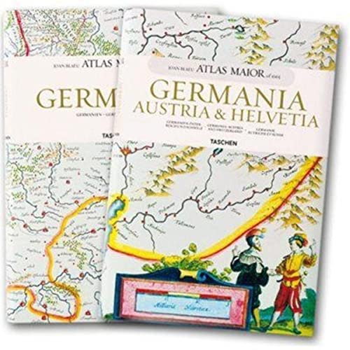
Atlas Maior - Germania, Austria Et Helvetia (Joan Blaeu Atlas Maior 1665)
Anbieter: Mooney's bookstore, Den Helder, Niederlande
Verkäuferbewertung 4 von 5 Sternen
Zustand: Very good.
-
Zustand: good. Befriedigend/Good: Durchschnittlich erhaltenes Buch bzw. Schutzumschlag mit Gebrauchsspuren, aber vollständigen Seiten. / Describes the average WORN book or dust jacket that has all the pages present.
-
Zustand: very good. Gut/Very good: Buch bzw. Schutzumschlag mit wenigen Gebrauchsspuren an Einband, Schutzumschlag oder Seiten. / Describes a book or dust jacket that does show some signs of wear on either the binding, dust jacket or pages.
-
ATLAS MAIOR OF 1665 VOL. 1: ANGLIA AND VOL. 2: SCOTIA & HIBERNIA.
Verlag: Koln: Taschen, 2006., 2006
Anbieter: Grant's Bookshop, Cheltenham, VIC, Australien
Verkäuferbewertung 4 von 5 Sternen
Two volumes 58 color maps in Vol. 1, 55 in Vol. 2. Folio, original boards in colour illus dustwrappers, in colour illus slipcase. A fine set. . Reproductions of 17th century maps, text in English, French and German (translated form the original Latin). Part of the influential 11-volume Atlas ("Theatrum Orbis Terrarum") by the Dutch printer and mapmaker Joan Blaeu (1596-1673).
-
Atlas Maior - Hispania, Portugallia, America Et Africa (Joan Blaeu Atlas Maior of 1665) (Spanish Edition)
Anbieter: Mooney's bookstore, Den Helder, Niederlande
Verkäuferbewertung 4 von 5 Sternen
Zustand: Very good.
-
![Beispielbild für Atlas Maior 1665 - Italien. Aus der Österreichischen Nationalbibliothek, Wien: Italia [Gebundene Ausgabe]Joan Blaeu (Autor), Peter van der Krogt (Autor) zum Verkauf von BUCHSERVICE / ANTIQUARIAT Lars Lutzer](https://pictures.abebooks.com/isbn/9783822851074-de-300.jpg)
Atlas Maior 1665 - Italien. Aus der Österreichischen Nationalbibliothek, Wien: Italia [Gebundene Ausgabe]Joan Blaeu (Autor), Peter van der Krogt (Autor)
Anbieter: BUCHSERVICE / ANTIQUARIAT Lars Lutzer, Wahlstedt, Deutschland
Verkäuferbewertung 5 von 5 Sternen
Hardcover. Zustand: gut. 2007. Der Atlas Maior, das kartographische Meisterwerk des Barock, wurde in den Jahren 1662 bis 1665 von dem Amsterdamer Verleger Joan Blaeu, einem der führenden holländischen Kartographen, herausgegeben. Ursprünglich auf Latein erschienen, umfasste der Atlas 594 Karten in 11 Bänden, die die gesamte, damals bekannte Welt der frühen Neuzeit zeigten. Er war somit das umfangreichste und teuerste Buch, das im 17. Jahrhundert veröffentlicht wurde. Dieses Werk blieb über 100 Jahre der verbindliche Weltatlas und zählt heute zu den gesuchtesten und wertvollsten antiquarischen Raritäten. TASCHENs bibliophiler Nachdruck enthält alle 60 Karten zu Italien. Der vorliegenden Ausgabe liegt das kolorierte und mit Gold gehöhte Exemplar Österreichischen Nationalbibliothek in Wien zu Grunde. Neben Originalzitaten von Joan Blaeu zu den einzelnen Karten, erläutern die Texte von Peter van der Krogt die historischen und kulturellen Zusammenhänge und führen den Leser in die faszinierende Welt der frühneuzeitlichen Karthographie ein. Die Texte sind in Französich, Englisch und Deutsch. Synopsis:This work contains maps of Italy from Joan Blaeu's exquisite world atlas of 1665. "The Atlas Maior", the cartographical masterpiece of the Baroque period, was brought out between 1662 and 1665 by the Amsterdam publisher Joan Blaeu, one of Holland's leading cartographers. Originally appearing in Latin, the atlas comprised 594 maps in 11 volumes, which depicted the whole of the world as known to early modern Europe. It was the largest and most expensive book published during the 17th century. For more than 100 years, it remained the definitive atlas of the world, and today is among the most sought-after and valuable antiquarian rarities. This reprinted edition in six volumes is based on the hand-colored, gold-heightened copy in the "Osterreichische Nationalbibliothek" in Vienna, thus ensuring the best possible detail and quality. Alongside Joan Blaeu's original commentaries on the individual maps, a new text by Peter van der Krogt explains the historical and cultural associations and introduces the reader to the fascinating world of early modern cartography. This volume features all 60 maps of Italy and the text is in Italian, English, and German. In englischer Sprache. 207 pages. 38,8 x 25,8 x 2,8 cm.
-

ATLAS MAIOR ANGLIA, SCOTIA & HIBERNIA (2 VOLUMES)
Verlag: Taschen, 2006
ISBN 10: 3822851043 ISBN 13: 9783822851043
Anbieter: Stella & Rose's Books, PBFA, Tintern, MON, Vereinigtes Königreich
Verbandsmitglied: PBFA
Verkäuferbewertung 5 von 5 Sternen
EUR 46,72
EUR 21,60 shipping
Ships from Vereinigtes Königreich to USAAnzahl: 1 verfügbar
In den WarenkorbHardback. Zustand: Very Good. Zustand des Schutzumschlags: Very Good. 2006. Very good condition in a very good dustwrapper. The ATLAS MAIOR, the cartographical masterpiece of the Baroque, was brought out in 1662 and 1665 by the Amsterdam publisher Joan Blaeu, one of Holland's leading cartographers. Originally appearing in Latin, the atlas comprised 594 maps in 11 volumes, which depicted the whole of the world as known to early modern Europe. It was the largest and most expensive book to be published during the seventeenth century. For more than 100 years it remained the definitive atlas of the world, and today is one of the most sought-after and valuable antiquarian rarities. TASCHEN's bibliophile reprint of this costly atlas is based on the hand-colored copy with gilt highlights now in the Austrian National Library in Vienna. Alongside original quotes from Joan Blaeu relating to the individual maps, the new text by Peter van der Krogt explains the historical and cultural associations and introduces the reader to the fascinating world of early modern cartography. Veryl large, heavy format. Two volumes. Colour maps, 58 of England, 55 of Scotland and Ireland. The text is in English, French and German. Contained in pictorial slipcase. Spines are bumped. Contents are fine. Dustwrappers are very slightly edge rubbed with a tiny nick to centre of spine of volume 1. Packaged with care and promptly dispatched!
-
Atlas Maior (1665) / Introducción y textos de Peter van der Krogt; A partir de la copia conservada en la Österreichische Nationalbibliothek, Viena; Con una selección de textos originales de Joan Blaeu; Dirigido y producido por Benedikt Taschen
Anbieter: Librería Miguel Miranda, Lope de Vega n.ş XIX, Madrid, M, Spanien
Verkäuferbewertung 4 von 5 Sternen
Karte
Zustand: Good / Bien. Köln (pero imp. en Italia): Taschen, cop. 2005.- 593 p.: Profusión de ilustraciones, mapas y láminas a todo color, varios plegados; Folio Imperial (45 x 31 cm); Fina impresión sobre grueso papel couché; Edición trilingüe en espańol, italiano y portugués; Encuadernación en Cartoné Ed. con camisa.- CONTIENE: Prefacio de Joan Blaeu de 1665; Introducción a la Geografía de Joan Blaeu; Et Atlas Maior de Joan Blaeu, introducción de Peter van der Krogt; Catálogo de mapas, con una se textos originales de Joan Blaeu; Apéndice. Libro en espańol GEOGRAFÍA, GUÍAS Y ATLAS DEL EXTRANJERO.
-
Zustand: Good. Dutch, French, English.
-
Joan Blaeu. Atlas Major de 1665.
Verlag: Taschen Verlag., Köln, 2016
Anbieter: antiquariat volapük, Berlin, Deutschland
Verkäuferbewertung 5 von 5 Sternen
Umfangreichste Neuausgabe. OPpBd. 512 S. OU. Schuber. Zustand: Gutes Exemplar. Fotos auf Anfrage.
-
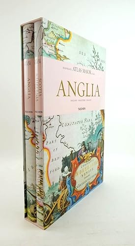
ATLAS MAIOR ANGLIA, SCOTIA & HIBERNIA (2 VOLUMES)
Verlag: Taschen, 2006
ISBN 10: 3822851043 ISBN 13: 9783822851043
Anbieter: Stella & Rose's Books, PBFA, Tintern, MON, Vereinigtes Königreich
Verbandsmitglied: PBFA
Verkäuferbewertung 5 von 5 Sternen
Erstausgabe
EUR 49,18
EUR 21,60 shipping
Ships from Vereinigtes Königreich to USAAnzahl: 1 verfügbar
In den WarenkorbHardback. Zustand: Fine. Zustand des Schutzumschlags: Fine. First edition. 1st thus 2006. Nearly fine condition in a nearly fine dustwrapper. The ATLAS MAIOR, the cartographical masterpiece of the Baroque, was brought out in 1662 and 1665 by the Amsterdam publisher Joan Blaeu, one of Holland's leading cartographers. Originally appearing in Latin, the atlas comprised 594 maps in 11 volumes, which depicted the whole of the world as known to early modern Europe. It was the largest and most expensive book to be published during the seventeenth century. For more than 100 years it remained the definitive atlas of the world, and today is one of the most sought-after and valuable antiquarian rarities. TASCHEN's bibliophile reprint of this costly atlas is based on the hand-colored copy with gilt highlights now in the Austrian National Library in Vienna. Alongside original quotes from Joan Blaeu relating to the individual maps, the new text by Peter van der Krogt explains the historical and cultural associations and introduces the reader to the fascinating world of early modern cartography. Veryl large, heavy format. Two volumes. Colour maps, 58 of England, 55 of Scotland and Ireland. The text is in English, French and German. Contained in pictorial slipcase. Light bumping to top & tail of spines and light scuffing to boards. Dustwrappers have minor rubbing to corners. A lovely set contained in publisher's slipcase in almost fine condition. Packaged with care and promptly dispatched!
-
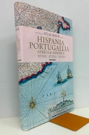
Joan Blaeu Atlas Maior of 1665: Hispania, Portugallia, Africa & America (English, espańol, portugués)
Verlag: Taschen, Koln, 2006
Anbieter: Librería Torres-Espinosa, CERCEDILLA, M, Spanien
Verkäuferbewertung 5 von 5 Sternen
Erstausgabe
1Ş edición. 39x26 cm.231 pp. Cartoné editorial con sobrecubierta. Profusamente ilustrado. Textos en Espańol-Inglés-Portugués. Muy buen estado. IMPORTANTE. Lea Nuestras Condiciones de Venta y Gastos de Envío.
-
Blaeu, Joan: Atlas maior of 1665; Teil: Vol. 1 + 2., Germania, Austria & Helvetia
Verlag: Taschen Verlag: Hongkong ; Köln ; London ; Los Angeles ; Madrid ; Paris ; Tokyo : Taschen,, 2006
ISBN 10: 3822851027 ISBN 13: 9783822851029
Sprache: Deutsch
Anbieter: Buchhandlung Neues Leben, Salzburg, S, Österreich
Verkäuferbewertung 5 von 5 Sternen
Reprint. Zustand: Gut. S. 223 u. 404 : Ill., Kt. Insgesamt gutes, ordentliches Exemplar. Im Originalschuber. Tadellos und schön. Legendärer Nachdruck dieses legendären Werkes zur Geographie und Topographie "Germanias". Mehrsprachrige Ausgabe. Sprache: Deutsch Gewicht in Gramm: 4500.
-
Atlas Maior of 1665. Germania. Deutschland, Österreich, Schweiz
Verlag: Taschenverlag, 2015
ISBN 10: 3836522926 ISBN 13: 9783836522922
Anbieter: ANTIQUARIAT H. EPPLER, Karlsruhe, Deutschland
Verkäuferbewertung 5 von 5 Sternen
Folio. 236 S. Orig.pappband, NEUWERTIG. mit 100 Tafeln.
-
Atlas Maior of 1665. Belgica Regia & Belgica Foederata. De Lage Landen - Les Pays-Bas et La Belgique - The Netherlands and Belgium [title on front cover: Joan Blaeu Atlas Maior of 1665. De Lage Landen].
Anbieter: Antiquariaat A. Kok & Zn. B.V., Amsterdam, Niederlande
Verkäuferbewertung 5 von 5 Sternen
Hongkong, Köln, [etc.], Taschen Verlag, [2006]. 207 pp. Num. col. ills. Orig. hardcover (boards), d./j. Sm. folio. Depicting all the 63 maps of the Netherlands and Belgium as published in Joan Blaeu's Atlas maior of 1665. - Text in English, French and Dutch language.