
Gesamtpreis (1 Artikel Artikel):
Versandziel:

beijing school (12 Ergebnisse)
Direkt zu den wichtigsten Suchergebnissen
Suchfilter
Produktart
- Alle Product Types
- Bücher (11)
- Magazine & Zeitschriften (Keine weiteren Ergebnisse entsprechen dieser Verfeinerung)
- Comics (Keine weiteren Ergebnisse entsprechen dieser Verfeinerung)
- Noten (Keine weiteren Ergebnisse entsprechen dieser Verfeinerung)
- Kunst, Grafik & Poster (1)
- Fotografien (Keine weiteren Ergebnisse entsprechen dieser Verfeinerung)
- Karten (Keine weiteren Ergebnisse entsprechen dieser Verfeinerung)
- Manuskripte & Papierantiquitäten (Keine weiteren Ergebnisse entsprechen dieser Verfeinerung)
Zustand Mehr dazu
- Neu (5)
- Wie Neu, Sehr Gut oder Gut Bis Sehr Gut (1)
- Gut oder Befriedigend (4)
- Ausreichend oder Schlecht (Keine weiteren Ergebnisse entsprechen dieser Verfeinerung)
- Wie beschrieben (2)
Einband
Weitere Eigenschaften
- Erstausgabe (Keine weiteren Ergebnisse entsprechen dieser Verfeinerung)
- Signiert (Keine weiteren Ergebnisse entsprechen dieser Verfeinerung)
- Schutzumschlag (Keine weiteren Ergebnisse entsprechen dieser Verfeinerung)
- Angebotsfoto (6)
Sprache (2)
Gratisversand
Land des Verkäufers
Verkäuferbewertung
-

Zustand: Very Good. Former library copy. Pages intact with possible writing/highlighting. Binding strong with minor wear. Dust jackets/supplements may not be included. Includes library markings. Stock photo provided. Product includes identifying sticker. Better World Books: Buy Books. Do Good.
-
Zustand: Good. Pages intact with minimal writing/highlighting. The binding may be loose and creased. Dust jackets/supplements are not included. Stock photo provided. Product includes identifying sticker. Better World Books: Buy Books. Do Good.
-
Zustand: Good. Former library copy. Pages intact with minimal writing/highlighting. The binding may be loose and creased. Dust jackets/supplements are not included. Includes library markings. Stock photo provided. Product includes identifying sticker. Better World Books: Buy Books. Do Good.
-
Hanyupinyin
Anbieter: Better World Books Ltd, Dunfermline, Vereinigtes Königreich
Verkäuferbewertung 5 von 5 Sternen

EUR 5,52
EUR 5,77 Versand
Versand von Vereinigtes Königreich nach USAAnzahl: 1 verfügbar
In den WarenkorbZustand: Good. Pages intact with minimal writing/highlighting. The binding may be loose and creased. Dust jackets/supplements are not included. Stock photo provided. Product includes identifying sticker. Better World Books: Buy Books. Do Good.
-
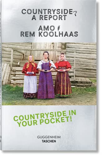
Koolhaas: Countryside, a Report
Anbieter: Revaluation Books, Exeter, Vereinigtes Königreich
Verkäuferbewertung 5 von 5 Sternen
EUR 43,03
EUR 11,54 Versand
Versand von Vereinigtes Königreich nach USAAnzahl: 1 verfügbar
In den WarenkorbPaperback. Zustand: Brand New. poc edition. 351 pages. 6.25x4.00x1.00 inches. In Stock.
-

EUR 59,02
EUR 48,99 Versand
Versand von Deutschland nach USAAnzahl: Mehr als 20 verfügbar
In den WarenkorbKartoniert / Broschiert. Zustand: New.
-

EUR 162,64
EUR 48,99 Versand
Versand von Deutschland nach USAAnzahl: Mehr als 20 verfügbar
In den WarenkorbGebunden. Zustand: New.
-
Advances in Ultra-low Emission Control Technologies for Coal-Fired Power Plants
Sprache: Englisch
Verlag: Elsevier Science & Technology, 2019
ISBN 10: 0081024185 ISBN 13: 9780081024188
SonderangebotEUR 111,42
EUR 105,00 Versand
Versand von Deutschland nach USAAnzahl: 2 verfügbar
In den WarenkorbZustand: Sehr gut. Zustand: Sehr gut | Seiten: 273 | Sprache: Englisch | Produktart: Bücher | Keine Beschreibung verfügbar.
-

EUR 194,68
EUR 48,99 Versand
Versand von Deutschland nach USAAnzahl: Mehr als 20 verfügbar
In den WarenkorbZustand: New. Wei Wang received her B.Eng degree in Electrical Engineering and Automation from Beihang University (BUAA) in 2005, MSc degree in Radio Frequency Communication Systems with Distinction from University of Southampton (UK) in 2006 and Ph.D.
-

Special Distillation Processes
Sprache: Englisch
Verlag: Elsevier Science Publishing Co Inc, 2021
ISBN 10: 0128205075 ISBN 13: 9780128205075
EUR 254,31
EUR 48,99 Versand
Versand von Deutschland nach USAAnzahl: Mehr als 20 verfügbar
In den WarenkorbZustand: New. Über den AutorrnrnZhigang Lei was born in Hubei province (China) in 1973. He received his B.S. degree in 1995 from Wuhan Institute of Technology, and Ph.D. degree in 2000 from Tsinghua University. Then, he became a postdoctoral researcher i.
-

Peoples Militia is Root of Victory
Verlag: China, 1970
Anbieter: AntikBar Original Vintage Posters, London, UK, Vereinigtes Königreich
Verkäuferbewertung 5 von 5 Sternen
Kunst / Grafik / Poster
EUR 416,19
EUR 34,63 Versand
Versand von Vereinigtes Königreich nach USAAnzahl: 1 verfügbar
In den WarenkorbBeijing No. 76 Middle School (illustrator). Original vintage propaganda poster for the Chinese Army - The people's militia is the root of victory - Bingmin shi shengli zhi ben (ĺµć°'ć čĺ ä ć ). Powerful image featuring three Chinese Army soldiers wearing uniforms from different battalions and holding rifle guns, standing firmly in front of a crowd of people, all of them looking to their left with the Chinese writing below in large red letters. Design by the Beijing No. 76 Middle School collective work. Horizontal. Good condition, creases and folds, tears on the right margin. Size: 76x106.5cm.
-

Cambalv.
Verlag: [Likely Antwerp or Amsterdam, circa 1590]., 1590
Anbieter: Antiquariat INLIBRIS Gilhofer Nfg. GmbH, Vienna, A, Österreich
Verbandsmitglied: ILAB VDA VDAO
Verkäuferbewertung 5 von 5 Sternen
Woodcut ovoid roundel (60 x 75 mm), contemporarily trimmed to just outside neatline and contemporarily mounted to a larger sheet of paper (in excellent condition). One of the earliest printed views of what is today Beijing: an unrecorded bird's eye prospect over 'Cambalu', or Khanbaliq (on the site of modern Beijing), the capital of China during the Yuan Dynasty (1271-1368). The Yuan Dynasty was founded by the legendary Mongol warrior Kublai Khan, who after conquering China proclaimed his new capital at Khanbaliq, although the city would not be completed until 1293. During the succeeding Ming Dynasty (1368-1644), Khanbaliq was transformed into what is known as Beijing. Interestingly, as seen in the view, the walled rectangular form of the old city of Beijing is already evident in the design of Khanbaliq. Marco Polo visited Khanbaliq, but his description of its location was vague. For over two centuries thereafter Europeans were confused as to not only the location of "Cambaluc", but they even sometimes confused its identify with "Cathay" (China), thinking that it was the name for the entire country. This confusion was cleared up by the Jesuit Matteo Ricci during his first visit to Beijing in 1598, when he definitively identified Khanbaliq as the precursor to the modern Chinese capital. The present work is one of a series of 26 woodcut roundels of views and maps that were found together as collection. Charming, mysterious and apparently unique, in the absence of any accompanying documentation we are left to make educated guesses about their genesis. By all appearances they seem to be late 16th or early 17th century Flemish or Dutch woodcuts, probably proofs for vignettes to adorn the sides of an unrealized copper-engraved wall map (or maps). Indeed, this period saw the beginnings of the "carte ŕ figures" wall maps that became all the rage during the 17th century, and which occupied an iconic place in the art world of the Low Countries. In the fluid and fast-paced environment of the large European print shops, it was common for artists to experiment with designs for copperplate maps by making woodcut proofs, as carving into wood was much quicker and cheaper. Only if the design was accepted for publication was it engraved into copper (an expensive and demanding process). The views within the roundels were generally predicated on the most authoritative recent sources. Many of the views are based on those published within the first four volumes of Braun & Hogenberg's "Civitates Orbis Terrarum" (6 vols., 1572-1618), the first great "town book", featuring bird's eye views of cities in Europe, Asia, Africa and America. Inspired by Ortelius's ground-breaking world atlas "Theatrum Orbis Terraum" (1570), which featured all of the world's known regions in detail, this monumental endeavour featured 546 views and maps of cities. The views from the "Civitates" are imbued with profound historical importance as, in many cases, they are the first accurate and detailed views of many great cities and towns, and were the most popular and influential images of these urban centres available to Europeans during the late 16th and much of the 17th centuries. Other fantastic sources include Jan van Linschoten's "Itinerario" (Amsterdam, 1596), one of the most consequential books ever written, responsible for breaking the Portuguese monopoly on European trade in South and East Asia. Likewise, other views were borrowed from important and pioneering 16th century prints and manuscripts. The unknown maker of the set of roundels to which the present view belongs likely intended for them to serve as proofs for the vignettes adorning the sides of an intended "carte ŕ figures" wall map (or more likely maps). The creation of such woodcut proofs was commonplace, although very few examples survive to this day, as most were destroyed once their incidental use had transpired. In any event, these woodcut roundels are a fascinating insight into the operations of a large cartographic workshop in the late 16th century.
