Gesamtpreis (1 Artikel Artikel):
Versandziel:

auguste logerot (11 Ergebnisse)
Direkt zu den wichtigsten Suchergebnissen
Suchfilter
Produktart
- Alle Product Types
- Bücher (8)
- Magazine & Zeitschriften (Keine weiteren Ergebnisse entsprechen dieser Verfeinerung)
- Comics (Keine weiteren Ergebnisse entsprechen dieser Verfeinerung)
- Noten (Keine weiteren Ergebnisse entsprechen dieser Verfeinerung)
- Kunst, Grafik & Poster (Keine weiteren Ergebnisse entsprechen dieser Verfeinerung)
- Fotografien (Keine weiteren Ergebnisse entsprechen dieser Verfeinerung)
- Karten (2)
- Manuskripte & Papierantiquitäten (1)
Zustand Mehr dazu
- Neu (Keine weiteren Ergebnisse entsprechen dieser Verfeinerung)
- Wie Neu, Sehr Gut oder Gut Bis Sehr Gut (Keine weiteren Ergebnisse entsprechen dieser Verfeinerung)
- Gut oder Befriedigend (4)
- Ausreichend oder Schlecht (Keine weiteren Ergebnisse entsprechen dieser Verfeinerung)
- Wie beschrieben (7)
Einband
Weitere Eigenschaften
- Erstausgabe (1)
- Signiert (Keine weiteren Ergebnisse entsprechen dieser Verfeinerung)
- Schutzumschlag (Keine weiteren Ergebnisse entsprechen dieser Verfeinerung)
- Angebotsfoto (10)
Sprache (3)
Preis
- Beliebiger Preis
- Weniger als EUR 20 (Keine weiteren Ergebnisse entsprechen dieser Verfeinerung)
- EUR 20 bis EUR 45 (Keine weiteren Ergebnisse entsprechen dieser Verfeinerung)
- Mehr als EUR 45
Gratisversand
- Kostenloser Versand nach USA (Keine weiteren Ergebnisse entsprechen dieser Verfeinerung)
Land des Verkäufers
Verkäuferbewertung
-

Chateaux, Egliese et Monuments of Paris, anno 1860, 28 Steelengr
Verlag: Logerot Auguste, Paris
Anbieter: Hammelburger Antiquariat, Hammelburg, Deutschland
Verkäuferbewertung 5 von 5 Sternen

Hardcover. Zustand: very good. Chateaux, Egliese et Monuments of Paris, anno 1860, 28 Steelengr Souveniralbum with 28 steelengravings of Paris, size: 10x13 cm., original cloth.
-

Carte de France le Cartes geographiques Tableaux etc. Carte Itinéraire complete de la france indiquant les routes royales avec leur .
Sprache: Deutsch
Verlag: Atelier de Collage, 1842
Anbieter: nika-books, Nordwestuckermark-Fürstenwerder, NWUM, Deutschland
Verkäuferbewertung 5 von 5 Sternen
Karte, Karte auf Leinwand mit leichten Randläsuren, Papier nachgedunkelt, sonst in einem altersentsprechend guten Zustand. Abgleich des Titelbildes bitte bei nika-books. Sprache: Deutsch Gewicht in Gramm: 550.
-

Plan de Paris et ses fortifications.
Verlag: Paris, Auguste Logerot, Atelier de Collage de Cartes Géographiques Tableaux, 1844
Anbieter: Buch- und Kunst-Antiquariat Flotow GmbH, Ottobrunn, Deutschland
Verkäuferbewertung 5 von 5 Sternen
71,5 x 103 cm. Seltener großformatiger Plan von Paris, graviert von Ch. Dyonnel nach Zeichnungen von Maillard und A. Toussaint. Mit Farbeinzeichnungen der Arrondissements, der Fortificationen, sowie gestochenen Ansichten bekannter Baudenkmäler von Paris. Mit mehreren Tabellen der Zeichenerklärungen. - In schöner, sauberer Erhaltung Grenzkolorierter Kupferstich-Plan, mehrfach gefaltet in 32 Segmenten auf Leinen aufgezogen.
-

Plan de Paris et ses Fortifications (Stadtplan Paris),
Verlag: Verlag ohne Angabe,, 1847
Anbieter: Versandantiquariat Höbald, Halle, Deutschland
Verkäuferbewertung 5 von 5 Sternen
ca. 102 x 70 cm, Landkarte. Zustand: Gut. Landkarte, Übersichtskarte, Stadtplan, Frankreich, Paris Landkarten, Übersichtskarten 2 S. Schöne grenzcolorierte Landkarte / Übersichtskarte; Stadtplan von Paris; Stahlstich von Ch. Dyonnet; mit Straßenübersicht und kelinen Detailbildern von Sehenswürdigkeiten; Geografie / Kartografie / Vermessungskunde; französische Sprache; auf Leinen gezogen; im Schuber; gut erhalten An staatliche Institutionen und Einrichtungen, auch an Bibliotheken, versenden wir im Inland gern auf Rechnung. Sprache: Französisch Gewicht in Gramm: 195.
-
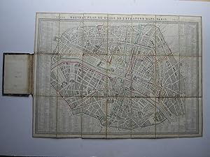
Nouveau Plan ou Guide de l'Estranger dans Paris.
Verlag: Auguste Legerot, Paris, 1852
Anbieter: Angelika C. J. Friebe Ltd. - MapWoman, Dorking, Vereinigtes Königreich
Verkäuferbewertung 4 von 5 Sternen

Karte
EUR 476,38
EUR 23,13 Versand
Versand von Vereinigtes Königreich nach USAAnzahl: 1 verfügbar
In den WarenkorbSoft cover. Zustand: Very Good. steel engraved map with original hand colouring; overall 46 x 62 cm; on cloth; 21 segments; some dusting and soiling; spotting on verso; o/w vg cond. green marbled paper cover with paper label (damaged); overall 16 x 10 cm. wear and tear; o/w g cond. A very attractive townplan of Paris with the various arrondissements shown in different coloured lines, and illustrated with important monuments and sites. NB This is oneof the last plans of Paris before the Haussman renovation.
-

Nouveau Plan de Paris divisé en 20 arrondissements.
Verlag: Paris, Auguste Logerot, 1867
Anbieter: Buch- und Kunst-Antiquariat Flotow GmbH, Ottobrunn, Deutschland
Verkäuferbewertung 5 von 5 Sternen
Seltener Plan von Paris im gefalteten Taschenformat mit den 20 Arrondissements, diese jeweils flächig im Original-Kolorit. Interessant ist der Plan, der die Umgestaltung von Paris durch den Stadtplaner Georges-Eugène Haussmann mit den bereits fertig gestellten und teils projektierten großen Boulevards genau enthält. Eingezeichnet sind auch die umliegenden Festungen, sowie der Bois de Vincennes. Die Straßennamen sind in der Original-Mappe auf 13 Blättern aufgeführt. - In sauberer Erhaltung Flächenkolorierter lithografischer Plan, gefaltet in 40 Segmenten auf starkem Papier In goldgeprägter Orig.-Mappe, 74 x 105 cm.
-
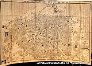
Plan de Paris et ses fortifications.
Verlag: Paris, 1843
Anbieter: ANTIQUARIAT.WIEN Fine Books & Prints, Wien, Österreich
Verkäuferbewertung 5 von 5 Sternen
Karte
Plan de Paris monté sur lin, ca. 103 x 72 cm, 24 segments; état: fortifications coloriées avec la main d'un propriétaire passé, plusieurs taches sur le verso, entre les segments 16 et 24 séparée et segment 24 avec un petit trou, a part ca bon état // map of Paris, mounted on linen, ca. 103x72 cm, 24 segments, the fortifications have been coloured by hand by a previous owner, spots on the back of the linen, linen between segments 16 and 24 seperated and segment 24 with a little defect, a part from that good copy Dessiné par Maillard et Toussaint, gravé par Ch. Dyonnet fr 500 Landkarte.
-
Logerot published puzzle '"ATLAS" with six Atlas maps (1870 - 1880)
Verlag: Auguste Logerot Mid-late 19th century, Paris
Anbieter: Rare Books Honolulu, Honolulu, HI, USA
Verbandsmitglied: IOBA
Verkäuferbewertung 5 von 5 Sternen
Manuskript / Papierantiquität Erstausgabe
n/a. Dyonnet (illustrator). Paris, Publisher: Auguste Logerot, Mid-late 19th century 6 hand-colored lithographed puzzle maps, with hand-colored maps laid down in sections to jigsaw pieces. Text in French. Engraved after Dyonnet's illustrations for A.R. Fremin's Geography. 8¾" x 11¾" (22x30cm), publisher's box with decorative cover label. All puzzles are complete, even after 130+ years. The only default is a small gap on the top left side of the map of France (see photo). Looks more like a production mistake, as the gap is too small for a missing piece. Jigsaw puzzle maps of the world. Comprises maps of France, Asia, North America, South America, Europe, and Africa. Each map is cut along political boundaries; other versions of the North America map show Mexico as claiming much of the western United States, though this example shows essentially the present-day boundaries. These puzzle maps, popular as educational tools in the 19th century, are rarely found in such good condition. Provenance: The Warren Heckrotte and Margaret Gee Collection. Condition: Case worn with some splits at edges; some pieces bent, some minor losses to image, minor wear and toning; very good in good box. Logerot edited maps from renowned cartographers such as Fremin, Dufour, Dyonnet, Delamarche and Vuillemin, crafting a collection that comprised maps, atlases, folding case maps, and intricate jigsaw puzzle maps. Logerot and Fremin collaborated on various atlases, with one of their editions serving as the foundation for this collection. The maps, such as the one depicting Africa, reflect the geographic knowledge of the time, dating back to 1829 . Notably, the map of the United States not included Texas, California, and New Mexico as part of Mexico, as these regions were still in dispute before 1846. There is still a part of California claimed by the English Crown as New Albion.
-

Carte de la Normandie - Carte de la Normandie - Seine Inférieure - Logerot 185
Sprache: Französisch
Anbieter: Librairie AMB, SAINT-OUEN-SUR-SEINE, STOUE, Frankreich
Verkäuferbewertung 5 von 5 Sternen
Feuille. Zustand: Bon Etat. Physique Carte de la Normandie comprenant les départements de la Seine Inférieure, de la manche, du Calvados, de Leur et de Lorne.En haut, à gauche : armes de la province de NormandieFormat : 73x59 cm - 16x10 cm. Belle carte rempliée sous cartonnage détaché. propre, deux petites fentes sur bordure.Non entoilée. bel étatParis par Auguste Logerot (1804-1876) 55 Quai des Grands Augustin"Occasion" 0g.
-
Paris illustré et ses fortifications. Paris divisé en 20 arrondissements pour 1862.
Anbieter: Libreria Oreste Gozzini snc, Firenze, FI, Italien
Verkäuferbewertung 5 von 5 Sternen
Paris, 1862, pianta della città in litografia, con arrondissements colorati, mm. 570x745, intelata a sezioni e ripiegata entro custodia in cartoncino marmorizzato. Buone condizioni.
-

Nouveau plan de Paris divise en 20 arrondissements. Dans un rayon de 10 kilometres.
Erscheinungsdatum: 1863
Anbieter: Henry Sotheran Ltd, London, Vereinigtes Königreich
Verbandsmitglied: ABA ILAB PBFA
Verkäuferbewertung 5 von 5 Sternen
EUR 357,28
EUR 46,25 Versand
Versand von Vereinigtes Königreich nach USAAnzahl: 1 verfügbar
In den WarenkorbParis: Le plan par Ch. Smith, Mangeron for Logerot. 1863. Folding linen-backed lithographic map with hand-colouring, measuring 71 by 104 cm; evenly a little darkened; printed label on the verso of the first panel.