
Gesamtpreis (1 Artikel Artikel):
Versandziel:

addyman peter (10 Ergebnisse)
Direkt zu den wichtigsten Suchergebnissen
Suchfilter
Produktart
- Alle Product Types
- Bücher (8)
- Magazine & Zeitschriften (Keine weiteren Ergebnisse entsprechen dieser Verfeinerung)
- Comics (Keine weiteren Ergebnisse entsprechen dieser Verfeinerung)
- Noten (Keine weiteren Ergebnisse entsprechen dieser Verfeinerung)
- Kunst, Grafik & Poster (Keine weiteren Ergebnisse entsprechen dieser Verfeinerung)
- Fotografien (Keine weiteren Ergebnisse entsprechen dieser Verfeinerung)
- Karten (2)
- Manuskripte & Papierantiquitäten (Keine weiteren Ergebnisse entsprechen dieser Verfeinerung)
Zustand Mehr dazu
- Neu (7)
- Wie Neu, Sehr Gut oder Gut Bis Sehr Gut (Keine weiteren Ergebnisse entsprechen dieser Verfeinerung)
- Gut oder Befriedigend (2)
- Ausreichend oder Schlecht (Keine weiteren Ergebnisse entsprechen dieser Verfeinerung)
- Wie beschrieben (1)
Einband
Weitere Eigenschaften
- Erstausgabe (Keine weiteren Ergebnisse entsprechen dieser Verfeinerung)
- Signiert (Keine weiteren Ergebnisse entsprechen dieser Verfeinerung)
- Schutzumschlag (Keine weiteren Ergebnisse entsprechen dieser Verfeinerung)
- Angebotsfoto (4)
Sprache (2)
Gratisversand
- Kostenloser Versand nach USA (Keine weiteren Ergebnisse entsprechen dieser Verfeinerung)
Land des Verkäufers
Verkäuferbewertung
-
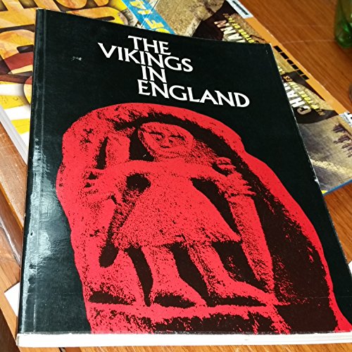
The Vikings in England and Their Danish Homeland
Sprache: Englisch
Verlag: The Anglo-Danish Viking Project, London, 1981
ISBN 10: 0950743208 ISBN 13: 9780950743202
Anbieter: Westwood Books, Cramlington, Vereinigtes Königreich
Verkäuferbewertung 4 von 5 Sternen

EUR 5,92
EUR 13,22 Versand
Versand von Vereinigtes Königreich nach USAAnzahl: 1 verfügbar
In den WarenkorbSoft cover. Zustand: Very Good. No Jacket. N/A (illustrator). 1981. The Anglo-Danish Viking Project, London, 1981. Pictorial soft cover. Book Condition : Very good, clean text, Superb photographs, illustrations. Previous owners pastedown inside cover. Covers have shelf wear, spine creased. Book will be sent by UK postal service.Inventory #BB014480. N/A.
-

An Historical Map of York
Anbieter: PBShop.store UK, Fairford, GLOS, Vereinigtes Königreich
Verkäuferbewertung 4 von 5 Sternen
EUR 13,14
EUR 3,78 Versand
Versand von Vereinigtes Königreich nach USAAnzahl: 15 verfügbar
In den WarenkorbUNK. Zustand: New. New Book. Shipped from UK. Established seller since 2000.
-

Archaeology and Planning: An Exhibition by York Archaeological Trust for the 1979 Town and Country Planning Summer School at York under the auspices of the Royal Town Planning Institute
Verlag: Misc.
Anbieter: WeBuyBooks, Rossendale, LANCS, Vereinigtes Königreich
Verkäuferbewertung 5 von 5 Sternen

EUR 8,99
EUR 5,92 Versand
Versand von Vereinigtes Königreich nach USAAnzahl: 1 verfügbar
In den WarenkorbZustand: Good. Most items will be dispatched the same or the next working day. A copy that has been read but remains in clean condition. All of the pages are intact and the cover is intact and the spine may show signs of wear. The book may have minor markings which are not specifically mentioned. A good condition vintage book. Minor handling and age but generally a clean, sound copy.
-
Historical Map Of York: From Medieval Times To 1850
Anbieter: Revaluation Books, Exeter, Vereinigtes Königreich
Verkäuferbewertung 5 von 5 Sternen
Karte
EUR 12,76
EUR 11,50 Versand
Versand von Vereinigtes Königreich nach USAAnzahl: 2 verfügbar
In den WarenkorbSheet Map, Flat. Zustand: Brand New. 2 pages. 8.94x5.28x0.59 inches. In Stock.
-

Karte/Landkarte. Zustand: New. KlappentextrnrnA full colour map based on a digitising of a large-scale map of York surveyed in 1850. The map shows the main medieval and post-medieval buildings in this attractive and interesting city including the Minster , York Castle (Cliff.
-

An Historical Map of York : From Medieval Times to 1850
Sprache: Englisch
Verlag: The Historic Towns Trust Jun 2018, 2018
ISBN 10: 0993469841 ISBN 13: 9780993469848
Anbieter: AHA-BUCH GmbH, Einbeck, Deutschland
Verkäuferbewertung 5 von 5 Sternen
Karte. Zustand: Neu. Neuware - A full colour map based on a digitising of a large-scale map of York surveyed in 1850. The map shows the main medieval and post-medieval buildings in this attractive and interesting city including the Minster , York Castle (Clifford's Tower), St mary's Abbey and the well-known city walls.
-

Samuel Beckett: Debts and Legacies - New Critical Essays
Anbieter: Revaluation Books, Exeter, Vereinigtes Königreich
Verkäuferbewertung 5 von 5 Sternen
EUR 282,74
EUR 11,50 Versand
Versand von Vereinigtes Königreich nach USAAnzahl: 2 verfügbar
In den WarenkorbHardcover. Zustand: Brand New. 244 pages. 8.75x5.75x1.00 inches. In Stock.
-
HISTORICAL MAP OF YORK
Anbieter: Speedyhen, Hertfordshire, Vereinigtes Königreich
Verkäuferbewertung 5 von 5 Sternen
EUR 13,40
EUR 47,15 Versand
Versand von Vereinigtes Königreich nach USAAnzahl: 2 verfügbar
In den WarenkorbZustand: NEW.
-

(Land-)Karte. Zustand: Neu. An Historical Map of York | From Medieval Times to 1850 | Giles Darkes (u. a.) | (Land-)Karte | Karte/Landkarte | Englisch | 2018 | The Historic Towns Trust | EAN 9780993469848 | Verantwortliche Person für die EU: Libri GmbH, Europaallee 1, 36244 Bad Hersfeld, gpsr[at]libri[dot]de | Anbieter: preigu.
-
Zustand: Hervorragend. Zustand: Hervorragend | Seiten: 2 | Sprache: Englisch | Produktart: Bücher | A full colour map based on a digitising of a large-scale map of York surveyed in 1850. The map shows the main medieval and post-medieval buildings in this attractive and interesting city including the Minster , York Castle (Clifford's Tower), St mary's Abbey and the well-known city walls.