
Gesamtpreis (1 Artikel Artikel):
Versandziel:

HARRISON, RICHARD EDES (30 Ergebnisse)
Direkt zu den wichtigsten Suchergebnissen
Suchfilter
Produktart
- Alle Product Types
- Bücher (28)
- Magazine & Zeitschriften (1)
- Comics (Keine weiteren Ergebnisse entsprechen dieser Verfeinerung)
- Noten (Keine weiteren Ergebnisse entsprechen dieser Verfeinerung)
- Kunst, Grafik & Poster (Keine weiteren Ergebnisse entsprechen dieser Verfeinerung)
- Fotografien (Keine weiteren Ergebnisse entsprechen dieser Verfeinerung)
- Karten (1)
- Manuskripte & Papierantiquitäten (Keine weiteren Ergebnisse entsprechen dieser Verfeinerung)
Zustand Mehr dazu
- Neu (Keine weiteren Ergebnisse entsprechen dieser Verfeinerung)
- Wie Neu, Sehr Gut oder Gut Bis Sehr Gut (1)
- Gut oder Befriedigend (15)
- Ausreichend oder Schlecht (1)
- Wie beschrieben (13)
Einband
Weitere Eigenschaften
Sprache (2)
Gratisversand
Land des Verkäufers
Verkäuferbewertung
-

NEW YORK WALK BOOK
Sprache: Englisch
Verlag: Doubleday / Natural History Press, 1971
ISBN 10: 0385032560 ISBN 13: 9780385032568
Anbieter: ThriftBooks-Atlanta, AUSTELL, GA, USA
Verkäuferbewertung 5 von 5 Sternen

Paperback. Zustand: Good. No Jacket. Dickinson, Robert L.; Harrison, Richard Edes (illustrator). Pages can have notes/highlighting. Spine may show signs of wear. ~ ThriftBooks: Read More, Spend Less.
-
NEW YORK WALK BOOK
Sprache: Englisch
Verlag: Doubleday / Natural History Press, 1971
ISBN 10: 0385032560 ISBN 13: 9780385032568
Anbieter: ThriftBooks-Dallas, Dallas, TX, USA
Verkäuferbewertung 5 von 5 Sternen
Paperback. Zustand: Good. No Jacket. Dickinson, Robert L.; Harrison, Richard Edes (illustrator). Missing dust jacket; Pages can have notes/highlighting. Spine may show signs of wear. ~ ThriftBooks: Read More, Spend Less.
-
NEW YORK WALK BOOK
Sprache: Englisch
Verlag: Doubleday / Natural History Press, 1971
ISBN 10: 0385032560 ISBN 13: 9780385032568
Anbieter: Wonder Book, Frederick, MD, USA
Verkäuferbewertung 5 von 5 Sternen
Zustand: Good. Dickinson, Robert L.; Harrison, Richard Edes (illustrator). Good condition. 4th edition. (hiking, new york, guidebooks ) A copy that has been read but remains intact. May contain markings such as bookplates, stamps, limited notes and highlighting, or a few light stains. Bundled media such as CDs, DVDs, floppy disks or access codes may not be included.
-
NEW YORK WALK BOOK
Sprache: Englisch
Verlag: Doubleday / Natural History Press, 1971
ISBN 10: 0385032560 ISBN 13: 9780385032568
Anbieter: Better World Books, Mishawaka, IN, USA
Verkäuferbewertung 5 von 5 Sternen
Zustand: Good. Dickinson, Robert L.; Harrison, Richard Edes (illustrator). Pages intact with minimal writing/highlighting. The binding may be loose and creased. Dust jackets/supplements are not included. Stock photo provided. Product includes identifying sticker. Better World Books: Buy Books. Do Good.
-
NEW YORK WALK BOOK
Sprache: Englisch
Verlag: Doubleday Natural History Press, 1971
ISBN 10: 0385032560 ISBN 13: 9780385032568
Anbieter: Robinson Street Books, IOBA, Binghamton, NY, USA
Verbandsmitglied: IOBA
Verkäuferbewertung 4 von 5 Sternen

Paperback. Zustand: Very Good. Dickinson, Robert L.; Harrison, Richard Edes (illustrator). Prompt Shipment, shipped in Boxes, Tracking PROVIDEDSome creasing to spine.
-

The Battle for the Atlantic. Landmark Books Series No. 87
Verlag: Random House
Anbieter: Wonder Book, Frederick, MD, USA
Verkäuferbewertung 5 von 5 Sternen
Erstausgabe
Zustand: Good. First edition copy. . Good dust jacket. (World War 2, Atlantic Ocean).
-
The Battle for the Atlantic. Landmark Books Series No. 87
Verlag: Random House
Anbieter: Wonder Book, Frederick, MD, USA
Verkäuferbewertung 5 von 5 Sternen
Zustand: Fair. Acceptable condition. Good dust jacket. Book 87 in Landmark Series. (Juvenile Historical Fiction, History, United States History) A readable, intact copy that may have noticeable tears and wear to the spine. All pages of text are present, but they may include extensive notes and highlighting or be heavily stained. Includes reading copy only books.
-
The Battle for the Atlantic. Landmark Books Series No. 87
Verlag: Random House
Anbieter: Wonder Book, Frederick, MD, USA
Verkäuferbewertung 5 von 5 Sternen
Zustand: Good. Good condition. Acceptable dust jacket. #87. (juvenile, nonfiction, world war ii, naval operations) A copy that has been read but remains intact. May contain markings such as bookplates, stamps, limited notes and highlighting, or a few light stains.
-
Océanie et régions polaires (Atlas illustré)
Verlag: Deux Coqs D'Or, 1961
Anbieter: Librairie Thé ŕ la page, Montélimar, Frankreich
Verkäuferbewertung 5 von 5 Sternen
Couverture rigide. Zustand: Bon. Deux Coqs D'Or collection Les Encyclopédies Du Livre D'Or, 1961. 1 volume relié(s) format In-4 bon seconde edition.
-

New York Walk Book / pen sketches by Robert L. Dickinson and Richard Edes Harrison
Verlag: New York : Doubleday, 1971
4th edition. Good copy in the original title-blocked cloth. Boards dust-toned. Spine bands and panel edges somewhat bumped and rubbed as with age. Internally, bright and clean. Remains quite well-preserved overall. Physical description; 326 pages, colour maps, b&w illustrations, 22 cm. Subjects; New York. New Jersey Trail Conference. Guidebooks. Hiking. Hiking New Jersey Guidebooks. Hiking New York (State) Guidebooks. New York (State). Travel guidebooks. 3 Kg.
-
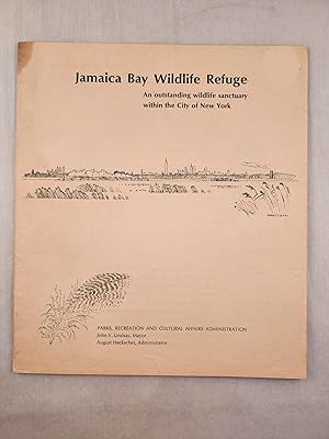
Jamaica Bay Wildlife Refuge An outstanding wildlife sanctuary within the city of New York
Verlag: NY: Parks, Recreation and Cultural Affairs Administration [1963], 1963
Anbieter: WellRead Books, Shamong, NJ, USA
Verbandsmitglied: IOBA
Verkäuferbewertung 5 von 5 Sternen
Sm 8vo.; illustrated wraps with stapled binding, softcover; green and white illustrations and map; grease stain on top spine end else very good.
-
Great Adventures and Explorations; From the Earliest Times to the Present, as told by the Explorers Themselves
Verlag: The Dial Press, New York, 1947
Anbieter: Ground Zero Books, Ltd., Silver Spring, MD, USA
Verkäuferbewertung 5 von 5 Sternen
Erstausgabe
Hardcover. Zustand: Good. Richard Edes Harrison (Maps) (illustrator). Presumed First Edition, First printing. xii, 788 pages. Name and date in ink inside front cover. Cover has some wear and soiling. Slightly shaken. Some edge soiling. Illustrated endpapers. Includes Note on the Maps, Concerning the Use of Symbols in this Book. Maps. Introduction, Acknowledgments, and Index, as well as 18 chapters. Also includes 18 black and white illustrations, as well as a map of The Mediterranean Discovers the Arctic. The maps illustrating this book were designed primarily to place the various explorations in their proper world perspective. This was deemed more important to the reader than complete detail, some of which is necessarily sacrificed in the larger view. Accordingly, most of the maps are on the orthographic projection. This shows exactly a hemisphere, and proves a good visual impression of the globe. Vilhjalmur Stefansson (November 3, 1879 - August 26, 1962) was an Icelandic American Arctic explorer and ethnologist. Under the auspices of the American Museum of Natural History, New York, he and Dr. R. M. Anderson undertook the ethnological survey of the Central Arctic coasts of the shores of North America from 1908 to 1912. In 1908, Stefansson made a decision that would affect the rest of his time in Alaska: he hired the Inuk guide Natkusiak, who would remain with him as his primary guide for the rest of his Alaska expeditions. At the time he met Natkusiak, the Inuk guide was working for Capt. George B. Leavitt, a Massachusetts whaling ship captain and friend of Stefansson's who sometimes brought him replenishments of supplies from the American Museum of Natural History. Late in life, through his affiliation with Dartmouth College (he was Director of Polar Studies), he became a major figure in the establishment of the US Army's Cold Regions Research and Engineering Laboratory (CRREL) in Hanover, New Hampshire. CRREL-supported research, often conducted in winter on the forbidding summit of Mount Washington, was key to developing matériel and doctrine to support alpine conflict. Stefansson joined the Explorers Club in 1908, four years after its founding. He later served as Club President twice: 1919-1922 and 1937-1939. This book contains the great stories of explorations and tells them in the words of the discoverers themselves, their companions, or their contemporaries. The great tales which we are able to present are those of rediscovery. We can tell how the Greeks discovered the British Isles with the British already in them; how North Europeans discovered North America with the Indians there to meet them; how the Spaniards discovered the Pacific Ocean when the Chinese had already maintained on its shores a great empire through long ages; how modern navigators discovered islands a thousand miles from the nearest inhabited land to find living there the descendants of Stone Age navigators who had been the real discoverers. In our book you find some of history's big success stories, with merit finally and justly awarded, as in the case of the indomitable twenty-three-year struggle of Peary which led to his demonstrating that Greenland is an island, instead of being larger than Australia and thus a continent. This book, as the story of how man came to know his world, had endeavored to secure historical continuity by leading from one major narrative to the next through summaries of less important ones that belong in between, and by occasional passages of interpretations which seek to give the reader needed perspective. In a way, the book is an outline history of the world, told by its chief discoverers from Pytheas to Peary.
-
Winged Peace; The Air Age, its birth, its future, and its impact in terms of progress or devastation [From front of DJ]
Verlag: The Viking Press, New York, 1944
Anbieter: Ground Zero Books, Ltd., Silver Spring, MD, USA
Verkäuferbewertung 5 von 5 Sternen
Erstausgabe
Hardcover. Zustand: Good. Zustand des Schutzumschlags: Fair. Richard Edes Harrison (Maps) (illustrator). xiv, photo insert, 175, [1] pages. Occasional footnotes. Maps. DJ has substantial wear, damp staining, scuffing, edge tears, creases and chips. Marks and erasure residue inside cover and on fep. Some page discoloration and damp staining but pages are all separate with no impact to the text. The author, perhaps the most famous Canadian aviation hero, or more broadly military hero, of the First World War. He became the greatest Allied Act by destroying 72 German aircraft. He rose to the rank of Air Marshall in the Royal Canadian Air Force. He was awarded the Victoria Cross, Distinguished Flying Cross, Military Cross, Distinguished Service Order, Legion of Honor, the Croix de Guerre and was named a Commander of Bath. During the Second World War, Bishop played a vital role in the military training and air-transport activities. In this book he recounts the history of flight and forecasts elements of the future of flight. His message is that "The key to peace is in the skies." First Edition [stated], presumed first printing.
-
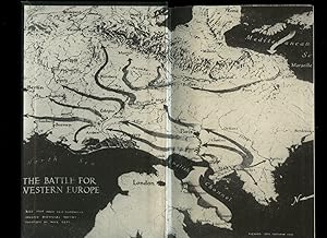
Top Secret; The Battle for Western Europe
Verlag: Published by Partridge Publications Ltd., 23 Bloomsbury Square, London First Edition . London 1946., 1946
Anbieter: Little Stour Books PBFA Member, Canterbury, Vereinigtes Königreich
Verbandsmitglied: PBFA
Verkäuferbewertung 5 von 5 Sternen
Erstausgabe
EUR 9,54
EUR 34,73 Versand
Versand von Vereinigtes Königreich nach USAAnzahl: 1 verfügbar
In den WarenkorbFirst edition hard back binding in publisher's original black cloth covers, gilt title and author lettering to the spine. 8vo. 9'' x 6''. Contains [iv] 285 printed pages of text with monochrome maps throughout, maps to the end papers. Gilt title oxidised, shallow rubs to the softened spine ends and corners and in Very Good condition, no dust wrapper. Member of the P.B.F.A. ESPIONAGE (Clandestine).
-
Way of a Fighter: The Memoirs of Claire Lee Chennault (History United States Series)
Anbieter: ThriftBooksVintage, Tukwila, WA, USA
Verkäuferbewertung 5 von 5 Sternen
Erstausgabe
Hardcover. Zustand: Good. No Jacket. Richard Edes Harrison (illustrator). First Edition. Sparse marks inside text. Sealed in plastic for shipping. This could have light cosmetic flaws, but remains in good condition. No dust jacket included with this book. This copy is the First Edition of the published work. Secure packaging for safe delivery.
-
Winged Peace; The Air Age, its birth, its future, and its impact in terms of progress or devastation
Verlag: The Viking Press, New York, 1944
Anbieter: Ground Zero Books, Ltd., Silver Spring, MD, USA
Verkäuferbewertung 5 von 5 Sternen
Erstausgabe
Hardcover. Zustand: Good. Zustand des Schutzumschlags: Fair. Richard Edes Harrison (Maps) (illustrator). xiv, 8 page photo insert, 175, [1] pages. Occasional footnotes. Maps. Table. DJ somewhat worn. DJ is in a plastic sleeve. Some page discoloration. The author is perhaps the most famous Canadian aviation hero, or more broadly military hero, of the First World War. He became the greatest Allied Act by destroying 72 German aircraft. He rose to the rank of Air Marshall in the Royal Canadian Air Force. He was awarded the Victoria Cross, Distinguished Flying Cross, Military Cross, Distinguished Service Order, Legion of Honor, the Croix de Guerre and was named a Commander of Bath. During the Second World War, Bishop played a vital role in the military training and air-transport activities. In this book he recounts the history of flight and forecasts elements of the future of flight. His message is that "The key to peace is in the skies." By 1944 the stress of the war had taken a serious toll on Bishop's health, and he resigned his post in the RCAF to return to private enterprise in Montreal, Quebec, before retiring in 1952. His son later commented that he looked 70 years old on his 50th birthday in 1944. Bishop remained active in the aviation world, predicting the phenomenal growth of commercial aviation postwar. His efforts to bring some organization to the nascent field led to the formation of the International Civil Aviation Organization (ICAO) in Montreal. He wrote a second book at this time, Winged Peace, advocating international control of global air power. First Edition [stated], presumed first printing.
-

Way of a Fighter: The Memoirs of Claire Lee Chennault (History United States Series)
Anbieter: John Hopkinson - Bookseller, Cremona, AB, Kanada
Verkäuferbewertung 4 von 5 Sternen
Erstausgabe
Hardcover. Zustand: Good. No Jacket. Richard Edes Harrison (illustrator). 1st Edition. Hardcover. Condition: Good for Age. No Jacket. various {photography} (illustrator). This copy of the Second Impression has some light rubbing of the covers. All corners lightly bumped, board just starting to show. some shadowing of the endpapers. Interior text has yellowed with age, Poor spine small tear. Ex-Lib. No DJ, Sunned/shelfwear wear and tear.
-
Way of a Fighter: The Memoirs of Claire Lee Chennault (History United States Series)
Anbieter: ThriftBooksVintage, Tukwila, WA, USA
Verkäuferbewertung 5 von 5 Sternen
Hardcover. Zustand: Good. No Jacket. Richard Edes Harrison (illustrator). Dust jacket missing. Shelf and handling wear to cover and binding, with general signs of previous use. Wear commensurate with age and use. Clean unmarked copy. Foxing visible across page edges. Light bumping visible to corners of boards and ends of spine strip. Light scuffing and smudging to boards and spine strip. Secure packaging for safe delivery.
-

Venezuela, Viewed from the North-Northeast
Sprache: Englisch
Verlag: Fortune, New York, 1939
Anbieter: Argosy Book Store, ABAA, ILAB, New York, NY, USA
Verkäuferbewertung 5 von 5 Sternen
Original map. Color Lithograph. 14" x 22 1/2" Beautifully designed map of Venezuela by Richard Edes Harrison. Artistically rendered with an impressive amount of detail (although Harrison notes that much is conjectural), the map depicts the country from the north-northeast perspective - from the point of view of "700 miles above Antigua." Color coding reflects elevation, showing mountainous regions, temperate & cultivated zones, and torrid (or tropical) zone. The unique compass rose features a small globe centered on the Caribbean and oriented with south at the top, with Venezuela highlighted in red. In the bottom right corner, three insets maps show major population centers, states, and the physiography. The map shows roads, distinguishing between paved cement or macadam roads, other roads accessible year-round, and those only accessible in the dry season. Railroads and abandoned railroads are also indicated, and symbols representing mineral products and oil fields are noted. In very good condition. Minor toning at edges and along fold, barely noticeable. Richard Edes Harrison (1901-1994) was a prominent American cartographer and designer. He was well-known for his innovative approach to perspective and projection; his skills in visualization and graphic design transformed the field of map-making into an important storytelling tool and a way to make spatial information more accessible to the public.
-
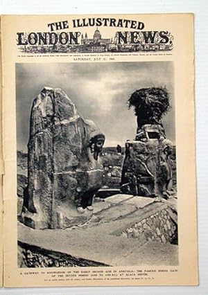
The Illustrated London News, July 21, 1945: WWII Aftermath / Mr. T. V. Soong
Verlag: The Illustrated London News, London, 1945
Anbieter: RareNonFiction, IOBA, Ladysmith, BC, Kanada
Verbandsmitglied: IOBA
Verkäuferbewertung 5 von 5 Sternen
Magazin / Zeitschrift Erstausgabe
Paperback. Zustand: Good. Karsh; Wood, Charles; Harrison, Richard Edes; Davis, G.H.; Turner, C.E. (illustrator). First Edition. Pages 57- 84. Features: Nice colour Dunlop ad inside front cover features Charles Wood painting of naval plane spotter at work; Cover photo of the famous Sphinx gate of the Hittite period at Alaca Huyuk; One-page Karsh photo portrait of China's prime minister, T. V. Soong; Two-page artist's rendition of an aerial view of Japan's homeland; Two large photos of Allied warships struggling in mountainous seas; The City of the Dead - Berlin, the modern Pompeii - two pages of photos present horrific bomb damage; Article entitled "The British soldier in Germany"; Powerful display of Britain's armed might in Berlin - 5 photos; Two pages of fascinating illustrations show how British science and ingenuity contributed to defeat the Germans on sea, on land, and in the air; Dramatic centrefold illustration of "Glowworm" ramming the German cruiser "Hipper"; Seven photos of Potsdam, venue of the latest "big three" conference; Photos of personalities of the week include Maj. Gen. Claire L. Chennault, Signor Parri, Gen. William J. Slim, J. B. Chifley, Lt. Col. Sir Francis Shelmerdine, Lieut. Cmdr. G. B. Roope, the Regent of Iraq with the king and queen, Cpl. E. T. Chapman, the newly formed Council of Berlin, Marshall Rokossovsky, Marshall Zhukov, and Field Marshal Montgomery; Photo of Pres. Truman being cheered in Antwerp; Photo of US cruiser "Augusta" with Truman aboard, steaming through the English Channel, escorted by British warships; Photos of French liberated prisoners carrying a large wooden crucifix memorial to victims of brutality; Interior and exterior photos of Goering's private plane, now to be used to the benefit of sick French children; Three photos of the now peaceful beaches of Dunkirk; Three photos of the R. A. F. Jet propelled fighter, the Gloster Meteor, developed from the prototype E.28/39; photos of English silver and Chinese porcelain of great price; Article on "The bronze age in Anatolia"; Two pages of photos of artifacts from pre-Hittite Anatolia - proof of the high level of civilization 3500 years ago; Photo illustrated article on British production of the airman's octane fuel; Colour Johnnie Walker ad on back cover shows farmers loading horse- drawn wagon. Discrete archival tape repairs to Coverfold of outer advertising pages, otherwise unmarked with average wear. A sound vintage copy.
-

South America in Globular Perspective looking Northwest from a Height of about Eight Thousand Miles.
Verlag: New YorkTime Inc. ., 1937
Anbieter: Robert Frew Ltd. ABA ILAB, London, Vereinigtes Königreich
Verbandsmitglied: ABA ILAB PBFA
Verkäuferbewertung 5 von 5 Sternen
Karte
EUR 417,36
EUR 11,58 Versand
Versand von Vereinigtes Königreich nach USAAnzahl: 1 verfügbar
In den WarenkorbOriginal colour-printed pictorial map of South America in globular perspective (69 x 56.5 cm), with insets of Buenos Aires, Rio de Janeiro, Transportation in South America, and South America folded back along the equator to demonstrate latitudinal and longitudinal equivalents to those of U.S.A. Descriptive text to verso, folding twice as issued. An excellent example This map was a foldout supplement from the December 1937 issue of Fortune magazine, in the style of Richard Edes Harrison - not attributed but we list him as author. Verso includes portions of article "To South America and Back".
-

The Eagle Still Has Two Wings
Verlag: TIME, inc, New York, 1938
Anbieter: Argosy Book Store, ABAA, ILAB, New York, NY, USA
Verkäuferbewertung 5 von 5 Sternen
Print. Image measures 8.75" x 10". This political cartoon, published in Fortune Magazine in February 1938, portrays FDR's America at the end of the first year of his second term. An eagle protects a nest of New Deal programs from bullets, labeled with names of anti-New Deal journalists. Its wing feathers contain names of political figures representing the right and left wings of American politics, while oversized tailfeathers hold the names of Roosevelt and his closest collegues steering both wings. The New Deal faced critiques from journalists and the public after the Great Depression. Richard Edes Harrison (1901-1994) was a prominent American cartographer and designer. He was well-known for his innovative approach to perspective and projection; his skills in visualization and graphic design transformed the field of map-making into an important storytelling tool and a way to make spatial information more accessible to the public.
-

Peru
Verlag: TIME, inc, New York, 1938
Anbieter: Argosy Book Store, ABAA, ILAB, New York, NY, USA
Verkäuferbewertung 5 von 5 Sternen
unbound. Richard Edes Harrison (illustrator). Map. Chromolithograph. Sheet measures 11" x 14". This topographical map of Peru was published in Fortune Magazine's January 1938 edition. The map shows all of Peru and relief is depicted pictorially, including a cross-section to show elevation, and many other details. Notes about natural resources, climate, and waterways are included. Richard Edes Harrison was Fortune's in-house cartographer and made an impact by demonstrating world politics through uncoventional mapping. Verso contains photolithograph of Machu Picchu. In very good condition.
-

Air Empire - Air Freedom
Verlag: TIME, inc, New York, 1943
Anbieter: Argosy Book Store, ABAA, ILAB, New York, NY, USA
Verkäuferbewertung 5 von 5 Sternen
unbound. Map. Color lithograph. Sheet measures 12 7/8" x 20 3/4" This WWII era map features five azimuthal equidistant projections centered on various points. In the center is a map centered on the North Pole, featuring an idealistic conception of the politically uninhibited air where all nations would have the right to fly and trade in one another's air. The four surrounding maps center on the "four empires" - American, French, British, and Portuguese - illustrating a potential political doctrine where every nation has the right to close off air space above its frontiers, forcing oversea routes for air travel. Pie charts above the maps show each empire's percentage of world population, and percentage of total world trade. This map was published in Fortune Magazine's April 1943 issue. Joined at centerfold. In very good condition. Richard Edes Harrison (1901-1994) was a prominent American cartographer and designer. He was well-known for his innovative approach to perspective and projection; his skills in visualization and graphic design transformed the field of map-making into an important storytelling tool and a way to make spatial information more accessible to the public.
-
U.S.N. Ships-Bases-Men As of January 1938
Verlag: Fortune, New York, 1938
Anbieter: Argosy Book Store, ABAA, ILAB, New York, NY, USA
Verkäuferbewertung 5 von 5 Sternen
Original map. Color Lithograph. 14" x 22 1/4" This impressive thematic map showing United States Naval bases was designed by Richard Edes Harrison. Incredibly detailed and rich with data, the map is centered on Pearl Harbor, with distances indicated to surrounding bases in California, Guam, and the Philippines. Foreign naval bases are also indicated. Pictorial details illustrate naval assets, showing number of battleships, submarines, carriers, and other vessels. Text notations throughout provide information on naval strategies, military planning, and geography. This map appeared in the March 1938 issue of Fortune Magazine. In excellent condition. Centerfold as issued. Richard Edes Harrison (1901-1994) was a prominent American cartographer and designer. He was well-known for his innovative approach to perspective and projection; his skills in visualization and graphic design transformed the field of map-making into an important storytelling tool and a way to make spatial information more accessible to the public.
-

Great Circle Airways
Verlag: TIME, inc, New York, 1943
Anbieter: Argosy Book Store, ABAA, ILAB, New York, NY, USA
Verkäuferbewertung 5 von 5 Sternen
unbound. Map. Color lithograph. Sheet measures 19.5" x 24.25". Centered on the North Pole, this gnomonic projection shows the shortest possible air routes between cities around the world. Marginal text and insets describe gnomonic projection, the "Great Circles" represented by straight lines on this map, and the shift from sea to air travel. This map was published as a supplement to Fortune Magazine's May 1943 issue. Harrison was assisted by Marjorie k. Ullrich. Folds in quarters as originally published. In very good condition, vibrant colors. Richard Edes Harrison (1901-1994) was a prominent American cartographer and designer. He was well-known for his innovative approach to perspective and projection; his skills in visualization and graphic design transformed the field of map-making into an important storytelling tool and a way to make spatial information more accessible to the public.
-

U.S.S.R.
Verlag: Fortune, New York, 1941
Anbieter: Argosy Book Store, ABAA, ILAB, New York, NY, USA
Verkäuferbewertung 5 von 5 Sternen
Original map. Color Lithograph. 13 7/8" x 22 3/8" Artistically rendered map of the Soviet Union drawn by Richard Edes Harrison in May 1941. The map is drawn on a globular projection, with the terminator line (or twilight zone) depicted along the eastern border with Germany, with a notation describing the time of day - "when dawn breaks at 5:30 over the Carpathians, it is 8:00 in the Urals, noon at Vladivostok, and 4:30pm at the eastern tip of Siberia." Harrison's use of coloring beautifully illustrates the region's topography, enhanced by pictorial detail showing forested areas and snow-covered peaks. Railroads, roads, canals, and cities are labeled. In the lower right, an inset maps show major population centers, density, and urban population growth between 1926 and 1939. Intended for an American audience, Harrison includes the latitude lines of Cape Hatteras, Washington D.C., New York City, and Montreal/Portland, OR for comparison. In very good condition. Minor toning at edges and along fold, barely noticeable. Richard Edes Harrison (1901-1994) was a prominent American cartographer and designer. He was well-known for his innovative approach to perspective and projection; his skills in visualization and graphic design transformed the field of map-making into an important storytelling tool and a way to make spatial information more accessible to the public.
-

Africa in Maps
Verlag: TIME, inc, New York, 1941
Anbieter: Argosy Book Store, ABAA, ILAB, New York, NY, USA
Verkäuferbewertung 5 von 5 Sternen
unbound. Map. Color lithograph. Sheet measures 13 7/8" x 22 1/4" Vibrant thematic maps of the continent of Africa during the WWII era. The map on the left depicts physical geography, and on the right shows political ally-ship as of October 1941. Along the bottom margin are 8 inset maps, showing rainfall, time periods of European exploration, drainage basins, population, races, German colonies, and Islam. This map appeared in the November 1941 issue of Fortune Magazine. In very good condition, with one small closed tear to upper margin and minor wear along original fold line. Richard Edes Harrison (1901-1994) was a prominent American cartographer and designer. He was well-known for his innovative approach to perspective and projection; his skills in visualization and graphic design transformed the field of map-making into an important storytelling tool and a way to make spatial information more accessible to the public.
-

World Island / A Fortune Map; Orthographic Series, III
Verlag: TIME, inc, New York, 1943
Anbieter: Argosy Book Store, ABAA, ILAB, New York, NY, USA
Verkäuferbewertung 5 von 5 Sternen
Signiert
unbound. Map. Color lithograph. Sheet measures 21.25" x 26.75". January 1943 map of Africa, Asia, and Europe, or the "World Island" as defined by Halford John Mackinder. Coloring represents Ally/Axis affiliation and occupation status. A small insert shows the other side of the globe, and another shows the World Island on a Mercator projection with a textual explanation as to why the Orthographic projection is better suited for analyzing geopolitics. Text in the margins describes Mackinder's Heartland theory, and the relationship between world geography and the events of World War II. This map was published as a supplement to Fortune Magazine's January 1943 issue. Harrison was assisted by Marjorie k. Ullrich and J. McA. Smiley. Folds in quarters as originally published. In very good condition, vibrant colors. Richard Edes Harrison (1901-1994) was a prominent American cartographer and designer. He was well-known for his innovative approach to perspective and projection; his skills in visualization and graphic design transformed the field of map-making into an important storytelling tool and a way to make spatial information more accessible to the public.
-

Pacific Watershed: Land of Contrasts
Verlag: Fortune, New York, 1945
Anbieter: Argosy Book Store, ABAA, ILAB, New York, NY, USA
Verkäuferbewertung 5 von 5 Sternen
Original map. Color Lithograph. Map measures 13" x 20 3/4" Striking map of the Pacific coast of the United States designed by Richard Edes Harrison. Artistically rendered with an impressive amount of detail, the map depicts the coast from Vancouver to San Diego, highlighting the topography is the region. Cities, rivers, and state lines are labeled. The text describes the five watersheds of the region, with the drainage areas depicted. Individual power plants over 50,000 kilowatts are also shown on the map, with their relative power indicated by circles, and line thickness representing present capacity, future capacity, and power plants under construction. The unique compass rose features a small globe centered on North America, with the United States highlighted in red. The map is accompanied by the first five pages of an article titled "Ports of the Pacific", published in the February 1945 issue of Fortune Magazine. In very good condition. Joined at centerfold. Richard Edes Harrison (1901-1994) was a prominent American cartographer and designer. He was well-known for his innovative approach to perspective and projection; his skills in visualization and graphic design transformed the field of map-making into an important storytelling tool and a way to make spatial information more accessible to the public.


