
Gesamtpreis (1 Artikel Artikel):
Versandziel:

1792 1868 mitchell augustus (27 Ergebnisse)
Direkt zu den wichtigsten Suchergebnissen
Suchfilter
Produktart
- Alle Product Types
- Bücher (27)
- Magazine & Zeitschriften (Keine weiteren Ergebnisse entsprechen dieser Verfeinerung)
- Comics (Keine weiteren Ergebnisse entsprechen dieser Verfeinerung)
- Noten (Keine weiteren Ergebnisse entsprechen dieser Verfeinerung)
- Kunst, Grafik & Poster (Keine weiteren Ergebnisse entsprechen dieser Verfeinerung)
- Fotografien (Keine weiteren Ergebnisse entsprechen dieser Verfeinerung)
- Karten (Keine weiteren Ergebnisse entsprechen dieser Verfeinerung)
- Manuskripte & Papierantiquitäten (Keine weiteren Ergebnisse entsprechen dieser Verfeinerung)
Zustand Mehr dazu
- Neu (11)
- Wie Neu, Sehr Gut oder Gut Bis Sehr Gut (Keine weiteren Ergebnisse entsprechen dieser Verfeinerung)
- Gut oder Befriedigend (1)
- Ausreichend oder Schlecht (Keine weiteren Ergebnisse entsprechen dieser Verfeinerung)
- Wie beschrieben (15)
Einband
Weitere Eigenschaften
- Erstausgabe (7)
- Signiert (Keine weiteren Ergebnisse entsprechen dieser Verfeinerung)
- Schutzumschlag (Keine weiteren Ergebnisse entsprechen dieser Verfeinerung)
- Angebotsfoto (3)
Sprache (2)
Gratisversand
Land des Verkäufers
Verkäuferbewertung
-
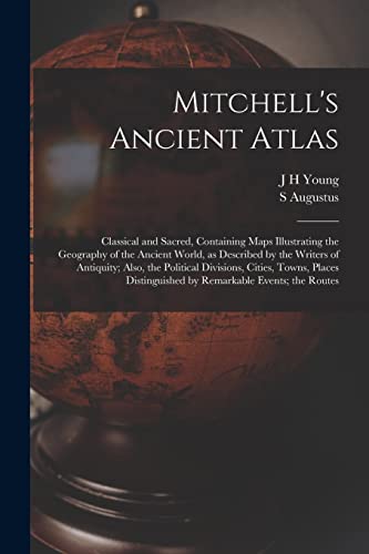
Mitchell's Ancient Atlas: Classical and Sacred, Containing Maps Illustrating the Geography of the Ancient World, as Described by the Writers of ... by Remarkable Events; the Routes
Anbieter: Ria Christie Collections, Uxbridge, Vereinigtes Königreich
Verkäuferbewertung 5 von 5 Sternen

EUR 15,59
EUR 13,86 Versand
Versand von Vereinigtes Königreich nach USAAnzahl: Mehr als 20 verfügbar
In den WarenkorbZustand: New. In.
-

The Principal Stage, Steam-boat, and Canal Routes in the United States;
Anbieter: Ria Christie Collections, Uxbridge, Vereinigtes Königreich
Verkäuferbewertung 5 von 5 Sternen
EUR 17,73
EUR 13,86 Versand
Versand von Vereinigtes Königreich nach USAAnzahl: Mehr als 20 verfügbar
In den WarenkorbZustand: New. In.
-
![Beispielbild für Mitchell's Geographical Question Book [microform]: Comprising Geographical Definitions, and Continuing Questions on All the Maps of Mitchell's School ... Tables in Mathematical and Physical Geography zum Verkauf von Ria Christie Collections](https://pictures.abebooks.com/isbn/9781014407559-de-300.jpg)
Mitchell's Geographical Question Book [microform]: Comprising Geographical Definitions, and Continuing Questions on All the Maps of Mitchell's School ... Tables in Mathematical and Physical Geography
Anbieter: Ria Christie Collections, Uxbridge, Vereinigtes Königreich
Verkäuferbewertung 5 von 5 Sternen
EUR 20,54
EUR 13,86 Versand
Versand von Vereinigtes Königreich nach USAAnzahl: Mehr als 20 verfügbar
In den WarenkorbZustand: New. In.
-
![Bild des Verkäufers für A System of Modern Geography [ect.] zum Verkauf von MW Books](https://pictures.abebooks.com/inventory/md/md30144521218.jpg)
First Edition. Poor copy in the original stiff-card wrappers; wear and tear as with age. Text remains in fine condition and without blemish. Physical description; 320 pages (incomplete). Notes; [1873?]. Subjects; Scales differ. Geography. Statistics. World 1873. 3 Kg.
-
![Beispielbild für A System of Modern Geography [microform]: Comprising a Description of the Present State of the World and Its Five Great Divisions; America, Europe, ... Kingdoms, States, Territories, &c. ... zum Verkauf von Ria Christie Collections](https://pictures.abebooks.com/isbn/9781014060891-de-300.jpg)
A System of Modern Geography [microform]: Comprising a Description of the Present State of the World and Its Five Great Divisions; America, Europe, ... Kingdoms, States, Territories, &c. ...
Anbieter: Ria Christie Collections, Uxbridge, Vereinigtes Königreich
Verkäuferbewertung 5 von 5 Sternen
EUR 26,94
EUR 13,86 Versand
Versand von Vereinigtes Königreich nach USAAnzahl: Mehr als 20 verfügbar
In den WarenkorbZustand: New. In.
-
![Beispielbild für A System of Modern Geography [microform]: Comprising a Description of the Present State of the World and Its Grand Divisions, North America, South ... Empires, Kindgoms, States, Territories, ... zum Verkauf von Ria Christie Collections](https://pictures.abebooks.com/isbn/9781014223555-de-300.jpg)
A System of Modern Geography [microform]: Comprising a Description of the Present State of the World and Its Grand Divisions, North America, South ... Empires, Kindgoms, States, Territories, ...
Anbieter: Ria Christie Collections, Uxbridge, Vereinigtes Königreich
Verkäuferbewertung 5 von 5 Sternen
EUR 26,94
EUR 13,86 Versand
Versand von Vereinigtes Königreich nach USAAnzahl: Mehr als 20 verfügbar
In den WarenkorbZustand: New. In.
-

Mitchell's Ancient Atlas: Classical and Sacred, Containing Maps Illustrating the Geography of the Ancient World, as Described by the Writers of ... by Remarkable Events; the Routes
Anbieter: Ria Christie Collections, Uxbridge, Vereinigtes Königreich
Verkäuferbewertung 5 von 5 Sternen
EUR 28,41
EUR 13,86 Versand
Versand von Vereinigtes Königreich nach USAAnzahl: Mehr als 20 verfügbar
In den WarenkorbZustand: New. In.
-
![Beispielbild für A System of Modern Geography, Physical, Political, and Descriptive [microform]: Accompanied by a New Atlas of Forty-four Copperplate Maps and Illustrated by Two Hundred Engravings zum Verkauf von Ria Christie Collections](https://pictures.abebooks.com/isbn/9781013937569-de-300.jpg)
A System of Modern Geography, Physical, Political, and Descriptive [microform]: Accompanied by a New Atlas of Forty-four Copperplate Maps and Illustrated by Two Hundred Engravings
Anbieter: Ria Christie Collections, Uxbridge, Vereinigtes Königreich
Verkäuferbewertung 5 von 5 Sternen
EUR 30,15
EUR 13,86 Versand
Versand von Vereinigtes Königreich nach USAAnzahl: Mehr als 20 verfügbar
In den WarenkorbZustand: New. In.
-

The Principal Stage, Steam-boat, and Canal Routes in the United States;
Anbieter: Ria Christie Collections, Uxbridge, Vereinigtes Königreich
Verkäuferbewertung 5 von 5 Sternen
EUR 31,22
EUR 13,86 Versand
Versand von Vereinigtes Königreich nach USAAnzahl: Mehr als 20 verfügbar
In den WarenkorbZustand: New. In.
-
![Beispielbild für A System of Modern Geography [microform]: Comprising a Description of the Present State of the World and Its Five Great Divisions; America, Europe, ... Kingdoms, States, Territories, &c. ... zum Verkauf von Ria Christie Collections](https://pictures.abebooks.com/isbn/9781013419089-de-300.jpg)
A System of Modern Geography [microform]: Comprising a Description of the Present State of the World and Its Five Great Divisions; America, Europe, ... Kingdoms, States, Territories, &c. ...
Anbieter: Ria Christie Collections, Uxbridge, Vereinigtes Königreich
Verkäuferbewertung 5 von 5 Sternen
EUR 35,48
EUR 13,86 Versand
Versand von Vereinigtes Königreich nach USAAnzahl: Mehr als 20 verfügbar
In den WarenkorbZustand: New. In.
-
![Beispielbild für A System of Modern Geography [microform]: Comprising a Description of the Present State of the World and Its Grand Divisions, North America, South ... Empires, Kindgoms, States, Territories, ... zum Verkauf von Ria Christie Collections](https://pictures.abebooks.com/isbn/9781013460005-de-300.jpg)
A System of Modern Geography [microform]: Comprising a Description of the Present State of the World and Its Grand Divisions, North America, South ... Empires, Kindgoms, States, Territories, ...
Anbieter: Ria Christie Collections, Uxbridge, Vereinigtes Königreich
Verkäuferbewertung 5 von 5 Sternen
EUR 35,48
EUR 13,86 Versand
Versand von Vereinigtes Königreich nach USAAnzahl: Mehr als 20 verfügbar
In den WarenkorbZustand: New. In.
-
![Beispielbild für A System of Modern Geography, Physical, Political, and Descriptive [microform]: Accompanied by a New Atlas of Forty-four Copperplate Maps and Illustrated by Two Hundred Engravings zum Verkauf von Ria Christie Collections](https://pictures.abebooks.com/isbn/9781013394058-de-300.jpg)
A System of Modern Geography, Physical, Political, and Descriptive [microform]: Accompanied by a New Atlas of Forty-four Copperplate Maps and Illustrated by Two Hundred Engravings
Anbieter: Ria Christie Collections, Uxbridge, Vereinigtes Königreich
Verkäuferbewertung 5 von 5 Sternen
EUR 38,68
EUR 13,86 Versand
Versand von Vereinigtes Königreich nach USAAnzahl: Mehr als 20 verfügbar
In den WarenkorbZustand: New. In.
-
Illinois in 1837; a sketch descriptive of the situation, boundaries, face of the country,.also, Suggestions to Emigrants.
Verlag: Philadelphia: S. Augustus Mitchell, 1837 [but 1838]., 1838
Anbieter: Arader Galleries - AraderNYC, New York, NY, USA
Verkäuferbewertung 5 von 5 Sternen
Erstausgabe
Hardcover. 1st Edition. 8vo., (8 4/8 x 5 3/8 inches). 8-page publisher's catalogue at end (spotted). Fine lithographic map "Mitchell's Map of Illinois." printed on blue tissue paper and hand-colored in outline (some browning). Original plum cloth backed green printed paper boards (extremities rubbed). Provenance: Ownership inscription of George van Vliet on the front cover, and on the recto of the front free endpaper, dated 1838. First Edition, second issue, with "Animals" spelled correctly on the title-page; the front cover reads: "Illinois In 1837 & 8: With a Map. Containing, also, the Emigrant's Guide to the West". Philadelphia: Grigg & Elliot, 1838". "No state in the Western Country has attracted more attention and elicited so many inquiries from those who desire to avail themselves of the advantages of a settlement in a new and rising country, as that of Illinois; and none is filling up so rapidly with an industrious and intelligent population, from every part of our extensive country. Howes M689; Graff 2840. Catalogued by Kate Hunter.
-

Illinois in 1837; a sketch descriptive of the situation, boundaries, face of the country,.also, Suggestions to Emigrants.
Verlag: Philadelphia: S. Augustus Mitchell, and by Grigg & Elliot, 1837., 1837
Anbieter: Arader Galleries - AraderNYC, New York, NY, USA
Verkäuferbewertung 5 von 5 Sternen
Erstausgabe
Hardcover. 1st Edition. 8vo., (8 4/8 x 5 3/8 inches). Fine lithographic map "Mitchell's Map of Illinois." printed on blue tissue paper and hand-colored in outline (some browning). Original brown muslin cloth backed drab printed paper boards (extremities rubbed). First Edition, first issue, with "Animlas" [Animals] spelled incorrectly on the title-page. "No state in the Western Country has attracted more attention and elicited so many inquiries from those who desire to avail themselves of the advantages of a settlement in a new and rising country, as that of Illinois; and none is filling up so rapidly with an industrious and intelligent population, from every part of our extensive country. Howes M689; Graff 2840.
-

Mitchell's School Atlas: Comprising the Maps, Etc. , Designed to Illustrate Mitchell's School and Family Geography
Verlag: Thomas, Copperthwait, Philadelphia, 1846
Anbieter: Bookshelf of Maine, Franklin, ME, USA
Verkäuferbewertung 5 von 5 Sternen
Hardcover. Zustand: Very Good+. Second Revised Edition. Bumped corners. Age-toning on covers and interior pages - does not affect the integrity or legibility of text or maps. A couple of small ink spots on covers. Edgewear to the covers - see image. ; Book is in Very Good + condition. Tight binding. The atlas is part of a series designed to accompany Mitchell's school and family geography materials, offering educational resources for understanding geographical and statistical information relevant to the mid-19th century. The cover is quarter-bound with dark green leather and brown paper, emphasizing durability and usability for educational purposes. Additionally, the atlas includes geographical and statistical tables. The atlas serves as both an educational tool and a reflection of contemporary geopolitical knowledge and interests. Scarce copy in this condition, edition and price. ; 4to 11" - 13" tall; 28 pages.
-
Mitchell's Traveller's Guide through the United States, Containing the Principal Cities, Towns, &c Alphabetically Arranged; Together with the Stage, Steam-Boat, Canal, and Rail-Road Routes, with the Distances, in Miles, from Place to Place.
Verlag: Philadelphia: Thomas, Cowperthwait & Co., [1845]., 1845
Anbieter: Arader Galleries - AraderNYC, New York, NY, USA
Verkäuferbewertung 5 von 5 Sternen
Hardcover. Folding engraved map (17 4/8 x 21 4/8 inches) showing the United States as far west as Indiana Territory, as far south as Florida with 8 insets of the Vicinity of Cincinnati; Vicinity of Albany; Vicinity of the Falls of Niagara; Vicinity of New York; Vicinity of Charleston; Vicinity of Baltimore and Washington; Vicinity of Philadelphia; and Vicinity of Boston, with original hand-colour in outline (very browned). 78-page guide. Original blind-embossed tan roan, lettered in gilt on upper cover. Provenance: Several canal routes through Ohio, Indiana, Pennsylvania, and New York shown in blue ink. First published in 1832, with accompanying text added in 1834, and continuously updated and enlarged. "Internal improvements coupled with the great Irish and German migrations beginning in 1827 led to the production of traveler's guides that depicted roads and their distances, steamboat and canal routes, and lengths of principal railroads. In 1832 Samuel Augustus Mitchell first issued his 'Traveller's Guide through the United States' and complimented it two years later with 'Tourist Pocket Maps' of the different states. These early works and their multitudinous progeny over the next fifty years laid the foundation for the road maps of today" (Schwartz & Ehrenberg, The Mapping of America, page 255).
-
Map of the States of Ohio, Indiana and Illinois with the Settled Part of Michigan.
Verlag: Philadelphia: S. Augustus Mitchell, 1835., 1835
Anbieter: Arader Galleries - AraderNYC, New York, NY, USA
Verkäuferbewertung 5 von 5 Sternen
Hardcover. Engraved folding pocket map (17 4/8 x 21 6/8 inches to the neat-line, full margins). Letterpress census laid down on the front past-down. Fine folding engraved map with insets of the "Lead Region East of the Mississippi River"; "Falls of Ohio"; "Vicinity of Cincinnati"; and "Vicinity of Detroit", with original hand-colour in full (some browing and short separations at folds). Contemporary publisher's red roan, gilt (scuffed). First issued in 1834, and with some changes from that issue: Lake Michigan has been redrawn, the addition of new counties in Indiana is notes, such as Porter, Newton, and Jasper, etc.). Iowa did not become a territory until 1838 and a state until 1844, and is labeled here as Missouri and Wisconsin Territory. Interestingly this map shows the controversial Dubuque lead mining region, including the site of Julien Dubuque's grave. Between 1796, when this grant was confirmed by the Spanish governor of Louisiana, and his death in 1810, Dubuque had succeeded in establishing a monopoly controlling the smelting and shipping of lead from the region, known as the "Mines of Spain". Unable to sustain a working relationship with the local Ioway Indians Dubuque's creditors who succeeded to his rights abandoned the enterprise, and lead-mining rights in Iowa remained in a legal turmoil that lasted until 1853, when the United States Supreme Court issued a landmark decision on the ownership of the Dubuque area mines, disallowing claims based on Julien Dubuque's Spanish land grants.
-
Map of the States of Ohio, Indiana and Illinois with the Settled Part of Michigan.
Verlag: Philadelphia: S. Augustus Mitchell, 1836., 1836
Anbieter: Arader Galleries - AraderNYC, New York, NY, USA
Verkäuferbewertung 5 von 5 Sternen
Hardcover. Engraved folding pocket map (17 4/8 x 22 2/8 inches to the neat-line, full margins). Letterpress census laid down on the front past-down. Fine folding engraved map with insets of the "Lead Region East of the Mississippi River"; "Falls of Ohio"; "Vicinity of Cincinnati"; and "Vicinity of Detroit", with original hand-colour in full (some spotting and offseting). Contemporary publisher's cherry roan, gilt (a bit rubbed). First issued in 1834, and with some changes from that issue: Lake Michigan has been redrawn, the addition of new counties in Indiana is notes, such as Porter, Newton, and Jasper, etc.). Iowa did not become a territory until 1838 and a state until 1844, and is labeled here as Missouri and Wisconsin Territory. Interestingly this map shows the controversial Dubuque lead mining region, including the site of Julien Dubuque's grave. Between 1796, when this grant was confirmed by the Spanish governor of Louisiana, and his death in 1810, Dubuque had succeeded in establishing a monopoly controlling the smelting and shipping of lead from the region, known as the "Mines of Spain". Unable to sustain a working relationship with the local Ioway Indians Dubuque's creditors who succeeded to his rights abandoned the enterprise, and lead-mining rights in Iowa remained in a legal turmoil that lasted until 1853, when the United States Supreme Court issued a landmark decision on the ownership of the Dubuque area mines, disallowing claims based on Julien Dubuque's Spanish land grants.
-
Map of the States of Ohio, Indiana and Illinois with the Settled Part of Michigan.
Verlag: Philadelphia: S. Augustus Mitchell, 1837., 1837
Anbieter: Arader Galleries - AraderNYC, New York, NY, USA
Verkäuferbewertung 5 von 5 Sternen
Hardcover. Single sheet (17 x 21 inches to the neat-line, full margins). Letterpress census laid down on the front past-down. Fine folding engraved map with insets of the "Lead Region East of the Mississippi River"; "Falls of Ohio"; "Vicinity of Cincinnati"; and "Vicinity of Detroit", with original hand-colour in full (laid down on archival tissue, one or two small losses, some staining). Original black roan, gilt (a bit rubbed). Provenance: some canal routes marked in red and blue pen. First issued in 1834, and with some changes from that issue: Lake Michigan has been redrawn, the addition of new counties in Indiana is notes, such as Porter, Newton, and Jasper, etc.). Iowa did not become a territory until 1838 and a state until 1844, and is labeled here as Missouri and Wisconsin Territory. Interestingly this map shows the controversial Dubuque lead mining region, including the site of Julien Dubuque's grave. Between 1796, when this grant was confirmed by the Spanish governor of Louisiana, and his death in 1810, Dubuque had succeeded in establishing a monopoly controlling the smelting and shipping of lead from the region, known as the "Mines of Spain". Unable to sustain a working relationship with the local Ioway Indians Dubuque's creditors who succeeded to his rights abandoned the enterprise, and lead-mining rights in Iowa remained in a legal turmoil that lasted until 1853, when the United States Supreme Court issued a landmark decision on the ownership of the Dubuque area mines, disallowing claims based on Julien Dubuque's Spanish land grants.
-
A New Map of Texas, Oregon and California, with the Regions Adjoining. Compiled from the Most Recent Authorities.
Verlag: Philadelphia: S. Augustus Mitchell, 1846., 1846
Anbieter: Arader Galleries - AraderNYC, New York, NY, USA
Verkäuferbewertung 5 von 5 Sternen
Erstausgabe
Hardcover. 1st Edition. Folding lithographed pocket map (22 4/8 x 21 inches) with original hand-colour in full (laid down at an early date on tissue). Bound after "Accompaniment to Mitchell's New Map of Texas, Oregon, and California, With the Regions Adjoining". Original black roan embossed in blind and lettered in gilt (rebacked). First edition. When published this was the most accurate map and emigrant information available, and self-avowedly compiled from "the Congressional Map of Texas, 1844, Kennedy's Map of Texas by Arrowsmith, Mitchell's Map of Texas, Ward's Map of Mexico, Frémont's Map of his explorations in Oregon, California, &c., 1842, 1843, 1844, Map of Lewis and Clarke's tour, Major Long's tour to the Rocky Mountains, Nicollet and Frémont's exploration of the country between the Mississippi and Missouri, the Congressional Map of the Indian territory, and Mitchell's Map of the United States" (page 3). Clearly showing the Oregon Road, and the Santa Fe trails from Independence, Missouri, and with a table of distances between Westport and Oregon City. "In the Upper California portion, Fremont is carefully followed, while further north Wilkes is followed. The boundary (to be) with Mexico is imperfectly shown but Texas appears with the magnified boundaries, including Santa Fe, of the 1844 Emory. The various claims to Oregon appear. The Accompaniment is of particular interest, containing perhaps the clearest statement of Oregon and California facts that came out of the period just prior to settlement of the former's boundaries and inclusion of the latter in the United State" (Wheat). "California" occupies the entire area of modern-day California, Arizona, Nevada, New Mexico, Utah, and Colorado. Texas is shown as a state of the Union, including a Panhandle that reaches north to the 42nd parallel and a border on the Rio Grande. This popular maps was published in several formats: pocket map with guide (as here), separate map in pocket folder (no guide), separate sheet map, map included with printed reference or general guides to the U.S., wall map, and inset on a larger wall map of the U.S. Another edition appeared in Mitchell's 1849 'Description of Oregon and California'. Cowan p.433; Graff 2841; Howes M685; Wheat Transmississippi 520; Wheat Gold Rush 29.
-
A New Universal Atlas Containing Maps of the various Empires, Kingdoms, States and Republics of the World.
Verlag: Philadelphia: S. Augustus Mitchell, 1848., 1848
Anbieter: Arader Galleries - AraderNYC, New York, NY, USA
Verkäuferbewertung 5 von 5 Sternen
Hardcover. Folio (17 2/8 x 14 inches). Lithographed vignette title-page. Hand-coloured lithographed frontispiece showing the lengths of rivers and the heights of mountains, a fine lithographed double-hemisphere map of the world and 70 full-page maps all with original hand-colour in full and engraved by Peter S. Duval of Philadelphia. Original half red morocco, marbled paper boards, gilt (extremities quite worn). Provenance: with the pencil trials of a young John H williams of Petersville Frederick County on the endpapers. First published by Mitchell in 1846 after having acquired the rights to Henry Schenk Tanner's "New Universal Atlas" from Carey & Hart who had published editions in 1843 and 1844. However Mitchell changed many of the maps, changed the copperplates to lithography, and then issued the atlas at least once a year until 1850, when he sold the rights to Thomas, Cowperthwait & Company. Thereafter the rights were bought and sold several times, with the atlas being published until at least 1860. Catalogued by Kate Hunter.
-
Mitchell's New Traveller's Guide Through the United States.
Verlag: Philadelphia: Thomas Cowperthwait & co., 1851., 1851
Anbieter: Arader Galleries - AraderNYC, New York, NY, USA
Verkäuferbewertung 5 von 5 Sternen
Hardcover. Single sheet (22 x 29 inches). Folding steel-engraved map of the southern and eastern states, hand-colored in outline (detached, 8 x 3 inches of lower left-hand side area missing, extensive tears to folds, some stains). Original burgundy leather, covers gilt-decorated, title lettered in gilt within border in the center of the front cover (extremities a bit rubbed). First published in 1832 by Mitchell himself, one of several variant issues of the New Traveller's Guide later published by Thomas Cowperthwait, and a copy of a map of what is now the eastern half of the United States. Includes five inset maps of cities and regions; namely the Copper Region, the Vicinity of the Niagara Falls, a Map of the Maritime and overland routes to California, a Map of the Gold and Quicksilver district of California, a Map of New England or Easter states. Rumsey 4374; Braislin 1265; Howes M690; Graff 4790; Clark, Travels in the Old South III, 74. Catalogued by Kate Hunter.
-
A New Map of Texas Oregon and California With the Regions Adjoining.
Verlag: Philadelphia, 1846., 1846
Anbieter: Arader Galleries - AraderNYC, New York, NY, USA
Verkäuferbewertung 5 von 5 Sternen
Erstausgabe
Hardcover. 1st Edition. Single sheet (22 x 21 inches). Folding lithographic map with original color, linen backed (evidence of early repair, a bit browned). Modern cloth portfolio. Provenance: Near contemporary annotations recording journals westward. The rare first edition of this important map of the West at a time of geographic discovery as well as political upheaval and change. The table in the lower left-hand corner details the distances between way points of the "Emigrant Route from Missouri to Oregon" Other official routes indicated on the map but not described in detail are those of Fremont's explorations, the "Caravan Route from Missouri to Santa Fe," the "Great Spanish Trail from California to Santa Fe," and "Lt. Col. Cooke's wagon road." In addition a contemporary hand has marked the routes west taken by three emigrants "Ch. Verendige", "Alex" and "Whitney". Cowan p.433; Graff 2841; Howes M685; Wheat Transmississippi 520; Wheat Gold Rush 29.
-
The Tourists Pocket map of Pennsylvania Exhibiting Its Internal Improvements, Road Distances, &c.
Verlag: Philadelphia: S. Augustus Mitchell, 1833., 1833
Anbieter: Arader Galleries - AraderNYC, New York, NY, USA
Verkäuferbewertung 5 von 5 Sternen
Hardcover. Single sheet (13 x 14 6/8 inches to the neat-line, full margins). Letterpress Pennsylvania Census for 1830 laid-down on the front paste-down, Mitchell's imprint on the back paste-down. Fine engraved map of Pennsylvania, with insets of the Lehigh and Schuylkill Coal Regions, the Vicinity of Philadelphia, and a profile of Pennsylvania Canal, with original hand-colour in full (one or two separations at folds). Original blue roan, gilt (expertly rebacked to style). First published by Mitchell, one of America's pre-eminent cartographers, in 1831 in his re-issue of Finley's "New American Atlas" but with considerable additions and improvements, on which he collaborated with Young. Mitchell and Young continued to work together for decades, including on this series of pocket maps, of which this is one of the earliest.
-
A New Map of Texas Oregon and California with the Regions Adjoining. - Accompaniment to Mitchell's New Map of Texas, Oregon, and California, with the Regions Adjoining.
Verlag: S. Augustus Mitchell, Philadelphia, 1846
Anbieter: Arader Galleries - AraderNYC, New York, NY, USA
Verkäuferbewertung 5 von 5 Sternen
Erstausgabe
Hardcover. 1st Edition. Single sheet (22 x 21 inches). Folding lithographic map with original color, tipped in after the "Accompaniment." (some folds strengthened on verso, but a FINE AND BRIGHT COPY of a fragile map). Original maroon morocco, covers elaborately decorated in blind, lettered in gilt within an elaborate border in the center of the front cover. Modern quarter maroon morocco clamshell box. Provenance: Penciled presentation inscription from "John B. Colahan to his friend Joseph Trasel Esq. Lodge Hall Aug 5. 1846" on the front free endpaper. The rare first edition, and AN EXCEPTIONALLY FINE COPY of this important map of the West at a time of geographic discovery as well as political upheaval and change. As noted in the "Accompaniment.", Texas has recently been gathered into the bosom of the United States, and California is in limbo, "Upper California. This part of Mexico was declared independent in 1845. It has of late attracted much attention in the United States; a number of Americans are already settled in it, and many others are preparing to emigrate thither." Regarding Oregon, the "Accompaniment." declares that "the United States have an indubitable claim to the whole region of Oregon, from N. lat 42o to 54o 40', yet the government has several times proposed, from motives of accommodation, to adopt the 49th parallel of latitude as the dividing line.". Wheat describes the map: "In the Upper California portion, Fremont is carefully followed, while further north Wilkes is followed. The boundary (to be) with Mexico is imperfectly shown but Texas appears with the magnified boundaries, including Santa Fe, of the 1844 Emory. The various claims to Oregon appear. The "Accompaniment." is of particular interest, containing perhaps the clearest statement of Oregon and California facts that came out of the period just prior to settlement of the former's boundaries and inclusion of the latter in the United States." Cowan p.433; Graff 2841; Howes M685; Wheat Transmississippi 520; Wheat Gold Rush 29.
-
Mitchell's Compendium of the Internal Improvements of the United States; comprising general notices of all the most important Canals and Rail-Roads, throughout the Several States and Territories of the Union: together with a brief notice of works of the I
Verlag: Philadelphia: Mitchell & Hinman, 1838., 1838
Anbieter: Arader Galleries - AraderNYC, New York, NY, USA
Verkäuferbewertung 5 von 5 Sternen
12mo., (6 x 4 6/8 inches). Engraved frontispiece, a fine folding engraved maps " Mitchell's Map of the United States; showing the Principal Travelling, Turnpike and Common Roads. 1838" (18 4/8 x 23 inches) with insets of the environs of Niagara Falls, Baltimore and Washington, Charleston, Hartford and New Haven, Albany, Boston, New York, and Philadelphia, with original hand-colour in full (some browning and offsetting), and a folding letterpress index at end. Original publisher's plum glazed muslin, printed blue paper label on the front cover (quite spotted). First published in 1835, and with the same map which extends in the west to the Brazos River in Texas, which is still called Mexico, even though Texas had declared itself a republic in March of 1836. Mexico never recognized Texas as independent, but its independence was recognised by the United States in March of 1837, France in September of 1839, and by Great Britain in November 1840. Interestingly "Missouri Territory" is lettered over tribal designations for Kickapoos, Shawnees, Osages, Cherokees, Creeks, and Choctaws. Howes M686.
-
A New Map of Texas, Oregon, and California, with the Regions Adjoining. Philadelphia: S. Augustus Mitchell, 1846. - Accompaniment to Mitchell's New Map of Texas, Oregon, and California, with the Regions Adjoining.
Verlag: Philadelphia: S. Augustus Mitchell, 1846., 1846
Anbieter: Arader Galleries - AraderNYC, New York, NY, USA
Verkäuferbewertung 5 von 5 Sternen
Erstausgabe
1st Edition. "Single sheet (22 x 20 ˝ inches). Folding lithographic map with original full hand coloring, tipped in after the "Accompaniment" (strengthened on verso, a bit stained). Original green leather binding, lettered in gilt within an elaborate embossed border in the center of the front cover (extremities a bit rubbed, but a FINE copy). Provenance: penciled ownership inscription of Jacob Warner, from Cincinnati, Ohio, on front free-end paper. The first edition, and A FINE COPY of one of Mitchell's most popular and important map. As noted in the "Accompaniment", Texas has recently been gathered into the bosom of the United States, and California is in limbo, "Upper California. This part of Mexico was declared independent in 1845. It has of late attracted much attention in the United States: a number of Americans are already settled in it, and many others are preparing to emigrate thither" Regarding Oregon, the "Accompaniment" declares that "the United States have an indubitable claim to the whole region of Oregon, from N. lat 42o to 54o 40', yet the government has several times proposed, from motives of accommodation, to adopt the 49th parallel of latitude as the dividing line". Wheat describes the map: "In the Upper California portion, Fremont is carefully followed, while further north Wilkes is followed. The boundary (to be) with Mexico is imperfectly shown but Texas appears with the magnified boundaries, including Santa Fe, of the 1844 Emory. The various claims to Oregon appear. The "Accompaniment" is of particular interest, containing perhaps the clearest statement of Oregon and California facts that came out the period just prior to settlement of the former's boundaries and inclusion of the latter in the United States." Cowan p.433; Graff 2841; Howes M685; Sabin 49714; Wheat Transmississippi 520; Wheat Gold Rush 29.".

