Beschreibung
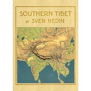
ca. 3.300 pages in 12 Volumes neu / Modernes Schriftbild / Volume 1: Lake Manasarovar and the sources of the Great Indian Rivers - From the remotest antiquity to the end of the eighteenth century Volume 2: Lake Manasarovar and the sources of the Great Indian Rivers - From the end of the eighteenth century to 1913 Volume 3: Transhimalaya Volume 4: Kara-Korum and Chang-Tang Volume 5: Petrographie und Geologie von Anders Hennig Volume 6: Part 1: Die Meteorologischen Beobachtungen, bearbeitet von Nils Ekholm Part 2: Les Observations astronomiques, calculées et rédigées par K.G. Olsson Part 3: Botany, by C. H. Ostenfeld Volume 7: History of exploration in the Kara-Korum Mountains Volume 8: Part 1: The Tsung-Ling Mountains by Sven Hedin and Albert Herrmann; Part 2: Die Westländer in der Chinesischen Kartugraphie von Albert Herrmann; Part 3: Zwei Osttürkische Manuskriptkarten, unter Mitwirkung von Albert v. Le Coq, herausgegeben von Albert Herrmann; Part 4: Chinesische Umschreibungen von älteren geographischen Namen, zusammengestellt von Albert Herrmann Volume 9: Part 1: Journeys in Eastern Pamir by Sven Hedin; Part 2: Osttürkische Namenliste von Albert von Le Coq; Part 3: Zur Geologie von Ost-Pamir. Auf Grundlage der von Sven Hedin gesammelten Gesteinsproben, von Bror Asklund; Part 4: Eine Chinesische Beschreibung von Tibet, vermutlich von Julius Klaproth. Nach Amiots Übersetzung bearbeitet. Herausgegeben von Erich Hänisch. Das Goldstromland im Chinesisch-Tibetischen Grenzgebiete. Nach dem großen Kriegswerk von Jahre 1781 dargestellt von Erich Hänisch; Part 5: General Index Volume 10: Maps, Part 1 and 2 Volume 12: Atlas of Tibetan Panoramas (reduced in size 20 %) / Volume 1: XVIII, 293 pages, with 103 maps Volume 2: XII, 330 pages, with many illustrations and 24 maps Volume 3: XII, 369 pages, with many illustrations and 31 maps Volume 4: XII, 428 pages, with more than 200 illustrations Volume 5: 220 pages, with 21 figures and 11 plates, 2 geographical maps Volume 6: Part 1: XVI, 134 pages, Part 2: IV, 86 pages, Part 3: XII, 196 pages, with many statistics and 11 botanical plates Volume 7: XII, 605 pages, with 103 maps and plates, 20 illustrations Volume 8: XVIII, 456 pages, with 4 general maps, 40 historical maps, 8 folded maps Volume 9: X pages, Part 1 - 3: 180 pages, Part 4 - 5: 176 pages with more than 20 plates, some coloured and folded Volume 10: Maps 1: II, IV pages text, 25 general maps of Eastern Turkestan, 26 coloured maps of the journey in Eastern Turkestan Maps 2 : VI pages, 52 coloured hyprosometrical maps of Southern Tibet Volume 11: VI, 105 pages, with 105 panoramas Sprache: Englisch Gewicht in Gramm: 21500 44,3 x 30,5 cm 30,5 x 22,4 cm, gebundene Ausgabe Faksimile-Reprint der Ausgabe von 1894-1922 Stockholm, Lithographic Institue of the General Staff of the Swedish Army.
Bestandsnummer des Verkäufers 69405
Verkäufer kontaktieren
Diesen Artikel melden
