Beschreibung
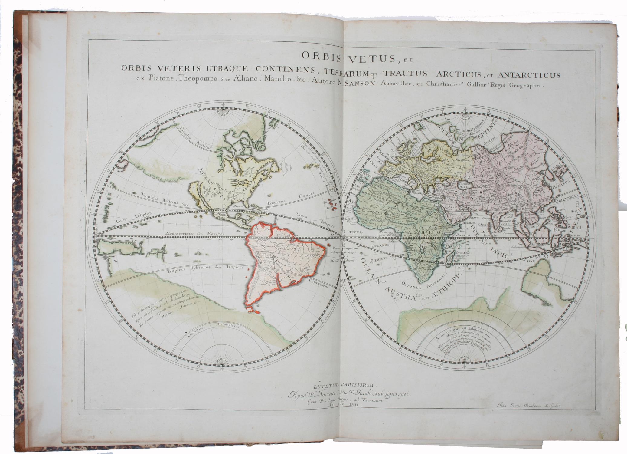
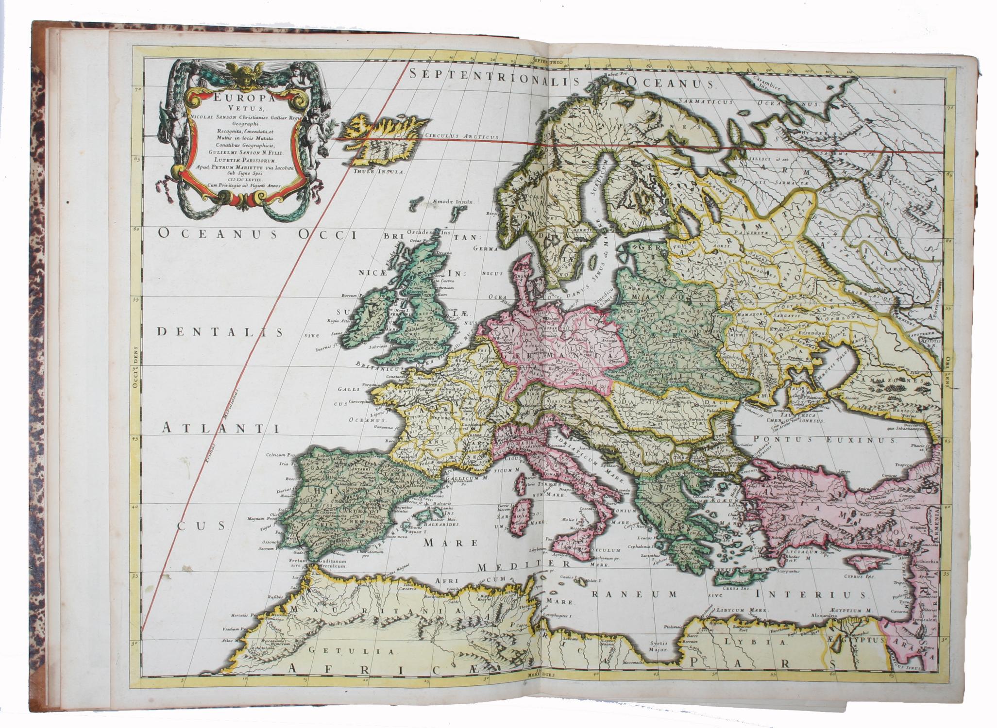
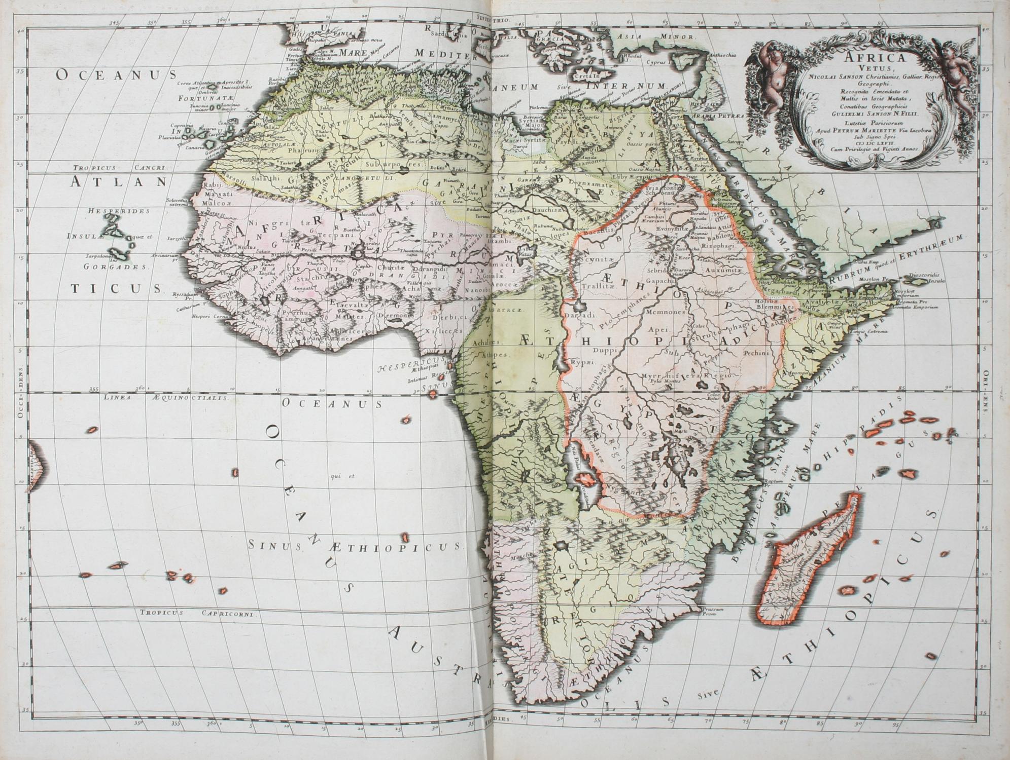
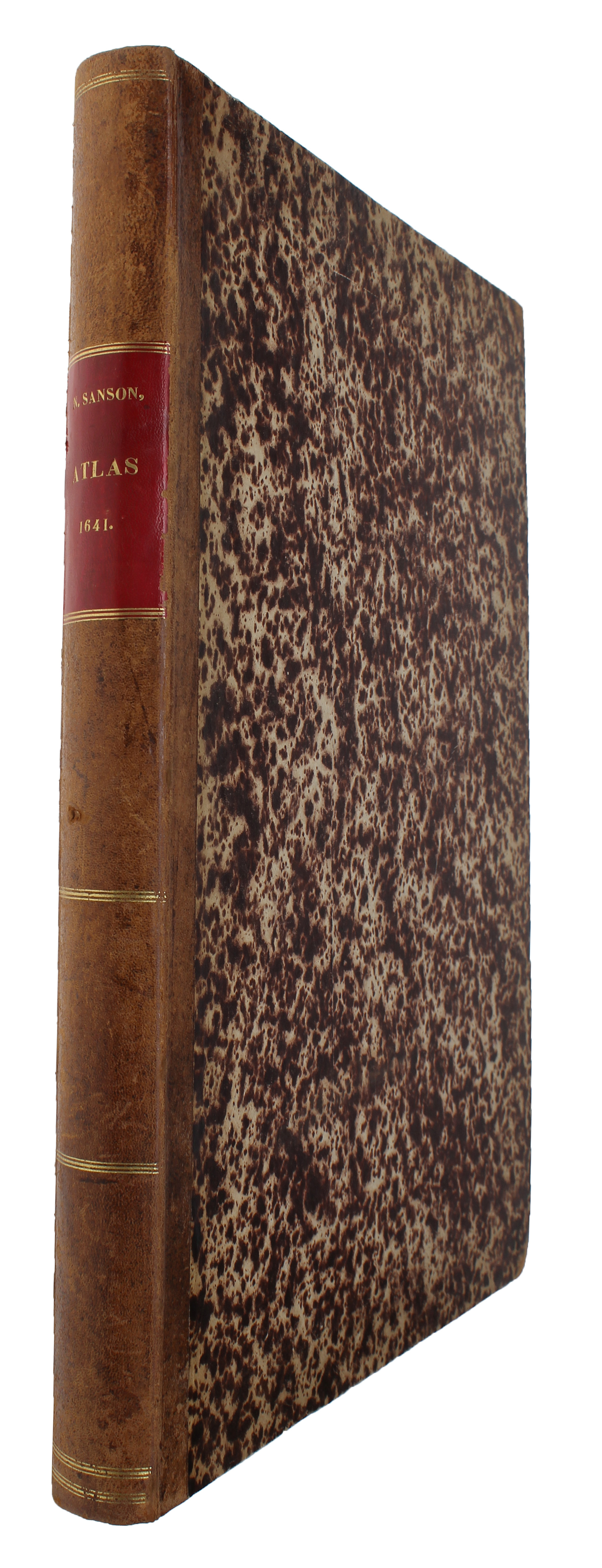
Paris, Melchior Tavernier, Pierre Mariette et al., 1636-78. Folio. (45 x 32,5 cm.). Bound in a 19th Century hcalf with title on spine in gilt lettering: "N. Sanson - Atlas - 1641". Maps varying sizes Ca. (38-43 cm.) x (50-53 cm.). With 67 fine engraved maps, 40 by N. Sanson and G. Sanson, 8 by De la Rue, 7 by Duval, 10 by Tavernier (done by Sanson), 2 by Philippus Briet (Chez Pierre Mariette, Henri le Roy fecit, and Michel van Lochom). The first 22 fully coloured !!, the last 45 outline coloured. Map 42-45 by Tavernier with 2 small inkspots on verso which are seen in the middle of the maps in one case creating a small whole in the image. The last map with 2 small repairs in upper margin, not affecting image. Otherwise the maps are clean and fine, all in contemporary handcolouring. This is a fine composite atlas by the engravers of the French 17th century school. Most of the 67 maps are by Nicolas Sanson and his son Guillaume Sanson (40 + 10, as the Tavernier-maps are done by Sanson).Nicolas Sanson (1600-1667) is generally thought of as the father of the 17th century school of map-making, maps which are known for their charm and elegance in the fine lettering and delicate engraving. Sanson published an atlas of France, world atlasses and another atlas with the title "Cartes G�n�rales de toutes les Parties du Monde (1658), containing 82 maps. After his death, the firm was run by his sons Guillaume and Adrian. After 1670 the firm's map-making material was taken over by Herbert Jaillot. Pierre Duval (1618-1683), here represented with 7 maps, was geographer to the King of France and pupil of Sanson.Content: 1. World Map (2 hemispheres, "Orbis Vetus", (showing California as an island) Sanson 1657). - 2. Europa Vetus (N. & G. Sanson 1668). - 3. Asia Vetus (N. & G. Sanson 1667). - 4. Africa Vetus (N. & G. Sanson 1667) - 5. Atlantis Insula (North- and South America. Showing California as an island. N. & G. Sanson, 1669). - 6. Hispania Antiquae Tabulae. (N. Sanson, 1641) - 7. Galliae Antiqiquae. (N. Sanson 1642. - 8. Les Suisses.Souabe etc. (N. Sanson 1667). - 9. Germania Antiqua. (N. Sanson 1641). - 10. Belgica in provincias quattor. N. Sanson 1659). - 11. Italia Antiqua cum .Sicilia Sardinia & Corsica. (N. Sanson 1641). - 12. Illyricum Orientis.Moesia et Thracia.(Sanson no date ca. 1640). - 13. Illyricum Occidens. (N. Sanson no date, ca 1640), . 14. Graeciae Antiquae. (N. Sanson 1636). - 15.Creta Insula. (G. Sanson 1676). - 16. Britannicae Insulae. N. Sanson 1641). - 17. L Royaume D'Angleterre. (N. Sanson 1665). - 18. L'Escosse Royaume. (N. Sanson 1665). - 19. Iralnde Royaume. (Sanson 1665). - 20. Baltiae, quae est Scandia, Finninga, Cimbrica. (N. Sanson, 1654). - 21. Germano-Sarmatia. (N. Sanson 1655). - 22. Sarmatia Utraque Europaea et Asiatica (Russie etc.). (N. Sanson 1654). - 23. Cimmeria quae Posteaa Scythia Europaea seu Parua Scythia. (G. Sanson 1665). - 24. Bisphorus Cimmerius et Regnum Bosphoranum. (G. Sanson 1665). - 25. Anaplus Bosphori Thracii. (G. Sanson 1666). - 26. Asia Minor (Turkey). (Ph. de la Rue 1652). - 27. Armenia vetus. (Th. de la Rue 1653). - 28. Lyaconia in Minores Regiones. (G. Sanson 1676). - 29. Colchis, Iberia, Albania. (G. Sanson 1667). - 30. Pamphilia et Pisidia. (G. Sanson 1670). 31. Assyria Vetus. Syriam, Mesopotamiam, Babyloniam et Assyriam. (Ph. de la Rue 1651). - 32. Syriae Veteris.Hierusalem. Exodus Israelis. Palaestinae delineatio. 4 separate maps on one. (Philippus Briet, chez Pierre Mariette 1641). - 33. Geographia Patriarchalis. (Europa with North Africa and Asia Minor.). (G. Sanson 1668). - 34. Patriarchatus Romanus. (M. Tavernier no date ca. 1640). - 35. Patriarchatus Constantinopolitani. (M. Tavernier no date ca. 1640). - 36. Patriarchatus Antiocheni. (M. Tavernier 1640). - 37. Patriarchatus Hierosolymitani. (M. Tavernier 1640). - 38. Pinax geographicus Patriarchatus Hierosolymitani. (Ph. de la Rue 1651). - 39. Patriarchatus Alexandrini (Egypt etc.). (M. Tavernier 1640). - 40. Antiquorum Afr.
Bestandsnummer des Verk�ufers 45569
Verk�ufer kontaktieren
Diesen Artikel melden