
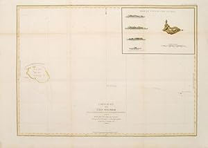
Carte plate de l'Ile Necker.
LA P…ROUSE, Jean Francois de Galaup.
Verlag: Paris: 1797
Verkšufer Peter Harrington. ABA/ ILAB., London, Vereinigtes KŲnigreich
AbeBooks Verkšufer seit 26. Juli 1999
Verkšuferbewertung
![]()
Alle Artikel dieses Verkšufers anzeigen
Anzahl: 1