Atlas de Toutes les Parties Connues du Globe Terrestre
BONNE, Rigobert; RAYNAL, Guillaume Thomas Francois
Verlag: J. L. Pellet, Geneva, 1783
Gebraucht
hardcover
Verk�ufer
Argosy Book Store, ABAA, ILAB, New York, NY, USA
Verk�uferbewertung 5 von 5 Sternen
![]()
Heritage Bookseller
AbeBooks-Mitglied seit 1996
Dieses Exemplar ist nicht mehr verf�gbar. Hier sind die �hnlichsten Treffer f�r Atlas de Toutes les Parties Connues du Globe Terrestre von BONNE, Rigobert; RAYNAL, Guillaume Thomas Francois.
Beschreibung
Beschreibung:
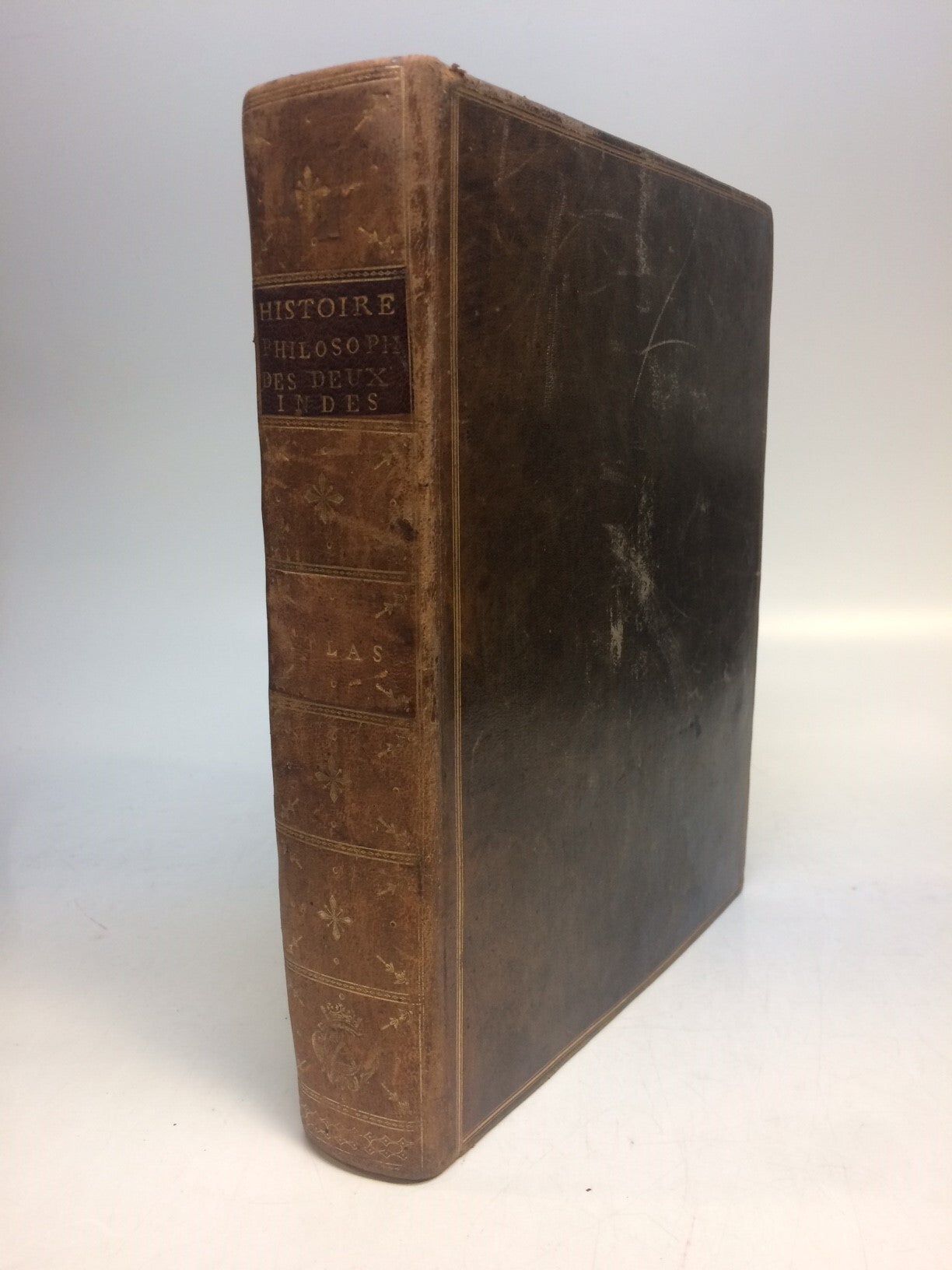
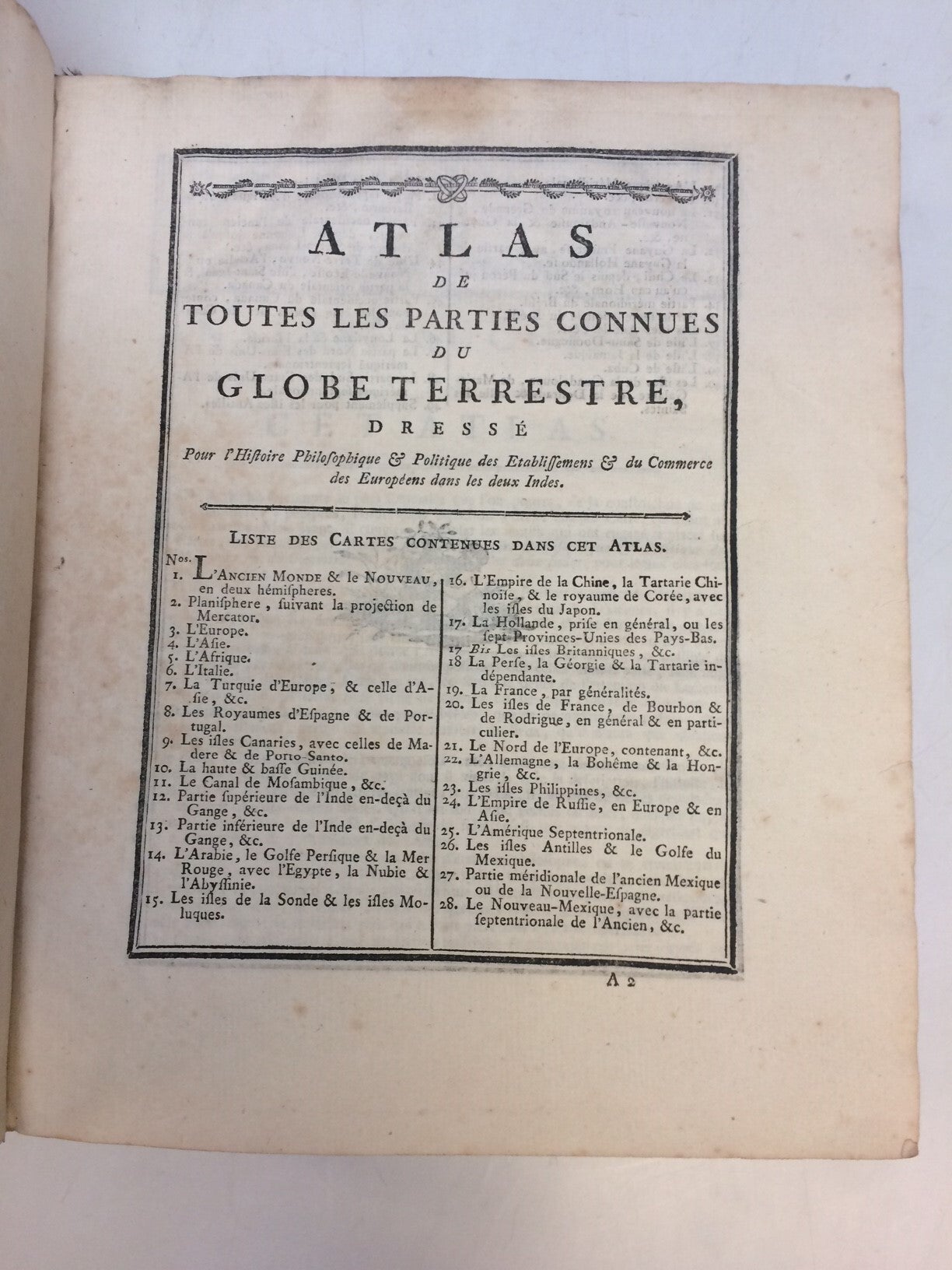
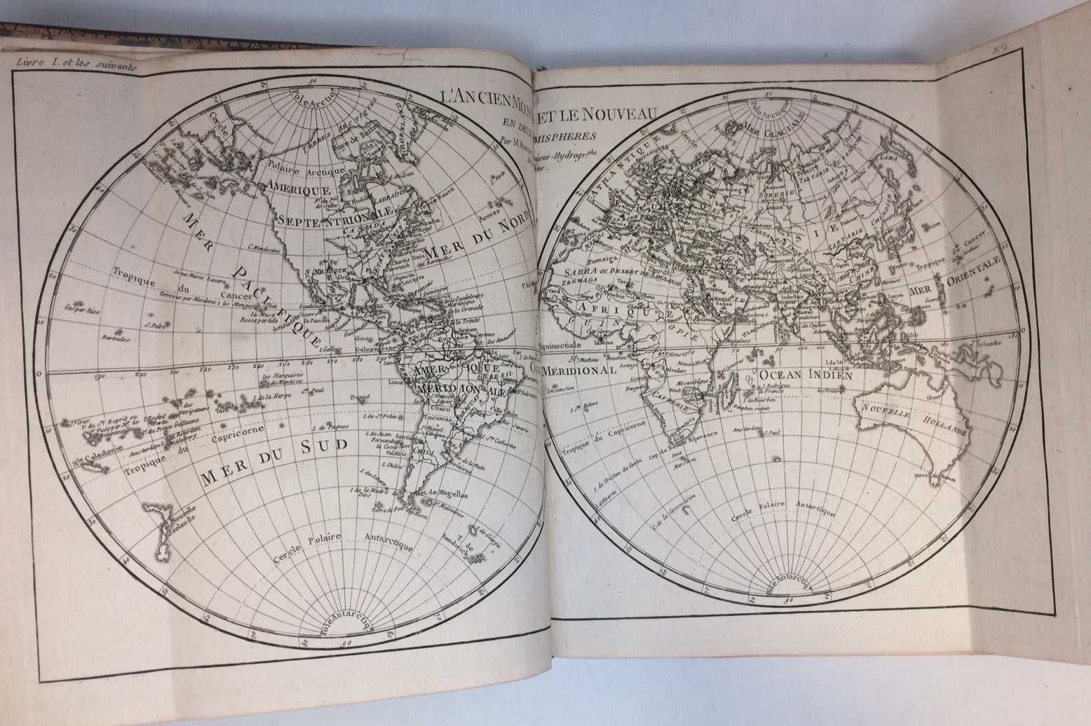
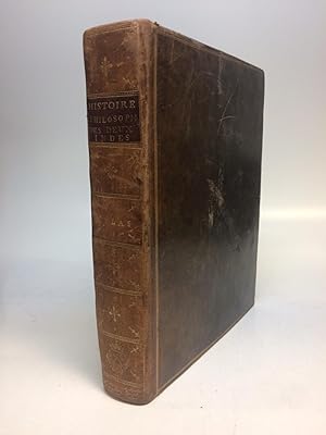
Atlas. 4to (9 3/4 x 8 inches); 22pp, 50 double-page or folding engraved maps, by Rigobert Bonne, the index numbered to 49; 23 letter-press tables, giving economic data. All maps have centerfold, plate I ("L'Ancien Monde et le Nouveau en Deux Hemispheres") has two additional folds. Minor scuffing to original brown leather binding, gilt spine in 7 compartments. Original marble end pages. Green silk book mark present. Only very minor toning and light scattered foxing to text. In very good condition. Geneva: 1783. Atlas volume for Abbe Raynal's "L'Histoire philosophique et politique des etablissements et du commerce des Europeens dans les deux Indes." Title-page provides no publication data. Maps and charts are in very good condition. Includes 2 world maps. Rigobert Bonne (1727-1795) was one of the most important cartographers of the late 18th century. He served as Hydrographer to France, and during his term, he produced a number of detailed and useful maps, particularly of coastal regions. His work is often devoid of decorative cartouches and compasses roses and marks a turn in European mapmaking away from decoration toward technical mapping. Bestandsnummer des Verk�ufers 288841
Bibliografische Details
Titel: Atlas de Toutes les Parties Connues du Globe...
Verlag: J. L. Pellet, Geneva
Erscheinungsdatum: 1783
Einband: hardcover
Beste Suchergebnisse beim ZVAB

Foto des Verk�ufers
Atlas de toutes les parties connues du globe terrestre dress� pour l`histoire philosophique et politique des �tablissemens et du commerce des Europ�ens dans les deux Indes.
Verlag:
[Genf] [J.L. Pellet] [ca 1780], 1780
Gebraucht
Hardcover
Anbieter: Antiquariat L�cker, Wien, �sterreich
Verk�uferbewertung 5 von 5 Sternen
![]()
Atlaswerk zur Histoire philosophique von G.T. Raynal. Das Werk, das zu einem gro�en Teil Diderot zugeschrieben wird, erschien erstmals 1770 in Paris, wurde von der Zensur verboten und im Ausland mehrfach nachgedruckt. Alle Karten in dieser Ausgabe, au�er der Karte 2 (Planisphere suivant la projection de Mercator), sind von Rigobert Bonne (1727-1794), wobei viele von Gaspard Andre gestochen wurden. Darin 2 Weltkarten sowie Karten v. Afrika (7), Asien (9) u. Europa (9), Nord-, Mittel- und S�damerika (23).- Borba de Moraes II,174; Sabin 68081; Sander 1656; Hill Coll. 250: "This Geneva edition is considered the best edition. The atlas is very scarce". 26,5 x 22 cm. 2 Bl., Ss. 5-22, 50 doppelblattgro�e Kupfertafeln, 23 teils mehrfach gefaltete typogr. Falttafeln, Lederband der Zeit auf 6 B�nden mit goldgepr. R�ckenschild, sehr gut erhalten, die Karten �beraus frisch und fleckenfrei in kr�ftigen Abz�gen, einige Textbl. bzw. Tafeln mit Quetschfalten. Artikel-Nr. KART0261
Gebraucht kaufen
EUR 1.500,00
EUR 72,50 Versand
Versand von �sterreich nach USA
Versand von �sterreich nach USA
Anzahl: 1 verf�gbar
Histoire philosophique et politique des �tablissements et du commerce des Europ�ens dans les deux Indes & Atlas de toutes les parties connues du globe terrestre, dress� pour l'histoire Philosophique et Politique des �tablissements et du Commerce des Europ�ens dans les deux Indes.
Verlag:
Pellet, 1780
Gebraucht
Hardcover
Anbieter: Librairie Voyage et Exploration, Cerny, Frankreich
Verk�uferbewertung 4 von 5 Sternen
![]()
Couverture rigide. Zustand: Bon. 3�me �dition. Gen�ve, Pellet, 1780, 5 volumes in-4, 4 de texte et un atlas in-4, Texte ; portrait, XVI, 741 pp., 1 pl.; front., (2 ff.), VIII, 485 pp.; front., XV, 629 pp.; front., (2 ff.), VIII, 770 pp., (1 f.), Atlas ; 2f., 28pp. ; illustr� complet des 50 cartes (chiffr�es 1-49 et 17 bis) ; quelques cartes mal chiffr�es et 23 tableaux de statistiques in fine, la plupart d�pliants. Rousseurs �parses, feuillets l�g�rement brunis par places. Tampons humides "Biblioth�que populaire de Bordeaux". Reliure Texte ; Basane fauve marbr�e de l'�poque, dos � nerfs orn�s, triple filet dor� encadrant les plats, Atlas ; veau brun marbr� de l'�poque, dos � nerfs orn�, fleurons tulipes entre caissons, tranches marbr�es, filet � froid encadrant les plats, double filet dor� sur coupes 2 coiffes aras�es, une arrach�e, petits chocs � 2 autres, frottements et �pidermures, coins tr�s �mouss�s, mors fendill�s aux entr�es, coins �mouss�s, tranches marbr�es (atlas). La grande �dition du Raynal : elle est illustr�e d'un portrait par Cochin, de 4 figures par Moreau grav�es par De Launay, Delignon et Simonet et de 23 tableaux hors-texte dont 12 d�pliants. L'atlas comprend 50 cartes grav�es dont une carte d�pliante des deux h�misph�res et 49 sur double page par M. Bonne, Ing�nieur-hydrographe de la Marine Publi� de mani�re clandestine d�s 1770, puis condamn� par le Parlement de Paris, l'ouvrage rencontra un succ�s consid�rable. Outre une histoire de l'exploration et de la colonisation de l'Am�rique, il contient une vive d�nonciation de l'esclavage et de l'exploitation des colonies. Chadenat, n�1960. Sabin, n�68081. Artikel-Nr. ABE-1741625332377
Gebraucht kaufen
EUR 2.000,00
EUR 45,00 Versand
Versand von Frankreich nach USA
Versand von Frankreich nach USA
Anzahl: 1 verf�gbar
Atlas de toutes les Parties Connues du Globe Terrestre .
Verlag:
[ca. 1780]., 1780
Gebraucht
Hardcover
Anbieter: Maggs Bros. Ltd ABA, ILAB, PBFA, London, Vereinigtes K�nigreich
Verk�uferbewertung 5 von 5 Sternen
![]()
Quarto (258 x 191 mm); [iv], 28pp, fifty double-page or folding engraved maps, credited to Rigobert Bonne. Contemporary tree calf, rebacked with old spine laid down, gilt, red morocco label to spine. Extremities rubbed, front joint splitting. [Paris or Geneva ?], The Raynal/Bonne atlas was one of the most popular and successful French atlases of its period, and the most confusing. It was intended to accompany Raynal's Historique Philosophique et Politique des Etablissemens et du Commerce dans les deux Indes ., 1778, but the atlas volumes appeared without a publisher's imprint. This version, one of a number of presumed French/Swiss printings, has the maps signed by Bonne, while many of the maps�are signed by the�engraver, Gaspard Andr�. Other versions appear with the maps by other engravers, unsigned and in some cases inexpertly performed. Artikel-Nr. 223989
Gebraucht kaufen
EUR 2.382,53
EUR 31,23 Versand
Versand von Vereinigtes K�nigreich nach USA
Versand von Vereinigtes K�nigreich nach USA
Anzahl: 1 verf�gbar
Atlas de toutes les Parties Connues du Globe Terrestre .
Verlag:
[ca. 1780]., 1780
Gebraucht
Hardcover
Signiert
Anbieter: Maggs Bros. Ltd ABA, ILAB, PBFA, London, Vereinigtes K�nigreich
Verk�uferbewertung 5 von 5 Sternen
![]()
Quarto (255 x 207 mm); 22pp, 50 double-page or folding engraved maps, performed by Rigobert Bonne, the index numbered to 49, the British Isles numbered 17 bis; 23 letter-press tables, giving economic data, particularly for the Americas. 19th century half red morocco over marbled boards, five raised bands and gilt titling to spine. Some minor wear and darkening to spine, otherwise very good. [Paris or Geneva ?] The Raynal/Bonne atlas was one of the most popular and successful French atlases of its period, and the most confusing. It was intended to accompany Raynal's Historique Philosophique et Politique des Etablissemens et du Comerce dans les deux Indes ., 1778, but the atlas volumes appeared without a publisher's imprint. This version, one of a number of presumed French/Swiss printings, has the maps signed by Bonne, but none are signed by an engraver. Artikel-Nr. 223539
Gebraucht kaufen
EUR 2.680,35
EUR 31,23 Versand
Versand von Vereinigtes K�nigreich nach USA
Versand von Vereinigtes K�nigreich nach USA
Anzahl: 1 verf�gbar
Atlas de Toutes les Parties Connues du Globe Terrestre
Verlag:
J. L. Pellet, Geneva, 1780
Gebraucht
Hardcover
Anbieter: Argosy Book Store, ABAA, ILAB, New York, NY, USA
Verk�uferbewertung 5 von 5 Sternen
![]()
hardcover. Quarto (10 1/2 x 7 3/4 inches); 28pp, 50 double-page or folding engraved maps by Rigobert Bonne, the index numbered to 49. Half brown morocco over marbled boards, five raised bands and gilt titling to spine. Gilt spine in 6 compartments. Title on spine in gold 'Atlas Du Globe Terrestre'. Red edges. Corners bumped. Minor toning and light scattered foxing throughout. Geneva: 1780. Atlas volume for Abbe Raynal's "L'Histoire philosophique et politique des etablissements et du commerce des Europeens dans les deux Indes." Title-page provides no publication data. Maps and charts are in very good condition. Includes 2 world maps. Rigobert Bonne (1727-1795) was one of the most important cartographers of the late 18th century. He served as Hydrographer to France, and during his term, he produced a number of detailed and useful maps, particularly of coastal regions. His work is often devoid of decorative cartouches and compasses roses and marks a turn in European mapmaking away from decoration toward technical mapping. Artikel-Nr. 243715
Gebraucht kaufen
EUR 3.238,25
EUR 5,17 Versand
Versand innerhalb von USA
Versand innerhalb von USA
Anzahl: 1 verf�gbar