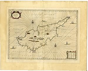
Antique Map-CYPRUS ISLAND-Anonymous-Janssonius-c.1658
Anonymous
Verkauft von Pictura Prints, Art & Books, Overasselt, Niederlande
Verbandsmitglied:
AbeBooks-Verkäufer seit 1. November 2019
Gebraucht
Anzahl: 1 verfügbar
In den Warenkorb legenVerkauft von Pictura Prints, Art & Books, Overasselt, Niederlande
Verbandsmitglied:
AbeBooks-Verkäufer seit 1. November 2019
Anzahl: 1 verfügbar
In den Warenkorb legen'CYPRUS INSULA LAETA […].'An attractive map of the island of Cyprus.Made by Anonymous after own design.Medium: Engraving with original hand colouring on hand laid (verge) paper.Sheet size: 59.5 x 48.5 cm (23.43 x 19.09 inch). Image size: 47.5 x 34.8 cm. (18.7 x 13.7 inch).CYPRUS ISLAND | RB-CYPRUS-1BACKGROUND INFORMATIONPublished by Johannes Janssonius in his Atlas 'Accuratisima Orbis Antiqui' (french ed.) published c. 1658. Publisher: Johannes Janssonius (Jansson),( 1588- 1664) Amsterdam was born in Arnhem, the son of Jan Janszoon the Elder,a publisher and bookseller. In 1612 he married Elisabeth de Hondt, the daughter of Jodocus Hondius. He produced his first maps in 1616 of France and Italy. In 1623 Janssonius owned a bookstore in Frankfurt am Main, later also in Danzig, Stockholm, Copenhagen, Berlin, Königsberg, Geneva and Lyon. In the 1630s he formed a partnership with his brother in law Henricus Hondius, and together they published atlases as Mercator/Hondius/Janssonius. Under the leadership of Janssonius the Hondius Atlas was steadily enlarged. Renamed Atlas Novus, it had three volumes in 1638, one fully dedicated to Italy. 1646 a fourth volume came out with ''English County Maps'', a year after a similar issue by Willem Blaeu. Janssonius' maps are similar to those of Blaeu, and he is often accused of copying from his rival, but many of his maps predate those of Blaeu and/or covered different regions. By 1660, at which point the atlas bore the appropriate name ''Atlas Major'', there were 11 volumes, containing the work of about a hundred credited authors and engravers. It included a description of ''most of the cities of the world'' (Townatlas), of the waterworld (Atlas Maritimus in 33 maps), and of the Ancient World (60 maps). The eleventh volume was the Atlas of the Heavens by Andreas Cellarius. Editions were printed in Dutch, Latin, French, and a few times in German. Condition: good, given age. Image fine. Ghosting line from previous framing. Paper separation at original middle folds top and bottom, backed. . General age-related toning and/or occasional minor defects from handling. Please study scan carefully.
Bestandsnummer des Verkäufers RB-cyprus
Pictura Prints guarantees the items to be as described. We always add scans or photographs to our listings. Further information is possibly available on request. Certificates of autenticity (COA) can be provided on request. We use a margin tax treatment.
We ship worldwide and package our items meticulously. We carry an umbrella insurance policy. Our shipment rates are based on shipments up to 1 kg. For heavier shipments we will contact you with a quote. Currently our surcharge for international shipments over 1 kg is 9,14 euro / kg. In addition POST NL temporarly charges 3,60 euro per kg due to CORONA related logistics. We ship by registered mail through POST NL. Expedited shipping or shipment through another carrier is available on request at a possible surcharge.
Bestellmenge | 8 bis 14 Werktage | 8 bis 14 Werktage |
---|---|---|
Erster Artikel | EUR 15.00 | EUR 15.00 |
Die Versandzeiten werden von den Verkäuferinnen und Verkäufern festgelegt. Sie variieren je nach Versanddienstleister und Standort. Sendungen, die den Zoll passieren, können Verzögerungen unterliegen. Eventuell anfallende Abgaben oder Gebühren sind von der Käuferin bzw. dem Käufer zu tragen. Die Verkäuferin bzw. der Verkäufer kann Sie bezüglich zusätzlicher Versandkosten kontaktieren, um einen möglichen Anstieg der Versandkosten für Ihre Artikel auszugleichen.