
Verwandte Artikel zu Historcial & Curious Maps + CD ROm
Inhaltsangabe
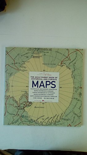
HISTORISCHE UND KURIOSE LANDKARTEN enthält eine Sammlung beeindruckender und wunderschön gestalteter Landkarten, die aufgrund ihrer visuellen Wirkung und ihrer Einzigartigkeit ausgewählt wurden. Das Buch umfasst eine Vielzahl von Darstellungsformen und Inhalten. Es bietet Vergleichsübersichten über die Länge von Flüssen und die Höhe von Bergen und enthält Seekarten, mittelalterliche Stadtpläne sowie prähistorische Landkarten. Ebenfalls enthalten sind Abbildungen, die erkennen lassen, wie das Weltbild der Europäer vor vielen hundert Jahren ausgesehen hat, sowie detaillierte Japankarten aus der Vogelperspektive und faszinierende, altertümliche Karten, die einst von den amerikanischen Ureinwohnern und den australischen Aborigenes gezeichnet wurden. Darüber hinaus befinden sich in dem Buch zahlreiche, außergewöhnliche, doppeldeutige Landkarten. Die CD-ROM enthält Dateien aller Karten in hoher und geringer Auflösung.
Die Inhaltsangabe kann sich auf eine andere Ausgabe dieses Titels beziehen.
Von der hinteren Coverseite
The Agile Rabbit Book of Historical and Curious Maps contains a collection of amazing and beautifully-made maps that have been chosen for their visual impact and rarity. The selection is of great diversity in appearance and meaning
„Über diesen Titel“ kann sich auf eine andere Ausgabe dieses Titels beziehen.
Suchergebnisse für Historcial & Curious Maps + CD ROm

Beispielbild für diese ISBN
Historical and Curious Maps
Anbieter: Better World Books, Mishawaka, IN, USA
Verkäuferbewertung 5 von 5 Sternen

Zustand: Very Good. Pages intact with possible writing/highlighting. Binding strong with minor wear. Dust jackets/supplements may not be included. Stock photo provided. Product includes identifying sticker. Better World Books: Buy Books. Do Good. Artikel-Nr. 7749075-6
Gebraucht kaufen
EUR 10,39
Versand gratis
Versand innerhalb von USA
Versand innerhalb von USA
Anzahl: 1 verfügbar
Beispielbild für diese ISBN
The Agile Rabbit book of Historical & Curious Maps
Anbieter: WorldofBooks, Goring-By-Sea, WS, Vereinigtes Königreich
Verkäuferbewertung 5 von 5 Sternen
Paperback. Zustand: Very Good. The book has been read, but is in excellent condition. Pages are intact and not marred by notes or highlighting. The spine remains undamaged. Artikel-Nr. GOR003497766
Gebraucht kaufen
EUR 5,21
EUR 6,53 Versand
Versand von Vereinigtes Königreich nach USA
Versand von Vereinigtes Königreich nach USA
Anzahl: 7 verfügbar
Foto des Verkäufers
The Agile Rabbit book of Historical & Curious Maps
Anbieter: WeBuyBooks, Rossendale, LANCS, Vereinigtes Königreich
Verkäuferbewertung 5 von 5 Sternen
paperback. Zustand: Very Good. Most items will be dispatched the same or the next working day. A copy that has been read, but is in excellent condition. Pages are intact and not marred by notes or highlighting. The spine remains undamaged. Artikel-Nr. rev2902514019
Gebraucht kaufen
EUR 5,58
EUR 10,27 Versand
Versand von Vereinigtes Königreich nach USA
Versand von Vereinigtes Königreich nach USA
Anzahl: 1 verfügbar
Beispielbild für diese ISBN
Historical & Curious MapThe agile rabbit book of historical and curious maps
Anbieter: medimops, Berlin, Deutschland
Verkäuferbewertung 5 von 5 Sternen
Zustand: very good. Gut/Very good: Buch bzw. Schutzumschlag mit wenigen Gebrauchsspuren an Einband, Schutzumschlag oder Seiten. / Describes a book or dust jacket that does show some signs of wear on either the binding, dust jacket or pages. Artikel-Nr. M09057680513-V
Gebraucht kaufen
EUR 10,70
EUR 10,00 Versand
Versand von Deutschland nach USA
Versand von Deutschland nach USA
Anzahl: 2 verfügbar
Foto des Verkäufers
The Agile Rabbit Book of Historical and Curious Maps
Verlag:
Amsterdam : The pepin Press/Agile Rabbit Editions, 2005
ISBN 10: 9057680513
ISBN 13: 9789057680519
Gebraucht
Softcover
Anbieter: Klondyke, Almere, Niederlande
Verkäuferbewertung 5 von 5 Sternen
Zustand: Good. Square paperback, circa 28x28cm, richly illusrated in colour and b/w, CD-rom in pocket in rear. Artikel-Nr. 425709-LH11
Gebraucht kaufen
EUR 11,00
EUR 20,00 Versand
Versand von Niederlande nach USA
Versand von Niederlande nach USA
Anzahl: 1 verfügbar
Foto des Verkäufers
The Agile Rabbit Book of Historical and Curious Maps + CD ROm
Anbieter: books4less (Versandantiquariat Petra Gros GmbH & Co. KG), Welling, Deutschland
Verkäuferbewertung 5 von 5 Sternen
Softcover/Großformat. Zustand: Gut. 127 Seiten, + 1 CD-Rom. Der Erhaltungszustand des hier angebotenen Werks ist trotz seiner Bibliotheksnutzung sehr sauber und kann entsprechende Merkmale aufweisen (Rückenschild, Instituts-Stempel.). In ENGLISCHER Sprache. MEHRSPRACHIG. Sprache: Englisch Gewicht in Gramm: 1001. Artikel-Nr. 2292460
Gebraucht kaufen
EUR 12,99
EUR 19,95 Versand
Versand von Deutschland nach USA
Versand von Deutschland nach USA
Anzahl: 1 verfügbar
Foto des Verkäufers
The Agile Rabbit Book of Historical and Curious Maps
Verlag:
Amsterdam, The Pepin Press BV 2005, 2005
ISBN 10: 9057680513
ISBN 13: 9789057680519
Gebraucht
Softcover
Anbieter: Antiquariaat Schot, Hendrik-Ido-Ambacht, Niederlande
Verkäuferbewertung 5 von 5 Sternen
127 p. Paperback (In good condition, incl. accompanying CD.)7. Artikel-Nr. 040383
Gebraucht kaufen
EUR 13,80
EUR 25,00 Versand
Versand von Niederlande nach USA
Versand von Niederlande nach USA
Anzahl: 1 verfügbar
Beispielbild für diese ISBN
The agile rabbit books of historical and curious maps
Anbieter: LE PIANO-LIVRE, QUIMPER, Frankreich
Verkäuferbewertung 5 von 5 Sternen
Rayon : Géographie Editeur : Pepin Date de parution : 2005 Description : In-4 carré, 128 pages, broché, avec son CD, occasion, très bon état. IMPORTANT : Pour les envois internationaux, merci de vous renseigner avant de passer commande. Les envois se font uniquement en point relais MONDIAL RELAY ou INPOST pour les pays suivants : Belgique, Espagne, Italie, Luxembourg, Pays-Bas, Pologne, et Portugal. Merci de nous indiquer en retour le point relais choisi ainsi que votre numéro de téléphone mobile pour assurer le suivi du colis. ATTENTION : Les expéditions nationales de plus de 2 kilos et les expéditions internationales de plus de 1 kilo se voient appliquer un supplément de port. Envois quotidiens du mardi au samedi. Les livres sont envoyés sous enveloppe bulles. Les frais de ports comprennent les frais d'affranchissements et d'emballage. Librairie Le Piano-Livre. Merci. Référence catalogue vendeur: 65964. Artikel-Nr. 65964
Gebraucht kaufen
EUR 22,00
EUR 39,00 Versand
Versand von Frankreich nach USA
Versand von Frankreich nach USA
Anzahl: 1 verfügbar
Beispielbild für diese ISBN
The Agile Rabbit Book of Historical and Curious Maps / Mapas Históricos y Curiosos
Verlag:
Pepin Press, 2005
ISBN 10: 9057680513
ISBN 13: 9789057680519
Gebraucht
Encuadernación de tapa blanda
Anbieter: Libros Angulo, Madrid, M, Spanien
Verkäuferbewertung 5 von 5 Sternen
Encuadernación de tapa blanda. Zustand: Bien. Pepin Press, Netherlands, 2005. Texto en inglés, español, italiano, francés, portugués y alemán. Cartografía. Historia. Profusamente ilustrado. Geografía. 127 pp. 28 x 29. Tapa blanda de editorial ilustrada. Sin subrayados. Buen estado de conservación. ISBN: 9789057680519. Artikel-Nr. 036657
Gebraucht kaufen
EUR 21,00
EUR 50,00 Versand
Versand von Spanien nach USA
Versand von Spanien nach USA
Anzahl: 1 verfügbar
Foto des Verkäufers
The Agile Rabbit Book of Historical and Curious Maps - CD-Rom
Verlag:
Pepin Press, Amsterdam, Netherlands, 2008
ISBN 10: 9057680513
ISBN 13: 9789057680519
Gebraucht
Soft cover
Anbieter: CURIO, Cleethorpes, North East Lincolnshire, Vereinigtes Königreich
Verkäuferbewertung 5 von 5 Sternen
Soft cover. Zustand: Near Fine. No Jacket. First Edition / Fourth Print (number line on copyright page 10 9 8 7 6 5 4). Large paperback copy, no dustjacket as issued. 127pp. Colour and b/w maps throughout. With CD-Rom. Not library copy, no inscriptions, no creasing to spine. (2/5). Artikel-Nr. ABE-1590153697964
Gebraucht kaufen
EUR 36,04
EUR 34,99 Versand
Versand von Vereinigtes Königreich nach USA
Versand von Vereinigtes Königreich nach USA
Anzahl: 1 verfügbar