
Verwandte Artikel zu Geographic Information and Cartography for Risk and...
Geographic Information and Cartography for Risk and Crisis Management: Towards Better Solutions (Lecture Notes in Geoinformation and Cartography) - Softcover
Buch 13 von 74: Lecture Notes in Geoinformation and Cartography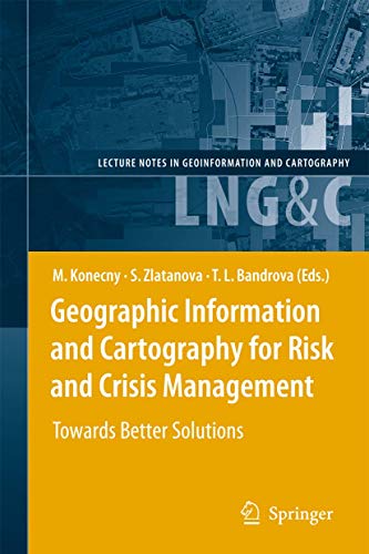
Inhaltsangabe
Cartography and geographic information (GI) are remarkably appropriate for the requirements of early warning (EW) and crisis management (CM). The use of geospatial technology has increased tremendously in the last years. ICT has changed from just using maps created in advance, to new approaches, allowing individuals (decision-makers) to use cartography interactively, on the basis of individual user's requirements. The new generation of cartographic visualizations based on standardisation, formal modelling, use of sensors, semantics and ontology, allows for the better adaptation of information to the needs of the users. In order to design a new framework in pre-disaster and disaster management safety/security/privacy aspects of institutions and citizens need to be considered. All this can only be achieved by demonstrating new research achievements, sharing best practices (e.g. in the health area) and working towards the wider acceptance of geospatial technology in society, with the help of education and media.
This book will outline research frontiers and applications of cartography and GI in EW and CM and document their roles and potentials in wider processes going on in information/knowledge-based societies.
Die Inhaltsangabe kann sich auf eine andere Ausgabe dieses Titels beziehen.
Von der hinteren Coverseite
Cartography and geographic information (GI) are remarkably appropriate for the requirements of early warning (EW) and crisis management (CM). The use of geospatial technology has increased tremendously in the last years. ICT has changed from just using maps created in advance, to new approaches, allowing individuals (decision-makers) to use cartography interactively, on the basis of individual user's requirements. The new generation of cartographic visualizations based on standardisation, formal modelling, use of sensors, semantics and ontology, allows for the better adaptation of information to the needs of the users. In order to design a new framework in pre-disaster and disaster management safety/security/privacy aspects of institutions and citizens need to be considered. All this can only be achieved by demonstrating new research achievements, sharing best practices (e.g. in the health area) and working towards the wider acceptance of geospatial technology in society, with the help of education and media. This book will outline research frontiers and applications of cartography and GI in EW and CM and document their roles and potentials in wider processes going on in information/knowledge-based societies.
„Über diesen Titel“ kann sich auf eine andere Ausgabe dieses Titels beziehen.
Suchergebnisse für Geographic Information and Cartography for Risk and...

Foto des Verkäufers
Geographic Information and Cartography for Risk and Crisis Management | Towards Better Solutions
Anbieter: preigu, Osnabrück, Deutschland
Verkäuferbewertung 5 von 5 Sternen

Taschenbuch. Zustand: Neu. Geographic Information and Cartography for Risk and Crisis Management | Towards Better Solutions | Milan Konecny (u. a.) | Taschenbuch | Lecture Notes in Geoinformation and Cartography | xxii | Englisch | 2012 | Springer | EAN 9783642262937 | Verantwortliche Person für die EU: Springer Verlag GmbH, Tiergartenstr. 17, 69121 Heidelberg, juergen[dot]hartmann[at]springer[dot]com | Anbieter: preigu. Artikel-Nr. 106478597
Neu kaufen
EUR 140,35
EUR 70,00 Versand
Versand von Deutschland nach USA
Versand von Deutschland nach USA
Anzahl: 5 verfügbar
Foto des Verkäufers
Geographic Information and Cartography for Risk and Crisis Management : Towards Better Solutions
Anbieter: AHA-BUCH GmbH, Einbeck, Deutschland
Verkäuferbewertung 5 von 5 Sternen
Taschenbuch. Zustand: Neu. Druck auf Anfrage Neuware - Printed after ordering - Cartography and geographic information (GI) are remarkably appropriate for therequirements of early warning (EW) and crisis management (CM). The use of geospatial technology has increased tremendously in the lastyears. ICT has changed from just using maps created in advance, to new approaches, allowing individuals (decision-makers) to use cartography interactively, on the basis of individual user's requirements. The new generation of cartographic visualizations based on standardisation, formal modelling, use of sensors, semantics and ontology, allows for the better adaptation of information to the needs of the users. In order to design a newframework in pre-disaster and disaster management safety/security/privacy aspects of institutions and citizens need to be considered. All this can only be achieved by demonstrating new research achievements, sharing best practices (e.g. in the health area) and working towards the wider acceptance of geospatial technology in society,with the help of education and media. This book will outline research frontiers and applications of cartography and GI in EW and CM and document their roles and potentials in wider processes going on in information/knowledge-based societies. Artikel-Nr. 9783642262937
Neu kaufen
EUR 183,30
EUR 35,00 Versand
Versand von Deutschland nach USA
Versand von Deutschland nach USA
Anzahl: 1 verfügbar
Beispielbild für diese ISBN
Geographic Information and Cartography for Risk and Crisis Management: Towards Better Solutions
Anbieter: Revaluation Books, Exeter, Vereinigtes Königreich
Verkäuferbewertung 5 von 5 Sternen
Paperback. Zustand: Brand New. 2010 edition. 451 pages. 9.25x6.10x1.06 inches. In Stock. Artikel-Nr. x-3642262937
Neu kaufen
EUR 244,54
EUR 14,97 Versand
Versand von Vereinigtes Königreich nach USA
Versand von Vereinigtes Königreich nach USA
Anzahl: 2 verfügbar