Verwandte Artikel zu Voie de la liberté. Juin 1944-janvier 1945: Map (Carte...
Zu dieser ISBN ist aktuell kein Angebot verfügbar.
Alle Exemplare der Ausgabe mit dieser ISBN anzeigen:
Reseńa del editor:
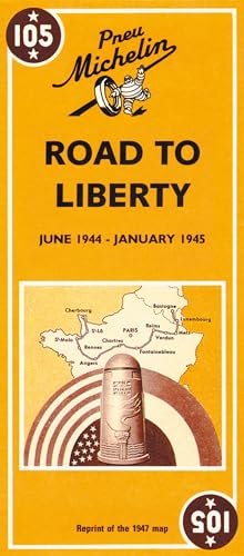
Michelin's Road to liberty Map 105 covers the region associated with France's liberation between June 1944 and January 1945, at a scale of 1:500,000. This is a reprint of the 1947 map to commemorate the liberation of France. The map shows the route of the Allied Forces across northern France, from the Normandy beaches to Alsace. Also shown are liberation dates against individual places and the location of American war cemeteries for both World Wars. Text is included on the map sheet which describes key events and actions on the road to liberty. From Sainte-Mere-Eglise to Bastogne in Belgium, through Luxembourg: shows the main stages of the Liberation Legend/Key in French and English
Reseńa del editor:
Covering the region associated with "Voie de la Liberte", at a scale of 1:500,000, this is a reprint of the 1947 map.
„Über diesen Titel“ kann sich auf eine andere Ausgabe dieses Titels beziehen.
- VerlagMichelin Italiana
- Erscheinungsdatum2006
- ISBN 10 2067002651
- ISBN 13 9782067002654
- EinbandMapa
- Anzahl der Seiten1
(Keine Angebote verfügbar)
Buch Finden: Kaufgesuch aufgebenSie kennen Autor und Titel des Buches und finden es trotzdem nicht auf ZVAB? Dann geben Sie einen Suchauftrag auf und wir informieren Sie automatisch, sobald das Buch verfügbar ist!
Kaufgesuch aufgeben